Archives: Articles

This is the example article

Linguist’s ‘big data’ research supports waves of migration into the Americas

UNIVERSITY OF VIRGINIA—University of Virginia linguistic anthropologist Mark A. Sicoli and colleagues are applying the latest technology to an ancient mystery: how and when early humans inhabited the New World. Their new research analyzing more than 100 linguistic features suggest more complex patterns of contact and migration among the early peoples who first settled the Americas.

The diversity of languages in the Americas is like no other continent of the world, with eight times more “isolates” than any other continent. Isolates are “languages that have no demonstrable connection to any other language with which it can be classified into a family,” Sicoli said. There are 26 isolates in North America and 55 in South America, mostly strung across the western edge of the continents, compared to just one in Europe, eight in Africa[?] and nine in Asia.

“Scientists in the past few decades have rethought the settlement of the Americas,” Sicoli said, “replacing the idea that the land which connected Asia and North America during the last ice age was merely a ‘bridge’ with the hypothesis that during the last ice age humans lived in this refuge known as ‘Beringia’ for up to 15,000 years and then seeded migrations not only into North America, but also back into Asia.”

In a Feb. 17 presentation to the annual meeting of the American Association for the Advancement of Science in Boston, Sicoli will join other scientists discussing “Beringia and the Dispersal of Modern Humans to the Americas.” Since much of Beringia, theorized to have been located generally between northwest North America and northeastern Asia, has been under water for more than 10,000 years, it has been challenging to find archaeological and ecological evidence for this “deep history,” as Sicoli calls it.

Recent ecological, genetic and archaeological data support the notion of human habitation in Beringia during the latest ice age. The new linguistic research methods, which use “big data” to compare similarities and differences between languages, suggest that such a population would have been linguistically diverse, Sicoli said.

In “Linguistic Perspectives on Early Population Migrations and Language Contact in the Americas,” Sicoli shows how big data analyses point to the existence of at least three now-extinct languages of earlier migrations that influenced existing Dene and Aleut languages as they moved to the Alaska coast. The data comparing dozens of indigenous languages support phases of migration for the Dene languages and multilingual language contact systems along the Alaska coast, which potentially involved languages related to current linguistic isolates. Traces of such language contacts support that the mixing populations also mixed their languages as part of human adaptation strategies for this region and its precarious environment.

“The computational methods give us traction on questions that have been unanswered,” said Sicoli, who has been working in collaboration with Anna Berge of the University of Alaska and Gary Holton of the University of Hawaii. “They help us understand how people migrated and languages diversified not simply through isolation, but through multilingual contact.”

____________________________________

beringiapic

 Graphic illustration of Beringia, showing light blue areas of Beringia that are now underwater with the rise of sea level during modern times. Wikimedia Commons

_____________________________________________________ 

Analyzing languages of the Dene-Yeniseian macro-family, Sicoli and Holton previously found support for Dene migrations from Beringia into North America and Yeniseian migration into Siberia. The linguists’ continuing research is following up on this earlier study that posited a back-migration for the Yeniseian language family.

“In new work, Holton and I also are considering typological linguistic evidence for the subgrouping of the Dene languages suggestive of multiple routes and phases for Dene migrations in North America,” Sicoli said. “We find additional support for coastal and interior distributions with two interior migration chains from Alaska into Canada and a later phase of migration involving connections between Tsuut’ina Athabaskan in western Canada and the Apache and Navajo languages of the U.S. Southwest. We also find support for a series of migrations from the Alaska and Canadian interior to the Alaska coast, which raises the question of language contact with prior languages that we are exploring with Aleut specialist Anna Berge.”

In his presentation, Sicoli describes several comparisons from computational work with multiple languages from the Dene family and the more recently arriving Eskimo-Aleut family of languages. He combines geographical maps with language networks from the database that show shared features. For example, they “coded Aleut and Eskimo languages, adding them to the typological database that already included Dene languages and Haida [an isolate], and have been integrating results of phylogenetic and network analysis with prior studies of vocabulary and grammatical patterns,” Sicoli writes.

“Based on linguistic analysis including computational phylogenetics,” Sicoli writes, “we suggest the prehistory of South Alaska, the Aleutian Islands, and the Pacific Northwest Coast involved intensive language contacts, including language shifts from now extinct languages that we can infer through typological features, grammar and vocabulary found in languages documented in historic periods.”

Article Source: University of Virginia

______________________________________________

Subscribe to Popular Archaeology Premium. Available on all laptops and mobile devices, and still the industry’s best value at only $9.00 annually.

___________________________________________ 

Travel and learn with Far Horizons.

farhorizons1

____________________________________________

winter2016ebookcover

 This richly illustrated issue includes the following stories: Recent findings shedding new light on the whereabouts of the remains of Philip of Macedon, father of Alexander the Great; how an archaeologist-sculptor is bringing bones of the dead back to life; archaeologists uncovering town life at the dawn of civilization; an exclusive interview with internationally acclaimed archaeologist James M. Adovasio about what makes the Meadowcroft Rockshelter prominent in the ongoing search for the first Americans; what archaeologists are finding at the site of the ancient city of Gath, the home town of the biblical Philistine giant, Goliath; and how scientists are redrawing the picture of human evolution in Europe.  Find it on Amazon.com.


Looking at Sardinian DNA for genetic clues to an island’s – and Europe’s – past

MOLECULAR BIOLOGY AND EVOLUTION (OXFORD UNIVERSITY PRESS)—Sardinia sits at a crossroads in the Mediterranean Sea, the second largest island next to Sicily. Surrounded by sparkling turquoise waters, this Mediterranean jewel lies northwest of the toe of the Italian peninsula boot, about 350 kilometers due west of Rome.

For evolutionary biologists, islands are often intriguing, geographically isolated pockets with unique populations that can be ripe for exploration.

Now, in a new study appearing in the advanced online edition of Molecular Biology and Evolution an international team led by geneticist Anna Olivieri from the University of Pavia tackles a highly interesting question: what were the origins of the Sardinian population in the context of European prehistory and ancient human migrations?

The authors analyzed 3,491 modern, whole mitochondrial DNA genomes from Sardinia (which are only passed down maternally). These were compared with 21 samples of ancient mitogenomes from the island, a large panel of non-Sardinian mitogenomes—and even Ötzi (the nickname of Europe’s oldest natural mummy, the 3,300 BCE-year old “Tyrolean Iceman”)—to better understand their origins.

sardinia

Their findings show Sardinia as an outlier in the general European genetic landscape. Almost 80 percent of modern Sardinian mitogenomes belong to branches that cannot be found anywhere else outside the island. Thus, they were defined as Sardinian-Specific Haplogroups (SSHs) that most likely arose in the island after its initial occupation. Almost all SSHs coalesce in the post-Nuragic, Nuragic and Neolithic-Copper Age periods. However, some rare SSHs display age estimates older than 7,800 years ago, the postulated archeologically-based starting time of the Neolithic in Sardinia.

“Our analyses raise the possibility that several SSHs may have already been present on the island prior to the Neolithic,” said prof. Francesco Cucca, from the Institute of Genetic and Biomedical Research (IRGB), at the CNR in Cagliari (Sardinia).

The most plausible candidates would include haplogroups K1a2d and U5b1i1, which together comprise almost 3 percent of modern Sardinians, and possibly others. Such a scenario would not only support archaeological evidence of a Mesolithic occupation of Sardinia, but could also suggest a dual ancestral origin of its first inhabitants. K1a2d is of Late Paleolithic Near Eastern ancestry, whereas U5b1i1 harbours deep ancestral roots in Paleolithic Western Europe.

This work provides evidence that contemporary Sardinians harbour a unique genetic heritage, as a result of their distinct history and relative isolation from the demographic upheavals of continental Europe. Anna Olivieri stresses: “It now seems plausible that human mobility, inter-communication and gene flow around the Mediterranean from Late Glacial times onwards may well have left signatures that survive to this day. Some of these signals are still retained in modern Sardinians.”

“Although in the past the stress has often been on the spread of the Neolithic, genetic studies too are beginning to emphasize the complexity and mosaic nature of human ancestry in the Mediterranean, and indeed in Europe more widely,” concludes prof. Antonio Torroni, from the University of Pavia. “Future work on ancient DNA should be able to test directly to what extent this more complex model is supported by genetic evidence, and whether our predictions of Mesolithic ancestry in contemporary Sardinians can be sustained.”

Article Source: Molecular Biology and Evolution

Image: Satellite view of Sardinia

___________________________________________________ 

Subscribe to Popular Archaeology Premium. Available on all laptops and mobile devices, and still the industry’s best value at only $9.00 annually.

___________________________________________ 

Travel and learn with Far Horizons.

farhorizons1

____________________________________________

winter2016ebookcover

 This richly illustrated issue includes the following stories: Recent findings shedding new light on the whereabouts of the remains of Philip of Macedon, father of Alexander the Great; how an archaeologist-sculptor is bringing bones of the dead back to life; archaeologists uncovering town life at the dawn of civilization; an exclusive interview with internationally acclaimed archaeologist James M. Adovasio about what makes the Meadowcroft Rockshelter prominent in the ongoing search for the first Americans; what archaeologists are finding at the site of the ancient city of Gath, the home town of the biblical Philistine giant, Goliath; and how scientists are redrawing the picture of human evolution in Europe.  Find it on Amazon.com.


Ancient jars found in Judea reveal earth’s magnetic field is fluctuating, not diminishing

AMERICAN FRIENDS OF TEL AVIV UNIVERSITY—Albert Einstein considered the origin of the Earth’s magnetic field one of the five most important unsolved problems in physics. The weakening of the geomagnetic field, which extends from the planet’s core into outer space and was first recorded 180 years ago, has raised concern by some for the welfare of the biosphere.

But a new study published in PNAS from Tel Aviv University, Hebrew University of Jerusalem, and University of California San Diego researchers finds there is no reason for alarm: The Earth’s geomagnetic field has been undulating for thousands of years. Data obtained from the analysis of well-dated Judean jar handles provide information on changes in the strength of the geomagnetic field between the 8th and 2nd centuries BCE, indicating a fluctuating field that peaked during the 8th century BCE.

“The field strength of the 8th century BCE corroborates previous observations of our group, first published in 2009, of an unusually strong field in the early Iron Age. We call it the ‘Iron Age Spike,’ and it is the strongest field recorded in the last 100,000 years,” says Dr. Erez Ben-Yosef of TAU’s Institute of Archaeology, the study’s lead investigator. “This new finding puts the recent decline in the field’s strength into context. Apparently, this is not a unique phenomenon — the field has often weakened and recovered over the last millennia.”

Additional researchers included Prof. Oded Lipschits and Michael Millman of TAU, Dr. Ron Shaar of Hebrew University, and Prof. Lisa Tauxe of UC San Diego.

Delving into the inner structure of the planet

“We can gain a clearer picture of the planet and its inner structure by better understanding proxies like the magnetic field, which reaches more than 1,800 miles deep into the liquid part of the Earth’s outer core,” Dr. Ben-Yosef observes.

The new research is based on a set of 67 ancient, heat-impacted Judean ceramic storage jar handles, which bear royal stamp impressions from the 8th to 2nd century BCE, providing accurate age estimates.

“The period spanned by the jars allowed us to procure data on the Earth’s magnetic field during that time — the Iron Age through the Hellenistic Period in Judea,” says Dr. Ben-Yosef. “The typology of the stamp impressions, which correspond to changes in the political entities ruling this area, provides excellent age estimates for the firing of these artifacts.”

To accurately measure the geomagnetic intensity, the researchers conducted experiments at the Paleomagnetic Laboratory of Scripps Institution of Oceanography (SIO), University of California San Diego, using laboratory-built paleomagnetic ovens and a superconducting magnetometer.

“Ceramics, baked clay, burned mud bricks, copper slag — almost anything that was heated and then cooled can become a recorder of the components of the magnetic field at the time of the event,” said Dr. Ben-Yosef. “Ceramics have tiny minerals—magnetic ‘recorders’—that save information about the magnetic field of the time the clay was in the kiln. The behavior of the magnetic field in the past can be studied by examining archaeological artifacts or geological material that were heated then cooled, such as lava.”

_________________________________________

magneticfield

 ‘Snapshot’ of the main magnetic field at Earth’s surface as of June 2014 based on Swarm data. Wikimedia Commons

_______________________________________________________ 

Advanced dating method

Observed changes in the geomagnetic field can, in turn, be used as an advanced dating method complementary to the radiocarbon dating, according to Dr. Ben-Yosef. “The improved Levantine archaeomagnetic record can be used to date pottery and other heat-impacted archaeological materials whose date is unknown.

“Both archaeologists and Earth scientists benefit from this. The new data can improve geophysical models—core-mantle interactions, cosmogenic processes and more—as well as provide an excellent, accurate dating reference for archaeological artefacts,” says Dr. Ben-Yosef.

The researchers are currently working on enhancing the archaeomagnetic database for the Levant, one of the most archaeologically-rich regions on the planet, to better understand the geomagnetic field and establish a robust dating reference.

Article Source: American Friends of Tel Aviv University

_______________________________________________________

Subscribe to Popular Archaeology Premium. Available on all laptops and mobile devices, and still the industry’s best value at only $9.00 annually.

___________________________________________ 

Travel and learn with Far Horizons.

farhorizons1

____________________________________________

winter2016ebookcover

 This richly illustrated issue includes the following stories: Recent findings shedding new light on the whereabouts of the remains of Philip of Macedon, father of Alexander the Great; how an archaeologist-sculptor is bringing bones of the dead back to life; archaeologists uncovering town life at the dawn of civilization; an exclusive interview with internationally acclaimed archaeologist James M. Adovasio about what makes the Meadowcroft Rockshelter prominent in the ongoing search for the first Americans; what archaeologists are finding at the site of the ancient city of Gath, the home town of the biblical Philistine giant, Goliath; and how scientists are redrawing the picture of human evolution in Europe.  Find it on Amazon.com.


Broken pebbles offer clues to Paleolithic funeral rituals

UNIVERSITY OF MONTREAL—Humans may have ritualistically “killed” objects to remove their symbolic power, some 5,000 years earlier than previously thought, a new international study of marine pebble tools from an Upper Paleolithic burial site in Italy suggests.

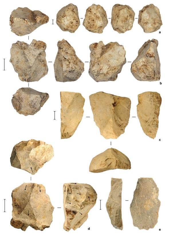
Researchers at Université de Montréal, Arizona State University and University of Genoa examined 29 pebble fragments recovered in the Caverna delle Arene Candide on the Mediterranean Sea in Liguria. In their study, published online Jan. 18 in the Cambridge Archeological Journal, they concluded that some 12,000 years ago the flat, oblong pebbles were brought up from the beach, used as spatulas to apply ochre paste to decorate the dead, then broken and discarded.

The intent could have been to “kill” the tools, thereby “discharging them of their symbolic power” as objects that had come into contact with the deceased, said the study’s co-author Julien Riel-Salvatore, an associate professor of anthropology at UdeM who directed the excavations at the site that yielded the pebbles.

The Arene Candide is a hockey-rink-sized cave containing a necropolis of some 20 adults and children. It is located about 90 metres above the sea in a steep cliff overlooking a limestone quarry. First excavated extensively in the 1940s, the cave is considered a reference site for the Neolithic and Paleolithic periods in the western Mediterranean. Until now, however, no one had looked at the broken pebbles.

“If our interpretation is correct, we’ve pushed back the earliest evidence of intentional fragmentation of objects in a ritual context by up to 5,000 years,” said the study’s lead author Claudine Gravel-Miguel, a PhD candidate at Arizona State’s School of Human Evolution and Social Change, in Tempe. “The next oldest evidence dates to the Neolithic period in Central Europe, about 8,000 years ago. Ours date to somewhere between 11,000 and 13,000 years ago, when people in Liguria were still hunter-gatherers.”

No matching pieces to the broken pebbles were found, prompting the researchers to hypothesize that the missing halves were kept as talismans or souvenirs. “They might have signified a link to the deceased, in the same way that people today might share pieces of a friendship trinket, or place an object in the grave of a loved one,” Riel-Salvatore said. “It’s the same kind of emotional connection.”

Between 2008 and 2013, the researchers painstakingly excavated in the Arene Candide cave immediately east of the original excavation using small trowels and dental tools, then carried out microscopic analysis of the pebbles they found there. They also scoured nearby beaches in search of similar-looking pebbles, and broke them to see if they compared to the others, trying to determine whether they had been deliberately broken.

“This demonstrates the underappreciated interpretive potential of broken pieces,” the new study concludes. “Research programs on Paleolithic interments should not limit themselves to the burials themselves, but also explicitly target material recovered from nearby deposits, since, as we have shown here, artifacts as simple as broken rocks can sometimes help us uncover new practices in prehistoric funerary canons.”

_________________________________

pebbles2

 Claudine Gravel-Miguel with anthropologist Vitale Stefano Sparacello at the Arene Candide site in 2011. Credit: Université de Montréal.

____________________________________________

pebbles1

 Pebbles were refitted during analysis. Credit: Université de Montréal

_________________________________

The findings could have implications for research at other Paleolithic sites where ochre-painted pebbles have been found, such as the Azilian sites in the Pyrenee mountains of northern Spain and southern France. Broken pebbles recovered during excavations often go unexamined, so it might be worth going back and taking a second look, said Riel-Salvatore.

“Historically, archeologists haven’t really looked at these objects – if they see them at a site, they usually go ‘Oh, there’s an ordinary pebble,’ and then discard it with the rest of the sediment,” he said. “We need to start paying attention to these things that are often just labeled as rocks. Something that looks like it might be natural might actually have important artifactual meaning.”

Source: University of Montreal news release

_____________________________________________

About this study:

“The Breaking of Ochred Pebble Tools as Part of Funerary Ritual in the Arene Candide Epigravettian Cemetery,” by Claudine Gravel-Miguel, Julien Riel-Salvatore, Roberto Maggi, Gabriele Martino and C. Michael Barton, published Jan. 18, 2017 in the Cambridge Archaeological Journal. Funding of the data collection was provided by the Italian Ministry of Cultural Goods and Tourism of the region of Liguria, with support from the city of Finale Ligure and the Società Cave Arene Candide S.r.l. Funding for the excavations at the site was provided by Fredy S.p.A and the University of Colorado, Denver. The analysis presented in this study was funded by the Social Science and Humanities Research Council (Fellowship no. 752-2011-1015-A14) and the School of Human Evolution and Change, at Arizona State University

_____________________________________________

Subscribe to Popular Archaeology Premium. Available on all laptops and mobile devices, and still the industry’s best value at only $9.00 annually.

___________________________________________ 

Travel and learn with Far Horizons.

farhorizons1

____________________________________________

winter2016ebookcover

 This richly illustrated issue includes the following stories: Recent findings shedding new light on the whereabouts of the remains of Philip of Macedon, father of Alexander the Great; how an archaeologist-sculptor is bringing bones of the dead back to life; archaeologists uncovering town life at the dawn of civilization; an exclusive interview with internationally acclaimed archaeologist James M. Adovasio about what makes the Meadowcroft Rockshelter prominent in the ongoing search for the first Americans; what archaeologists are finding at the site of the ancient city of Gath, the home town of the biblical Philistine giant, Goliath; and how scientists are redrawing the picture of human evolution in Europe.  Find it on Amazon.com.


Chimpanzee feet allow scientists a new grasp on human foot evolution

NEW YORK INSTITUTE OF TECHNOLOGY—An investigation into the evolution of human walking by looking at how chimpanzees walk on two legs is the subject of a new research paper published in the March 2017 issue of Journal of Human Evolution.

The human foot is distinguished from the feet of all other primates by the presence of a longitudinal arch, which spans numerous joints and bones of the midfoot region and is thought to stiffen the foot. This structure is thought to be a critical adaptation for bipedal locomotion, or walking on two legs, in part because this arch is absent from the feet of humans’ closest living relatives, the African apes.

In contrast, African apes have long been thought to have highly mobile foot joints for climbing tree trunks and grasping branches, although few detailed quantitative studies have been carried out to confirm these beliefs.

But now, Nathan Thompson, Ph.D., assistant professor of Anatomy at New York Institute of Technology College of Osteopathic Medicine (NYITCOM), is one of the researchers questioning some long-held ideas about the function and evolution of the human foot by investigating how chimpanzees use their feet when walking on two legs. The research team, including members Nicholas Holowka, Ph.D. (Harvard University); Brigitte Demes, Ph.D. (Stony Brook University School of Medicine); and Matthew O’Neill, Ph.D. (University of Arizona College of Medicine, Phoenix), conducted the research and collected data while all were at Stony Brook University (2013-2015).

Most researchers studying human evolution assume a stark dichotomy between human and chimpanzee feet. One is a rigid lever that makes walking long distances easy and efficient. The other one is a grasping device, much more mobile and less effective at walking on two legs. Fossil feet of early human ancestors are nearly always compared with chimpanzee feet, making knowledge of their foot biomechanics crucial for understanding how the human foot evolved. However, prior to this research, no one has been able to actually investigate whether differences existed between humans and chimpanzees in how the foot works during walking on two legs.

To find out, this research team used high-speed motion capture to measure three-dimensional foot motion in chimpanzees and humans walking at similar speeds. They then compared ranges of midfoot motion between species.
Contrary to expectations, the researchers found that human feet are more — not less — mobile than chimpanzees walking on two limbs.

“This finding upended our assumptions about how the feet of both humans and chimpanzees work. Based on simple visual observation, we’ve long known that human feet are stiffer than those of chimpanzees and other apes when the heel is first lifted off the ground in a walking step. What surprised us was that the human midfoot region flexes dramatically at the end of a step as the foot’s arch springs back into place following its compression during weight-bearing. This flexion motion is greater than the entire range of motion in the chimpanzee midfoot joints during a walking step, leading us to conclude that high midfoot joint mobility is actually advantageous for human walking. We never would have discovered this without being able to study chimpanzees with advanced motion capture technology,” said Holowka, with Harvard’s department of Human Evolutionary Biology.

Ultimately, according to the findings, the fact that the traditional dichotomy between humans and chimpanzees has been disproven means that researchers may have to rethink what can be learned from the fossil feet of humans’ earliest ancestors. “The presence of human-like midfoot joint morphology in fossil hominins can no longer be taken as indicating foot rigidity, but it may tell us about the evolution of human-like enhanced push off mechanics,” said NYITCOM’s Thompson.

______________________________________

chimppic

 A juvenile chimpanzee in the Gombe Stream National Park. Ikiwaner, Wikimedia Commons

____________________________________________________ 

Based on these findings, the researchers encourage future studies to consider the ways in which human foot morphology reflects longitudinal arch function throughout the full duration of stance phase, especially at the beginning and end of a step.

Thompson added, “One of the things that is really remarkable about this project is that it shows us how much we have still to learn about our closest relatives. It seems like the more we learn about how chimpanzees move, the more we have to rethink some of the assumptions that paleoanthropologists have held on to for decades.”

Article Source: New York Institute of Technology

____________________________________________________

Subscribe to Popular Archaeology Premium. Available on all laptops and mobile devices, and still the industry’s best value at only $9.00 annually.

___________________________________________ 

Travel and learn with Far Horizons.
farhorizons1

____________________________________________

winter2016ebookcover
 This richly illustrated issue includes the following stories: Recent findings shedding new light on the whereabouts of the remains of Philip of Macedon, father of Alexander the Great; how an archaeologist-sculptor is bringing bones of the dead back to life; archaeologists uncovering town life at the dawn of civilization; an exclusive interview with internationally acclaimed archaeologist James M. Adovasio about what makes the Meadowcroft Rockshelter prominent in the ongoing search for the first Americans; what archaeologists are finding at the site of the ancient city of Gath, the home town of the biblical Philistine giant, Goliath; and how scientists are redrawing the picture of human evolution in Europe.  Find it on Amazon.com.


Shifting monsoon altered early cultures in China, study says

THE EARTH INSTITUTE AT COLUMBIA UNIVERSITY—The annual summer monsoon that drops rain onto East Asia, an area with about a billion people, has shifted dramatically in the distant past, at times moving northward by as much as 400 kilometers and doubling rainfall in that northern reach. The monsoon’s changes over the past 10,000 years likely altered the course of early human cultures in China, say the authors of a new study.

Researchers from the Lamont-Doherty Earth Observatory and the Chinese Academy of Sciences in Xi’an studied ancient water levels for Lake Dali, a closed-basin lake in Inner Mongolia in the northeast of China. They found that the lake was six times larger and water levels were 60 meters higher than present during the early and middle Holocene–the period beginning about 11,700 years ago, and encompassing the development of human civilization.

“I think it is important to emphasize that these spatial fluctuations in the monsoon drive large changes in northern China,” said Yonaton Goldsmith, a graduate student at Lamont-Doherty Earth Observatory and lead author of the paper. “When the monsoon is strong, it shifts northward and northern China becomes green. When the monsoon is weak, the monsoon stays in the south and northern China dries out. Such large fluctuations must have altered the ecosystems in northern China dramatically.”

The study, appearing this week in the Proceedings of the National Academy of Sciences, also ties the shifting monsoon to changes in the earth’s orbit and other periodic changes in the climate system. The study should help scientists understand how the monsoon is affected by those natural cycles, and how a changing climate today might influence the monsoon in the future.

Goldsmith said it’s still unclear how the monsoon will react to global warming. One view is that the monsoon should grow stronger, but the area studied has been drying out over recent decades, he said, “so there is still a lot that needs to be done in that region before we can get definitive answers.”

Dali Lake is located near the northwestern limit of the East Asian monsoon, and so would reflect the changes brought about when the monsoon shifted north. The researchers studied outcrops of sediments left behind when the lake was far larger, and used those and other markers to construct a timeline of lake levels, and the fluctuation of rainfall over millennia.

They found that the lake reached peak levels around 123,000 years ago, again around 58,000 years ago, and once more between 11,000 and 5,500 years ago. They tie the periodic increases in rainfall to the range of the monsoon shifting north by as much as 400 kilometers. The lake record is “highly correlated” with measurements taken earlier from cave deposits in both northern and southern China.

Between 5,500 and 5,000 years ago, the monsoon weakened and rainfall over northern China decreased by 50 percent, the researchers found. They speculate that this drying triggered a major cultural transition in the region. As they describe it, two early Neolithic societies, the Hongshan culture in North China and the Yangshao culture in central China, collapsed around 5,000 years ago. In central China, the following period saw the rise of more stratified and socially and politically complex societies, including the Longshan culture. Previously unoccupied areas on the eastern margin of the Tibetan plateau were populated. Meanwhile, northeast China experienced a sharp population decline, represented by the Xiaoheyan culture.

“These findings show that climate change can have dramatic effects on human societies and highlight the necessity to understand the effect of global warming on rainfall patterns in China and all over the world,” the authors write.

_______________________________________

horses

Horses near Lake Dali, in Inner Mongolia. Scientists studying the lake have concluded that the size of the lake has changed dramatically over the distant past, due to changes in the climate and resulting shifts in the annual monsoon. Credit: Yonaton Goldsmith

____________________________________________________ 

Intense variations in rainfall may have played a role in the collapse of other civilizations. A study led by Lamont scientist Brendan Buckley, published several years ago, suggested that extended drought coupled with changes in the monsoon could have doomed Cambodia’s ancient Khmer civilization at Angkor nearly 600 years ago. Drought is thought to have played a role in the decline of the Classic Maya civilization, too, though in that case, another Lamont study suggests that the Maya themselves contributed to the drought by clearing forests for cities and crops.

Article Source: The Earth Insitute at Columbia University

______________________________________________________

Subscribe to Popular Archaeology Premium. Available on all laptops and mobile devices, and still the industry’s best value at only $9.00 annually.

___________________________________________ 

Travel and learn with Far Horizons.

farhorizons1

____________________________________________

winter2016ebookcover

 This richly illustrated issue includes the following stories: Recent findings shedding new light on the whereabouts of the remains of Philip of Macedon, father of Alexander the Great; how an archaeologist-sculptor is bringing bones of the dead back to life; archaeologists uncovering town life at the dawn of civilization; an exclusive interview with internationally acclaimed archaeologist James M. Adovasio about what makes the Meadowcroft Rockshelter prominent in the ongoing search for the first Americans; what archaeologists are finding at the site of the ancient city of Gath, the home town of the biblical Philistine giant, Goliath; and how scientists are redrawing the picture of human evolution in Europe.  Find it on Amazon.com.


Study shows Pre-Columbian builders managed Amazonian forests

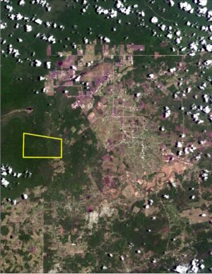
A new study* published by the Proceedings of the National Academy of Sciences suggests that the Amazonian forests in the Acre state of Brazil were managed by human inhabitants for thousands of years, further supporting the theory that much of the Amazon rainforest was already to some extent a product of human design by the time Europeans arrived in the region more than 450 years ago.

Amazonian rainforests once thought to be pristine wildernesses are now known to have been inhabited by large populations before European contact. But how and to what extent these societies impacted their landscape is still controversial. However, in Brazil, scientists and explorers have discovered hundreds of geometric earthworks — over 450 pre-Columbian (pre-AD 1492) geometric ditched enclosures (“geoglyphs”) occupying about 13,000 km2 of the Acre state in Brazil. These huge earthworks were concealed for centuries within the upland interfluvial rainforest, directly challenging the “pristine” status of this ecosystem and its perceived vulnerability to human impacts — suggesting that this region was also deforested to a large extent in the past, challenging the apparent vulnerability of Amazonian forests to human land use. In a study co-authored by Jennifer Watling of the University of Sao Paulo and University of Exeter and colleagues, researchers show that bamboo forest dominated the region for at least 6,000 years and that small, temporary clearings were made to build the geoglyphs; however, construction occurred within an anthropogenic forest, meaning that the forest had already been actively managed by its human inhabitants for millennia. In the absence of widespread deforestation, exploitation of forest products shaped a largely forested landscape that survived intact until the late 20th century. In contrast, the authors suggest, long-term, regional-scale deforestation is primarily a modern phenomenon.

____________________________________

geoglyphs

 Geoglyphs in the Acre state of Brazil. Sanna Saunaluoma, Wikimeda Commons 

_________________________________________________ 

Article Source: Edited and adapted from the PNAS article summary for “Impact of pre-Columbian “geoglyph” builders on Amazonian forests”* 

__________________________________________________

*Jennifer Watling, et al., Impact of pre-Columbian “geoglyph” builders on Amazonian forestswww.pnas.org/cgi/doi/10.1073/pnas.1614359114 

__________________________________________________

Subscribe to Popular Archaeology Premium. Available on all laptops and mobile devices, and still the industry’s best value at only $9.00 annually.

___________________________________________ 

Travel and learn with Far Horizons.

farhorizons1

____________________________________________

winter2016ebookcover

 This richly illustrated issue includes the following stories: Recent findings shedding new light on the whereabouts of the remains of Philip of Macedon, father of Alexander the Great; how an archaeologist-sculptor is bringing bones of the dead back to life; archaeologists uncovering town life at the dawn of civilization; an exclusive interview with internationally acclaimed archaeologist James M. Adovasio about what makes the Meadowcroft Rockshelter prominent in the ongoing search for the first Americans; what archaeologists are finding at the site of the ancient city of Gath, the home town of the biblical Philistine giant, Goliath; and how scientists are redrawing the picture of human evolution in Europe.  Find it on Amazon.com.


Baltic hunter-gatherers began farming without influence of migration, ancient DNA suggests

TRINITY COLLEGE DUBLIN—New research indicates that Baltic hunter-gatherers were not swamped by migrations of early agriculturalists from the Middle East, as was the case for the rest of central and western Europe. Instead, these people probably acquired knowledge of farming and ceramics by sharing cultures and ideas—rather than genes—with outside communities.

Scientists extracted ancient DNA from a number of archaeological remains discovered in Latvia and the Ukraine, which were between 5,000 and 8,000 years old. These samples spanned the Neolithic period, which was the dawn of agriculture in Europe, when people moved from a mobile hunter-gatherer lifestyle to a settled way of life based on food production.

We know through previous research that large numbers of early farmers from the Levant (the Near East) – driven by the success of their technological innovations such as crops and pottery – had expanded to the peripheral parts of Europe by the end of the Neolithic and largely replaced hunter-gatherer populations.

However, the new study, published today in the journal Current Biology, shows that the Levantine farmers did not contribute to hunter-gatherers in the Baltic as they did in Central and Western Europe.

The research team, which includes scientists from Trinity College Dublin, the University of Cambridge, and University College Dublin, says their findings instead suggest that the Baltic hunter-gatherers learned these skills through communication and cultural exchange with outsiders.

The findings feed into debates around the ‘Neolithic package,’—the cluster of technologies such as domesticated livestock, cultivated cereals and ceramics, which revolutionised human existence across Europe during the late Stone Age.

Advances in ancient DNA work have revealed that this ‘package’ was spread through Central and Western Europe by migration and interbreeding: the Levant and later Anatolian farmers mixing with and essentially replacing the hunter-gatherers.

But the new work suggests migration was not a ‘universal driver’ across Europe for this way of life. In the Baltic region, archaeology shows that the technologies of the ‘package’ did develop—albeit less rapidly—even though the analyses show that the genetics of these populations remained the same as those of the hunter-gatherers throughout the Neolithic.

________________________________________

ukrainegromko

 The Neolithic peoples of the Baltics acquired agriculture and other elements of permanent settlement culture through diffusion, not through large migratory movements from Anatolia and the Middle East, according to genetic study. Gromko, Wikimedia Commons

__________________________________________ 

Andrea Manica, one of the study’s senior authors from the University of Cambridge, said: “Almost all ancient DNA research up to now has suggested that technologies such as agriculture spread through people migrating and settling in new areas.”

“However, in the Baltic, we find a very different picture, as there are no genetic traces of the farmers from the Levant and Anatolia who transmitted agriculture across the rest of Europe.”

“The findings suggest that indigenous hunter-gatherers adopted Neolithic ways of life through trade and contact, rather than being settled by external communities. Migrations are not the only model for technology acquisition in European prehistory.”

While the sequenced genomes showed no trace of the Levant farmer influence, one of the Latvian samples did reveal genetic influence from a different external source—one that the scientists say could be a migration from the Pontic Steppe in the east. The timing (5-7,000 years ago) fits with previous research estimating the earliest Slavic languages.

Researcher Eppie Jones, from Trinity College Dublin and the University of Cambridge, was the lead author of the study. She said: “There are two major theories on the spread of Indo-European languages, the most widely spoken language family in the world. One is that they came from the Anatolia with the agriculturalists; another that they developed in the Steppes and spread at the start of the Bronze Age.”

“That we see no farmer-related genetic input, yet we do find this Steppe-related component, suggests that at least the Balto-Slavic branch of the Indo-European language family originated in the Steppe grasslands of the East, which would bring later migrations of Bronze Age horse riders.”

The researchers point out that the time scales seen in Baltic archaeology are also very distinct to the rest of Europe, with a much more drawn-out and piecemeal uptake of Neolithic technologies, rather than the complete ‘package’ that arrives with migrations to take most of Europe by storm.

Andrea Manica added: “Our evidence of genetic continuity in the Baltic, coupled with the archaeological record showing a prolonged adoption of Neolithic technologies, would suggest the existence of trade networks with farming communities largely independent of interbreeding.”

“It seems the hunter-gatherers of the Baltic likely acquired bits of the Neolithic package slowly over time through a ‘cultural diffusion’ of communication and trade, as there is no sign of the migratory wave that brought farming to the rest of Europe during this time.

“The Baltic hunter-gatherer genome remains remarkably untouched until the great migrations of the Bronze Age sweep in from the East.”

About the study

The researchers analysed eight ancient genomes – six from Latvia and two from Ukraine – that spanned a timeframe of three and a half thousand years (between 8,300 and 4,800 years ago). This enabled them to start plotting the genetic history of Baltic inhabitants during the Neolithic.

DNA was extracted from the petrous area of skulls that had been recovered by archaeologists from some of the region’s richest Stone Age cemeteries. The petrous, at the base of the skull, is one of the densest bones in the body, and a prime location for DNA that has suffered the least contamination over millennia.

Article Source: Trinity College Dublin

_____________________________________________________

Subscribe to Popular Archaeology Premium. Available on all laptops and mobile devices, and still the industry’s best value at only $9.00 annually.

___________________________________________ 

Travel and learn with Far Horizons.

farhorizons1

____________________________________________

winter2016ebookcover

 This richly illustrated issue includes the following stories: Recent findings shedding new light on the whereabouts of the remains of Philip of Macedon, father of Alexander the Great; how an archaeologist-sculptor is bringing bones of the dead back to life; archaeologists uncovering town life at the dawn of civilization; an exclusive interview with internationally acclaimed archaeologist James M. Adovasio about what makes the Meadowcroft Rockshelter prominent in the ongoing search for the first Americans; what archaeologists are finding at the site of the ancient city of Gath, the home town of the biblical Philistine giant, Goliath; and how scientists are redrawing the picture of human evolution in Europe.  Find it on Amazon.com.


Ancient DNA reveals ‘continuity’ between Stone Age and modern populations in East Asia

UNIVERSITY OF CAMBRIDGE—Researchers working on ancient DNA extracted from human remains interred almost 8,000 years ago in a cave in the Russian Far East have found that the genetic makeup of certain modern East Asian populations closely resemble that of their hunter-gatherer ancestors.

The study, published today in the journal Science Advances, is the first to obtain nuclear genome data from ancient mainland East Asia and compare the results to modern populations.

The findings indicate that there was no major migratory interruption, or “population turnover”, for well over seven millennia. Consequently, some contemporary ethnic groups share a remarkable genetic similarity to Stone Age hunters that once roamed the same region.

The high “genetic continuity” in East Asia is in stark contrast to most of Western Europe, where sustained migrations of early farmers from the Levant overwhelmed hunter-gatherer populations. This was followed by a wave of horse riders from Central Asia during the Bronze Age. These events were likely driven by the success of emerging technologies such as agriculture and metallurgy

The new research shows that, at least for part of East Asia, the story differs – with little genetic disruption in populations since the early Neolithic period.

Despite being separated by a vast expanse of history, this has allowed an exceptional genetic proximity between the Ulchi people of the Amur Basin, near where Russia borders China and North Korea, and the ancient hunter-gatherers laid to rest in a cave close to the Ulchi’s native land.

The researchers suggest that the sheer scale of East Asia and dramatic variations in its climate may have prevented the sweeping influence of Neolithic agriculture and the accompanying migrations that replaced hunter-gatherers across much of Europe. They note that the Ulchi retained their hunter-fisher-gatherer lifestyle until recent times.

“Genetically speaking, the populations across northern East Asia have changed very little for around eight millennia,” said senior author Andrea Manica from the University of Cambridge, who conducted the work with an international team, including colleagues from Ulsan National Institute of Science and Technology in Korea, and Trinity College Dublin and University College Dublin in Ireland.

“Once we accounted for some local intermingling, the Ulchi and the ancient hunter-gatherers appeared to be almost the same population from a genetic point of view, even though there are thousands of years between them.”

The new study also provides further support for the ‘dual origin’ theory of modern Japanese populations: that they descend from a combination of hunter-gatherers and agriculturalists that eventually brought wet rice farming from southern China. A similar pattern is also found in neighbouring Koreans, who are genetically very close to Japanese.

However, Manica says that much more DNA data from Neolithic China is required to pinpoint the origin of the agriculturalists involved in this mixture.

The team from Trinity College Dublin were responsible for extracting DNA from the remains, which were found in a cave known as Devil’s Gate. Situated in a mountainous area close to the far eastern coast of Russia that faces northern Japan, the cave was first excavated by a soviet team in 1973.

Along with hundreds of stone and bone tools, the carbonised wood of a former dwelling, and woven wild grass that is one of the earliest examples of a textile, were the incomplete bodies of five humans.

If ancient DNA can be found in sufficiently preserved remains, sequencing it involves sifting through the contamination of millennia. The best samples for analysis from Devil’s Gate were obtained from the skulls of two females: one in her early twenties, the other close to fifty. The site itself dates back over 9,000 years, but the two women are estimated to have died around 7,700 years ago.

Researchers were able to glean the most from the middle-aged woman. Her DNA revealed she likely had brown eyes and thick, straight hair. She almost certainly lacked the ability to tolerate lactose, but was unlikely to have suffered from ‘alcohol flush’: the skin reaction to alcohol now common across East Asia.

______________________________________

devilsgate1

View from the interior of Devil’s Gate: the cave in the Primorye region, about 30km from the far eastern coast of Russia, where the human remains were found from which the ancient DNA used in the study was extracted. Credit: Yuriy Chernyavskiy

_________________________________________ 

devilsgate2

 Exterior of Devil’s Gate: the cave in the Primorye region, about 30km from the far eastern coast of Russia, where the human remains were found from which the ancient DNA used in the study was extracted. Credit: Yuriy Chernyavskiy

_______________________________________ 

devilsgate3

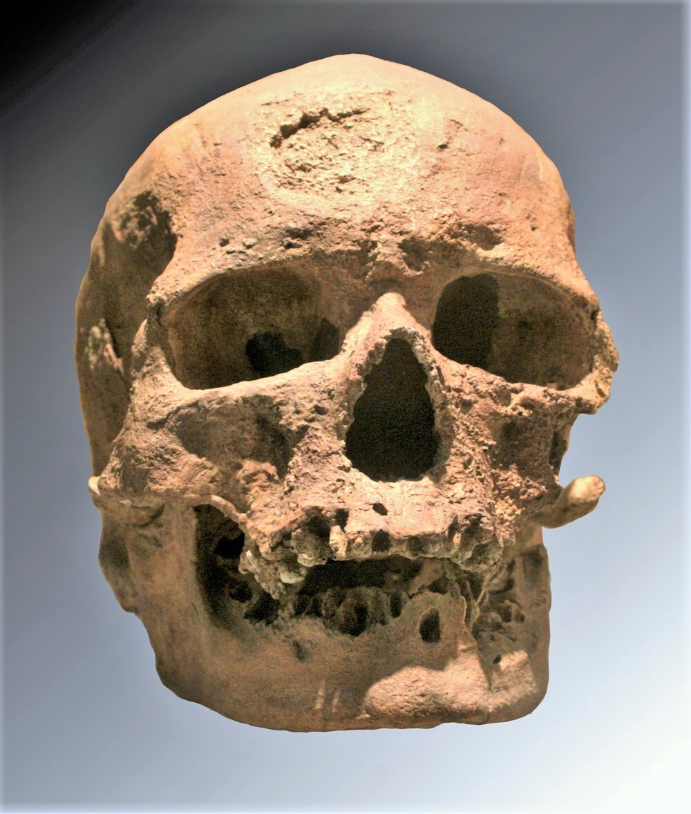
 One of the skulls found in the Devil’s Gate cave from which ancient DNA used in the study was extracted. Credit: Elizaveta Veselovskaya

___________________________________________________ 

While the Devil’s Gate samples show high genetic affinity to the Ulchi, fishermen from the same area who speak the Tungusic language, they are also close to other Tungusic-speaking populations in present day China, such as the Oroqen and Hezhen.

“These are ethnic groups with traditional societies and deep roots across eastern Russia and China, whose culture, language and populations are rapidly dwindling,” added lead author Veronika Siska, also from Cambridge.

“Our work suggests that these groups form a strong genetic lineage descending directly from the early Neolithic hunter-gatherers who inhabited the same region thousands of years previously.”

Article Source: University of Cambridge

____________________________________________________

Subscribe to Popular Archaeology Premium. Available on all laptops and mobile devices, and still the industry’s best value at only $9.00 annually.

___________________________________________ 

Travel and learn with Far Horizons.

farhorizons1

____________________________________________

winter2016ebookcover

 This richly illustrated issue includes the following stories: Recent findings shedding new light on the whereabouts of the remains of Philip of Macedon, father of Alexander the Great; how an archaeologist-sculptor is bringing bones of the dead back to life; archaeologists uncovering town life at the dawn of civilization; an exclusive interview with internationally acclaimed archaeologist James M. Adovasio about what makes the Meadowcroft Rockshelter prominent in the ongoing search for the first Americans; what archaeologists are finding at the site of the ancient city of Gath, the home town of the biblical Philistine giant, Goliath; and how scientists are redrawing the picture of human evolution in Europe.  Find it on Amazon.com.


Climate change drove population decline in New World before Europeans arrived

INDIANAPOLIS—What caused the rapid disappearance of a vibrant Native American agrarian culture that lived in urban settlements from the Ohio River Valley to the Mississippi River Valley in the two centuries preceding the European settlement of North America? In a new study, researchers from Indiana University-Purdue University Indianapolis reconstructed and analyzed 2,100 years of temperature and precipitation data—and point the finger at climate change.

Employing proxies of prehistoric temperature and precipitation preserved in finely layered lake sediments, somewhat analogous to tree-ring records used to reconstruct drought and temperature, the IUPUI scientists have reported on the dramatic environmental changes that occurred as the Native Americans—known as Mississippians—flourished and then vanished from the Midwestern United States. The researchers theorize that the catastrophic climate change they observed, which doomed food production, was a primary cause of the disappearance.

“Abrupt climate change can impose conditions like drought. If these conditions are severe and sustained, as we have determined that they became for the Mississippians, it is virtually impossible for societies, especially those based on agriculture, to survive,” said paleoclimatologist Broxton Bird, corresponding author of the new study. “From the lake records, we saw that the abundant rainfall and consistent good weather—which supported Mississippian society as it grew—changed, making agriculture unsustainable.” Bird is an assistant professor of earth sciences in the School of Science at IUPUI.

This failure of their principal food source likely destabilized the sociopolitical system that supported Mississippian society, according to archeologist Jeremy Wilson, a study co-author. He is an associate professor of anthropology in the School of Liberal Arts at IUPUI.

“Archeologists have recognized that from 1300 onward, Mississippian villages started disappearing—one after the other—almost like lightbulbs in a string, but the question has always been ‘why?,'” said Wilson. “Dr. Bird and his students have shown from the lake-sediment evidence that during the period known as the Little Ice Age, from 1300 to 1800, there was a profound change in climate to colder and drier conditions, which would have negatively impacted the growing of maize in and around Mississippian villages.

“It’s important for us to understand how past civilizations coped with climate change as we encounter things like changing precipitation patterns and temperatures that appear to be rising around the world today.”

martinlakerevised

As the Mississippians’ culture waned, the IUPUI researchers found, there were lower temperatures and significantly less summer rainfall than during its rise. They attribute these changes to more El Niño-like conditions in the Pacific Ocean and cooling during the Little Ice Age, which altered atmospheric circulation such that moisture delivered to the Midwest was derived from the northwestern U.S. (Pacific and Arctic) instead of the Gulf of Mexico, as was the case during the Mississippians’ rise. The longer transport distance of Pacific air masses during the Little Ice Age left less moisture available for rainfall in the Midwest, resulting in drought conditions that undermined agricultural production.

“Climate change had been previously postulated as one of the factors responsible for the disappearance of the Mississippians,” Bird said. “What our research did was develop the highest-resolution record yet produced of rainfall in the midcontinental U.S. for the last 2,100 years, including the time frame from the beginning of the Mississippian period—about 1,000 years ago—to 500 years ago, when much of the lower Midwest was totally abandoned by these people. Our results strongly support climate change—drought, specifically—as a significant cause of the disappearance of Mississippians from the midcontinent through its impact on their ability to farm and produce food surpluses.

“Mississippians did not have irrigation and relied on rainfall to grow their crops. Modern agriculture in the Midwest corn belt likewise relies on rainfall with very little irrigation infrastructure, making us similarly vulnerable to drought,” Bird said.

“Midcontinental Native American Population Dynamics and Late Holocene Hydroclimate Extremes” is published in Scientific Reports, an open access, peer-reviewed Nature research journal.

The sediment studied was from Martin Lake in northeast Indiana. Bird and Wilson are continuing their research at additional lakes, especially those adjacent to archeological sites, throughout the midcontinent.

Article Source: INDIANA UNIVERSITY-PURDUE UNIVERSITY INDIANAPOLIS SCHOOL OF SCIENCE

____________________________________________________

Image: Studying finely layered sediments from Martin Lake in LaGrange county, Indiana, IUPUI scientists have reported on dramatic environmental changes that occurred in the New World before the Europeans arrived. Credit: Broxton Bird, PhD, School of Science, Indiana University-Purdue University Indianapolis

________________________________________________________

Subscribe to Popular Archaeology Premium. Available on all laptops and mobile devices, and still the industry’s best value at only $9.00 annually.

___________________________________________ 

Travel and learn with Far Horizons.

farhorizons1

____________________________________________

winter2016ebookcover

 This richly illustrated issue includes the following stories: Recent findings shedding new light on the whereabouts of the remains of Philip of Macedon, father of Alexander the Great; how an archaeologist-sculptor is bringing bones of the dead back to life; archaeologists uncovering town life at the dawn of civilization; an exclusive interview with internationally acclaimed archaeologist James M. Adovasio about what makes the Meadowcroft Rockshelter prominent in the ongoing search for the first Americans; what archaeologists are finding at the site of the ancient city of Gath, the home town of the biblical Philistine giant, Goliath; and how scientists are redrawing the picture of human evolution in Europe.  Find it on Amazon.com.


Anthropologists uncover art by (really) old masters — 38,000 year-old engravings

NEW YORK UNIVERSITY—An international team of anthropologists has uncovered a 38,000-year-old engraved image in a southwestern French rockshelter—a finding that marks some of the earliest known graphic imagery found in Western Eurasia and offers insights into the nature of modern humans during this period.

“The discovery sheds new light on regional patterning of art and ornamentation across Europe at a time when the first modern humans to enter Europe dispersed westward and northward across the continent,” explains NYU anthropologist Randall White, who led the excavation in France’s Vézère Valley.

The findings, which appear in the journal Quaternary International, center on the early modern humans’ Aurignacian culture, which existed from approximately 43,000 to 33,000 years ago.

Abri Blanchard, the French site of the recently uncovered engraving, a slab bearing a complex image of an aurochs, or wild cow, surrounded by rows of dots, was previously excavated in the early 20th century. White and his team members began their methodical exploration of remaining deposits at the site in 2011, with the discovery occurring in 2012.

__________________________________

engravedimage

An international team of anthropologists has uncovered a 38,000-year-old engraved image, above, in a southwestern French rockshelter—a finding that marks some of the earliest known graphic imagery found in Western Eurasia and offers insights into the nature of modern humans during this period. The limestone slab engraved with the image of an aurochs, or extinct wild cow, was discovered at Abri Blanchard in 2012. Credit: Musée national de Préhistoire collections – photo MNP – Ph. Jugie

______________________________________________ 

White contends that Aurignacian art offers a window into the lives and minds of its makers—and into the societies they created.

“Following their arrival from Africa, groups of modern humans settled into western and Central Europe, showing a broad commonality in graphic expression against which more regionalized characteristics stand out,” he explains. “This pattern fits well with social geography models that see art and personal ornamentation as markers of social identity at regional, group, and individual levels.”

Abri Blanchard and its sister site, Abri Castanet, previously excavated by White’s team, have long been recognized as being among the oldest sites in Eurasia bearing artifacts of human symbolism. Over time, hundreds of personal ornaments have been discovered, including pierced animal teeth, pierced shells, ivory and soapstone beads, engravings, and paintings on limestone slabs.

Article Source: New York University

______________________________________________

Subscribe to Popular Archaeology Premium. Available on all laptops and mobile devices, and still the industry’s best value at only $9.00 annually.

___________________________________________ 

Travel and learn with Far Horizons.

farhorizons1

____________________________________________

winter2016ebookcover

 This richly illustrated issue includes the following stories: Recent findings shedding new light on the whereabouts of the remains of Philip of Macedon, father of Alexander the Great; how an archaeologist-sculptor is bringing bones of the dead back to life; archaeologists uncovering town life at the dawn of civilization; an exclusive interview with internationally acclaimed archaeologist James M. Adovasio about what makes the Meadowcroft Rockshelter prominent in the ongoing search for the first Americans; what archaeologists are finding at the site of the ancient city of Gath, the home town of the biblical Philistine giant, Goliath; and how scientists are redrawing the picture of human evolution in Europe.  Find it on Amazon.com.


The ancient Indus civilization’s adaptation to climate change

UNIVERSITY OF CAMBRIDGE—With climate change in our own era becoming increasingly evident, it’s natural to wonder how our ancestors may have dealt with similar environmental circumstances. New research methods and technologies are able to shed light on climate patterns that took place thousands of years ago, giving us a new perspective on how cultures of the time coped with variable and changing environments.

A new article in the February issue of Current Anthropology explores the dynamics of adaptation and resilience in the face of a diverse and varied environmental context, using the case study of South Asia’s Indus Civilization (c.3000-1300 BC). Integrating research carried out as part of the Land, Water and Settlement project—part of an ongoing collaboration between the University of Cambridge and Banaras Hindu University—that worked in northwest India between 2007 and 2014, the article looks at how Indus populations in north-west India interacted with their environment, and considers how that environment changed during periods of climate change.

Lead author, Dr. Cameron Petrie of the Division of Archaeology, University of Cambridge notes that “for most ancient complex societies, water was a critical factor, and the availability of water and the way that it was managed and used provide critical insight into human adaptation and the resilience of subsistence practices”.

Most early complex societies developed in regions where the climatic parameters faced by ancient subsistence farmers were varied, but not especially diverse. The Indus Civilization developed in a specific environmental context, where the winter and summer rainfall systems overlapped. There is now evidence to show that this region was subject to climate change during the period when the Indus Civilization was at its height (c.2500-1900 BC). The Indus Civilization therefore provides a unique opportunity to understand how an ancient society coped with diverse and varied ecologies and change in the fundamental and underlying environmental parameters.

In the early Holocene, the Indus Civilization was situated in proximity to Kotla Dahar, a deep lake, implying regular and consistent rainfall input to offset evaporation, which given its location, would have been primarily monsoonal. The lake showed evidence for two dramatic decreases in monsoon rainfall and a progressive lowering of the lake level. The second of these shows Kotla Dahar becoming completely ephemeral ca. 2200-2000 BC as a result of an abrupt weakening of the monsoon, and the weakening of the monsoon is visible in speleothem records in Oman and northeast India. The proximity of the Kotla Dahar record to the area occupied by Indus populations shows that climate must be formally considered as a contributing parameter in the process of Indus deurbanization, at least in the context of the plains of northwest India.

____________________________________

indus1

 On-site photography during the excavations at Masudpur I, Haryana, India. Image credit: C. Petrie

____________________________________ 

indus2

 Land, Water and Settlement project members excavating a sounding at Lohari Ragho II, Haryana, India. Image credit: C. Petrie

______________________________________

indus3

Distribution of urban-phase Indus settlements (A) and post-urban-phase Indus settlements (B) in northwest India and their relationship to mean annual rainfall (1900–2008). Major Indus sites and sites investigated by the Land, Water and Settlement project are shown in white. Image credit: C. Petrie 

________________________________________________

It has long been hypothesized that there was variation in the subsistence practices used by Indus populations and this fits with the theme of coping with diverse environments. Petrie comments that “we argue that rather than being forced to intensify or diversify subsistence practices in response to climatic change, we have evidence for the use of millet, rice, and tropical pulses in the pre-urban and urban phases of the Indus Civilization. This evidence suggests that local Indus populations were already well adapted to living in varied and variable environmental conditions before the development of urban centers. It is also possible that these adaptations were beneficial when these populations were faced with changes to the local environment that were probably beyond the range of variation that they typically encountered”.

Article Source: University of Cambridge

__________________________________

If you liked this article, you may like Mitigating Climate Change: It Starts With Better Ocean Data.

________________________________________________

Subscribe to Popular Archaeology Premium. Available on all laptops and mobile devices, and still the industry’s best value at only $9.00 annually.

___________________________________________

Travel and learn with Far Horizons.

farhorizons1

____________________________________________

winter2016ebookcover

This richly illustrated issue includes the following stories: Recent findings shedding new light on the whereabouts of the remains of Philip of Macedon, father of Alexander the Great; how an archaeologist-sculptor is bringing bones of the dead back to life; archaeologists uncovering town life at the dawn of civilization; an exclusive interview with internationally acclaimed archaeologist James M. Adovasio about what makes the Meadowcroft Rockshelter prominent in the ongoing search for the first Americans; what archaeologists are finding at the site of the ancient city of Gath, the home town of the biblical Philistine giant, Goliath; and how scientists are redrawing the picture of human evolution in Europe.  Find it on Amazon.com.


Climate change helped kill off super-sized Ice Age animals in Australia

VANDERBILT UNIVERSITY—During the last Ice Age, Australia, Tasmania and New Guinea formed a single landmass, called Sahul. It was a strange and often hostile place populated by a bizarre cast of giant animals.

There were 500-pound kangaroos, marsupial tapirs the size of horses and wombat-like creatures the size of hippos. There were flightless birds that weighed twice as much as modern emu, 33-foot snakes, 20-foot crocodiles, 8-foot turtles with horned heads and spiked tails, and giant monitor lizards that measured greater than 6 feet from tip to tail and were likely venomous.

By about 30,000 years ago, however, most of these ‘megafauna’ had disappeared from the Sahul as part of a global mass extinction that saw the end of nearly all of the super-sized animals that had evolved to survive in extreme Ice Age climates. The factors that forced the Australian megafauna into extinction remain a matter of considerable controversy. Many experts argue that the ancestors of the Australian aborigines, who made an appearance approximately 50,000 years ago, either hunted them into extinction or gradually destroyed the habitat they required by practices such as fire-stick burning. Others argue that the gradual drying out of Australia and weakening of the Australian monsoon played a major role in their demise.

A new study has compared the diet of a variety of Australian megafaunal herbivores from the period when they were widespread (350,000 to 570,000 years ago) to a period when they were in decline (30,000 to 40,000 years ago) by studying their fossil teeth. The analysis suggests that climate change had a significant impact on their diets and may well have been a primary factor in their extinction.

“We have found evidence that, as the climate was changing and getting drier, animal diets were shifting dramatically,” said Larisa DeSantis, assistant professor of earth and environmental studies at Vanderbilt University, who directed the study. “If climate change was a primary or contributing factor in their demise, as it appears, we need to pay more attention to how current levels of climate change are affecting animals today.”

The results of the study are described in a paper titled “Dietary responses of Sahul (Pleistocene Australia-New Guinea) megafauna to climate and environmental change” published Jan. 26 by the journal Paleobiology. Co-authors on the paper are Judith Field and John Dodson from the University of New South Wales and Stephen Wroe from the University of New England.

Michael Archer, a leading Australian paleontologist at the University of New South Wales who was not involved in the study, commented, “This new study, based on hard evidence, makes it clear that changes in late Pleistocene climate had a major impact on the late Pleistocene megafauna of Australia, adding even more evidence to challenge the imaginative a priori assumption that ‘blitzkrieg’ by early humans caused the extinction of this continent’s lost megafauna. Climate change clearly has been in the past and will continue to be a major cause of extinction into the future.”

The teeth that were analyzed came from the Cuddie Springs site in southeastern Australia. It is located on a prehistoric ephemeral lake and it is the only site on mainland Australia that has produced fossil evidence of the co-existence of humans and megafauna. “Unfortunately, many of the advocates of the human predation hypothesis have discounted Cuddie Springs because it does not support the popular ‘blitzkrieg’ theory that maintains the megafauna went extinct in the 1,000-year period after humans arrived on the scene,” said DeSantis.

It’s amazing how much information about the prehistoric environment paleontologists can extract from fossil teeth using a dental drill, dental impression material and some sophisticated instruments. The ratios of oxygen and carbon isotopes locked in the enamel provide clues about the animals’ diet and the average temperature and humidity of the environment at the time the teeth formed.

_______________________________________

marsupial

Skull of Diprotodon optatum, extinct Australian marsupial megafauna, at the Melbourne Museum. The specimen clearly shows the large front teeth for which the genus is named (Diprotodon = “two forward teeth”) and the dentition adapted for browsing. Melbourne, Victoria, Australia.  jjron, Wikimedia Commons

___________________________________________________ 

Differences within individual teeth mirror climate variability. Analysis of the microscopic scratches on the surface of the teeth provides evidence of what the animal was eating in the last few weeks of its life. Differences in wear-patterns can differentiate between animals that were grazing on grass and browsing on bushes.

“For example, we know from the analysis of modern day kangaroos that oxygen isotope ratios in their teeth are highly correlated with the relative humidity and amount of precipitation in their environment,” DeSantis said. “This makes them ideally suited for tracking changes in aridity over time.”

During the megafaunal heyday around 500,000 years ago, the dental analysis revealed that the climate was semi-arid. In addition, the animals’ diets were highly variable, implying that there were a number of ecological niches available to them. That contrasts markedly with the period from 30,000 to 40,000 years ago. Here, the analysis indicates that the climate was substantially drier and the diet of the giant herbivores was considerably more restricted.

“It appears that long-term aridification may have reduced the ability of megafauna to consume certain types of plants, including salt-bush. Eating salt-rich plants requires drinking additional water that was less available and likely increased competition for similar plant resources,” said DeSantis. “These data clarify the impacts of climatic change on marsupial megafauna and suggest that the long-term drying out of Australia, identified here and in other records, likely played a key role in the decline and disappearance of this unique suite of animals.”

_____________________________________________________

Article Source: Vanderbilt University

The work was supported by National Science Foundation grants EAR1053839 and FAIN1455198, Australian Research Foundation grants ARC LP211430 and DPO5579230, University of New South Wales, the University of Sydney, Oak Ridge Associated Universities and Vanderbilt University.

______________________________________________________

Subscribe to Popular Archaeology Premium. Available on all laptops and mobile devices, and still the industry’s best value at only $9.00 annually.

___________________________________________ 

Travel and learn with Far Horizons.

farhorizons1

____________________________________________

winter2016ebookcover

 This richly illustrated issue includes the following stories: Recent findings shedding new light on the whereabouts of the remains of Philip of Macedon, father of Alexander the Great; how an archaeologist-sculptor is bringing bones of the dead back to life; archaeologists uncovering town life at the dawn of civilization; an exclusive interview with internationally acclaimed archaeologist James M. Adovasio about what makes the Meadowcroft Rockshelter prominent in the ongoing search for the first Americans; what archaeologists are finding at the site of the ancient city of Gath, the home town of the biblical Philistine giant, Goliath; and how scientists are redrawing the picture of human evolution in Europe.  Find it on Amazon.com.


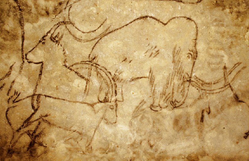
Palaeolithic art developed from public galleries towards more private exhibitions

UNIVERSITY OF THE BASQUE COUNTRY—The study of Palaeolithic art is “one of the few tools we have to find out about the culture and society of prehistoric groups,” said Blanca Ochoa, researcher in the UPV/EHU’s department of Geography, Prehistory and Archaeology. Knowing who the representations were meant for “could indicate the intended use of cave art for prehistoric groups: whether it was something for the whole group, shared by all its members, or whether it was limited to small groups, or even to just one individual,” she explained.

In her research the aim was to specify whether there were any preferences in terms of choosing the spaces where the Palaeolithic representations were drawn or engraved in nine caves on the Cantabrian coast located in Asturias and Cantabria. “It is an aspect that has been analysed very little until now,” remarked the researcher. They developed an in-house methodology to analyse the visibility of the figures depicted, which covers not only variables relating to the space where they are located (room size, accessibility, presence of natural light etc.) but also characteristics relating to the depictions themselves: “The size of the works, the height they are at, and, above all, the technique used to execute them (painting or engraving) largely determines visibility,” said Ochoa. “The paintings are much more visible than the engravings, and even more so if the engraving is not very deep”.

Differences in location, possible change of use

As Ochoa explained, one of the most interesting results they have extracted in the research are the chronological differences observed: “Throughout the Upper Palaeolithic the topographical distribution of the works gradually changed: during the early phases of the Upper Palaeolithic there is a preference for executing medium-sized and large drawings in the main galleries of the caves. During the Magdalenian, between 20,000 and 12,000 years ago, there was an increase in the use of spaces located in places far from the main cave route, in small, sometimes concealed rooms; what is more, there was a preference for a smaller size when it came to creating the figures and an increase in the use of the engraving as a technique. Art may have been used to be seen in community during the Pre-Magdalenian. The use of smaller spaces during the Magdalenian, however, could indicate that art became something more restricted or that it performed another kind of function”.

_____________________________________

cavepic

This is a panel located in the cave at La Pasiego (Puente Viesgo, Cantabria), where various figures painted in different phases and chronologies can be seen: the largest figure is an auroch and various types of signs of a triangular type and groups of dots can be seen. The panel is located in a small side room open to the main gallery of the cave just a few meters from the entrance. Credit: Blanca Ochoa

_________________________________________________ 

As it is a new type of study and conducted in a limited geographical area, Ochoa stresses the preliminary nature of the results obtained. Nevertheless, she believes it will “help to establish the bases to find out who Palaeolithic art was intended for. We have confirmed that the methodology developed does in fact work and that it can continue to be applied in other areas of the Cantabrian region or outside it. I would like to continue with the research, because the results for this area have been very interesting, and I would like to see whether the conclusions we have drawn can be extended to other areas. Although there will probably be geographical differences as well and the different groups may have had other uses of art”.

Article Source: University of the Basque Country

__________________________________________________

Subscribe to Popular Archaeology Premium. Available on all laptops and mobile devices, and still the industry’s best value at only $9.00 annually.

___________________________________________ 

Travel and learn with Far Horizons.

farhorizons1

____________________________________________

winter2016ebookcover

 This richly illustrated issue includes the following stories: Recent findings shedding new light on the whereabouts of the remains of Philip of Macedon, father of Alexander the Great; how an archaeologist-sculptor is bringing bones of the dead back to life; archaeologists uncovering town life at the dawn of civilization; an exclusive interview with internationally acclaimed archaeologist James M. Adovasio about what makes the Meadowcroft Rockshelter prominent in the ongoing search for the first Americans; what archaeologists are finding at the site of the ancient city of Gath, the home town of the biblical Philistine giant, Goliath; and how scientists are redrawing the picture of human evolution in Europe.  Find it on Amazon.com.


ASU scientist finds advanced geometry no secret to prehistoric architects in US Southwest

ARIZONA STATE UNIVERSITY—Imagine you are about to plan and construct a building that involves several complicated geometrical shapes, but you aren’t allowed to write down any numbers or notes as you do it. For most of us, this would be impossible.

Yet, new research from Arizona State University has revealed that the ancient Southwestern Pueblo people, who had no written language or written number system, were able to do just that – and used these skills to build sophisticated architectural complexes.

Dr. Sherry Towers, a professor with the ASU Simon A. Levin Mathematical, Computational and Modeling Sciences Center, uncovered these findings while spending several years studying the Sun Temple archaeological site in Mesa Verde National Park in Colorado, constructed around A.D. 1200.

“The site is known to have been an important focus of ceremony in the region for the ancestral Pueblo peoples, including solstice observations,” Towers says. “My original interest in the site involved looking at whether it was used for observing stars as well.”

However, as Towers delved deeper into the site’s layout and architecture, interesting patterns began to emerge.

“I noticed in my site survey that the same measurements kept popping up over and over again,” she says. “When I saw that the layout of the site’s key features also involved many geometrical shapes, I decided to take a closer look.”

The geometrical shapes used within this location would be familiar to any high school student: equilateral triangles, squares, 45-degree right triangles, Pythagorean triangles, and the “Golden rectangle,” which was well known to architects in ancient Greece and Egypt and is often used in Western art due to its pleasing proportions.

With some geometrical know-how, a straight-edge, a compass or cord, and a unit of measurement, all of the shapes are fairly easy to construct. But, unlike the ancient Greeks, Egyptians and Maya, the ancestral Pueblo people had no written language or number system to aid them when they built the site. Incredibly, their measurements were still near-perfect, with a relative error of less than one percent.

“This is what I find especially amazing,” Towers says. “The genius of the site’s architects cannot be underestimated. If you asked someone today to try to reconstruct this site and achieve the same precision that they had using just a stick and a piece of cord, it’s highly unlikely they’d be able to do it, especially if they couldn’t write anything down as they were working.”

______________________________________

geometry2

 A satellite photo of Sun Temple archaeological site with illustrations demonstrating its geometrical properties. Credit: Dr. Sherry Towers

______________________________________________________ 

During her research, Towers discovered that the site was laid out using a common unit of measurement just over 30 centimeters in length – equal to about one modern-day foot. She also found evidence that some of the same geometrical constructs from Sun Temple were used in at least one other ancestral Puebloan ceremonial site, Pueblo Bonito, located in New Mexico’s Chaco Culture National Historic Park.

_________________________________________

geometry1

 A satellite photo of Pueblo Bonito archaeological site with illustrations demonstrating its geometrical properties. Credit: Dr. Sherry Towers

__________________________________________________ 

“Further study is needed to see if that site also has the same common unit of measurement,” she says. “It’s a task that will keep us busy for some years to come.”

The study Advanced geometrical constructs in a Pueblo ceremonial site, c. 1200 CE will appear in the Journal of Archaeological Science: Reports.

Article Source: Arizona State University

___________________________________________________

Subscribe to Popular Archaeology Premium. Available on all laptops and mobile devices, and still the industry’s best value at only $9.00 annually.

___________________________________________ 

Travel and learn with Far Horizons.

farhorizons1

____________________________________________

winter2016ebookcover

 This richly illustrated issue includes the following stories: Recent findings shedding new light on the whereabouts of the remains of Philip of Macedon, father of Alexander the Great; how an archaeologist-sculptor is bringing bones of the dead back to life; archaeologists uncovering town life at the dawn of civilization; an exclusive interview with internationally acclaimed archaeologist James M. Adovasio about what makes the Meadowcroft Rockshelter prominent in the ongoing search for the first Americans; what archaeologists are finding at the site of the ancient city of Gath, the home town of the biblical Philistine giant, Goliath; and how scientists are redrawing the picture of human evolution in Europe.  Find it on Amazon.com.


Archaeologists uncover new clues to Maya collapse

UNIVERSITY OF ARIZONA—Using the largest set of radiocarbon dates ever obtained from a single Maya site, archaeologists have developed a high-precision chronology that sheds new light on patterns leading up to the two major collapses of the ancient civilization.

Archaeologists have long puzzled over what caused what is known as the Classic Maya collapse in the ninth century A.D., when many of the ancient civilization’s cities were abandoned. More recent investigations have revealed that the Maya also experienced an earlier collapse in the second century A.D.—now called the Preclassic collapse—that is even more poorly understood.

University of Arizona archaeologist Takeshi Inomata and his colleagues suggest in a new paper, published in the Proceedings of the National Academy of Sciences, that both collapses followed similar trajectories, with multiple waves of social instability, warfare and political crises leading to the rapid fall of many city centers.

The findings are based on a highly refined chronology developed by Inomata and his colleagues using an unprecedented 154 radiocarbon dates from the archaeological site of Ceibal in Guatemala, where the team has worked for over a decade.

While more general chronologies might suggest that the Maya collapses occurred gradually, this new, more precise chronology indicates more complex patterns of political crises and recoveries leading up to each collapse.

“What we found out is that those two cases of collapse (Classic and Preclassic) follow similar patterns,” said Inomata, the paper’s lead author and a professor in the School of Anthropology in the UA College of Social and Behavioral Sciences. “It’s not just a simple collapse, but there are waves of collapse. First, there are smaller waves, tied to warfare and some political instability, then comes the major collapse, in which many centers got abandoned. Then there was some recovery in some places, then another collapse.”

Using radiocarbon dating and data from ceramics and highly controlled archaeological excavations, the researchers were able to establish the refined chronology of when population sizes and building construction increased and decreased at Ceibal.

__________________________________

ceibal2

Archaeologists excavate the royal palace of Ceibal, which was burned during the Classic Maya collapse in the ninth century. Credit: Takeshi Inomata/University of Arizona

__________________________________________________

ceibal1

 University of Arizona anthropology professor Daniela Triadan excavates the collapsed facade of the royal palace of Ceibal, which was burned during the Classic Maya collapse in the ninth century. Credit:Takeshi Inomata/University of Arizona

_____________________________________________________ 

While the findings may not solve the mystery of why exactly the Maya collapses occurred, they are an important step toward better understanding how they unfolded.

“It’s really, really interesting that these collapses both look very similar, at very different time periods,” said Melissa Burham, one of three UA anthropology graduate students who co-authored the paper. “We now have a good understanding of what the process looked like, that potentially can serve as a template for other people to try to see if they have a similar pattern at their (archaeological) sites in the same area.”

Inomata and his UA colleagues—anthropology professor Daniela Triadan and students Burham, Jessica MacLellan and Juan Manuel Palomo—worked with collaborators at Ibaraki University, Naruto University of Education and the Graduate University for Advanced Studies in Japan, and with Guatemalan archaeologists and students.

Radiocarbon dating was done at Paleo Laboratory Company in Japan and at the Accelerator Mass Spectrometry Laboratory in the UA Department of Physics.

“Radiocarbon dating has been used for a long time, but now we’re getting to an interesting period because it’s getting more and more precise,” said Inomata, who also is an Agnese Nelms Haury Chair in Environment and Social Justice at the UA. “We’re getting to the point where we can get to the interesting social patterns because the chronology is refined enough, and the dating is precise enough.”

Article Source: University of Arizona

___________________________________________

Subscribe to Popular Archaeology Premium. Available on all laptops and mobile devices, and still the industry’s best value at only $9.00 annually.

___________________________________________ 

Travel and learn with Far Horizons.

farhorizons1

____________________________________________

winter2016ebookcover

 This richly illustrated issue includes the following stories: Recent findings shedding new light on the whereabouts of the remains of Philip of Macedon, father of Alexander the Great; how an archaeologist-sculptor is bringing bones of the dead back to life; archaeologists uncovering town life at the dawn of civilization; an exclusive interview with internationally acclaimed archaeologist James M. Adovasio about what makes the Meadowcroft Rockshelter prominent in the ongoing search for the first Americans; what archaeologists are finding at the site of the ancient city of Gath, the home town of the biblical Philistine giant, Goliath; and how scientists are redrawing the picture of human evolution in Europe.  Find it on Amazon.com.


Humans, not climate change, wiped out Australian megafauna

UNIVERSITY OF COLORADO AT BOULDER—New evidence involving the ancient poop of some of the huge and astonishing creatures that once roamed Australia indicates the primary cause of their extinction around 45,000 years ago was likely a result of humans, not climate change.

Led by Monash University in Victoria, Australia and the University of Colorado Boulder, the team used information from a sediment core drilled in the Indian Ocean off the coast of southwest Australia to help reconstruct past climate and ecosystems on the continent. The core contains chronological layers of material blown and washed into the ocean, including dust, pollen, ash and spores from a fungus called Sporormiella that thrived on the dung of plant-eating mammals, said CU Boulder Professor Gifford Miller.

Miller, who participated in the study led by Sander van der Kaars of Monash University, said the sediment core allowed scientists to look back in time, in this case more than 150,000 years, spanning Earth’s last full glacial cycle. Fungal spores from plant-eating mammal dung were abundant in the sediment core layers from 150,000 years ago to about 45,000 years ago, when they went into a nosedive, said Miller, a professor in the Department of Geological Sciences.

“The abundance of these spores is good evidence for a lot of large mammals on the southwestern Australian landscape up until about 45,000 years ago,” he said. “Then, in a window of time lasting just a few thousand years, the megafauna population collapsed.”

A paper on the subject was published online Jan. 20 in Nature Communications.

The Australian collection of megafauna some 50,000 years ago included 1,000-pound kangaroos, 2-ton wombats, 25-foot-long lizards, 400-pound flightless birds, 300-pound marsupial lions and Volkswagen-sized tortoises. More than 85 percent of Australia’s mammals, birds and reptiles weighing over 100 pounds went extinct shortly after the arrival of the first humans, said Miller.

The ocean sediment core showed the southwest is one of the few regions on the Australian continent that had dense forests both 45,000 years ago and today, making it a hotbed for biodiversity, said Miller, also associate director of CU Boulder’s Institute of Arctic and Alpine Research.

“It’s a region with some of the earliest evidence of humans on the continent, and where we would expect a lot of animals to have lived,” Miller said. “Because of the density of trees and shrubs, it could have been one of their last holdouts some 45,000 years ago. There is no evidence of significant climate change during the time of the megafauna extinction.”

__________________________________

megafauna

 This is a menagerie of megafauna that inhabited Australia some 45,000 years ago. Credit: Peter Trusler, Monash University

_______________________________________________ 

Scientists have been debating the causes of the Australian megafauna extinctions for decades. Some claim the animals could not have survived changes in climate, including a shift some 70,000 years ago when much of the southwestern Australia landscape went from a wooded eucalyptus tree environment to an arid, sparsely vegetated landscape.

Others have suggested the animals were hunted to extinction by Australia’s earliest immigrants who had colonized most of the continent by 50,000 years ago, or a combination of overhunting and climate change, said Miller.

Miller said the extinction may have been caused by “imperceptible overkill.” A 2006 study by Australian researchers indicates that even low-intensity hunting of Australian megafauna – like the killing of one juvenile mammal per person per decade – could have resulted in the extinction of a species in just a few hundred years.

“The results of this study are of significant interest across the archaeological and Earth science communities and to the general public who remain fascinated by the menagerie of now extinct giant animals that roamed the planet – and the cause of their extinction – as our own species began its persistent colonization of Earth,” said van der Kaars.

In 2016 Miller used burned eggshells of the 400-pound bird, Genyornis, as the first direct evidence that humans actually preyed on the Australian megafauna.

The new study also included Research Professor Scott Lehman of INSTAAR. The study was funded in part by the U.S. National Science Foundation and the German Research Foundation.

Article Source: University of Colorado at Boulder

_____________________________________________________

Subscribe to Popular Archaeology Premium. Available on all laptops and mobile devices, and still the industry’s best value at only $9.00 annually.

___________________________________________ 

Travel and learn with Far Horizons.

farhorizons1

____________________________________________

winter2016ebookcover

 This richly illustrated issue includes the following stories: Recent findings shedding new light on the whereabouts of the remains of Philip of Macedon, father of Alexander the Great; how an archaeologist-sculptor is bringing bones of the dead back to life; archaeologists uncovering town life at the dawn of civilization; an exclusive interview with internationally acclaimed archaeologist James M. Adovasio about what makes the Meadowcroft Rockshelter prominent in the ongoing search for the first Americans; what archaeologists are finding at the site of the ancient city of Gath, the home town of the biblical Philistine giant, Goliath; and how scientists are redrawing the picture of human evolution in Europe.  Find it on Amazon.com.


Major Viking Age manor discovered at Birka, Sweden

STOCKHOLM UNIVERSITY—During the spring of 2016 a number of large presumed house terraces were identified by the authors at Korshamn, Sweden. As a consequence, high resolution geophysical surveys using ground-penetrating radar were carried out in September 2016. Korshamn is one of the main harbour bays of the island of Björkö, situated outside the town boundaries of the Viking town of Birka. The survey revealed a major Viking period hall on the site, with a length of around 40 meters. Based on the land upheaval the area of the Viking hall can be dated to sometime after 810 AD. The hall is connected to a large fenced area that stretches towards the harbour basin.

“This kind of Viking period high status manor has previously only been identified at a few places in southern Scandinavia, for instance at Tissø and Lejre in Denmark. It is known that the fenced area at such manors was linked to religious activities” says Johan Runer, archaeologist at the Stockholm county museum.

During the survey a predecessor for the Viking Age manor was also identified at the site: a high status manor that existed during the Vendel period, prior to the establishment of the Viking Age town of Birka. Both the identified buildings and their continued use from the Vendel period to the Viking Age correlate well with the “ancestral property” of Birka’s royal bailiff Herigar as mentioned in Rimbert’s Vita Anskarii. Herigar was Christianized by Ansgar, archbishop of Hamburg-Bremen, during his first mission c. 830 AD, and he built the first church on his land.

“The consequences of our discoveries cannot be overestimated: in terms of the emergence of the Viking town of Birka, its royal administration and the earliest Christian mission to Scandinavia”, says Sven Kalmring, researcher at the Zentrum für Baltische und Skandinavische Archäologie, Schleswig.

“The results highlight the benefits of using non-intrusive geophysical surveys for the detection of archaeological features and, once again, prove to be an invaluable tool for documenting Iron Age building remains in Scandinavia”, says Andreas Viberg, researcher at the Archaeological Research Laboratory at Stockholm University.

______________________________________

vikingmanor

 Reconstruction of Viking age manor. Credit: Reconstruction by Jacques Vincent

______________________________________ 

The results will be published in the international scientific journal Archäologisches Korrespondenzblatt volume 2017/1. Send an e-mail to Anders Viberg to get a preview of the article.

The research is a collaboration between Zentrum für Baltische und Skandinavische Archäologie, Stockholm county museum and the Archaeological Research Laboratory, Stockholm University.

Article Source: Edited from a Stockholm University press release.

__________________________________________________

Subscribe to Popular Archaeology Premium. Available on all laptops and mobile devices, and still the industry’s best value at only $9.00 annually.

___________________________________________ 

Travel and learn with Far Horizons.

farhorizons1

____________________________________________

winter2016ebookcover

 This richly illustrated issue includes the following stories: Recent findings shedding new light on the whereabouts of the remains of Philip of Macedon, father of Alexander the Great; how an archaeologist-sculptor is bringing bones of the dead back to life; archaeologists uncovering town life at the dawn of civilization; an exclusive interview with internationally acclaimed archaeologist James M. Adovasio about what makes the Meadowcroft Rockshelter prominent in the ongoing search for the first Americans; what archaeologists are finding at the site of the ancient city of Gath, the home town of the biblical Philistine giant, Goliath; and how scientists are redrawing the picture of human evolution in Europe.  Find it on Amazon.com.


Iron Age structures discovered at Tel Aviv University excavation

AMERICAN FRIENDS OF TEL AVIV UNIVERSITY—Some believe that the fabled mines of King Solomon were located among copper smelting camps in Israel’s Timna Valley. The arid conditions at Timna have seen the astonishing preservation of 3,000-year-old organic materials, which have provided Tel Aviv University archaeologists with a unique window into the culture and practices of a sophisticated ancient society.

An advanced military fortification — a well-defined gatehouse complex — unearthed recently at Timna, including donkey stables, points to the community’s highly-organized defense system and significant dependence on long-distance trade. The research was recently published in The Journal of Archaeological Science: Reports.

The fortification dates to the reigns of Kings David and Solomon in the 10th century BCE.

“While there is no explicit description of ‘King Solomon’s mines’ in the Old Testament, there are references to military conflicts between Israel and the Edomites in the Arava Valley,” says Dr. Erez Ben-Yosef of TAU’s Institute of Archaeology and one of the leaders of the Timna research and excavation team, along with his colleagues Dr. Lidar Sapir-Hen and Dr. Dafna Langgut. “According to the Bible, David traveled hundreds of miles outside of Jerusalem and engaged in military conflict in the desert — striking down ‘18,000 Edomites in the Valley of Salt.’ Now, having found evidence of defensive measures — a sophisticated fortification — we understand what must have been at stake for him in this remote region: copper.”

Military threats

“Copper was a rare product and very challenging to produce,” Dr. Ben-Yosef continues. “Because copper — like oil today, perhaps — was the most coveted commodity, it landed at the very heart of military conflicts. The discovery of the fortification indicates a period of serious instability and military threats at that time in the region.”

In the remarkably intact two-room fortification, located in one of the largest smelting camps in the Timna Valley, the researchers also found evidence of a complex long-distance trade system that probably included the northern Edomite plateau, the Mediterranean coastal plain and Judea. The complex featured pens for draught animals and other livestock. According to precise pollen, seed, and fauna analyses, they were fed with hay and grape pomace — high-quality sustenance that must have been delivered from the Mediterranean region hundreds of miles away.

“The gatehouse fortification was apparently a prominent landmark,” says Dr. Ben-Yosef. “It had a cultic or symbolic function in addition to its defensive and administrative roles. The gatehouse was built of sturdy stone to defend against invasion. We found animal bones and dung piles so intact, we could analyze the food the animals were fed with precision. The food suggests special treatment and care, in accordance with the key role of the donkeys in the copper production and in trade in a logistically challenging region.”

________________________________________________

timnasitepic


 The entrance complex with a two-room gatehouse flanked by animal pens and piles of dung. Credit: Erez Ben-Yosef et al.

_____________________________________ 

Archaeology and the Old Testament

The site was discovered in 1934 by the American archaeologist Nelson Glueck. He called the copper smelting site “Slaves’ Hill,” because he believed it bore all the marks of an Iron Age slave camp, complete with fiery furnaces and a formidable stone barrier that seemed designed to prevent escape. But in 2014 Dr. Ben-Yosef and colleagues debunked this theory, revealing that the diets and clothing of the smelters — perfectly preserved by the desert conditions — pointed instead to a hierarchical, sophisticated society.

“The historical accuracy of the Old Testament accounts is debated, but archaeology can no longer be used to contradict them,” Dr. Ben-Yosef observes. “On the contrary, our new discoveries are in complete accordance with the description of military conflicts against a hierarchical and centralized society located south of the Dead Sea.”

Dr. Ben-Yosef and his team plan to continue exploring the ancient societies that worked in these remote copper mines. “The unique preservation of organic materials in Timna, coupled with 21st century research methods including ancient DNA and residue analyses, bear the potential for additional significant discoveries in the future,” says Dr. Ben-Yosef.

Article Source: American Friends of Tel Aviv University

The excavations at the ancient mines of Tinma continue every winter as part of the Central Timna Valley (CTV) Project of Tel Aviv University. More information about the excavation can be found at http://archaeology.tau.ac.il/ben-yosef/CTV/.

_______________________________________________________ 

Subscribe to Popular Archaeology Premium. Available on all laptops and mobile devices, and still the industry’s best value at only $9.00 annually.

___________________________________________ 

Travel and learn with Far Horizons.

farhorizons1

____________________________________________

winter2016ebookcover

 This richly illustrated issue includes the following stories: Recent findings shedding new light on the whereabouts of the remains of Philip of Macedon, father of Alexander the Great; how an archaeologist-sculptor is bringing bones of the dead back to life; archaeologists uncovering town life at the dawn of civilization; an exclusive interview with internationally acclaimed archaeologist James M. Adovasio about what makes the Meadowcroft Rockshelter prominent in the ongoing search for the first Americans; what archaeologists are finding at the site of the ancient city of Gath, the home town of the biblical Philistine giant, Goliath; and how scientists are redrawing the picture of human evolution in Europe.  Find it on Amazon.com.


Discovery adds rock collecting to Neanderthal’s repertoire

UNIVERSITY OF KANSAS—LAWRENCE—An international group that includes a University of Kansas researcher has discovered a brownish piece of split limestone in a site in Croatia that suggests Neanderthals 130,000 years ago collected the rock that stands out among all other items in the cave.

“If we were walking and picked up this rock, we would have taken it home,” said David Frayer, a professor emeritus of anthropology who was part of the study. “It is an interesting rock.”

The finding is important, he said, because it adds to other recent evidence that Neanderthals were capable—on their own—of incorporating symbolic objects into their culture. The rock was collected more than 100 years ago from the Krapina Neanderthal site, which has items preserved in the Croatian Natural History Museum in Zagreb, where in recent years the research team has re-examined them.

The group’s findings on the collected rock at Krapina were published recently in the French journal Comptes Rendus Palevol. Davorka Radovčić, curator at the Croatian Natural History Museum, was the study’s lead author, and Frayer is the corresponding author.

The same research group in a widely recognized 2015 study published a PLOS ONE article about a set of eagle talons from the same Neanderthal site that included cut marks and were fashioned into a piece of jewelry.

“People have often defined Neanderthals as being devoid of any kind of aesthetic feelings, and yet we know that at this site they collected eagle talons and they collected this rock. At other sites, researchers have found they collected shells and used pigments on shells,” Frayer said. “There’s a little bit of evidence out there to suggest that they weren’t the big, dumb creatures that everybody thinks they were.”

Similar to the Neanderthal jewelry discovery at Krapina, Frayer credits Radovčić’s keen eye in examining all items found at that the site, originally excavated between 1899-1905 and found to contain Neanderthal bones.

The cave at the Krapina site was sandstone, so the split limestone rock stuck out as not deriving from the cave, Frayer said. None of the more than 1,000 lithic items collected from Krapina resemble the rock, but the original archaeologists apparently did nothing more with the rock other than to collect it.

Frayer said the limestone rock—which is roughly five inches long, four inches high and about a half-inch thick—did not have any striking platforms or other areas of preparation on the rock’s edge, so the research team assumed it was not broken apart.

“The fact that it wasn’t modified, to us, it meant that it was brought there for a purpose other than being used as a tool,” Frayer said.

There was a small triangular flake that fits with the rock, but the break appeared to be fresh and likely happened well after the specimen was deposited into the sediments of the Krapina site. Perhaps it occurred during transport or storage after the excavation around 1900, he said.

The look of the rock also caught the researchers’ eye as many inclusions or black lines on it stood out from the brown limestone. Perhaps that is what made the Neanderthal want to collect it in the first place.

“It looked like it is important,” Frayer said. “We went back through all the collected items to make sure there weren’t other rocks like it. It just sat there for 100 years like most of the other stuff from the site. The original archaeologists had described stone tools, but didn’t pay any attention to this one.”

___________________________________

krapinarock1

Arrow indicates edge of the rock with the reddish-brown limonite staining. An international research team that includes Davorka Radovči, Croatian Natural History Museum, curator, and David Frayer, University of Kansas, professor emeritus of anthropology, discovered a limestone rock recovered from the Krapina Neanderthal site didn’t belong in the cave and was evidence a Neanderthal collected it 130,000 years ago. Credit: David Frayer, University of Kansas

____________________________________ 

krapinarock2

“Clam-shell” view of Side A and B showing black dendrites against the background of the brown mudstone. The flake, only shown re-attached on Side A, is the result of a post-excavation fracture of the specimen. Arrows point to large inclusion visible on Sides A and B. Credit: David Frayer, University of Kansas

______________________________________________________ 

krapinarock3

A microscopic view of some dendritic forms from Side A; (b) microscopic image of the limonite stains. . Credit: David Frayer, University of Kansas

___________________________________________________ 

They suspect a Neanderthal collected the rock from a site a few kilometers north of the Krapina site where there were known outcrops of biopelmicritic grey limestone. Either the Neanderthal found it there or the Krapinica stream transported it closer to the site.

The discovery of the rock collection is likely minor compared with other discoveries, such as more modern humans 25,000 years ago making cave paintings in France. However, Frayer said it added to a body of evidence that Neanderthals were capable of assigning symbolic significance to objects and went to the effort of collecting them.

The discovery could also provide more clues as to how modern humans developed these traits, he said.

“It adds to the number of other recent studies about Neanderthals doing things that are thought to be unique to modern Homo sapiens,” Frayer said. “We contend they had a curiosity and symbolic-like capacities typical of modern humans.”

Article Source: University of Kansas

______________________________________________

Subscribe to Popular Archaeology Premium. Available on all laptops and mobile devices, and still the industry’s best value at only $9.00 annually.

___________________________________________ 

Travel and learn with Far Horizons.

farhorizons1

____________________________________________

winter2016ebookcover

 This richly illustrated issue includes the following stories: Recent findings shedding new light on the whereabouts of the remains of Philip of Macedon, father of Alexander the Great; how an archaeologist-sculptor is bringing bones of the dead back to life; archaeologists uncovering town life at the dawn of civilization; an exclusive interview with internationally acclaimed archaeologist James M. Adovasio about what makes the Meadowcroft Rockshelter prominent in the ongoing search for the first Americans; what archaeologists are finding at the site of the ancient city of Gath, the home town of the biblical Philistine giant, Goliath; and how scientists are redrawing the picture of human evolution in Europe.  Find it on Amazon.com.