
Editor’s Note: The following article is an update on a previous article published in the Winter 2015/2016 issue of Popular Archaeology.
Not at Jamestown Island, and not at Plymouth Rock, did the first English settlers step onto American soil.
It was at Roanoke Island, lying between the present-day North Carolina mainland and the barrier islands of the Outer Banks, where the very beginnings of English colonization took place. And though far from the shores of the Elizabethan England of its time, the site owes its inception in large measure to the geopolitics, culture and economic enterprise of the broader European 16th century stage. Queen Elizabeth I and her England, with its upstart naval prowess, were challenging Spain’s undisputed position as the world’s preeminent naval power. News of Spain’s solid and strengthening foothold in the New World and the vast new resources—especially gold—that flowed from it, quickly caught the attention of the Queen’s chief playmakers—men like the favored and influential courtier Sir Walter Raleigh.
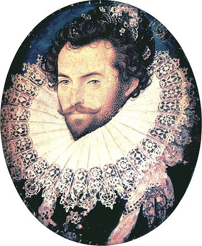 Keen to make England the most powerful monarchy of Europe, the Virgin Queen and Raleigh (pictured right) knew that enlarging the royal treasury and expanding the kingdom’s economy was key. Steeped in the politics of the times, they aimed to explore the New World and establish colonies to stake England’s claim and to also act as a springboard for launching raids on the Spanish West Indies and Spain’s treasure fleets. The Queen granted Raleigh a royal charter, authorizing him to explore, colonize, and control any “remote, heathen and barbarous lands, countries, and territories, not actually possessed of any Christian Prince, or inhabited by Christian People,” in return for one-fifth of all the gold and silver that might be mined there.*
With that, Raleigh financed, solicited investors, and organized the first English expeditions. It was first and foremost an economic venture, as well as a thrust in scientific research. The initial two expeditions, the first a reconnaissance mission headed by Philip Amadas and Arthur Barlowe, and the second a military colony commanded by Sir Richard Grenville, which were launched in 1584 and 1585 respectively, were fruitful, bringing back new knowledge of the resources and inhabitants of the newly found land. Discovered and documented in detail through notes, watercolors and drawings by expedition artist, cartographer and explorer John White and expedition scientist Thomas Harriot, the earliest expeditions produced for the first time a picture of “the new found land of Virginia,” and of “the commodities and of the nature and manners of the natural inhabitants” for Raleigh and the expedition’s gentlemen British investors—and perhaps more importantly, from the Crown’s perspective, rumors of gold and a passage to the South Sea.* Though the rumors and reports on the latter ultimately proved fanciful (the sassafras tree, it turned out, became the biggest takeaway in terms of commodities), it was enough in the beginning to incentivize and outfit a civilian expedition to permanently colonize the new territory with a start-up group of 118 men, women, and children.
This time, veteran explorer John White was commissioned as the expedition’s leader and colony governor. In addition to the enormous responsibility for the welfare and protection of friends and families under his command, his stake in the mission was also deeply personal—along with him came his daughter Ellinor and son-in-law Ananias Dare. It was an unprecedented experiment in first-seed English civilian colonization on North American soil.
But, as it turned out, the effort was short-lived. After six weeks, White left the colony to return to England for much-needed supplies and reinforcements, leaving behind the bulk of the group, including his daughter Ellinor, son-in-law Ananias, and new granddaughter Virginia, the first English person to be born on American soil, to thrive as best they could until his return.
A return that wouldn’t occur for another three years.
The Queen needed every ship she could muster to defend England against the impending Spanish threat, and that, along with other complicating circumstances, locked White into a furiously frustrating wait until resources could finally be made available for the return trip.
Finally, in the year 1590, White stepped back onto Roanoke Island and into the site of the settlement on August 18, serendipitously coinciding with the third birthday of his granddaughter, Virginia. But there was no birthday celebration, for as White and his party could see, not a single settler remained.
“We passed toward the place where they were left in sundry houses,” White wrote in his account, “but we found the houses taken down, and the place very strongly enclosed with a high palisado of great trees, with cortynes and flankers very fort-like, and one of the chief trees or posts at the right side of the entrance had the bark taken off, and 5 feet from the ground in fair capital letters was [en]graven CROATOAN without any cross or sign of distress…..”**
White and the settlers had agreed that a cross symbol would be engraved if the settlers had encountered trouble or distress before, or as the cause for leaving, should they have to abandon the settlement. Clearly from the lack of such signage, all seemed to be well. Engraved into the tree post, ‘CROATOAN’ was the name of an Indian group that inhabited present-day Hatteras Island to their south. Had the colonists gone to live with the Indians there?
White and his party then sailed south toward Hatteras. But a violent storm drove his ship out to sea. The attempt was abandoned and he returned to England, never to return again.
One can only imagine White’s heartbreak and the enduring haunt that likely plagued the rest of his days. His last years are lost to history, but in a letter he wrote to Richard Hakluyt, the English author who wrote about the early English experience in America, he summed up his final trip with the words “as luckless to many, as sinister to myself”.
Needless to say, the fate and whereabouts of the “lost colony”, as it came to be called in the popular literature, has been the subject of historical and archaeological investigation for many decades. But the story and mysteries of the first English settlement go well beyond the “lost colony”, and archaeologists and historians have been busy, off and on and as resources have allowed, conducting research to find the answers.
The search began on the north end of Roanoke Island, where some surface features and finds gave clues to the presence of the elusive first colony remains.
______________________________________________
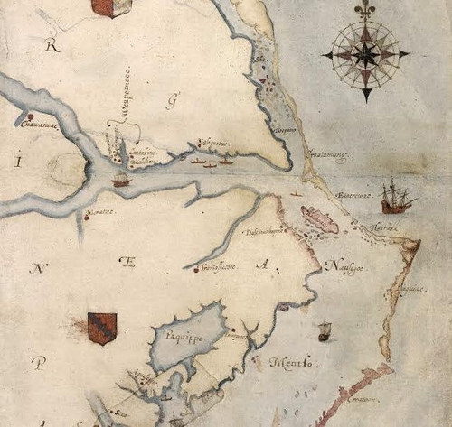
Section of the 1585 map of the east coast of North America from the Chesapeake Bay to Cape Lookout by John White. The pink island, center right, is Roanoke. Courtesy British Museum
______________________________________________________________
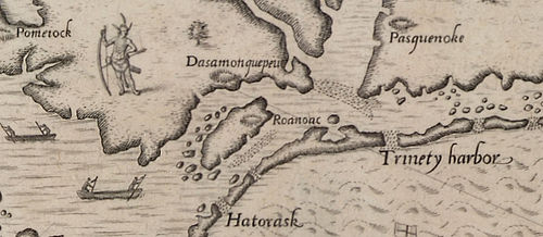
Detail focusing on Roanoke Island in “The Carte of All the Coast of Virginia,” engraving by Theodor de Bry based on John White’s map of the coast of Virginia and North Carolina circa 1585-1586. De Bry’s engraving was published in Thomas Hariot’s “A Briefe and True Report of the New Found Land of Virginia,” published in 1588 and in Vol. 1 of Theodore de Bry’s Great Voyages, printed in French, English and German. This was the first printed map with a high degree of detail and accuracy for any part of the United States. It was the first separate map of Virginia. It was based on a manuscript map by John White from 1585, a copy of which is in the British Museum, revised for additional names and coastal detail gained from Roanoke Colony travels in 1587 and 1588. Quinn notes that White’s original drawing is accepted as the major contemporary authority on the configuration of the coastline in the late sixteenth century. The map was the same in all four editions of Harriot’s work. John White, one of the company sent by Sir Walter Raleigh to establish an English colony on Roanoke Island in 1585, went at least twice to the Carolina coast in the 1580s. There he produced a series of drawings of the everyday life of the Native American populations. White also compiled this map of the North Carolina coast from Cape Lookout to the mouth of the Chesapeake Bay, based on the British explorations of 1585-86, which de Bry then engraved and published in 1590. Image and text from Wikimedia Commons Courtesy British Museum
____________________________________________________________
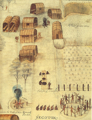
One example among a number of illustrations made by John White depicting the lives of the Native American villagers the colonists encountered. Village of the Secotan in North Carolina. Watercolour painted by John White, 1585. Courtesy British Museum
________________________________________________________________
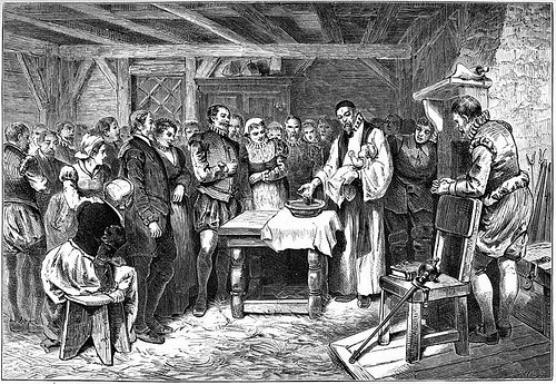
“Baptism of Virginia Dare,” lithograph, 1876.
_____________________________________________________________
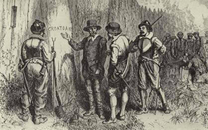
John White discovers the word “CROATOAN” at the site of the Roanoke colonists, now abandoned.
____________________________________________________________
The Lost Settlement
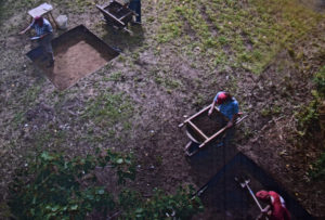
Edward “Clay” Swindell, who is the Mid-Atlantic Regional Archaeologist for the U.S. Navy, leads me down narrow paths in a thicket of woods within what is today the Fort Raleigh National Historic Site area. Swindell has been a key member of a team that has recently uncovered artifacts that could give new clues about the final whereabouts of at least some of the members of the lost colony. But here, in these woods on the Island of Roanoke, North Carolina, he guides me to four places where scientists over the decades have unearthed some tantalizing traces of this first English presence in America.
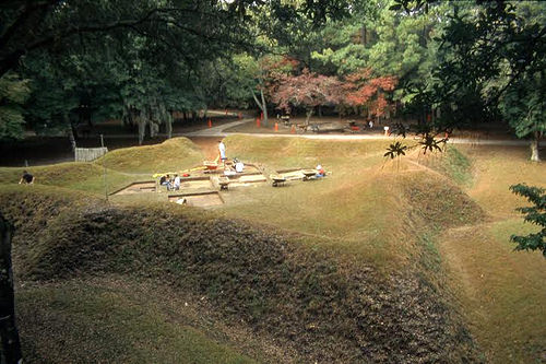
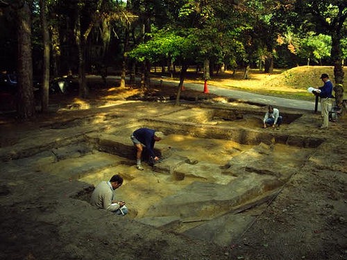
One such place is the famous earthwork “fort”, the most prominent and visible feature on the historical landscape surrounding the Fort Raleigh National Historic Site visitor center. It was in this immediate area where the first full professional excavations on the island began under the direction of National Park Service archaeologist Jean “Pinky” Harrington in 1947 and 1948. What he excavated then, however, was a faint physical reminder of what once stood here. Visitors today see the reconstructed earthwork, the way researchers and archaeologists suggest the “fort” may have appeared in its day. For years, historians and archaeologists have suggested that the simple earthwork sconce, or ‘fort’, served as the major defensive function for the early colonists, featuring perhaps the placement of cannon directed to the nearby shoreline to protect the main colony from potential Spanish attack or advances. But Swindell disagrees with that scenario.
“It’s just too far from the shoreline for that to work,” he says. “It wouldn’t make sense.”
The shoreline has changed over time since the late 16th century. But even given the original shoreline, the distance would have been too great for the fort placement to make sense. Swindell suggests that the earthwork may have been constructed as a quickly-raised earthen sconce to defend or protect an element of the early colony from nearby Indians, known to be living in an established village just north of the location—or that it may have served some purpose other than defense of the colony from threats from the sea. Harrington and his team uncovered musket balls, sherds of small crucibles, olive jars, German jettons, and copper nuggets from the earthwork site. Further excavations just west of the earthwork in 1982 and 1983 by the Southeast Archaeological Center of the National Park Service also revealed similar Elizabethan period artifacts, including sherds of crucibles, more Normandy flasks, and tin-glazed ointment pots. And most recently, in 2010, ground-truthing excavations connected to a 2008-2009 Radar Tomography survey uncovered a spread of charcoal. More telling was Harrington’s excavation in 1965, including later excavations by the late Ivor Noël Hume of the Colonial Willamsburg Foundation, which revealed another adjacent site, defined by a nine-foot-square line of postmolds (dark soil where wooden posts in the ground had long rotted away) and a one-foot-deep sunken floor that featured three pits. One of the pits contained bricks, some of which were modified, 16 sherds of a Normandy flask, and Indian pottery. The consensus among archaeologists now suggests that this site was Thomas Harriot’s “workshop” or “science center”, a place where he, as the expedition ‘scientist’, conducted work to extract minerals and other resources – a metallurgical workshop of sorts. The charcoal feature at the earthwork uncovered in the 2010 excavations has also since been identified as fuel made by Harriot and his workmen, likely during the 1585 expedition. The archaeology has shown that this workshop site may actually have preceded the earthwork. So it is not an altogether unsupportable suggestion that the earthwork feature might have been designed to protect the workshop due to worsening relations with the neighboring Indians.
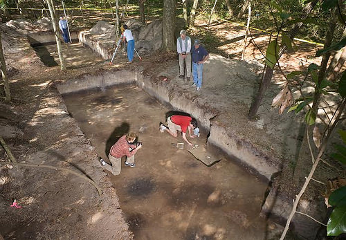
Walking further north, Swindell leads me to a place where, in 2008, 2009, and 2010, archaeologists uncovered more artifacts. As we swat mosquitoes from our faces, he points and delineates the area where the excavations took place. One would hardly know any excavation had ever taken place here. Tucked deep in the woods along a nature trail, it appeared virtually untouched by the human hand. But in 2008 archaeologists had to dig 3 feet down through sand in this place before they could reach any signs of past cultural activity. The dune build-up over time had covered over the original late 16th century surface. Today the place is known as the ‘Harriot Woods’ site, where excavators uncovered two cache pits containing European artifacts, including a necklace made of diamond-shaped copper plates (a likely trade item of high value to the local Algonquian Indians of the time), copper aglets typically used to lace up Elizabethan clothing, a fragment of lace, and glass Venetian beads (also a valued trade item among the local Indians). Further excavation at the site revealed a slot trench feature that was identified as evidence of a palisade fence that ran northward toward the shoreline. Radiocarbon dating of organic material found at the site indicated a date range of 1540 – 1640.
Was this, along with the earthwork and the ‘science center’ site, part of the remains of the main settlement and fort documented in the historical accounts?
Swindell has his doubts.
“None of the artifacts or features here are evidence of domestic activity,” says Swindell. “Harrington’s work, Hume’s work, and our (more recent) work didn’t show any kind of habitation here (that would be characteristic of a domestic settlement, such as at Jamestown).”
And even the earthwork, interpreted as a defensive feature, would not be substantial enough to be considered a fort of the type that the colony would need for overall defense. Now, archaeologists question the earlier suppositions that the main settlement site has been found. Nonetheless, the earthwork site and the other sites nearby clearly indicate a 16th century European presence on the island.
Much more work needs to be done before solid conclusions can be drawn, says Swindell. That work will be challenging, and part of that challenge has to do with the changing environment and the dunes. Dune formation in this area has covered the surface to the point where one must typically excavate at least several feet before reaching any cultural layers that could be identified with the colonial period. Significant shoreline erosion has been another culprit. Swindell walked me eastward along a narrow trail through the woods to a point on the shoreline. We emerged at the edge of a high sand dune bluff overlooking the shoreline. It was sculpted by the unrelenting elements of water and wind over time. Called “Barrel Beach”, this is where archaeologists recovered the lower part of a wooden barrel and a hollowed-out log in shallow water along the shore in 1982. Radiocarbon-dated to the late 16th century, they are thought by some archaeologists to be parts of a well facility established by the colonists for access to fresh water. Here also archaeologists found Iberian olive jar sherds and a few 16th century objects, including an axe. But the point is that none of these objects would have been found at the time if it hadn’t been for the extensive, ongoing erosion of the deep dune layers along shoreline. The erosion, in a sense, did the digging for them. Yet even this has its drawbacks. “It’s a race against time,” says Swindell. “In 2006 test units were excavated at this spot above the shoreline. Now that surface is gone. We’ve probably lost about 50 feet of shoreline due to erosion over the past decade. There was potentially an Elizabethan component here. Underwater testing has been done, but it hasn’t turned up much.” Swindell added that much of the dune accumulation, shifting and erosion we see today occurred since the early 19th century after logging removed the foliage critical for supporting and protecting the land surface from sand encroachment and erosion. It has vastly complicated efforts to investigate what lies beneath. “In some places the sand could be as much as 10 to 12 feet above the original 16th century land surface,” he says.
So, with the emerging doubts about the earthwork as a viable candidate for ‘Fort Raleigh’ and no evidence of artifacts or structures in the area that would signal domestic habitation, I asked Swindell where he thought the main settlement could possibly be.
We hopped into his SUV and proceeded south from the archaeological sites along highway 64 toward Manteo, the modern town on Roanoke. “Even Pinky (long before the popular perception that the main settlement was located around or near the earthwork) suspected that the main settlement and fort was down south in the vicinity of Shallowbag Bay,” said Swindell. Manteo abuts Shallowbag Bay, home to the town’s main marina and an ideal waterfront for docking boats of a variety of capacities. The trip took only 5 minutes, and we were soon walking up a peer that jutted into the bay. We stopped at the end of the pier, at the edge of the water.
Looking at it, and comparing it to the shore area further north near the archaeological sites, it was easy to see how this would have been a much more desirable place to establish a fort and settlement.
“This is a nice, deep area for portage and docking,” he says. “The entrance to the Outer Banks is more easily accessible. You have this nice sheltered bay that better accommodates the docking of ships. So you can imagine that this would be a better place to protect your ships and to actually bring supplies in, whereas toward the north (where the current archaeological sites are) there is really no (workable) place to keep your boats and offload supplies.”
“This isn’t a new revelation or proposal,” he continues, “but the traditional ‘Fort Raleigh’ location identified with the earthwork further north at the Park acted like a ‘red herring’, diverting attention from further exploration or consideration of this location.”
He points to another side of the bay, a concentration of condos along the shoreline. “That is one of the areas we are interested in—back in the 30’s, there was a young man who found an English sixpence in that area. Other (unprovenanced) small finds have cropped up in the area. None of them have been pursued archaeologically. We are hoping to pursue some of these leads, among other things.”
But none of this is to say that investigations at the traditional ‘Fort Raleigh’ site on the north of the island are over.
“People think there is nothing left to find here,” says archaeologist Eric Deetz, a member of the First Colony Foundation team and lecturer at the University of North Carolina in Chapel Hill. “I don’t buy that.”
Deetz conducted a limited excavation at the workshop/science center site in 2017, re-investigating what has already been done to clarify and hopefully find answers to some outstanding questions—like uncovering and identifying postholes for missed clues to any structures. He suggests that during Harrington’s time, the excavators were not as adept at recognizing the subtle soil features that give clues to the presence of past structures. Deetz applies his years of experience from the Jamestown excavations, where they uncovered the many subtle posthole traces of the (what was thought to be long lost) palisade trenches defining James Fort, as well as its other associated structures.
“I have a dream,” he says. “And I think it’s going to come to pass.”
Like the renewed workshop/science center excavation, Deetz hopes to re-excavate many of Harrington’s old, now re-filled trenches. He shows me a site plan made of Harrington’s old trenches. He argues that the level and intensity, and thus the thoroughness, of the investigations and excavations conducted at the present-day Fort Raleigh National Historic Park area never approached the level and intensity given to the Jamestown site further north in Virginia. To illustrate this further he describes an excavation conducted in 2009-2010 that uncovered traces of a previously undetected slot trench not far from where excavators found the copper necklace and trade beads (see above). “It could be a 16th century palisade,” he speculates, “or it could be some place where they built a fence for a pigsty in 1760.” No artifacts were found that could help date the feature. However, archaeologists took soil samples from the site and sent them for OSL (Optimally Stimulated Luminescence) testing. “So if we get results indicating it could be 16th century,” he exclaims with a hopeful gleam in his eye, “then we’re off to the races.”
___________________________________________
The reconstructed earthwork, showing excavations in progress at the site. Courtesy First Colony Foundation
__________________________________________________
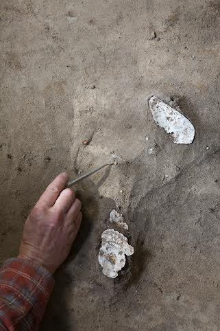
The workshop or “science center” site under excavation. Courtesy First Colony Foundation
___________________________________________________
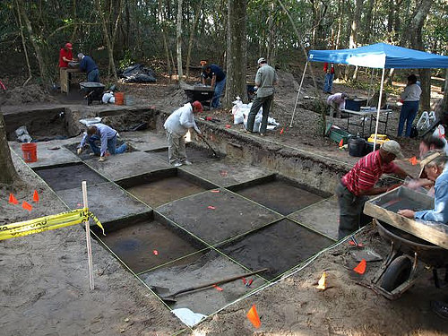
Above and below: The ‘Harriot Woods’ site under excavation. Courtesy First Colony Foundation
___________________________________________________________________
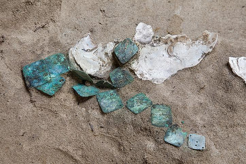
The copper plates, thought to have been components of a necklace, unearthed at the Harriot Woods site. Courtesy First Colony Foundation
___________________________________________________
Venetian beads excavated at the Harriot Woods site. Courtesy First Colony Foundation
____________________________________________________
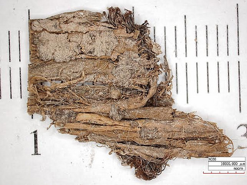
Sample of organic cordage found in association with the copper necklace. It is thought to have been part of a container or bag in which the necklace was placed. Courtesy First Colony Foundation
___________________________________________________
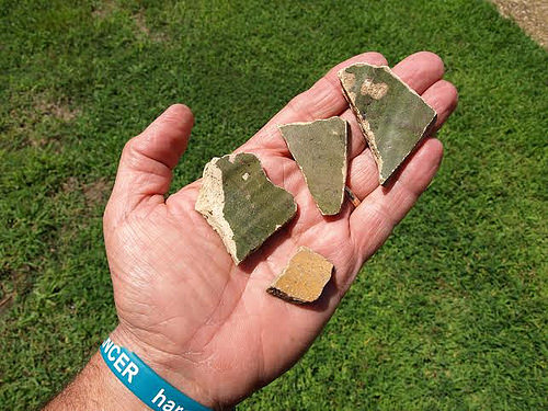
16th century ceramic fragments found near Barrel Beach. Courtesy First Colony Foundation
______________________________________________________
Above and below: Deetz’s 2017 excavated unit at the site of the Harriot workshop/science center.
_________________________________________________________________
Artifacts recovered from the 2017 excavated unit at the Harriot workshop/science center site. They were found within the back-fill from the old Harrington excavations. At least two of the fragments are 16th century ceramic ware.
_______________________________________________________________
Clues to the Lost Colony and a New Working Hypothesis
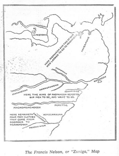
The first efforts to solve the mystery of the ‘lost colony” of 1587 actually came centuries ago, with the English settlers of Jamestown, Virginia. Captain John Smith, leader of the Jamestown Colony from 1608 to 1609, was, according to chronicler Samuel Purchas, told by Chief Powhatan that he had slaughtered the Lost Colonists. William Strachey, Secretary of the Jamestown colony in 1610-11, also wrote that, according to Powhatan, he had killed the colonists while they were living with friendly Indians because of prophecies by his priests, the slaughter having taken place in 1607. With rumors of possible survivors, Jamestown colonists conducted search expeditions, but no trace of them had ever been found. But further research by Brandon Fullam suggested that Strachey had actually described two slaughters and that members of the lost colony were not among the victims, and historian Lee Miller has postulated that some of the lost colony members lived among the Chowanoke, who were attacked by another tribe, resulting also in the deaths of the colonists. The so-called “Zuniga Map” (named after Spanish amabassodor to England Pedro de Zúñiga, who had obtained a copy and passed it on to King Philip III of Spain), which was drafted in 1607 by Jamestown settler Francis Nelson, seems to support this. On that map one can read that “four men clothed that came from roonock” were living at an Iroquois site on the Neuse. There were other reported sightings. According to Strachey’s reporting in 1612, four English men, two boys and one girl were sighted at an Eno Indian settlement. He stated that they were treated as captives and compelled to work copper, and that some of them escaped and fled up the Chaonoke river, today known as Chowan River in Bertie County, North Carolina.
________________________________________________
__________________________________________________________________
These accounts and theories are only a few among a number that have been advanced over the years by historians and scholars about the fate of the lost colonists. But recent archaeological investigatons may be shedding new light on this 400+-year-old mystery…………
Site X
Most archaeologists who have been involved in the ongoing research related to the first English colonial ventures on Roanoke would say that it was unlikely that everything happened in one place. As Swindell maintains, the Raleigh expedition operations and colonial attempts likely extended beyond the single settlement locale most often depicted in the popular perception. Based on the historical accounts alone, we know that Raleigh and the explorer-colonists he sent were keenly interested in exploring into the interior of the land, with the prospect of claiming and settling new territory and tapping into new resources for the English Crown. The Virginea Pars map, originally drawn by John White, shows a strong interest in what is today the western Albemarle Sound. Indeed, according to White, there were plans to “remove 50 miles into the Main” from Roanoke Island. Combined with the evidence of White’s map, that would place their intentions into the lands bordering the western Albemarle Sound.
Could this be where at least some of the members of the ‘lost colony’ ended up?
Archaeologists of the First Colony Foundation think this is an explanation that cannot be dismissed. Established in 2004, the First Colony Foundation has been dedicated primarily to conducting archaeological and historical research on American beginnings related to the Elizabethan expeditions and colonies of the 1580’s.
“Work and resources shifted away from Roanoke to the Salmon Creek area (adjacent to the western Albemarle Sound) after about 2009,” said Swindell. “With pending construction of new developments in the area, the James River Institute (a cultural resources management firm) was enlisted to survey the area. One of the sites surveyed yielded early ceramics that hinted at a European presence that appeared to predate the later colonial settlements of the area.”
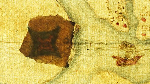
The Salmon Creek site (now popularly referred to as “Site X”) was actually first identified in 2007 through an archaeological shovel test survey and later through test pits. During the surveys, archaeologists recovered a mix of Native American and early English ceramic artifacts, artifacts indicating evidence of 17th and 18th century English activity or settlement. But some of the ceramic fragments, based on later expert examination, suggested late 16th century, the time of the Raleigh expeditions. Subsequently, the First Colony Foundation began excavations at the site in 2012—and this is where the story really took off. It began when Brent Lane, professor of Heritage Economics at the University of North Carolina at Chapel Hill, requested the British Museum to examine White’s 1585 Virginea Pars map. The document was being used by the Foundation to inform their research and surveys in the area. “We noticed the patches on the White map and asked the British Museum to place the map (the original being located at the Museum) on a light table,” said Swindell. “This revealed a symbol or shape beneath that looked much like a fort. We had already done work in that area, so we went back to look at it again, what had been found (the early ceramics), and renewed excavations there.”
What they discovered, and the resulting interpretation of the finds, has since become a major media splash that has captured the attention of the general public and scholars alike. Beginning in 2012 and ending in 2017, with each season lasting from 7 to 10 days, archaeologists dug a total of 53 two-meter-square units over 2,250 square feet, recovering a variety of artifacts and features providing evidence mostly of a Native American, but also, to a much smaller degree, a possible European presence. Most noteworthy were objects, for these purposes, consisting of 40 sherds representing perhaps 6 or 7 vessels of 16th century Surrey-Hampshire Border ware; 8 sherds representing a North Devon plain baluster jar—both types of ceramic ware commonly used during the 16th and 17th centuries, the baluster jar having been typically used as a provisioning jar on sea voyages—two tenter hooks, of a type similar to that used at the early Jamestown settlement and possibly used to stretch canvas (sail cloth) to create temporary shelters or to stretch and dry animal skins; an aglet of the type that would have secured Elizabethan clothing, among other artifacts. The finds were generally concentrated in two of the 53-unit total excavation area. It is worth noting that the artifacts are also significant in that the earliest recorded presence of English settlement in the western Albemarle Sound area did not occur before about 1655.
So what do these finds mean? Is this evidence of the lost colony?
Perhaps. But the accounts of the Raleigh expeditions also record initial exploratory forays westward into the mainland under the leadership of Philip Amadas and Ralph Lane, leaders of the first expedition in 1585. Could the artifacts represent traces of those ventures?
The Foundation report dismisses this explanation. “The excavation of domestic table wares from several different diagnostic vessels along with other less diagnostic, but possibly contemporaneous artifacts, strongly suggests that the above mentioned European presence was of a longer duration and the activities different from those recorded for the pre-1587 English exploration of the lower Chowan River basin [as documented in the historical record].”***
But were the artifacts simply transported there by the Native Americans through trade? Possibly—Site X is primarily a Native American settlement site, and the Native American inhabitants of the time had a known, active trade network. The early colonists exchanged goods with them as needs dictated. European objects, unique and novel to the native inhabitants, were highly valued, especially items made of copper and glass Venetian beads. But, reports the Foundation team, “missing at Site X are the most common trade goods, like beads…….fragments of European pottery do occur in a few VA/NC Indian site assemblages that probably date as early as the 1660s, but they are not common, and it seems that ceramics were not routinely carried into Indian country by traders until the mid-1700s.”*** The report further notes that there are no records that indicate the presence of European traders in the area prior to 1655. And even the Native American artifacts provide some clues, suggest the report authors — “preliminary analysis of the Colington series [a type of Native American pottery] ceramics from Site X suggests that this phase of Carolina Native American occupation occurred before the 17th century. Years of regional research informs us that this shell-tempered ware is representative of the Carolina Algonkians, or the group of Native American Indians occupying the region at the time of Elizabethan exploration in the 16th century.”***
Nonetheless,”we do not have the smoking gun,” said archaeologist Nicholas Luccketti, director of the Site X excavations. “We have no features of European-built structures. We have not found a fort. Nor do we claim to have found the main relocation site or even the main group of the 1587 Roanoke colonists” at this site. “Quite the contrary, we believe that a small number of Roanoke colonists resided for a few years at Site X—a contention based on circumstancial evidence.”****
The First Colony Foundation team thus suggests that any habitation by Roanoke colonists at the site may have only consisted of a small surviving part of the original 1587 group, similar in vain to the accounts acquired by some Jamestown colonists from the Native Americans about the presence of other ‘white people’ in other places in the region, as later recorded on the Zuniga map of 1608. (The reported locations were placed on a map of the region, the original having been lost. But a Spanish spy sent a copy, the so-called Zuniga Map, to the Spanish court. The map indicated two locations along tributaries to the North Carolina Sounds where survivors of the 1587 colony may have resided – see above Zuniga Map copy).
Assuming that what the Foundation archaeologists are suggesting is true, what about the rest of the colonists? And what about the letters White observed carved into a tree or post at the abandoned 1587 colony site, which seemed to indicate that the colonists had moved to live with or near the Croatoans, who inhabited the present-day Outer Banks island of Hatteras at the time?
A site on Hatteras Island may possibly provide some clues………….
________________________________________________
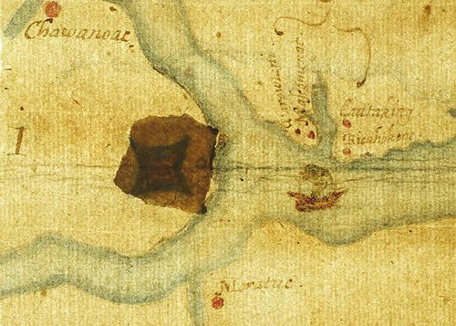
Above and below: A patch applied to a map painted by explorer John White between 1585-1586,when enhanced with ultraviolet light, showed a faint image that could be a clue to understanding what happened to the Roanoke settlement that disappeared after White sailed back to England (the ‘lost colony’). The image featured characteristics typical of a 16th century English fort. Courtesy British Museum
____________________________________________________________________
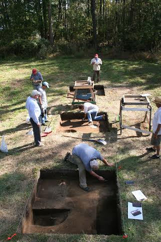
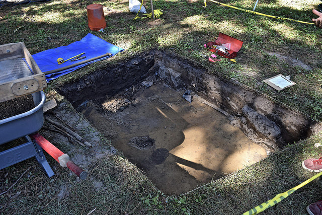
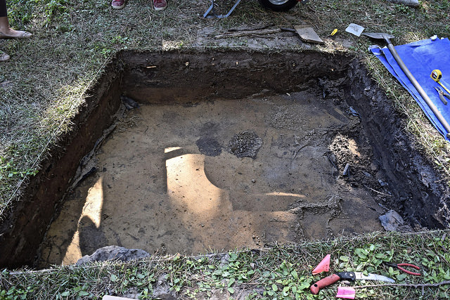
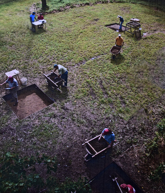
Excavations at the Salmon Creek site, or ‘Site X’. Below, a view of the latest 2017 excavations underway. Courtesy First Colony Foundation
__________________________________________________________________
_______________________________________________________________
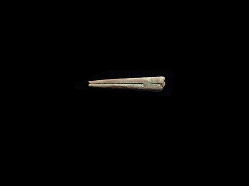
16th century aglet excavated at Site X. This was typically used to secure clothing, much like a button. Courtesy First Colony Foundation
____________________________________________________________________
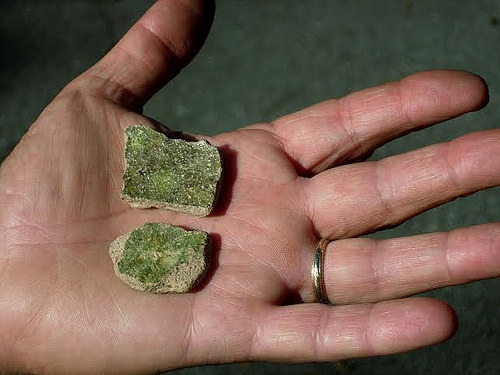
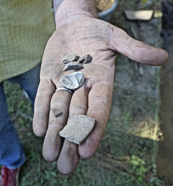
Sherds of yellow and green glazed Surrey-Hampshire Border Ware, excavated from Site X. Courtesy First Colony Foundation
_______________________________________________________________________
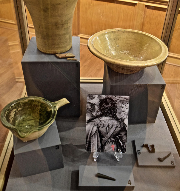
This exhibit, open in October 2017 for the visiting public at the Dare County Arts Council museum in Manteo on Roanoke Island, shows examples of the artifacts uncovered at Site X. (1) Sherds of a North Devon baluster jar shown along with a complete reproduction — these jars were typically used in the 16th century for storing foods such as beans, fish and butter; (2) Yellow-glazed Surrey Hampshire Border ware complete reproduction. A typical 16th century ceramic ware, sherds of this were excavated at Site X; (3) Yellow-glazed Surrey Hampshire Border ware porringer, complete reproduction — typically used in the 16th century for individual servings of porridge, soups and stews. Sherds of this were excavated at Site X; (4) Early style lace tip aglet, an example of which was found at Site X. They were used, like buttons, to secure Elizabethan period clothing; (5) Snaphaunce priming pan, found at Site X. It is an element of a 16th century gunlock; (6) Iron tenterhook, found at Site X. Tenterhooks were hammered into wood in rows and used to stretch cloth or skins.
_________________________________________________________________
Cape Creek
Headed by Mark Horton of Britain’s Bristol University, a separate team of archaeologists consisting in large measure of members of the Croatoan Archaeological Society are uncovering signs of a possible 16th century English presence at the site of a Native American settlement on Hatteras Island (Croatoan in the 16th century) called Cape Creek. Excavations there during the spring of 2015 have turned up some tantalizing artifacts, including a small fragment of slate that may have been used as a writing tablet (showing a small letter “M” in one corner and found near a lead pencil) similar to that found at the 1607 James Fort excavations on Jamestown Island, Virginia; a part of the hilt of an English iron rapier (a sword of the type used in England during the 16th century); an iron bar; and a large copper ingot. The finds appear to be consistent with the long-held assumption that the 1587 colonists did indeed move and settle with the Native American inhabitants on present–day Hatteras, as implied by the ‘Croatoan’ signage at the Roanoke site in the historic record.
Moreover, it isn’t the first time that possible 16th century English artifacts have been uncovered at the location. In 1998, investigations of the site by archaeologists under a East Carolina University project yielded what was thought to be a gold signet ring dated to the 16th century. Engraved with the image of a lion or horse, it is suggested that it likely originally belonged to an English gentleman, as such items would have been more typically worn by English noblemen. It was this find, among other things, that inspired the renewed excavations at the site. But the ring was well-worn, and found mixed in with other artifacts dated to the 17th and 18th centuries, which suggests the possibility that it was actually an item of trade that eventually found its way to the Native American settlement site much later. “We interpreted the site as a 17th century Croatan Indian workshop complete with hearths for working and lots of metal working related items,” said Swindell. Swindell, who participated in the 1998 excavations when the signet ring was found, expresses an additional air of caution. “We need to be very careful about how we interpret our finds at these sites,” he emphasizes. “It’s easy to catch the ‘fever’ of looking for the ‘lost colony’, and this can color our conclusions. We’re looking at sites that bear a paltry few artifacts (related to European presence), and so it’s easy to cave into the temptation of saying, ‘this is it’ about the lost Roanoke settlement or the lost colony.” Thus Swindell, like his other colleagues, is the first to say that there is a lot more work to do before anyone can draw conclusions with any reasonable degree of certainty.
_____________________________________________________
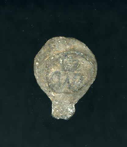
A bale seal excavated at Cape Creek. Courtesy Dr. David S. Phelps and Charles L. Heath.
__________________________________________________
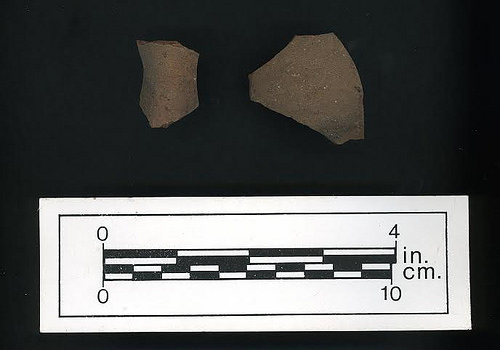
Ceramic sherds from a 16th century Martincamp flask, excavated at Cape Creek. Courtesy Dr. David S. Phelps and Charles L. Heath.
___________________________________________________
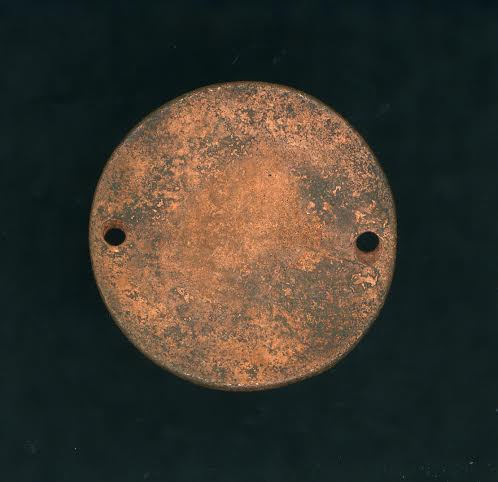
A 17th century Charles II farthing drilled coin excavated at Cape Creek. Courtesy Dr. David S. Phelps and Charles L. Heath
___________________________________________________
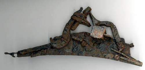
16th century gunlock excavated at Cape Creek site. Courtesy Dr. David S. Phelps and Charles L. Heath
____________________________________________________
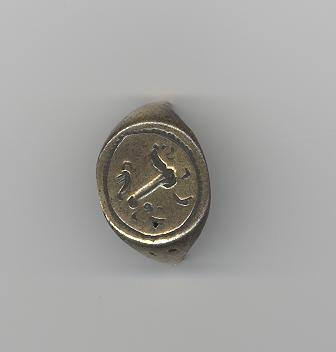
The gentleman’s signet ring excavated at Cape Creek site. Courtesy Dr. David S. Phelps and Charles L. Heath
____________________________________________________
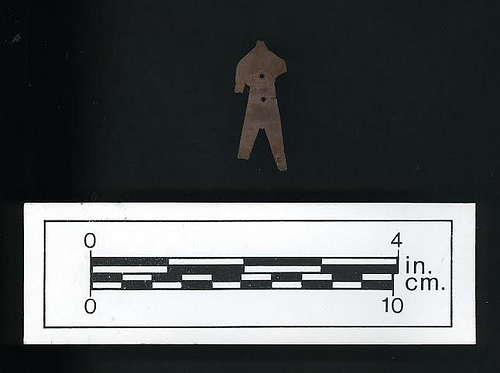
Copper figure excavated at Cape Creek. Courtesy Dr. David S. Phelps and Charles L. Heath
___________________________________________________
Why did they move?
Not touched upon here are the various hypotheses advanced to explain why the 1587 group of colonists abandoned their established settlement after White’s departure. Were hostilities between the colonists and the local Native American inhabitants to blame? Were there emerging Spanish threats in the area? Did the colonists simply decide to carry out plans to go “into the Maine” and establish themselves further inland to the west?
Swindell suggests another possibility: Dwindling food resources. The area was affected by significant drought conditions during the time of the first colonization attempts. Dendrochronology research bears this out. This would have surely effected any crop production, including the surrounding ecosystem for supporting game for hunting. The local Native American population may well have been helpful in sharing their production with the upstart colony, especially in exchange for sought-after copper and beads. But “even the local Native Americans were struggling” with the drought, said Swindell, who is a specialist in the Native American prehistory of the region. So did everyone, including the local Native American villagers, pack up and leave for ‘greener pastures’? No tangible messages of ‘distress’ due to Indian hostilities that White and the 1587 colonists had agreed would be left at the settlement site were in evidence when White returned from England, as he himself noted in his record. So the prospect of mutual starvation, not mutual hostility, is within the realm of explanatory possibilities.
Going Forward
Ultimately, could one truly say that the first colonization effort failed? The obvious fact is that the Roanoke colony, or City of Raleigh, as the Crown, Raleigh and his investors were hoping to see flourish as their first New World center, never endured and developed as initially planned. But the knowledge and experience gained from the first exploratory and colonization effort was everlasting and had a profound impact on what was to follow under the Virginia Company at Jamestown Island in Virginia. The record of White and the information other members of the first expeditions brought back with them to England did much to inform the future ventures and colonization efforts, contributing significantly to the success of realizing a permanent foothold on the North American continent.
For now, work has terminated at Site X, with an eye toward exploring and surveying other areas surrounding the site for evidence of English occupation, perhaps even the main 1587 group.
But as mentioned before, there is much more to the first colony story than the case of the missing 1587 colonists.
“We hope to return to Roanoke,” said Swindell. And Deetz, as previously noted, has already begun re-investigating the previously excavated units at the Fort Raleigh National Historic Park site.
They face two challenges to those plans—time and resources. The erosion at Roanoke continues, threatening to destroy and drown any possible remaining vestiges of the colony. Will there be the will and enough resources in time to uncover and save what might be left at Roanoke?
Swindell shakes his head. “Funding is always a problem.”
Moreover, until the “fever” that now drives the search for the lost colony catches in equal measure for the search for the elusive main settlement remains on Roanoke, any answers still lying buried on Roanoke may never see the light of day.
Eric Deetz is hoping otherwise.
_______________________________________________________
Readers interested in learning more about Raleigh’s Roanoke expeditions, the archaeology, and the work of the First Colony Foundation, may go to the website at www.firstcolonyfoundation.org and www.firstcolonyfoundation.org/give to donate critical funds needed to support further work. Readers interested in visiting the Fort Raleigh National Historic Site may also learn more at http://www.nps.gov/fora/index.htm.
_______________________________________________________
* From Thomas Harriot’s “A Briefe and True Report of the New Found Land of Virginia”.
** From Richard Hakluyt, Principal Navigations, Voyages and Discoveries of the English Nation (1600).
*** From First Colony Foundation Report, An Archaeological Brief for Site X.
****From Nicholas Luccketti’s remarks at the OBX History Weekend Symposium, October 27-28, 2017, on Roanoke Island.
______________________________________________________
Receive 30 days free access to the popular new CuriosityStream lineup of documentaries on science, history, nature, and technology as a new Popular Archaeology premium subscriber.
___________________________________________
Travel and learn with Far Horizons.

____________________________________________


