When one thinks of Portugal historically and archaeologically, its colonial heyday typically comes to mind. Along with Spain, England, and other European powers of the 15th through 19th centuries, it had established its foothold well beyond its own borders into lands far distant.
But there is a much more ancient Portugal — one that extends far back into the Bronze Age more than 3,000 years ago, and even further back into prehistory.
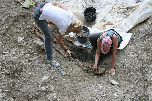
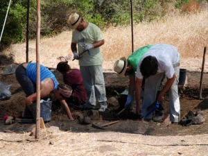
Kate Leonard, a young archaeologist from Canada, had a brush with this more ancient heritage during the summer of 2016. Take, for example, the peculiar stone she encountered while excavating in her trench at a Late Bronze Age site in the Alentejo plain of the Beja region in the southern part of the country.
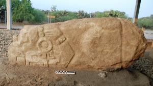
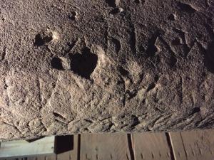
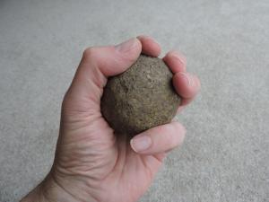
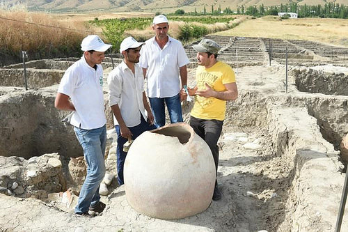
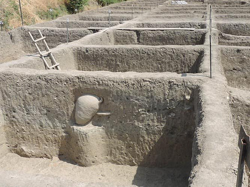
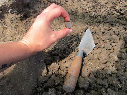
“One morning when I arrived on site the sunrise was slanting across the site and I noticed some indentations on one of the larger stones in the trench,” she explains. “As I excavated this stone it became clear that it was decorated with prehistoric cup-marks, intentionally created by someone (or multiple someone’s) and then positioned in the Late Bronze Age structural feature we were revealing. Cup-marked stones, or in Portuguese “rochas com covinhas” – or just “covinhas” for short –are a type of prehistoric decorated stone found across western Europe. They are difficult to date but are certainly prehistoric – Neolithic, Copper Age and/or Early Bronze Age – and have frequently been found reused on later sites, as is the case at Outeiro do Circo.”
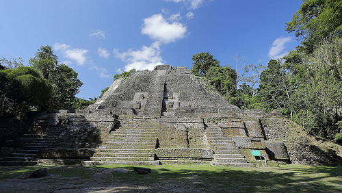
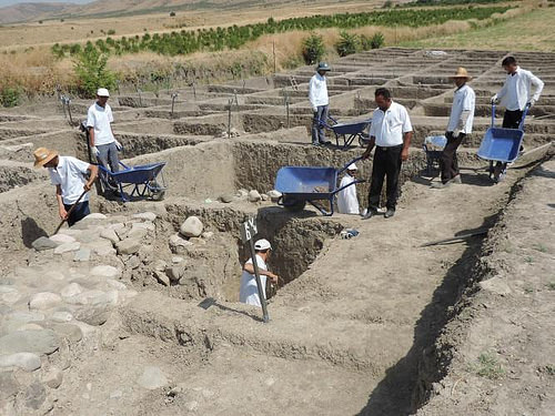
Outeiro do Circo is a Late Bronze Age fortified hilltop settlement spread across 17 hectares. Today, it appears as a long narrow hill in a relatively flat agricultural area. Archaeological investigations under directors Miguel Serra, Eduardo Porfirio and supervisor Sofia Eiras of Palimpsesto, Inc., are slowly revealing a major monumental site at this location. The cup-marked covinha, a find of its kind that remains a mystery for archaeologists, suggests an ancient significance associated with the object that has been the subject of competing theories. The curious find is not to distract from the importance of the context, however.
“This huge area was enclosed by a complex defensive system: a double wall of stone, fire hardened clay and wood was augmented with bastions, ramps, platforms and an exterior retaining wall built on a disused ditch,” says Leonard. “By its size alone it is clear that Outeiro do Circo was an important location in the region. The site is one of the largest settlements of this time period in the Iberian Peninsula.”
Leonard and the archaeology team are currently investigating the interior area of the fortification. Toward that end, they have dug a number of trenches on the hilltop summit and inside its wall enclosure, a part of their goal to better understand what activities or functions were performed within it during the Late Bronze Age (1250 – 850 BC), and to determine how modern agriculture has disturbed the archaeological remains.
__________________________________________

The author and other team members excavating. Photo courtesy of Projecto Outeiro do Circo
___________________________________________
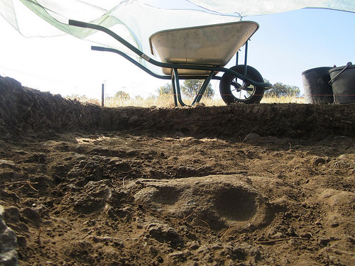
The cup-marked stone emerging from the trench. Photo courtesy Kate Leonard
____________________________________________
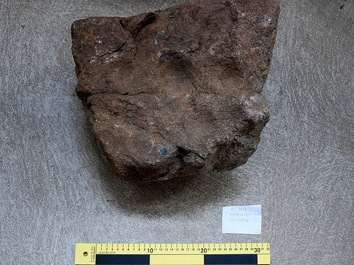
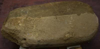
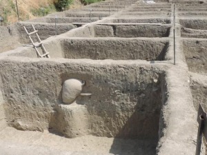
The cup-marked stone from the enclosing wall. Photo courtesy of Projecto Outeiro do Circo
_________________________________________________________
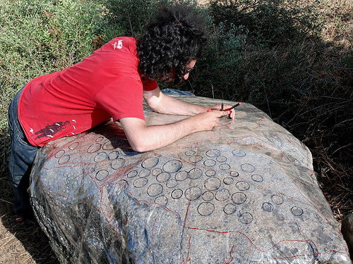
Tracing a cup-marked boulder in a previous excavation season. Photo courtesy of Projecto Outeiro do Circo
__________________________________________
The most obvious feature, of course, has been the wall itself, an ancient construction that, according to the archaeologists, must have employed a great deal of labor — and an interesting technique. “Large amounts of clumped burnt clay were uncovered in the area of the enclosing wall,” says Leonard. “These clumps of burnt clay and the locations where they were found indicate to the archaeological team that one method used to strengthen the wall foundation was to set it on fire! To set a wall of this size alight, huge amounts of wood would have been heaved up to the top of the hill from the surrounding countryside. Imagine how a wall of fire on top of the highest point in the landscape would have appeared to a person in the Late Bronze Age! There is no doubt this would have demonstrated the importance and power of the wall-builders to anyone who saw the flames or told the story of what they had seen.”
__________________________________________
Burnt clay from the foundation of the enclosing wall. Photo courtesy Kate Leonard
_________________________________________________________
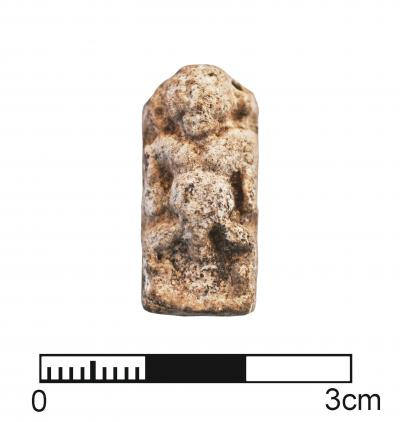
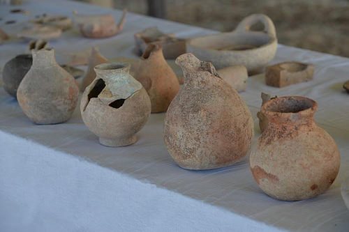
Perhaps more telling about these ancient people, however, are the small finds uncovered and examined at the site. They could relate a story about the everyday lives of the long-gone inhabitants. “Fragments of pottery from the Chalcolithic to the Roman period have been found on the ground surface at Outeiro do Circo,” continues Leonard, “but by far the most common are those from the Late Bronze Age. In the 3m by 3m trench that I am helping to excavate some very interesting Late Bronze Age pottery fragments have been found that help to shed light on the activities that went on in the settlement. These fragments fill out the narrative of this site with evidence of how long the settlement was in use and details about the everyday life of those who lived there.
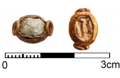
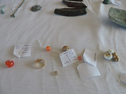
Some fragments found in my excavation trench have small holes in them that were made before they were ‘fired’. These small holes could have been for hanging the vessels by cords for storage or during cooking. I also uncovered a small black pottery fragment that had been shaped into a disc from an already broken piece. From many other ancient examples found across Europe it is likely that this was a gaming piece, used to mark a player’s move in a game now long forgotten. A similar piece found at Outeiro do Circo in a previous season is the only known decorated example from Portugal. Another fascinating find was a small rough fragment with three indents on its surface. This is a piece of a broken strainer that could have been used to make cheese!”
___________________________________________
The gaming piece. Photo courtesy Kate Leonard
_______________________________________________________
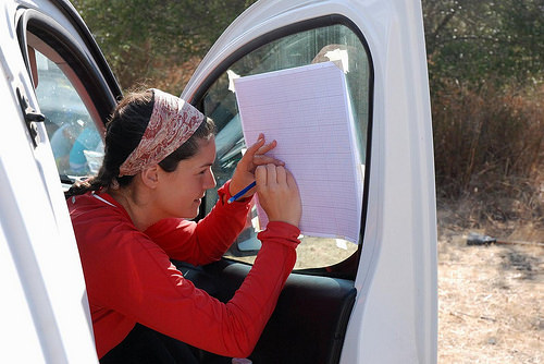
Kate Leonard doing a plan transfer at the site. Photo courtesy of Projecto Outeiro do Circo
_____________________________________________
According to what archaeologists have discovered to date, Outeiro do Circo was actually part of a larger Late Bronze Age culture or settlement region within a landscape that hosted other smaller settlements.
Excavations at the Outeiro do Circo site are ongoing with likely much more work to be done before a clearer picture of the lives of these ancient people, who populated and built settlements in the area long before the Romans arrived, can come to light. Leonard’s time at the location was short-lived, however. She has moved on to Scotland, where she is participating in another excavation as part of a global year-long journey to work at twelve different archaeological sites in 12 separate countries. She calls her project Global Archaeology: A Year of Digs. Outeiro do Circo was the 8th stop on her global trek.
Popular Archaeology will be following and reporting on Leonard’s worldwide experiences periodically throughout 2016 as she hops from one location to another during her global journey. To continue the work, however, Leonard will need financial support from donors. Readers interested in reading about and supporting her self-directed Global Archaeology crowdfunded project can learn more at gofundme.com/globalarchaeology.
You can read more about Leonard’s experience at Outeiro do Circo here.
_______________________________________________________
______________________________________________
Travel and learn with Far Horizons.
____________________________________________
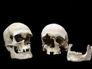
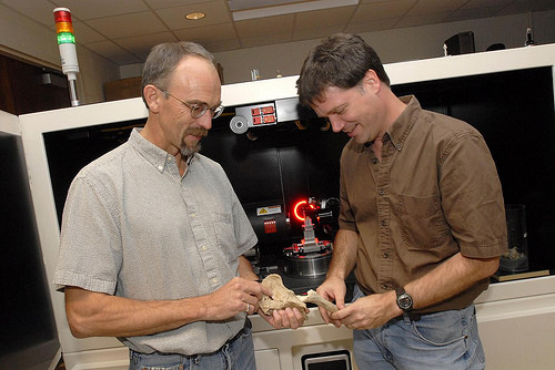
This richly illustrated issue includes the following stories: Recent findings shedding new light on the whereabouts of the remains of Philip of Macedon, father of Alexander the Great; how an archaeologist-sculptor is bringing bones of the dead back to life; archaeologists uncovering town life at the dawn of civilization; an exclusive interview with internationally acclaimed archaeologist James M. Adovasio about what makes the Meadowcroft Rockshelter prominent in the ongoing search for the first Americans; what archaeologists are finding at the site of the ancient city of Gath, the home town of the biblical Philistine giant, Goliath; and how scientists are redrawing the picture of human evolution in Europe. Find it on Amazon.com.