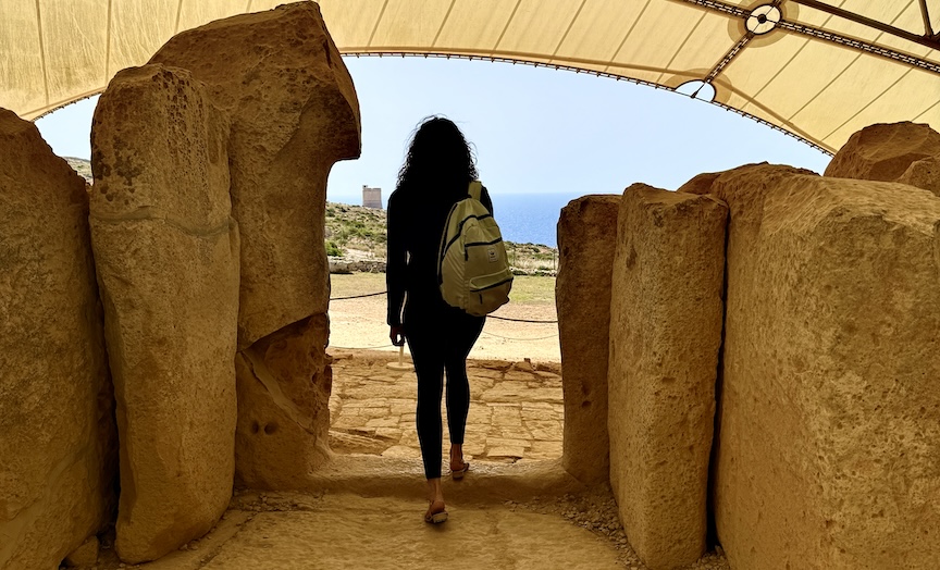
We arrived in late April, and every morning Noel came for us.
That detail turns out to matter more than it should. When you travel with an archaeological expedition, as I did again this time, accompanying Dan McLerran, editor-in-chief of Popular Archaeology, with whom I had traveled once before, and with Tatiana along as my companion and photographer, the official itinerary is usually the least interesting thing about the trip. What you keep afterward is everything that happens between the scheduled stops, and most of all the people who translate a place for you into a feeling more than a fact.
Noel was our driver for the whole time we were there, and I would not call him an old man, because at perhaps his mature stage of life, he was far from old, and in any case one of those people who seem to exist slightly outside of age. He arrived each morning at the Westin Dragonara in St. Julian’s, where we were based, impeccably dressed in a suit, courteous and humble and entirely without hurry, and drove us out across the island in a spotless Mercedes van.

Noel, foreground. Photo credit Anastasia Adeler
As we drove he talked, about the families who had held which land and for how long, about where to find the good fish, about what had changed on the islands and what had stubbornly refused to, and through all of it ran his family, mentioned constantly and with a respect for it that you could feel without his ever having to spell it out. We invited him to join us, for lunch, for dinner, for whatever we were doing, and every time he declined with some small variation of the same answer, that he had already had some tea, or that he would stop here and have some tea, so that the tea became a kind of polite boundary he kept between his life and ours, and a sign of how completely he belonged to himself. He was well-bred in the old sense. You could smell the real man and the professional in him at once.
I thought about Noel a few days later while standing in front of stones that were old before the Egyptians built anything at all. Malta, as every brochure will tell you, is sun and sea and the Knights of St. John, baroque churches and English-language schools and tourist marinas, and all of that is true and none of it is the part that kept me awake. Because Malta is also the site of some of the oldest freestanding stone structures anywhere on earth—seven prehistoric sanctuaries raised between roughly 3800 and 2500 BC—which is to say before Stonehenge and well before the pyramids—by a people so complete and so distinct that they surface in the record almost fully formed and then disappear from it around 2500 BC for reasons no one has settled. Noel had lived among these stones his entire life and was not especially impressed by their age. He had simply always known they were there, as familiar to him as his own street.
An island that undersells itself
Most people who fly into Malta come for the coast and the warmth, for medieval Valletta, for the traces of a crusading order that once ran the central Mediterranean from this small archipelago of two inhabited islands. These are real things, and the island’s history since the sixteenth century is dramatic enough on its own, the Great Siege and Napoleon’s brief and unwelcome occupation and the long British colonial period that ended only with independence in 1964, and the strange hybrid identity all of it left behind. The Maltese language is itself a kind of archaeological object, Arabic in its bones and overlaid with Italian and Sicilian and a thick recent layer of English, spoken in a cadence that resembles nothing else in the sea it sits in, which is why the island has become one of the places Europeans now come to learn English.
The older story, the one that begins long before the Knights, sits off to the side of all this. The megalithic temples appear on the official maps and in the heritage brochures and are perfectly accessible, and they are also not what most visitors come for, so they pass close by without stopping or stop briefly and move along. This would be unremarkable if the things they were passing were not, in the judgment of the people who study such things for a living, among the most significant prehistoric sites in the world.
__________________________
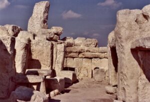
The megalithic temple sanctuary of Ħaġar Qim. Nitramserolf, CC BY-SA 4.0, Wikimedia Commons
__________________________
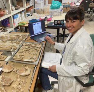
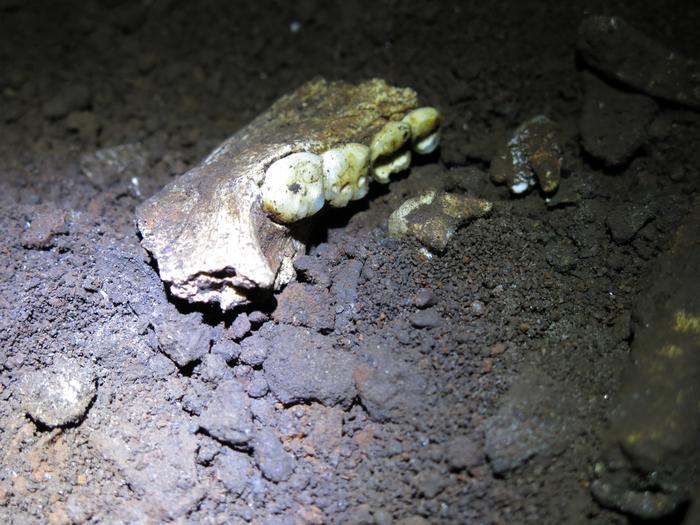
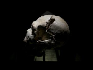
And the deep past here has lately gotten deeper. Until very recently the first Maltese were thought to be the Neolithic farmers who arrived around 7,500 years ago and went on to raise the temples, but in April 2025 a team led by the archaeologist Eleanor Scerri, of the Max Planck Institute for Geoanthropology and the University of Malta, published findings from a cave called Latnija in the north of the island that pushed the human story back a full thousand years, to Mesolithic hunter-gatherers who reached Malta around 8,500 years ago by crossing some hundred kilometers of open sea from Sicily, beyond the sight of land, presumably in dugout canoes, the longest such crossing yet known anywhere in the Mediterranean. We were meant to spend time with Scerri, and that is its own small story, told further down, and the discovery deserves a fuller account than I can give it here. It will receive this in a separate story. What matters for the moment is the gist of the thing: even the temple-builders, old as they are, turn out not to have been the first.
The crossing
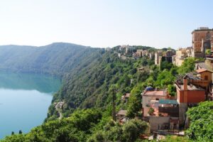
We reached Gozo by ferry from the northern tip of Malta, a half-hour crossing that runs every thirty minutes and carries everything the island needs moved: cars and trucks and tourists and schoolchildren and the day’s deliveries. We went up to the open deck because the sky was clear and the water was that particular blue the central Mediterranean turns in late April, which I have given up trying to name. The limestone cliffs of Gozo came up out of the sea slowly, pale and irregular, and as the ferry swung in toward harbor the island composed itself into something at once very old and entirely ordinary, a baroque dome floating above a town the color of bone.
We passed the Blue Lagoon, whose color is so improbable that it makes you briefly distrust your own eyes, the turquoise going down into cobalt as if someone had decided the sea should look the way it looks in other people’s holiday photographs and then overshot. There are places where the Mediterranean turns out to be exactly the thing it is in the imagination, and the channel between these islands is one of them.
Dawn, our archaeologist host, met us on the other side.
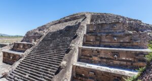
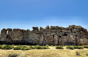
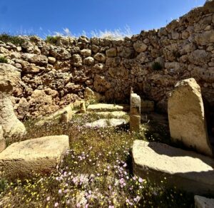
Ġgantija, which means giantess
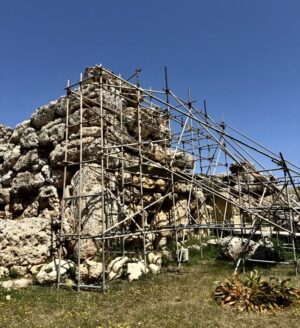
The name is Maltese, and it is the right name, because for a very long time the local explanation for these walls was that giants had raised them, that being the only theory adequate to the size of the blocks. The two temples of the Ġgantija complex sit on a plateau above the town of Xagħra, and even half-ruined they stop you where you stand. The outer walls reach several meters, individual blocks run up to fifty tons, and all of it was quarried and shaped and moved and stood upright by people working without metal tools and, if the official chronology holds, without the wheel.
The temples have been known to locals since antiquity, which is part of what is wrong with them. Excavation began in the eighteenth century, before archaeology had learned to be careful, and so much of what was there got disturbed in the digging, stones shifted to suggest a completeness that may never have existed and smaller rubble heaped on top to give the walls more height and dignity for the visitors. What stands at Ġgantija today is, as Dawn put it cheerfully while waving at the scaffolding currently holding up one of the outer walls, a collaboration between the original builders and several thousand years of other people’s opinions about them.
________________________
________________________
She said this while reaching out to lay a hand flat against the stone, running her palm over a surface pitted by millennia of sea wind, in a gesture somewhere between inspection and affection.
 Dawn Adrienne Saliba is a researcher at the University of Malta, whose published work concerns acoustics and ritual at the prehistoric temples, and she is also among the more vivid people I have met anywhere in some time. She wears her curly hair loose, talks with her hands and her whole upper body, laughs constantly, and when she is standing inside a five-thousand-year-old ruin telling you why she is sure the apse chambers were built for sound, she gives off a faith that is at once scholarly and entirely personal. On the day we saw Ġgantija she was wearing a faded Knicks T-shirt, and the arrangement of ancient stones and UNESCO scaffolding and an archaeologist in a basketball shirt explaining Neolithic ritual acoustics struck me as a very Maltese sort of composition, the old and the offhand crowded into a single frame.
The dating of the temples is where the genuinely interesting problem lives. Ġgantija is given as roughly 3600 BC, which puts it among the oldest freestanding structures on the planet and more than a thousand years ahead of the pyramids, and that figure rests heavily on what was found near the stones rather than on the stones themselves, so that objects of a given period turn up at a site and the site is assigned to their period. The limitation is plain enough, since it tells you when people were using a place and not when the place was made, and at Ġgantija, where the digging was early and rough and the reconstruction has muddied the original layout, the date is an estimate resting on an estimate. None of this is a cover-up, whatever the more excitable corners of the internet would prefer; it is just what any science looks like at the edge of its evidence, and the honest people in the field say so without being asked twice.
________________________
________________________
________________________
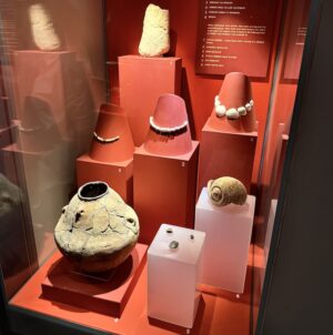
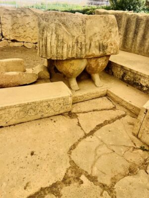
What the museum knows, and the man outside
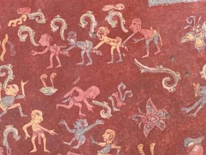
The interpretation center beside the Xagħra Circle, the Gozitan hypogeum where the remains of hundreds of Neolithic people were excavated and studied, holds objects that repay slowing down for. None of them looks like much at first glance. There is a skull on a plinth that forensic specialists studied in order to reconstruct how the woman it had belonged to looked while she was alive, and there are ceramic bowls cracked and pieced back together that still carry the trace of whatever was eaten or offered out of them six thousand years ago, and there are faceshell necklaces laid out on conical stands beside a large triton shell and a cow’s toe bone worked until it became a human face. The stylized limestone figurines have had their features worn nearly to nothing while their bodies stayed disproportionately full, and the seated clay figures are so small and so round and so oddly pleased with themselves that they seem to be commenting on something the language for which has been lost. One panel shows a wooden reconstruction of Neolithic furniture built out from the Sleeping Lady, the most famous figurine in all of Maltese prehistory, who lies on her side on what looks like a low couch with her robes folded around her in a sleep deep enough to seem ceremonial, and the label notes that she is the best evidence we have for furniture in the Neolithic, which is a small and unexpectedly moving thing to learn, that we know someone once lay down with that much care for the arrangement only because someone else thought it worth recording in clay.
________________________
________________________
It was outside this museum, while I was alone at the little souvenir stand buying bracelets as a gift for Tatiana and one for myself, that the trip handed me something I am still turning over. Tatiana had strained her back, and there was a delay while Dan and Noel went looking for medicine for her, and in the middle of it an old Maltese man was standing nearby, in a suit and glasses, smoking, ageless in the way Noel was ageless and strikingly handsome. He had spoken with Tatiana and knew about the back, and then he and I fell into conversation, and it drifted away from the back and toward life, the way conversations with certain strangers will. I was already sitting in the van when he came to the open door, leaned in, and said that eventually it stops, that the pain stops. He was not talking about the back anymore. He did not spell out what he meant, and we drove away, but I understood him, because a man does not lean into a stranger’s van to talk about a sore back, and I took the meaning he had intended for us. I did not need it said any plainer.
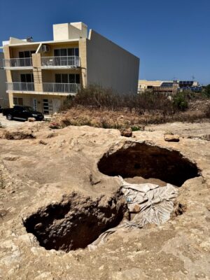
The hole in the ground
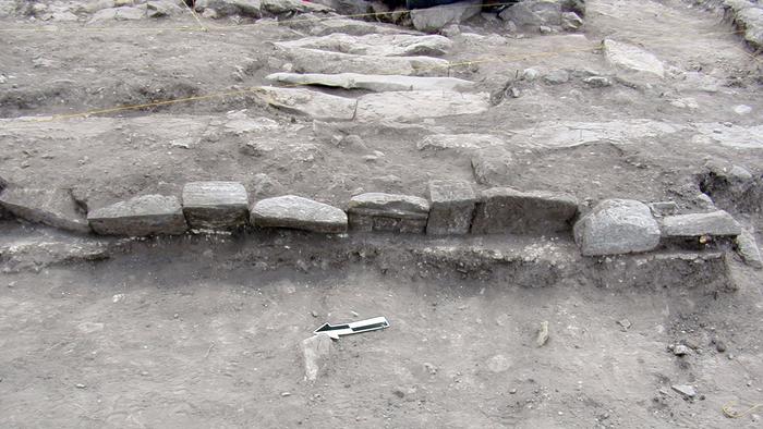
What I was not ready for, on the day of our visit to Gozo, was the construction site.
Dawn took us to it, and I am sorry now that I did not write down the exact address. What I can describe is a raw cut into pale limestone, two pits opened in the bedrock of the kind that come before foundations, with a finished apartment building standing directly alongside and the blue of the sea visible past it, and wildflowers already coming up through the disturbed soil at the edges, and a sheet of heavy canvas thrown over one of the openings, whether for safety or for appearances I could not tell.
Dawn stood at the lip of it and described what had been there before the machines came and what might still lie under the level the machines had reached, and her voice while she did this was steady in the way a voice goes steady once it has explained the same thing often enough to have worn through anger into something colder and more durable.
This, she said, was not unusual. This was the pattern.
The Maltese islands are saturated with archaeological potential, the density of prehistoric sites both dug and undug being remarkable for an archipelago this small, and development presses against the edges of the protected zones nonstop and now and then straight through them, because the legal protections exist on paper while the enforcement is a separate and weaker matter. Dawn has staged concerts inside temple precincts and put on theatrical performances and gathered residents and written articles and filed objections and built coalitions, all of it alongside her actual research, so that she is effectively running two careers at once, one of them proving what these places were and the other trying to keep them from being destroyed before the first one is finished. Standing at the edge of that pit and looking at a building whose foundations had gone into ground no one had surveyed, I could see the whole thing settled into a very Maltese kind of tragedy, a place that survives six thousand years only to be undone by a planning permit.*
_________________________
_________________________
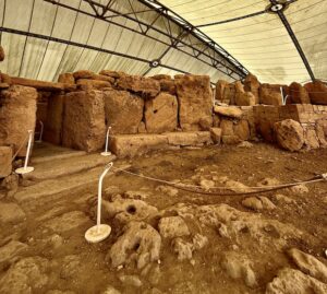
The room beneath the room
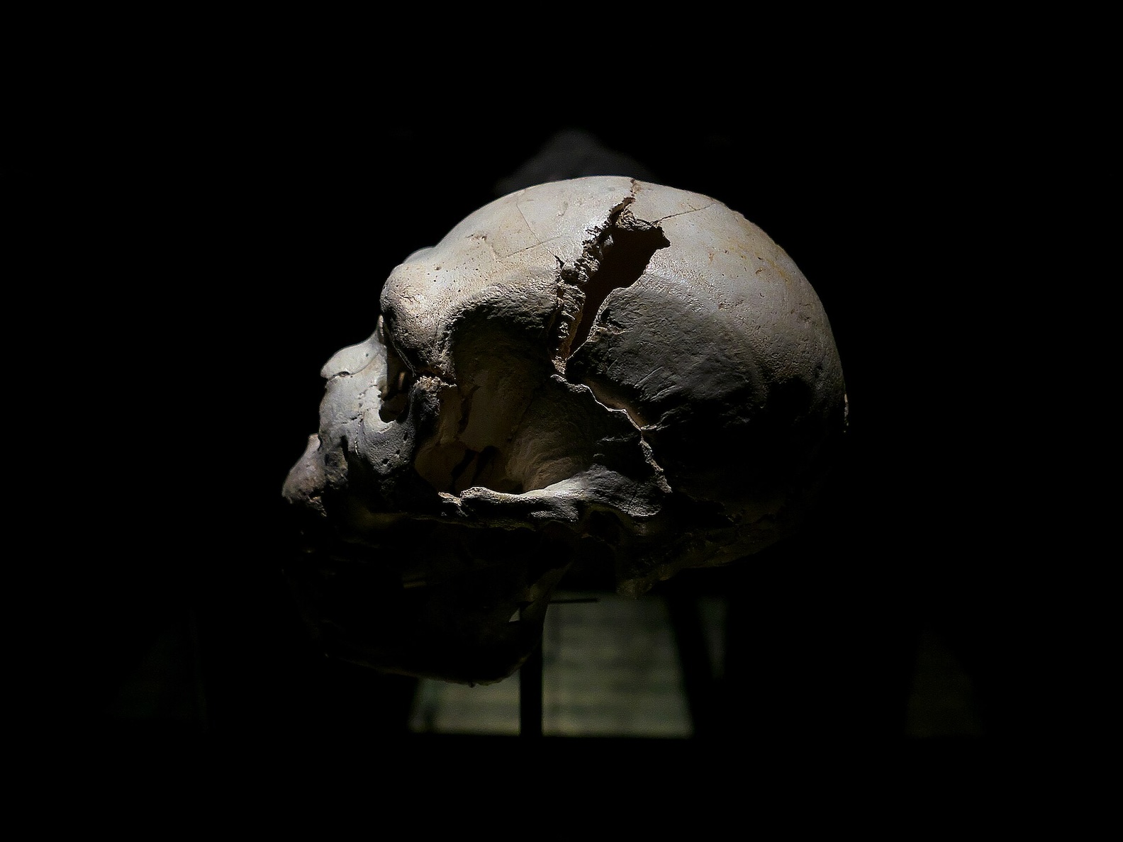
The Ħal Saflieni Hypogeum is the only known prehistoric underground temple in the world. It lies beneath a residential neighborhood in Paola on the main island, and it came to light in 1902 when workers cutting rock for a new cistern broke through the ceiling of a chamber they had no idea was under them, after which the discovery was kept quiet for several years before anyone investigated it properly. What they eventually found was a complex of three levels carved out of living rock, with chambers and niches and curved apses reaching about ten meters below the surface, and the remains of somewhere between seven and eight thousand people deposited there across several centuries, the Sleeping Lady among the things recovered.
Access is tightly controlled now, the number of visitors per session capped and the interior climate monitored and photography forbidden, so what I can give you is only the feeling of going down into it, a slow controlled descent through limestone that cools as you drop, a gradual loss of the ordinary logic of surfaces and daylight, and a steadily growing awareness that the walls around you were shaped by hands following a plan we have only partly recovered.
We went down twice.
The first time was the standard visit, a fixed route and explanatory panels and controlled lighting, informative and at moments genuinely affecting, because the scale of the communal burial and the thought that someone organized all of it, the carving and the placing of the dead and the arrangement of the objects, with a coherence that predates writing and metal and nearly everything we use to measure how complex a civilization was, is not a thing the mind takes in quickly.
The second visit was Dawn’s.
Dawn’s version
She had arranged a private session, and the difference lay less in what we saw than in what we heard. Her published research is specifically about how sound behaves inside the Hypogeum, how the carved chambers resonate at some frequencies and swallow others, how a voice placed in one position would have produced an effect that could be predicted and repeated, and she has done the formal acoustic testing there, with instruments and with human voices, and that work is documented and serious.
What she adds in person is the part the journals render more cautiously, which is the imaginative leap from the measurement into the scene. Standing in one of the chambers she described how a chant would have traveled through the stone and how a procession might have wound through the sequence of passages and what the gathered people would have felt as the sound stopped being something heard and became something physical, pressing on the chest, blurring the line between where the body ended and the chamber began. She described it with the precision of someone who has measured it and the conviction of someone who has also, plainly, felt it, and I could not always tell which of the two was speaking, the instrument or the believer, the woman who had run the tests or the woman for whom the place had long ago stopped being a hypothesis.
Some of what she said sat squarely on the acoustic data. Some of it had drifted out past the data into the particular faith of a person who has loved something so thoroughly and for so many years that the membrane between what can be shown and what must surely be true has gone a little permeable, and at times it was, to be honest with you, very funny, and I would not say so to her face, because the funniness and the seriousness were the same thing seen from two angles. She was the best possible guide to a place like this, since she had lived with its questions so long and turned them over from so many directions that standing near her you could feel the entire weight of what is still unknown, which is rarer than expertise and a good deal harder to come by.
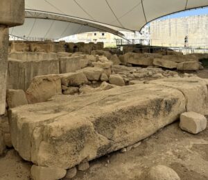
Tarxien, a short walk away
A few hundred meters from the Hypogeum, in the ordinary streets of the town that gives them their name, stand the temples of Tarxien, and the two sites belong together for more than their nearness, since both were brought to light by the same man, Themistocles Zammit, the Maltese physician who turned to archaeology and excavated the Hypogeum in the first years of the twentieth century and then opened Tarxien in 1915 after local farmers kept striking large stones with their ploughs. The complex is four linked temples raised across the same long stretch of centuries as the others, and what sets it apart is the decoration, the great blocks worked with running spirals and, on one famous slab, a procession of carved animals, rams and a sow with her litter and what reads as a bull, the closest thing the temple-builders left to a picture of the world they lived in.
___________________________
___________________________
The thing everyone remembers is the statue, or what is left of it. Near the entrance stands the lower half of a colossal figure, a broad pleated skirt and two heavy calves above small feet and nothing at all above the waist, the upper body lost so long ago that you are left with the foundation of a giant and asked to supply the rest, which when whole would have stood two or three meters tall. The Maltese call her, with the directness the island applies to all these figures, the fat lady, and like the smaller figurines she is built around an abundance the people who made her clearly read as holy. There is evidence too of what was done in these rooms, a hearth and a stone niche where a flint knife and the bones of animals were found together, which is about as close as the silent record comes to telling you outright that things were killed here and offered.
___________________________
___________________________
What you remember most at Tarxien, though, is the houses. The temple precinct sits hemmed in on every side by the modern town, ordinary dwellings with their washing out and their televisions audible, their walls running up to the edge of some of the oldest decorated stone in the Mediterranean, and the contrast is so complete that it stops feeling like contrast and starts feeling like the ordinary condition of Malta, where six thousand years are not kept at any respectful distance from each other but are stacked in the same few meters of rock. Centuries after the temple-builders had vanished, Bronze Age people who had nothing to do with them used this ground to burn and bury their dead, a second and unrelated population laying its ashes down on top of the first, and then they too disappeared, and then the town grew up over the whole of it, so that the washing now dries above ground holding the later ashes and the older spirals together beneath it.
___________________________
___________________________
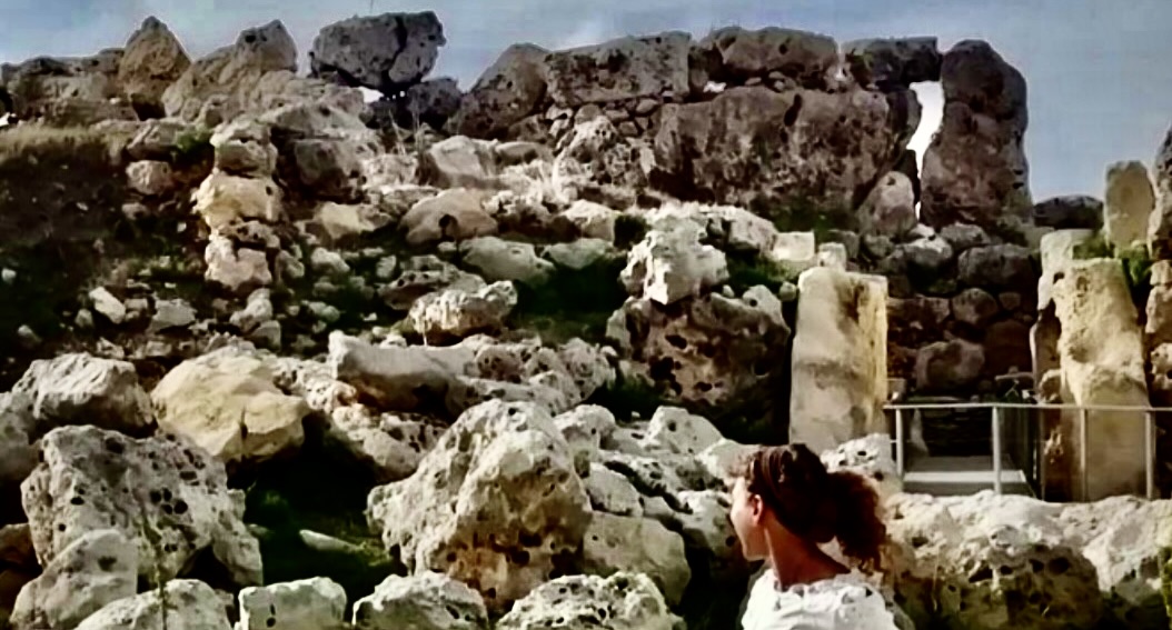
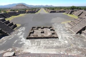
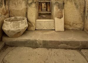
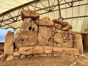
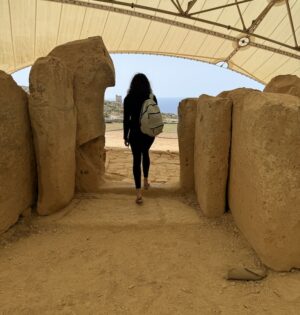
Ħaġar Qim and the wind off the sea
The temples of Ħaġar Qim and Mnajdra stand on the southern coast about three hundred meters from the water, in a landscape so open to the horizon that the wind off the sea never quite lets up. They live under large protective shelters now, the coral limestone they are built from being soft and the salt air having been patient with it, and the effect is strange, ancient stone sheltered under modern construction, a solution to one problem that quietly raises a different question about what preservation is for and whom it serves.
Here, as at Ġgantija, antiquity and restoration lie layered visibly on top of one another. The doorways cut from single blocks of stone are among the hardest features to account for, an engineering decision that cost enormous effort and serves no structural purpose anyone has since identified, and there are theories, and Dawn had views. The solstice alignments are documented, the way the light enters a particular opening on the shortest day and falls on a particular stone, and this is read by some as deliberate astronomy and by others as a coincidence thrown off by circular rooms that happen to point in various directions, and the argument between them is real and not settled. Standing inside the complex with the protective shelter overhead and the sea audible through the gaps in it, I could see why both sides keep their defenders, because the place feels intended in ways that slip out from under any attempt to say so precisely.
__________________________
__________________________
__________________________
__________________________
Mdina, my favorite
Late one day we went to Mdina, and it remains the place on this trip I loved most. If Valletta is loud and crowded and pressed for time, which it is, and which we mostly were while we were in it, Mdina is its opposite, calmer and more polished, a walled hill town of churches and beautiful streets where horse-drawn carriages still go by and the whole thing arranges itself into the Mediterranean exactly as you imagine the Mediterranean before you have ever been to it. 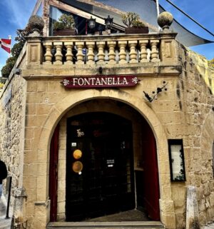 The history is enormous and worn smooth. We were there for several hours, which is itself a kind of luxury given how restricted we were on time everywhere else, and we walked it slowly, Dan and Tatiana and I, with Dawn not along for this one.
We had lunch at the Fontanella Tea Garden, one of the oldest places in the city, sitting outside on the terrace, and the impression while we sat there was that we had somehow slipped over into Tuscany, that Malta had quietly handed us off to a different country for an afternoon. The wine was a good local one. The pumpkin soup was extraordinary, and I am not in the habit of remembering soup. There were salads and small dishes to begin, all of them wonderful, and the place is famous as well for its desserts.
____________________________
____________________________
____________________________
____________________________
A slow lunch at the edge, and the cities we only glimpsed
There was one other meal like that, on the Dingli cliffs, where the limestone drops straight into deep water, at a restaurant whose plainness took confidence rather than neglect, simple linens and direct sun and food that tasted like exactly what it was, the octopus having been in the sea recently and the oil pressed from olives that had not traveled far and the wine cold because the afternoon had earned it. The three of us, Dan and Tatiana and I, sat there a good while longer than we needed to, the sea flat below us, and we did not once discuss archaeology. The Blue Lagoon, which we saw on another part of the same coast, belonged to the driving and to Noel, but this lunch was ours, and it was one of the two times on the whole island we were allowed to slow down enough to actually taste where we were.
___________________________

___________________________
The rest of Malta we mostly glimpsed. The Three Cities, the old fortified harbor towns across the water from Valletta, we did quickly, looking down from the bastions over the marina and the yachts, an impression rather than a visit. Valletta itself, which we came to on the third and last day, we took at speed, walking streets that narrowed and dropped toward the water, looking at façades, looking for somewhere to eat, until we turned a corner and came on a small restaurant where a waitress was setting the outside tables with the focused pleasure of someone who enjoys the preparing as much as the thing prepared. I spoke to her, and she told us to wait a little, and when she looked up her face opened so completely into welcome that I wrote in my journal that evening that I had wanted simply to hug her and go home. These cities are wonderful and we were restricted on time, and the contradiction between those two facts is most of what I carry away from them.
Every evening we came back to St. Julian’s, to the same hotel, and sat in the lobby and went back over how the day had gone, which became a ritual of its own, the fixed point we returned to no matter how far out across the islands the day had taken us.
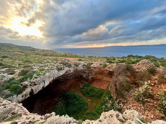
A brief appearance, and a much older Malta
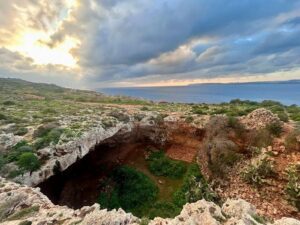
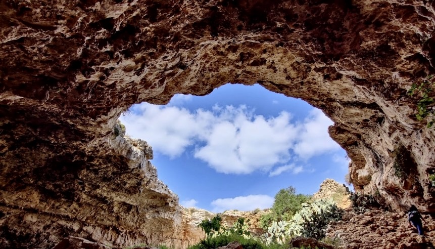
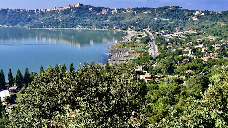
Eleanor Scerri, whose discovery at the Latnija Cave had reset the island’s whole chronology a year before we came, was scheduled to spend real time with us, though in the end circumstances forced her to materialize near the cave for only a few minutes before some prior obligation pulled her off in a direction we could not follow, so that there was a wave and an introduction and the first half of a sentence about the site’s importance and then she was gone, which was the most efficient possible delivery of a character, a person with somewhere else to be, a different shape of devotion from Dawn’s and no less real for being briefer. We did explore the area around the cave, and it was Dawn who was with us there, on the cliffs near Latnija, the sea enormous and pale-blue behind us and Comino floating off in the distance.
________________________
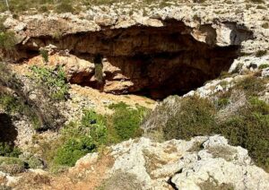
________________________
What Latnija means is best left for the fuller account in another article, but the short version is worth carrying out of here: the temple-builders, who themselves predate the pyramids, were not the first people on Malta after all. A thousand years before them, hunter-gatherers crossed a hundred kilometers of open sea in what were likely hollowed-out logs, beyond the sight of any land, to reach this rock, and came back, and came back again. The island keeps turning out to be older than the last person to measure it believed.
What the island is deciding
From almost any cliff on the southern coast you can see, by turning inland, both what Malta has been and what it is in the middle of becoming, the old rubble walls still dividing the farmland into small holdings while the apartment blocks climb toward them, and the church domes rising over every village out of all proportion to the populations they serve, which is a large part of their grandeur, standing now beside new construction that makes no reference to anything that came before it.
None of this is peculiar to Malta, since every island and every old city is somewhere inside the same negotiation between what it inherited and what it can sell, and what makes the Maltese version feel sharper than most is the age and the density of what is at stake, because the prehistoric sites are not lonely monuments out at the edge of the inhabited world but belong to the ordinary life of the place, sitting above villages and reachable by farm lanes and ringed by fields and rubble walls that hold fragments of the same vanished culture. Preserving any of it is therefore not a matter of fencing off a single ruin but requires a constant and politically awkward refusal to decide that the past is worth less than a parking space, which Dawn understands, and so does the Gozitan resident we met who has spent years documenting the building going up near Ġgantija, and so in his own way does Noel, who when I asked him what had changed most in Malta over his lifetime answered, after a moment, that it was the building, and then after another moment, that there was too much of it.
The stones that outlasted their builders
Malta’s temples survived because they were made of something that outlasted the people who intended them. The builders of Ġgantija and the Hypogeum and Ħaġar Qim are gone so completely that we do not know what they called themselves or what they spoke or what exactly happened around 2500 BC when they dropped out of the record with a thoroughness no one has neatly accounted for, and what is left is only the work, the aligned stones and the carved chambers and the acoustic geometries and the dead laid down among their necklaces and figurines and bowls. They were not building for posterity in any way they could have named, and yet they built to last, which says something about them even now that we cannot hear them say it.
The question Malta is answering at present, slowly and unevenly and under real economic and political pressure, is whether it values the same things its first builders did, and the evidence on that runs in both directions at once, the excavations continuing and the development continuing and Dawn staging another concert and filing another objection and taking another small group down into the Hypogeum to hear what the stone still does with a voice.
I keep going back, though, to the old man outside the museum on Gozo, leaning into the van in his suit and his glasses, telling me that eventually the pain stops, and meaning by it something he never named and did not have to, because I understood him. He had the same quality the island has, of saying something enormous in passing and then letting you drive away before you can ask what it was built on. Malta is full of that. The stones do it, and the people do it, and you leave with the last line withheld, which may be the only honest way to leave a place this old.
____________________________
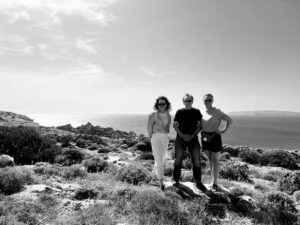
In the remarkable sea-side setting surrounding Latnija Cave: author Anastasia, far left, Dan, middle, Tatiana, far right.
____________________________
Unless otherwise noted, all images credit Anastasia Adeler.
____________________________