
In the fertile Carapelle Valley of northern Puglia, where the ancient territory of Daunia meets the sub-Apennine foothills, a late antique villa of extraordinary opulence lay concealed beneath agricultural soils for fifteen centuries. The Villa of Faragola—its summer dining hall furnished with Italy’s best-preserved masonry “stibadium”, its thermal complex among the largest private baths ever documented on the peninsula, its floors sheathed in the rarest polychrome marble “opus sectile”—represents the most spectacular aristocratic residence yet discovered in the Italian south. Excavated from 2003 onwards by the University of Foggia under Giuliano Volpe and Maria Turchiano, partially opened to the public, then savagely burnt in a suspected arson in September 2017, and now the subject of a hard-won, multi-million-euro restoration completed in November 2024, Faragola has endured a modern fate as dramatic as its ancient one. This article traces the full arc of its history—from its Daunian origins through its late antique apogee, its early medieval transformation, its modern discovery, its near destruction, and its current, cautious renaissance.
THE CARAPELLE VALLEY: A LANDSCAPE OF PERENNIAL HABITATION
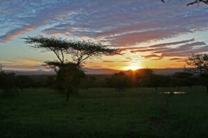
The Carapelle river descends from the sub-Apennine highlands of the Monti Dauni before widening into the great alluvial fan of the Tavoliere delle Puglie, one of the most productive agricultural plains in the Italian peninsula and among the earliest farming landscapes in the western Mediterranean. This valley corridor—traversed since prehistoric times by transhumance routes linking the Apennine pastures to the Adriatic lowlands—was also threaded, in the Roman period, by one of the most strategically important secondary road axes in the region: the Via Aurelia Aeclanensis, which connected the ancient city of Herdonia (modern-day Ordona, on the Via Traiana) to Aeclanum (modern-day Mirabella Eclano), thereby bridging the Via Traiana in the north to the Via Appia in the south and drawing the valley into the arterial infrastructure of the empire.
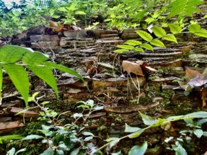
It was precisely at a node of this road network, on a low terrace above the left bank of the Carapelle, approximately five kilometers northeast of ancient Ausculum (modern-day Ascoli Satriano) and nine kilometers from Herdonia, that the Villa of Faragola was established. The site, which takes its name from the modern locality of Contrada Faragola within the municipality of Ascoli Satriano—famous for its two marble griffins from the Getty Museum—in the province of Foggia, Puglia, Southern Italy, commanded a gentle rise affording views across the valley’s wheat-gilded plain—a setting at once practical, commanding, and aesthetically eloquent of the aristocratic taste that would, in late antiquity, transform the location into one of the most opulent rural residences in southern Italy.
___________________________
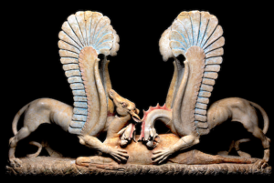
The two griffins, a polychrome marble trapezophoros, devouring a fallen doe. (CREDITS: Civic Museum Hub of Ascoli Satriano).
___________________________
The geological and hydrological character of the terrace was well chosen: the Carapelle’s alluvial deposits provided fertile agricultural land yielding the grain surpluses on which the villa’s economy, and ultimately its luxury, depended, while the river itself and a series of local springs supplied the abundant water resources that a complex bath establishment of over a thousand square meters demanded. In a region whose long, hot summers made the pleasures of water—fountains, pools, the cool percussion of hydraulic spectacle—both a practical necessity and a social performance, the hydrogeological endowment of Faragola was inseparable from its architectural ambitions.
_________________________
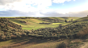
The Carapelle Valley is rich in both fertility and archaeological treasure (CREDITS: Polo Museale Civico di Ascoli Satriano).
_________________________
DEEP ROOTS: THE DAUNIAN SUBSTRATUM AND THE EARLY VILLA
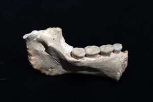
Faragola‘s story does not begin with Rome. Systematic excavation has demonstrated that the terrace was occupied in the Daunian period—from approximately the fourth to the second century BCE, with traces extending to earlier centuries—when a domestic structure, one of whose rooms was paved with a careful pebble mosaic, stood on the site. The Daunian peoples, whose distinctive painted sub-Geometric pottery, elaborate anthropomorphic grave stelae (the celebrated stele daunie), and warrior aristocracies defined the cultural landscape of ancient Daunia from the early Iron Age onwards, had established a rural presence at Faragola that prefigured the later villa by nearly half a millennium. The pebble mosaic—a sophisticated flooring technique that implies both resources and aesthetic aspiration—suggests this was no simple farmstead but a settlement of some social consequence within the Daunian settlement hierarchy.
Following an apparent abandonment in the third or second century BCE, coinciding with the convulsions of the Punic Wars that so catastrophically disrupted the social fabric of Puglia—among them the Roman annihilation at Cannae (216 BCE), fought on the Aufidus river less than forty kilometres away, and the subsequent Roman reprisal against communities that had allied with Hannibal—the site was reoccupied in the early imperial period. A villa rustica of the first to third centuries CE developed here, organised around the fundamental productive logic of the latifundium: large-scale grain cultivation, slave labour, and the generation of agricultural surplus for markets accessible via the road network. This early villa remains imperfectly known, its structural traces largely obliterated by the radical rebuilding of late antiquity, but its existence is attested by ceramic sequences and scattered architectural evidence sufficient to confirm continuous occupation from the Republican period.
_______________________
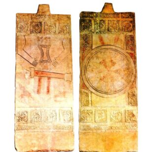
Herdonia’s Stelae Daunie.
(CREDITS: ORDONA’S HERMA – HERDONIA ARCHAEOLOGICAL MUSEUM)
_______________________
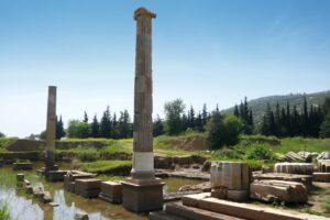
THE LATE ANTIQUE APOGEE: ARCHITECTURE OF ARISTOCRATIC POWER
Between the fourth and the sixth centuries CE—a period that elsewhere in the Roman West is associated with fiscal crisis, barbarian incursion, and urban contraction—the Villa of Faragola underwent a transformation of extraordinary ambition. The modest productive estate of the early empire was progressively dismantled, its rooms partially razed or absorbed, and in their place arose a complex of a wholly different character: a luxurious residential and recreational establishment whose architectural program, decorative investment, and hydraulic sophistication place it in the first rank of late antique aristocratic villas anywhere in the Mediterranean world.
The excavated pars urbana of the villa—the residential and representational core—covers an area of approximately 1,550 square metres, though survey evidence suggests the full extent of the estate, including its productive dependencies, workshops, and outbuildings, was considerably larger. The plan conforms to the type of the villa a padiglioni—a pavilion-type layout—in which residential and service spaces are disposed horizontally across the terrain rather than around a single compact nucleus, though with anomalies consistent with the stratified phasing of its construction history. A large peristyle courtyard—a colonnaded garden at the heart of the residence—organized the principal reception and residential rooms in its first late antique phase, while a second major rebuilding in the fifth century fundamentally altered the spatial logic of the complex.
_________________________
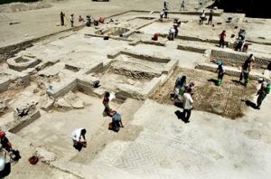
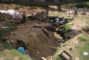
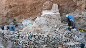
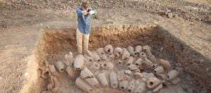
The initial stratigraphic archaeological excavations of the Villa of Faragola in 2003 (Credits: Civic Museum Hub of Ascoli Satriano).
_________________________
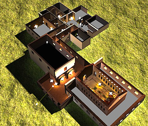
3D reconstruction of the Villa of Faragola (Credits: Laboratorio Archeologia Digitale, Department of Human Studies, University of Foggia).
_________________________
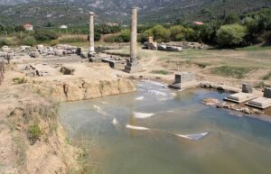
The Great Thermal Complex
The baths of Faragola are among the most remarkable structures to have emerged from any late antique excavation in Italy. Covering an area of over a thousand square meters—and thus qualifying as one of the largest private bath establishments yet documented anywhere on the peninsula—the thermal complex was organized across two contiguous but functionally semi-autonomous bodies of building: a Great Baths wing and a Small Baths wing, the latter apparently constructed as a supplement or replacement for certain functions of the former, perhaps as the thermal demands of the household changed over time.
Whether this double arrangement was conceived to separate the sexes, to distinguish the needs of the dominus from those of his guests or staff, or simply to accommodate the hydraulic impracticalities that the original design revealed in use remains a matter of scholarly debate.
Both wings followed the canonical sequence of imperial thermae: an undressing room (apodyterium) giving onto a cold hall (frigidarium) with plunge pools, a warm intermediate space (tepidarium), and one or more hot rooms (caldarium) heated by hypocaust underfloor systems in which ceramic pilae supported the floor above a combustion chamber. The frigidarium of the Great Baths was exceptional: equipped with two lateral pools and a large open natatio (swimming pool), it presented vault surfaces embellished with polychrome glass mosaic tesserae — a decorative technique more commonly associated with imperial or episcopal patronage than with private rural residences. Wall facings in opus sectile—cut polychrome marbles—and painted stucco completed a visual program whose cumulative effect must have been, to a visitor emerging from the summer heat of the Carapelle Valley, of dramatic and calculated magnificence.
The stratigraphic analysis of the bath complex documents a succession of construction and renovation phases spanning the fourth to the sixth centuries, with evidence for continuous use and periodic aesthetic upgrading. Fuel-wood analysis, drawing on archaeobotanical samples radiocarbon-dated by AMS, has provided a refined chronological sequence that also reflects palaeoclimatic fluctuations in the Tavoliere plain over the same period—a rare convergence of architectural and environmental history within a single excavated context.
_________________________

The inner map of the Great Baths wing and Small Baths wing of the villa of Faragola. (CREDITS: Civic Museum Hub of Ascoli Satriano).
_________________________
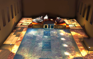
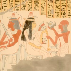
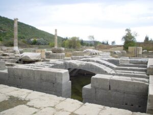
The Cenatio and the Stibadium: Theatre of Aristocratic Pleasure
No discovery at Faragola has attracted more scholarly attention, or captured more fully the imagination of specialists in late antique society, than the summer dining room—the cenatio aestiva (summertime dinner)—and its extraordinary centerpiece: a masonry stibadium that stood, before its partial destruction in 2017, as the finest preserved example of this form of aristocratic furniture anywhere in the Roman world.
The cenatio was inserted into the villa complex in the fifth century, replacing an earlier peristyle space, and was connected to the thermal wing by means of a long formal corridor conceived as a processional approach: guests moving from the baths to the banquet passed through a sequence of spaces designed to build, stage by stage, a sense of anticipation for the pleasures awaiting them. The dining hall itself was a large, luminous room—opening on its long sides through columns or pillars onto views of the surrounding agricultural landscape—designed as a kind of luxurious garden pavilion, at once interior and exterior, a space that blurred the Roman distinction between otium (leisure) and natura (nature).
At the focus of this space, raised on a slightly elevated platform and visible from every point in the room, stood the stibadium. This is the form of dining furniture described with vivid precision by the Gallo-Roman aristocrat and man of letters Sidonius Apollinaris (c. 430–489 CE), whose letters constitute an incomparable literary witness to the social rituals of fifth-century aristocratic dining: a curved, sigma-shaped masonry couch — its profile approximating the Greek letter sigma, or our letter C — on which up to seven diners could recline, arrayed in hierarchical order around its arc. The positions of the two lateral ‘horns’ of the sigma were the most honoured; access to the couch itself was regulated by the precise social conventions that governed every aspect of late antique aristocratic self-presentation.
The Faragola stibadium was no bare bench. Its frontal face, visible to all who entered the cenatio, was sheathed in carved marble reliefs depicting dancing maenads rendered in gold leaf in the act of presenting a libation to a serpent coiled around an altar — iconography of unmistakably Bacchic character. That the dominus of Faragola chose, in a fifth-century renovation executed when Christianity was the official religion of the empire and paganism formally proscribed, to celebrate the mysteries of Dionysus in the most prominent decorative position of his principal reception room speaks eloquently to the cultural conservatism—or deliberate archaism—of the senatorial class. These were men who defined themselves through their command of classical learning, whose libraries were stocked with Virgil and Cicero, and for whom the religious imagery of the classical tradition was a marker of paideia, of civilised cultivation, quite independent of theological commitment.
At the centre of the stibadium was a fountain, whose waters cascaded over the decorated front face into a shallow pool below — a hydraulic feature that served simultaneously as a cooling mechanism in the Puglian summer, a visual spectacle, and an acoustic enrichment of the dining experience. The play of water, the glint of light on polychrome marble, and the scent of the surrounding landscape: these were the calculated sensory conditions in which the dominus of Faragola conducted the ritual of the convivium—the aristocratic banquet that, in late antique culture, was as much a theatrical performance of power and learning as it was a meal.
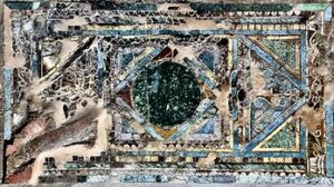
The floor surrounding the stibadium was paved in opus sectile of exceptional quality: cut panels of giallo antico, pavonazzo, and serpentine marble — quarried respectively at Chemtou in Tunisia, from the veins of the Greek islands, and from the Laconian mountains of the Peloponnese — were assembled into geometric compositions framing the dining space. Two large carpet-like panels, symmetrically disposed on either side of the stibadium‘s approach, were composed of mirrored squares of giallo antico and pavonazzo framed in serpentine: objects whose material cost, derived from the imperial marble trade that linked Faragola to quarries across the entire Mediterranean basin, was itself a form of conspicuous social communication.
__________________________
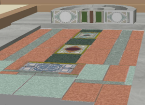
3D reconstruction of the cenatio aestiva. (CREDITS: Laboratorio Archeologia Digitale, Department of Human Studies, University of Foggia).
__________________________

An angled view of today’s stibadium in the villa of Faragola. (CREDITS: Civic Museum Hub of Ascoli Satriano).
__________________________

3D reconstruction of the stibadium. (CREDITS: Laboratorio Archeologia Digitale, Department of Human Studies, University of Foggia).
__________________________
A luxurious glass-made opus sectile in the cenatio of the villa of Faragola. (CREDITS: Civic Museum Hub of Ascoli Satriano).
__________________________
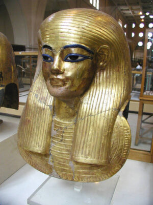
THE OWNERS: THE CORNELII SCIPIONES ORFITI AND THE SENATORIAL ARISTOCRACY OF LATE ANTIQUE PUGLIA
For whom was this extraordinary establishment built? The excavations have not yielded the kind of definitive epigraphic evidence — an owner’s name inscribed in mosaic or bronze — that would settle the question with certainty. However, a combination of inscriptional fragments recovered from the site and the prosopographical analysis of senatorial families known to have held landed property in the Apulian latifundia during the fourth and fifth centuries has led Volpe, Silvestrini, and their collaborators to identify the most plausible candidate as a branch of the Cornelii Scipiones Orfiti: a senatorial family of ancient pedigree whose members held senior positions in the imperial administration of the fourth century, including the consulship.
___________________________
3D reconstruction of the stibadium and thermal complex in an opulent senatorial setting. (CREDITS: Laboratorio Archeologia Digitale, Department of Human Studies, University of Foggia).
___________________________
The most prominent individual associated with the family in the relevant period is Servius Cornelius Scipio Salvidienus Orfitus, who served as Prefect of the City of Rome under Constantius II. The Orfiti were representative of the class of senatorial grandees—a class that, paradoxically, grew richer and more powerful as the imperial state contracted around it in the fifth century—whose wealth was rooted in the great agricultural estates of southern Italy and North Africa, and whose cultural investments in villa luxury, literary patronage, and philosophical otium constitute the most vivid evidence for the persistence of classical civilisation in the western empire’s final generations. The correspondence of Quintus Aurelius Symmachus, the greatest letter-writer of the late fourth century and himself the owner of multiple villae in southern Italy, provides the closest literary analogue for the world to which the owner of Faragola belonged: a world of elegant agricultural management, learned conversation at dinner, and the deliberate cultivation of classical tradition as a social identity.
Sidonius Apollinaris, writing in the 460s from a villa in Gaul that he describes in terms strikingly parallel to Faragola‘s architecture, provides another literary coordinate. His accounts of the stibadium banquet—the cool water in the fountain, the geometrical brilliance of the floor, the hierarchy of reclining positions, the musicians and performers—might have been composed with Faragola in mind. That a Gallo-Roman aristocrat could describe a setting virtually identical to one being constructed simultaneously on the plains of Puglia is eloquent testimony to the cultural coherence of the senatorial class across the late antique west: a class whose members, scattered from Bordeaux to Brindisi, shared not only a legal status and a literary formation but also an architectural vocabulary of pleasure.
THE POST-ANTIQUE VILLA: FROM ARISTOCRATIC RESIDENCE TO LOMBARD FARMSTEAD
The sixth century brought fundamental transformation. By the latter decades of that century—the period in which the Ostrogothic kingdom of Italy, which had maintained and even elaborated the forms of late Roman aristocratic culture, was destroyed by the Byzantine reconquest under Justinian’s generals Belisarius and Narses, and in which the Lombard invasion (568 CE) introduced a new and radically different political and social order into the Italian peninsula—the Villa of Faragola ceased to function as an aristocratic residence. The archaeological evidence for this transition is unambiguous: the luxury spaces are progressively abandoned, their marble and mosaic surfaces left unmaintained; domestic structures of a more modest character begin to appear in spaces formerly reserved for representational use; the thermal complex falls out of regular operation.
What replaced the villa was, in archaeological terms, equally fascinating: a village and farm settlement of the early medieval period, its small residential rooms, animal enclosures, and industrial installations — furnaces for ceramics and glass production, clay settling tanks, metal-smelting pits — occupying the shells of the former luxury spaces with the pragmatic economy of a society that no longer recognised, or at least no longer reproduced, the values those spaces had embodied. Written sources, interpreted in the light of the archaeological evidence, suggest that this agricultural complex was organised under Lombard administration as a form of curtis—a productive unit of the early medieval agrarian economy—making Faragola one of the rare southern Italian sites where the transition from late antique villa to Lombard farmstead can be observed in stratigraphic detail.
By the eighth century, the stone and marble structures had given way to wooden huts, their organic materials now recoverable only through post-holes and refuse deposits. The magnificent cenatio, whose fountain had played and whose stibadium had hosted the elaborate rituals of senatorial conviviality, became a barn. The thermal halls, whose mosaic vaults had glittered with glass tesserae, became animal pens. By the ninth or tenth century the site was effectively abandoned, its ruins progressively buried under the alluvial silts and ploughed fields of the Carapelle Valley. When the medieval town of Ascoli Satriano—rebuilt after the earthquake of 1456 destroyed the earlier settlement—looked out over the valley from its hilltop, Faragola was already a memory older than its oldest inhabitants could reach.
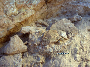
MODERN DISCOVERY: THE UNIVERSITY OF FOGGIA AND THE EXCAVATION CAMPAIGNS (2003–2017)
The systematic archaeological investigation of Faragola owes its existence to a broader program of landscape archaeology initiated by the University of Foggia’s Department of Cultural Heritage at the turn of the millennium.
Under the scientific direction of Dr. Giuliano Volpe—who would go on to serve as Chancellor of the University of Foggia, President of the Superior Council of Cultural Heritage at the Ministry, and one of the most energetic advocates for the archaeological heritage of the Italian south—the university undertook a systematic survey of the cultural landscape of the Carapelle and Celone Valleys as part of the Carta dei Beni Culturali of the Puglia Region: a comprehensive regional mapping of archaeological sites and cultural assets.
The area of the future excavation had been acquired in 1997 by the Municipality of Ascoli Satriano, which recognised the archaeological potential of the site — known locally through the perennial surface scatter of Roman and medieval ceramic material that ploughing brings to the surface of Puglian fields — and took the prescient step of securing it for public investigation before development pressures could compromise its integrity. Systematic excavations began in 2003, co-directed by Dr. Giuliano Volpe and Maria Turchiano, with campaigns continuing annually through the 2000s and into the 2010s.
From the outset, the Faragola excavation was conceived not merely as an episode of discovery but as a model of integrated research methodology.
Alongside conventional stratigraphic excavation, the team deployed an impressive array of digital documentation technologies—laser scanning surveys beginning as early as January 2007.
Among the earliest applications of this technology to an active Italian excavation were drone photogrammetry, three-dimensional modelling of architectural remains and individual artefacts, and GIS-based site mapping—which enabled the progressive construction of a comprehensive digital record of the site’s development.
The scientific results were published with admirable promptness in a series of papers, monographs, and congress contributions that established Faragola as a key reference point in international discussions of late antique rural society, villa architecture, and the archaeology of the transition from antiquity to the Middle Ages.
The discoveries that emerged from the excavations were, by any measure, exceptional. The identification of the stibadium as Italy’s best-preserved example of this rare banqueting form attracted immediate scholarly attention and was reported in the international archaeological press.
The scale and quality of the thermal complex—its polychrome mosaics, glass tesserae vaulting, and opus sectile panels—established Faragola as one of the most opulently decorated late antique buildings in the Italian south.
The recovery of three removable opus sectile emblematic panels from the cenatio—intricate compositions of cut vitreous glass in polychrome geometric patterns, paralleled only at Piazza Armerina in Sicily and at the great villa complexes of the eastern Mediterranean—placed the site in genuinely international scholarly company.
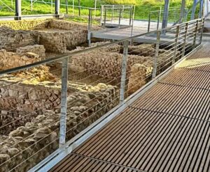
The public dimension of the excavation was equally pioneering. The site was progressively musealised in situ: a protective roofing structure of laminated timber and metal sheeting was erected over the cenatio and the adjacent bath area to preserve the exposed mosaics, marble floors, and standing walls against weathering.
Interpretive panels, visitor pathways, and educational programmes were developed in collaboration with the municipality and regional authorities.
__________________________
Dr. Giuliano Volpe, Faragola expert and professor of archaeology, University of Foggia. (CREDITS: Dr. Giuliano Volpe personal website).
__________________________
In 2009 the Archaeological Park of Faragola was partially opened to the public, welcoming school groups, tourists, and general visitors to an archaeological park that represented—in the judgement of both the excavators and the Italian heritage administration—a model of how an active research excavation could simultaneously function as a public cultural attraction and a tool for sustainable local development.
__________________________

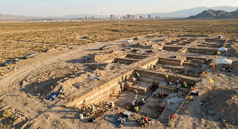
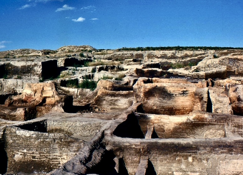
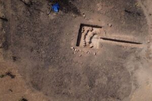
Aerial view of the Faragola excavation. FAM1885, CC BY-SA 4.0, Wikimedia Commons
__________________________
________________________________
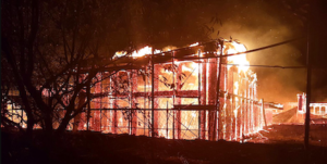
The night of 6–7 September 2017 did not merely destroy a roof. It attempted to obliterate fifteen centuries of survival and fourteen years of painstaking scholarly recovery.
________________________________
THE NIGHT OF FIRE: ARSON, DEVASTATION, AND THE QUESTION OF CULTURAL IMPUNITY (2017)
In the early hours of the night of 6 to 7 September 2017, the protective timber roofing structure over the cenatio and bath area of Faragola was engulfed in fire. By the time the flames were extinguished, the approximately three-thousand-square-metre covering had been entirely destroyed.
_________________________
The arson fire at night destroyed years of conservation efforts within the Villa of Faragola. (CREDITS: Civic Museum Hub of Ascoli Satriano).
_________________________
The intense heat generated beneath the collapsed structure — preliminary estimates placed temperatures in the vicinity of two thousand degrees Celsius — had calcined the marble panels of the cenatio floor, converting them from polished stone to something approaching quicklime; it had caused the mosaic tesserae to erupt from their bedding, scattering and deforming surfaces that had survived intact through fifteen centuries of burial and fourteen years of careful conservation; it had cracked and shattered the standing wall structures; and it had destroyed in their emplacements the Bacchic reliefs of the stibadium’s frontal face. A first-century BCE oscillum — a rare votive disc depicting a dancer, one of the site’s most beautiful portable artefacts — was stolen during or immediately after the conflagration.
Dr. Giuliano Volpe was in Kuala Lumpur at the time of the fire and learned of the disaster through a WhatsApp message in the early morning. His public response — posted to Facebook and rapidly circulated across Italian and international media — gave voice to the grief of the entire Italian scholarly community: fourteen years of excavation, research, publication, and careful musealisation, he wrote, reduced to ashes in a single night by what he described as organised criminality, professional expertise, or both.
__________________________
The oscillum, a disc-shaped marble of terracotta, typical of elite residences like Faragola. (CREDITS: Civic Museum Hub of Ascoli Satriano).
__________________________
The fire’s behavior—the ignition apparently simultaneous across multiple points; the penetration of a fire-retardant laminated timber structure; the systematic thoroughness of the destruction—pointed, in the view of investigators and scholars alike, to deliberate and professional arson.
The regional prosecutor opened a criminal investigation. Despite the reported capture on a local business’s surveillance camera of a vehicle in the vicinity of the site before the blaze began, no prosecutions have followed. The perpetrators remain unidentified.
The cultural loss was immense and, in significant respects, irreversible. The three removable opus sectile emblematic panels that had been removed from the cenatio before the fire for separate restoration treatment at the Istituto Centrale del Restauro in Rome were among the objects spared: a providential circumstance that preserved at least these masterworks from destruction. The statue of a young hunter-boy, similarly removed for museum display at Ascoli Satriano, also survived. But the physical fabric of the cenatio—its stibadium, its floor, its walls, the atmospheric totality that had made the space legible to the visitor—had been fundamentally compromised.
It would be analytically incomplete, however, to conclude the story of the fire with loss alone. Italian archaeological thinking on the disaster has, with admirable intellectual rigour, resisted the impulse to restore Faragola to a fictive ‘original splendour’ that would erase the fire from its history.
As the site’s archaeologists have argued, the conflagration of 2017 is itself now part of Faragola‘s stratigraphic biography—an episode of violent destruction as real as the fires that ended the life of late antique buildings across the Mediterranean, and one whose traces the archaeological record must incorporate rather than conceal. The ethical and professional challenge of Faragola‘s post-2017 restoration has therefore been not simply to repair damage but to restore, interpret, and commemorate simultaneously – making visible both the villa’s original magnificence and the scar of its modern assault.
TOWARDS RENAISSANCE: CONSERVATION, RESTORATION, AND THE FUTURE OF FARAGOLA (2018–2026)
The institutional response to the arson was swift and, eventually, substantial — though the conversion of initial emergency measures into sustained funded recovery took, as is characteristic of Italian heritage administration, considerably longer than the emergency itself. In the immediate aftermath of the fire, conservators from the Soprintendenza Archeologia Belle Arti e Paesaggio for the provinces of Foggia and BAT began emergency stabilization works: veiling the damaged mosaic surfaces with gauze layers to arrest further tessera displacement, applying chemical consolidants to the calcined marble surfaces to prevent spalling, and removing the most seriously compromised debris to allow structural assessment.
The central conservation instrument proved to be the CIS Capitanata—the Contratto Istituzionale di Sviluppo, orInstitutional Developmental Contract, a coordinated public investment program for the cultural and economic development of the Capitanata region, of which the province of Foggia is the principal territory.
Under this framework, a restoration and valorization project for Faragola received funding of approximately three million euros, administered through Invitalia and managed with the Municipality of Ascoli Satriano as the contracting station, under the architectural and technical supervision of the Soprintendenza. The main restoration contract was awarded in 2021 to the specialist firm De Marco s.r.l., experts in the conservation of immovable cultural heritage.
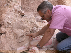
Restoration works began in earnest in September 2023 under the scientific direction of Soprintendente Anita Guarnieri and a team of specialist conservators that included, significantly, Antonella Martinelli—a restorer who had worked on the original pre-fire conservation campaigns at Faragola and therefore brought both technical expertise and institutional memory to the recovery process.
The team was further supported by the scientific evaluation of the Istituto Centrale del Restauro in Rome. The work was described by Guarnieri, on its completion, as extraordinary in its complexity and length: the challenge was not merely the mechanical re-adhesion of displaced tesserae or the chemical stabilization of calcined marble but the interpretation of a surface that had been fundamentally altered by heat—deformed, discoloured, and in places destroyed—and the determination, at each point, of what degree of restoration served both legibility and historical honesty.
A conscious and principled decision was made to retain, in certain locations, visible traces of the fire’s transformation — not as a concession to defeat but as an act of archaeological and ethical intelligence. The 2017 conflagration, the conservators and archaeologists agreed, had become part of Faragola‘s history; to erase its evidence entirely would be to falsify that history. The restored site will therefore bear, in its material fabric, the layered testimony of fifteen centuries of occupation, abandonment, and revival — including the attempted destruction of 2017 and the determined recovery that followed.
In November 2024, the Soprintendenza announced the formal conclusion of the marble and mosaic restoration works. The site’s protective infrastructure was simultaneously renewed, with a new covering system replacing the destroyed timber structure.
The Municipality of Ascoli Satriano, supported by regional and national heritage authorities, has proceeded with planning for the full reopening of the Archaeological Park di Faragola, which is expected to welcome the public again in a substantially restored and reinterpreted form — encompassing the cenatio, the thermal complex, the medieval village overlay, and new interpretive installations communicating the full stratigraphic depth of the site’s history.
FARAGOLA IN CONTEXT: SIGNIFICANCE AND SCHOLARLY LEGACY
The senatorial Villa of Faragola occupies a position of singular importance within the archaeology of late antique Italy, and its significance operates simultaneously at several scales of analysis. At the regional level, it is the most spectacular demonstration yet recovered of the persistence and vitality of aristocratic villa culture in the Puglian latifundia during the fourth and fifth centuries — a period when the imperial political structure was fragmenting around the senatorial elite even as that elite was, paradoxically, consolidating its landed wealth and investing it with increasing confidence in architectural and decorative display. No other site in Puglia offers such a comprehensive material correlate for the world evoked by the letters of Symmachus and Sidonius Apollinaris.
At the national level, Faragola’s stibadium—even in its damaged post-2017 state, and certainly as documented in the exhaustive pre-fire laser scans and photographic records—remains the defining archaeological example of this architectural form in Italy and one of a very small number of in situ instances known anywhere in the Mediterranean world.
The site’s thermal complex, similarly, belongs to the restricted catalogue of large-scale private bath establishments whose scale and decorative program rival those of imperial construction. The opus sectile panels of the cenatio, even partially surviving, are among the most important examples of this luxury craft technique from the post-Constantinian west.
At the international level, Faragola has become a focal point in scholarly discussions of late antique aristocratic culture, the social rituals of the convivium, the persistence of pagan religious iconography in a Christianizing world, the transition from Roman villa to early medieval village, and the methodological challenges of digital documentation and in situ musealisation.
The bibliography generated by the excavations runs to hundreds of entries across a dozen European languages; the site has been discussed in major comparative studies of late antique villas from North Africa to Britain, and its stibadium cited as a reference point in analyses of similar structures from Portugal to Syria.
The arson of 2017, far from diminishing this scholarly significance, has added to Faragola‘s relevance a new dimension: it is now also a case study in the archaeology of modern crime against cultural heritage, in the ethics of post-disaster conservation, and in the resilience—institutional, intellectual, and communal—that the recovery of an injured site demands. The project of integrating memory of the fire into the interpretive framework of the archaeological park, rather than concealing it behind a restored veneer, has attracted international attention as a model for thinking about how sites that have suffered recent traumatic damage should be presented to the public.
__________________________
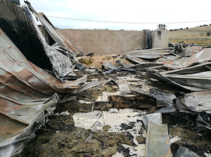
The remains after the arson fire of the Villa of Faragola in September 2017. (CREDITS: Civic Museum Hub of Ascoli Satriano).
__________________________
CONCLUSIONS: A VILLA AWAITING ITS SECOND OPENING
The senatorial Villa of Faragola has survived, across fifteen centuries, fire, abandonment, agricultural obliteration, and—most recently—an act of deliberate criminal violence. It has survived, in the modern era, fourteen years of painstaking excavation, a decade of partial public accessibility, the catastrophe of 2017, and seven years of slow institutional recovery. As the restoration of its mosaics and marbles reaches completion and the design of its new public infrastructure advances, Faragola stands at a pivotal moment: poised to become, as its excavators have always envisioned, one of the great archaeological parks of the Italian south, a site capable of communicating to a broad public the full depth and complexity of a landscape inhabited, transformed, and mourned across three thousand years.
Several arguments converge to support the claim that Faragola merits sustained international attention of the kind its national significance demands. First, the site’s research archive—its comprehensive digital documentation, its extensive published bibliography, its laboratory collections of ceramics, glass, archaeobotanical samples, and numismatic materials—constitutes a resource of exceptional scholarly value that continued excavation in the as-yet uninvestigated zones of the estate has the potential to multiply many times over.
Second, Faragola‘s story is, unusually, a story with a living and engaged scholarly community: Volpe, Turchiano, and their collaborators have never abandoned the site or its research program, and the conditions for resuming fieldwork in a fully funded, publicly supported context now exist for the first time since 2017.
Third, and perhaps most urgently, Faragola embodies a form of archaeological significance that transcends the scholarly domain. It is a place whose beauty—even damaged, even partially reconstructed, even bearing the scars of its modern ordeal—can communicate directly and powerfully to the general visitor the reality of a civilization whose material culture was of astonishing refinement and whose fate raises questions—about what we value, what we protect, and what we choose to destroy—that are as urgent in the present as they were in the fifth century.
The view from the cenatio across the wheat fields of the Carapelle Valley, unchanged in its essential character since the age of the stibadium banquets, is one of the most evocative in the Italian south.
Faragola awaits its second opening.
__________________________

Above and below: the new , modern facilities of the Villa of Faragola. (CREDITS: Civic Museum Hub of Ascoli Satriano).
_____________________________
__________________________

__________________________
Acknowledgments
The author acknowledges the foundational contributions of Giuliano Volpe and Maria Turchiano to the discovery and study of Faragola and expresses gratitude to the Soprintendenza Archeologia Belle Arti e Paesaggio for the Provinces of Foggia and BAT, to the Municipality of Ascoli Satriano, and to the University of Foggia’s Department of Human Studies for their continuing commitment to the site’s recovery and valorisation. Thanks are due also to the conservators and restorers—led by Antonella Martinelli—whose expertise and dedication have made the post-2017 recovery possible. The site’s survival is, in no small measure, a testament to their professional resilience and scholarly integrity.
Selected Bibliography and Further Reading:
Volpe, G., De Felice, G., and Turchiano, M. (2005). ‘I rivestimenti marmorei, i mosaici e i pannelli in opus sectile vitreo della villa tardoantica di Faragola (Ascoli Satriano, Foggia),’ Atti del X Colloquio AISCOM, Tivoli.
Volpe, G. and Silvestrini, M. (2004). ‘La villa di Faragola (Ascoli Satriano) e gli Scipiones Orfiti’, Epigraphy and Public Space from the Severans to the Theodosian Era, XII Rencontre sur l’épigraphie, Rome.
Volpe, G. and Turchiano, M. (various years). Faragola 1–2: Un insediamento rurale nella Valle del Carapelle. Edipuglia, Bari.
Volpe, G., De Felice, G., and Sibilano, M.G. (2008). ‘Late Roman Villa at Faragola (Foggia, Italy): Laser Scanning for a Global Documentation Methodology during Field Research’, CAA Proceedings, Bonn.
Istituto Centrale del Restauro / Soprintendenza ABAP Foggia-BAT (2024). Meraviglie di vetro e marmo: le vicende conservative dei pannelli in opus sectile della villa romana di Faragola. Edizioni Quasar, Rome.
______________________________


