Archives: Articles

This is the example article

Artifacts suggest humans arrived in Australia earlier than thought

UNIVERSITY OF WASHINGTON—When and how the first humans made their way to Australia has been an evolving story.

While it is accepted that humans appeared in Africa some 200,000 years ago, scientists in recent years have placed the approximate date of human settlement in Australia further and further back in time, as part of ongoing questions about the timing, the routes and the means of migration out of Africa.

Now, a team of researchers, including a faculty member and seven students from the University of Washington, has found and dated artifacts in northern Australia that indicate humans arrived there about 65,000 years ago — more than 10,000 years earlier than previously thought. A paper published July 20 in the journal Nature describes dating techniques and artifact finds at Madjedbebe, a longtime site of archaeological research, that could inform other theories about the emergence of early humans and their coexistence with wildlife on the Australian continent.

The new date makes a difference, co-author and UW associate professor of anthropology Ben Marwick said. Against the backdrop of theories that place humans in Australia anywhere between 47,000 and 60,000 years ago, the concept of earlier settlement calls into question the argument that humans caused the extinction of unique megafauna such as giant kangaroos, wombats and tortoises more than 45,000 years ago.

“Previously it was thought that humans arrived and hunted them out or disturbed their habits, leading to extinction, but these dates confirm that people arrived so far before that they wouldn’t be the central cause of the death of megafauna,” Marwick said. “It shifts the idea of humans charging into the landscape and killing off the megafauna. It moves toward a vision of humans moving in and coexisting, which is quite a different view of human evolution.”

Since 1973, digs at Madjedbebe, a rock shelter in Australia’s Northern Territory, have unearthed more than 10,000 stone tools, ochres, plant remains and bones. Following the more recent excavations in 2012 and 2015, a University of Queensland-led research team, which included the UW, evaluated artifacts found in various layers of settlement using radiocarbon dating and optical stimulated luminescence (OSL).

The new research involved extensive cooperation with the local Aboriginal community, Marwick added. The Gundjeihmi Aboriginal Corporation, representing the Mirarr people, joined much of the excavation and reviewed the findings, Marwick said. Researchers had both a memorandum of understanding and a contract with the community, which gave control to the Mirarr as senior custodians, oversight of the excavation and curation of the finds. The Mirarr were interested in supporting new research into the age of the site and in knowing more about the early human occupants, particularly given environmental threats posed by nearby modern-day mining activities.

Noteworthy among the artifacts found were ochre “crayons” and other pigments, what are believed to be the world’s oldest edge-ground hatchets, and evidence that these early humans ground seeds and processed plants. The pigments indicate the use of paint for symbolic and artistic expression, while the tools may have been used to cut bark or food from trees.

Labs in Australia used OSL to identify the age range, Marwick explained. Radiocarbon dating, which requires a certain level of carbon in a substance, can analyze organic materials up to about 45,000 or 50,000 years old. But OSL is used on minerals to date, say, the last time a sand grain was exposed to sunlight—helpful in determining when an artifact was buried—up to 100,000 years ago or more. That process measured thousands of sand grains individually so as to establish more precise ages.

_______________________________

australia1

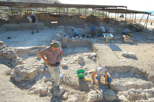
Ben Marwick, associate professor of anthropology at the University of Washington, and other team members excavate the lowest reaches of the dig site. Credit: Dominic O’Brien, Gundjeihmi Aboriginal Corporation

_____________________________________ 

australia2

Chris Clarkson of the University of Queensland talks with Djurrubu Aboriginal Rangers Vernon Hardy, Mitchum Nango, Jacob Baird and Claude Hardy at the excavation site in Australia’s Northern Territory. Credit: Dominic O’Brien, Gundjeihmi Aboriginal Corporation

_________________________________________ 
The UW researchers worked in the geoarchaeology lab on the Seattle campus, testing sediment samples that Marwick helped excavate at Madjedbebe. One graduate student and six undergraduate students studied the properties of hundreds of dirt samples to try to picture the time in which the ancient Australian humans lived.

Using a scanning electron microscope, the students examined the composition of the sediment layers, the size of the grains of dirt and any microscopic plant matter. For another test, the students baked soil samples at various temperatures, then measured the mass of each sample, said UW doctoral student Gayoung Park, another author on the paper. Because organic matter turns into gases at high heat, a loss of mass indicated how much matter was in a given sample. This helped create a picture of the environments across the sedimentary layers of the site. The team found that when these human ancestors arrived, northern Australia was wetter and colder.

“Together, we were working on establishing questions: What kind of environments did these people live in? What was the climate like? Were there any disturbances to the site, and were artifacts mixed up from different ages?” Marwick said. “I’m proud of being able to involve UW students in this research in a really substantial way.”

One of the authors, Mara Page, was a senior double-majoring in archaeology and Earth and space sciences when she joined the project. She analyzed stable carbon isotopes found in sediment, which can reveal the types of plants present in the past and the kinds of environments they lived in. She determined that the vegetation at Madjedbebe remained stable during the time of human occupation, which suggests that there was no major environmental change that might have prompted humans to leave the area.

“I feel that I contributed something important by being able to rule something out of the story we were telling,” Page explained.

By placing the date of Australian settlement at around 65,000 years ago, researchers confirm some of the shifting theories about when the first humans left Africa. A common view is that humans moved into Asia 80,000 years ago, and if they migrated to Australia some 15,000 years later, it means those ancestors co-existed with another early human in Asia, Homo florensiensis. It also means that these early Australians preceded early Europeans, who are believed to have entered that continent 45,000 years ago. A related question is whether these early human species left Africa at one time, gradually spreading the population through Asia, Europe and Australia, or whether there were multiple waves of migration.

In recent years, new evidence, obtained through DNA testing of a 90-year-old hair sample of an Aboriginal Australian man, suggests Australia was settled as far back as 70,000 years ago.

Marwick believes the Madjedbebe results, because they rely on so many artifacts and intensive analysis of sediment samples, confirm that early humans occupied Australia at least 65,000 years ago and support the theory that Homo sapiens, the species of modern-day humans, evolved in Africa before dispersing to other continents. The findings also suggest Homo sapiens’ predecessors, Neanderthals and Denisovans, overlapped with humans for a long period of time, and suggest a larger role for Australia, and the Eastern Hemisphere in general, in the story of humankind.

Marwick, who advocates for open science, particularly in data collection and the code used to analyze it, noted that the Nature paper is also pushing new frontiers because it combines three strands of reproducibility. Researchers examined a field site that has been excavated in the past; they’ve made available their raw data and code; and they consulted an outside lab for third-party OSL verification.

Article Source: University of Washington news release

_____________________________________________
The research was funded primarily by the Australian Research Council, as well as the Australian Institute of Nuclear Science and the Australian Government’s National Collaborative Research Infrastructure Strategy. Marwick and his students were also supported by the German Academic Exchange Service, the UW-UQ Trans-Pacific Fellowship program, and the UW Royalty Research Fellowship.

_____________________________________________
Receive 30 days free access to the popular new CuriosityStream lineup of documentaries on science, history, nature, and technology as a new Popular Archaeology premium subscriber.

___________________________________________ 

Travel and learn with Far Horizons.

farhorizons1

____________________________________________
winter2016ebookcover

 This richly illustrated issue includes the following stories: Recent findings shedding new light on the whereabouts of the remains of Philip of Macedon, father of Alexander the Great; how an archaeologist-sculptor is bringing bones of the dead back to life; archaeologists uncovering town life at the dawn of civilization; an exclusive interview with internationally acclaimed archaeologist James M. Adovasio about what makes the Meadowcroft Rockshelter prominent in the ongoing search for the first Americans; what archaeologists are finding at the site of the ancient city of Gath, the home town of the biblical Philistine giant, Goliath; and how scientists are redrawing the picture of human evolution in Europe.  Find it on Amazon.com.


Easter Island not victim of ‘ecocide’, analysis of remains shows

BINGHAMTON UNIVERSITY—Analysis of remains found on Rapa Nui, Chile (Easter Island) provides evidence contrary to the widely-held belief that the ancient civilization recklessly destroyed its environment, according to new research co-conducted by faculty at Binghamton University, State University of New York.

“The traditional story is that over time the people of Rapa Nui used up their resources and started to run out of food,” said Binghamton University Professor of Anthropology Carl Lipo. “One of the resources that they supposedly used up was trees that were growing on the island. Those trees provided canoes and, as a result of the lack of canoes, they could no longer fish. So they started to rely more and more on land food. As they relied on land food, productivity went down because of soil erosion, which led to crop failures…Painting the picture of this sort of catastrophe. That’s the traditional narrative.”

Lipo and a team of researchers analyzed human, faunal and botanical remains from the archaeological sites Anakena and Ahu Tepeu on Rapa Nui, dating from c. 1400 AD to the historic period, and modern reference material. The team used bulk carbon and nitrogen isotope analyses and amino acid compound specific isotope analyses of collagen isolated from prehistoric human and faunal bone, to assess the use of marine versus terrestrial resources and to investigate the underlying baseline values. Similar isotope analyses of archaeological and modern botanical and marine samples were used to characterize the local environment. Results of carbon and nitrogen analyses independently show that around half the protein in diets from the humans measured came from marine sources; markedly higher than previous estimates. These findings point to concerted efforts to manipulate agricultural soils, and suggest the prehistoric Rapa Nui population had extensive knowledge of how to overcome poor soil fertility, improve environmental conditions, and create a sustainable food supply. These activities demonstrate considerable adaptation and resilience to environmental challenges—a finding that is inconsistent with an ‘ecocide’ narrative.

“We found that there’s a fairly significant marine diet, over time, throughout history and that people were eating marine resources, and it wasn’t as though they only had food from terrestrial resources,” said Lipo. “We also learned that what they did get from terrestrial resources came from very modified soils, that they were enriching the soils in order to grow the crops. That supports the argument we’ve made in our previous work, that these people came up with am ingenious strategy in enriching the soils by adding bedrock to the surface and inside the soil to create, essentially, fertilizer to support their populations, and that forest loss really isn’t a catastrophe as previously described.”

________________________________

easterisland1

Lipo and a team of researchers analyzed human, faunal and botanical remains from the archaeological sites Anakena and Ahu Tepeu on Rapa Nui, dating from c. 1400 AD to the historic period, and modern reference material. Credit: Jonathan Cohen, Binghamton University Photographer

___________________________________________

easterislandalanbritom

Pictured to the right in this photo: One of the many monumental statues, called moai, created and erected by the early Rapa Nui people. Alan Britom, Wikimedia Commons

___________________________________________ 

Lipo said that these new findings continue to support the idea that the story of Easter Island is more interesting and complex than assumed.

“The Rapa Nui people were, not surprisingly, smart about how they used their resources,” he said. “And all the misunderstanding comes from our preconceptions about what subsistence should look like, basically European farmers thinking, ‘Well, what should a farm look like?’ And it didn’t look like what they thought, so they assumed something bad had happened, when in fact it was a perfectly smart thing to do. It continues to support the new narrative that we’ve been finding for the past ten years.”

Article Source: Binghamton University news release

__________________________________________

The paper, “Diet of the prehistoric population of Rapa Nui (Easter Island, Chile) shows environmental adaptation and resilience,” was published in “American Journal of Physical Anthropology.”

__________________________________________

Receive 30 days free access to the popular new CuriosityStream lineup of documentaries on science, history, nature, and technology as a new Popular Archaeology premium subscriber.

___________________________________________ 

Travel and learn with Far Horizons.

farhorizons1

____________________________________________

winter2016ebookcover

 This richly illustrated issue includes the following stories: Recent findings shedding new light on the whereabouts of the remains of Philip of Macedon, father of Alexander the Great; how an archaeologist-sculptor is bringing bones of the dead back to life; archaeologists uncovering town life at the dawn of civilization; an exclusive interview with internationally acclaimed archaeologist James M. Adovasio about what makes the Meadowcroft Rockshelter prominent in the ongoing search for the first Americans; what archaeologists are finding at the site of the ancient city of Gath, the home town of the biblical Philistine giant, Goliath; and how scientists are redrawing the picture of human evolution in Europe.  Find it on Amazon.com.


Live-in grandparents helped human ancestors get a safer night’s sleep

DUKE UNIVERSITY—DURHAM, N.C.—A sound night’s sleep grows more elusive as people get older. But what some call insomnia may actually be an age-old survival mechanism, researchers report.

A study* of modern hunter-gatherers in Tanzania finds that, for people who live in groups, differences in sleep patterns commonly associated with age help ensure that at least one person is awake at all times.

The research suggests that mismatched sleep schedules and restless nights may be an evolutionary leftover from a time many, many years ago, when a lion lurking in the shadows might try to eat you at 2 a.m.

“The idea that there’s a benefit to living with grandparents has been around for a while, but this study extends that idea to vigilance during nighttime sleep,” said study co-author David Samson, who was a postdoctoral fellow at Duke University at the time of the study.

The Hadza people of northern Tanzania live by hunting and gathering their food, following the rhythms of day and night just as humans did for hundreds of thousands of years before people started growing crops and herding livestock.

The Hadza live and sleep in groups of 20 to 30 people. During the day, men and women go their separate ways to forage for tubers, berries, honey and meat in the savanna woodlands near Tanzania’s Lake Eyasi and surrounding areas. Then each night they reunite in the same place, where young and old alike sleep outside next to their hearth, or together in huts made of woven grass and branches.

“They are as modern as you and me. But they do tell an important part of the human evolutionary story because they live a lifestyle that is the most similar to our hunting and gathering past,” said co-author Alyssa Crittenden, associate professor of anthropology at the University of Nevada, Las Vegas.

“They sleep on the ground, and have no synthetic lighting or controlled climate—traits that characterized the ancestral sleeping environment for early humans,” Crittenden said.

As part of the study, 33 healthy men and women aged 20 to 60 agreed to wear a small watch-like device on their wrists for 20 days, that recorded their nighttime movements from one minute to the next.

Hadza sleep patterns were rarely in sync, the researchers found. On average, the participants went to bed shortly after 10 p.m. and woke up around 7 a.m. But some tended to retire as early as 8:00 p.m. and wake up by 6 a.m., while others stayed up past 11 p.m. and snoozed until after 8 a.m.

In between, they roused from slumber several times during the night, tossing and turning or getting up to smoke, tend to a crying baby, or relieve themselves before nodding off again.

As a result, moments when everyone was out cold at once were rare. Out of more than 220 total hours of observation, the researchers were surprised to find only 18 minutes when all adults were sound asleep simultaneously. On average, more than a third of the group was alert, or dozing very lightly, at any given time.

“And that’s just out of the healthy adults; it doesn’t include children, or people who were injured or sick,” said Samson, now an assistant professor of anthropology at the University of Toronto, Mississauga.

Yet the participants didn’t complain of sleep problems, Samson said.

The findings may help explain why Hadza generally don’t post sentinels to keep watch throughout the night—they don’t need to, the researchers say. Their natural variation in sleep patterns, coupled with light or restless sleep in older adults, is enough to ensure that at least one person is on guard at all times.

“If you’re in a lighter stage of sleep you’d be more attuned to any kind of threat in the environment,” said co-author Charlie Nunn, professor of evolutionary anthropology at Duke.

___________________________________

sleep

 A Hadza man sleeps on the ground on an impala skin in northern Tanzania. Photo by David Samson.

________________________________________________ 

Previous studies have found similar patterns in birds, mice and other animals, but this is the first time the phenomenon has been tested in humans, Samson said.

The researchers found that the misaligned sleep schedules were a byproduct of changing sleep patterns common with age.

Older participants in their 50s and 60s generally went to bed earlier, and woke up earlier than those in their 20s and 30s.

They call their theory the “poorly sleeping grandparent hypothesis.” The basic idea is that, for much of human history, living and sleeping in mixed-age groups of people with different sleep habits helped our ancestors keep a watchful eye and make it through the night.

“Any time you have a mixed-age group population, some go to bed early, some later,” Nunn said. “If you’re older you’re more of a morning lark. If you’re younger you’re more of a night owl.”

The researchers hope the findings will shift our understanding of age-related sleep disorders.

“A lot of older people go to doctors complaining that they wake up early and can’t get back to sleep,” Nunn said. “But maybe there’s nothing wrong with them. Maybe some of the medical issues we have today could be explained not as disorders, but as a relic of an evolutionary past in which they were beneficial,” said Nunn, who also directs Triangle Center for Evolutionary Medicine, or TriCEM.

Article Source: Duke University news release

_______________________________________________

The study is published July 12, 2017, in Proceedings of the Royal Society B. Other authors include Ibrahim Mabulla and Audax Mabulla of the University of Dar es Salaam.

This research was supported by a grant from National Geographic (9665-15).

*”Chronotype Variation Drives Nighttime Sentinel-Like Behaviour in Hunter-Gatherers,” David Samson, Alyssa Crittenden, Ibrahim Mabulla, Audax Mabulla and Charles Nunn. Proceedings of the Royal Society B, July 12, 2017. http://dx.doi.org/10.1098/rspb.2017.0967.

_______________________________________________

Receive 30 days free access to the popular new CuriosityStream lineup of documentaries on science, history, nature, and technology as a new Popular Archaeology premium subscriber.

___________________________________________ 

Travel and learn with Far Horizons.

farhorizons1

____________________________________________

winter2016ebookcover

 This richly illustrated issue includes the following stories: Recent findings shedding new light on the whereabouts of the remains of Philip of Macedon, father of Alexander the Great; how an archaeologist-sculptor is bringing bones of the dead back to life; archaeologists uncovering town life at the dawn of civilization; an exclusive interview with internationally acclaimed archaeologist James M. Adovasio about what makes the Meadowcroft Rockshelter prominent in the ongoing search for the first Americans; what archaeologists are finding at the site of the ancient city of Gath, the home town of the biblical Philistine giant, Goliath; and how scientists are redrawing the picture of human evolution in Europe.  Find it on Amazon.com.


Molar from Fourth Denisovan Extends “Meager” Fossil Record

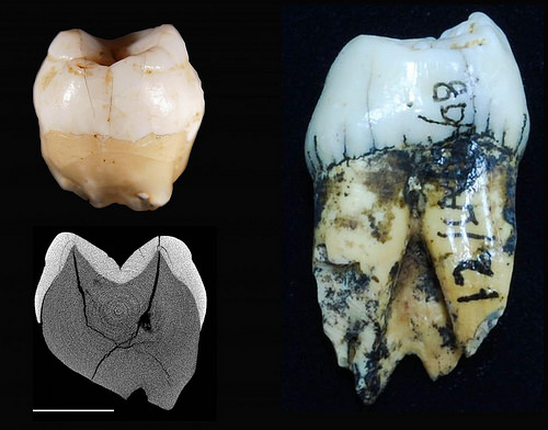
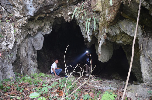
Scientists studying a newly discovered molar from the Denisova Cave in Siberia estimate the tooth is at least 20,000 years older than previously examined Denisovan fossils. The finding has important implications for understanding hominin evolution and adds to the “meager Denisovan fossil record,” of just three other Denisovan individuals, the authors say. What’s more, the molar provides evidence that Denisovans were present for a longer time in the region, allowing for more potential mingling between Neanderthals and Denisovans. The poor preservation of the molar was a challenge for Viviane Slon, Svante Pääbo, and colleagues as they analyzed the tooth. Nonetheless, they were able to extract DNA and compare the sequence to other Denisovan samples, as well as Neanderthal and human DNA. Results suggested that the female owner of the deciduous tooth, or “baby tooth,” lived at least 100,000 years ago. This age would make the tooth one of the oldest hominin remains discovered in Central Asia to date. The DNA found in the tooth is consistent with low levels of diversity among DNA from all the Denisovan samples recovered from the cave, the authors say, comparable to the lower range of genetic diversity in modern human populations. It’s possible, however, the samples from the cave represent an isolated population and that the genetic diversity of Denisovans across their geographical range was greater. Additional Denisovan fossils from other locations are needed to more comprehensively gauge their genetic diversity, the authors add.

___________________________________

denisovan1

Photographs of the Denisova 2 lower second molar in (A) occlusal, (B) mesial, (C) buccal, (D) lingual, (E) distal, and (F) apical views. Scientists estimate the molar found in the Denisova Cave in Siberia is older than previously studied Denisovan fossils. Credit: Slon et al. Sci. Adv. 2017; 3: e1700186 

______________________________________________

denisovan2

Photographs of the Denisova 2 lower second molar in (A) occlusal, (B) mesial, (C) buccal, (D) lingual, (E) distal, and (F) apical views. The scale for all panels is 2.5 millimeters. The area sampled for ancient DNA analyses is marked by a gray circle in panel C. Credit: Slon et al. Sci. Adv. 2017; 3: e1700186

_______________________________________________

Figure1_revised_withSima_scaledFossils

Phylogenetic tree relating the Denisova 2 mitochondrial DNA with other Denisovan mitochondrial DNA sequences. The mitochondrial DNA from Sima de los Huesos was used as an outgroup. The schematic representations of the specimens are drawn to scale, shown in the lower right corner. Credit: Slon et al. Sci. Adv. 2017; 3: e1700186

______________________________________________ 

Science Advances is published by AAAS, the nonprofit science society.

Article Source: News release of the AAAS

_______________________________________________

Receive 30 days free access to the popular new CuriosityStream lineup of documentaries on science, history, nature, and technology as a new Popular Archaeology premium subscriber.

___________________________________________ 

Travel and learn with Far Horizons.

farhorizons1

____________________________________________

winter2016ebookcover

 This richly illustrated issue includes the following stories: Recent findings shedding new light on the whereabouts of the remains of Philip of Macedon, father of Alexander the Great; how an archaeologist-sculptor is bringing bones of the dead back to life; archaeologists uncovering town life at the dawn of civilization; an exclusive interview with internationally acclaimed archaeologist James M. Adovasio about what makes the Meadowcroft Rockshelter prominent in the ongoing search for the first Americans; what archaeologists are finding at the site of the ancient city of Gath, the home town of the biblical Philistine giant, Goliath; and how scientists are redrawing the picture of human evolution in Europe.  Find it on Amazon.com.
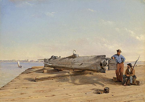


Archaeologists put sound back into a previously silent past

UNIVERSITY AT BUFFALO—BUFFALO, N.Y. – Many attempts to explain how past people experienced their wider world have focused on sight at the expense of sound, but researchers from the University at Albany and the University at Buffalo have developed a tool that puts sound back into the ancient landscape.

UAlbany’s Kristy Primeau and UB’s David Witt use GIS technology to advance a largely theoretical discussion into a modeled sensory experience to explore how people may have heard their surroundings throughout an entire archaeological landscape, or soundscape.

The results, published in the Journal of Archaeological Science: Reports, have more fully animated the ancient world and opened a discussion about how people at various locations, at sites ranging from sacred to political, experienced their soundscapes. The findings ultimately color what was formerly a sterile space into a living place – and sound ties itself to the identity of that place.

This attempt to infuse character into the material world and incorporate the relationship between people and their surroundings is part of what’s called phenomenology.

“From a phenomenological perspective, the difference between a space and a place is critical. People don’t live in a vacuum and we have to look at all aspects of the lived experience,” says Primeau, an archeologist and PhD candidate at UAlbany. “There is more to the experience of the landscape than just being present there.”

“The phenomenological approach tries to learn about the past by finding those things that resonate with the way we experience the landscape now,” says Primeau. When people share a common culture it contributes to a general conception of experience within the landscape that includes meaning, memory and identity. “Sound is one way in which we hope to understand a multifaceted experience of the people that lived in these ‘places.'”

Primeau and Witt are both employees of the New York State Department of Environmental Conservation (DEC). Sound, and its effect on people and animals, is among the factors the DEC considers as part of its permitting process.

Witt, who is a UB research associate in the Department of Anthropology, developed a spreadsheet for the DEC that calculates the impact of sound on the environment. The spreadsheet models the effect of distance and intervening features on sound. That data provides a two-dimensional, point-to-point analysis that the researchers expanded further into a program for GIS technology that models sound over the entire landscape, from one point to all surrounding locations.

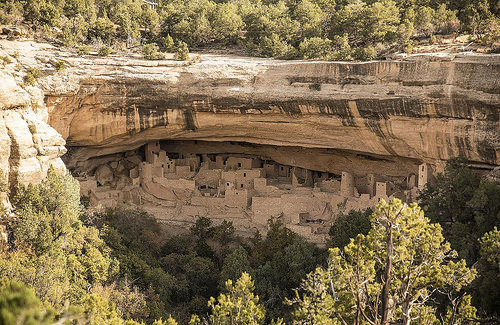
With this three-dimensional tool, Primeau and Witt explored Chaco Canyon, New Mexico, a major cultural center for ancestral Pueblo people, which reached its high point around A.D. 1040.

Chaco Canyon offered advantages and curiosities that made it an attractive location to study. The required data for the site was readily available, but it also illustrates the sight-centered focus of archaeological research.

“Southwestern archaeologists have been talking about whether or not buildings and other structures were placed in their locations so they could see people, or be seen by people,” says Witt. “It got me wondering if these sites were located where they were to hear, as well as see, other locations.”

They explored the possible relationships between the features of the built environment and the canyon’s performance space. Their work suggests that certain features could have been placed at their locations so culturally relevant sounds like a raised voice, which might serve as an alert, could be heard elsewhere.

But it’s the sound of musical instruments that might provide the most direct evidence of intentional design, specifically the conch shell trumpet.

“Individuals at [four different points] would have heard a conch shell trumpet blown on the platform found at Pueblo Bonito,” Primeau and Witt write in their paper. “We interpret this to illustrate that events at the mound were not just meant to be experienced in front of Pueblo Bonito, but throughout Downtown Chaco.”

____________________________________

chaco

Hungo Pavi, located in the central portion of Chaco Canyon. A staircase can be seen leading out of the complex. Wikimedia Commons

____________________________________ 

Witt and Primeau say they’re still working on the model and this research is a first step into an innovative area of research.

“There aren’t a lot of people who do this type of work,” says Primeau. “It brings a new component into landscape studies.”

Article Source: University at Buffalo news release

_________________________________________________

Receive 30 days free access to the popular new CuriosityStream lineup of documentaries on science, history, nature, and technology as a new Popular Archaeology premium subscriber.

___________________________________________ 

Travel and learn with Far Horizons.

farhorizons1

____________________________________________

winter2016ebookcover

 This richly illustrated issue includes the following stories: Recent findings shedding new light on the whereabouts of the remains of Philip of Macedon, father of Alexander the Great; how an archaeologist-sculptor is bringing bones of the dead back to life; archaeologists uncovering town life at the dawn of civilization; an exclusive interview with internationally acclaimed archaeologist James M. Adovasio about what makes the Meadowcroft Rockshelter prominent in the ongoing search for the first Americans; what archaeologists are finding at the site of the ancient city of Gath, the home town of the biblical Philistine giant, Goliath; and how scientists are redrawing the picture of human evolution in Europe.  Find it on Amazon.com.
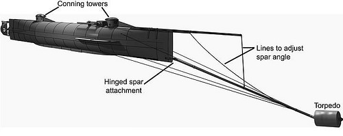


Breakthrough in dating Viking fortress

AARHUS UNIVERSITY—In 2014 archaeologists from the Museum of South East Denmark and Aarhus University discovered the previously unknown Viking fortess at Borgring south of Copenhagen. Since then the search has been on to uncover the life, function, destruction and, not least, the precise dating of the Viking fortress. Now a new find has produced a break-through in the investigation.

In the period 2016-18 a programme of new excavations is made possible by a grant from the A.P. Møller Foundation. The team from the Museum of South East Denmark and Aarhus University are joind by leading experts from the Environmental Archeology and Materials Research at the Danish National Museum and the National Police Department’s Section for arson investigation. Prior to this year’s excavations it was only known that the massive, 150m wide fortress dated to the tenth century. Experts suspected that it was built in the reing of Viking king Harold Bluetooth (c.958-c.987), but the association could not be proven.

On Monday 26 June, the archaeological team opened new trenches is the meadow next to the fortress to search for evidence of the landscape surrounding the fortress. Around 2.5 meters below the current surface of the valley was found a c. 1m long piece of carved oak wood with drilled holes and several wooden pegs in situ. The wood carries clear traces of wear, but it is not currently possible to say what function the wood piece has had.

Leading specialist in dendrochronological dating, Associate Professor Aoife Daly from the University of Copenhagen and the owner of dendro.dk, has just completed his study of the piece of wood and says: “The plank is oak and the conserved part of the tree trunk has grown in the years 829-950 In the Danish area. A comparison with the material from the Trelleborg fortress in Sjælland shows a high statistical correlation that confirms the dating. Since no splints have been preserved, it means that the tree has fallen at some point after year 966 “.

Research leader Jens Ulriksen says: “The wood piece was found on top of a peat layer, and is fully preserved as it is completely water-logged. We now have a date of wood in the valley of Borgring, which corresponds to the dating from the other ring fortresses from Harold Bluetooth’s reign. With the dendrochronological dating, in conjunction with the traces of wear the piece has, it is likely that the piece ended as waste in the late 900s, possibly in the early 1000’s. “

“In the coming week, the National Museum’s environmental archaeologists will take samples of wet depositions in the valley with the aim of uncovering how the layers have evolved from the earliest strata we have dated to the Bronze Age and over time.” Says excavation leader Nanna Holm. Nanna Holm, of course, hopes that the studies will particularly clarify one of the unclear questions archaeologists have, namely where the river was exactly when the fortress was built in the Viking Age, and how passable it was.

Søren M. Sindbæk, professor in Archaeology at Aarhus University and part of the excavation team says: “This find is the major break-through, which we have been searching for. We finally have the dating evidence at hand to prove that this is a late tenth century fortress. We lack the exact year, but since the find also shows us where the river flowed in the Viking Age, we also know where to look for more timbers from the fortress.”

__________________________________

viking

The carved oak timber object recently found in peat layers just outside the south gateway of the fortress. The piece has been cut and sampled for dendrochronological sampling (left). The function of the piece is unknown, but it may be a part of a door or building. Credit: The Museum of South East Denmark / Nanna Holm.

_____________________________________________ 

Article Source: Aarhus University news release

_____________________________________________

Receive 30 days free access to the popular new CuriosityStream lineup of documentaries on science, history, nature, and technology as a new Popular Archaeology premium subscriber.

___________________________________________ 

Travel and learn with Far Horizons.

farhorizons1

____________________________________________

winter2016ebookcover

 This richly illustrated issue includes the following stories: Recent findings shedding new light on the whereabouts of the remains of Philip of Macedon, father of Alexander the Great; how an archaeologist-sculptor is bringing bones of the dead back to life; archaeologists uncovering town life at the dawn of civilization; an exclusive interview with internationally acclaimed archaeologist James M. Adovasio about what makes the Meadowcroft Rockshelter prominent in the ongoing search for the first Americans; what archaeologists are finding at the site of the ancient city of Gath, the home town of the biblical Philistine giant, Goliath; and how scientists are redrawing the picture of human evolution in Europe.  Find it on Amazon.com.
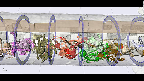


How Humans Transformed Wild Wheat into its Modern Counterpart

A sophisticated sequencing study reveals genetic changes that emerged in wheat as it became domesticated by agricultural societies in the Fertile Crescent, roughly 10,000 years ago. The findings provide scientists with a better understanding of traits in modern wheat – the variety used to make bread and pasta – and could inform efforts to improve the yield and quality of this key food source. The domestication of wild wheat caused a shift in traits, which mostly relate to seed dormancy, spike morphology, and grain development. For example, while the spikes of wild wheat shatter at maturity, all domesticated wheat spikes remain intact, which enables easier harvest. Here, Raz Avni and colleagues used 3-D genetic sequencing data and software to reconstruct the 14 chromosomes of wild tetraploid wheat, Triticum turgidum. The team then compared genes responsible for shattering in domesticated wheat to the corresponding genes in wild wheat, in order to understand genetic changes underlying the evolutionary transition to a non-shattering state. They identified two clusters of genes in domesticated wheat that have lost their function. When they engineered strains of wheat with one of these gene clusters restored, the wheat exhibited unique spikes where the upper part was brittle and the lower part was not brittle. These results suggest that the two gene clusters play a part in the transforming the brittle qualities of wild wheat.

______________________________________________

israelwheat

 Wild emmer wheat growing in Israel. Cedit: Zvi Peleg

______________________________________________ 

This research appears in the 7 July 2017 issue of Science.

Science is published by AAAS, the nonprofit science society.

Article Source: News release of the AAAS

______________________________________________

Receive 30 days free access to the popular new CuriosityStream lineup of documentaries on science, history, nature, and technology as a new Popular Archaeology premium subscriber.

___________________________________________ 

Travel and learn with Far Horizons.

farhorizons1

____________________________________________

winter2016ebookcover

 This richly illustrated issue includes the following stories: Recent findings shedding new light on the whereabouts of the remains of Philip of Macedon, father of Alexander the Great; how an archaeologist-sculptor is bringing bones of the dead back to life; archaeologists uncovering town life at the dawn of civilization; an exclusive interview with internationally acclaimed archaeologist James M. Adovasio about what makes the Meadowcroft Rockshelter prominent in the ongoing search for the first Americans; what archaeologists are finding at the site of the ancient city of Gath, the home town of the biblical Philistine giant, Goliath; and how scientists are redrawing the picture of human evolution in Europe.  Find it on Amazon.com.
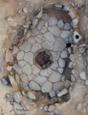


DNA of early Neanderthal gives timeline for new modern human-related dispersal from Africa

MAX PLANCK INSTITUTE FOR THE SCIENCE OF HUMAN HISTORY—Ancient mitochondrial DNA from the femur of an archaic European hominin is helping to resolve the complicated relationship between modern humans and Neanderthals. The genetic data recovered by the research team, led by scientists from the Max Planck Institute for the Science of Human History and the University of Tübingen, provides a timeline for a proposed hominin migration out of Africa that occurred after the ancestors of Neanderthals arrived in Europe by a lineage more closely related to modern humans. These hominins interbred with Neanderthals already present in Europe, leaving their mark on the Neanderthals’ mitochondrial DNA. The study, published today in Nature Communications, pushes back the possible date of this event to between 470,000 and 220,000 years ago.

Mitochondria are the energy-producing machinery of our cells. These mitochondria have their own DNA, which is separate from our nuclear DNA. Mitochondria are inherited from mother to child and can thus be used to trace maternal lineages and population split times. In fact, changes due to mutations in the mitochondrial DNA over time can be used to distinguish groups and also to estimate the amount of time that has passed since two individuals shared a common ancestor, as these mutations occur at predictable rates.

Complicated relationship between Neanderthals and modern humans

Prior research analyzing nuclear DNA from Neanderthals and modern humans estimated the split of the two groups at approximately 765,000 to 550,000 years ago. However, studies looking at mitochondrial DNA showed a much more recent split of around 400,000 years ago. Moreover, the mitochondrial DNA of Neanderthals is more similar to that of modern humans, and thus indicates a more recent common ancestor, than to that of their close nuclear relatives the Denisovans. There has been debate about the cause of these discrepancies, and it has been proposed that a hominin migration out of Africa might have occurred prior to the major dispersal of modern humans. This human group, more closely related to modern humans than to Neanderthals, could have introduced their mitochondrial DNA to the Neanderthal population in Europe through genetic admixture, as well as contributing a small amount of nuclear DNA to Neanderthals but not to Denisovans as recently detected. However, more data was needed to evaluate the feasibility of this scenario and to define the temporal limits of the proposed event.

The femur of a Neanderthal excavated from the Hohlenstein-Stadel Cave in southwestern Germany provided just such an opportunity. “The bone, which shows evidence of being gnawed on by a large carnivore, provided mitochondrial genetic data that showed it belongs to the Neanderthal branch,” explains Cosimo Posth of the Max Planck Institute for the Science of Human History, lead author of the study. Traditional radiocarbon dating did not work to assess the age of the femur, which was instead estimated using the mutation rate as approximately 124,000 years old. This makes this Neanderthal specimen, designated HST by the researchers, among the oldest to have its mitochondrial DNA analyzed to date. Interestingly, it represents a different mitochondrial lineage than the Neanderthals previously studied. The mitochondrial lineage of HST and of all other known Neanderthals separated from each other very deeply in time, at a minimum of 220,000 years ago. The differences between their mitochondrial DNA indicate that there was more mitochondrial genetic diversity in the Neanderthal population than was previously thought. This suggests that the Neanderthal population size once was much bigger than that estimated for the final stage of their existence.

______________________________________

dnadispersal

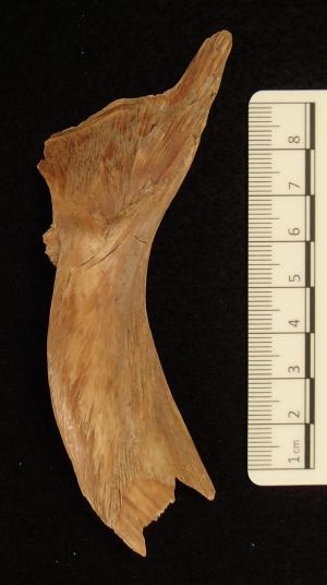
During excavations near the entrance of Hohlenstein-Stadel cave in southwestern Germany in 1937 a 124,000 year old Neanderthal femur was discovered. Now its mitochondrial DNA was analyzed and provides a timeline for a suggested migration of hominins out of Africa before 220,000 years ago. © Photo Museum Ulm

___________________________________________________

dnadispersal2

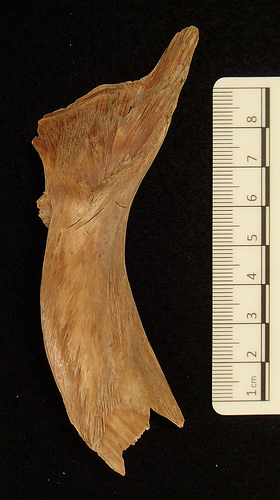
The bone, which shows evidence of being gnawed on by a large carnivore, provided mitochondrial genetic data that showed it belongs to the Neanderthal branch. It is among the oldest to have its mitochondrial DNA analyzed to date. Photo: Oleg Kuchar © Photo Museum Ulm

______________________________________________________ 

Timeline for additional migration of hominins out of Africa

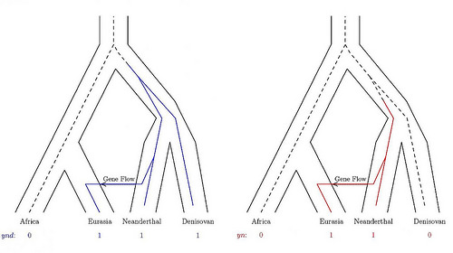
The proposed scenario is that after the divergence of Neanderthals and modern human mitochondrial DNA (dated to a maximum of 470,000 years ago), but before HST and the other Neanderthals diverged (dated to a minimum of 220,000 years ago), a group of hominins moved from Africa to Europe, introducing their mitochondrial DNA to the Neanderthal population. Thus this intermediate migration out of Africa would have occurred between 470,000 and 220,000 years ago. “Despite the large interval, these dates provide a temporal window for possible hominin connectivity and interaction across the two continents in the past,” says Posth.

This influx of hominins would have been small enough that it did not result in a large impact on the Neanderthals’ nuclear DNA. However, it would have been large enough to completely replace the existing mitochondrial lineage of Neanderthals, more similar to the Denisovans, with a type more similar to modern humans. “This scenario reconciles the discrepancy in the nuclear DNA and mitochondrial DNA phylogenies of archaic hominins and the inconsistency of the modern human-Neanderthal population split time estimated from nuclear DNA and mitochondrial DNA,” explains Johannes Krause, also of the Max Planck Institute for the Science of Human History, senior author of the study.

Nuclear data from the HST femur would be pivotal in assessing its genomic relationships with Neanderthals, Denisovans and modern humans, but it is extremely challenging to retrieve nuclear DNA from HST due to poor preservation and high levels of modern human contamination. In any case, however, high quality nuclear genome data from more than one individual would be necessary to fully investigate this proposed wave of human migration out of Africa, and is an intriguing area for future study.

______________________________________

dnadispersal3

This is a schematic representation of the evolutionary scenario for mitochondrial and nuclear DNA in archaic and modern humans. Neanderthal mitochondrial DNA recovered in this study suggests an intermediate migration out of Africa before 220,000 years ago. Photo: Annette Günzel, © Max Planck Institute for the Science of Human History

____________________________________________________ 

Article Source: Max Planck Insitute for the Science of Human History news release

____________________________________________________

Receive 30 days free access to the popular new CuriosityStream lineup of documentaries on science, history, nature, and technology as a new Popular Archaeology premium subscriber.

___________________________________________ 

Travel and learn with Far Horizons.

farhorizons1

____________________________________________

winter2016ebookcover

 This richly illustrated issue includes the following stories: Recent findings shedding new light on the whereabouts of the remains of Philip of Macedon, father of Alexander the Great; how an archaeologist-sculptor is bringing bones of the dead back to life; archaeologists uncovering town life at the dawn of civilization; an exclusive interview with internationally acclaimed archaeologist James M. Adovasio about what makes the Meadowcroft Rockshelter prominent in the ongoing search for the first Americans; what archaeologists are finding at the site of the ancient city of Gath, the home town of the biblical Philistine giant, Goliath; and how scientists are redrawing the picture of human evolution in Europe.  Find it on Amazon.com.


New studies of ancient concrete could teach us to do as the Romans did

DOE/LAWRENCE BERKELEY NATIONAL LABORATORY—A new look inside 2,000-year-old concrete – made from volcanic ash, lime (the product of baked limestone), and seawater – has provided new clues to the evolving chemistry and mineral cements that allow ancient harbor structures to withstand the test of time. The research has also inspired a hunt for the original recipe so that modern concrete manufacturers can do as the Romans did.

A team of researchers working at the Department of Energy’s Lawrence Berkeley National Laboratory (Berkeley Lab) used X-rays to study samples of Roman concrete – from an ancient pier and breakwater sites – at microscopic scales to learn more about the makeup of their mineral cements.

The team’s earlier work at Berkeley Lab’s Advanced Light Source (ALS), an X-ray research center known as a synchrotron, found that crystals of aluminous tobermorite, a layered mineral, played a key role in strengthening the concrete as they grew in relict lime particles. The new study, published today in American Mineralogist, is helping researchers to piece together how and where this mineral formed during the long history of the concrete structures.

The work ultimately could lead to a wider adoption of concrete manufacturing techniques with less environmental impact than modern Portland cement manufacturing processes, which require high-temperature kilns. These are a significant contributor to industrial carbon dioxide emissions, which add to the buildup of greenhouse gases in Earth’s atmosphere.

Also, researchers suggest that a reformulated recipe for Roman concrete could be tested for applications such as seawalls and other ocean-facing structures, and may be useful for safeguarding hazardous wastes.

“At the ALS we map the mineral cement microstructures,” said Marie Jackson, a geology and geophysics research professor at the University of Utah who led the study. “We can identify the various minerals and the intriguingly complex sequences of crystallization at the micron scale.”

Jackson said that lime (also known as calcium oxide, or CaO) – exposed to seawater in the Roman concrete mixture – probably thoroughly reacted with volcanic ash early in the history of the massive harbor structures. Previous studies showed how the aluminous tobermorite crystallized in the lime remnants during a period of elevated temperature.

The new findings suggest that after the lime was consumed via these pozzolanic chemical reactions (so named for the volcanic ash found in the Pozzuoli, or Naples, region of Italy), a new period of mineral growth began.

The new growth of aluminous tobermorite is often associated with crystals of phillipsite, another mineral. The minerals form fine fibers and plates that make the concrete more resilient and less susceptible to fracture over time. They may explain an ancient observation by the Roman scientist Pliny the Elder, who opined that the concrete, “as soon as it comes into contact with the waves of the sea and is submerged, becomes a single stone mass, impregnable to the waves and every day stronger.”

In fact, the Romans relied on the reaction of a volcanic rock mixture with seawater to produce the new mineral cements. In rare instances, underwater volcanoes, such as the Surtsey Volcano in Iceland, produce the same minerals found in Roman concrete.

“Contrary to the principles of modern cement-based concrete,” Jackson said, “The Romans created a rock-like concrete that thrives in open chemical exchange with seawater.”

The ancient Roman recipe is very different than the modern one for concrete, Jackson noted. Most modern concrete is a mix of Portland cement – limestone, sandstone, ash, chalk, iron, and clay, among other ingredients, heated to form a glassy material that is finely ground – mixed with so-called “aggregates.” These are materials such as sand or crushed stone that are not intended to chemically react. If reactions do occur in these aggregates, they can cause unwanted expansions in the concrete.

To understand the long-term chemical processes that occurred in the Roman structures, researchers used thin, polished slices of the concrete with an electron microscope in Germany to map the distribution of elements in the mineral microstructures.

They coupled these analyses with a technique at Berkeley Lab’s ALS known as X-ray microdiffraction, and a technique at UC Berkeley known as Raman spectroscopy, to learn more about the structure of crystals in the samples.

Nobumichi Tamura, an ALS staff scientist, said the X-ray beamline where the Roman concrete samples were studied can produce beams focused to about 1 micron, or 1 thousandth of an inch, “which is useful for identifying each mineral species and mapping their distribution.” The beam is almost a hundred times smaller than what can be found in a conventional laboratory. The X-ray technique measures an average signal from many tiny mineral grains, providing high resolution and fast data collection.

Jackson added, “We can go into the tiny natural laboratories in the concrete, map the minerals that are present, the succession of the crystals that occur, and their crystallographic properties. It’s been astounding what we’ve been able to find.”

She added, “This is a concrete that apparently grows aluminum-tobermorite mineral cements over millennia.” The study suggests that this process could be useful for modern seawall structures, she said, as well as for encasing high-level wastes in cement-like barriers that protect the surrounding environment.

Jackson is working with a geological engineer to rediscover the Romans’ complex recipe for concrete. She is mixing seawater from the San Francisco Bay and volcanic rock from the Western United States to find the right formula, and is also leading a scientific drilling project to study the production of tobermorite and other related minerals at the Surtsey volcano in Iceland.

_____________________________________

romanpier

Samples from this Ancient Roman pier, Portus Cosanus in Orbetello, Italy, were studied with X-rays at Berkeley Lab. Credit: J.P. Oleson

________________________________________________

romanpierconcrete

This image, from a scanning electron microscope, shows formations of aluminum tobermite crystals in a volcanic ash sample from the Campi Flegrei Volcano in Italy. X-ray experiments at Berkeley Lab’s Advanced Light Source have helped researchers to understand how these crystals develop over time to strengthen ancient Roman concrete structures. The scale bar at lower right represents 20 microns, or 20 millionths of a meter. Credit: University of Utah

__________________________________________________ 

Already, a growing number of concrete manufacturers are exploring the use of volcanic rock and less energy-intensive processes, Jackson said, which could be a win-win for industry and the environment.

The concrete industry is big in the United States, with sales valued at about $50 billion in 2015. The nation’s production of Portland cement – the most commonly produced cement type – amounted to about 80.4 million tons in 2015, according to the U.S. Geological Survey, or roughly the weight of about 90 Golden Gate Bridges or 12 Hoover Dams.

In order for Roman concrete recipes to gain more traction, Jackson said, test structures will be needed to evaluate the long-term properties of marine structures built with volcanic rock and measure how they stack up against the properties of steel-reinforced concrete, for example.

“I think people don’t really know how to think about a material that doesn’t have steel reinforcement,” she said.

Article Source: DOE/LAWRENCE BERKELEY NATIONAL LABORATORY news release

________________________________________________

Receive 30 days free access to the popular new CuriosityStream lineup of documentaries on science, history, nature, and technology as a new Popular Archaeology premium subscriber.

___________________________________________ 

Travel and learn with Far Horizons.

farhorizons1

____________________________________________

winter2016ebookcover

 This richly illustrated issue includes the following stories: Recent findings shedding new light on the whereabouts of the remains of Philip of Macedon, father of Alexander the Great; how an archaeologist-sculptor is bringing bones of the dead back to life; archaeologists uncovering town life at the dawn of civilization; an exclusive interview with internationally acclaimed archaeologist James M. Adovasio about what makes the Meadowcroft Rockshelter prominent in the ongoing search for the first Americans; what archaeologists are finding at the site of the ancient city of Gath, the home town of the biblical Philistine giant, Goliath; and how scientists are redrawing the picture of human evolution in Europe.  Find it on Amazon.com.


Researchers document early, permanent human settlement in Andes

UNIVERSITY OF WYOMING—Using five different scientific approaches, a team including University of Wyoming researchers has given considerable support to the idea that humans lived year-round in the Andean highlands of South America over 7,000 years ago.

Examining human remains and other archaeological evidence from a site at nearly 12,500 feet above sea level in Peru, the scientists show that intrepid hunter-gatherers — men, women and children — managed to survive at high elevation before the advent of agriculture, in spite of lack of oxygen, frigid temperatures and exposure to elements.

“This gives us a very strong baseline to help understand the rates of cultural and genetic change in the Andean highlands, a region known for the domestication of alpaca, potatoes and other plants; emergence of state-level political and economic complexity; and rapid human adaptation to high-elevation life,” says Randy Haas, a postdoctoral research associate in the University of Wyoming’s Department of Anthropology and the team’s leader.

The research appears in the July issue of Royal Society Open Science, a peer-reviewed, open-access scientific journal. Along with Haas, the second author is Ioana Stefenescu, graduate student in UW’s Department of Geology and Geophysics. Also contributing to the paper were Alexander Garcia-Putnam, doctoral student in the UW Department of Anthropology; Mark Clementz, associate professor in the Department of Geology and Geophysics; Melissa Murphy, associate professor in the Department of Anthropology; and researchers from the University of California-Davis, the University of California-Merced, the University of Arizona and Peruvian institutions.

Excavations led by Haas at the site in southern Peru produced the remains of 16 people, along with more than 80,000 artifacts, dating to as early as 8,000 years ago. Evidence from that site, as well as others, has led some researchers to estimate that hunter-gatherers began living in the Andes around 9,000 years ago, but debate has continued over whether that human presence was permanent or seasonal.

_____________________________________

andeanhighlands

 Intrepid hunter-gatherer families permanently occupied high-elevation environments of the Andes Mountains at least 7,000 years ago, according to new research led by University of Wyoming scientists. Credit: Lauren A. Hayes

______________________________________ 

The research team led by Haas took five different approaches to test whether there was early permanent use of the region: studying the human bones for oxygen and carbon isotopes; the travel distances from the site to low-elevation zones; the demographic mixture of the human remains; and the types of tools and other materials found with them.

The scientists found low oxygen and high carbon isotope values in the bones, revealing the distinct signature of permanent high-elevation occupation; that travel distances to low-elevation zones were too long for seasonal human migration; that the presence of women and small children meant such migration was highly unlikely; and that almost all of the tools used by the hunter-gatherers were made with high-elevation stone material, not brought from elsewhere.

“These results constitute the strongest evidence to date that people were living year-round in the Andean highlands at least 7,000 years ago,” Haas says. “Such high-elevation environments were among the last frontiers of human colonization, and this knowledge holds implications for understanding rates of genetic, physiological and cultural adaption in the human species.”

Article Source: University of Wyoming news release

_________________________________________________ 

Receive 30 days free access to the popular new CuriosityStream lineup of documentaries on science, history, nature, and technology as a new Popular Archaeology premium subscriber.

___________________________________________ 

Travel and learn with Far Horizons.

farhorizons1

____________________________________________

winter2016ebookcover

 This richly illustrated issue includes the following stories: Recent findings shedding new light on the whereabouts of the remains of Philip of Macedon, father of Alexander the Great; how an archaeologist-sculptor is bringing bones of the dead back to life; archaeologists uncovering town life at the dawn of civilization; an exclusive interview with internationally acclaimed archaeologist James M. Adovasio about what makes the Meadowcroft Rockshelter prominent in the ongoing search for the first Americans; what archaeologists are finding at the site of the ancient city of Gath, the home town of the biblical Philistine giant, Goliath; and how scientists are redrawing the picture of human evolution in Europe.  Find it on Amazon.com.


Genetic evidence from the South Caucasus region shows surprising long-term stability

CELL PRESS—The South Caucasus–home to the countries of Georgia, Armenia, and Azerbaijan–geographically links Europe and the Near East. The area has served for millennia as a major crossroads for human migration, with strong archaeological evidence for big cultural shifts over time. And yet, surprisingly, ancient mitochondrial DNA evidence reported in Current Biology on June 29 finds no evidence of any upheaval over the last 8,000 years.

Mitochondria are passed from mothers to their children. Therefore, the study* of mitochondrial genomes enables scientists to trace the unique history of females over time.

“We analyzed many ancient and modern mitochondrial genomes in parts of the South Caucasus and found genetic continuity for at least 8,000 years,” said Ashot Margaryan and Morten E. Allentoft from Centre for GeoGenetics at the Natural History Museum of Denmark. “In other words, we could not detect any changes to the female gene pool over this very long time frame. This is highly interesting because this region has experienced multiple cultural shifts over the same time period, but these changes do not appear to have had a genetic impact–at least not on the female population.”

The researchers were interested to study this part of the world because of its position as a cultural crossroads since ancient times. It’s also known as an important area for the potential origin and spread of Indo-European languages.

To shed light on the maternal genetic history of the region, the researchers analyzed the complete mitochondrial genomes of 52 ancient skeletons from present-day Armenia and Artsakh, an unrecognized republic bordering Armenia and Azerbaijan. Those specimens span 7,800 years of history. Allentoft’s team combined this new data with 206 mitochondrial genomes of modern Armenians and previously published data representing more than 480 individuals from seven neighboring populations.

Their analyses suggest that the population size in the region rapidly increased after the last glacial maximum, about 18,000 years ago. The researchers also used several sophisticated analyses to test five different demographic scenarios that could explain the formation of the modern Armenian gene pool. Despite well-documented cultural shifts in the South Caucasus across the time period in question, their results strongly favor genetic continuity in the maternal gene pool, the researchers report.

The findings imply that the female population in at least some parts of the South Caucasus has been highly stable through many cultural shifts that have occurred over thousands of years. They also suggest that documented migrations into this region during the last 2,000 to 3,000 years have had little genetic impact on the local female population.

Margaryan says the findings suggest either that cultural shifts occurred primarily through the exchange of ideas or that it was primarily men who moved into new territories, bringing new cultural ideas along with them.

The researchers say the next step is to explore these questions in whole-genome data to see if it tells the same story. They also hope to expand the study by including both modern and ancient samples from neighboring countries, which could involve collaborations with researchers in Georgia and Azerbaijan.

_________________________________________________

southcaucasus

This photograph shows human remains, excavated in Armenia, that were used for ancient DNA analyses. The remains are of a Middle Bronze Age (17th century BC) individual excavated in Karashamb, burial 462. Credit: Pavel Avetisyan

____________________________________________________ 

Article Source: Cell Press news release

_________________________________________________

*Current Biology, Margaryan and Derenko et al.: “Eight Millennia of Matrilineal Genetic Continuity in the South Caucasus” http://www.cell.com/current-biology/fulltext/S0960-9822(17)30695-4

_________________________________________________

Receive 30 days free access to the popular new CuriosityStream lineup of documentaries on science, history, nature, and technology as a new Popular Archaeology premium subscriber.

___________________________________________ 

Travel and learn with Far Horizons.

farhorizons1

____________________________________________

winter2016ebookcover

 This richly illustrated issue includes the following stories: Recent findings shedding new light on the whereabouts of the remains of Philip of Macedon, father of Alexander the Great; how an archaeologist-sculptor is bringing bones of the dead back to life; archaeologists uncovering town life at the dawn of civilization; an exclusive interview with internationally acclaimed archaeologist James M. Adovasio about what makes the Meadowcroft Rockshelter prominent in the ongoing search for the first Americans; what archaeologists are finding at the site of the ancient city of Gath, the home town of the biblical Philistine giant, Goliath; and how scientists are redrawing the picture of human evolution in Europe.  Find it on Amazon.com.


Analysis of Neanderthal teeth grooves uncovers evidence of prehistoric dentistry

UNIVERSITY OF KANSAS—LAWRENCE—Neanderthals treating toothaches?

A discovery of multiple toothpick grooves on teeth and signs of other manipulations by a Neanderthal of 130,000 years ago are evidence of a kind of prehistoric dentistry, according to a new study led by a University of Kansas researcher.

“As a package, this fits together as a dental problem that the Neanderthal was having and was trying to presumably treat itself, with the toothpick grooves, the breaks and also with the scratches on the premolar,” said David Frayer, professor emeritus of Anthropology. “It was an interesting connection or collection of phenomena that fit together in a way that we would expect a modern human to do. Everybody has had dental pain, and they know what it’s like to have a problem with an impacted tooth.”

The Bulletin of the International Association for Paleodontology recently published the study. The researchers analyzed four isolated but associated mandibular teeth on the left side of the Neanderthal’s mouth. Frayer’s co-authors are Joseph Gatti, a Lawrence dentist, Janet Monge, of the University of Pennsylvania; and, Davorka Radovčić, curator at the Croatian Natural History Museum.

The teeth were found at Krapina site in Croatia, and Frayer and Radovčić have made several discoveries about Neanderthal life there, including a widely recognized 2015 study published in PLOS ONE about a set of eagle talons that included cut marks and were fashioned into a piece of jewelry.

The teeth and all the Krapina Neanderthal fossils were discovered more than 100 years ago from the site, which was originally excavated between 1899-1905.

However, Frayer and Radovčić in recent years have reexamined many items collected from the site.

In this case, they analyzed the teeth with a light microscope to document occlusal wear, toothpick groove formation, dentin scratches, and ante mortem, lingual enamel fractures.

Even though the teeth were isolated, previous researchers were able to reconstruct their order and location in the male or female Neanderthal’s mouth. Frayer said researchers have not recovered the mandible to look for evidence of periodontal disease, but the scratches and grooves on the teeth indicate they were likely causing irritation and discomfort for some time for this individual.

They found the premolar and M3 molar were pushed out of their normal positions. Associated with that, they found six toothpick grooves among those two teeth and the two molars further behind them.

“The scratches indicate this individual was pushing something into his or her mouth to get at that twisted premolar,” Frayer said.

The features of the premolar and third molar are associated with several kinds of dental manipulations, he said. Mostly because the chips of the teeth were on the tongue side of the teeth and at different angles, the researchers ruled out that something happened to the teeth after the Neanderthal died.

_____________________________________

toothpick

Three views of the four articulated teeth making up KDP 20; (a) occlusal view showing lingually placed mesial interproximal wear facet on P4 (arrow) and buccal wear on M3; (b) lingual view showing a mesially placed interproximal wear facet on P4 (arrow), chips from lingual faces of all teeth and rotated, partially impacted M3; (c) buccal view showing rotated buccal face of M3 (arrow) and hypercementosis on its root. Credit: David Frayer, University of Kansas

_________________________________________________

toothpick2

Toothpick grooves, irregular interproximal facets and other anomalies on the left P4; (a) mesial face with a small toothpick groove on the mesial-lingual edge. Above it is a very lingually positioned interproximal wear facet (arrow); (b) distal surface with a deep toothpick groove and an interproximal wear facet that has an abnormal lingual location (arrow); (c) chips from the occlusal/lingual margin; (d) probing striations on the mesial/buccal facet. Credit: David Frayer, University of Kansas

____________________________________________________ 

Past research in the fossil record has identified toothpick grooves going back almost 2 million years, Frayer said. They did not identify what the Neanderthal would have used to produce the toothpick grooves, but it possibly could have been a bone or stem of grass.

“It’s maybe not surprising that a Neanderthal did this, but as far as I know, there’s no specimen that combines all of this together into a pattern that would indicate he or she was trying to presumably self-treat this eruption problem,” he said.

The evidence from the toothpick marks and dental manipulations is also interesting in light of the discovery of the Krapina Neanderthals’ ability to fashion eagle talons fashioned into jewelry because people often think of Neanderthals as having “subhuman” abilities.

“It fits into a pattern of a Neanderthal being able to modify its personal environment by using tools,” Frayer said, “because the toothpick grooves, whether they are made by bones or grass stems or who knows what, the scratches and chips in the teeth, they show us that Neanderthals were doing something inside their mouths to treat the dental irritation. Or at least this one was.”

Article Source: University of Kansas news release

_________________________________________________

Receive 30 days free access to the popular new CuriosityStream lineup of documentaries on science, history, nature, and technology as a new Popular Archaeology premium subscriber.

___________________________________________ 

Travel and learn with Far Horizons.

farhorizons1

____________________________________________

winter2016ebookcover

 This richly illustrated issue includes the following stories: Recent findings shedding new light on the whereabouts of the remains of Philip of Macedon, father of Alexander the Great; how an archaeologist-sculptor is bringing bones of the dead back to life; archaeologists uncovering town life at the dawn of civilization; an exclusive interview with internationally acclaimed archaeologist James M. Adovasio about what makes the Meadowcroft Rockshelter prominent in the ongoing search for the first Americans; what archaeologists are finding at the site of the ancient city of Gath, the home town of the biblical Philistine giant, Goliath; and how scientists are redrawing the picture of human evolution in Europe.  Find it on Amazon.com.


In Turkey, Carved Skulls Provide the First Evidence of a Neolithic “Skull Cult”

Three carved skull fragments uncovered at a Neolithic dig site in Turkey feature modifications not seen before among human remains of the time, researchers say. Thus, these modified skull fragments could point to a new “skull cult” — or ritual group — from the Neolithic period. Throughout history, people have valued skulls for different reasons, from ancestor worship to the belief that human skulls transmit protective properties. This focus on the skull has led to the establishment of the term skull cult in anthropology, and various such cults — each with characteristic modifications to skull bones — have been catalogued. Recently, Julia Gresky and colleagues observed a previously unknown type of modification in three partial skulls uncovered at Göbekli Tepe. Each skull had intentional deep incisions along its sagittal axes and one of those skulls also displayed a drilled hole in the left parietal bone, as well as red ochre remnants, the authors say. By using different microscopic techniques to analyze the fragments, Gresky et al. verified that the carvings were executed using lithic tools, thus ruling out natural causes, like animal gnawing. In addition, they were able to discount scalping as a source of the marks, due to the depth of the carvings; however, other minor cut-marks on the skulls show signs of possible defleshing, they say. More likely, the skulls were carved to venerate ancestors not long after their death, say the authors, or, to put recently “dispatched” enemies on display. These findings, published in an article about the research in Science Advances*, present the very first evidence for treatment of the dead at Göbekli Tepe.

_____________________________________

gobekli2

 Göbekli Tepe “Southeast-Hollow.” Credit: German Archaeological Institute (DAI)

_______________________________________________________

gobekli3

 Details of artificial skull modifications. A, C, D: carvings, B: drilled perforation. Credit:Julia Gresky, DAI

_______________________________________________________

gobekli4

 Schematic drawings of Göbekli Tepe skulls. Gray, preserved elements; red, modifications.  Credit: Julia Gresky, Juliane Haelm, DAI.

_________________________________________________________

gobekli1

A pillar from Building D at Göbekli Tepe seen from the southeast. Credit: German Archaeological Institute (DAI) 

_____________________________________________ 

*Science Advances is published by AAAS, the nonprofit science society.

__________________________________________________

Receive 30 days free access to the popular new CuriosityStream lineup of documentaries on science, history, nature, and technology as a new Popular Archaeology premium subscriber.

___________________________________________ 

Travel and learn with Far Horizons.

farhorizons1

____________________________________________

winter2016ebookcover

 This richly illustrated issue includes the following stories: Recent findings shedding new light on the whereabouts of the remains of Philip of Macedon, father of Alexander the Great; how an archaeologist-sculptor is bringing bones of the dead back to life; archaeologists uncovering town life at the dawn of civilization; an exclusive interview with internationally acclaimed archaeologist James M. Adovasio about what makes the Meadowcroft Rockshelter prominent in the ongoing search for the first Americans; what archaeologists are finding at the site of the ancient city of Gath, the home town of the biblical Philistine giant, Goliath; and how scientists are redrawing the picture of human evolution in Europe.  Find it on Amazon.com.


Animals, not drought, shaped our ancestors’ environment

UNIVERSITY OF UTAH—The shores of Lake Turkana, in Kenya, are dry and inhospitable, with grasses as the dominant plant type. It hasn’t always been that way. Over the last four million years, the Omo-Turkana basin has seen a range of climates and ecosystems, and has also seen significant steps in human evolution. Scientists previously thought that long-term drying of the climate contributed to the growth of grasslands in the area and the rise of large herbivores, which in turn may have shaped how humans developed. It’s tough to prove that hypothesis, however, because of the difficulty of reconstructing four million years of climate data.

Researchers from the University of Utah have found a better way. By analyzing isotopes of oxygen preserved in herbivore teeth and tusks, they can quantify the aridity of the region and compare it to indicators of plant type and herbivore diet. The results, published in a study issued through the Proceedings of the National Academy of Sciences (PNAS) show that, unexpectedly, no long-term drying trend was associated with the expansion of grasses and grazing herbivores. Instead, variability in climate events, such as rainfall timing, and interactions between plants and animals may have had more influence on our ancestors’ environment. This shows that the expansion of grasslands isn’t solely due to drought, but more complex climate factors are at work, both for modern Africans now and ancient Africans in the Pleistocene.

______________________________________

laketurkana

 A view of the Lake Turkana environment as it exists today. AdamPG, Wikimedia Commons

___________________________________________________ 

Article Source: University of Utah news release

______________________________________

Receive 30 days free access to the popular new CuriosityStream lineup of documentaries on science, history, nature, and technology as a new Popular Archaeology premium subscriber.

___________________________________________ 

Travel and learn with Far Horizons.

farhorizons1

____________________________________________

winter2016ebookcover

 This richly illustrated issue includes the following stories: Recent findings shedding new light on the whereabouts of the remains of Philip of Macedon, father of Alexander the Great; how an archaeologist-sculptor is bringing bones of the dead back to life; archaeologists uncovering town life at the dawn of civilization; an exclusive interview with internationally acclaimed archaeologist James M. Adovasio about what makes the Meadowcroft Rockshelter prominent in the ongoing search for the first Americans; what archaeologists are finding at the site of the ancient city of Gath, the home town of the biblical Philistine giant, Goliath; and how scientists are redrawing the picture of human evolution in Europe.  Find it on Amazon.com.



A wooden toe: Swiss Egyptologists study 3,000-year-old prosthesis

UNIVERSITY OF BASEL—It is likely to be one of the oldest prosthetic devices in human history: Together with other experts, Egyptologists from the University of Basel have reexamined an artificial wooden big toe. The find is almost 3000 years old and was discovered in a female burial from the necropolis of Sheikh ´Abd el-Qurna close to Luxor. This area is currently being studied using state-of-the-art methods.

The international team investigated the one-of-a-kind prosthesis using modern microscopy, X-ray technology, and computer tomography. They were able to show that the wooden toe was refitted several times to the foot of its owner, a priest’s daughter. The researchers also newly classified the used materials and identified the method with which the highly developed prosthesis was produced and utilized. Experts from the Egyptian Museum in Cairo – where the prosthetic device was brought to after it had been found – and the Institute of Evolutionary Medicine at the University of Zurich were also involved in this study.

The artificial toe from the early first millennium BC testifies to the skills of an artisan who was very familiar with the human physiognomy. The technical know-how can be seen particularly well in the mobility of the prosthetic extension and the robust structure of the belt strap. The fact that the prosthesis was made in such a laborious and meticulous manner indicates that the owner valued a natural look, aesthetics and wearing comfort and that she was able to count on highly qualified specialists to provide this.

___________________________________

toe

Toe prosthesis of a female burial from the Theban tomb TT95, early first millennium BC. Egyptian Museum Cairo.  Credit: University of Basel, LHTT. Image: Matja Kačičnik

___________________________________________________ 

Life histories of a burial ground

The prosthesis from the Early Iron Age was found in a plundered shaft tomb that was cut into the bedrock of an older, long time idle burial chapel at the graveyard hill of Sheikh ´Abd el-Qurna to the west of Luxor. This chapel belongs to a group of monumental rock-cut tombs from the late 15th century BC which were built for a small upper class that was close to the royal family. Since the end of 2015, the University of Basel has been studying this ancient Egyptian elite cemetery, its long history of usage, and surroundings.

For this project, funded by the Swiss National Science Foundation, microanalytic, scientifically oriented methods, as well as precision technology for surveying and photography were used. The researchers are looking into the materiality of archaeological remains and are thus gaining insight into the life histories of building structures and objects. These material biographies can provide information about the manufacturing practices, usages, personal skills, habits and preferences of people who were in contact with these objects.

______________________________________

toe2

 A view of the excavation area in the cemetery of Sheikh ´Abd el-Qurna. Credit: University of Basel, LHTT. Image: Matja Kačičnik

__________________________________________________ 

A necropolis in 3-D

The oldest known tombs from Sheikh ´Abd el-Qurna date back to the early second millennium BC. The cemetery saw its heyday in the 15th century BC. However, many of these rock-cut structures were reused and in parts remodeled several times for burials during the first millennium BC. Much later, they served as dwellings mostly for locals – a process that began with the early Christian hermits and only ended in the early 20th century.

Together with the experts for geodesy and geology from the ETH Zurich, the Basel team of archaeologists is scientifically assessing the natural and artificial structures of the excavation area and its surroundings. The specialists are currently developing geometric precise digital elevation, landscape, and architecture models for this area. These will then be combined to an archaeological and geological 3-D map that will illustrate the morphology of the terrain as well as the investigated subterranean structures. On that basis, the researchers want to reconstruct and simulate the development of the cemetery and its use phases.

Article Source: University of Basel news release

_________________________________________________

Receive 30 days free access to the popular new CuriosityStream lineup of documentaries on science, history, nature, and technology as a new Popular Archaeology premium subscriber.

___________________________________________ 

Travel and learn with Far Horizons.

farhorizons1

____________________________________________

winter2016ebookcover

 This richly illustrated issue includes the following stories: Recent findings shedding new light on the whereabouts of the remains of Philip of Macedon, father of Alexander the Great; how an archaeologist-sculptor is bringing bones of the dead back to life; archaeologists uncovering town life at the dawn of civilization; an exclusive interview with internationally acclaimed archaeologist James M. Adovasio about what makes the Meadowcroft Rockshelter prominent in the ongoing search for the first Americans; what archaeologists are finding at the site of the ancient city of Gath, the home town of the biblical Philistine giant, Goliath; and how scientists are redrawing the picture of human evolution in Europe.  Find it on Amazon.com.
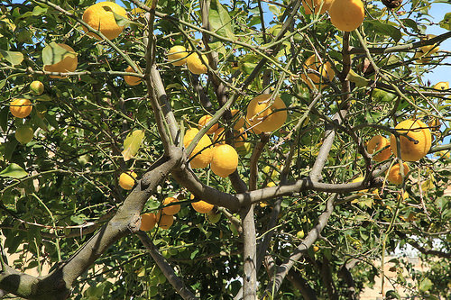


Ancient skulls shed light on migration in the Roman empire

NORTH CAROLINA STATE UNIVERSITY—Skeletal evidence shows that, hundreds of years after the Roman Republic conquered most of the Mediterranean world, coastal communities in what is now south and central Italy still bore distinct physical differences to one another – though the same could not be said of the area around Rome itself.

Using state-of-the-art forensic techniques, anthropologists from North Carolina State University and California State University, Sacramento examined skulls from three imperial Roman cemeteries: 27 skulls from Isola Sacra, on the coast of central Italy; 26 from Velia, on the coast of southern Italy; and 20 from Castel Malnome, on the outskirts of the city of Rome. The remains at the cemeteries in both Isola Sacra and Velia belonged to middle-class merchants and tradesmen, while those from Castel Malnome belonged to manual laborers. All of the remains date from between the first and third centuries A.D.

The researchers took measurements of 25 specific points on each skull using a “digitizer,” which is basically an electronic stylus that records the coordinates of each point. This data allowed them to perform shape analysis on the skulls, relying on “geometric morphometrics” — a field of study that characterizes and assesses biological forms.

“We found that there were significant cranial differences between the coastal communities, even though they had comparable populations in terms of class and employment,” says Ann Ross, a professor of anthropology at NC State and co-author of a paper on the work.

“We think this is likely due to the fact that the area around Velia had a large Greek population, rather than an indigenous one,” says Samantha Hens, a professor of biological anthropology at Sacramento State and lead author of the paper.

_____________________________________

romanskulls1

 A student uses a digitizer to record geometric morphometric sites on a skull. Credit: NC State University

____________________________________________________

romanskulls2

 A map showing the locations of the three imperial Roman cemeteries in relation to modern day Rome and Naples. Credit: Samantha Hens, California State University, Sacramento

____________________________________________________

In addition, the skulls from Castel Malnome had more in common with both coastal sites than the coastal sites had with each other.

“This likely highlights the heterogeneity of the population near Rome, and the influx of freed slaves and low-paid workers needed for manual labor in that area,” Hens says.

“Researchers have used many techniques — from linguistics to dental remains – to shed light on how various peoples moved through the Roman Republic and the Roman Empire,” Ross says. “But this is the first study we know of in which anyone has used geometric morphometrics to evaluate imperial Roman remains.

“That’s important because geometric morphometrics offers several advantages,” Ross says. “It includes all geometric information in three-dimensional space rather than statistical space, it provides more biological information, and it allows for pictorial visualization rather than just lists of measurements.”

“The patterns of similarities and differences that we see help us to reconstruct past population relationships,” Hens says. “Additionally, these methods allow us to identify where the shape change is occurring on the skull, for example, in the face, or braincase, which gives us a view into what these people actually looked like.”

Article Source: North Carolina State University news release

___________________________________________________

Receive 30 days free access to the popular new CuriosityStream lineup of documentaries on science, history, nature, and technology as a new Popular Archaeology premium subscriber.

___________________________________________

Travel and learn with Far Horizons.

farhorizons1

____________________________________________

winter2016ebookcover

This richly illustrated issue includes the following stories: Recent findings shedding new light on the whereabouts of the remains of Philip of Macedon, father of Alexander the Great; how an archaeologist-sculptor is bringing bones of the dead back to life; archaeologists uncovering town life at the dawn of civilization; an exclusive interview with internationally acclaimed archaeologist James M. Adovasio about what makes the Meadowcroft Rockshelter prominent in the ongoing search for the first Americans; what archaeologists are finding at the site of the ancient city of Gath, the home town of the biblical Philistine giant, Goliath; and how scientists are redrawing the picture of human evolution in Europe.  Find it on Amazon.com.
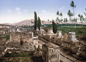


Ancient DNA reveals role of Near East and Egypt in cat domestication

KU LEUVEN—DNA found at archaeological sites reveals that the origins of our domestic cat are in the Near East and ancient Egypt. Cats were domesticated by the first farmers some 10,000 years ago. They later spread across Europe and other parts of the world via the trade hub of Egypt. The DNA analysis also revealed that most of these ancient cats had stripes: spotted cats were uncommon until the Middle Ages.

Five subspecies of the wildcat Felis silvestris are known today. All skeletons look exactly alike and are indistinguishable from that of our domestic cat. As a result, it’s impossible to see with the naked eye which of these subspecies was domesticated in a distant past. Paleogeneticist Claudio Ottoni and his colleagues from KU Leuven (University of Leuven) and the Royal Belgian Institute of Natural Sciences set out to look for the answer in the genetic code. They used the DNA from bones, teeth, skin, and hair of over 200 cats found at archaeological sites in the Near East, Africa, and Europe. These remains were between 100 and 9,000 years old.

The DNA analysis revealed that all domesticated cats descend from the African wildcat or Felis silvestris lybica, a wildcat subspecies found in North Africa and the Near East. Cats were domesticated some 10,000 years ago by the first farmers in the Near East. The first agricultural settlements probably attracted wildcats because they were rife with rodents. The farmers welcomed the wildcats as they kept the stocks of cereal grain free from vermin. Over time, man and animal grew closer, and selection based on behaviour eventually led to the domestication of the wildcat.

_________________________________

cats1

Several cats buried in a 6000-year-old pit in Hierakonpolis, Egypt. © Hierakonpolis Expedition

___________________________________

cats2

 A cat buried in a 6000-year-old context in Hierakonpolis, Egypt. © Hierakonpolis Expedition

__________________________________________

Migrating farmers took the domesticated cat with them. At a later stage, the cats also spread across Europe and elsewhere via the trade hub of Egypt. Used to fight vermin on Egyptian trade ships, the cats travelled to large parts of South West Asia, Africa, and Europe. Bones of cats with an Egyptian signature have even been found at Viking sites near the Baltic Sea.

“It’s still unclear, however, whether the Egyptian domestic cat descends from cats imported from the Near East or whether a separate, second domestication took place in Egypt,” says researcher Claudio Ottoni. “Further research will have to show.” The scientists were also able to determine the coat pattern based on the DNA of the old cat bones and mummies. They found that the striped cat was much more common in ancient times. This is also illustrated by Egyptian murals: they always depict striped cats. The blotched pattern did not become common until the Middle Ages.

Article Source: Ku Leuven news release

___________________________________________

The study was led by the Centre for Archaeological Sciences at KU Leuven (University of Leuven), Belgium, and by the Royal Belgian Institute of Natural Sciences, in collaboration with the genetics lab at the Institut Jacques Monod in Paris and dozens of specialists from around the world who provided cat bones retrieved from archaeological sites.

___________________________________________

Receive 30 days free access to the popular new CuriosityStream lineup of documentaries on science, history, nature, and technology as a new Popular Archaeology premium subscriber.

___________________________________________ 

Travel and learn with Far Horizons.

farhorizons1

____________________________________________

winter2016ebookcover

 This richly illustrated issue includes the following stories: Recent findings shedding new light on the whereabouts of the remains of Philip of Macedon, father of Alexander the Great; how an archaeologist-sculptor is bringing bones of the dead back to life; archaeologists uncovering town life at the dawn of civilization; an exclusive interview with internationally acclaimed archaeologist James M. Adovasio about what makes the Meadowcroft Rockshelter prominent in the ongoing search for the first Americans; what archaeologists are finding at the site of the ancient city of Gath, the home town of the biblical Philistine giant, Goliath; and how scientists are redrawing the picture of human evolution in Europe.  Find it on Amazon.com.
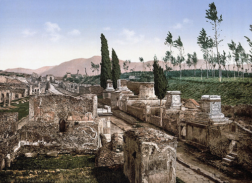


Multispectral imaging reveals ancient Hebrew inscription undetected for over 50 years

AMERICAN FRIENDS OF TEL AVIV UNIVERSITY—Using advanced imaging technology, Tel Aviv University researchers have discovered a hitherto invisible inscription on the back of a pottery shard that has been on display at The Israel Museum for more than 50 years.

The ostracon (ink-inscribed pottery shard) was first found in poor condition in 1965 at the desert fortress of Arad. It dates back to ca. 600 BCE, the eve of the kingdom of Judah’s destruction by Nebuchadnezzar. The inscription on its front side, opening with a blessing by Yahweh, discusses money transfers and has been studied by archaeologists and biblical scholars alike.

“While its front side has been thoroughly studied, its back was considered blank,” said Arie Shaus of TAU’s Department of Applied Mathematics, one of the principal investigators of the study published today in PLOS ONE. The study can be found at http://journals.plos.org/plosone/article?id=10.1371/journal.pone.0178400.

“Using multispectral imaging to acquire a set of images, Michael Cordonsky of TAU’s School of Physics noticed several marks on the ostracon’s reverse side. To our surprise, three new lines of text were revealed,” Shaus said.

The researchers were able to decipher 50 characters, comprising 17 words, on the back of the ostracon. “The content of the reverse side implies it is a continuation of the text on the front side,” said Shira Faigenbaum-Golovin of TAU’s Department of Applied Mathematics, another principal investigator of the study.

The multidisciplinary research was conducted by Faigenbaum-Golovin, Shaus, and Barak Sober, all doctoral students in TAU’s Department of Applied Mathematics, and by Dr. Anat Mendel-Geberovich of TAU’s Department of Archaeology. Additional collaborators include Prof. David Levin and Prof. Eli Turkel of TAU’s Department of Applied Mathematics, Prof. Benjamin Sass of TAU’s Department of Archaeology, as well as Michael Cordonsky and Prof. Murray Moinester of TAU’s School of Physics. The research team was co-led by Prof. Eli Piasetzky of TAU’s School of Physics and Prof. Israel Finkelstein of TAU’s Department of Archaeology.

“Using multispectral imaging, we were also able to significantly improve the reading of the front side, adding four ‘new’ lines,” said Sober.

_____________________________________

ostracon

 Above: The inscription found on reverse of ostraca at Arad. Credit: American Friends of Tel Aviv University (AFTAU)

_______________________________________ 

A request for more wine

“Tel Arad was a military outpost—a fortress at the southern border of the kingdom of Judah—and was populated by 20 to 30 soldiers,” said Dr. Mendel-Geberovich. “Most of the ostraca unearthed at Arad are dated to a short time span during the last stage of the fortress’s history, on the eve of the kingdom’s destruction in 586 BCE by Nebuchadnezzar. Many of these inscriptions are addressed to Elyashiv, the quartermaster of the fortress. They deal with the logistics of the outpost, such as the supply of flour, wine, and oil to subordinate units.”

“The new inscription begins with a request for wine, as well as a guarantee for assistance if the addressee has any requests of his own,” said Shaus. “It concludes with a request for the provision of a certain commodity to an unnamed person, and a note regarding a ‘bath,’ an ancient measurement of wine carried by a man named Ge’alyahu.”

“The newly revealed inscription features an administrative text, like most of the Arad inscriptions,” said Dr. Mendel-Geberovich. “Its importance lies in the fact that each new line, word, and even a single sign is a precious addition to what we know about the First Temple period.”

“On a larger scale, our discovery stresses the importance of multispectral imaging to the documentation of ostraca,” said Faigenbaum-Golovin. “It’s daunting to think how many inscriptions, invisible to the naked eye, have been disposed of during excavations.”

“This is ongoing research,” concluded Sober. “We have at our disposal several additional alterations and expansions of known First Temple-period ostraca. Hence, the future may hold additional surprises.”

Article Source: American Friends of Tel Aviv University news release

__________________________________________________

Receive 30 days free access to the popular new CuriosityStream lineup of documentaries on science, history, nature, and technology as a new Popular Archaeology premium subscriber.

___________________________________________

Travel and learn with Far Horizons.

farhorizons1

____________________________________________

winter2016ebookcover

This richly illustrated issue includes the following stories: Recent findings shedding new light on the whereabouts of the remains of Philip of Macedon, father of Alexander the Great; how an archaeologist-sculptor is bringing bones of the dead back to life; archaeologists uncovering town life at the dawn of civilization; an exclusive interview with internationally acclaimed archaeologist James M. Adovasio about what makes the Meadowcroft Rockshelter prominent in the ongoing search for the first Americans; what archaeologists are finding at the site of the ancient city of Gath, the home town of the biblical Philistine giant, Goliath; and how scientists are redrawing the picture of human evolution in Europe.  Find it on Amazon.com.
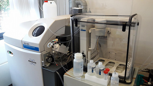


Ancient Jerusalem tower younger than thought

WEIZMANN INSTITUTE OF SCIENCE—Gihon Spring, just downhill from the ancient city of Jerusalem, was crucial to the survival of its inhabitants, and archaeologists had uncovered the remains of a massive stone tower built to guard this vital water supply. Based on pottery and other regional findings, the archaeologists had originally assigned it a date of 1,700 BCE. But new research conducted at the Weizmann Institute of Science provides conclusive evidence that the stones at the base of the tower were laid nearly 1,000 years later. Among other things, the new results highlight the contribution of advanced scientific dating methods to understanding the history of the region.

Dr. Elisabetta Boaretto, Head of the Weizmann Institute of Science’s D-REAMS Radiocarbon Dating Laboratory and track leader within the Max Planck-Weizmann Center for Integrative Archaeology and Anthropology, had the opportunity to date the tower as part of her ongoing cooperative research projects with the Israel Antiquity Authority (IAA). Since 2012, Dr. Joe Uziel and Nahshon Szanton of the IAA, in continuing the excavations around the tower, have discovered that the base of the tower was not built on bedrock. “The boulders in the tower’s base, in and of themselves,” explains Boaretto, “do not yield any information other than the fact that whoever placed them there had the ability to maneuver such heavy stones. But underneath the boulders, the soil exhibits the layers typical of archaeological strata, and these can reveal the latest date that the site was occupied before the tower was built.”

The unique and methodical approach of the D-REAMS lab team begins by planning and executing the field sampling and excavation from the beginning – together with the site archaeologists. “Getting one’s hands dirty is all part of building a reliable chronology,” says Boaretto. During field work conducted with the archaeologists and later in her laboratory with postdoctoral fellow Dr. Johanna Regev, Boaretto identified several clearly-delineated strata. From these, they carefully collected remains of charcoal, seeds and bones – organic matter that can be definitively dated through radiocarbon dating.

The first dating was conducted on mid-to-lower levels of sediment, and these dates indeed agreed with those originally proposed. “But there was another half-meter of sediment between the material we had dated and the large cornerstone,” says Boaretto. “At a glance, we thought this might represent another few hundred years before the stone was placed.” The presence of separate, sequential layers, which they identified using microarchaeological tools and radiocarbon dating, enabled the researchers to attach dates to the strata just below the tower.

The radiocarbon dating method is based on counting the radioactive 14C atoms in a sample. These carbon atoms are found in all living things in a small, but stable ratio to that of regular carbon, and they begin to decay at a known rate after death. At the Weizmann Institute of Science, the count of 14C atoms in a sample is performed with an accelerator, so it can return highly accurate results on something as small as a seed.

The date revealed by this radiocarbon dating was sometime around 800-900 BCE. That is nearly 1,000 years later than thought, and it moves the building of the tower to another historical period entirely, from the Middle Bronze Age to the Iron Age.

____________________________________

stonetower

Recently uncovered remains of a massive stone tower built to guard Gihon Spring—a vital water supply just downhill from the ancient city of Jerusalem. Cedit: Weizmann Institute of Science

_______________________________________________ 

To complete the study, Boaretto and her team asked whether any explanation could allow the tower to have been built earlier – repairs, for example – but the presence of the large boulders sitting above layers of earth containing the remains of everyday activities would appear to be fairly conclusive evidence that the later date is the correct one. Boaretto: “The conclusive, scientific dating of this massive tower, placing it in a later era than was presumed, will have repercussions for other attempts to date construction and occupation in ancient Jerusalem.”

Article Source: Weizmann Institute of Science news release

_______________________________________________ 

Dr. Elisabetta Boaretto’s research is supported by the Dangoor Accelerator Mass Spectrometer Laboratory.

The Weizmann Institute of Science in Rehovot, Israel, is one of the world’s top-ranking multidisciplinary research institutions. Noted for its wide-ranging exploration of the natural and exact sciences, the Institute is home to scientists, students, technicians and supporting staff. Institute research efforts include the search for new ways of fighting disease and hunger, examining leading questions in mathematics and computer science, probing the physics of matter and the universe, creating novel materials and developing new strategies for protecting the environment.

_______________________________________________ 

Receive 30 days free access to the popular new CuriosityStream lineup of documentaries on science, history, nature, and technology as a new Popular Archaeology premium subscriber.

___________________________________________ 

Travel and learn with Far Horizons.

farhorizons1

____________________________________________

winter2016ebookcover

 This richly illustrated issue includes the following stories: Recent findings shedding new light on the whereabouts of the remains of Philip of Macedon, father of Alexander the Great; how an archaeologist-sculptor is bringing bones of the dead back to life; archaeologists uncovering town life at the dawn of civilization; an exclusive interview with internationally acclaimed archaeologist James M. Adovasio about what makes the Meadowcroft Rockshelter prominent in the ongoing search for the first Americans; what archaeologists are finding at the site of the ancient city of Gath, the home town of the biblical Philistine giant, Goliath; and how scientists are redrawing the picture of human evolution in Europe.  Find it on Amazon.com.
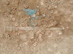


The Lost Cities of Ethiopia

Samuel C. Walker was born and raised in East Africa and subsequently spent fifteen years in the Middle East including Yemen, Israel/West Bank, Jordan, Sudan, and Egypt. He currently is working in Ethiopia. He holds two Bachelor’s degrees; Religious Studies – Anthropology, and Natural Sciences & History, and two Master’s degrees; History and education (Western Oregon U) and Archaeology & Heritage Mgmt. (University of Leicester). For seven years he lived in the Micronesian Pacific islands conducting research on climate change, ecologies, and conducting research as lead field supervisory archaeologist for US Navy projects for EIS and cultural resource management. Since 2013, Walker has worked in Ethiopia, including establishing a Master’s program in Archaeology for Heritage Management and serving as lead field and supervisory archaeologist. As part of his research dissertation, he is working on creating graduate level field-intensive Cultural Resource Management teams (CRMT) specifically to address the critical needs of archaeological site identification, comprehensive field survey, data recovery and excavation field management skills, laboratory analysis and cultural material conservation, and presentation and display of these rich tangible and intangible heritages.
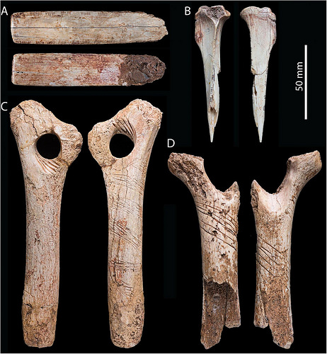
The Fra Mauro map (mid-15th century) provides a rare lens into the geographical worldview and mental landscapes of the medieval world. By connecting identifiable geography from this map to historical place names, we have begun to discover lost, medieval cities in Ethiopia. Scholars long considered Africa the least reliable portion of the Fra Mauro map. It is the contention of this article, however, that implementing a more Afro-Arabian geographical framework resolves apparent idiosyncrasies to the western mind, revealing a compelling story long hidden in plain view. Untangling the region of Abassia Ethyopia requires interpreting the physical features and polities transposed upon the map through the worldview of the informants from these respective regions: emissaries, pilgrims, merchants, etc. Our hypothesis asserts we can translate images of the medieval geography through the centuries to locate archaeological features. Using remote-sensing in conjunction with other early maps, we identified sites of long-lost cities such as Sadai and Tegulet, and via field-walking, have confirmed substantial architecture and period-specific cultural materials. Our continuing research traces patterns of land-use across landscapes, identifying phases of occupation and trade networks during Ethiopia’s poorly understood medieval periods. Having now created a template for interpreting this map, we expect to be able to read and understand other regions in Africa. Indeed, the Fra Mauro map has proven more than the fanciful rendering of a medieval mind. Rather, it is the “before” snapshot of a Mappa Mundi, that literally turned our view of the world upside down within a single generation, and eventually expanding it by four new continents.  

The Fra Mauro Map: An Icon of Medieval Mental Landscapes at a Pivotal Point in History

Maps serve as temporal, mental constructs of any given age. As graphic symbols for visualizing the world, each literally represents a product or icon of one’s respective worldview, in essence, the world made in our image. Medieval maps served very different functions than our current, science-based demands. Medieval navigators and, therefore cartographers, focused primarily upon safe passage, trade networks, and political alliances. Most maps contemporary with Fra Mauro depended wholly upon the Ptolemaic model, or were tied to a cosmography of Christ as Pantocrator reigning supremely from his heavenly throne (See Fig 2) (Falchetta, pp 57)

________________________________________

fraumaurofig1

 This Ptolemaic map is a later rendering showing the Indian Ocean as an inland lake. https://upload.wikimedia.org/wikipedia/commons/f/f0/Claudius_Ptolemy-_The_World.jpg

_________________________________________________

Fig 2 - Pantocrator

Fig. 2 – http://www.bl.uk/learning/timeline/item99816.html

______________________________________

In sharp contrast, the Fra Mauro map diverges from this mindset, using an empirical, verifiable framework, gleaned from existing accounts and charts. Most Christian or western maps from this period centered around Jerusalem with east at the top. Muslim maps traditionally were south-oriented given most medieval Muslims lived north of Mecca, the center or qiblah for pilgrimage and prayer. As a masterpiece of medieval cartography, the mid-15th century Fra Mauro map provides a rare lens into the geographical mindset and mental landscapes of one of the most critical transitions in Mediterranean history (Cattaneo, pp.123). Also southern-oriented, the genius of this Venetian monk in collecting maps and compiling written and oral primary accounts of travelers, merchants, pilgrims, and emissaries, creates a remarkably accurate planisphere representation of our world. Fra Mauro sketches his map not simply to expedite navigation or exploration, rather, to lay the foundations for a new world order.

______________________________________

Fig 3 - NASA

Fig. 3 – Note: this image is inverted from our typical perspective with south at the top. Europe and the Mediterranean, on the right, are more clearly defined –  https://landsat.gsfc.nasa.gov/fra-mauros-mappamundi/

_________________________________________ 

In the contentious contexts of the mid-15th century, this map lays out a “Who’s who” of the medieval world. Like an intricate, medieval Risk gameboard, the cartographer’s draftings of geographical features, regional and city names, and trade routes, across his mappa mundi, identifies possible alliances alongside real and potential threats. Anything Christian, even the thinnest web of connection, is emphasized. Every city stands fortified, bounded by copious notes on regions, rulers, rivers, and where gold, spices, pearls, and fresh water can be found. Unnamed walled villages (casali) bristle across landscapes. Mountains feature prominently throughout. Passes or rivers clearly bisect the landscapes, demarcating regions and polities. Ships, identifiable with the contemporary, dominate traders, ply their respective seas. 

_________________________________________

Fig 4 - FM Ships

 Fig. 4 – Detailed excerpt of Indian Ocean shipping and southern India from the Fra Mauro Map. Image courtesy Marco Vigano

______________________________________ 

Mental Landscapes of Medieval Africa  

With the sacking of Constantinople in 1453, the migration of Byzantine refugees to Europe swells to a flood. From this pinnacle of learning come architects, artists, engineers, cartographers, and scholars, carrying not only tools of their trade, but an alternate world view framed by principles of an empirical perspective. Like midwives, these intelligentsia from around the world, including the far-too-often, underrepresented regions of Africa, help birth a new scientism in Europe, of which Fra Mauro is a product.

Modern scholarship has long considered Africa the least reliable portion of the Fra Mauro map (Falchetta, pp.94). It is the contention of this article, however, that by exploring and implementing a more Afro-Arabian geographical perception, apparent idiosyncrasies to the modern mind resolve, revealing a compelling story long hidden in plain view. A re-assessment of the geographical and political representations on the African continent, especially the various Ethyopias and the “island” of Diab, demands we appreciate and honor the vantage-point and geographical knowledge of Fra Mauro’s respective African informants.

Fra Mauro’s Ethiopian, Arabian, and East African informants would undoubtedly exhibit an abundance of caution along with a fundamentally diverse worldview in transmitting geographical information. Medieval Ethyopia Abassia’s reticence in divulging too much information is rooted in a preservation mentality, seven centuries in the making. Surrounded by adversaries, the Christian kingdom of Abyssinia has long maintained its near-monastic solitude, safeguarding its identity as the authentic church. The myths and legends of the Kebra Negast, known in English as the Glory of the Kings, grow deeper, entrenched in the Ethiopian psyche. Claiming direct descendancy from Israel’s King Solomon via the Queen of Sheba, along with St. Phillip’s conversion of Queen Candace’s eunuch as the first Ethiopian Christian, Abyssinia visualizes itself as the new, chosen-people of God. Comparatively, what this younger, diaphysite, western church might proffer appears inconsequential.

During the early medieval period, it is the west that initially courts Africa. For three centuries, the legends of the famed Prester John have fermented in the medieval mind, intoxicating the courts of Europe with stories of wealth, military power, and a biblical, spiritual lineage second only to Christ. By the mid-14th century, the futile search for this monarch in Asia turns its focus to Africa, where, due to Ethiopia’s intermediary trading position, exporting trade goods from India to Europe, Ethiopian kings are often misidentified as kings of India (Van den Bosch, 2007, pp.22). Fra Mauro inscribes references to the legendary king, Prester John, across Abassia, even to mentioning his capital and the number of kingdoms under his Lordship.

In contrast, embassies from Abyssinia-Ethiopia visiting Venice in the 1430’s, and Florence in 1441, seek relics and icons over mere political or religious alliances (Falchetta, pp.98; Siebold, Monograph #249). One can easily imagine various diplomats and our monks plying these illustrious pilgrims with wine and questions regarding geography, political boundaries, trade networks, and allegiances. Over the following decade, further information is gleaned, eventually making its way onto a map that will literally turn the way we imagine our world upside down.

The political and geographical information on Abassia, or Abyssinia-Ethiopia, is disproportionately represented in relation to other parts of Africa for two primary reasons. First, given their respective Christian ties, Fra Mauro and his colleagues enjoy far more contact and therefore, primary accounts from informants of these regions than from southern, central, or western African communities. Second, informants upon the Swahili Coast, in the 13th – 14th centuries called the Daybuli, consisting of African trade cities established by Muslim-Arab conquerors from India (Davidson,1967, pp.99), appear reticent to divulge information of their particular region to a competing, foreign, non-Islamic power. Understanding these factors proved essential in reading and unlocking the secrets of what appears an arbitrary, even nonsensical southern African geography.  

Fra Muaro’s World Within a Gilded Frame 

Fra Mauro defends the reliability of his African primary sources as justification for expanding upon Ptolemy’s terra incognita. Inscription number *98 regarding these regions informs our scholarship, “Because to some it will appear as a novelty that I should speak of these southern parts, which were almost unknown to the Ancients, I will reply that this entire drawing, from Sayto (Assiut, Egypt) upwards, I have had from those who were born there. These people were clerics who, with their own hands, drew for me these provinces and cites and rivers and mountains with their names; all these things I have not been able to put in due order for lack of space” (Falchetta, pps. 210-203).

Fra Mauro’s paramount intent is reliability and authenticity to an expanding body of knowledge. Yet bound by the parameters of his parchment and wishing to be faithful to his latitudinal and longitudinal constraints, he states, “I do not think that I am being unfaithful to Ptolemy if I do not follow his Cosmography, because if I had wanted to observe his meridians, parallels, and degrees, I would have had to omit many provinces within the known part of the world that Ptolemy does not give: everywhere in his account, but especially to the north and south, he gives areas as terra incognita because in his day they were not known” (*2892 – Falchetta, pp. 711).

__________________________________________

Fig 5 - FM Mappa mundi

Fig. 5 – Note: This map is inverted from its original for ease of reading. The enclosure indicates direct governance according to Fra Mauro’s informants. Other inscriptions indicate tributary allegiances across the continent.  https://upload.wikimedia.org/wikipedia/commons/1/1b/FraMauroDetailedMap.jpg

_________________________________________ 

For reasons stated above, the further south the cartographer ventures, the less information is available. Fra Mauro defends himself against claims that he does not follow Ptolemy, by paraphrasing the ancient geographer, “one can only speak correctly of regions that are visited continually; of those which are less frequented no-one should think himself capable of speaking with equal accuracy.” Fra Mauro continues, “So I say that in my own day I have been careful to verify the text by practical experience, investigating for many years and frequenting persons worthy of faith, who have seen with their own eyes I faithfully report above” (ibid, pp. 701). Fra Mauro evidently feels justified to move beyond the constraints of existing scholastic mindsets. 

Our current research has likewise benefited from this vantage point, aided by an Afrocentric, indigenous frame of reference and many newly translated manuscripts from these regions and periods. We too have attempted to carefully “verify the text by practical experience” as we continue to investigate on the ground what we have seen with our own eyes. Our investigation has confirmed the surprising completeness and accuracy of Fra Mauro’s research.  In more southern regions, we accounted for cultural, economic, and political factors while recognizing a necessary shift in orientation, imposed by the limit of his parchment space. 

Approaching the upper, southern margins of his parchment with regions yet to be included, the cartographer is forced to sketch these further reaches of Africa via shifting everything east. Recognizing the inevitable inaccuracies in his degrees in longitude, he chooses rather to favor completeness. We will come back to the operative words “in due order for lack of space.” 

Translating Fra Mauro: a Cartographic Rosetta Stone

The nature of most medieval maps dictates we interpret each through a broader Ptolemaic or ecclesiastical metanarrative. In contrast, Fra Mauro’s golden frame encompasses the medieval world within the broader, regional, mental-constructs laid out above. Armed with this perspective, our team began reading our current Ethiopian landscapes through the flat iconography portrayed in the early renaissance style of Fra Mauro. Rivers and mountains of varying hues designate the major physical features enfolding respective medieval provinces and kingdoms. Five centuries on, this geography still broadly defines Ethiopia’s current regions and states, distinguished by factors of language, cultures, and religious expressions. Cities within these regions, illustrated as turreted towns, lay along trade routes.

_________________________________________

Fig 6 - FM Geo locations

Fig. 6 – Excerpt of Fra Mauro of Ethyopia Abbasia showing geographical and political features. 

 ____________________________________

Our initial task in untangling the provinces of Abassia Ethyopia, writ large across most of central and east Africa, required recognition of identifiable geographical features and polities transposed upon the map by reputable Afro-centric clerics, scholars, and representatives of these regions. Starting from Egypt’s first cataract at Sua (Aswan) near Nuba or Nubi, we traced mountain ridges and rivers up to the southern reaches of Abyssinian hegemony referred to as Ethyopia quasi deserta e montuosa. An arbitrary river with a line of forest on either side demarcates regions south of direct Ethiopic governance. Within Abyssinia-Ethiopia, discernable rivers, mountains, kingdoms (Regnos), or provinces and cities, include Aksum in Tigray (hacsum, tegre) and the four tributaries of the Tekeze river streaming from the mountain of Roha. The map clearly defines Lake Tana and Abay, Ethiopia’s name for the Blue Nile. Further south, the geographical features of the Awash river (fl. Ausai) with Mt. Zukwala and lake Zwai (xiauala ouer xiquala & lago zuua) circumscribe Prester John’s suzerainty of African Christendom under the oversight of the Metropolitan of the Alexandrian Coptic church.   

Having oriented ourselves, we then attempted to “translate” the Fra Mauro map, much as an epigrapher would an ancient inscription. Like a cartographic Rosetta Stone, moving from the known to the unknown, we collected images of subsequent medieval maps in an attempt to decipher the conceptual content and mental landscapes of represented physical geography through successive shifts in political, religious, or economic paradigms. Throughout, our noted geographical features remained constant. Topographies represented on medieval maps, such as lakes, rivers, and mountains, evolved into discernable landmarks and observable landscapes on modern maps. Slowly, like a developing embryo, we witnessed these morph from medieval icons into recognizable place names of regions, cities, or trade routes. 

Our final test sought to read our current landscapes back through the centuries and interpret the physical geography seen and described by mid-fifteenth century Ethiopian monks and emissaries to a Venetian monk who then transcribed them on a two-meter piece of parchment thousands of kilometers and a few cultures and languages removed. To crack the code of the Fra Mauro map in regard to our regions, to say nothing of south and central Africa, we had to try. 

_______________________________________

Fig 7 - Munster

Fig. 7 – Munster, 1554 – https://libweb5.princeton.edu/visual_materials/maps/websites/africa/maps-continent/1554munster.jpg

_______________________________________ 

Our first hurdle required we demythologize the majority of maps from the subsequent centuries which retained much of the fanciful Ptolemaic narratives and mythical topography of Africa’s interior, including cyclops, fabled beasts, the Mountains of the Moon, and of course, Prester John. Ironically, these maps were to provide invaluable clues in addressing one of the major debates related to the interpretation of the Fra Mauro map and Africa, that of the “island” of Diab

The second hurdle involved geopolitical ramifications wrought by decades of war in the middle of the 16th century. Regional conflicts left desolation to both sides. Many of the main population centers and trade routes depicted on the Fra Mauro map simply ceased to exist. Where once thriving, urban centers dominated, sparse villages dotted the landscapes. In the highlands, new population centers with new names replaced anything old. By the end of the 17th century, the memory of the raging conflicts between the Islamic forces of Imam Ahmad, known as Ahmad Gran or the left-handed, and the variably named Christian kingdom of Shoa, Xoa, or Sewa, had cooled to an uneasy, smoldering detente. Yet these wars had prompted mass migrations of populations followed by the influx of new cultures and languages (Newman, pp. 99). A shifting of place-memory displaced most previously associated oral traditions. Alternate land use and new agricultural practices swallowed up previous occupational contexts. Most associated religious structures, along with their treasures of relics and manuscripts, also perished, usually via fire. The loss of contexts with which to even begin to identify lost cities was exacerbated by a paucity of scholarship related to these eras. Undaunted, we pressed on.

_________________________________________

Fig 8 - Coronelli

Fig. 8 – Coronelli, 1690 – https://upload.wikimedia.org/wikipedia/commons/3/3f/1690_Coronelli_Map_of_Ethiopia%2C_Abyssinia%2C_and_the_Source_of_the_Blue_Nile_-_Geographicus_-_Abissinia-coronelli-1690.jpg

__________________________________________ 

The earliest map that proved critical in framing the rugged landscapes of Abyssinia’s identifiable mountain ranges, passes, and rivers, along with cities in associated regions, was the 1690 Coronelli map, also from Venice. This primary source provided a post-medieval perspective on our tangible topography. The mountains that had defined medieval political states continued to limit expansion. Like words borrowed from an archaic vocabulary, Coronelli’s mountains helped us translate a matching political narrative, back to Fra Mauro’s century-and-half-old geography, and its original African mindset. Corresponding geographical features provided our first key to unlocking locations of long-lost cities on the Fra Mauro map. 

__________________________________________

Fig 9 - Cary

Fig. 9 – Cary Arabia and Abyssinia map, 1811 – http://www.raremaps.com/gallery/enlarge/33908

____________________________________________ 

The 1811 Cary map provided us our next series of clues. With each century, the earlier artistic mythologies gave way to a more realistic physical geography. Regions and political entities remained bounded by the strictures of observable landscapes. Connecting rivers or mountains on an 1811 map to rivers and mountains etched on a 1690’s map, we translated back to the 1450’s map. Thus, we were able to “read” the conceptualized landscapes through time and, more importantly, through a medieval mind’s eye. 

____________________________________________

Fig 10 - Pinkerton

Fig. 10 – Section of Pinkerton, 1818 – https://commons.wikimedia.org/wiki/File:1818_Pinkerton_Map_of_Nubia,_Sudan_and_Abyssinia_-_Geographicus_-_Abyssinia-pinkerton-1818.jpg

____________________________________________ 

Pinkerton’s 1818 Abyssinia & Nubia map traces the upper Nile. The odd and inaccurate orientation of the mountains of Shoa, however, caught my eye. The cartographer appeared to have regressed to an earlier time where mountains could arbitrarily be drawn upon a map for aesthetic purposes rather than indicators of true landforms. This led me to reassess Pinkerton’s abstractions of depicted mountains surrounding Ifat, Fatagar and southern Abassia, and subsequently to reconsider and weigh analogous geographical or conceptual biases all the way back to the Fra Mauro map. 

Since Pinkerton’s focus is hydrology, his mountains appear drawn as merely presumed necessary elements to funnel water from the highlands to the Nile. Fra Mauro’s emphasis, on the other hand, frames the boundaries of regional hegemonies and trade networks of an ancient and wealthy kingdom determining potential alliances, trade, and partnerships for the future. Whereas Pinkerton’s mountains seem practically superfluous, Fra Mauro’s mountains represent physical barriers to commerce or conquest, and inviolable boundaries between friend and foe.

____________________________________________

Fig 10 - Pinkerton

Fig. 11 -Kautx, 1868 – https://www.bigstockphoto.com/image-26737070/stock-photo-old-map-of-abyssinia-with-red-sea-region-map-insert-created-by-kautx-and-gillot,-published-on-l-illustration,-journal-universel,-paris,-1868

___________________________________________ 

The final piece to our puzzle came with the 1868 Kautx map showing substantial elements of geography recognizable to a modern map reader. Many of the details on this map are sourced in an episodeall but forgotten episode in the west: the British Napier Expedition against the Emperor Tewodros in 1868 (Sharf). For Ethiopians, however, this event defines the critical juncture of Ethiopia’s emergence into the modern era. On Kautx’s map, the political names and physical-geographical features we previously observed, had gestated from fanciful images, into recognizable place names of cities, lakes, rivers, and mountains. Through four centuries, our maps, like Ethiopia itself, had entered the modern era.  

A Tale of Two Lost Cities: From Google Earth to Artifacts on the Ground  

Now came the challenge to test our hypothesis. Could we physically locate and discover a medieval site listed on the Fra Mauro map, but long-forgotten and lost for centuries? Could we read the physical geography of our current landscapes and then interpret back through the centuries the actual landscapes as described by mid-fifteenth century Ethiopian monks and emissaries to a Venetian monk? To crack the code of the Fra Mauro map pertaining to Abassia and south and central Africa—again, we had to try.

_____________________________________________

Fig 12 - FM South with Names

Fig. 12 – Southern Abassia section of the Fra Mauro map indicating toponomy and geographical features – Note: The southern orientation means that south is above.  

____________________________________________ 

We selected an undiscovered site within the southern reaches of Abbasia called Sadai or Saba. It is listed under Regno de Saba (the Kingdom of Sheba and, therefore, of Prester John), as the residence of the Metropolitan sent by the Coptic Patriarch in Alexandria (Questa el legato euicario del patarcha). It lies on the west slope of a mountain called Ambanegst and south of a mountain range running east-west called the Entoto-Amba Range. It lies northeast of the Awash River (fl. Auasi), and west of the 3,000-meter volcano still called Mt. Zokwala (Xiquala). The only large mountain fitting the description for Ambanegest is now called Menagesha or Mt. Wechecha, with a small mountain adjacent where, until recently, emperors were crowned. The name Ambanegst loosely translates to “the uplift or mountain of kings.” East of this mountain, the still unidentified capital city of Barara is indicated as the principal residence of Prester John. We have a candidate for this site, but it remains off limits. Note: the map above is inverted from our normal orientation.

Fra Mauro illustrates Sadai hugging the western slope of Mt. Ambanegst. I searched Google Earth for locations fitting our parameters. And there it was: large, circular fortifications upon a knoll overlooking the entire western and much of the southern frontier. Clear evidence of architectural features accompanied by crop marks indicated possible occupation over an area extending several kilometers square. Sadai had been one of the first cities destroyed in 1530 by the marauding forces of Imam Ahmad Gran. None of our subsequent maps contain any mention of this ecclesiastical capital. Since we had no possibility of cross-referencing its location, we elected to physically visit the site and hopefully confirm what we were seeing on images.

___________________________________________

Fig 13 - GE Sadai

Fig. 13 – Google Earth image with identified sites associated with Sadai – on the west slopes of Mt. Menagesha/Wechecha or Ambanegst  

___________________________________________

Managing a team from the College of Development Studies at Addis Ababa University, we visited the southern-most identified features, and walked north. Cultural material and architecture were immediately evident upon our transects across an area of several hundred meters. Thinking like medieval strategists, we moved from high-point to high-point, noting walls of ashlar masonry (carved stones), fieldstones, even evidence of earthen bulwarks and moats or ditches. Every footfall evidenced urban habitation.

___________________________________________

Fig 14 - Sadai Pics

Fig. 14 – Sadai – Architecture and Cultural Material – (Photo credit – SCW)

___________________________________________ 

Eventually, we identified three substantial occupational areas and a possible fourth distinct fortification site. Each contains dense period-specific cultural material and architecture, with corresponding monumental walls containing varying stages or phases of occupation. Immediately south upon an isolated hill, lies a possibly related church complex where we discovered a series of pre-Christian funerary monuments with inscribed, monumental stones, deliberately toppled stone stelae, and a series of well-built, rectangular, architectural elements. The current church sits atop a much larger, older foundation. Medieval pottery remains in-situ in cuts along the road to the church.

Local farmers and a church deacon gave us various renditions of stories related to the sites, referring to the areas south as Sada, or north as Sabu, similar to Fra Mauro’s Saba. The sites upon the forested slopes they simply refer to as “the walls.” In asking for a translation, we were told Sadai is the local word for standing stones, or stelae, precisely like the desecrated ones identified in the ancient, pre-Christian cemetery. This was our Eureka moment; a previously un-identified site, fitting the descriptions on the Fra Mauro map, containing substantial architecture and quantities of medieval cultural material spread over an eight kilometer transect. Additionally, an ecclesiastical capital required an adjacent major church. The small modern church is built upon the substantial ruins of a much older and larger church. 

Convinced now of the tenability of our hypotheses, I returned to our collections of historical and modern maps. I sought hints to validate this as our candidate. Upon each map, I traced feasible trade routes, constraining topographical features, and traveling distances between identified sites and settlements against associated geographical landmarks. I evaluated geology and soil types, rainfall patterns, hydrological data, and vegetation potentials in relation to relief maps. All these data affirmed, this must be Sadai

This process of discovering Sadai provided a key whereby we could unlock the location of other lost cities. We followed discernable trends as they echoed repeatedly across the centuries. Specific physical features consistently restricted the parameters of trade into and out of the highlands. At strategic choke points, we found ruins of medieval fortifications. Upon protected, defensible ridges with sufficient access to water and agricultural soils, yet close enough to trade routes, larger population densities were secreted away. 

I then had an epiphany—it was a technological shift in the tools of war that generated the biggest alteration in occupational patterns. The introduction of the musket and cannon in the early 16th century radically altered the parameters of what constituted defensibility. More than any other factor, gunpowder rendered moats and wooden palisades inconsequential. Prior geopolitical criteria determining strategic positions for earlier medieval sites and fortifications became obsolete. Adding this new variable to our equation enabled us to create an invaluable template of where pre-16th century sites should be situated.

As if on cue, another long-lost city, Tegulet, asserted its presence. All place-memory of this medieval capital had vanished. Though it is mentioned throughout the medieval period as the capital of Abyssinia, its location remained a mystery. Utilizing the remote sensing methodology we had devised, and adding our new variable, we narrowed our search to a series of ridges along the Jemma River drainage basin, west of the ancient trade routes and north of Debra Berhan, the new city established by Emperor Zara Yaqob in 1456. 

___________________________________________

Fig 15 - Tegulet GE

Fig. 15 – Tegulet overview – Google Earth images 

___________________________________________ 

Within less than twenty minutes of scanning images on Google Earth, given our set parameters, we had identified three possible candidates for occupational-sites with probable architectural features. Hopeful, we again ventured forth for a two-day excursion with a team from Addis Ababa University. Driving along the main ridge we had identified, we inquired of locals and were told the place was called Addis Ga, “the New Place.” So, there had been an “old place” somewhere nearby. Another name repeatedly given was Debra Warq, “the Hill of Gold.” A designation of Tegulet was never volunteered. Eventually we inquired, “Have you heard of Tegulet?” Most gave a shrug or mentioned a region at the end of the valley by that name, yet no one knew for sure. A bit disappointed, we continued walking west, descending the narrow ridge toward our main sites, ten and twelve kilometers further west. 

Less than a kilometer in, atop a flat plateau to the north, we discovered our first evidence of architecture comprised of a double coursing of monumental stones. Just beyond, the track dropped along a narrow escarpment, where oddly, a road had been carved into the hillside. At the base of the cliff, the road continued with pavers imbedded in the earth. Three hundred meters further, where the road ascended a slight slope, the bedrock showed evidence of ruts cut by wheeled vehicles over a period of perhaps several centuries. 

____________________________________________

Fig 15 - Tegulet GE

Fig. 16 – The “Royal Road”:  left- ruts; center- the pavers; right- terraced road. Note, the left terrace is modern. (Photo credit – SCW)

____________________________________________ 

In medieval Ethiopia, there is no record of wheeled vehicles, carts, chariots, or the like. Yet, we followed an obvious, built-road, wide enough for two vehicles with axels 185 cm, to the main site, a full ten kilometers along the ridge. In the fields all along the route, medieval cultural material abounded. When asked, our informants replied that similar things could be found in heavy concentrations further down the ridge.

____________________________________________

Fig 17 - Tegulet Architecture

 Fig. 17 Linear and circular architectural elements at Tegulet – (Photo credit – SCW)

____________________________________________

Two hard days of trekking produced ample proof this was indeed an area containing all the hallmarks of a substantial, if not royal medieval site. We documented five main areas containing dense concentrations of cultural material including pottery fragments, stone tools, cores, flakes, and iron slag. Architectural features including walls, towers, enclosures, and stone alignments, and stone abrading tools used for preparing manuscripts, along with debitage from semi-precious stones such as carnelian, jasper, agate, chalcedony, and corundum – used in jewelry, book covers, and vestments – were also discovered. Many seeps or small springs percolated sufficient water for year-long irrigation and for livestock. Locals retained no place memory of these sites; to them, these old places had simply always existed. 

In reading Burton’s First Footsteps in East Africa for our desk-based analysis, I came across various accounts of Tegulet and the conflicts during the Imam Ahmad Gran wars of the late 1520’s through 40’s. Burton claims that much of the kingdom of Shoa was conquered by Islamic forces in 1528 accompanied by much destruction by fire (Burton, vol. II, pp.5). A century earlier, in 1456, Emperor Zara Yaqob established the new city of Debre Berhan, a mere 23 kilometers south of our proposed research area—this town of course appearing too late for the Fra Mauro map. Additionally, Tegulet is mentioned as the launching point of Emperor Amda Sion (1312-1342) against the lowlands of Adel and Ifat (Burton, vol. II pp.3-4). Emperor Alexander (reigned 1478-1495) was assassinated in Tegulet by his complicit bodyguard, forcing his successors, Naud and Dawit or David III, (died 1540) to live encamped in transient sites supported by the newly arrived Portuguese, engaging in conflicts with Imam Ahmad Gran, (ibid, pp. 6).

Burton relates one final intriguing episode. After the death of Imam Ahmad at the hands of the Portuguese (1543), Emperor Claudius began rebuilding a site known as Debra Warq, “a celebrated (Christian) shrine” destroyed by invading Islamic forces (ibid, pp11). He was killed in battle (1559) before completing the goal. While there are many sites with this name, at the furthest point upon our research ridge sits a ruin called Debra Warq with evidence of an extremely intense fire. The very soil itself still retains a burnt aspect a full five centuries on. Fire-cracked rock and elements of vitrification strew the landscape.

___________________________________________

Fig 18 - Tegulet CM collection

Fig. 18 – Tegulet cultural materials collection: top- flakes and debitage; lower left- abrasion stone for vellum preparation; center- early choppers; right- pottery shards from the main occupation site gathered in an area covering 25 meters. Photo credit – SCW

_____________________________________________ 

These data: historical accounts, the “royal road”, the ubiquitous period-specific cultural material, the monumental architecture, the semi-precious stones, the iron slag, the affects of intense fire, combined as confirming evidence that we had indeed found our site. Our second eureka moment in as many weeks, painted an intriguing, rich narrative lost in history—the forgotten grandeur of a medieval kingdom hidden beneath the contemporary demands of a developing nation. 

These discoveries provide a promising beginning. In our exploration, no day is ever routine. Using our research template, we continue seeking lost cities and ruins strewn across Ethiopia’s magnificent and varied landscapes. Daily we are tantalized with Ethiopia’s secrets. With every footfall, the ground seems to reverberate this noble history’s sheer will to be reborn. Starting from the ground up, our team continues to actively pursue partnerships to enhance our remote sensing and comprehensive field-walking surveys, and bring others along this journey of discovery.

Regarding our regions in Africa then, it appears the Fra Mauro map has proven itself far more than the fanciful rendering of a medieval mind. It is indeed a prescient icon or a Mappa Mundi that launched thousands of ships which literally turned our view of the world upside down within a single generation, eventually expanding it by four new continents. As for us, we have set our sights to disentangle other regions in Ethiopia including the unnamed cities on the southern border of Abassi. We are also well on our way to implementing our methodologies and creating partnerships with hopes we can eventually address the mysteries associated with the “island” of Diab.

A Call for More African-based Research 

Questions inevitably remain pertaining to the poorly understood, yet complex subjects relative to broader ancient and medieval studies. Historical, cultural, and geographical connections across the Southern Red Sea, the Indian Ocean, and the Eastern Mediterranean remind us of the larger and deeper significance Ethiopian history and heritage holds for our world. The mysterious, forgotten past that paint Ethiopia’s landscapes in myriad colors of the impossible, inspire us. The brilliance of these varied, interred ancient and medieval empires whisper their faded splendor to those who still intently seek it. 

Our hope remains that we can initiate a series of broader conversations by creating greater access to the literature from these regions, thus informing and building a network of scholarship which utilizes all the resources available to us. We wish to create partnerships with local scholars across our regions and begin asking new questions, tying our respective medieval periods together beyond the artificial standards of comparisons based upon modern economic or religio-political terms. To better understand our commonality and connectivity beyond modern or traditional boundaries, we must validate and honor indigenous self-perceptions within historical, national, and individual frameworks. All will benefit from the cross-pollination of worldviews originating within this wide-ranging, local historical discourse. 

Through the auspices of St. Mary’s University in Addis Ababa, Ethiopia, we continue our research and discovery. Our goal is to present our finds while working alongside other professionals, institutions, agencies, and governmental organizations to create indigenous capacity and trained scholars to advance research and tourism potential within Ethiopia and the broader region. The next steps require creating desk-based analyses for each site and to conduct comprehensive field-walking surveys to include sub-surface/geophysical survey and remote sensing analysis. Upon completion of this phase, our goal is to preserve, present, and promote these newly discovered cities to the world, opening them up for further research, training, and tourism development.

___________________________________

For questions, comments, or clarifications, please contact the author at:  [email protected]

___________________________________________ 

Bibliography  

-Brotton, J. ed. Great Maps – The World’s Masterpieces Explored and Explained, DK Publishing, 2014.

-Burton, R. F. First Footsteps in East Africa or An Exploration of Harar, Dover Publications, Inc. 1987.

-Cattaneo, A. Terrarum Orbis 8 – Fra Mauro’s Mappa Mundi and Fifteenth-Century Venice, ­ Brepolis, 2011.

-Davidson, B. The Growth of African Civilizations- East and Central Africato the Late Nineteenth Century, Longmans, 1967.

-Davidson, B. The Lost Cities of Africa, An Atlantic Monthly Press Book – Little, Brown, and Co. 1959.

-Dudd. R. E. The Adventures of Ibn Battuta – A Muslim Traveler of the 14th Century, University of California Press, 1989.

-Edson, E. The World Map 1300-1492 The Persistence of Tradition and Tranformation, The Johns Hopkins Univeristy Press, 2007.

-Falchetta, P. Terrarum Orbis 5 – Fra Mauro’s World Map, With a Commentary and Translation of the Inscriptions, Brepolis, 2006.

-Hibbert, C. Africa Explored – Europeans in the Dark Continent 1769-1889, Penguin Books, 1984.

-Hugh, C, ed. (1911).Unyamwezi“. Encyclopædia Britannica27 (11th ed.). Cambridge University Press. pp. 781–782.

-Newman, J. L. The Peopling of Africa – A Geographic Interpretation, Yale University Press, 1995.

-Pearson, M. N. Port Cities and Intruders – The Swahili Coast, India, and Portugal in the Early Modern Era, The Johns Hopkins University Press, 1998.

Sharf, F. A. Abyssinia 1867-1868: Artists on Campaign, McMullen Museum of Art, 2007

– Van den Bosch, G. Maps on the legend of Prester John, BIMCC Newsletter No. 29. pps. 19-24.2007

-Whitfield, P. The Charting of the Oceans – Ten Centuries of Maritime Maps, Pomegranate Artbooks, 1996.

-Williams, F. M. Understanding Ethiopia – Geology and Scenery, Springer, 2016.


Web Sources 

http://cartographic-images.net/Cartographic_Images/249_Fra_Mauros_Mappamundi.html (Siebold, J. Monograph #249)

https://en.wikipedia.org/wiki/Bunyoro

https://en.wikipedia.org/wiki/Kingdom_of_Karagwe

– (Cary 1811) – http://www.raremaps.com/gallery/enlarge/33908 

– (Coronelli 1690) – http://www.geographicus.com/P/AntiqueMap/Abissinia-coronelli-1690

– Fra Mauro 1450) – https://upload.wikimedia.org/wikipedia/commons/1/1b/FraMauroDetailedMap.jpg

– (Kauxt map 1868) – https://www.bigstockphoto.com/image-26737070/stock-photo-old-map-of-abyssinia-with-red-sea-region-map-insert-created-by-kautx-and-gillot,-published-on-l-illustration,-journal-universel,-paris,-1868

– (Munster, 1554) – https://libweb5.princeton.edu/visual_materials/maps/websites/africa/maps-continent/1554munster.jpg  

– (NASA Comparative map) – https://landsat.gsfc.nasa.gov/fra-mauros-mappamundi/ 

– (Pantocrator map) http://www.bl.uk/learning/timeline/item99816.html (Pinkerton 1818) – http://www.geographicus.com/P/AntiqueMap/Abyssinia-pinkerton-1818 

– (Ptolemy Map) – https://upload.wikimedia.org/wikipedia/commons/f/f0/Claudius_Ptolemy-_The_World.jpg

_____________________________________________________