Traditional societies usually had restrictions to prevent self-support land from being alienated outside of the family or clan. By holding that the essence of private property is its ability to be sold or forfeited irreversibly, Roman law removed the archaic checks to foreclosure that prevented property from being concentrated in the hands of the few. This Roman concept of property was essentially creditor-oriented, and quickly became predatory.
Roman land tenure was based increasingly on the appropriation of conquered territory, which was declared public land, the ager publicus populi. The normal practice was to settle war veterans on it, but the wealthiest and most aggressive families grabbed such land for themselves in violation of early law.
Patricians Versus the Poor
The die was cast in 486 BC. After Rome defeated the neighboring Hernici, a Latin tribe, and took two-thirds of their land, the consul Spurius Cassius proposed Rome’s first agrarian law. It called for giving half the conquered territory back to the Latins and half to needy Romans, who were also to receive public land that patricians had occupied. But the patricians accused Cassius of “building up a power dangerous to liberty” by seeking popular support and “endangering the security” of their land appropriation. After his annual term was over he was charged with treason and killed. His house was burned to the ground to eradicate memory of his land proposal.
The fight over whether patricians or the needy poor would be the main recipients of public land dragged on for twelve years. In 474 the commoners’ tribune, Gnaeus Genucius, sought to bring the previous year’s consuls to trial for delaying the redistribution proposed by Cassius. He was blocked by that year’s two consuls, Lucius Furius and Gaius Manlius, who said that decrees of the Senate were not permanent law, “but measures designed to meet temporary needs and having validity for one year only.” The Senate could renege on any decree that had been passed.
A century later, in 384, M. Manlius Capitolinus, a former consul (in 392) was murdered for defending debtors by trying to use tribute from the Gauls and to sell public land to redeem their debts, and for accusing senators of embezzlement and urging them to use their takings to redeem debtors. It took a generation of turmoil and poverty for Rome to resolve matters. In 367 the Licinio-Sextian law limited personal landholdings to 500 iugera (125 hectares, under half a square mile). Indebted landholders were permitted to deduct interest payments from the principal and pay off the balance over three years instead of all at once.
Latifundia
Most wealth throughout history has been obtained from the public domain, and that is how Rome’s latifundia were created. The most fateful early land grab occurred after Carthage was defeated in 204 BC. Two years earlier, when Rome’s life and death struggle with Hannibal had depleted its treasury, the Senate had asked families to voluntarily contribute their jewelry or other precious belongings to help the war effort. Their gold and silver was melted down in the temple of Juno Moneta to strike the coins used to hire mercenaries.
Upon the return to peace the aristocrats depicted these contributions as having been loans, and convinced the Senate to pay their claims in three installments. The first was paid in 204, and a second in 202. As the third and final installment was coming due in 200, the former contributors pointed out that Rome needed to keep its money to continue fighting abroad but had much public land available. In lieu of cash payment they asked the Senate to offer them land within fifty miles of Rome, and to tax it at only a nominal rate. A precedent for such privatization had been set in 205 when Rome sold valuable land in the Campania to provide Scipio with money to invade Africa.
The recipients were promised that “when the people should become able to pay, if anyone chose to have his money rather than the land, he might restore the land to the state.” Nobody did, of course. “The private creditors accepted the terms with joy; and that land was called Trientabulum because it was given in lieu of the third part of their money.”
Most of the Central Italian lowlands ended up as latifundia cultivated by slaves captured in the wars against Carthage and Macedonia and imported en masse after 198. This turned the region into predominantly a country of underpopulated slave-plantations as formerly free peoples were driven off the land into overpopulated industrial towns. In 194 and again in 177 the Senate organized a program of colonization that sent about 100,000 peasants, women and children from central Italy to more than twenty colonies, mainly in the far south and north of Italy.
The Gracchi and the Land Commission
In 133, Tiberius Gracchus advocated distributing ager publicus to the poor, pointing out that this would “increase the number of property holders liable to serve in the army.” He was killed by angry senators who wanted the public land for themselves. Nonetheless, a land commission was established in Italy in 128, “and apparently succeeded in distributing land to several thousand citizens” in a few colonies, but not any land taken from Rome’s own wealthy elite. The commission was abolished around 119 after Tiberius’s brother Gaius Gracchus was killed.
Civil War and Landless Soldiers
Appian describes the ensuing century of civil war as being fought over the land and debt crisis:
“For the rich, getting possession of the greater part of the undistributed lands, and being emboldened by the lapse of time to believe that they would never be dispossessed, absorbing any adjacent strips and their poor neighbors’ allotments, partly by purchase under persuasion and partly by force, came to cultivate vast tracts instead of single estates, using slaves as laborers and herdsmen, lest free laborers should be drawn from agriculture into the army. At the same time the ownership of slaves brought them great gain from the multitude of their progeny, who increased because they were exempt from military service. Thus certain powerful men became extremely rich and the race of slaves multiplied throughout the country, while the Italian people dwindled in number and strength, being oppressed by penury, taxes and military service.”
Dispossession of free labor from the land transformed the character of Rome’s army. Starting with Marius, landless soldiers became soldati, living on their pay and seeking the highest booty, loyal to the generals in charge of paying them. Command of an army brought economic and political power. When Sulla brought his troops back to Italy from Asia Minor in 82 and proclaimed himself Dictator, he tore down the walls of towns that had opposed him, and kept them in check by resettling 23 legions (some 80,000 to 100,000 men) in colonies on land confiscated from local populations in Italy.
Sulla drew up proscription lists of enemies who could be killed with impunity, with their estates seized as booty. Their names were publicly posted throughout Italy in June 81, headed by the consuls for the years 83 and 82, and about 1,600 equites (wealthy publican investors). Thousands of names followed. Anyone on these lists could be killed at will, with the executioner receiving a portion of the dead man’s estate. The remainder was sold at public auctions, the proceeds being used to rebuild the depleted treasury. Most land was sold cheaply, giving opportunists a motive to kill not only those named by Sulla, but also their personal enemies, to acquire their estates. A major buyer of confiscated real estate was Crassus, who became one of the richest Romans through Sulla’s proscriptions.
By giving his war veterans homesteads and funds from the proscriptions, Sulla won their support as a virtual army in reserve, along with their backing for his new oligarchic constitution. But they were not farmers, and ran into debt, in danger of losing their land. For his more aristocratic supporters, Sulla distributed the estates of his opponents from the Italian upper classes, especially in Campania, Etruria and Umbria.
Caesar likewise promised to settle his army on land of their own. They followed him to Rome and enabled him to become Dictator in 49. After he was killed in 44, Brutus and Cassius vied with Octavian (later Augustus), each promising their armies land and booty. As Appian summarized: “The chiefs depended on the soldiers for the continuance of their government, while, for the possession of what they had received, the soldiers depend on the permanence of the government of those who had given it. Believing that they could not keep a firm hold unless the givers had a strong government, they fought for them, from necessity, with good-will.” After defeating the armies of Brutus, Cassius and Mark Antony, Octavian gave his indigent soldiers “land, the cities, the money, and the houses, and as the object of denunciation on the part of the despoiled, and as one who bore this contumely for the army’s sake.”
Empire of Debt
The concentration of land ownership intensified under the Empire. By the time Christianity became the Roman state religion, North Africa had become the main source of Roman wealth, based on “the massive landholdings of the emperor and of the nobility of Rome.” Its overseers kept the region’s inhabitants “underdeveloped by Roman standards. Their villages were denied any form of corporate existence and were frequently named after the estates on which the villagers worked, held to the land by various forms of bonded labor.”
A Christian from Gaul named Salvian described the poverty and insecurity confronting most of the population ca. 440:
“Faced by the weight of taxes, poor farmers found that they did not have the means to emigrate to the barbarians. Instead, they did what little they could do: they handed themselves over to the rich as clients in return for protection. The rich took over title to their lands under the pretext of saving the farmers from the land tax. The patron registered the farmer’s land on the tax rolls under his (the patron’s) own name. Within a few years, the poor farmers found themselves without land, although they were still hounded for personal taxes. Such patronage by the great, so Salvian claimed, turned free men into slaves as surely as the magic of Circe had turned humans into pigs.”
The Church as a Corporate Power
Church estates became islands in this sea of poverty. As deathbed confessions and donations of property to the Church became increasingly popular among wealthy Christians, the Church came to accept existing creditor and debtor relationships, land ownership, hereditary wealth and the political status quo. What mattered to the Church was how the ruling elites used their wealth; how they obtained it was not important as long as it was destined for the Church, whose priests were the paradigmatic “poor” deserving of aid and charity.
The Church sought to absorb local oligarchies into its leadership, along with their wealth. Testamentary disposition undercut local fiscal balance. Land given to the Church was tax-exempt, obliging communities to raise taxes on their secular property in order to maintain their flow of public revenue. (Many heirs found themselves disinherited by such bequests, leading to a flourishing legal practice of contesting deathbed wills.) The Church became the major corporate body, a sector alongside the state. Its critique of personal wealth focused on personal egotism and self-indulgence, nothing like the socialist idea of public ownership of land, monopolies, and banking. In fact, the Crusades led the Church to sponsor Christendom’s major secular bankers to finance its wars against the Holy Roman Emperors, Moslems, and Byzantine Sicily.
This article was produced by Human Bridges.
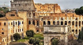
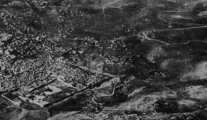
Cover Photo, Top Left: View of remains of ancient Rome. The_Double_A, Pixabay


