In central Anatolia, about 150 kilometers east of Ankara, lies a remarkable archaeological site. Over 3,000 years old, the rock sanctuary of Yazılıkaya is located a few hundred meters outside the city walls of the former Hittite capital Hattuša. Since 1986 it has ranked as a UNESCO World Heritage Site. Even without this accolade it emits a unique aura. Tucked away in a group of limestone cliffs near the village of Boğazkale, the sanctuary remains virtually anonymous: its Turkish name means simply “inscribed rock.” When the French archaeologist Charles Texier visited this area for the first time in 1834, he initially saw and sketched only the ruins of the former capital. But soon the villagers also led him to the well-hidden Yazılıkaya.
A few decades before the fall of the Hittite kingdom (around 1190 BC), stonemasons of the Hittite Great King chiseled over ninety reliefs of people, animals and mythical figures into the rock massif’s two natural courtyards (Chambers A and B). The figures in Chamber A form a line of reliefs and appear much like a procession of Hittite deities. There is no doubt that these are gods, for many of them bear their name in Luwian hieroglyphic signs. Mythical creatures and chimeras are also present, including two particularly striking bull-men with their arms stretched high over their heads, carrying what looks like a bowl. Charles Texier’s drawings of these reliefs made a splash in central Europe, because no one would have expected such distinctive art in remote central Anatolia. It is different from anything known from Greece, Egypt, or Mesopotamia, even today.
Part of the sanctuary’s aura may stem from the fact that it was here that for several centuries, Hittite great kings came together with their families and senior echelons of society to celebrate special festivals. The hidden location of the chambers, their obvious importance in Hittite religion, and the pictorial representation of the most important gods of the time contribute to the fascination. Yazılıkaya can also be seen as a challenge to archaeology, because the actual function of the sanctuary has always remained enigmatic. Despite numerous attempts to explain this procession of the Hittite pantheon, the complex withstood all attempts at interpretation for nearly two centuries.
___________________________
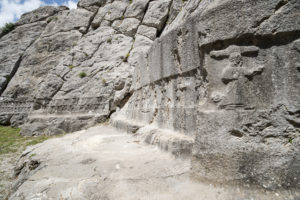
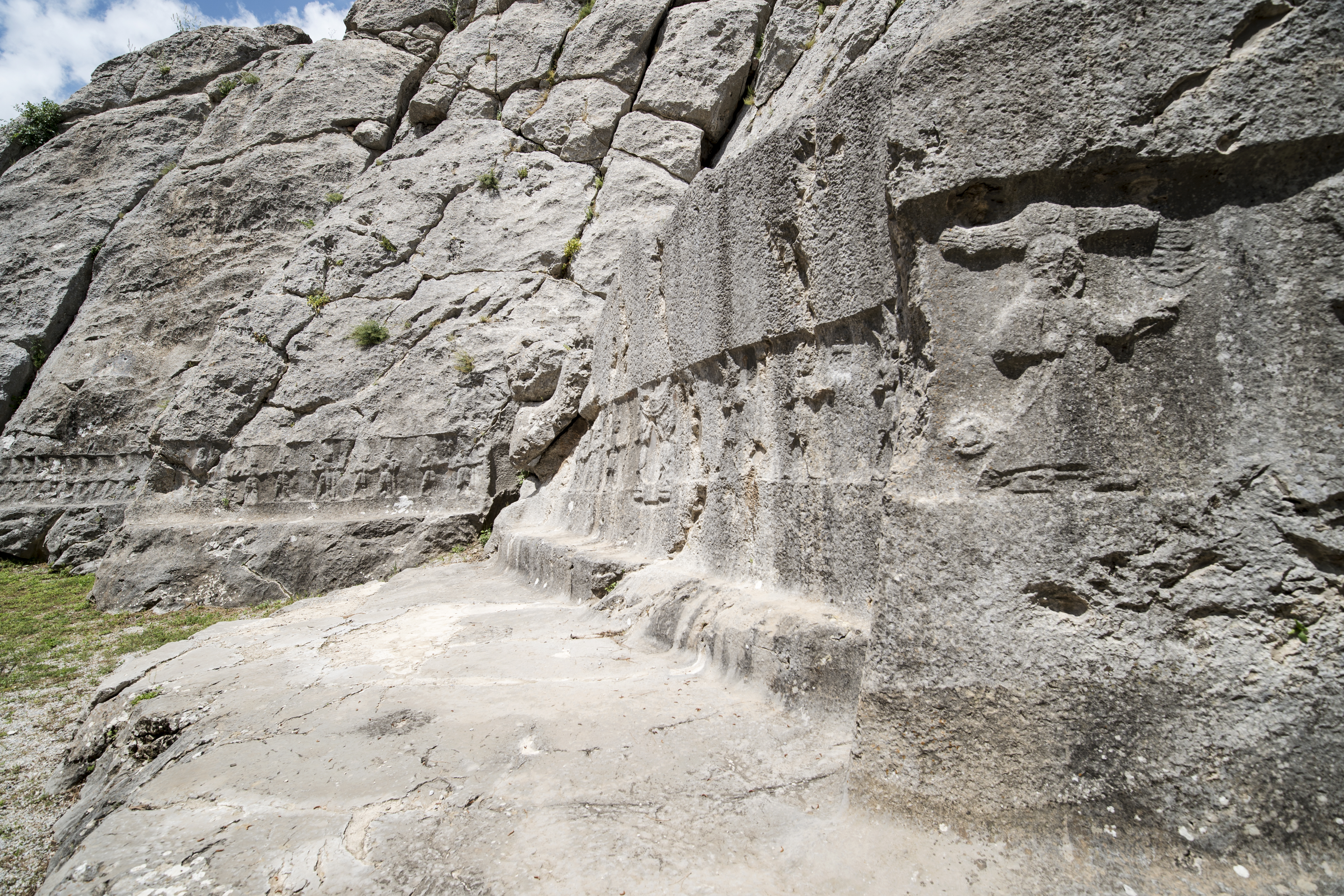
Wall on the western inside of Chamber A with 12 identical gods (Reliefs 1–12) on the far left and Relief 34, the Sun god of the heavens, on the right. (© Luwian Studies)
___________________________
Hints Suggesting a Technical Function
The German prehistorian Jürgen Seeher, a former excavator of Hattuša, says that Yazılıkaya has kept its secret to this day. In his Hattuša Guide, and in a monograph on Yazılıkaya published in 2011, he mentions in passing that the particularly imposing relief of the Great King Tuthalija IV in Chamber A is brightly lit by the sun for only a few days around the summer solstice. This detail, and the flat walls of Chamber B (up to twelve meters high), prompted me to ask a compelling question. Did Yazılıkaya have a technical function? Although the vertical walls of Chamber B seem to be essentially of natural origin, as similar structures occur nearby, their flat surfaces were extended with ashlar masonry by the builders of the sanctuary. In addition, the two chambers were never roofed over, even though this would have been easy to do. This suggested that the course of the sun, the moon, the stars, or light-shadow-effects might well have played a role in the sanctuary’s function. Some of the relief figures also imply a reference to heaven: the Sun God of the Heavens is explicitly labeled with his name. He is proceeded by the winged moon god, who in turn follows Šauška, also depicted with wings, a deity attributed to the planet Venus. And before Šauška appears Ea, the Babylonian god of heaven. Allusions to the sky thus abound – and when I first visited the place in 2014, considering a technical function involving sky-gazing and calendar-keeping seemed quite conceivable.
Rita Gautschy, who works at the Archaeological Institute of the University of Basel, holds a doctor of science degree in both archaeology and astronomy. We agreed to join forces in search of Yazılıkaya’s possible astronomical function. Fortuitously, in 2015 the Handbook of Archaeoastronomy and Ethnoastronomy appeared, edited by the eminent British professor of archaeoastronomy Clive Ruggles, and comprising almost 2,300 pages in three volumes. It includes articles by the Spanish astrophysicists Juan Antonio Belmonte and A. César González-García dealing with an astral or solar orientation of the Hittite religion. These led us to more of their publications, in which they report how they measured the alignments of temples and gates in Hattuša. These were suggested to be astronomically oriented, with a high statistical probability. Belmonte and González-García also paid particular attention to the rock sanctuary at Yazılıkaya. They found that the northern wall of the gatehouse points at the sunset during the summer solstice. As early as 1990, Juan Antonio Belmonte proposed that the twelve uniform male deities in Chamber B might well correspond to the number of lunar months in a year. What is more, the American astronomer Edwin C. Krupp had also visited Yazılıkaya, and had recognized signs of celestial elements. In his opinion, the processions represented a “cosmic narrative”. These findings by renowned archaeoastronomers encouraged us to proceed.
Temple Walls Point toward the Solstices

Summer solstice sunset alignment of the northern wall of the monumental gatehouse. (© Luwian Studies)
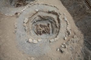
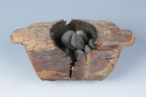
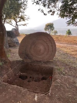
Soon we realized that the north wall of the last building (IV) to be constructed at Yazılıkaya was aligned with the sunset at winter solstice. The oblique arrangement of the temple buildings, erected during at least three distinct construction phases, suddenly began to make sense. The earliest building was oriented to the summer solstice, the most recent to the winter solstice. Whether their functions were symbolic or technical was still unclear. Both solstice-oriented walls, however, had in their extensions a protruding piece of natural bedrock which was evidently left intentionally by the Hittite builders. In Building IV, this boulder even contained an artificial hemispherical depression of 28 centimeters in diameter. Archaeologists interpreted this as a basin for holy water.
In order to better understand the mindset that prevailed some 3000-4000 years ago, we began reading numerous scientific treatises on Hittite religion and Babylonian astronomy. We found that of the more than 33,000 documents and fragments found in Hattuša, at least 50 deal with astronomical or astrological subjects. Accordingly, the Hittites received their knowledge of celestial regularities almost entirely from Mesopotamia. The pamphlets produced by Hattuša’s first excavator, Hugo Winckler, were particularly helpful for me. Already in 1901, Winckler proffered a hypothesis that today’s world religions had a common source in ancient Babylonian astral religion. Winckler saw an astounding number of interrelationships, but did not proceed to apply them to Yazılıkaya.
Figures Symbolize the Days of the Lunar Month
Over a period of five years, we managed to gradually develop a new model for interpreting the site. During the Bronze Age, dates were determined in principle based on the phases of the moon. The lunar month consisted of either 29 or 30 days, and it began with the first appearance of the crescent moon after the new moon. Twelve lunar months added up to 354 days – and were thus 11¼ days short of a solar year. That is why as early as the 4th millennium BC, intercalary months were commonly used. Every third year or so comprised thirteen lunar months rather than twelve. Consequently, year by year the beginning of the seasons coincided more or less with the same date in the solar year.
If the twelve uniform male deities in Chamber A reflect lunar months, it would only be logical for the next thirty figures to represent the days within a lunar month. This group of thirty deities, for the most part male, is clearly separated from the actual climactic scene in Chamber A by the long staff of the Storm God of Hatti (Relief 41). We deduced that the days (and months) were counted from right to left, as in Luwian hieroglyphic writing the reading direction always runs counter to faces and hands. If the long staff of the Storm God of Hatti marked the beginning of the lunar month, the full moon would have always coincided with the two bull-men (Reliefs 28-29). The bowl they carry actually corresponds to the hieroglyphic sign for “heaven,” which in Mesopotamia was also called the “boat of light.” So the bull-men did not indicate a crescent moon as it may seem at first sight; instead they mark the full moon. They thus highlighted the only day of the month when lunar eclipses could occur. According to Babylonian beliefs, such eclipses, if they happened unexpectedly, could potentially be harmful for the king. The priests therefore had a duty to predict such events – and thus needed a calendar.
Female Deities Indicate Solar Years
We had thus found a plausible explanation for the deities on the western side of Chamber A. But we still had no clue as to the function of the climactic scene and the procession of female deities on the chamber’s eastern side. In an attempt to come to grips with this challenge, we drew all figures of Chamber A on a single sheet. Seventeen of the female deities are almost completely preserved. All that remains of one figure is the name, and yet another female deity was discovered in 1945 in a neighboring village called Yekbas, where it was used as a building block in masonry. It is now exhibited in the museum in Boğazkale. The procession of female deities thus apparently involved a total of nineteen figures. The stonemasons had left a column of natural stone to separate a subset of eight of the female figures. Eight and nineteen are the years needed to synchronize solar years and lunar months. Greek scholars later named these two cycles octaeteris and enneadecaeteris. After 19 solar years, or 235 lunar months, or 6,940 days, the sun and moon again reach almost the same constellation in the sky. The female deities thus symbolize years.
Yazılıkaya appears to be the place where the Hittite priests kept their calendar. They most likely indicated the current day, month, and year with moving markers in the form of stone or wood columns. Proceeding in this way they could determine the most important dates of the year: New Year, the solstices, the equinoxes, and monthly festivals. After all, with the Hittites never missing an opportunity to serve one of their countless deities, the priests had the challenge of setting the dates for as many as 165 festivals per year.
Festivities for the Summer Solstice
Such an interpretation makes it easier to imagine what a festival in Yazılıkaya, like the summer solstice, may have looked like. The king and his family, accompanied by priests, would have gathered in the temple court in the late afternoon. The gatehouse would have provided, above all, an entrance for the sun goddess of Arinna to the complex. Shortly before sunset, the rays of the sun would have penetrated the gatehouse and illuminated a precisely placed (probably gold-plated) statue of the Goddess herself, thereby producing an epiphany for those attending the festival. Deeply moved by this unforgettable experience, the congregation would have stepped into Chamber A, where they would have seen the now magnificently illuminated effigy of the Great King, for the rest of the year in shadow. The sacred power of the sun goddess had thus been transferred to her earthly representative, thereby reinforcing his might.
By no means will this new interpretation put an end to the search for an explanation of Yazılıkaya. It may more likely be a first step in a new direction. Many questions remain: what exactly do the five deities of the climactic group represent? What was the function of Chamber B – and what do the deities in it depict? What was the purpose of the impressive Yerkapı structure in the uppermost part of the Upper City of Hattuša? Could there have been other, perhaps smaller and less elaborate, facilities elsewhere with a similar function to that of Yazılıkaya? After more than a hundred years of systematic exploration of Hittite culture, in many ways we still seem to be at the very beginning.
___________________________

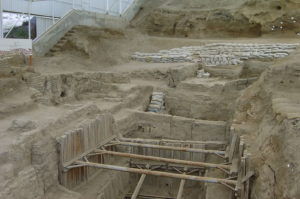
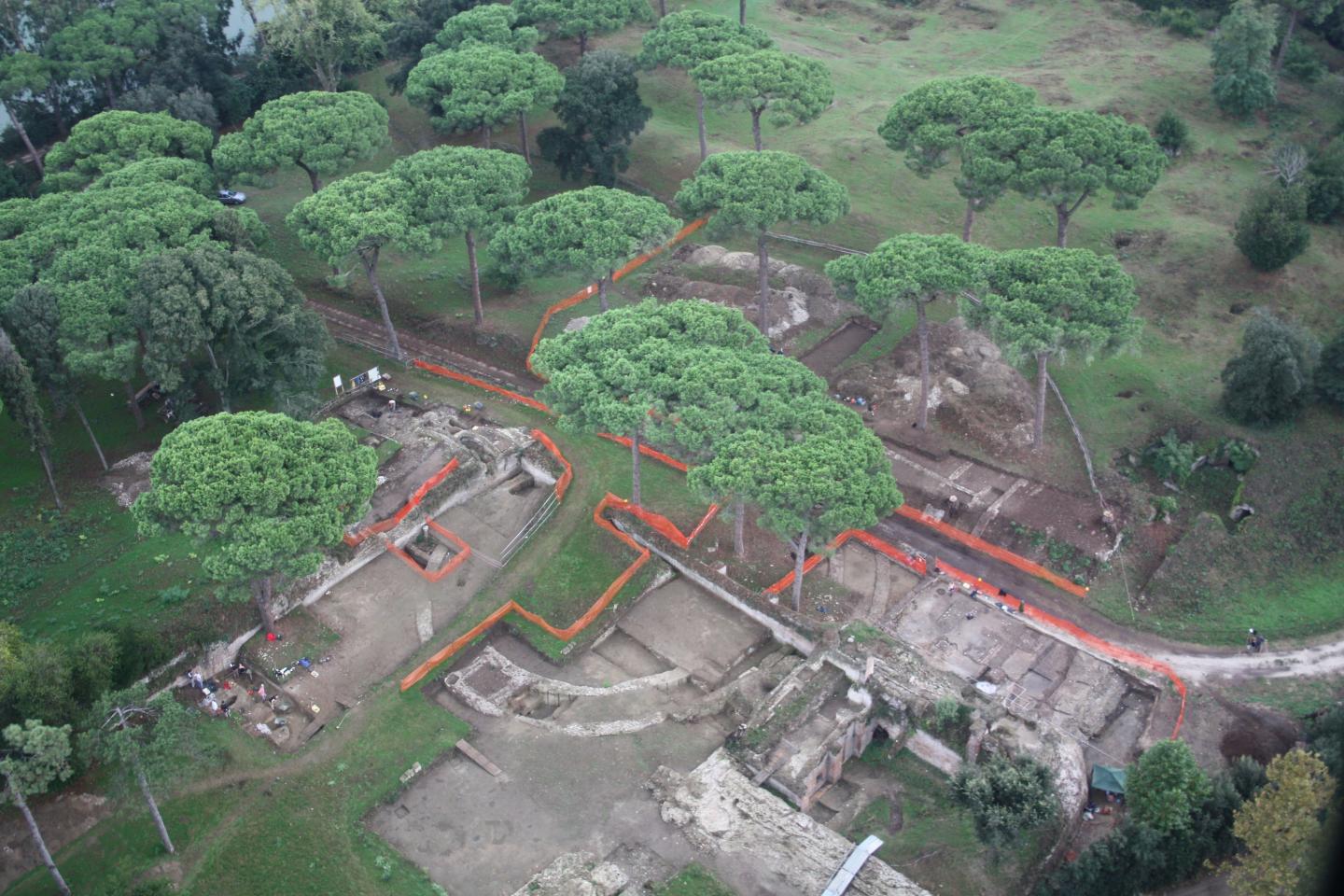
Chamber 1 in the upper city of Ḫattuša was built to catch the light of the Sun as it sets during the winter solstice. (photo taken on 21st December, 2018 – © Luwian Studies).
___________________________

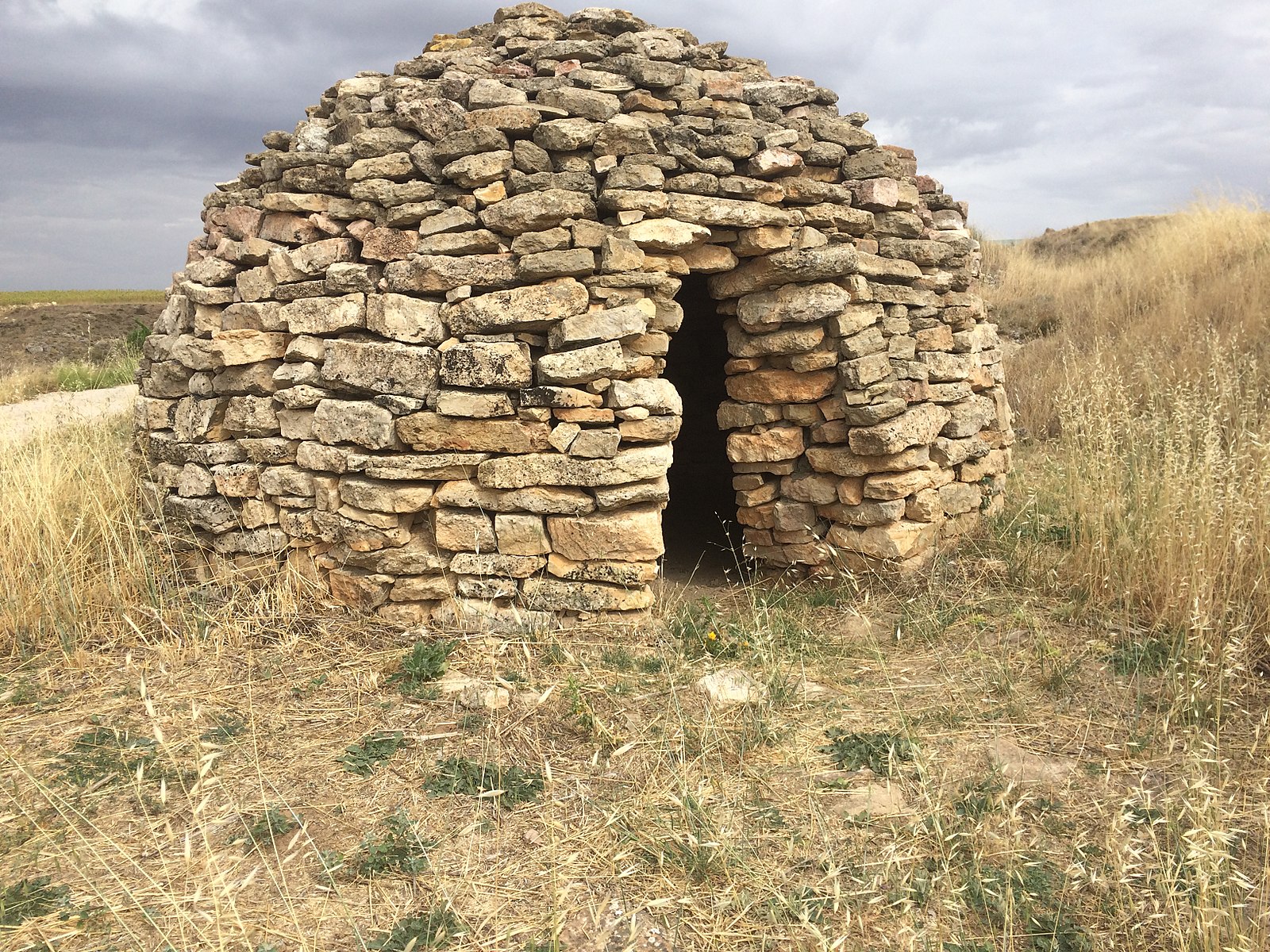
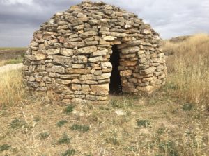
The southwestern corner of the pyramidal base of Yerkapı points towards sunset at the winter solstice. (photo taken on 21st December, 2018 – © Luwian Studies).
___________________________
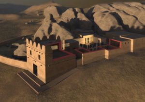
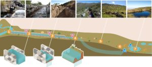
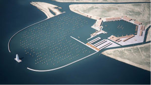
3D-visualization of Building II and III (gatehouse) at Yazılıkaya showing how the object on the pedestal in the courtyard may have been illuminated during a religious service on the day of the summer solstice.
(© Oliver Bruderer / Luwian Studies)
___________________________
Reference:
Eberhard Zangger, Rita Gautschy: “Celestial Aspects of Hittite Religion: An Investigation of the Rock Sanctuary Yazılıkaya”, Journal of Skyscape Archaeology 5.1 (2019) 1–33
Contact:
Eberhard Zangger
Luwian Studies
P.O. Box 166
8024 Zurich, Switzerland
Tel. +41 44 250 74 94
e.zangger@luwianstudies.org
www.luwianstudies.org