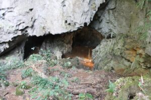
Near Pollonia, Milos, Greece — At first blush, my uninitiated eye could only see what appeared to be random jumbles and scatterings of large volcanic stones strewn across an arid, sloping, rocky island landscape. As I looked closer and longer, however, I could see some organization and structure to this expanse. Though the natural fury of volcanism was responsible for creating these stones, I knew nature did not place them here like this.
Humans did.
More than 4,000 years ago.
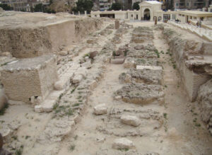
The site, known today to archaeologists and historians as ancient Phylakopi, was for centuries one of the most important commercial and trading centers of the Bronze Age Aegean. Situated on the northeast coast of what is present-day Milos, ships laden with goods from Minoan Crete, Mycenaean Greece and Pharaonic Egypt would ply their trade here and receive in return the best products the people of the island of Milos could offer. Here, a sophisticated community of people built and sustained administrative palaces, structures dedicated to sacred ritual spaces, house structures, and monumental defensive fortifications, among other features typical of Bronze Age urban settlements. Other significant Bronze Age urban settlements of the Aegean, like Phylakopi’s contemporaneous city of Knossos on the island of Crete and Akrotiri on the island of Santorini, have loomed much larger in the minds and imagination of the scholarly world and the public. Yet, at least among scholars of the Bronze Age Aegean, Phylakopi has not been lost in the shadow of those sites. In fact, in some ways, the archaeology of this island city has eclipsed them in the gravity of its importance. Archaeologists began to realize this as they explored this island-dotted Mediterranean region late in the 19th century.
_______________________________
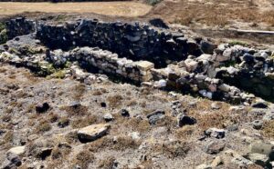
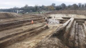
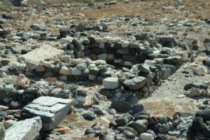
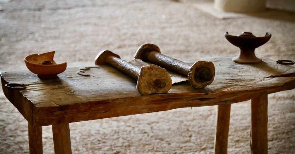
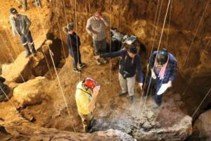
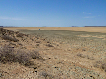
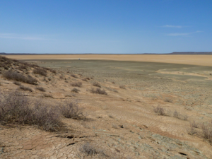
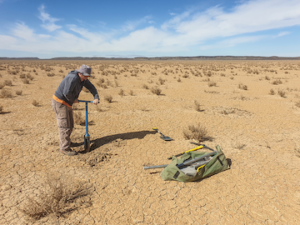
A view of the Phylakopi site as it exists today.
_______________________________
The Fruits of Excavation
Adamas, the main coastal town of Milos, affords a rich variety of places to relax for an outdoor meal, and with the right location, one can view the blue water of the adjacent Milos Harbor while sitting and eating traditional Greek cuisine. It was under these circumstances that I met and conversed with Pavlos Kotronakis, a long-time resident of Milos and, for a time, an actively engaged archaeologist at the Phylakopi site. From 2004 to 2008 ( July 2004 until December 2008) he managed a team of excavators under the overall direction of Marisa Martha, who was then Director of the 21st Ephorate of Classical Antiquities of Greece’s Ministry of Culture.
Unlike previous excavations at the site, this project was primarily a clean-up operation, meant to clear the site of debris that remained after years of excavations earlier in the late 19th and then later in the 20th century, to make the site accessible to visitors. Historically, Phylakopi saw several British expeditions under the auspices of the British School at Athens, the first conducted between 1896 and 1899 by Duncan MacKenzie, the second from 1910 to 1911, and the third under Colin Renfrew from 1974 to 1977. A limited excavation was conducted in 1964 under Zepheiropoulou on behalf of the Zephorate of Antiquities for the Cyclades.
“Digging in and gradually removing the old British debris proved much more interesting and fruitful than anticipated, “ said Pavlos about the latest excavation of 2004 — 2008. “Excavators in the late 19th century, though close to modern standards, were quite far from paying much attention to excavation techniques, such as sieving the soil to find small artifacts, as would normally be required today for such an important site as Phylakopi. Consequently, we found many objects, even of significant archaeological value, that 19th century workers had simply overseen and thrown away. We were also able to bring to light again a part of the city walls that had been covered by the excavation debris.”
Some of the significant small finds of the excavations are now housed and exhibited at the Archaeological Museum of Milos, a modest yet architecturally beautiful edifice, affording well-appointed spaces richly endowed with artifacts not just from Phylakopi but from other sites and time periods, as well.
Beyond artifacts, however, the physical site and features of Phylakopi bespeak a long-occupied ancient center that must have been an important player in the heydays of Aegean commerce from as early as the Late Neolithic through the Late Bronze Age. Key to this was one product Phylakopi, and by extension the volcanic island of Milos of which it was a part, had in abundance:
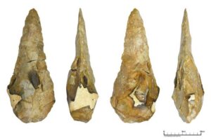
Obsidian.
“It is commonly believed that Phylakopi played a major role in the obsidian trade during the Later Neolithic – Early Bronze Age,” said Pavlos. “Phylakopi may well have been, if not the sole, perhaps main exporting center of obsidian — and that not only in Milos, but in the whole of the Aegean. But Phylakopi was not a production center. It was a refinement and exporting one. Obsidian was brought to Phylakopi from the production centers [also located on Milos], and was then refined on the spot and finally exported.”
The (often) black, hard, glassy consistency of this volcanically produced rock was enormously useful and effective for producing tools, its sharp, knifelike edges ideal for cutting and other productive activities. Though demand was robust for obsidian even during Neolithic times, trade and the use of it increased exponentially during the Bronze Age. Thus, Phylakopi is thought to have been a major destination or stopping point for maritime trade, in large part because it was one of only a few locations in the Mediterranean where obsidian could be acquired in such abundance with such high quality.
_____________________________
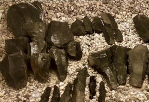
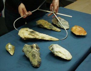
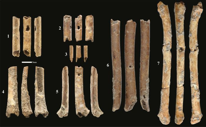
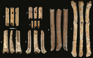
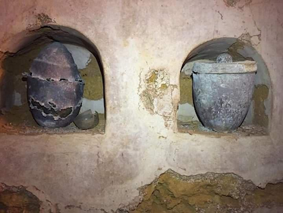
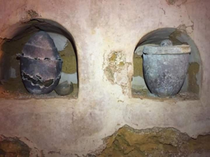
Obsidian artifacts discovered on the island of Milos, as exhibited in the Milos Mining Museum.
_____________________________
Obsidian artifacts discovered at Phylakopi, as exhibited in the Milos Mining Museum
_____________________________
But obsidian was not all. Archaeological investigations turned up signs of another precious product — lithargyros fragments.
“Lithargyros was a by-product of the process of making silver (the Greek words “lithos” and “argyros” meaning “stone” and “silver”),” added Pavlos. “Renfrew has published some fragments of lithargyros found in his excavations. Lithargyros was “garbage” to be frank, and it was thrown away by the ancient workers. However, the existence of such “garbage” in Phylakopi shows that there may have existed workshops on the spot dealing with the production of silver. Though it was the “Bronze” Age, the people of Phylakopi may have had much more advanced knowledge in dealing with metals than previously thought.”
A Bonze Age Motherlode
I asked Pavlos about his thoughts on the most salient small finds of the combined series of excavations at Phylakopi. In his own words, he summarized the prolific results of the major efforts conducted at the site. What follows reflects his personal experience and perspective:
“First of all, unearthing a hitherto unknown and major commercial center of the Aegean Bronze Age was a great achievement; the British were lucky in “stumbling upon” its remains. The finds and findings of the British excavations were, of course, too many to number – however, some of them stand out in my mind:
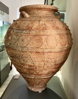
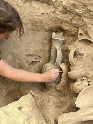
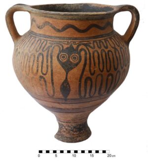
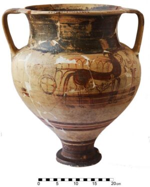
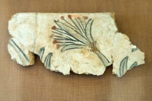
Pottery, perhaps, would be number one: seemingly countless sherds appeared and a great percentage among them were decorated sherds; even whole vases appeared. This led to the building of a typology (a succession of ceramic styles, based on the relevant depth in which the sherds and the vases were found). This, in turn, greatly enabled dating and the building of chronological charts (the deeper a sherd/vase was found, the older it was. If found under a wall, for example, the sherd could date the wall and the whole building). The British were, thus, able to establish a solid new chronology for the specific era and place (Later Neolitihic / Bronze Age Aegean). This chronology applied not only to Phylakopi, Milos, but to the other Cycladic islands, as well.
“Linear A” findings could, perhaps, be number two. The inhabitants of Phylakopi knew how to read and write. Renfrew published a fragment of a clay tablet inscribed in Linear A script. Although this script has not yet been deciphered, it clearly shows connections with Crete. It also suggests that many more inscribed clay tablets once existed in the archives of the palace — in Knossos, for example, many tablets were saved because of the fire which destroyed the palace, thus “baking” the tablets and making clay durable. But in Phylakopi there was no fire; the city was simply abandoned sometime in the late 12th century B.C. and nobody knows what happened to the archives of the palace. It has even been supposed that the 19th century A.D. workers may have destroyed the tablets while digging, quite by accident, since unbaked clay would be almost indistinguishable from the surrounding earth context and there was no knowledge of the existence of inscribed clay tablets at the time. Though the latter is a possibility explaining why no archives have been found except a sole tablet, I do not think it is a strong one.”
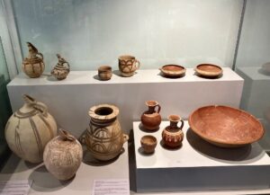
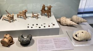
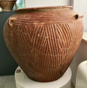
_____________________________
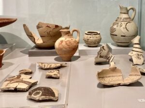
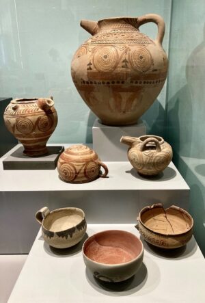
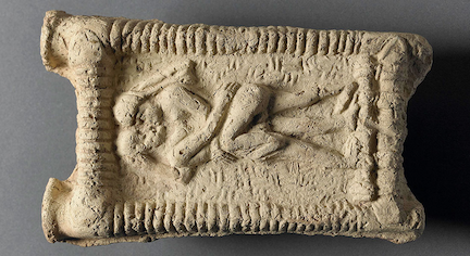
Above and below: Pottery and clay artifacts discovered at Phylakopi, as exhibited in the Archaeological Museum of Milos.
_____________________________
_____________________________
_____________________________
_____________________________
_____________________________
_____________________________
_____________________________
_____________________________
A Monumental Place
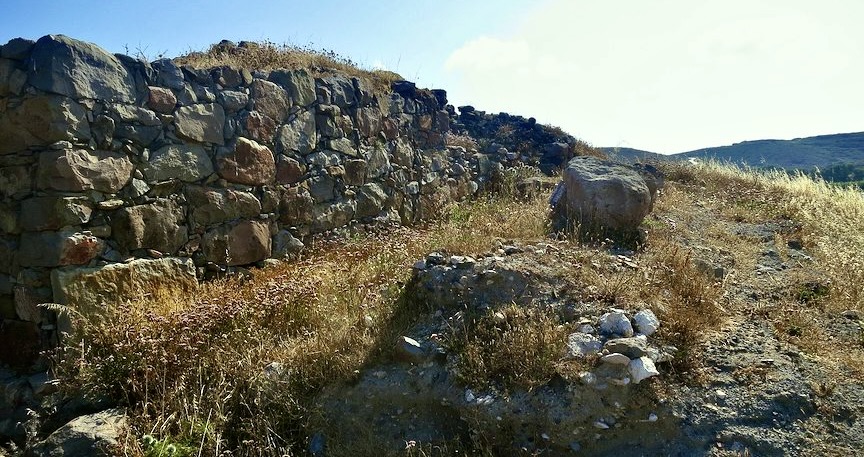
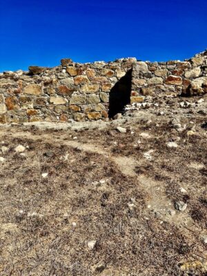
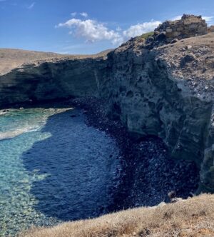
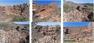
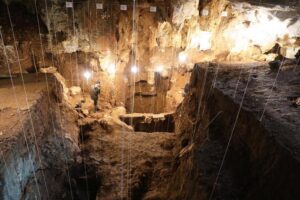
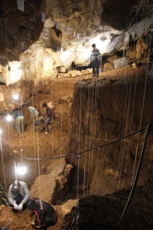
For the casual observer, what stands out most strikingly is the massive assortment of scattered volcanic stones. Collectively, they distinguish the face of the site from the surrounding landscape much like an expansive, rocky outcrop might present in any other natural scene. But careful survey and investigation by archaeologists with trained eyes and excavation experience over the past century have gleaned a picture of a coastal city that boasted (for the Bronze Age Cyclades) a monumental presence. Although its evolutionary beginning as an urban center extends as far back as 3300 BC, in its heyday, particularly between 1550 and 1100 BC, Phylakopi must have struck an impressive view from the ships that approached its docks.
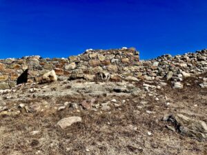
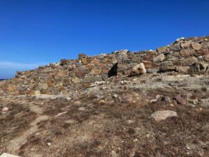
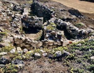
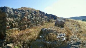
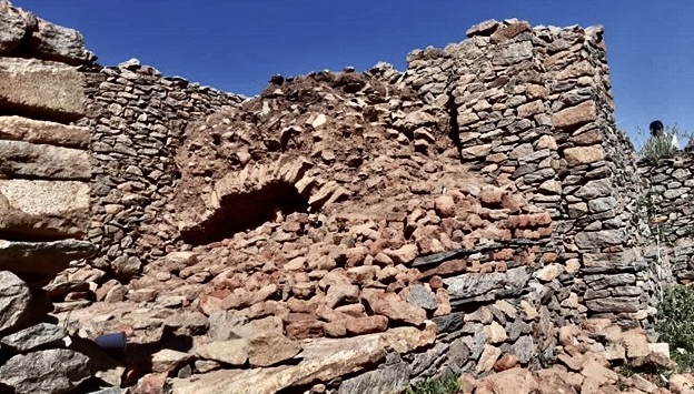
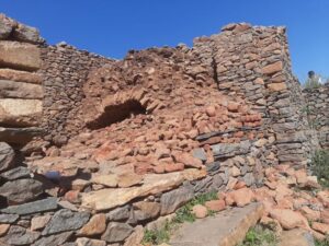
Most visible and prominent is the stone defensive wall, of which today only a small segment remains. Close to the edge of the site where the land meets the sea, it straddles the top of the cliffs that overlook the inlet. They appear as if suspended, situated as it were precariously above the waves that have continuously eroded the land upon which the site sits. The wall was constructed between 1600 — 1400 BC, during the Middle Bronze Age, a time when Minoan influence was strong at Phylakopi, and in the Cyclades generally. This wall was destroyed and then later reconstructed during the last phase of the settlement, a time when the Mycenaeans wielded great influence over the city. It is the remnant of this later wall that is primarily visible on the landscape.
___________________________
Above and below: The Mycenaean wall as it is seen today.
___________________________
___________________________
___________________________
___________________________
___________________________
The Pillar Room
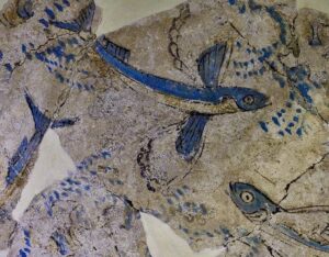
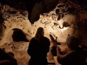
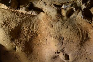
The excavations of 1896 — 1899 uncovered what remained of a structure named by the site investigators as the “Pillar Room”, a building complex that features two ground-floor rooms with a pillar in the center, a characteristic typical for Minoan architecture. Based on architecture alone, therefore, the archaeologists have ascertained influence from Crete, where the Minoan civilization was centered. But further evidence of this influence was discovered when excavators encountered fragments of fresco paintings, which they determined had fallen from what once were upper rooms. Some of the fragments came from the scene of an offering to a seated female, interpreted to be a goddess, in a coastal setting. Others originated from two narrow friezes of flying fish, a composition of white Lilly flowers, and a frieze featuring blue monkeys. Archaeologists have interpreted the rooms in which the fresco paintings were located as serving a religious function. The room featuring the seated goddess, for example, was quite possibly a shrine. The paintings have been dated to 1600 — 1500 BC, somewhat later than the dates for similar works discovered at the site of Akrotiri on the island of Santorini (ancient Thera).
__________________________
__________________________
__________________________
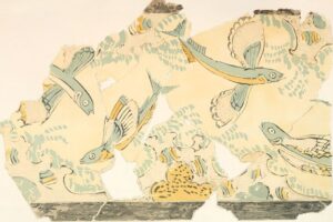
Published report illustration of the wall painting illustrating the flying fish.
__________________________
__________________________
The Megaron
Not far from the Pillar Room, archaeologists encountered evidence for a ‘mansion’ complex. Dated to the 16th-15th c. BC, it was built during the time of Minoan influence. Not actually a private residential structure, it is thought to have been an administrative center for the city. Here, excavators unearthed a clay tablet inscribed in Linear A script. Linear A has yet to be deciphered, but it is often associated with palatial administrative contexts at sites in Crete that are dated to Minoan times. Later, a Megaron was constructed at the same location, and it is the remains of this latter structure that can be seen. Dated to the early 14th century BC, it is identified as a Mycenaean building, resembling similar such Mycenaean structures in Mainland Greece but somewhat simpler in complexity. Archaeologists uncovered defining features of an antechamber at its core with a threshold of two large stone ashlar blocks and a large hall with a plaster floor and hearth. This central portion was flanked by corridors and then a series of small rooms and spaces.
The Sanctuary
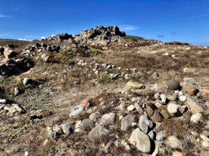
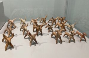
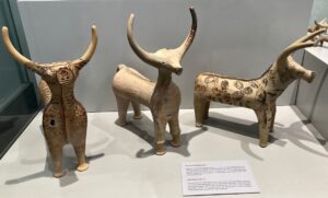
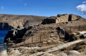
Other than the defensive wall, perhaps the best defined and most visibly recognizable structural features at Phylakopi are the remains of what archaeologists have designated as the Mycenaean Sanctuary. Dated to an original nucleus (West Shrine) construction of 1360 BC, it was rectangular with a flat roof supported by wooden columns. The main room featured benches along the walls, with a doorway in its west wall leading to two ancillary rooms. The doorway was flanked by platforms with niches that supported figurines. About 1270 BC a new major rectangular construction was added, designated the East Shrine. Both the West and East Shrines functioned jointly. A structural collapse that occurred in 1130 BC led to architectural alterations, but the Sanctuary continued to be functional until around 1090 BC. Archaeologists recovered a significant number of clay figurines during excavation of the Sanctuary, including both female and male as well as bovine figurines. Here, the famous ‘Lady of Phylakopi’ figurine (c. 1350 BC) was found. Also found were three stone columnar lamps, tortoise shells that are thought to be parts of lyres, a gold mask, two bronze male figurines and two scarabs. Many of the finds have been interpreted as cult images and votive offerings and thus the Sanctuary is thought to have been a center for religious activity.
_________________________________
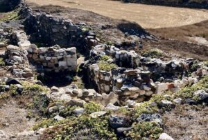
Above and below: Remains of the Sanctuary, as they can be seen today.
_________________________________
_________________________________
_________________________________
The South Entrance
A common feature of Bronze Age cities were monumental gates, or gateways, that led by definition into the settlement’s interior spaces. These gates were often part of the city fortifications, characterized by bastions and towers. This is no less true of Phylakopi and excavators encountered the remains of such in the area designated as the South Entrance. Here, archaeologists uncovered evidence of a bastion with a stone-built staircase that possibly led up to a tower. This is the only entrance to this city discovered, though archaeologists are certain there were more entrances. Erosion of the site by the adjacent sea has since destroyed all evidence of these entrances, excepting the South Entrance.
The Legacy of Phylakopi
One could say that Phylakopi, compared to better-known ancient Aegean sites such as Knossos, Akrotiri, and Phaistos, is a forgotten city. Few, other than scholars, students, and enthusiasts of Aegean and Cycladic history, have ever heard of the place. Yet unbeknownst to most, the site boasts a profound significance.
“[Archaeologists] have unearthed a hitherto unknown Aegean civilization and a major commercial center of the Later Neolithic-Early Bronze Age, that had previously been completely unknown,” said Pavlos. “They were able to establish connections between Milos and Crete, since the findings clearly indicated close ties between these two islands and Cretan (“Minoan”) influence on Phylakopi.” Moreover, “Phylakopi, is considered to be one of the main centers of export for obsidian. It could well be possible that Phylakopi was the main center of this trade. This, apparently, makes Phylakopi stand out, since very few such exporting centers for obsidian are known (e.g. Nissyros), which, however, seem to have had a lesser part in this trade. And the obsidian exported from other centers was of rather inferior quality. The obsidian of Milos was number one.”
Beyond the fact that Phylakopi was the main center of a previously unknown Cycladic civilization, excavation work at the site established a foundation upon which later excavations and archaeological investigations of early Aegean civilizations could be based. The excavations at Phylakopi were particularly beneficial for the famous excavations conducted later under the direction of Arthur Evans at Knossos on the island of Crete.
“They [meaning the excavators of Phylakopi] were able to establish a stratigraphy, since different strata (layers) were documented and studied,” continues Pavlos. “This led to modeling a much-needed chronology pattern for the site. With the help of pottery found in these strata, the British were able to model chronological patterns for the era that also applied to other Cycladic islands. Last but not least, the investigators learned excavation techniques! Phylakopi was the first “modern”, so to say, excavation held in Greece. It was the first strictly “scientific” excavation, paying attention to stratigraphy, pottery evolution and chronology……. Duncan MacKenzie, the leader of the Phylakopi excavations, later went on to Crete at the beginnings of the 20th century, where the British School also held excavations at Knossos under Sir Arthur Evans. MacKenzie became the “right hand” of Evans and, with his valuable experience gained at Phylakopi, greatly helped in establishing chronology in the Knossos excavations. It is quite probable that without Phylakopi, MacKenzie would not have been able to help Evans as much and a solid stratigraphy and chronology pattern would not have been as easily produced.”
______________________________
______________________________
Finally, Phylakopi is among the longest lasting urban centers of the Aegean, progressing through a number of different developmental and construction phases, beginning in the Neolithic, but then continuing seamlessly throughout the Bronze Age (i.e. from the 3rd millennium BC until the 12th century BC), thus establishing its place as an important type-site for several chronological periods of the Aegean Bronze Age.
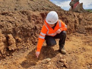
An Endangered Site
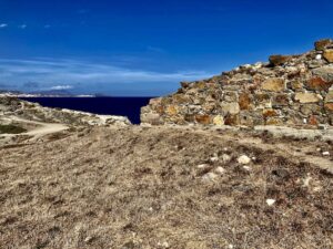
Today, thanks to site clean-up and preparations, the Phylakopi archaeological site draws hundreds if not thousands of visitors per year. With greater publicity, the numbers would surely climb. But Phylakopi faces a slow killer — erosion. For centuries, the sea has gradually eroded away the coastline of the ancient city, eating into the city itself. Much of what remains of this once critically important commercial port settlement has disappeared into the sea. The section of the city’s fortification wall that can still be seen at the edge of the cliff that overhangs the ocean appears precariously on the precipice of plummeting into the water below it.
__________________________
Some remains of the wall precariously hug the edge of the cliff that overlooks the sea.
__________________________
I asked Pavlos about the plight of the site.
“Erosion by the sea of the volcanic rock on which the city lies continues,” he said. “One could say that erosion will, eventually, some day “eat” the rest of the city. Of course, centuries will need to pass before Phylakopi becomes ‘extinct’ in this way; but this is what will eventually happen unless modern technology finds a way to stop it. Rain and wind during winter also produce damage; the ancient walls of the city houses cannot withstand harsh weather conditions, unless they are reinforced [or protected] somehow.”
“Nothing is being done to stop the erosion of the soil by the sea, nor to somehow protect the remains of the city from the impacts of harsh weather. It is such a pity.”
Efforts to protect the site will require an important resource — new money — words easier said than done in the current economy. But Phylakopi is not alone. It is an issue affecting many other ancient sites across the world.
Walking among this ancient port city’s remains, I could imagine a bustling monumental center of tradesmen, skilled artisans, laborers, palace administrators, religious officials and many others carrying out their daily tasks. Here was a center of work, government, and cultural symbolism, as well as a place where the elite ran their up-scale households. Goods from Crete and Mainland Greece found their way here, and scribes recorded important business transactions and other documents on clay tablets, first in the form of a script (Linear A) that is today yet undeciphered, and then likely later in a script (Linear B) with which many scholars of Greek today are already familiar. People lived and worked here continuously for centuries, and people living and working in far-flung communities across the sea likely knew the names of this city and their inhabitants. After the 12th century BC, however, there was silence and stillness. The city was abandoned or slowly depopulated and never re-occupied. It was not until the late 19th century that explorers and scholars came to recognize and act on what the local population had known for centuries — that there was something very significant going on in this place in the distant past. The jumbled stones and the artifacts they picked up and dug up at the site over the years told them so.
It may be many years before archaeologists return to this site to investigate its secrets further. Pavlos, and others like him, are only hoping that the sea, the wind, rain and global warming will be merciful long enough to allow them the chance to add to the city’s story — provided there is the financial grace to make it happen.
Cover Image, Top Left: The western edge of the Mycenaean fortification in Phylakopi. Zde, Creative Commons Attribution-Share Alike 4.0 International, Wikimedia Commons
________________________________


.jpg)