AlUla, Saudi Arabia: Results of two recent archaeological excavations supported by the Royal Commission for AlUla (RCU) demonstrate that the Neolithic inhabitants of north-west Arabia conducted “complex and sophisticated ritual practices” in the late 6th millennium BCE.
The unprecedented findings open unsuspected horizons for a broader understanding of the social, cultural and spiritual background of the ancient peoples of north-west Arabia.
Researchers emphasize the probable communal character of the ritual and the possibility that people journeyed specifically to prehistoric stone structures known as mustatils to undertake the ritual, which would represent one of the earliest known pilgrimage traditions. Further, greater representation of domestic species among the animal offerings confirms the pastoral nomadic nature of the community, whose members may have built the mustatils as a form of social bonding and/or a marker of territory.
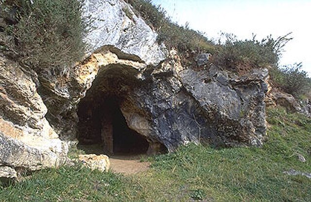
Mustatils are large-scale, open-air rectangular structures with low stone walls. Through aerial surveys, researchers have identified more than 1,600 of them across north Arabia. Though the structures’ function was at first unknown, excavations since 2018 have pointed to a ritual significance and provided increasing insights into the practice.
Results of the two studies have been peer-reviewed and recently published. The study led by Dr Wael Abu-Azizeh of the Archéorient Laboratory and France’s Lyon 2 University appears in the book ‘Revealing Cultural Landscapes in North-West Arabia’, edited by a team of experts led by Dr Rebecca Foote, Director of Archaeology at RCU. The study led by Dr Melissa Kennedy of Australia’s University of Sydney appeared in the journal PLoS One in March.
Abu-Azizeh study
In 2018 Dr Abu-Azizeh began an excavation on behalf of Oxford Archaeology that unearthed the ‘Horn Chamber’ in a mustatil at site IDIHA-0000687 north-east of AlUla dating to circa 5300-5000 BCE. The chamber measures 3.25m by 0.8m and is at the western end of a mustatil measuring 40×12 meters – smaller than most mustatils.
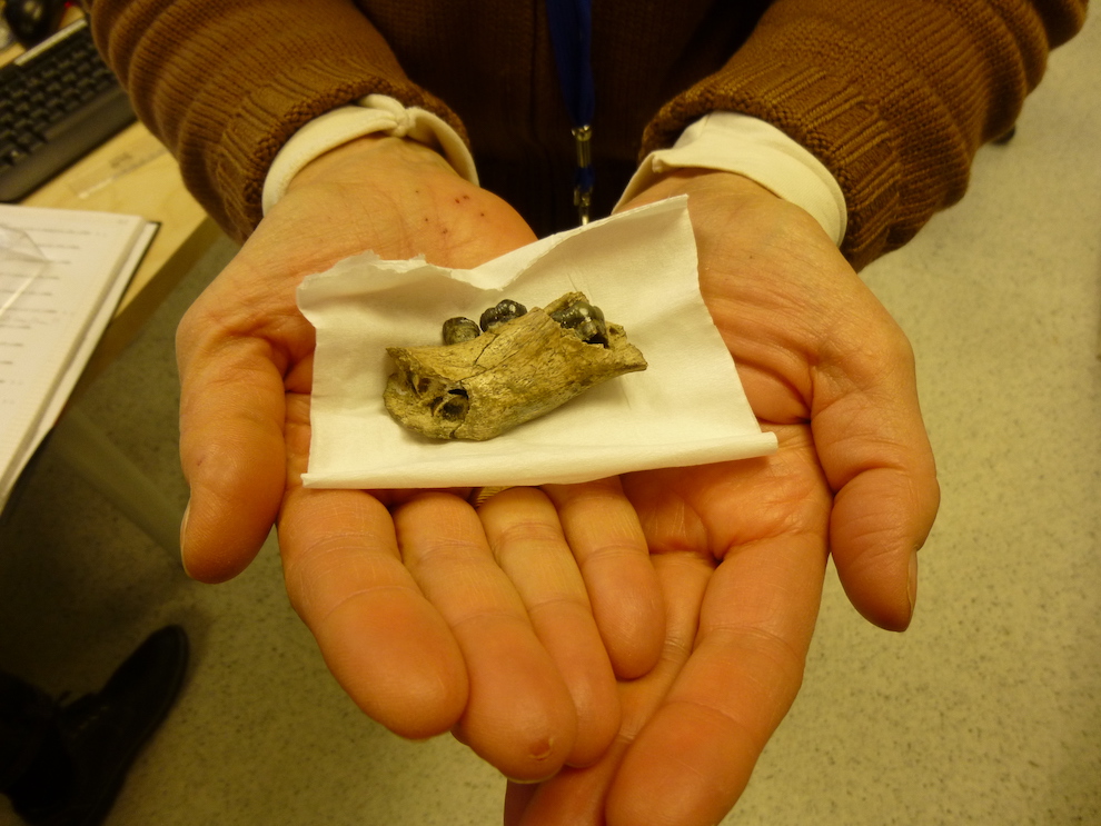
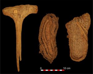
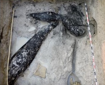
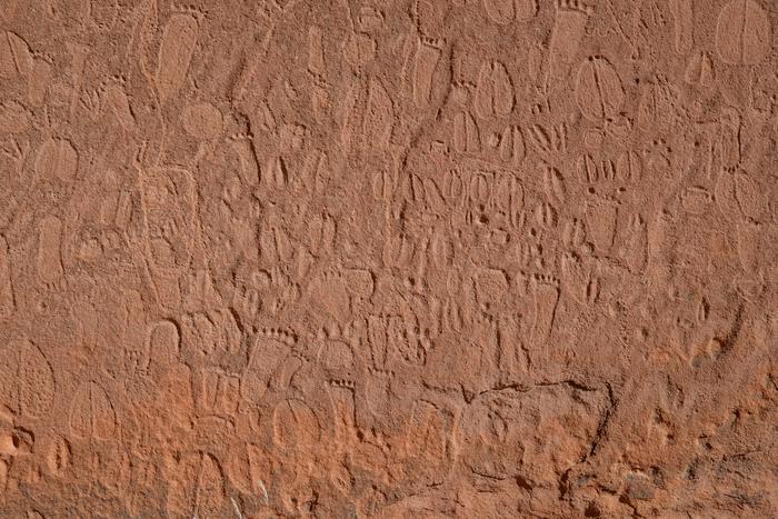
Inside the ‘Horn Chamber’ he and his team made an exceptional discovery of horns and skull fragments, densely packed into a layer 20 to 30 cm deep that covered the floor of the chamber. This, they write, is “a unique and unprecedented assemblage in the context of north Arabian Neolithic.”
About 95% of the horns and skull fragments were from domestic species – goat, sheep and cattle – with the rest from wild species including gazelle, Nubian ibex and aurochs (a now-extinct ancestor of domestic cattle). Beneath the assemblage was a thin bedding of twigs that in preparation for the ritual had been placed on the chamber’s sandstone surface.
The researchers conclude that the horns and skull fragments were probably deposited during a single ceremony. In a tentative reconstruction of the ritual, they propose that pastoral nomads gathered and bore the offerings as part of the ritual performance. To reach the solemn space of the small Horn Chamber they entered one by one through a narrow doorway and small antechamber with hearths to present this trophy on behalf of their social group. The collective hoard of enshrined offerings expressed a cohesive identity for the wider social group.
The researchers write: “By the quantity of remains, the diversity of species represented, and the unusual state of preservation, this assemblage constitutes a unique and unprecedented discovery in the archaeological record of the region. This deposit is interpreted as a testimony of complex and sophisticated ritual practices … ”
Kennedy study
In 2019, the second study, by a team led by Dr Kennedy, then of the University of Western Australia, began excavation of a mustatil deep within dense sandstone canyons east of AlUla, at site IDIHA-0008222. Like Abu-Azizeh’s team, they found a chamber containing horns and skull parts that dated to circa 5200-5000 BCE, though not in as great a quantity. There are further differences: these bones appeared to have been deposited in three or four phases over a generation or two, rather than all at once.
Most of the horns and skull parts were from cattle, and several from goats. The researchers write that this finding is “amongst the earliest attestation of domestic cattle and goat in northern Arabia”.
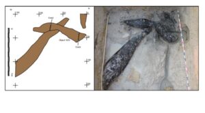
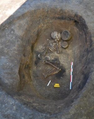
At the center of the shrine is an upright stone that is believed to have served as the focal point for the ritual. Most of the horns and skull parts were deposited around this standing stone, which stood 0.8m high. The researchers interpret this stone as being a betyl, “a mediator between humankind and the divine, acting as a proxy or a manifestation of an unknown Neolithic deity/deities or religious idea, to which the faunal elements were deposited as votive offerings.” This would constitute one of the earliest known betyls in the Arabian Peninsula.
The researchers further note that the repeated used of the shrine over a period of years “represents one of the earliest examples of ‘pilgrimage’ or shrine revisiting currently identified in the Arabian Peninsula.”
Intriguingly, they hypothesize that the placement of the mustatils might have had an ecological basis. The Arabian climate was growing more arid in the Middle Holocene Period; varying micro-climates made mobility essential and herding viable. The ritual might have been intended to ensure fertility and the continuity of rains, with the mustatils themselves possibly located near water sources such as wadis. This, the writers say, is a key avenue for future research.
Dr Rebecca Foote, Director of Archaeology and Cultural Heritage Research at RCU, said: “RCU has embarked on one of the largest archaeological research programmes worldwide. Across AlUla and Khaybar, 12 current surveys, excavations and specialist projects are deepening our understanding of the past environment, land use, and human occupation of the region. Rich cultural landscapes are being revealed, including funerary avenues, mustatils, ancient cities, inscriptions in 10 languages, rock art and complex agricultural practices. AlUla is a leading hub of archaeological activity, a standing that will be enhanced by the inaugural AlUla World Archaeology Summit.”
________________________________
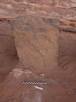
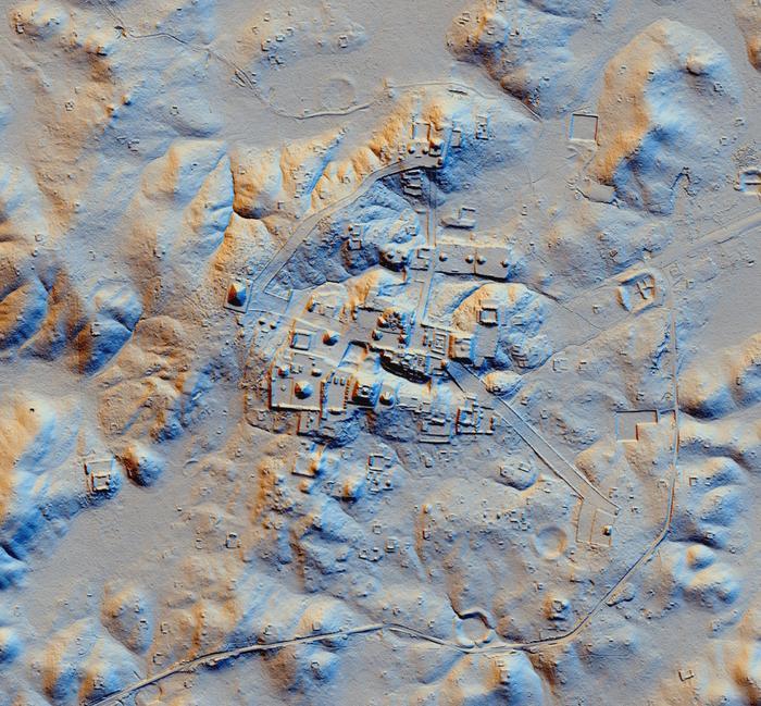
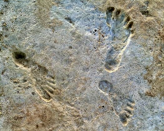
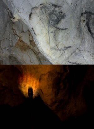
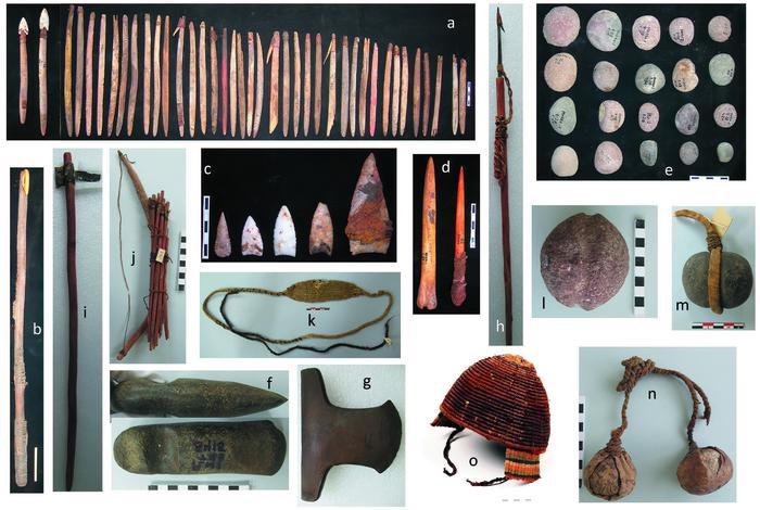
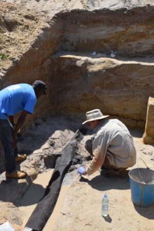
In this overview of the horn chamber mustatil, SU300 marks the eastern wall of the mustatil, SU200 marks a stone cairn and SU100 marks the 7×2.5m platform containing the horn chamber. The cliff overhang protected the horn chamber from exposure to the elements. Credit: Wael Abu-Azizeh et al 2022 / RCU
________________________________
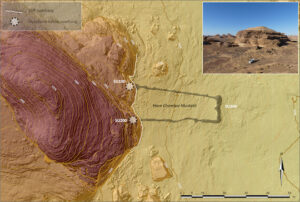
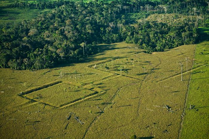
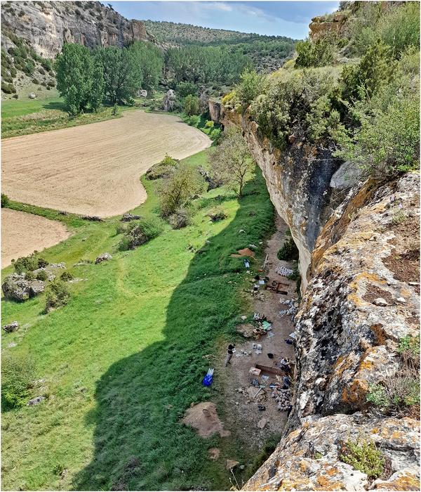
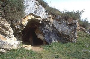
The outline of the Kennedy team’s mustatil is at the forefront of this image of the landscape east of AlUla. They describe the location as “essentially hidden in the sandstone canyons”. Credit: Hugh Kennedy, AAKSA / RCU
________________________________

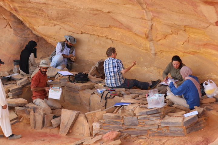
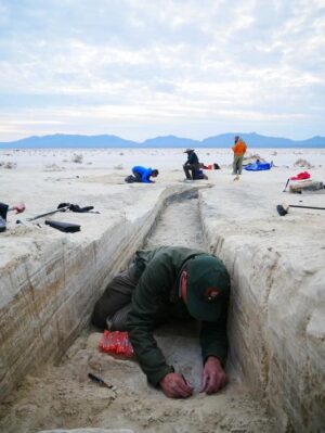
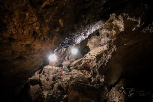
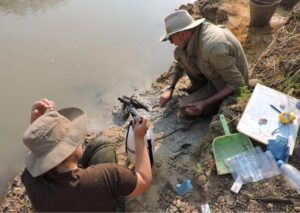
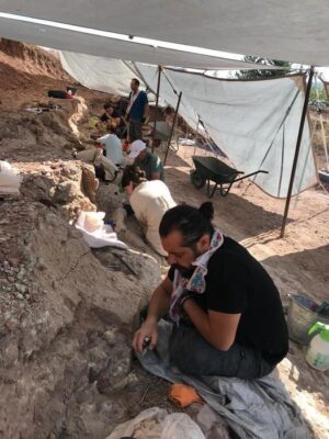
The team led by Dr Wael Abu-Azizeh excavates the chamber that contained “an exceptional discovery” of skull and horn fragments. Muhammad Al-Dajani / RCU
________________________________
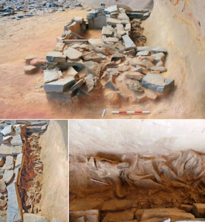
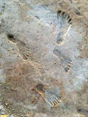
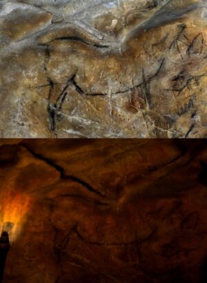
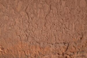
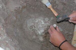
At top is a general view of the SU100 platform; at bottom are details of the horn chamber. Credit: Wael Abu-Azizeh et al 2022 / RCU
________________________________
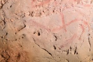
The Kennedy team found most of the skulls and horns deposited around a central standing stone that the researchers interpret as a betyl, “a mediator between humankind and the divine”. Credit: Melissa Kennedy, AAKSA / RCU
________________________________
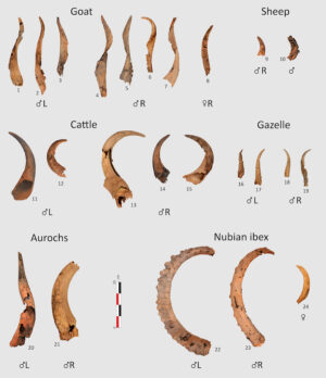
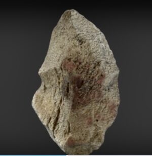
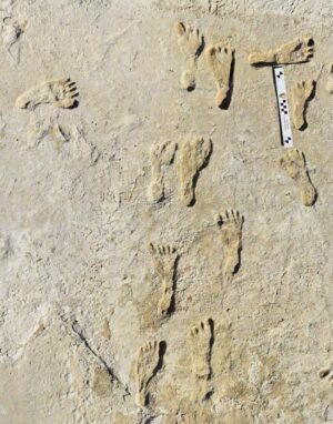
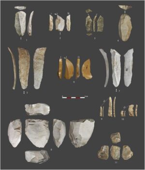
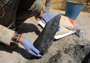
The Abu-Azizeh team found horns from several domestic and wild species, ranging from goats to the now-extinct aurochs. The horns were predominantly from male animals. Credit: Wael Abu-Azizeh et al 2022 / RCU
________________________________
About the Royal Commission for AlUla
The Royal Commission for AlUla (RCU) was established by royal decree in July 2017 to preserve and develop AlUla, a region of outstanding natural and cultural significance in north-west Saudi Arabia. RCU’s long-term plan outlines a responsible, sustainable, and sensitive approach to urban and economic development that preserves the area’s natural and historic heritage while establishing AlUla as a desirable location to live, work, and visit. This encompasses a broad range of initiatives across archaeology, tourism, culture, education, and the arts, reflecting a commitment to meeting the economic diversification, local community empowerment, and heritage preservation priorities of the Kingdom of Saudi Arabia’s Vision 2030 programme.
______________________________
Article Source: Royal Commission for AlUlA news release (edited).
______________________________
Advertisement


.jpg)