

Editor’s Note: Following is an interview conducted by Richard Marranca of archaeologist Guy Hepp, who is Associate Professor of Anthropology at California State University, San Bernardino. Dr. Hepp has been involved in research related to the ancient people of Oaxaca, a atate in southwestern Mexico. Oaxaca has a rich history of human occupation going back as far as 11,000 years ago, though it is best known for the ancient Zapotec and Mixtec civilizations……….
_______________________________
Part 1
RM (Richard Marranca): Hello Guy. It’s been a few years since we first met in Oaxaca and did the interview. I take it you recently returned from Tututepec? Can you tell us about this place and the Mixtecs?
GH (Guy Hepp: It’s great to hear from you, Richard. Yes, I volunteered on a project at Tututepec in 2022, directed by my good friend Marc Levine from the University of Oklahoma. This was coming full circle, for me, as Marc’s dissertation project in Tututepec in 2005 was my first experience in Oaxaca. Tututepec is both an ancient site and a modern town on the western Pacific coast of Oaxaca. It was the capital of a coastal empire stretching from near the Guerrero border to roughly the Isthmus of Tehuantepec during the late Postclassic period (1100–1522 CE). It is still the county seat in the region (largely for symbolic reasons) and one can still hear Mixtec spoken there, particularly by the older residents. There’s much to tell about Tututepec, including its founding by the famous hero-king Lord 8-Deer “Jaguar Claw,” whose exploits are recorded in the preserved Mixtec codices, but I refer you to research by Marc and others for the details.
RM: Can you say a few things about the excavation and ongoing research?
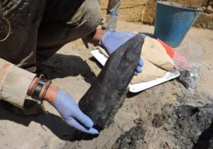
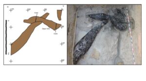
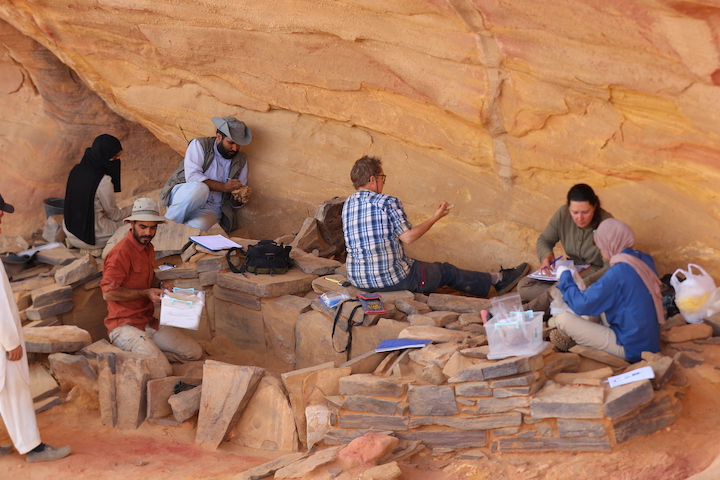
GH: I don’t want to spill the beans on Marc’s project, as this is his research area and he was kind enough to have me join his project as a volunteer. In addition to helping with the excavations, my focus has been on the ceramic figurines from the site. As I discuss below, figurines have been a specialty of mine since my MA project, completed in 2007. Marc has a wonderful relationship with the modern Tututepec community and an ongoing collaboration with the Museo Yucusaa, the town’s community museum. His research questions focus in part on craft specialization at the household and neighborhood levels. Tututepec is a fascinating inversion of a familiar trend. Rather than a large modern city crowding around archaeological ruins, the modern town has dwindled due to a shift in the population out of the defensible piedmont and onto the coastal plain below, where the local stretch of the Pan-American highway was built. As a result, modern Tututepec is dwarfed and surrounded by the terraces and preserved foundations of its ancient footprint. Marc has excavated in different parts of the site with the hopes of better understanding the economic specializations among the different households and neighborhoods and how those factored into the local economy.
RM: Is your focus the ceramic figures?
GH: I did a study of Formative period (2000 BCE – 250 CE) ceramic figurines from coastal Oaxaca for my MA thesis and have retained an interest in them in my subsequent work. Though an art history professor of mine would remind me that art need not directly mirror reality, I still find anthropomorphic (human-shaped) figurines one of our best ways to get a glimpse of how people in the past dressed and thought of the human body and identity. And yes, one of my favorite things about studying such figurines is that they give me an excuse to do scientific illustrations, which were my first entrée into professional archaeology when I was a high school student. Marc and I agreed that we would collaborate on a study of the Late Postclassic period figurines from Tututepec, as these are poorly understood but show some indications of widespread interactions and shared practices in Mesoamerica in the last few centuries before the arrival of the Spanish.
RM: Do archaeologists draw things or is that a specialized branch of artist-archaeologists? I recall a few Egyptologists who started out that way?
GH: Most archaeologists hire professional artists for their artifact illustrations and reconstruction drawings, though they might make their own schematic drawings of things like ceramic vessel profiles. Scientific illustration just happens to be a way I can bring two of my interests (art and archaeology) together. In fact, for me, archaeology is a wonderful sort of compromise that allows me to bring together my loves of writing, art, travel, music, teaching, and studying the past. Usually, I do pen-and-ink artifact illustrations using a standardized stippling technique. Later, I digitize these for publication. I’ve also done paintings such as an oil painting reconstruction of the ceramic vessel assemblage recovered from the Early Formative period (2000–1000 BCE) site of La Consentida during my dissertation project.
_______________________________
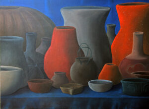
Painting of the Tlacuache ceramic complex by Guy Hepp.
_______________________________
RM: Do you generally draw objects from excavations and is that part of your job?
GH: I usually do illustrations of objects that are iconographic, meaning they bear decorations that I think may be useful for interpreting something about ancient beliefs, identity, or social practices. These artifacts may come from museums or excavated contexts. While museum examples may be more complete, they frequently lack the contextual information of excavated examples, which can help us better understand the roles they played in the past. Formal illustrations are still useful in the era of digital imagery because they can help us depict subtle surface details of objects, even eroded ones, that otherwise might just look like a blob in a photograph. Publishers tend to like these illustrations because they’re eye-catching, can convey a lot of information, are cheap to print, and don’t require color. When pigment is part of the decoration of an object, of course, we need to find a way to indicate that in the illustration or use photography in that instance. I began doing artifact illustrations for pay as a high school student (my first archaeology job) and have since done pro-bono illustrations for friends and colleagues just because I love to do it and it gives me a chance to work with some truly amazing pieces, such as a stone rain deity mask I illustrated for my friend Jeff Brzezinski’s project. From a copyright perspective, artifact illustration also gives me the chance to show imagery from other research projects or artifacts whose whereabouts are unknown without worrying about image permission. I simply re-draw the object and cite the source like a bibliographic citation, since the artwork is mine.
______________________________
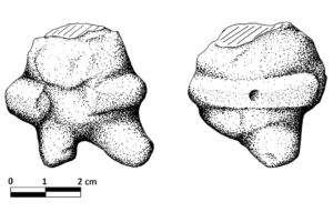
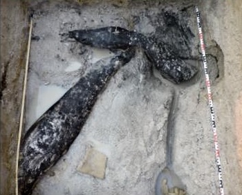
Above and below: All artifacts illustrated here are from the Early Formative period (2000–1000 BCE) village site of La Consentida, Oaxaca, Mexico. Based on radiocarbon dates from the site, most probably date to about 1850–1500 BCE, specifically. All dates are calibrated. Figure above: Figurine depicting possible ballplayer with protective belt and broken tripod support for standing and repositioning. Image courtesy Guy Hepp.
______________________________
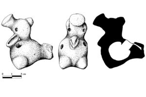
Playable bird instrument (ocarina) from ritual cache. One of the oldest known ceramic musical instruments in Mesoamerica. Image courtesy Guy Hepp.
______________________________
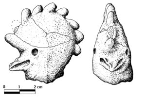
Head of a crested bird instrument (whistle or ocarina) with smoothed interior surface from resonating chamber. From early platform fill layer near human burials. Image courtesy Guy Hepp.
______________________________
Part II
RM: Your essay, Landfalls, Sunbursts, and the Capacha Problem: A Case for Pacific Coastal Interaction in Early Formative–Period Mesoamerica, is wide-ranging and fascinating. So, there are objects in Mesoamerica that show influences from far away in S. America? Can you speak about this long network of exchange?
GH: When the Spanish arrived in the 16th century, they recorded long-distance expeditions of merchants using balsa rafts and traveling between distant coastal points in Ecuador and West Mexico. This exchange network is still not fully understood but has been replicated with experimental archaeology, studied with complex charts of offshore currents, and is likely responsible for the broad distribution of spondylus shell jewelry and some metallurgical techniques, including lost-wax casting, which seem to have been imported to Mesoamerica from South America. In the paper you’re referring to, I argued based on pottery decorations (particularly a motif sometimes called the “sunburst”) as well as basic ceramic forms and patterns of human dental modification, that this interaction network can be pushed much further back, to approximately 3,500–4,000 years ago.
This would explain why early ceramics in western Mesoamerica are dissimilar to those found closer to Central America, in a region called the Soconusco. It would also suggest that there were two ancient sources of Mesoamerican pottery traditions, one stemming from Central America and the other from northern South America by way of this Pacific coastal maritime route. This is a bold claim, but it actually revives work in the mid-20th century by scholars such as Isabel Kelly, who predicted by at least as early as the 1970s that we should expect to see evidence along the Pacific coast of “landfalls” by participants in such a network connecting South America and Mesoamerica. This project was fantastic to work on because it combined ceramic analyses from my dissertation work in Oaxaca with opportunities to visit some of the oldest pottery in the Americas (called Valdivia) in Ecuador and the Capacha phase ceramics of West Mexico. My paper was part of a larger research collaboration with scholars working mostly in later periods, and there’s much more to do. Linguistic evidence, for example, would be a strong way to support such an argument.
RM: Where did the shapes and objects first appear in S. America?
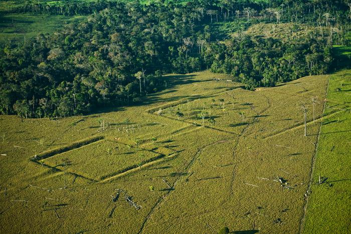
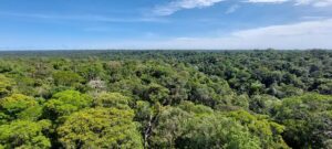
GH: This is a fascinating area of emerging research and one in which I’m not an expert. The Valdivia ceramics of the Pacific coast of northern South America are some of the oldest in the hemisphere but there are even older ceramics that are poorly understood from elsewhere in South America, including in the Amazon. If some of the earliest ceramics and complex communities existed in the Amazon rainforest, they are difficult to trace now, in part because of the highly acidic sediments of the forest and a lack of extensive study there.
_____________________________
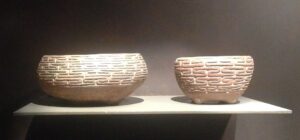
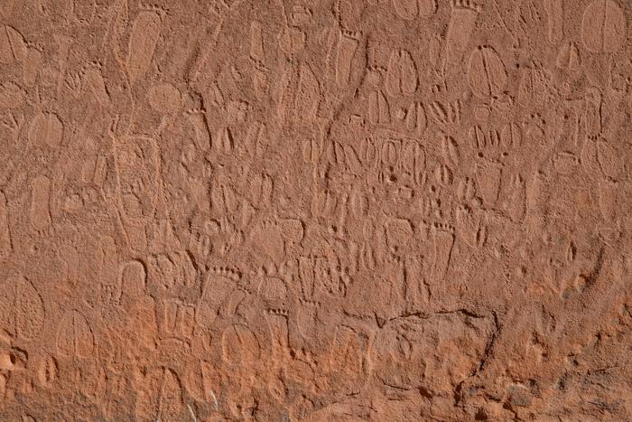
Valdivia bowls with labyrinth pattern, Museo Casa del Alabado, Quito, Ecuador. Marsupium, Creative Commons CC0 1.0 Universal Public Domain Dedication, Wikimedia Commons
_____________________________
I’ve seen it suggested by a Brazilian scholar that the Amazon rainforest itself is not a primordial, natural phenomenon but rather the remnants of an anthropogenic garden landscape long curated by native peoples to emphasize cultivation and support village life. We have so much more to learn about ancient human influence in the Americas and the true early origins of the Anthropocene.
RM: Were historians and archaeologists of past generations aware of this long-distance bartering and exchange?
GH: Arguments for long-distance trade and interaction were very common in archaeology throughout most of the 20th century. These fell from favor after about the 1970s and were replaced by an emphasis on local developments of many technological innovations. Without discounting the ingenuity of local populations to develop their own traditions and goods, I am in a camp of scholars who think that this theoretical pendulum shift away from “diffusionist” arguments may have been an over-correction. The baby was tossed out with the bathwater, so to speak, and we now tend to underestimate the abilities of ancient people to travel, navigate, communicate, and exchange goods and ideas across long distances. Calling me a “neo-diffusionist” might be going too far, as I think we always must remember that local people will adapt ideas from elsewhere to their own needs. I do think that we must follow the evidence, though, even when it suggests that people of the past surmounted daunting obstacles.
RM: Can you tell us about your upcoming plans for research in Oaxaca?
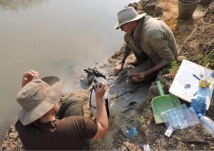
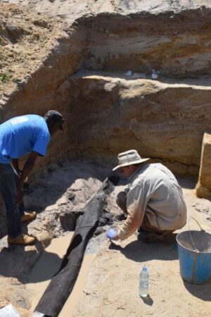
GH: I’ve recently submitted a grant proposal to return to coastal Oaxaca to study La Consentida, the Early Formative period village site where I did my doctoral dissertation work. If approved, this new study would take place over at least three seasons and include excavations at La Consentida, more excavations and mapping at a neighboring site called Cabeza de Vaca, and the first of what will likely be several seasons of laboratory analysis of the artifacts and other materials we recover. La Consentida, and likely also Cabeza de Vaca (based on some artifacts found at the surface) were among the earliest settled villages in Mesoamerica. Radiocarbon dates for La Consentida, for example, indicate that the site was occupied between about 2000 and 1500 BCE, which was a time of fundamental changes in Mesoamerica including the establishment of settled villages, a shift toward the first complex social hierarchies, and an increasing reliance on domesticated foods such as maize. Whereas the goal of my dissertation project was to gather as much information as possible about the broad topics of social organization, settlement practices, and ancient diet, my goals for this new project will intentionally be much narrower. The team and I (it will be a collaborative endeavor) will focus on remnants of domestic contexts, particularly houses and their associated refuse. We hope to better understand the social units (or “households”) that occupied the homes of Early Formative period coastal Oaxacan communities to question decades-old assumptions about gender roles, the organization of the family, and in general the social units that populated these settlements. For decades, researchers have assumed that the house in early Mesoamerican villages was the domain of women and that public space was reserved for men. But ethnohistoric evidence from Oaxaca describing the public and political activities of women and collectives, as well as the ubiquity of artifacts gendered “feminine,” such as figurines, really throw this into question in my opinion. At the very least, these old assumptions, which may say more about 20th-century Western society than they do about the Early Formative period, should be crafted into testable research questions.
For my dissertation project, I was in coastal Oaxaca multiple times, the longest of which had me living in a small coastal town for 10 months. Since my wife and I recently had a baby, and because I have teaching responsibilities during the academic year, I am hoping that this new targeted approach will help us address some very specific (but fundamental) research questions and take place in shorter, concentrated visits to coastal Oaxaca so I can still be a good dad at home!
________________________________
 Guy Hepp is an Associate Professor of Anthropology at California State University, San Bernardino. He holds a B.A. and a Ph.D. from the University of Colorado at Boulder and an M.A. from Florida State University. His research is focused on early complex societies of Mesoamerica and especially the archaeology of La Consentida, an Early Formative period (2000–1000 cal BC) village in Oaxaca, Mexico. This project, funded by the National Science Foundation and the Fulbright Program, was awarded the Society for American Archaeology’s 2016 Dissertation Award. In 2019, Hepp published a book based on his dissertation with the University Press of Colorado. He recently co-edited another book with the University Press of Florida and has authored publications about mortuary archaeology, paleoethnobotany, interregional interaction, radiocarbon dating, heritage politics, ceramic figurines, musical instruments, masks, and the archaeology of the senses.
________________________________
Advertisement

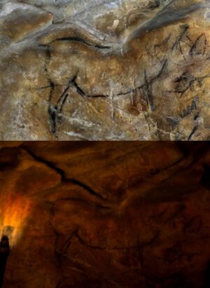
See the incredible archaeology, architecture, and art of northern Spain. A unique tour with special expert guides and lecturers through the collaboration of Popular Archaeology Magazine and Stone & Compass Tours. Not to be missed. Read More About It: https://popular-archaeology.com/article/northern-spains-triple-a-archaeology-architecture-and-art/.
________________________________
 In a world embattled by climate change, fragile ancient sites in Egypt can be destroyed in an instant and lost forever.
 Like a seed dropped into black fertile Nile soil, Aliaa Ismail is planting seeds for the future by educating and empowering her fellow Egyptians. Like the Ancient Egyptians in their quest for immortality, she has found a way of continuing her guardianship of Egypt’s rich cultural heritage for generations to come.
 M
M


.jpg)