The Lambayeque region in northern Peru is home to cultures as great as any other that emerged in the country’s Pacific Coast and in the Andes Mountains.
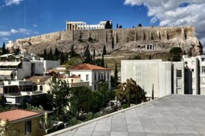
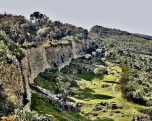
One of them is the Chachapoya, whose history arose east of Chiclayo in the rugged and remote northwestern province of Amazonas, bounded by the Marañón River valley to the north and west, and the Huallaga River to the south and east. Between these large rivers, affluents of the powerful Amazon, lies the Utcubamba valley, where the citadel of Kuélap was built ten thousand feet up in the northern Andes mountains.
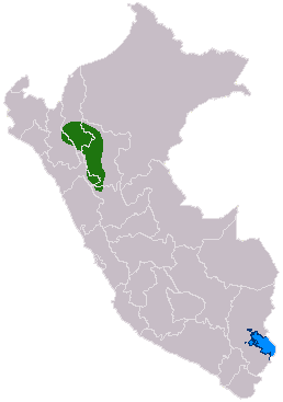
Map shows location of Chachapoya culture in Peru (in green). Marco Carrasco, CC-BY-SA 4.0, Wikimedia Commons
The Chachapoyas’ origins are uncertain, but they are believed to have migrated centuries ago, probably from Ecuador’s Amazon rain forest. Moving west, they crossed the mighty and dangerous Marañón (or Atunmayo River), a tributary of the Amazon, whose challenging power made their return hazardous. For this reason and because of their relative isolation, the Chachapoyas are a little-known ethnic group among the ancient societies of the Andes.
The culture appears to have developed sometime between the seventh and ninth centuries (unless otherwise noted, all dates are AD/CE). Sometime after that, at a cultural crossroads that once connected villages on the northeastern slopes of the Andes, the Chachapoyas developed trade with the cultures of the Amazon and with those on the lower western slopes of the Andes. Remains of their ancient villages (ayllus) and structures can be found between the Marañón and the Huallaga rivers.
The timeline of the Chachapoyas (called “Warriors of the Clouds” by scholars for their remote location in the tropical jungle-clad mountains of the northern Andes), points to interactions with the Chimú (900-1470) and other cultures on northern Peru’s Pacific Coast. They were followed by the Quechua (Runasimi) speakers from the central Andes around the late 900s (Lathrap, 1970; Isbell, 1974). The new arrivals cultivated maize on artificial stepped terraces at select elevations, but favored settlement locations on high defensible ridge tops, between seven thousand and eleven thousand feet. The geographic limits for the people we call Chachapoya, however, have never been clearly defined (Bradley, 2005). They were later conquered by the Incas, who appear to have given them the name Chachapoyas, since there is no record of their original name in the local language.
The Citadel
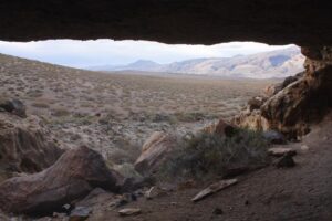
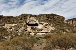
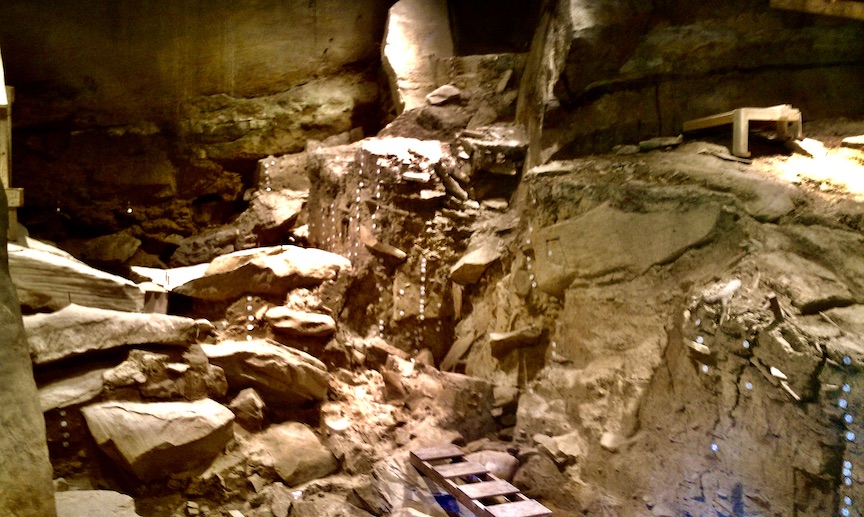
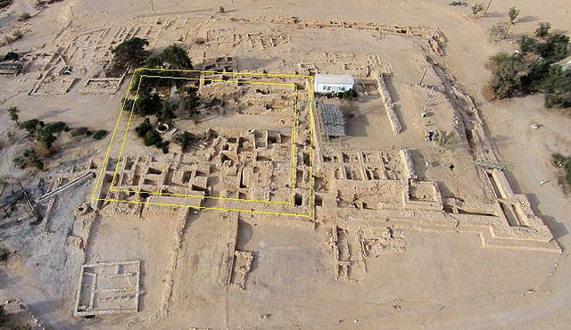
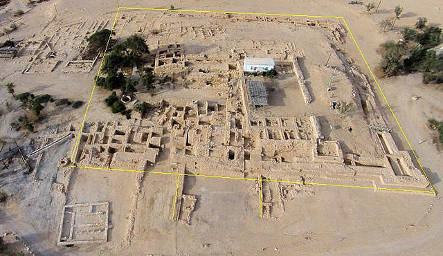
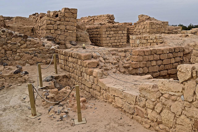
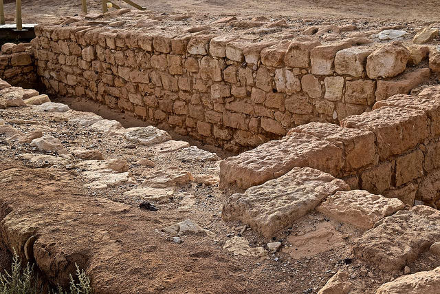
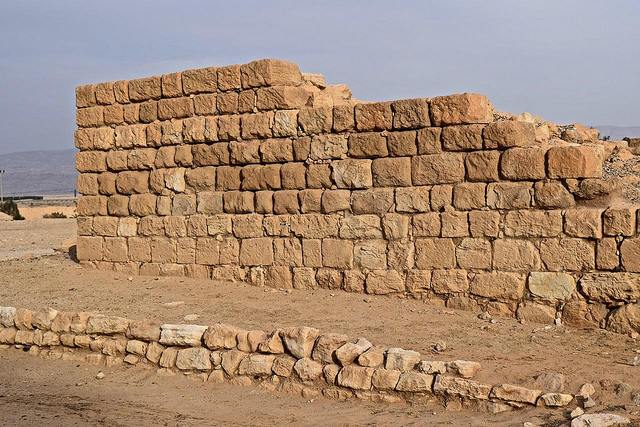
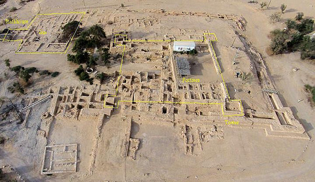
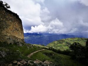
It is during the mid-fifteenth century that the tenth Sapa-Inca, Tupac Inca Yupanqui (1471-1493), the son of the great Pachacuti, conquered the Chachapoyas and forcibly transferred local villagers under the Inca system of forced resettlement of conquered people to other parts of the empire known as mitmaq. Archaeologist Federico Kauffmann Doig (2017) describes a citadel built on two large and leveled platforms on the ten thousand feet high plateau called La Barreta that overlooks much of the Utcubamba river valley. La Barreta is two thousand feet long by five hundred feet wide, narrowing down to less than a hundred feet in parts of its length. A seventy feet high stone wall surrounds most of the plateau.
_______________________________
_______________________________
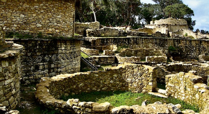
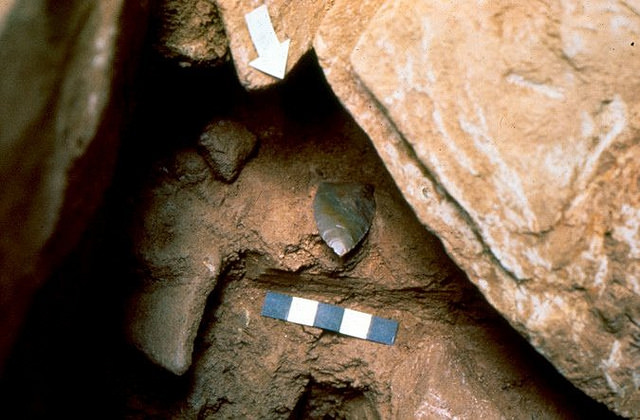
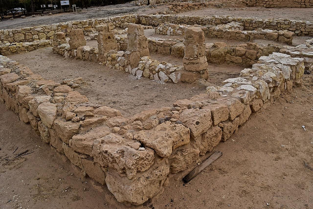
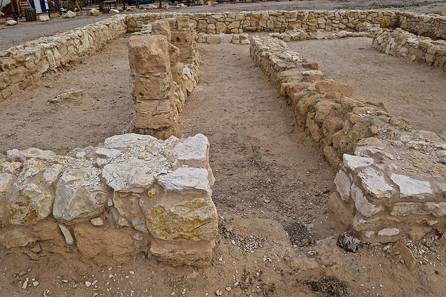
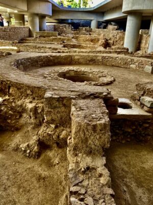
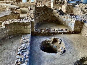
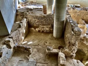
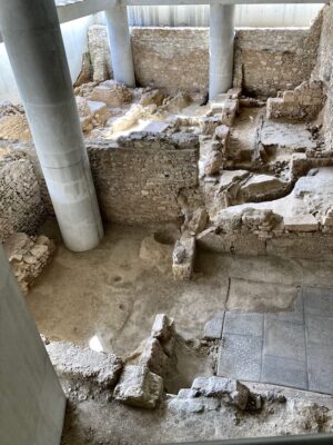
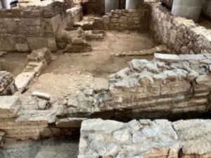
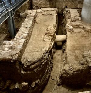
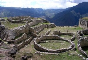
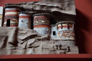
The citadel’s location, in the area’s cold and windy climate, was ideal as a storage facility for grains, other dry foodstuff and possibly, for short-time storage, dehydrated meat. It was also dedicated to the local animist cult, with buildings for permanent residents such as priests, civic leaders, and service staff. The circular structures were built for storage. They have no openings for either doors or windows; however, several were found to have small access ramps. The cone-shaped roofs were made of natural fibers tied onto a wood frame. There were openings for both access to storage from the top and ventilation at ground level to let in the dry mountain air. The reason for such a large food storage complex was primarily to answer periods of bad crops, among which were those generated by El Niño and La Niña climate events, which periodically decimated coastal and highland cultures. Each farmer may have contributed to a set quantity of products from their crops for storage under a levy or tax system.
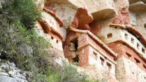
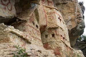
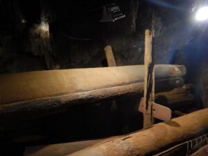
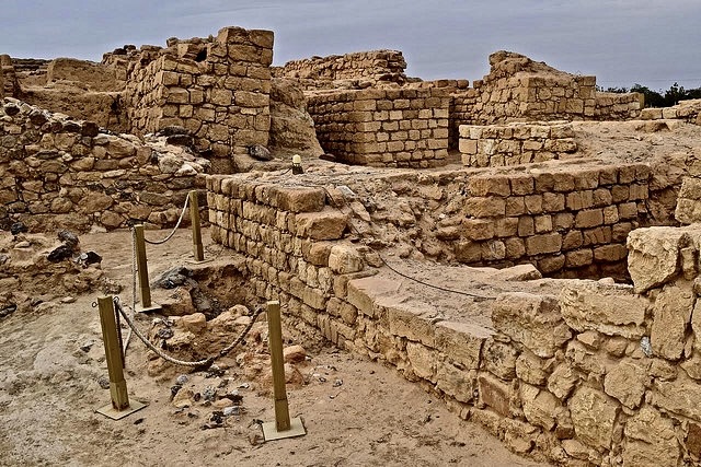
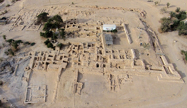
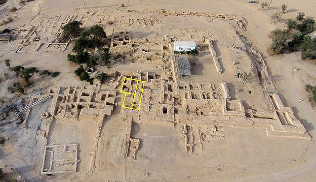
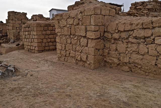
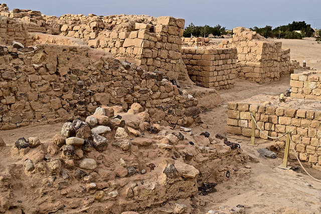
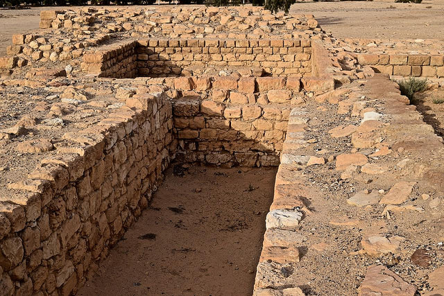
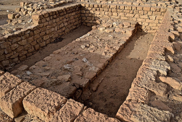
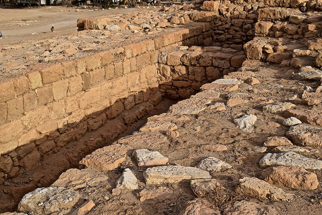
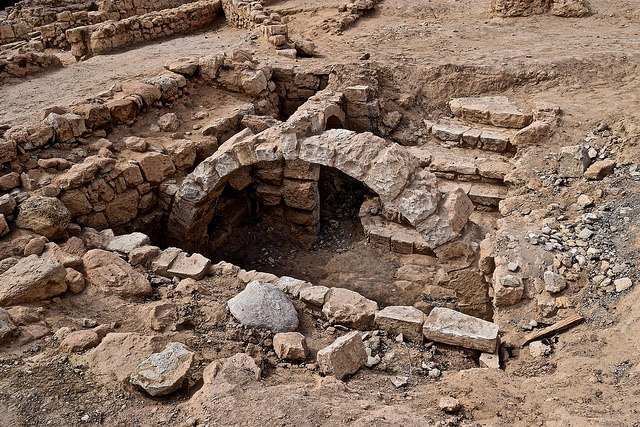
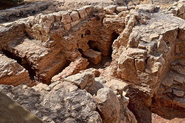
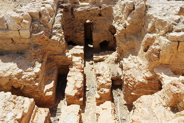
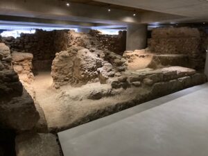
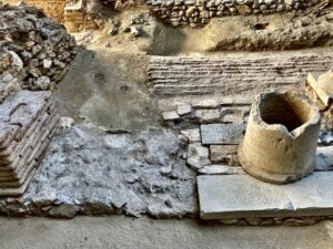
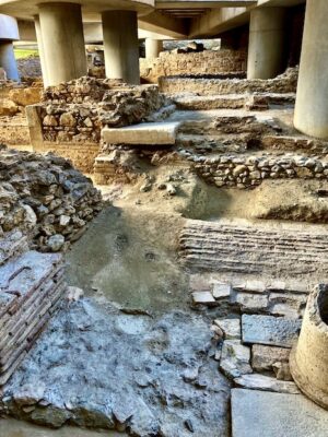
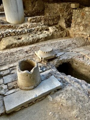
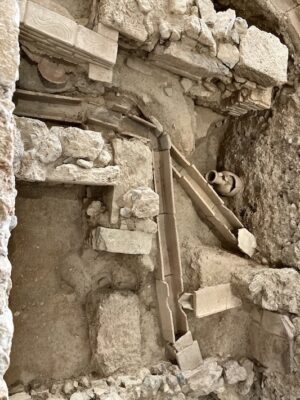
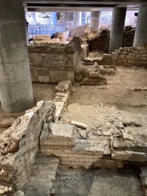
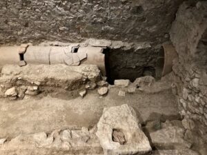
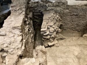
Kuélap is built in concentric tiers within which are over five hundred densely packed structures enclosed by the site’s outer wall, which is seventy feet high in its highest section (Narváez, 1996). Within the complex are several groups of circular buildings, as well as five square ones that may have housed administrators and service staff. Among the structures is the Atalaya, a forty-foot-high rectangular stone tower. Located at the northern low end of the plateau, it was a lookout post as well as a bastion from which to defend the site from attack along this lowest part of the ridge (Muscutt, 1993). At the opposite end of the site is an unusual circular structure called the Tintero (inkwell) for its inverted conical shape with sides flaring outward at its top. The neck of the inkwell forms a chimney that can only be accessed from above.
_____________________________
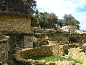
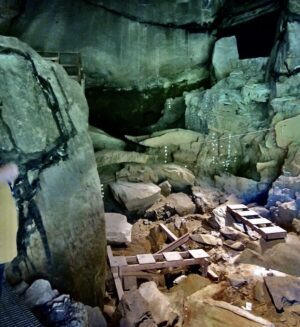
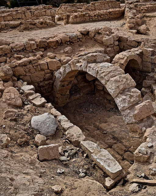
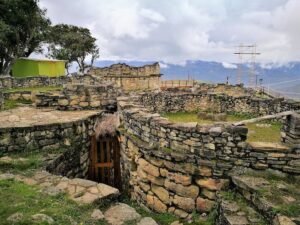
The fortress of Kuélap. Shown here are living quarters and storage. Elemaki, CC-BY-SA 4.0, Wikimedia Commons
_____________________________
_____________________________
_____________________________
_____________________________
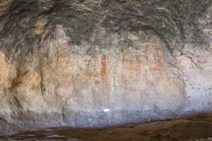
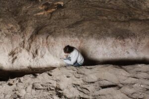
James McGraw, from the San Diego Museum of Man, noticed that the chimney is not fully vertical but deliberately tilted. Its dimensions correlate with the sun at noon on the day of the winter solstice, a key day in Andean rituals for agricultural cycles. At that time, the sun rays shine down the Tintero‘s top opening and projects a beam of light onto its floor. At its bottom were carved stones that may have served to track the movement of the sun, making the structure a solar calendrical observatory (Muscutt, 1993). Geometrical pattern motifs are found on select structures, together with representations of the jaguar and the serpent, both symbols found in most ancient cultures of the Americas. The jaguar is the dominant life-form in most domains by day or night, while the serpent is associated with nature’s rebirth, witnessed by the periodic shedding of its skin (molting).
When Bandelier (1907) and Langlois (1934) visited Kuélap, they noted that many of the niches in the buildings were used as open graves, for they found human remains on the outside of their walls, making the site both a living and a mortuary community. Even though the context for many of these burials is unknown, recent excavations have revealed the presence of many entombments within the site’s walls. Archaeologist Narváez, after counting over a hundred such burials, concluded that “in reality the outer wall is a cemetery” (1988). Recent excavations suggest that other burials could still be found within the site’s walls. Two trapezoidal entryways, about two hundred feet long and ten feet wide at the entry point, allowed access to the citadel. However, their width narrows down to allow only one person at a time to enter the guarded gate to the central plaza (Narvaez, 1988). A third narrow corridor opens west; it is difficult to access from the outside and was probably used to discard material in a ravine below.
Who built Kuélap is uncertain, for archaeological evidence is scant (Muscutt, 1998). Earlier dates indicate that it might have been originally conceived for defense against the expansion of the Chimú Empire, which exerted control over much of the central highlands (Kauffmann Doig, 1998). The site was likely visible from agricultural fields that lie west of the Utcubamba river. Church and Von Hagen report that many of the large communities that lie to the west of the citadel are in locations directly visible from the site’s outer walls (2007), such as the town of Chillo, in Kuélap’s shadows. The remains within the citadel’s walls were in all probability those of select ancestors of people living in nearby villages. Crandall points out that the social relationship between ancestor remains and living people, was an ongoing set of practices designed to reaffirm social ties to the ayllu or kin group (2012).
Based on Ruiz’s association (1972), the monumental construction and tombs probably began around the year 900. Southern sites, however, such as Gran Pajatén, Los Pinchudos and Revash, in today’s Rio Abiseo National Park, were occupied in Inca times (Bonavia, 1968, Church, Von Hagen, 2008). Other larger regional centers, besides Kuélap, appear to have developed between the eighth and tenth centuries. In the late nineteen-nineties, the area south of Leymebamba received much attention when pre-Columbian chullpas, (mausoleums or funeral houses), were found at Revash, fifty-two miles from Kuélap in the surrounding hills around Gran Pajatén, which may have been built at the height of the Chachapoya cultural florescence in the first millennium.
Karajia
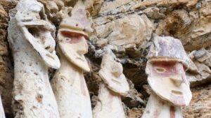
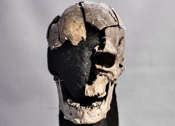
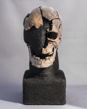
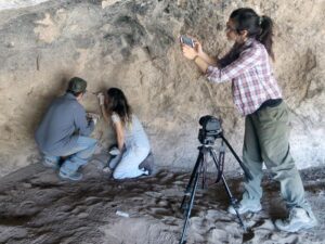
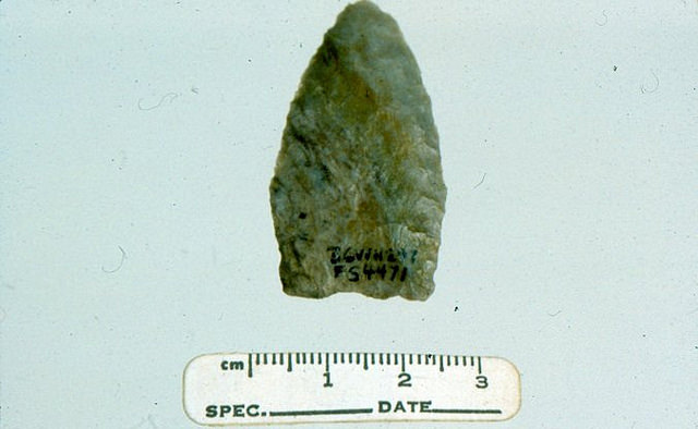
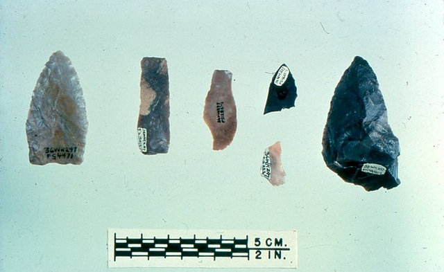
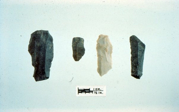
The citadel is an imposing socio-economic and religious complex, whose purposes were like those of other smaller sites. The common denominator with those sites is the prevalence of ancestor remains, which are found in either a coffin or wrapped up in funerary bundles placed in mausoleums. As Crandal (2012) notes, Chachapoya ontology, akin to other Andean people, was predicated on a collective relationship to ancestors who played an active role in reproducing social life. Coffins are called purunmatshus in the local language and were made to receive a single individual. The erect purunmatshus of Karajia in Luya province, are among the most eminent. They are found in large recesses carved in an abrupt rock face, that creates a rocky overhang, thus shielding them from the rain and helping in their preservation.
Their isolated location and overhang were at times insufficient against birds and rodents. They were studied by Kauffmann Doig and his teams during their field research which spanned from the late-1970s to the mid-2000s. The Karajia purunmatshus were found 985 feet up the rock wall overlooking the Aispacha River, each holding a family member or close relative. The coffins are made of clay mixed with natural fibers set on a wood frame; they portray a human shape that, at over eight feet in their upright position, is impressive.
Their appearance is chiefly due to the modeling of their heads and faces, the only anatomical reference to a human body. Their faces and bodies are painted with yellow, tan, and dark ochre designs that make them appear surrealistic and underline that they are men. Even though a few stands alone, they are commonly found in groups of four to ten standing on a thick mud base.
A space between the line of coffins at Karajia, shows that there were originally eight purunmatshus in the original group, but one of them (No.3), is recorded to have fallen in the river below during the violent 1928 earthquake (Kauffmann Doig, 2002). Above their heads, a mummified human skull was held in place by a spike. Of note, however, is that the skull did not belong to the individual inside the prunmatshu, but is from another party. We have no record of, nor do we know the reason why the mummified skull was placed there. Was it to record the hierarchical status of the departed? Neither do we have a history of the ancestors’ identities who, according to the collective memory of local people, point to ancestors of the mythic Ocspalin, a cacique or chief of the Conila’s ayllu or community, who built the bridge with the people over the Aispacha River. Why were the standing coffins placed in inaccessible locations? It seems that it was not so much to avoid eventual plunder, for at that time ancestors from all segments of society were fearfully respected and so were their resting places. The reason may be linked to the fact that those select ancestors were believed to hold powerful spiritual powers in the “other world.” At times, ancestors may raise the wrath of malevolent forces for the actions of their descendants.
In ancient Peru, the purunmatshus were only used by the Chachapoyas in their territory on the left bank of the Utcubamba river. Kauffmann Doig, in 1986, identified six types spanning from the sophisticated Type.A or Purunmatshu Regio at Karajia, to Types B, C and D, which varied through time and locations. The distinctive feature of B, C and D, is the migration through time of the head, made of compact clay on top of a stocky ovoid body without neck, to the chest and later to the belly. The absence of head applies to the more recent cone shaped Type E, while Type F is referred to as a pseudo-sarcophagus, for it is made of a semi-circular, four-feet-high wall made of clay placed in front of a rock face where, within the enclosure, bundled up mummies were found. In Type A, the mummified body inside was tightly wrapped in fine llama wool blankets in a seating or squatting position (the similarity with Wari mummies is striking), with small ceramics and stone votive items placed between the wrappings and at the feet of the ancestor.
______________________________
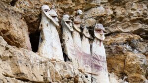
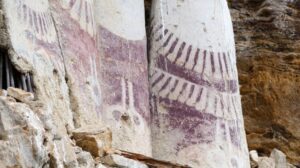
Above and below: The Karajia sarcophagi. BluesyPete, CC-BY-SA 4.0, Wikimedia Commons
______________________________
Detail
______________________________
Detail
______________________________
Under the Inca
In mid-fifteenth century, the Chachapoyas were incorporated into the Inca “Realm of the Four Parts” (the Tahuantinsuyu in Quechua), under the “son of the Sun,” the great Sapa-Inca in Cuzco, Pachacuti Inca Yupanqui (1418-1471). Pachacuti organized the kingdom into four regions or suyu: northwest, northeast, southwest and southeast, with Cuzco at the center. His son Topa Inca Yupanqui (1441-1493) would eventually extend the Tahuantinsuyu along the Pacific Coast to today’s western Ecuador, south central Bolivia, northwest Argentina, and most of Chile to the south. But before that, in the mid-fifteenth century the Sapa Inca conquered the powerful Chimú Empire on Peru’s north coast; his army then turned inland toward the Andes. The northeast (antisuyu) territory extended deep into the eastern slopes of the mountain range which was covered by a dense tropical forest. Garcilaso de la Vega (1539-1616) wrote that the Inca invasion of the Chachapoya territory started in the mid-1450s. The invaders went through repeated hard-fought battles in the challenging topography, but the Chachapoyas fought hard and were never defeated. The account does not include Kuélap, which may have been bypassed by the Inca armies. Historical sources relate that by the 1460s, after months of relentless battles and deadlocks, the Chachapoyas had no option but to concede to a bitter peace agreement. In accordance with the empire’s rules of occupation, Cuzco sent civil servants and army officers to oversee the territory’s towns and villages.
Furthermore, under the Inca’s rules of occupation, up to fifty per cent of the younger population was moved as mitmaq’ colonists to distant parts of the empire (Espinoza, 1967), while high ranking Chachapoya women were married to Inca administrators. The mummies of those Inca officials are found in mausoleums with their bundles placed side-by-side with those of Chachapoyas. As Crandal (2012) writes, Chachapoya ontology, akin to other Andean people, was predicated on a collective relationship to ancestors who played an active role in reproducing social life.
Gran Pajatén
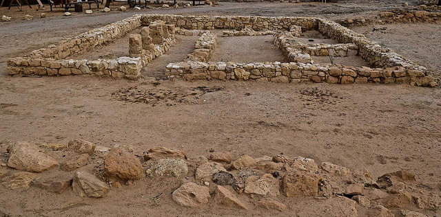
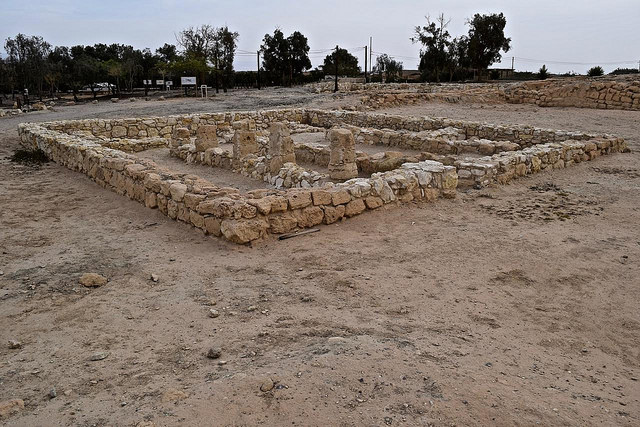
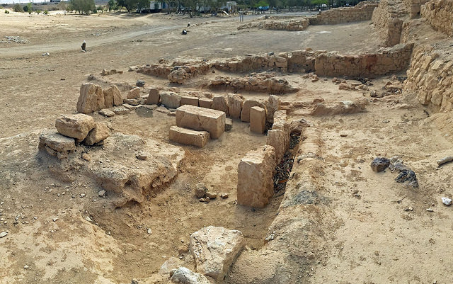
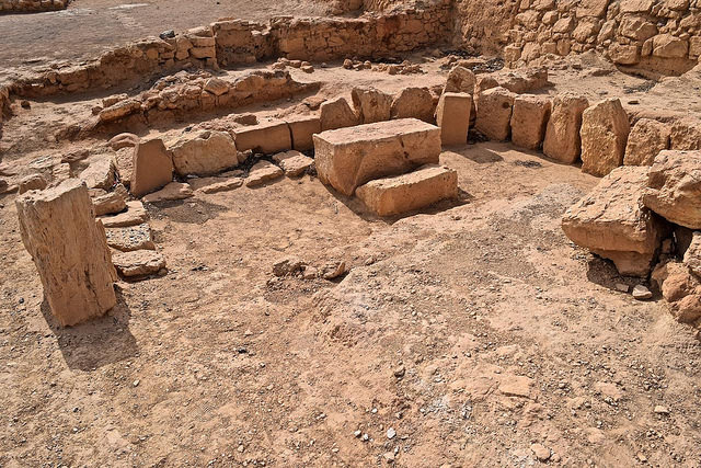
A smaller yet prominent Chachapoya site with unique particulars is the ancient city of Gran Pajatén, in the Andean cloud forest. Most sites are found between the Marañón and Huallaga rivers in the Rio Abiseo National Park. Gran Pajatén was discovered by Eduardo Peña Meza (1886-1968), but it was known before to people in surrounding villages and stands 9,350 feet on a five-acre hilltop above the Montecristo River, an affluent of the Abiseo River. Based primarily on architectural evidence, the settlement is unequivocally Chachapoya. The remains of over twenty-six circular stone structures, some with two levels, are built atop terraces with stairways. Initially several of them may have stood some fifty feet high with their high cone shaped roof supported by wood beams and covered with natural fibers (Bonavia, 1969, Davis, 1996).
Gran Pajatén is unique not only for its exceptional architecture, but for the number of symbolic and decorative motifs seen on its structures built in Inca times. Like Kuélap, besides being a religious locus, it was a granary depot and distribution center to answer recurring food scarcities. Unlike Kuélap, however, the site was most significant for its religious influence, attested by structures decorated with stone slates mosaic motifs, among which are human shapes and birds held in place with mortar. By and large, the recurrent patterns of most motifs are salient thematic elements that also bear similarities with Inca and Wari cultures. The walls of the second level of Circular Structure 1 are the most elaborate and best-preserved. The building technique shows finely cut limestone slates jutting out of the walls to create geometric motifs. The exceptions to the use of slates in human motifs are the heads, which were sculpted in the round from sandstone, and embedded in the slate design at the appropriate place through a spike jutting out from the head’s back. Kaufmann Doig notes that the schematic and geometric human figures are essentially those of a female that, as a mythical being, held various symbolic attributes.
____________________________
____________________________
The figures are repeatedly shown in a circular frieze that encircles Structure 1 and Structure 2, and singly on other buildings (1986). The main recurring stylized human motif is that of the powerful Pachamama. The earth-mother figure, which is shown in a seating position with legs bent at the knees and thighs spread out, indicates that she is giving birth to both humans and nature’s worlds.
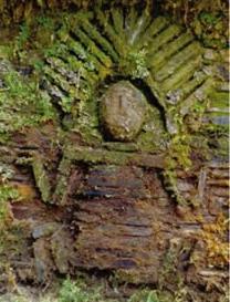
Pachamamma motif detail on Pajaten structure. Public Domain, Wikimedia Commons
The Pachamamas are found on both structures and are similar but for their stylized headgear. The first headgear is shown as a starlike crown, and may refer to bird feathers, probably those of the macaw from the Amazon. The second headgear is understood to be the wings of a bird of prey, probably that of the hawk, not the condor. The hawk, a foremost actor in the magico-religious beliefs and ceremonies of the cultures of the Andes tropical forest, is also found in other ancient societies. As Kauffmann Doig points out, the Pachamama “is the foremost fertility goddess who presided over planting and harvesting and is found in other cultures of ancient Peru” (2017). The Pachamama is the patron deity of most ayllus or localized social groups, self-defined as ancestor-focused kindred.
It was then believed that, among Pachamama’s abilities, was her ever-present creative powers that sustained life on this earth (1992). Ceramics analysis shows that Gran Pajatén was occupied as early as 200 BC, while stone and ceramics link the structures to early Inca occupation. So far there is no record of human remains, mummified or otherwise. The ancient city, like Kuélap, was a granary depot guarded by a strong force and backed up, it was believed, by powerful ancestors and the deities of another world. As Anselmo Lozano Calderón writes “The ancestral past of Andean and Amazonian cultures was replete with the esthetic and symbolic depiction of their existence, akin to the rhythms of nature, and grounded historically in their faith, their land and magic of the divine” (in Kauffmann Doig, 2017).
Los Pinchudos
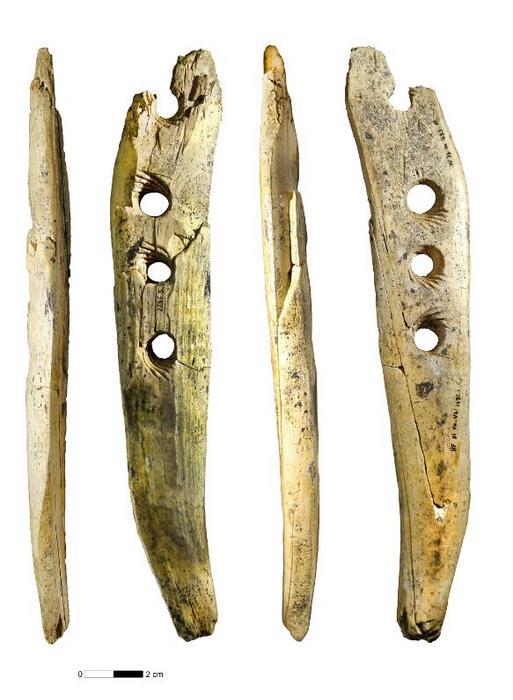
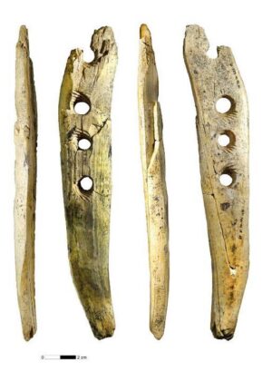
A day’s walk from Gran Pajatén, at 8,900 feet in the cloud forest, is the site of Los Pinchudos. It is another Chachapoya burial complex located in the Rio Abiseo National Park, in one of Peru’s northern Andean cloud forests. The site was named for seven mausoleums, two of them badly damaged. Los Pinchudos is notable for the carved wood figures displaying a prominent anatomy. They hang from the outside of the mausoleum’s walls below the stone awnings that protected them from the rain. The name “Los Pinchudos” is from local slang that stands for “the ones with penis.” Sculpted from hard wood, the twenty-inch tall Pinchudos dangle from a wood shaft, integral to the statue, that anchored it into the wall of the burial chamber. No mummies were found, but a few bones and pieces of wool from bundles indicated that the ancestors’ bundles were removed by the Europeans during the 16th or 17th century. The geometric symbolism used in the parietal ornaments is like the ones seen at Gran Pajatén and Gantumarca on the left bank of the Marañón river which, for their architecture, bear a close filiation with those of Los Pinchudos. Over five hundred years ago the five mausoleums were covered with painted clay whose residues were found on the back of one of the figures. We do not know if the Pinchudos mausoleums were each painted red, yellow-ochre, or white (Kauffmann 1980; Morales et al. 2002). The symbolic significance of colors was important associated with corresponding rituals, but those are unknown. Unlike purunmatshus made for one person, mausoleums harbored several mummified individuals each tightly wrapped in a bundle.
_______________________________
____________________________
Mummies and Mausoleums
Mummies and burials are rooted in people’s cultural and spiritual faith in a finite geographical environment. As for most cultures, those roots are primarily defined by language, traditions, and a common belief, which secure their “right of blood” to the soil where they were born and where their ancestors are buried, as opposed to the “right of land” claimed by invaders. In ancient Peru, mummification, or preservation of family members, rested on the belief that their death would be like their past life. They had no expectations about a paradise or a hell, a concept associated with Christianity that arrived with the Spaniards in 1532. Mummification was an ancient practice in Peru: witness the 420 mummy bundles from the Paracas Necropolis, 300-200BC (Tello, 1949). The process of mummification varied through time and place and followed strict imperatives beyond rituals, which were dependent on those of the local environment. In the case of Paracas, the area was, and still is, a dry desert with little humidity coming from the Pacific Ocean.
For the Chachapoyas and other cultures of northwestern Peru, however, the humidity factor was important in the process applied to preserving human remains. Trained people were probably members of shamanic fraternities of either gender, that may have been attached to the priesthood, and were dedicated to the task. The process required dehydration of the body in a cold, dry and well-ventilated location where the removal of the viscera and cleaning of the abdominal cavity took place. Organs in the thorax were not removed, nor were the eyes and brain. Organic substances such as ginger, other roots, and coca leaves were mixed in a light corn paste, which was then used to thoroughly clean and embalm the body. Cotton plugs, and a variety of plant leaves were introduced into the nose cavities as well as in the mouth, to preserve the appearance of the departed. The process was so skillful that the eyes’ sclera was preserved. The body was then placed in a tightly flexed seating position with legs and arms tied up against the body, the hands placed over the face. Each finger was wrapped before the body was tightly bundled up in fine llama wool fabrics. Between the wrappings were placed votive figurines or small items cherished by the departed. The bundle was then placed in a cold, dry and well-ventilated location for several weeks or months before being transferred permanently to its last resting place.
Mausoleums such as those seen at Revash, are called “house of the departed” in Quechua (Runasimi), and do not show Inca influence in their architecture. These funerary structures referred to as pukulio or tshullpas are known throughout Peru spanning from the Wari (500-1000) to the Chimú (900-1450). The Chachapoya mausoleums were built in an existing open corridor in the rock face that was enlarged and extended. The walls of the small structures are made of shaped stones set with mortar with a symbolic “roof.”
The roofs over the structures were of the gable or lean-to type but were not necessary since the tshullpas were already protected by the rocky overhang. According to local folklore, the roofs were made for ancestors to “feel at home.” Built close together, the mausoleums look like a little village, their walls covered with mud of a tan color.
_____________________________
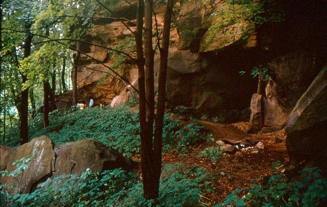
Revash Main Site – Funeral site of the Chachapoyas people. BluesyPete, above, and PsamatheM, below, CC-BY-SA 4.0, Wikimedia Commons
_____________________________
_____________________________
Not so inaccessible as the purunmatshus, over time the tshullpas were visited by people that damaged the mummies’ bundles in search of valuables. Unlike at Karajia, however, the mausoleums are collective with remains of select individuals of the same or extended family, for as in other parts of the Americas, not all progenitors qualified as ancestors. Revash’s distinctive features are symbolic figures painted red on the structures and on the rock face above the mausoleums, such as human shapes, local camelids (llama), and geometric motifs.
In most cultures of the Americas, red pigment is associated with blood, the stream of life. Cinnabar, a red pigment oxide powder, was used in burials, for it was believed to protect the departed soul’s “divine substance” and ward off malevolent forces while it traveled through the underworld. Other architectural particulars are cruciform shapes. Today, in ancient and traditional cultures in the Americas, the equilateral cross openings in structures or painted on ceramics, depict the four changing cardinal directions of the spiritual universe associated with their respective twenty deities and colors, such as red, yellow, black, and white for the Mayas. The equilateral Inca chakama cross holds the same symbolic significance. Each of the twenty right angles of the cross carries its own deity, while the steps between each arm of the cross are representative of andenes or terraces built in steep mountain slopes. Of note is that only funerary bundles of ascendant lineage members worthy of being venerated, were placed in mausoleums or in a purunmatshu. Many mausoleums dot the Chachapoya landscape such as Tingorbamba-Pueblo de los Muertos, La Petaca-Diablo Huasi, Laguna de los Condores and Huabayacu, among many.
* * * * * * * * *
One wonders why human remains have been so important to all cultures. Veneration of ancestors is found in the Pre-Pottery Neolithic (PPN-A,12,800-8,500BP), and much farther back in time. We have seen this concern at Kuélap, Los Pinchudos, and Revash among other sites in the Chachapoya landscape. As Paul Cornerton points out, repetitive rituals act as a mechanism to create communal memory (1989), and one should add identity. Constant to most ancient and traditional cultures today, is the belief in the permanence of life beyond life, hence the prominence given to forefathers believed to help in relieving the pains of life’s here and now.
The shape of funerary bundles recalls plant seeds about to sprout from their shells and was commonly associated with the rhythm of the seasons and the belief in an eternal return. As McAnany reminds us, “the cult to ancestors was integral to the cosmologies and traditions of most cultures in the Andean region and is well documented in those of Mesoamerica” (1995).
The phases of places and divinities follow the same fate as that of people, appearing and disappearing on the scene of life. The sixth Sapa-Inca of the Hanan dynasty, Huayna Capac (1464-1524), had two sons, Atahualpa (1502-1533), born in Ecuador and Huascar, born in Cuzco (1503-1532). Huayna Capac unwisely divided the empire between his two heirs. The northwest and the northeast were assigned to Atahualpa, while the southwest and the southeast, with Cuzco at the center of the realm, were allocated to Huascar. The decision proved deadly to the Inca empire. As expected, the brothers were soon at war with each other. The Chachapoyas in the northeast were drawn into the crossfire, and factions arose with some leaning toward Huascar, while others sided with Atahualpa. A major battle took place in the upper Andes that took the lives of over six thousand Chachapoya warriors. This tragedy so angered the population against Atahualpa, that it rose from rage to a full-fledged revolt. This massacre turned the Chachapoya population against the victorious Atahualpa, who exacted vengeance by killing their leaders and ordered all adolescents of both sexes deported to other parts of the empire (Keith Muscutt, 1998). Kuélap may have been bypassed by the Inca army because it might not have been militarily relevant at the time. Of note, however, is that more than 2,500 stones for slings were stashed in the Atalaya square tower, indicating that the citadel’s defenders were ready to fight off invaders. Large clumps of burnt roofing thatch, however, indicate that residents either burned the structures when the site was abandoned for unknown reasons, or that Kuélap came to a violent end. Whatever the outcome, for the next five centuries, remains of the ancestors buried in its walls were the citadel’s sole occupants.
________________________________________
____________________________________
References – Further Reading:
Federico Kauffmann Doig, 2017 – La Cultura Chachapoyas
Keith Muscutt, 1998 – Warriors of the Clouds
Federico Kauffmann Doig, 2009 – Construcciones de Kuélap y Pajatén
James M. Crandall, 2012 – Chachapoya Eschatology: Spaces of Death in the Northern Andes
Warren B. Church, Adriana Von Hagen, 2007 – Chachapoyas: Cultural Development at an Andean Cloud Forest Crossroads
Federico Kauffmann Doig, 1988 – Ultratumba entre los Antiguos Peruanos
Robert Bradley, 2005 – The Architecture of Kuelap
Garcilaso de la Vega, 1986 – La Florida del Inca (1605)
______________________________
Advertisement
______________________________


 If you liked this article, you may like


