

CELL PRESS—What did an ancient Chinese emperor from 1,500 years ago look like? A team of researchers reconstructed the face of Chinese Emperor Wu of Northern Zhou using DNA extracted from his remains. The study, published March 28 in the journal Current Biology, suggests the emperor’s death at the age of 36 might be linked to a stroke. It also sheds light on the origin and migration patterns of a nomadic empire that once ruled parts of northeastern Asia.
Emperor Wu was a ruler of the Northern Zhou dynasty in ancient China. Under his reign from AD 560 to AD 578, Emperor Wu built a strong military and unified the northern part of ancient China after defeating the Northern Qi dynasty.
Emperor Wu was ethnically Xianbei, an ancient nomadic group that lived in what is today Mongolia and northern and northeastern China.
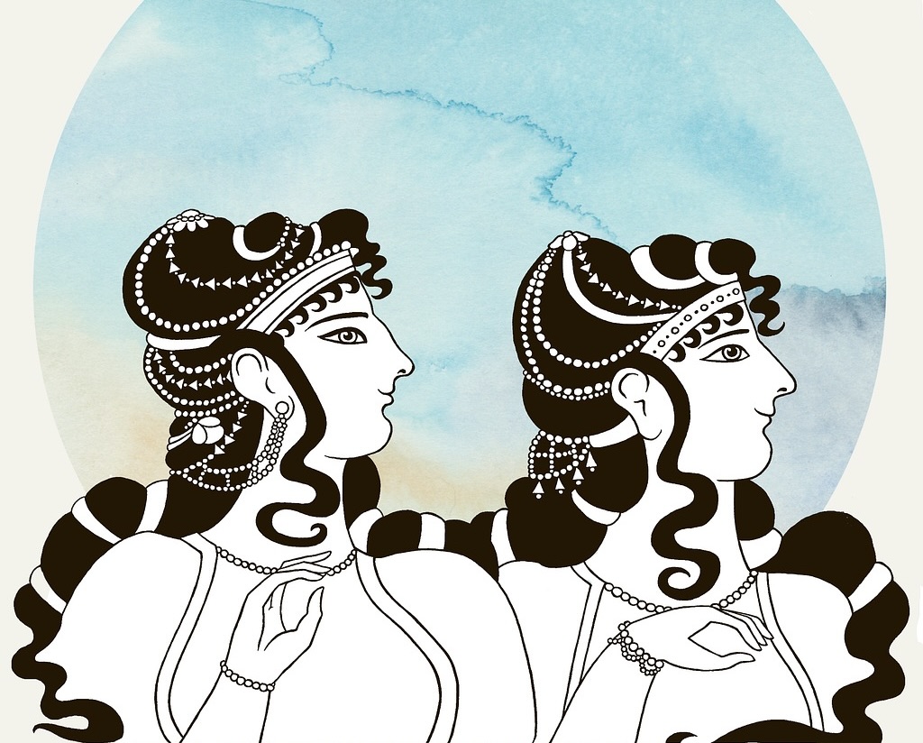
“Some scholars said the Xianbei had ‘exotic’ looks, such as thick beard, high nose bridge, and yellow hair,” says Shaoqing Wen, one of the paper’s corresponding authors at Fudan University in Shanghai. “Our analysis shows Emperor Wu had typical East or Northeast Asian facial characteristics,” he adds.
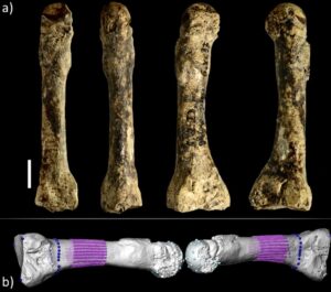
In 1996, archaeologists discovered Emperor Wu’s tomb in northwestern China, where they found his bones, including a nearly complete skull. With the development of ancient DNA research in recent years, Wen and his team managed to recover over 1 million single-nucleotide polymorphisms (SNPs) on his DNA, some of which contained information about the color of Emperor Wu’s skin and hair. Combined with Emperor Wu’s skull, the team reconstructed his face in 3D. The result shows Emperor Wu had brown eyes, black hair, and dark to intermediate skin, and his facial features were similar to those of present-day Northern and Eastern Asians.
“Our work brought historical figures to life,” says Pianpian Wei, the paper’s co-corresponding author at Fudan University. “Previously, people had to rely on historical records or murals to picture what ancient people looked like. We are able to reveal the appearance of the Xianbei people directly.”
Emperor Wu died at the age of 36, and his son also died at a young age with no clear reason. Some archaeologists say Emperor Wu died of illness, while others argue the emperor was poisoned by his rivals. By analyzing Emperor Wu’s DNA, researchers found that the emperor was at an increased risk for stroke, which might have contributed to his death. The finding aligns with historical records that described the emperor as having aphasia, drooping eyelids, and an abnormal gait—potential symptoms of a stroke.
The genetic analysis shows the Xianbei people intermarried with ethnically Han Chinese when they migrated southward into northern China. “This is an important piece of information for understanding how ancient people spread in Eurasia and how they integrated with local people,” Wen says.
Next, the team plans to study the people who lived in ancient Chang’an city in northwestern China by studying their ancient DNA. Chang’an was the capital city of many Chinese empires over thousands of years and the eastern terminus of the Silk Road, an important Eurasian trade network from the second century BC until the 15th century. The researchers hope that the DNA analysis can reveal more information about how people migrated and exchanged cultures in ancient China.
__________________________________
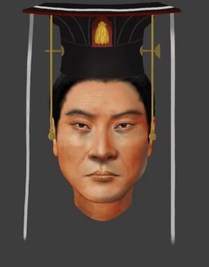
The facial reconstruction of Emperor Wu who was ethnically Xianbei. Pianpian Wei
__________________________
Article Source: CELL PRESS news release.
*Current Biology, Du et al. “Ancient genome of the Chinese emperor Wu of Northern Zhou” https://cell.com/current-biology/fulltext/S0960-9822(24)00240-9
__________________________
Advertisement

See the incredible archaeology, architecture, and art of northern Spain. A unique tour with special expert guides and lecturers through the collaboration of Popular Archaeology Magazine and Stone & Compass Tours. Not to be missed. Read More About It: https://popular-archaeology.com/article/northern-spains-triple-a-archaeology-architecture-and-art/.
__________________________


