
Of all the extinct hominins that came before us, we know most about the Neanderthals, the closest and most recent human species besides our own. The archaeological and fossil evidence has simply been more prolific for them, outside of Homo sapiens, our own species. The following article combines re-edited content of two previously published major feature articles bearing on Neanderthals, along with a review of the latest findings and research. It sheds new light on our understanding of who they were, how they lived, and how and why they went extinct. This story will begin, paradoxically, with their final days at the southern edge of present-day Europe….
___________________________
The Last Neanderthals
Gibraltar, a small country jutting out into the Mediterranean from the southern fringe of Spain, is perhaps best known by many around the world as a tourist destination. From atop its iconic Rock (popularly known as the Rock of Gibraltar) — the imposing natural edifice of Jurassic limestone that serves as its signature symbol — one can see as far as the coast of Morocco across the Strait, and neighboring Spain on the other side of the Bay. The population of this tiny English-speaking British possession, though robust for its geography, boasts little more than 32,000 people. Looking back in time, its population was even less, but spanned a rich history of settlements that included ancient Phoenicians, Carthaginians, and Romans. And prehistory…….
In recent years Gibraltar became a prominent chapter in the developing story of humanity’s close prehistoric cousin-ancestors — the Neanderthals — because some archaeological finds recovered from a series of sea caves known as the Gorham’s Cave Complex (consisting of the Gorham’s, Vanguard, Bennet and Hyaena caves), along Gibraltar’s rugged southeast coast, have yielded artifacts that suggest that a group of Neanderthals persisted beyond the generally accepted end-time for Neanderthals (about 39,000 — 40,000 years ago). The dating from the cave sediments indicated a Neanderthal presence perhaps as late as 30,000 – 20,000 BPE, based on a sequence of no less than 22 AMS dates. This would make these Neanderthals the last known surviving group in a world that by that time was dominated by Homo sapiens. Their artifactual remains included numerous objects like spear-points, knives, and scraping devices with characteristics identified as Mousterian, an industry that has been typically associated with Neanderthals.
It was a remarkable finding.
_______________________________

Gibraltar and its famous “rock” as it exists today.
_______________________________
_______________________________

_______________________________

A typical Mousterian point.
_______________________________
Above and below: Gibraltar 1 Neanderthal Skull. Jononmac46, Wikimedia Commons, and AquilaGib, Wikimedia Commons
_______________________________

The Gorham’s Cave Neanderthals
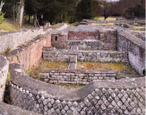
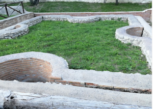
When first inhabited by humans tens of thousands of years ago, the Gorham’s Cave Complex was approximately 5 kilometers from the shore. Sea level changes over the ensuing millennia, however, have seen the shoreline advance to only a few meters of the cave openings, where the shore remains to this day. Even so, despite the greater distance from the sea in prehistoric times, the inhabitants must have benefited from the sea’s proximity and the aquatic resources it afforded, in addition to the inland sources nearby. Archaeological evidence from Vanguard Cave, for example, has shown that the inhabitants selected, collected, transported and consumed mussels or mollusks and limpets in the cave and the use of hearths for burning to open the shells. Further evidence indicated they were transporting, processing and consuming seal, monk seal, ibex, red deer, bream, dolphins, sea urchins, and bluefin tuna. Archaeologists have thus determined that these inhabitants had a varied diet, capitalizing on the food resources available from both the aquatic and inland environments.
Although not beyond dispute, an especially intriguing discovery relates to the finding of what appears to be an intentionally scratched floor in Gorham’s Cave in 2012. As a series of deeply-etched lines in a criss-cross pattern on the surface of a ledge about 330 ft from the cave entrance, they appeared to be eight lines that seem intentionally arranged in two groups of three long lines, intersected by two shorter lines. At least 39,000 years old and found below undisturbed sediment where numerous Mousterian stone tools were recovered, many archaeologists suggest that the lines were representative of symbolic behavior, a trait that has not been associated with Neanderthals without debate and controversy.
These finds, among others, have suggested a level of sophistication that most archaeologists have traditionally attributed to Homo sapiens, and that have not typically been found in contexts where Neanderthals have been known to exist in other parts of Eurasia.
So were they in fact Neanderthals, and not Homo sapiens? Although the famous Gibraltar 1 skull was found on the north face of the Rock of Gibraltar at Forbes Quarry in 1848, no equivalent fossil finds have yet emerged from the Gorham Caves Complex. Nonetheless, the Mousterian artifact assemblages found in association with the same levels containing processed animal remains in the caves suggest that they were Neanderthals, and until new information and fossil finds emerge, this suggestion persists with some measure of validity.
Notwithstanding their late persistence on the Paleolithic scene, however, this group of Neanderthals did finally meet their end. Clive Finlayson of the Gibraltar Museum and colleagues drew the following conclusions as noted in a 2008 study published in Quaternary International :
“Jime ́ nez-Espejo et al. (2007) have shown that the most inhospitable conditions of the previous 250 ka BP affected the region surrounding Gibraltar between 22.5 and 25.5 ka cal BP (dates were calibrated to allow direct comparison with marine core sequences) and have linked this with unstable conditions, extremely cold, arid and highly variable related to Heinrich event 2 (HE2) that led to the final disappearance of the Neanderthals. This study was based on new data from marine cores as well as an extensive literature concerning marine palaeoenviromental reconstructions (e.g., Cacho et al., 2002; Martrat et al., 2004; Moreno et al., 2005). We suggest that this event, particularly severe and short-lived around 24ka cal BP, would have been sufficient to kill off any surviving Neanderthals.”*
Thus, according to Finlayson and colleagues, it was the changing climate that saw the end of the Neanderthals at the Gorham’s Cave Complex — and perhaps other locations in the extreme southern part of the Iberian Peninsula — where the last known surviving Neanderthals may have made their last stand before disappearing into oblivion.
_______________________________

A Neanderthal engraving? AquilaGib (Stewart Finlayson, Gibraltar Museum)
____________________________
Pushing Up the Timeline on the Neanderthal Presence
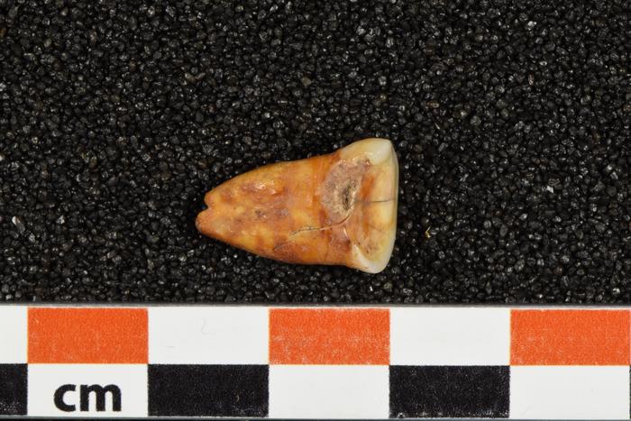
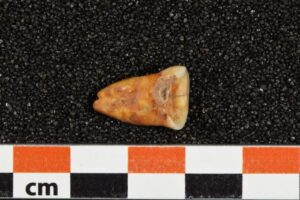
While Gorham’s cave provides perhaps the best known example of the suggested presence of Neanderthals on the European subcontinent later than 40,000 years ago, new discoveries and research are pointing to additional locations where they persisted after the advent of Homo sapiens on the Paleolithic scene. Notably, a number of sites on the Iberian peninsula have yielded some surprising but not altogether undisputed finds attesting to this contention. For example, at the Gruta Nova da Columbeira, just north of Lisbon, Portugal, archaeologists recovered more than 8,500 artifacts in the early 1960’s, then later, a separate team unearthed Neanderthal teeth remains dated from 26,400 to 28,900 B.P. At Lagar Velho, a rock shelter in Portugal’s Lapedo valley, a mostly complete skeleton of a Neanderthal/Homo sapiens hybrid child determined to be 4 years old at death was found associated with pierced shell and red ochre. It was dated to about ca. 24,500 year B.P. At the cave of La Carihuela in Piñar, Granada, Spain, scientists uncovered Neanderthal bone remains that date possibly to about 25,000-23,000 years ago; and in Malaga province, Spain, the cave of Zafarraya yielded a Neanderthal femur arguably dated to about 29,000 years old. The cave is known for a Neanderthal occupation at about 33,000 years ago, and perhaps as late as 27,000 years ago, as well as evidence of a Neanderthal ecosystem determined to be about 30,000 years old.
___________________________________

Remains of mollusks and barnacles from the Bajondillo cave, in Torremolinos, Spain. They were consumed by Neanderthals about 150,000 years ago. Miguel Cortés-Sánchez et al., Wikimedia Commons
_________________________________
Recent Revelations from New Research
Aside from Gorham’s cave and other recently reported sites and discoveries bearing on Neanderthal persistence through time, the past decade has seen a surge in new information from other sites, affording clues about who the Neanderthals really were, based on insights and discoveries made through archaeological excavation and investigation, new fossil discoveries, improved methods in dating, and new developments in the study of ancient proteins and ancient DNA. April Nowell, a Paleolithic archaeologist and Professor of Anthropology at the University of Victoria, Canada, has summarized many of the recent developments in the 2023 issuance of Annual Review of Anthropology in her popularly referenced article, Rethinking Neandertals. The article reviews the current state of knowledge and research as it applies to brain and cognition; social and family structure; growth and development; sexuality; disease, inbreeding and introgression; blood groups; symbolic behavior; and use of resources and subsistence. This research is beginning to paint a portrait of the Neanderthal as a being more like us than we previously thought, including the tendency to live in small family groups, bury their dead and care for each other, along with the already mentioned evidence for interbreeding (supporting the contention that they were not only like us but also liked us). Of particular note are the strides that have been made in understanding Neanderthals in the areas of the brain and cognition, symbolic behavior, and use of resources and subsistence as salient factors that contributed to their enduring persistence for over 500,000 years, and yet their subsequent demise around the time of Home sapiens’ entrance on the scene of prehistory….
The Neanderthal Brain and Cognition
Recent studies have provided clues that Neanderthals and Homo sapiens were both comparatively different yet similar in cognitive ability. Earlier morphological studies have shown that Neanderthal brains were at least as large, if not a bit larger, than those of Homo sapiens. However, new research has indicated some important differences in brain structure and anatomy. For example, a study by Kochiyama et al. (2018) that produced a 3D reconstruction of the Neanderthal brain indicated that Neanderthals had smaller cerebellar hemispheres than Homo sapiens. This suggested that Neanderthals were less sophisticated with language communication, were less flexible in their thinking, and possessed a more limited memory capacity. In another study by Pinson and colleagues published in 2022, they found that Homo sapiens produced more neurons and greater neuron connectivity than Neanderthals. On the other hand, research has suggested that Neanderthals and Home sapiens had similar auditory capacities.
The jury is still very much out when it comes to drawing definite overall conclusions about the similarities and differences between Neanderthal and Homo sapiens cognition, but work goes on and their is little doubt that much more will be learned as further study progresses.
Symbolic Behavior
Historically, scholars have attributed symbolic thinking exclusively to Homo sapiens, the ‘last hominin standing’ on the prehistoric hominin timeline. It goes without saying that the evidence supporting this has been prolific. But scientists have now uncovered new clues to a Neanderthal capacity to express themselves abstractly, or symbolically. Cave painting attributed to Neanderthals, such as hand stencils, lines and dots, have been found in a small number of Spanish caves, including La Pasiega, Maltravieso and Ardales. Digital (finger) tracings in soft sediment dated to 57,000 years ago were found in the La Roche-Cotard cave in France are suggested to have been made by Neanderthals, given the time period. A 51,000-year-old engraved giant deer phalanx was found at a site (Einhornhohle) in Germany. Cross-hatching on the interior of Gorham’s Cave (see above) has ben suggested to be the work of the Neanderthal occupants. What appear to be purposefully and systematically collected large herbivore crania (especially those with horns) were found at the Cueve Des-Cubierta cave site in Spain. All of these are remarkable and curious finds, though not without intense scholarly debate.
___________________________

Were Neanderthals the first artists?
___________________________
Somewhat less disputable is the increasing evidence of Neanderthal bodily adornment, another cultural behavior traditionally ascribed exclusively to Homo sapiens in prehistory and observable in known hunter-gatherer societies historically and even today. Recent examples of suggested Neanderthal ‘body culturing’ include: the remains of a necklace made from eight white-tailed eagle talons discovered at the site of Krapina in Croatia; the discovery of talons of large diurnal raptors at various Neanderthal sites, the study of which suggested the possibility that they were used for bodily adornment; feather remains of birds found at various Paleoarctic Neanderthal sites suggest that they may have been used to wear for some cultural reason; and painted and perforated marine bivalves found at other Neanderthal sites could give clues of use as personal ornaments. Materials or substances that could be used for painting found at one or more Neanderthal cave sites have suggested the possibility that they may have been used for painting on the body.
Subsistence Practices and Resource Use
Neanderthals have conventionally been depicted as brute prehistoric humans whose lives were dominated or characterized by big game hunting. While megafauna and the activities Neanderthals employed around the activity of pursuing and killing them were, based on the evidence, a major part of their living, recent discoveries and studies have significantly expanded from this view. As it turns out, they were actually more sophisticated and diverse than scientists have previously thought. For example, some studies have indicated that Neanderthals employed ambush hunting as a means of acquiring food, a strategy thought previously to have been exclusively characteristic of Homo sapiens. Likewise, another study showed that Neanderthals hunted and butchered adult male elephants at the site of Neumark-Nord in Germany. This study implied that this operation required larger group cooperation and a more sedentary lifestyle than previously thought for Neanderthals. Moreover, some new research suggests they hunted birds, as well as small prey, in some cases even to obtain their pelts, possibly for making clothing and other uses.
A variety of plant use is no longer exclusive to Homo sapiens. The oldest known creation and use of cordage is now attributed to Neanderthals. At the Abri du Mars rock shelter in France, archaeologists discovered a fabric (twisted) of fiber securely adhering to a Levallois flake, a type of lithic associated with Neanderthals and dated to between 41,000 and 52,000 years ago. The authors of the resulting research study note that twisted fibers were the basis of inventions such as rope, nets, bags, and other objects of vital daily use. Additional discoveries and studies have also indicated that Neanderthals manufactured adhesives from plants, used a variety of different plants for what appeared to be medicinal purposes, and consumed a variety of different plants as part of their diet.
Neanderthals are already long known to have created adhesives from substances such as birch bark and resins for making their hunting tools. But most recently, some artifacts originally recovered from the site of Le Moustier, a Middle Paleolithic site typically associated with Neanderthals, were analyzed and suggested to be the earliest evidence in Europe for the use of ochre – a clay pigment containing iron oxide that was often used by Homo sapiens – to produce a “gripping” adhesive used for using a variety of tools.
Landscape modification may also have been among their skill sets, as archaeologists unearthed evidence at the 125,000-year-old site of Neumark Nord in Germany that they may have purposefully cleared space of trees and vegetation to create a more open living space. At another site, the Riparo Bombrini site in northwestern Italy, scientists analyzed artifacts and features discovered in Protoaurignacian and Mousterian levels of the site and concluded that both Neanderthal and Homo sapiens group occupants of the site organized and utilized the space in very similar ways. Said Amélie Vallerand, a doctoral student at the University of Montreal who led the research: “Like Homo sapiens, Neanderthals organized their living space in a structured way, according to the different tasks that took place there and to their needs….” (As stated in a published article by the University of Montreal). There were also some important differences, however: Neanderthal occupations, for example, showed lower intensity use in comparison to the Homo sapiens.
Family Life and Death
Nothing about the Neanderthals hits closer to home than what scientists have uncovered related to:
families and community….
 More data is emerging that supports the notion that Neanderthals were not substantially different than us when it comes to being together as families. To cite just one recent discovery, for example: at the Chagyrskaya Cave in Siberia archaeologists have unearthed as many as 80 bone fragments, including teeth, along with animal bones and several hundred thousand stone tool objects. DNA was recovered from bones that were collectively identifiable as eight adults and five children. Analysis revealed a father with a teenage daughter, as well as a boy and adult woman who were related less directly (the woman perhaps a grandmother, cousin or aunt). These individuals, based on further investigation, seemed to have lived within the cave at the same time. Additional analysis suggested that the individuals who lived in this cave were part of a small community, with females migrating between communities. And 80,000-year-old hominin footprints from a single brief occupation event discovered at the site of Le Rozel in France, as documented through a study published in September, 2019 in the PNAS, supports the suggestion of a small Neanderthal social group. The group consisted of individuals ranging in age from early childhood to adult, with most of them children. Were some of these individuals part of a family, or multiple families? The research cannot conclude such, but in any case, this was clearly a small community.
and death and caring….
Regarding the issue of death, the most recent example of discovery occurred at the Neanderthal site of La Ferrassie in France, where scientists discovered the skeleton of a 2-year old child who was, based on examination of the context, suggested to have been intentionally buried. The instance adds to a number of other discoveries that have pointed to the possible Neanderthal practice of personally regarding their deceased by burying them, just as Homo sapiens do.
______________________________
______________________________
Much has been written about this, and although the attributed practice remains a topic of debate among scholars, there is more than one site that many scientists suggest supports the contention. No site has been more prominent than Shanidar cave as an example illustrating the practice….
______________________________
The Case for Shanidar
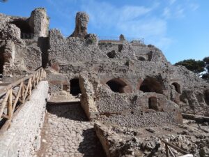
Well more than 50 years had passed since archaeologists last walked and worked within the massive Shanidar cave on the northern fringe of Iraq, when anthropologist Ralph Solecki led a team from Columbia University to the site. With help from local Kurdish workers, his team excavated and, along with hundreds of stone tools and animal bones, uncovered the skeletal remains of at least eight Neanderthals, two of them infants, and debatable evidence that one of the adult Neanderthals may have been deposited or buried with flowers. Based on dating at that time, their ages spanned a range between about 65,000 and 35,000 years BCE. For one location, it was a truly remarkable haul and made for sensational news for its time.
But that was then. Since those excavations closed in 1961, the cave has remained largely silent. Publications and scholarly debate about the famous finds have defined their story. One of the skeletons recovered during those excavations (‘Shanidar 3’) is at this writing curated and displayed at the Smithsonian Institution, and another, consisting of the leg and foot bones of what was identified as a tenth Neanderthal, was actually discovered in 2006 while Melinda Zeder, currently Curator Emeritus of Old World Archaeology and Archaeozoology at the Smithsonian’s National Museum of Natural History, was sorting a collection of bones documented to have come from the site. The others (Shanidar 1, 2, and 4–8) are thought to have remained in Iraq but possibly lost during the 2003 invasion. Casts of these bones, however, are currently curated at the Smithsonian.
It wasn’t until 2011 when Professor Graeme Barker of the Department of Archaeology at the University of Cambridge was invited to initiate a new season of excavations with a new team. The efforts were suspended in 2014 because of an ISIS threat, but then resumed in 2015. The team’s objective was to acquire new deposit/sediment data that could be analyzed using updated techniques and methodologies. “We thought with luck we’d be able to find the locations where they had found Neanderthals in the 1950s, to see if we could date the surrounding sediments,” said Barker.* But during the process of digging and examining the sediments at the location where Solecki’s team had dug more than 50 years ago, something new and very exciting began to emerge.
More bones.
With this, Emma Pomeroy, a biological anthropologist and osteologist with the University of Cambridge, was called upon to join efforts at the site.
______________________________

View of the entrance to Shanidar Cave. Graeme Barker
______________________________
______________________________

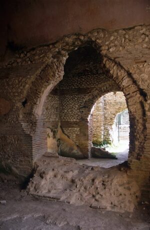
Looking out from Shanidar Cave, down to the valley of the Upper Zab river and the
mountains beyond — the rugged landscape of North – East Iraqi Kurdistan. Wider view of the
location of Shanidar, in the foothills of the Baradost Mountains of North – East Iraq. Kurdistan. Graeme Barker
Shanidar Z
Although time and new deposits have somewhat altered the cave interior with the passage of five decades, the view out from the cave has changed little over time. Its high, cliff-face entrance opens over a dramatic landscape below, lush with green foliage and punctuated by flowering plants during the spring. Ibex can be seen scaling the surrounding cliffs during the day, with howling wolves often breaking the silence at night. Though the working temperatures are pleasant in the spring during the year’s early field season, it can climb to an uncomfortable 42 + degrees Celsius in September. On this stage, the new team headed by Barker began to dig, dividing their digging activities into two field seasons a year, one in the spring and the other in early fall. With Pomeroy now on hand to help with identifying and analyzing the bones, they continued to dig and clean the wall of the old Solecki trench.
Soon, a rib emerged from the wall, then a lumbar vertebra, and then the bones of curled fingers of a clenched right hand. Following that, during 2018-19, they uncovered what appeared to be a complete skull, though massively crushed or flattened by thousands of years of sediment that had accumulated since its first deposit. “It was hugely exciting,” said Pomeroy. “We hadn’t been able to tell the skull was there when we first saw the remains in the trench wall, and it took some time to excavate all the layers above so that we could reveal the remains in plan. The edge of the right eye socket was the first part to be exposed, and immediately I knew it was part of the skull, meaning there was much more to this individual than we had originally seen from what was sticking out of the trench wall.”
With new vigor enhanced by excitement, they continued to dig. But as would be expected in a cave left untouched for decades, it was not easy. “The original trench was very deep (14m at its deepest), and had stepped sides and huge rocks sitting on the edge at the surface and through some of the strata,” recounted Pomeroy. “Over the years, the sections (walls) of the trenches had become less stable as the trench was left open and filled up slowly [with sediment]. Plus the area has seismic activity. One huge rock on the edge of the trench in Solecki’s time — probably larger than a typical car — had become dislodged into the trench in the intervening years. So safety was a concern.” Luckily, expert field archaeologists from Canterbury Archaeological Trust with knowledge about section excavation safety were employed. “For activities like wet-sieving, we had to carry all the sediment we removed down the side of the hill and had a flotation tank made locally, which works excellently under the supervision of Dr Evan Hill from Queens’ University Belfast. But it did mean carrying all the sediment we excavated down the hill every day.”
Excavation eventually revealed more upper body bones, the upper torso almost to the waist. All in all, the preliminary analysis indicated some tantalizing observations.
“What we have found is the articulated skeleton of the upper body of an older adult Neanderthal,” described Pomeroy. That relative age could be estimated based on analysis of the teeth, indicating a “middle-to-older aged adult”. “The skeleton was reclining on its back, with the left arm tucked under the head, and the right arm bent and sticking out to the side. We don’t yet know if the individual was male or female. This skeleton is directly adjacent to where Ralph Solecki’s famous Shanidar 4 ‘flower burial’ was found, and indeed it seems that the lower part of the body of the [newly found] Neanderthal was removed when Shanidar 4’s skeleton was recovered in a block of sediment by Solecki’s team in 1960, since they didn’t realize this new individual was there. At the time, they also didn’t realize the extent of the remains they had cut through, and they never had the opportunity to return to the site and re-investigate what they left behind.”
The date of this new find?
Early analysis suggests at least 70,000 years B.P.
By itself, this new articulated Neanderthal skeleton (designated ‘Shanidar Z’ by archaeologists) was remarkable enough. But in the context of the other finds recovered from the cave decades ago, it may promise even greater significance. What is its import? To answer this question, scientists had to consider the history of the other finds and the data and interpretation of the discoveries from Solecki’s previous excavations.
__________________________

Ribs and spine of the Neanderthal emerging from the sediment in Shanidar Cave.
Graeme Barker
__________________________

The bones of the Neanderthal’s left hand emerging from the sediment in Shanidar Cave.
Graeme Barker
__________________________
The bones of the Neanderthal’s left arm and ribs in situ in Shanidar Cave.
Graeme Barker
__________________________

The spinal column of the Neanderthal immediately after removal in a small block of the surrounding sediment. The bones are extremely delicate and embedded in layers of silt – the matrix. They are transported to Cambridge where they are scanned, conserved and micro-excavated to slowly remove the bones from the matrix.
Graeme Barker
__________________________
The Neanderthal skull, flattened by thousands of years of sediment and rock fall, in situ in Shanidar Cave, Iraqi Kurdistan.
Graeme Barker
__________________________

Illustration of the possible burial position of the new Neanderthal remains from Shanidar Cave; the stone behind the head is shown in grey.
Emma Pomeroy
The Shanidar Neanderthals
The Shanidar Cave has given us arguably some of the most tantalizing and telling insights into the Neanderthal species. Who were these people? How much were they like us? The analysis of the finds, and especially the forensic analysis and interpretation of the Neanderthal skeletal remains, has opened an intriguing window and helped scientists answer these questions. In addition to Shanidar Z, the relatively complete remains of four other adjacently located Neanderthal individuals have served to highlight the emerging story of the ancient group of people who occupied the cave:
Shanidar 1
Shanidar 1, a male Neanderthal determined to be between 30 and 45 years old at death, proved to be a kind of forensic gold mine for scientists, as the examination of the skeletal remains strongly suggested a man who, in life, suffered from multiple traumatic injuries and conditions that would have resulted in an inability to survive without the help of others.
A physical strike or impact on the left side of his head created a fracture which would have left him partially or totally blind in one eye. Significant changes to his incisors and capitulum indicated he was suffering from a degenerative disease. He likely suffered from hearing loss, given that his ear canals were blocked by exostoses, a bony growth that also effected other parts of his skeleton. His right arm had become withered in life, having been fractured in several places, in addition to the fracture of his C5 vertebrae, causing further damage to the functionality of the arm. There was loss of his lower arm and hand, which shows supporting evidence of possible amputation. Some scientists suggest that this could demonstrate one of the earliest known surgeries. Though the amputated arm had clearly healed, it is thought that amputation led to paralysis of his right side, which in turn led to deformities in the lower legs and feet. As if this were not enough, he suffered from two broken legs, resulting in a gate characterized by a limp when he walked.
Healing of his injuries and the perpetuation of his conditions for a substantial period of time before his death have raised questions among scientists as to how he could have continued to survive under these conditions in what was likely a physically challenging environment with low technology — the Neanderthal world of those times. Shanidar 1, or “Nandy”, as scientists have nick-named him, must have had help from at least one other person, and possibly a small community or group of Neanderthals, say the researchers. This suggests some sense of community and/or compassion, or recognition of this individual as very important to the group, which would be an indicator of social and cultural principles or values. These are all characteristics that have traditionally been attributed only to Homo sapiens, or modern humans.
Shanidar 2
Found lying on his right side, Shanidar 2 was a approximately 30-year-old Neanderthal male. Apparently healthier in life than Shanidar 1, he nonetheless suffered from mild arthritis. He met his death from a cave ceiling collapse, as heavy stones from the collapse were situated above his crushed bones. Many of his bones are missing, and given the evidence of carnivore teeth marks on his remains, scientists have concluded that animal scavenging was responsible for the missing remains. Curiously, archaeologists discovered what appeared to be an organized concurrently dated collection, or pile, of stones and chert stone points situated atop the skeletal deposit, suggesting a possible associated ritual activity. Evidence also indicated the presence of a concurrently dated large fire near the deposit location. Did something else happen in this spot after the fatal cave ceiling collapse? Scientists will likely never know for certain. But the combination of findings in one place does raise questions that may find answers in future research.
Shanidar 3
Found within the same ‘grave’ location as Shanidar 1 and 2, Shanidar 3 is a mostly complete 40- to 50-year-old male Neanderthal skeleton. This find has raised some intriguing questions about Neanderthal behavior and activity. Forensic examination of the remains indicates the presence of a wound on the left 9th rib, suggesting he may have died from ensuing complications developing from a stab wound by a sharp object. Moreover, evidence of bone growth around the wound suggests he likely lived at least several more weeks after the wound incident, while the object was still embedded in the rib. Wound angle analysis indicates that it is consistent with either purposeful or accidental stabbing by another individual, and that it was not due to self-infliction. Additional research has suggested that the wound caused by the sharp, perpetrating object matches what would typically have been caused by a long-range projectile.
Could this have been a case of inter-personal violence?
Perhaps. But if so, it would be the first example to date for such Neanderthal behavior — or, alternatively, a case in point for the hypothesis of inter-species conflict with contemporaneous early modern humans.
In either case, Shanidar 3 may have been at a competitive disadvantage vis-a-vis his attacker — forensic analysis also showed he suffered from a degenerative joint disorder in his foot because of a fracture or sprain, resulting in painful, limited movement.**
Shanidar 4
At the same ‘grave’ location within the cave, archaeologists uncovered the articulated skeleton of what was determined to be an adult male aged 30—45 years. He was found lying on his left side in a partial fetal position. Designated Shanidar 4, this skeleton is perhaps best known from the Solecki excavation as the “flower burial”. Solecki and his colleagues recovered soil samples taken from around the body, which were subsequently analyzed to reconstruct the paleoclimate and vegetation at the site at the time of the original deposit of the remains. In the process, they also found clumps of pollen in the soil that suggested the possibility that flowers may have been placed around the body when it was initially deposited. Did these Neanderthals place flowers at the location in special ritual consideration of a person among their group who was buried here? Moreover, the study of the flower types indicated the presence of yarrow, cornflower, bachelor’s button, St Barnaby’s thistle, ragwort, grape hyacinth, all of which can be used as natural diuretics, stimulants, and astringents and anti-inflammatories to treat illness or physical conditions. Did these Neanderthals also have knowledge of, and used, these plants for their medicinal properties?
Other research, however, has cast some doubt on the “flower burial” hypothesis. The thinking relates to the possibility that the pollen was introduced by animal action. Evidence for burrows of a gerbil-like rodent known as the Persian jird were found near the ‘burial’. The jird typically stores seeds and flowers in their burrows and, along with the apparent lack of evidence for similar flower treatment with the other Neanderthal depositions, this counter-argument cannot be ignored.
_________________________

Members of Ralph Solecki’s team, Dr T. Dale Stewart (right) and Jacques Bordaz (left) at Shanidar Cave in 1960, working on removing the remains of Shanidar 4 (the ‘flower burial’) en bloc. This block of sediment was later found to also contain the partial remains of 3 more individuals.
Credit: Ralph Solecki, with kind permission
_________________________

Members of Ralph Solecki’s excavation team carrying the block containing Shanidar 4 (the flower burial), 6, 8 and 9 down from the cave to be transported to the Baghdad Museum for further study.
Credit: Ralph Solecki, with kind permission
_________________________
_________________________

Artist’s reconstruction of the face/head of a Shanidar Neanderthal. As displayed in the Penn Museum in Philadelphia.
The Promise of Shanidar Z
Barker, Pomeroy, and their colleagues have been clear about the significance of Shanidar Z to the story that Shanidar Cave is telling us about Neanderthals. They emphasize two considerations:
The first revolves around the completeness and positioning of the skeleton.
“One thing that came out of the excavations in September 2019 was that the ribcage was almost completely intact,” Pomeroy says. Such an articulated assemblage of bones for a Neanderthal is rare.
“The discovery of this individual is particularly exciting because it formed part of an unparalleled cluster of at least 4 Neanderthal individuals found within a small space (Shanidar 4, 6, 8 and 9) that were recovered by Solecki’s team in 1960,” she continues. “Because the bones Solecki’s team found were so fragile and had to be removed in a block of sediment and were transported all the way to Baghdad by road [causing damage en route] before they could be fully excavated, much of the information about the position of the individuals in that block, the spatial relationships to one another, the positions of their bodies, and whether they were deposited at the same time, could not be recovered.”
But the discovery of Shanidar Z opens up a new opportunity for investigation, according to Pomeroy. “The new find offers a fresh chance to understand this unusual cluster of Neanderthal individuals and explore whether multiple individuals were deposited in the same place at the same time or whether they returned to the exact same spot on different occasions to deposit their dead.”
The second consideration relates to the depositional context in which Shanidar Z rested.
“There are long standing debates about how Neanderthals treated their dead and we will be able to significantly contribute to our knowledge of such behavior by looking at the microscopic structure of the sediments to find evidence for whether the depression in which the individual was found was natural or intentionally dug,” explains Pomeroy; “whether the body was quickly covered in soil or left exposed for a period of time; and whether plants (leaves, flowers, pollen) were included with the body. All this will give us valuable new information about how Neanderthals treated their dead, and clues as to what their attitudes to the dead may have been.”
Thus far, according to Barker, Pomeroy and colleagues, the evidence seems to support an intentionally dug depression, perhaps as an enhancement of an already existing natural channel or depression in the cave. After deposit of the bones, the depression “was filled relatively quickly with a distinct sediment from that in the layers underneath”. This points to an intentional burial.
“We also have evidence that ancient plant remains are contained within the sediments around the bones,” Pomeroy added. This presents the opportunity to evaluate the possibility that leaves and/or flowers were placed with the body when buried — and a chance to also re-evaluate the hypothesis that Shanidar 4, the so-called “flower burial” found directly adjacent to Shanidar Z, was buried with flowers as Solecki had originally suggested.
Finding Answers

Professor Graeme Barker onsite inside Shanidar Cave, with the emerging Neanderthal behind him. He’s holding a soil block to be analyzed microscopically in Cambridge.
Credit: Shanidar excavation team
Researchers believe that the Shanidar Cave findings can play a salient role in fleshing out a portrait of the Neanderthal species that will prove to depart significantly from the traditional view of Neanderthals as a more primitive, unintelligent, brutish sister species — that they were perhaps actually “caring, compassionate individuals capable of more abstract and symbolic thought, but also engaging in violence at times” — in short, much more like us ‘modern humans’ than scientists have previously thought.
But the Shanidar finds and their interpretation have also raised more questions and the tempo of scholarly debate. And even if the remains and their context could be definitively determined to be intentional burials, were they, Pomeroy asks, “purely practical, to avoid attracting scavengers and reduce the smell for the cave’s inhabitants, or did they have a symbolic and ritual component more similar to our own species?”
As the work continues at the site and in the labs, Shanidar will clearly have more to reveal. About 20cm below the Shanidar Z remains the excavators encountered more Neanderthal bones. They appeared less complete and not fully articulated like the others, but they have not yet been fully excavated. Could their recovery and analysis further support the suggestion that these Neanderthals may have returned to this same spot repeatedly to deposit their dead, at different times?
Much more work must be done before a more complete story from the Shanidar Cave finds can emerge. Popular Archaeology asked Pomeroy about the plans going forward. Her response summarized the forthcoming tasks ahead and their potential for providing answers. The detail is worth noting as it illustrates the extent and complexity of the task ahead:

Dr Emma Pomeroy onsite inside Shanidar Cave.
Credit: Graeme Barker
”We still have huge amounts of research to do. This is just the beginning, which is really exciting. There is the conservation, cleaning and reconstruction of all of the bones, including CT scanning and digital reconstruction as well. This alone is a huge amount of work. Analysis of the remains themselves will involve looking at their morphology and comparing that to other Neanderthals, looking for further evidence of age at death and health of this individual [Shanidar Z], plus analyses of the stable isotopes (chemical composition of the teeth and bones) to tell us about diet and where they [these Neanderthals] came from, and of the plaque on the teeth for evidence of diet and health. There is also the potential to extract ancient DNA from the bones, although this might be tricky because ancient DNA does not preserve well in this part of the world. But this could add important information about Neanderthal genetic variation (we have no aDNA from south west Asian Neanderthals, and low genetic diversity is implicated in Neanderthals’ extinction, plus there is the question of interbreeding).
Then we have all the analysis of other materials from the site – the stone tools, animal bones (including the bones of tiny animals to help reconstruct the climate and environment, which PhD student Emily Tilby here in Cambridge is doing); the preparation and analysis of the additional soil micromorphology blocks by Professor Charly French and Dr Lucy Farr here in Cambridge; analysis of the sediment samples for things like pollen by project co-director Professor Chris Hunt at Liverpool John Moores University, microscopic traces of plants, ancient DNA (known as environmental or ‘eDNA’); analysis of the charcoal by Drs Ceren Kabukcu and Eleni Asouti at Liverpool University and snail shells by Dr Evan Hill at Queens’ University Belfast again for more climatic evidence and [to determine] which plants were being used; and further analysis of the data that tell us how old the remains are. In terms of treatment of the dead body, it would be important for example to see whether plant remains are only preserved around the bones, or are common in other parts of the site of a similar age that don’t contain Neanderthal remains, to help us see if they may have been placed intentionally with the body. We also plan to continue excavations at the site, funding permitting, to help deepen our understanding of how Neanderthals and modern humans lived and died there.”
The story of Shanidar Cave continues to unfold.
________________________________
The Genetic Merger
Much has been studied and written about the genomic discoveries made from ancient human skeletal remains. Svante Pääbo, a director and leading scientist at the Max Planck Institute for Evolutionary Anthropology in Leipzig, Germany, and his team are famously known for developing methodologies for isolating and sequencing actual ancient DNA from the remains of extinct human species. More specifically, his genetic findings have suggested that Neanderthals mated with modern humans and left their genetic imprint in people who live today. It is now thought that approximately 1 — 2 percent of the genetic makeup of many people today contains traces of Neanderthal ancestry. This means, of course, that at least some Neanderthals and Homo sapiens interacted to the extent that they actually interbred. For purposes of this writing, it is significant to note that genomic evidence shows the last interbreeding events between modern humans and Neanderthals likely occurred about four to six generations before the Neanderthals finally disappeared from the archeological record between 20,000 and 40,000 years ago.
Through the study of bone samples from a number of Neanderthal specimens recovered from different archaeological sites across Eurasia, a substantial dataset has now been developed, characterizing the Neanderthal genome as the best known and most complete archaic human genome of any extinct hominin. Genetically, we only know more about one other hominin—modern humans, the last and only surviving hominin on the planet. Pivotal to the Neanderthal research was a landmark study published in Science in May of 2010, where R.E. Green, Svante Pääbo and colleagues at the Max-Planck Institute for Evolutionary Anthropology in Leipzig, Germany, relate in detail how they generated a draft sequence of the Neanderthal genome composed of more than 4 billion nucleotides from three Neanderthal bone specimens. They compared the Neanderthal genome to the genomes of five present-day humans from different parts of the world, identifying genomic regions that were possibly affected by selection in ancestral modern humans, genes such as those involved in metabolism and cognitive and skeletal development. In the process, they were able to show that Neanderthals shared more genetic variants with present-day humans in Eurasia than with present-day humans in sub-Saharan Africa, suggesting that gene flow from Neanderthals to the ancestors of present-day non-Africans likely occurred before the divergence of Eurasian groups from each other.
As research has progressed, geneticists and other scientists have been able to piece together some interesting suggestions for four evolutionary traits related to this, what is considered one of modern humanity’s closest extinct hominin relatives:
First, sequencing indicated that Neanderthal and modern human populations split from a common ancestor about ca. 550,000 – 765,000 years ago. Second, although Neanderthals are thought to have mostly inhabited what is present-day Eurasia and the Levant, genetic evidence of their presence has also been found as far east as the Okladnikov and Denisova caves in the Altai mountains of Western Siberia, suggesting the existence of distinct groups across a very broad geographic range. Third, even given the broad range, the size of the Neanderthal population seems to have been much smaller than that of the later, emerging modern humans, effectively only one-tenth the size of the latter. And fourth, more than their modern human cousins, the Neanderthals seem to have engaged in more intra-familial mating patterns, such as inbreeding between half-siblings, uncle and niece, grandfather and granddaughter, or double first cousins. Some scholars hypothesize that this may be in part because of the smaller size of the population groups and their comparatively greater extent of isolation as compared with their modern human counterparts. These factors may have played a role in setting the stage for the eventual Neanderthal extinction vulnerability.
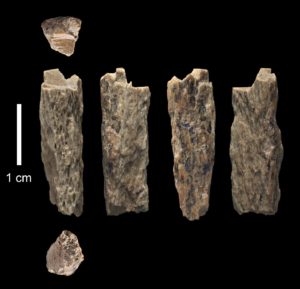
And finally, particularly interesting are the results of a genetic analysis conducted by Pääbo and colleagues on a small fragment of an ancient long bone. It was initially discovered in the now-famous Denisova Cave in Russia by Russian archaeologists in 2012. Protein analysis indicated that it was from a hominin, so it was then sent for DNA testing at the Max Planck Institute for Evolutionary Anthropology in Leipzig. Designated ‘Denisova 11’ to distinguish the specimen from the others found at the Cave, the analysis results showed that it belonged to a 13-year-old hybrid individual whose mother was a Neanderthal, and father a Denisovan. This person was a first-generation descendant of a Neanderthal and Denisovan, unique among the fossil finds at Denisova Cave, or any other site, for that matter. Moreover, the father’s genetic history, though he was Denisovan, indicated some Neanderthal ancestry, as well. “So from this single genome, we are able to detect multiple instances of interactions between Neanderthals and Denisovans”, said Benjamin Vernot from the MPI-EVA, a co-author of the study. The study may hint at the probability that separate ancient hominin species who coexisted within the same environments more than infrequently interbred. Indeed, says Pääbo, in addition to Neanderthals, the Denisovans have left their DNA in some of us to an even greater extent, as their markers have been found to be in greater abundance in certain populations than that of Neanderthals, and their ancient presence, genetically speaking, seems to have been more widespread geographically.
_________________________________

Denisova Cave. Xenochka, Wikimedia Commons
_________________________________
__________________________________
Climate Change and Neanderthal Extinction
As alluded to above, a prevailing theory suggests that the demise of the Neanderthals was due primarily to Middle and Late Pleistocene cold shifts in the climate across Eurasia has also received renewed support from a recent study conducted by Michael Staubwasser of the University of Cologne and colleagues. In that study, researchers analyzed paleoclimate records produced from the examination of stalagmites in east-central Europe. Focusing on the date range of 44,000 to 40,000 years ago, they found that archaeological layers that lacked artifacts normally associated with Neanderthals corresponded to stadials, or cold periods in the climate. Following the stadials, both the archaeological and genetic record indicates a turnover to Homo sapiens, or modern humans. This supports the suggestion that one of the reasons for the Neanderthal demise was decline in their food sources as compared to that of modern humans, who thrived with a more diversified diet. Although this may be true for Neanderthals that inhabited the more northern regions, it does not seem to match some of the evidence that scientists have been recovering from sites like the Gorham’s Cave Complex, assuming the inhabitants that produced the Mousterian artifacts found at those sites were Neanderthals. In any case, it is possible that the southern Neanderthals of Gibraltar persisted, for a few additional thousands of years, because of their access to and utilization of a broader variety of food sources, which included inland game, aquatic life, and plants. That is, until 22.5 – 25.5 ka cal BP, when even they seem to have capitulated to Heinrich Event 2.
Neanderthals alive and well?
We may never know for certain what caused Neanderthal extinction. But the upshot of what we know to date from the archaeological, paleoclimate, and genetic findings is that multiple factors may have been to blame. In any case, one could argue that the Neanderthals never really disappeared. “Different people tend to carry different pieces of the Neanderthal genome,” said Pääbo as quoted in an article by Anthony King in Horizon Magazine. “Something like 40–50% of the Neanderthal genome can still be found in people today.”*** Thus, “Neanderthals are not totally extinct. In some of us they live on, a little bit.”**
It may be no exaggeration to say that they left their legacy within us. We are their descendants.
________________________________

________________________________
Sections of this article were produced by combining edited and revised versions of previously published articles at Popular Archaeology: The Last Neanderthals, October 10, 2018; and Return to Shanidar, April 10, 2020.
Cover image, top left: Model of Homo neanderthalensis child in The Natural History Museum, Vienna, Jacob Halun, CC-BY-SA 4.0, Wikimedia Commons
*Clive Finlayson, et al., Gorham’s Cave, Gibraltar—The persistence of a Neanderthal population, Quaternary International · November 2008, DOI: 10.1016/j.quaint.2007.11.016
https://www.researchgate.net/publication/222706475_Gorham%27s_Cave_Gibraltar-The_persistence_of_a_Neanderthal_population
**Michael Gordon, Decoding Human Prehistory, Popular Archaeology Magazine, March 16, 2015.
***https://phys.org/news/2018-08-genetic-error-humans-evolve-bigger.html


_(14596218878).jpg)
.jpg)