
Editor’s Note: The following is an adapted excerpt from the article, In Search of the Historical Jesus, published previously in Popular Archaeology Magazine. (Cover image courtesy Jeff Jacobs, Pixabay)
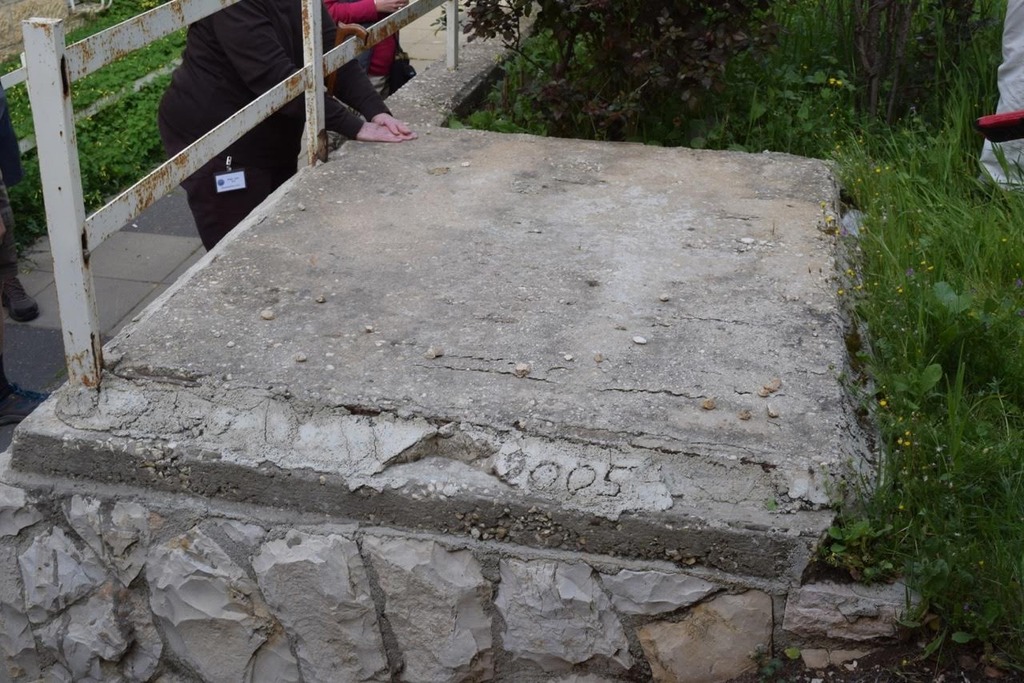
Nestled deep within a quiet residential community of apartments in southern Jerusalem lies a nondescript 5 x 5 square slab of concrete. It rests horizontally atop a small elevated garden plot or terrace of surrounding grass and other plants. To any stranger strolling by this slab, nothing would stand out to catch the eye. There are no decorative adornments. Other than the date ‘2005’ inscribed along its southern edge, there are no inscriptions or markings.
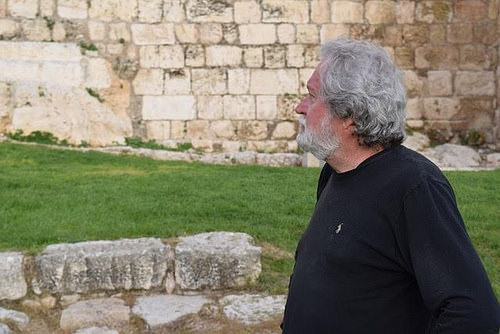
But on one clear morning in early March, 2016, a group of tourists quietly approach and surround the slab with a reverence most might ascribe to a group of friends and family standing before the grave of a lost loved one. Clearly, it means something to them. Some of them place small stones on top of it, long a graveside Jewish tradition for honoring deceased family members and friends, (and a way of letting their deceased loved ones know that they are not forgotten). Some shed tears. Some bow their heads in silent prayer. Some touch it with their hands. Still others snap photographs of the place for memory and posterity, including a journalist traveling with the group. An elderly man with a thick white mane and beard leads the group. Quietly addressing the group, his energy and crisp voice belie his age. But he is not a rabbi or priest. He is Dr. James Tabor, a prominent scholar and historian, professor of Christian origins and ancient Judaism at the University of North Carolina, Charlotte. He is considered one of the world’s foremost authorities on ancient Late Second Temple Judaism and early Christianity. And few others know more than he does about what lies beneath the surface in this place. The slab actually caps an ancient subterranean 1st century C.E. tomb, the excavated contents of which drew media headlines across the world more than 20 years after its initial discovery. For Tabor and others, the find represents the most direct archaeological evidence for the person and life of Jesus, the man who arguably has impacted more lives than any person in human history. For him, this tomb, popularly known as the Jesus Family Tomb, has represented a major milestone in a lifelong quest. But the discovery and his claims have generated scholarly debate like few other archaeological finds in history.
Final Hours, Death and Burial
More than any other part of the Jesus story, much has been written both anciently and in modern literature about the final days of Jesus’ life in Jerusalem. Summarized in a simple sentence, the gospel accounts describe Jesus being judged before the high priest Caiaphas, Herod Antipas, and then the responsible Roman prefect Pontius Pilate, followed by crucifixion at the hands of the Romans upon a cross at Golgotha (the “place of the skull”), and then laid in a nearby ‘new tomb’ under Joseph of Arimithea’s facilitation. Traditionally, the site of the Church of the Holy Sepulcher, located today in the northwestern part of the Old City, is perhaps the most broadly accepted location of both the crucifixion and the nearby temporary new tomb in which the body of Jesus was, according to the gospel accounts, laid. Some Christian groups, particularly Protestant groups, maintain that the actual tomb should be identified with what has been called the ‘Garden Tomb’, located significantly north of the Church of the Holy Sepulcher site. Looking at the exterior of this tomb, it is easy to see what has been depicted by many illustrators as the imagined image of this iconic place in the gospel stories. But results of archaeological investigation, particularly the seminal investigation by famed Israeli archaeologist Gabriel Barkay of the Hebrew University, have cast doubt on the Garden Tomb area location.
Tabor, based on his research, suggests yet a different location for the crucifixion and temporary burial.
“According to Josephus, the Romans conducted crucifixions outside the gate of the city,” says Tabor. “Anciently, the gate of the city was known as the eastern gate, or gate of the tabernacle.”
This would have placed the likely spot of the crucifixion to the east of the temple, as opposed to the traditionally accepted northwest location.
Tabor elaborates further in his book, The Jesus Dynasty: “A more likely site for Jesus’ crucifixion is on the Mount of Olives, east of the city, overlooking the Temple compound. One of our earliest sources remembers Jesus’ crucifixion as ‘outside the camp’ (Hebrews 13: 12-13). The technical expression “outside the camp” was interpreted as a distance of at least two thousand cubits (about half a mile) east of the Temple sanctuary.”
It would have placed the crucifixion clearly on the Mount of Olives, says Tabor, far enough away from the Temple sanctuary to avoid ritual defilement and in a place that would have been high and clearly visible to travelers journeying into the city on the heavily traveled main roads just to the east. The Romans were known to prefer crucifixions on hills near main roads where the population would be able to clearly see the examples of the crucified as a warning.
Where, then, was the temporary tomb, if not on the grounds where the Church of the Holy Sepulcher is located?
Given the gospel accounts of the tomb’s location very near to the site of crucifixion, this tomb would also, according to Tabor, have been located on the Mount of Olives. The Mount of Olives, as most scholars, historians and archaeologist know, does feature a relatively robust number of tombs, including tombs that have yielded commonly known gospel account names, based on archaeological investigation. But even under an assumption that the Mount of Olives was the true location of the crucifixion, which of these tombs could be identified as the temporary tomb? It remains a mystery. There is no evidence favoring any particular tomb.
____________________________________
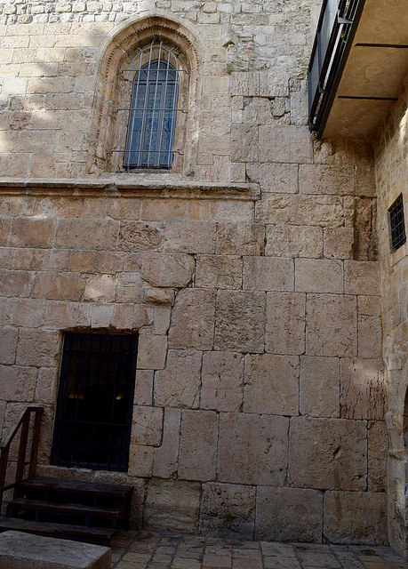
Above: To the right of the doorway of this building in Jerusalem, original Herodian period stones remain in place. This is the structure that tradition holds was the place where Jesus had his ‘last supper’ with his disciples.The upper room, as indicated by the window, is shown above the wall that contains the original Herodian stones. This is what one views while standing in the courtyard of the structure.
____________________________________
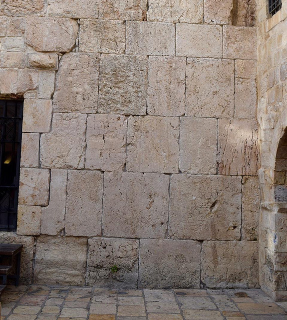
Above: A detailed view of the original Herodian stone in the structure that contains the upper room. Excavations by the Israel Antiquities Authority revealed a 1st century floor below this level. Destroyed in 70 CE by the Romans, the building that stood here housed the earliest followers of Jesus as the ‘headquarters’ of the movement after Jesus’ death, with James, the brother of Jesus, at the head and the other apostles and Jesus’ family all domiciled and/or meeting in this place, according to Tabor. James, as well as King David, are traditionally thought to have been interred there. It is thus considered to be a sacred structure and a destination for visitation by both Jews and Christians.
______________________________________
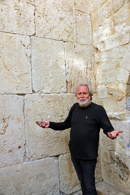
Dr. James Tabor stands before the the Herodian wall/stone section remnant of the building that features the upper room. It shows the scale of the stones. Photo by Victoria Brogdon
________________________________________________
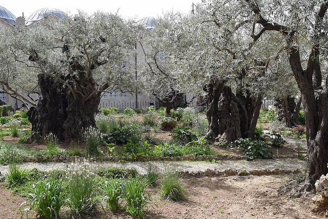
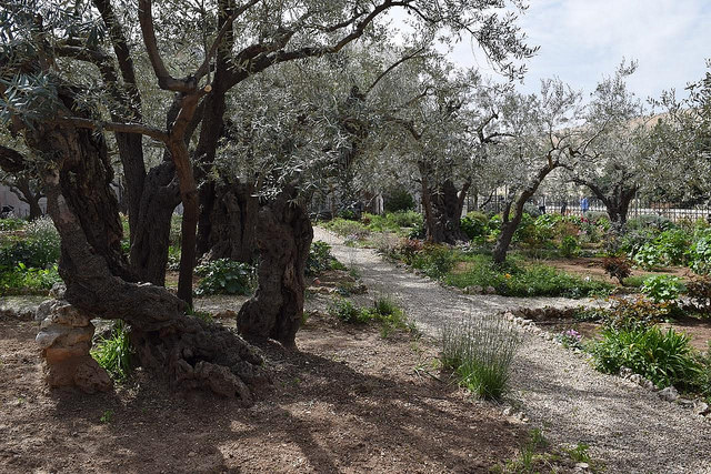
Above and below: Located at a lower location on the Mount of Olives, the site traditionally designated as the Garden of Gethsemane, where Jesus spent his last hours with his disciples before being captured and arrested after betrayal by Judas. According to Tabor, it is not known archaeologically that this was indeed the famous garden spot, but it is representative of the olive tree vegetation and gardens that characterized this part of the Mount of Olives during the 1st century CE.
________________________________________________________
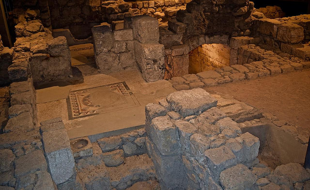
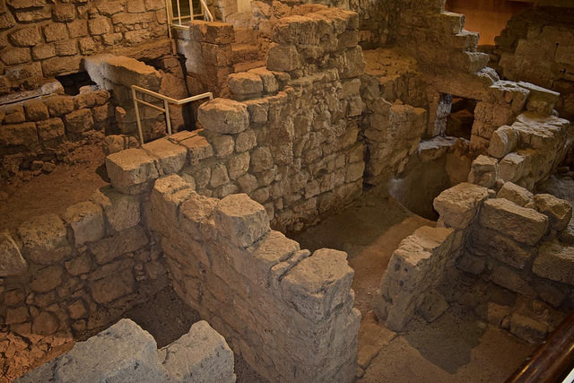
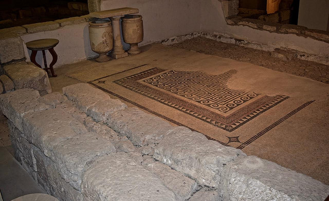
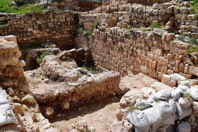
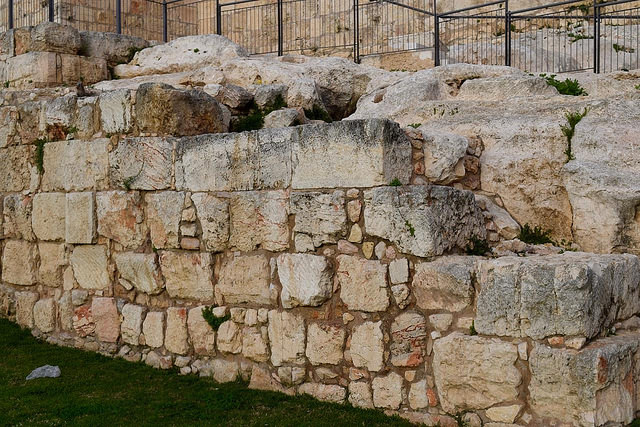
Above and below: About three meters beneath the surface in the Jewish quarter of the Old City of Jerusalem lie the remains of ancient 1st century CE mansion homes of the wealthiest residents of Jerusalem living at the time of Jesus, known today as the Herodian Quarter. Above and below are examples of some of the exquisite remains of the foundations and basements of these mansion homes, which once stood at least two stories high, excavated by Nachman Avigad. This area included the residences of Jerusalem’s aristocratic and noble families and priestly upper class such as the ruling Sanhedrin, among whom were personalities known from the New Testament gospel accounts, such as Caiaphas.
___________________________________________
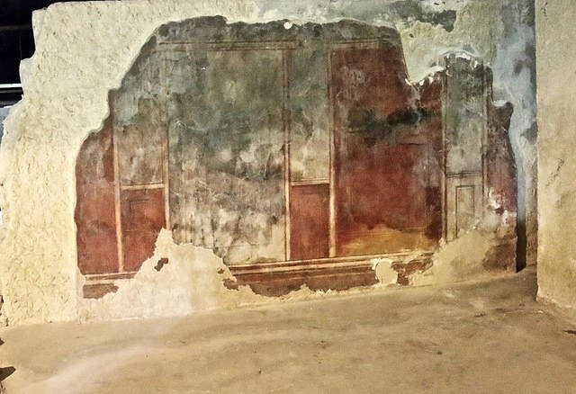
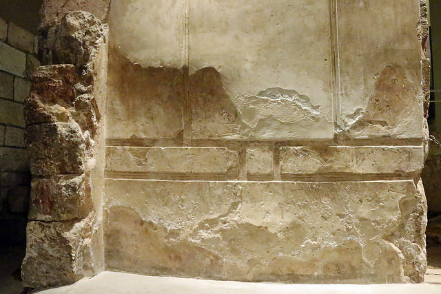
Remains of wall fresco within a wealthy resident’s mansion. Photo by Victoria Brogdon
____________________________________________________
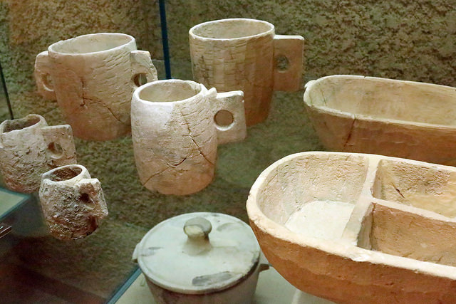
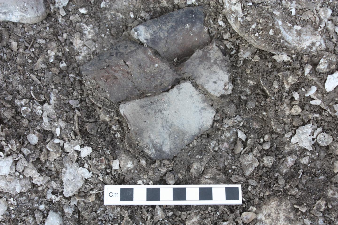
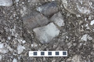
Stone vessels excavated from the remains of the Herodian Quarter. Among the Jewish residents, stone vessels were used to ensure purity. Photo by Victoria Brogdon
_________________________________________________
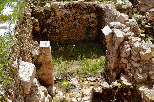
Above and below, features excavated from the largest residential structure in the Herodian Quarter, dubbed the “Mansion House”. Tabor suggests that this structure may have been the palacial building where Jesus stood in judgment before Caiaphas.
_________________________________________
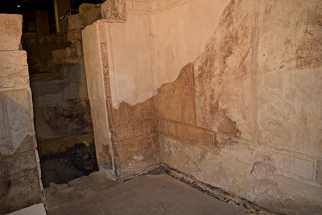
Above and below: Remnants of lavish ornamental detail can still be seen on the walls of the Mansion House. Photo below by Victoria Brogdon
_________________________________________
________________________________________________________
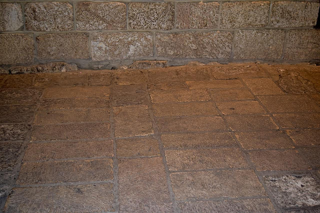
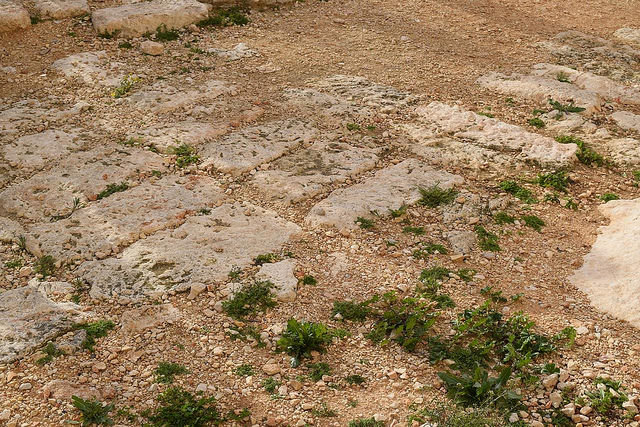
Above: The preserved stone paving within the Mansion House. Tabor suggests that this may possibly have been the very floor upon which Jesus stood in judgment before Caiaphas.
_____________________________________________
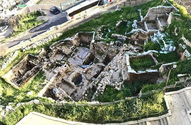
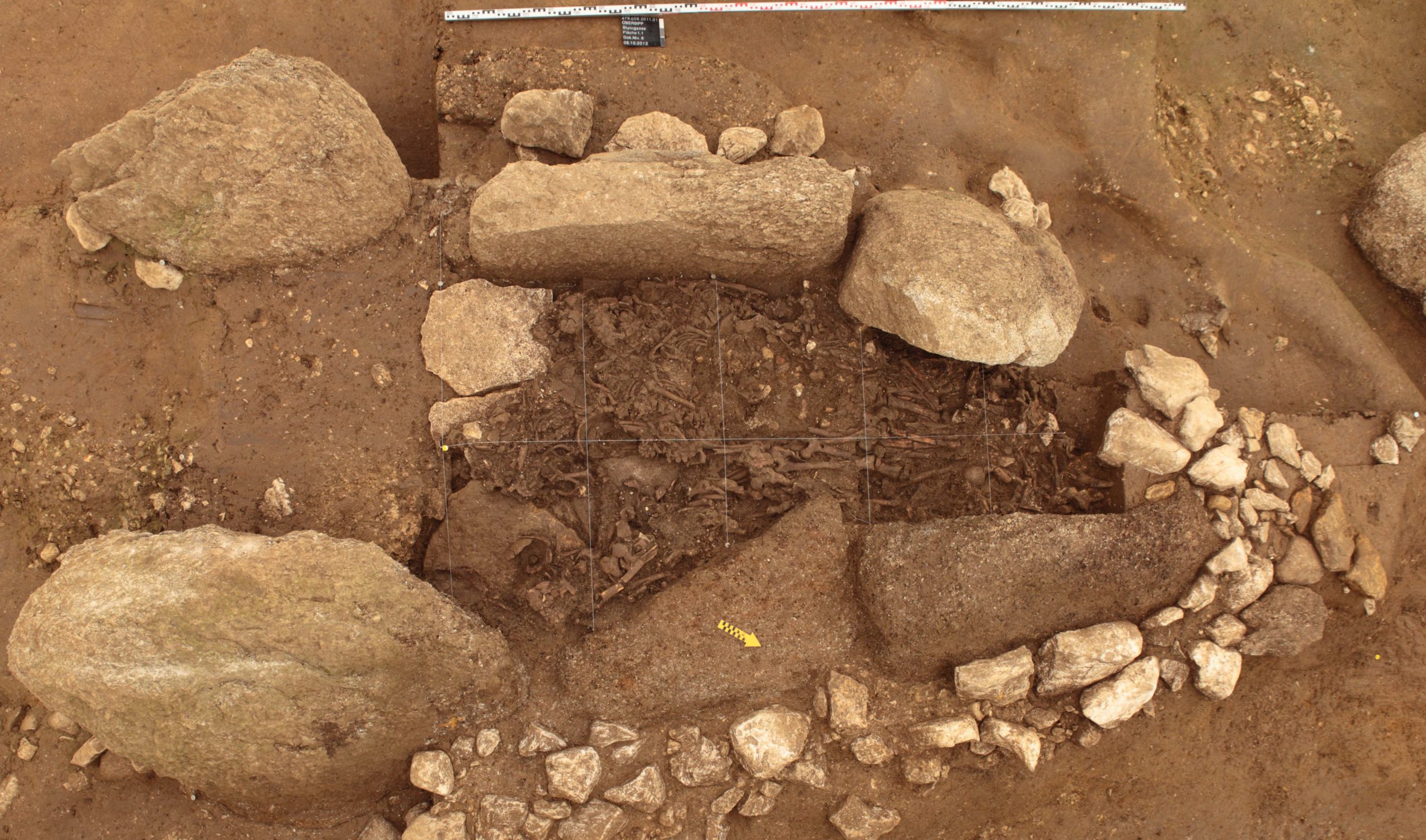
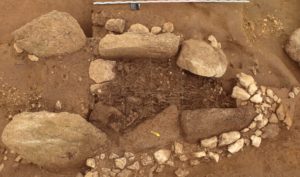
Pictured above and below: Just south and adjacent to the southern Old City wall, an archaeological team under the direction of Shimon Gibson and James Tabor is excavating another section of ancient homes that once belonged to Jerusalem’s aristocratic and noble families of the 1st century CE. Here, excavators have unearthed rooms, including an inscribed stone cup and a beautifully preserved bathtub. See more about this excavation here. Above photo by Victoria Brogdon
_____________________________________________________________
Above: Hugging the western Old City wall of Jerusalem, these structural remains in front of the Turkish-built wall are dated to the 1st century CE and, according to Tabor, are likely the vestiges of the famous ‘judgment seat’ area, just outside the Roman Praetorium, where Pontius Pilate sat in judgment of Jesus before the crucifixion. These structural features were exposed in archaeological excavations during the 1970’s. “They discovered these steps which appeared to be going up into the Turkish wall,” says Tabor. In the 1st century, there was a gate into the city at this place. “But it was completely destroyed,” continues Tabor. “Scholars do agree that beyond [behind] this wall stood Herod’s palace. But at the lower end of the palace [nearest to and just to the other side of the wall seen here] was the Praetorium, the military barracks where the soldiers were stationed. It was here, within the Praetorium and on the other side of the present wall, where Jesus was scourged.” Today, an Armenian parking lot occupies this space behind the wall. Tabor hopes to excavate it in the future with the prospect of possibly uncovering remains of the Praetorium. Photo by Victoria Brogdon
__________________________________________
A detailed view of an excavated Herodian period wall in the area that Tabor proposes was the judgment seat of Pilate.
___________________________________________________________
The stones, still in place, where Tabor and some colleagues suggest Pilate may have stood in judgment of Jesus before the crucifixion.
_________________________________________________________
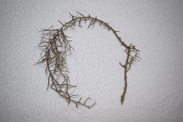
Above: A thorny plant naturally grows near the ‘judgment seat’ stones depicted in the previous photograph. When the skin is exposed to the plant’s thorns, its toxic elements create an irritating rash or welts on the exposed skin. When the plant dies, however, this toxic element disappears, but the dead plant curls into a shape as shown in the example above. This particular example was picked in 2016 near the ‘judgment seat’ stones. It was found among a number of other thorny plants. Was this the type plant used by Roman soldiers to fashion the crown of thorns placed on Jesus’ head before the crucifixion? Any association at this point would be purely speculative.
__________________________________________________________
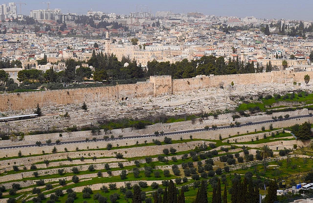
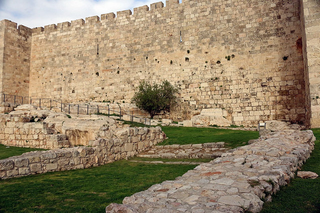
The view of the Eastern Gate from the elevated perspective of the Mount of Olives. According to Tabor, the more likely spot of the crucifixion was on the Mount of Olives. That location would also have afforded greater visibility to people as they passed by on the main roads to the east of the Old City walls, more consistent with the Roman practice of locating crucifixions and executions in places presenting maximum public exposure, while also being consistent in this instance with ensuring a sufficient distance from the sacred Temple sanctuary to minimize unrest among the Jewish population.
_____________________________________________________________
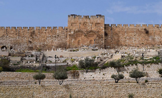
Peering up at the Eastern Gate from the perspective of the Kidron Valley.
___________________________________________________________

Above: One of the tombs near the Church of Dominus Flevit on the Mount of Olives. Tombs like this are scattered about on the Mount of Olives, and it was in one of these tombs, (the ‘new tomb’ according to the gospel accounts) where Tabor suggests Jesus was temporarily laid after his body was removed from the site of the crucifixion. The tomb shown above has been populated with a number of ossuaries, (limestone bone boxes in which 1st century Jewish families interred the bones of deceased family members one year after decomposition of the body) for public display purposes.
________________________________________________________
Tombs, Early Followers, and the Family of Jesus?
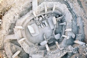
Arguably no events have raised more attention and controversy for Tabor than the now famous discovery and investigation of the two tombs discovered in the East Talpiot, or Armon HaNetziv, community in Jerusalem, less than three kilometers south of the Old City. Popularly known respectively as the ‘Jesus Family Tomb’ or ‘Garden Tomb’ (because of an adjacent garden — not to be confused with the traditional Garden Tomb) and ‘Patio Tomb’, Tabor and some of his colleagues have argued that these tomb discoveries, along with the much-publicized ‘James ossuary’, may provide the most direct archaeological evidence and connection ever found bearing on Jesus, his family, and the earliest followers of Jesus, later known as Christians.
The Garden Tomb
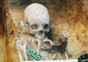
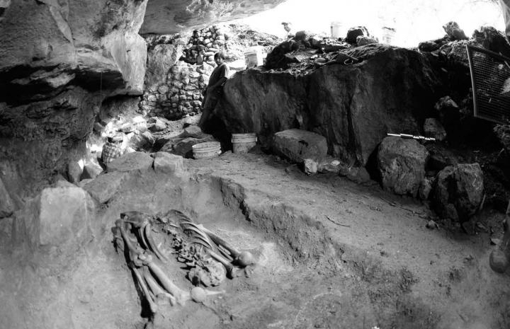
In a city like Jerusalem, construction work often inadvertently reveals historical treasures that might not ever otherwise be uncovered by surveying archaeologists. In 1980, this is exactly what happened. Dynamite detonation to pave the way for construction of a new apartment complex in the East Talpiot area of Jerusalem had exposed what appeared to be the entrance to a tomb. What would have been the outer courtyard area of the tomb had unfortunately been destroyed in the explosion. But the inner entrance, featuring a facade with a rock-cut chevron, a circle symbol, and rectangular opening, had been exposed, an inviting feature for anyone adventurous. As required by law, archaeologists of the Israel Antiquities Authority were called in to investigate the tomb as a quick salvage operation, and excavations began on March 28, 1980 with a team under the supervision of District archaeologist Amos Kloner, including archaeologists Joseph Gath and Eliot Braun, along with three or four excavators. Initial excavation revealed six burial niches, or kokhim, five of them containing ossuaries, two six-foot-long shelves or arcosolia (used to lay out corpses for decomposition before the bones were collected and stored in the ossuaries a year later), and bone fragments on the shelves as well as other skeletal remains, including skulls, on the ancient floor below the shelves. Ten ossuaries were recorded within the tomb.
But it wasn’t until 1996 when a report was compiled about the discovery, spurred by media attention about reports that the the tomb ossuaries featured inscriptions of names associated with Jesus, including Jesus himself. But by this time much information had been lost or unrecorded, and the bones within the tomb had presumably been turned over to the Orthodox religious authorities for reburial in unmarked common graves.
The biggest media splash about the tomb and its contents didn’t emerge, however, until after a re-investigation initiated by a team put together by filmmaker and investigative journalist Simcha Jacobovici in 2004, recruiting Tabor as an academic consultant. There were still some tantalizing outstanding questions about the tomb, not the least of which was the question of whether or not the tomb and its contents could reasonably be associated with the historical Jesus of Nazareth and his family. The names inscribed on each of five of the ossuaries raised a few eyebrows, to say the least — Yeshua bar Yehosef (Jesus son of Joseph); Maria (Mary); Mariamene Mara (interpreted from ancient sources to be another word for Mary Magdalene the Master or “the Lady”); Yosef (Joses – a brother of Jesus); and Yehuda bar Yeshua (Judah son of Jesus).
___________________________________________
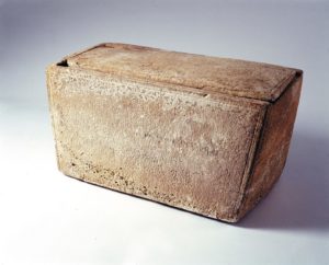
A concrete slab (shown above as one looks down from above, center of photo, and below, close up) now covers the entrance to the Garden Tomb, so-called because of the surrounding garden area.
_________________________________________________________
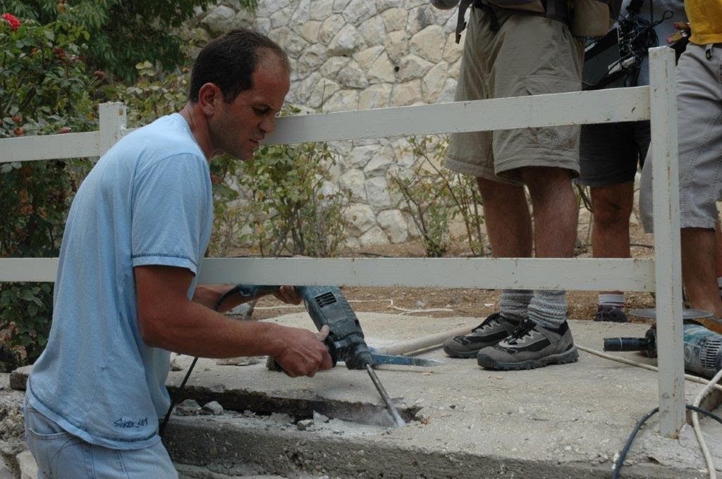
Above: A Workman removing the concrete slab covering of the tomb to acquire access for the investigative team. Photo courtesy William Tarant
___________________________________________________________
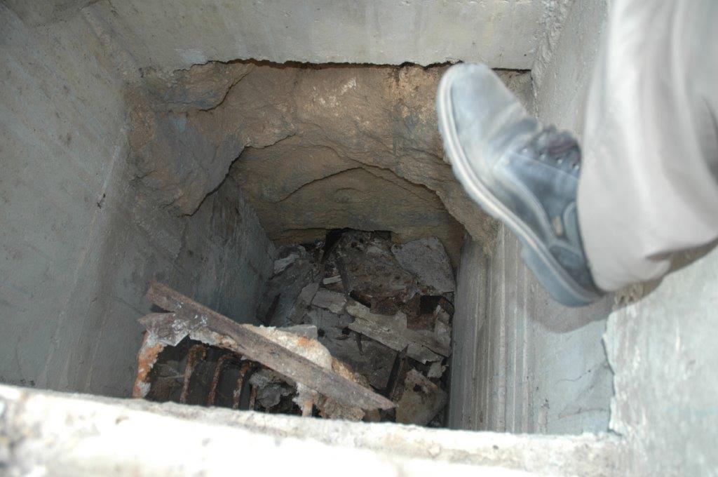
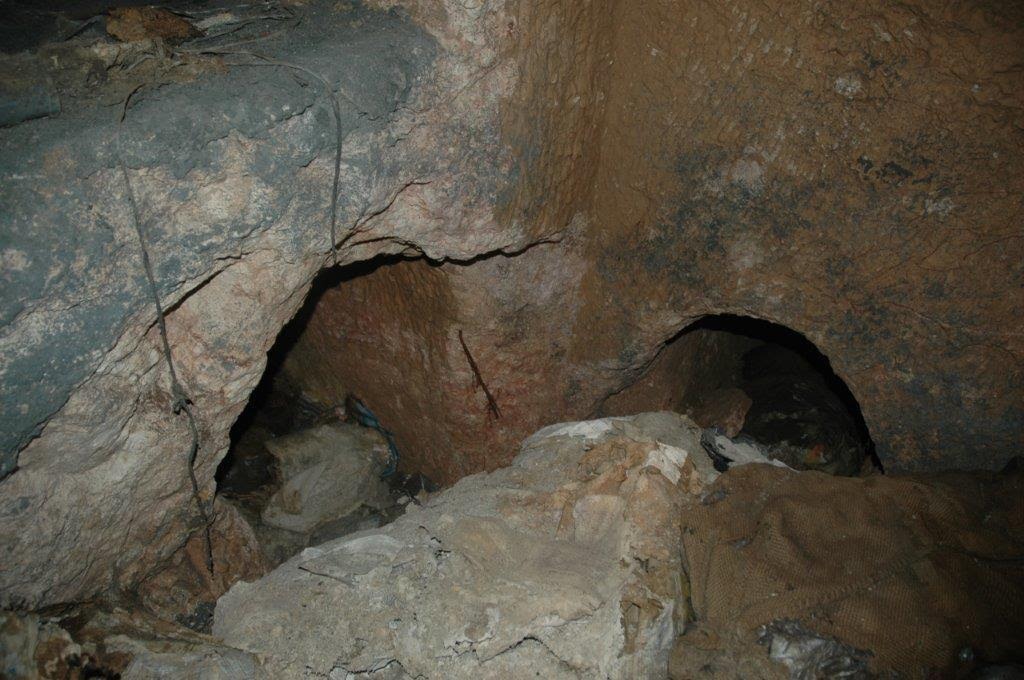
Entering the tomb after the slab was removed. The facade of the inner entrance to the tomb can be seen. Photo courtesy William Tarant
_____________________________________________
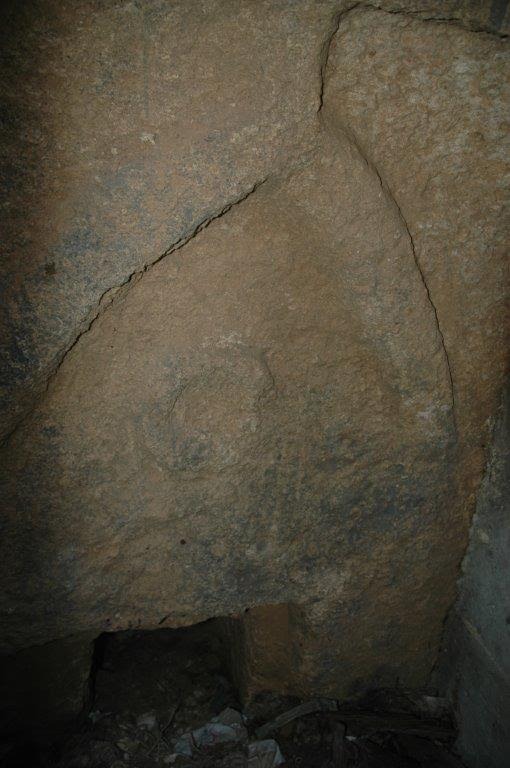
The distinctive chevron and circle facade could be clearly seen as the investigators stood in front at the bottom of the shaft to the tomb. The rectangular entrance shows how the tomb had been filled with books and manuscripts, used as a genizah, since it was first investigated years earlier. Photo courtesy William Tarant
_____________________________________________
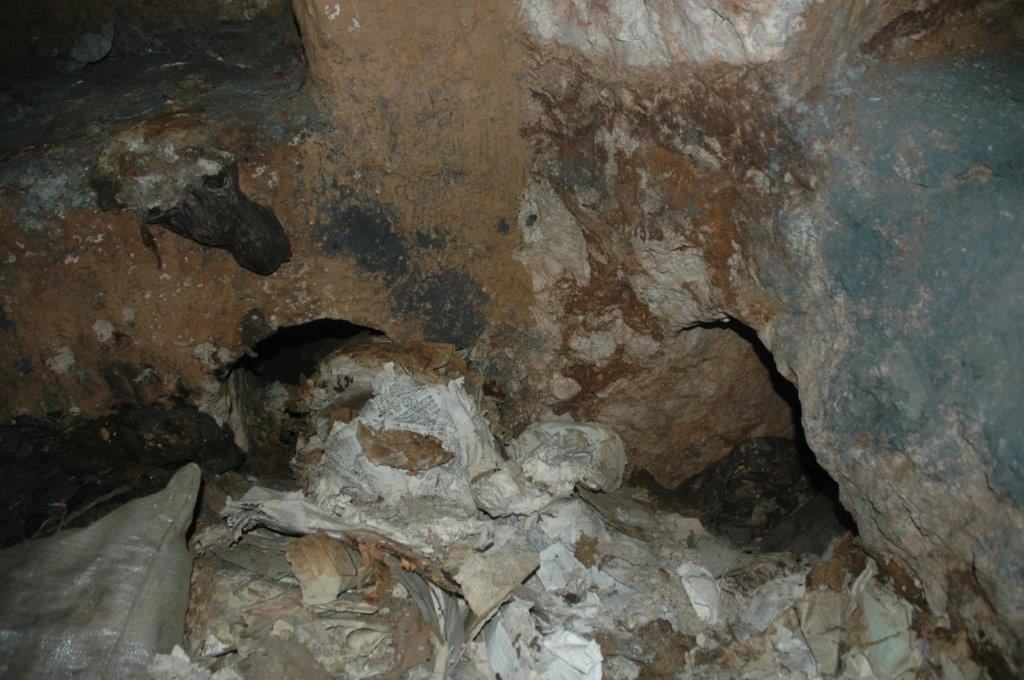
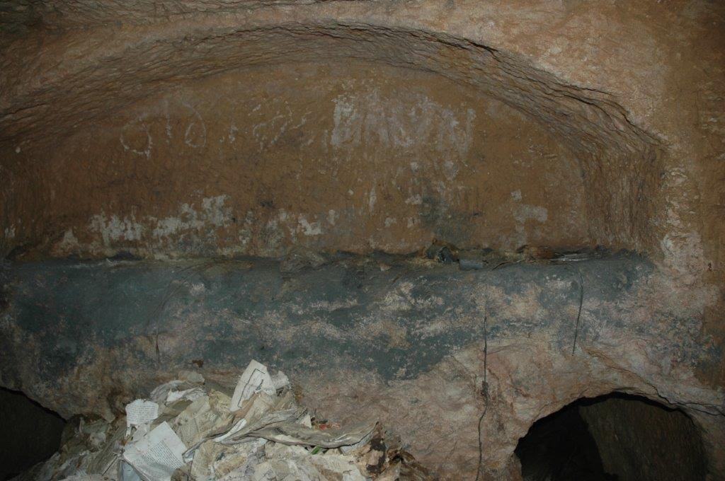
Above and below: Discarded books and manuscripts had accumulated within the tomb over a number of years, obstructing the burial niches. Because of the sacred nature of the printed word for Yahweh (God), the documents are not burned so they are buried. Photos courtesy William Tarant
___________________________________________________________
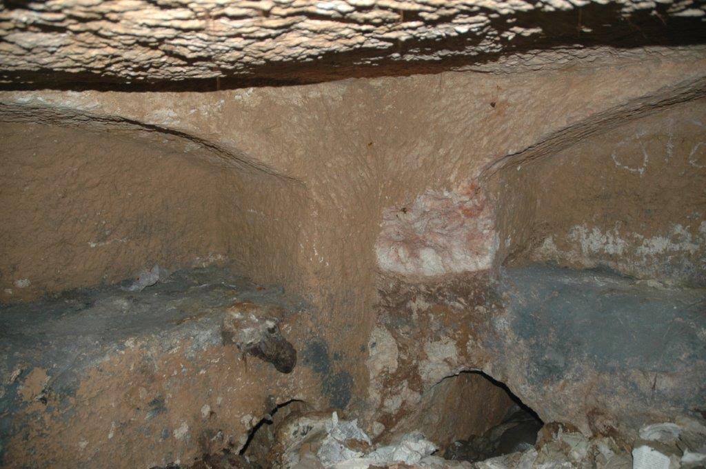
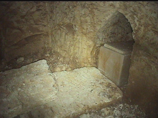
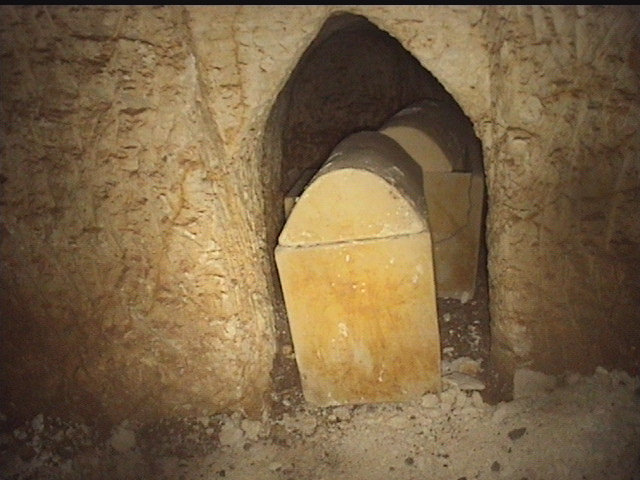
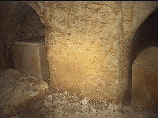
Above and below: Inside the tomb, the arcosolia, benches used to support shrouded bodies as they decomposed before being placed in ossuaries a year later, are still clearly defined. The niches below the arcosolia contained the ossuaries, which had been removed in the earlier investigation, at least some of which can now be viewed at the Israel Museum in Jerusalem. Photos courtesy William Tarant
______________________________________________
_______________________________________
Was this in fact direct evidence for Jesus of Nazareth and members of his family? And did it provide proof that Jesus’ body was in fact placed in a second, permanent tomb after the first, temporary tomb? Moreover, and perhaps equally controversial, did it provide evidence that Jesus may have been married and fathered a child named Judah?
Needless to say, a broad array of scholars and ecclesiastical authorities have vociferously disputed these notions. They have presented a number of reasons why these finds could not be related to the Jesus of the gospels. The most prominent argument has advanced the suggestion that the names inscribed on the ossuaries were common names for people living in the 1st century CE Jerusalem area. Indeed, when the names were considered individually, some of the names clearly met that explanation. (Using known data about the 1st century CE population and applying statistical analysis studies, Maria, or Mary, for example, accounts for nearly 22 percent of known female names in the area for the period, according to studies — although Yeshua, the Greek equivalent being Jesus, only 3.9 percent).
But the more convincing test, according to Tabor and some other scholars, lies in the unique combination of names in one place. When analyzed statistically in this way, they say, the probability that the tomb and its contents are those of the gospel account’s Jesus, and his family members, goes up significantly — so high, in fact, that it becomes likely, as opposed to possible. Enter two other major discoveries, and the likelihood rises still more:
The James Ossuary
The story broke at an October 21, 2002 Washington press conference co-hosted by the Discovery Channel and the Biblical Archaeology Society, when the existence of a 2,000-year-old ossuary was announced, featuring on its side an inscription that purportedly provided the oldest known archaeological record of Jesus of Nazareth. The inscription on the ossuary presented, in Aramaic, the words Ya’akov bar-Yosef akhui diYeshua, which in English translates as “James, son of Joseph, brother of Jesus”, originally translated by André Lemaire, a renowned Semitic epigrapher. Assuming that this was indeed the ossuary of James the Just of the gospel accounts — the brother of Jesus and the head of the early Christian movement in Jerusalem after the death of Jesus — the announcement created a media stir that reverberated worldwide and set in motion a chain of events which, like opening Pandora’s box, became a story that acquired far greater proportions than the initial players had initially intended.
But the ossuary had emerged from the antiquities market, not a controlled archaeological investigation, and a series of investigations by the Israel Antiquities Authority in 2003 led to a determination that the ‘James ossuary’ was a forgery. Oded Golan, collector and owner of the box, was charged with 44 counts of forgery, fraud and deception. However, after a seven-year trial with 120 sessions where the judge heard 126 witnesses and dozens of experts, producing 12,000 pages of testimony with a final 475-page verdict, Golan was acquitted of the forgery charges.
Few argue today that the ‘James ossuary’ itself is not authentic, but the authenticity of the inscription, particularly the ‘brother of Jesus’ segment of the inscription, is still open to scholarly debate. A number of scholar/scientists have, however, supported the observation that an authentic ancient patina (the thin bio-chemical layer that forms on the surface of the material as the object ages) has been found within the inscription engravings, indicating that the entire line of the inscription is authentic, at least in terms of age.
__________________________
__________________________
__________________________
What then, one may ask, does this have to do with the Garden Tomb?
“A lot,” says Tabor. He points, for example, to the recent and much publicized 2006 study that concluded that the James ossuary actually originated from this tomb. That study was conducted by a team of scientists led by Amnon Rosenfeld of the Israel Geologic Society. The results, after careful testing, indicated that the ancient patina found inside the inscribed letters on the ossuary was indeed authentic, supporting the authenticity of the inscription. But in that study, the team also conducted tests and an evaluative analysis of the comparative chemical composition of the patina accretions on ossuaries and interior surfaces of 14 other burial caves, including the Garden Tomb. “The premise of the tests was that ossuaries accumulate distinctive and measurable biochemical “signatures” based on the cave environments in which they have spent the past two millennia,” writes Tabor. Even two caves in close proximity to each other would bear different chemical signatures. But the results showed that the James ossuary had the very same chemical signature as the ossuaries that were tested from the Garden Tomb, including the chemical signature of the walls and ceiling of that tomb. “In contrast,” writes Tabor, “the James ossuary patina signature differed considerably from the chemical composition of ossuaries from the other thirteen burial caves.”
According Tabor and some other colleagues, the James ossuary, therefore, originally came from the Garden Tomb.
When and how the ossuary was separated from the tomb remains a mystery. But examination of the weathering on the surface of the ossuary, as compared to that of the other ossuaries of the Jesus tomb, suggested that the ossuary had been missing from the tomb, perhaps looted in antiquity, for at least two hundred years.
Thus, according to Tabor (who is not alone in this assertion), adding the James ossuary to the ring of objects and names of the Garden Tomb statistically raises the likelihood of identification of the tomb with Jesus of Nazareth and his family to a near certainty.
Does this prove that this tomb is in fact the tomb of Jesus of Nazareth and his family?
Tabor qualifies his statements about the tomb. “We do not believe that statistics alone prove one way or the other that the Talpiot Jesus tomb is that of Jesus of Nazareth but the statistics do show that the oft-repeated assertion that lots of tombs in Jerusalem would likely have a similar set of names is false.”
But there is more to all of this…………
The Patio Tomb
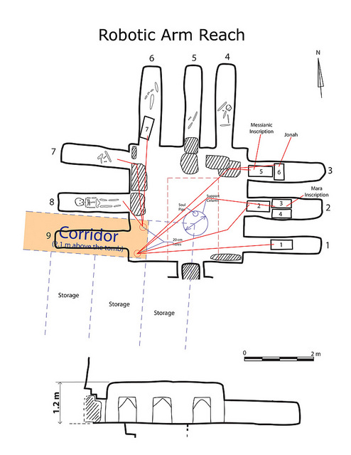
Only one year after the initial discovery of the Garden Tomb, a dynamite blast, again associated with apartment complex construction work, exposed another ancient tomb only 60 meters north of the previously exposed Garden Tomb. Again, Amos Kloner was called in to investigate the tomb. He could enter the tomb only through a break in the ceiling. Its ancient square entrance was closed, sealed tight by a large “stopper” stone. What he first saw was a 3.5 by 3.5 meter rock-cut single square chamber. Cut into and along three of its sides were nine carved gabled burial niches, about 2 meters deep, three in each side. Each niche was sealed in front with a blocking stone. Kloner observed skeletal remains in the niches, with significant primary burial remains in four of them, meaning those skeletal remains had not yet been placed permanently into ossuaries. Also found were some cooking pots placed in three locations on the floor.
Kloner wasn’t afforded much time to examine the tomb. Soon, he was forced to leave the tomb by protesting ultra-Orthodox Jews, determined to protect the sanctity of the tomb. But this was not before he was able to acquire one smaller ossuary for examination—a decorated ossuary with no inscription, fit for the remains of a child. He entrusted it to the custody of IAA authorities at their Rockefeller headquarters (The ossuary is now part of the State of Israel collections).
Despite the protests, Kloner and the IAA were determined to investigate the find. Although he had to depart the country to fulfill another commitment, he entrusted two IAA archaeologists, the late Joseph Gath and Shlomo Gudovitch, to continue the investigation. Upon returning to the site, they were able to remove the blocking stones from the niches and examine ossuaries inside, a total of seven, taking photographs and recording their positions. All ossuaries but one were decorated and two were observed to have Greek inscriptions. They spent several days at the tomb location, removing the ossuaries from their niches and opening their lids for further examination. While preparing to raise the ossuaries up through the tomb ceiling to transport them to the IAA Rockefeller headquarters, they were again prevented from completing the task by a group of ultra-Orthodox Jewish protesters. The seven remaining ossuaries were returned to their niches, albeit not all in their original positions. There they remain to this day.
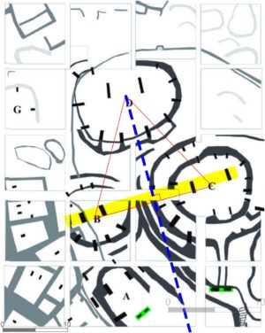
It was not until 2005, more than 25 years later, that a new archaeological team was assembled to take another look at the tomb (today known as the “Talpiot B” or “Patio” tomb) and its contents. This latest exploration and documentation was conducted by a team that included a mix of experts, including the well-known Canadian film producer and director Simcha Jacobovici, Tabor and noted archaeologist Rami Arav of the University of Nebraska, top Canadian film producer Felix Golubev, two key technical experts Walter Klassen and William Tarant, and Dr. James H. Charlesworth of Princeton Theological Seminary as an academic consultant. What prompted the new initiative was the proximity of the tomb to two other tombs, the first being the previously discovered Garden Tomb; and the second, a tomb mostly destroyed in 1980 by a dynamite blast during preparations for construction work.
“It was the proximity of these three tombs, and the possibility that they were clustered together on a wealthy estate in the 1st century CE that prompted us to request a permit to carry out further investigations,” reported Tabor in his Preliminary Report about the Patio Tomb exploration. The immediate vicinity of the three tombs also included the remains of a plastered ritual bath (or mikveh), water cisterns, and an ancient olive press. Joseph Gath, who surveyed the area, determined that they, including the tombs, belonged to a large, wealthy agricultural estate. They were likely the family tombs of the owner of the estate. “The object of our investigation was to determine whether the “patio” tomb, still intact, might contain names or other evidence that would provide for us further data that might conceivably shed light on the adjacent Garden Tomb with its intriguing cluster of names,” reported Tabor in the preliminary report.
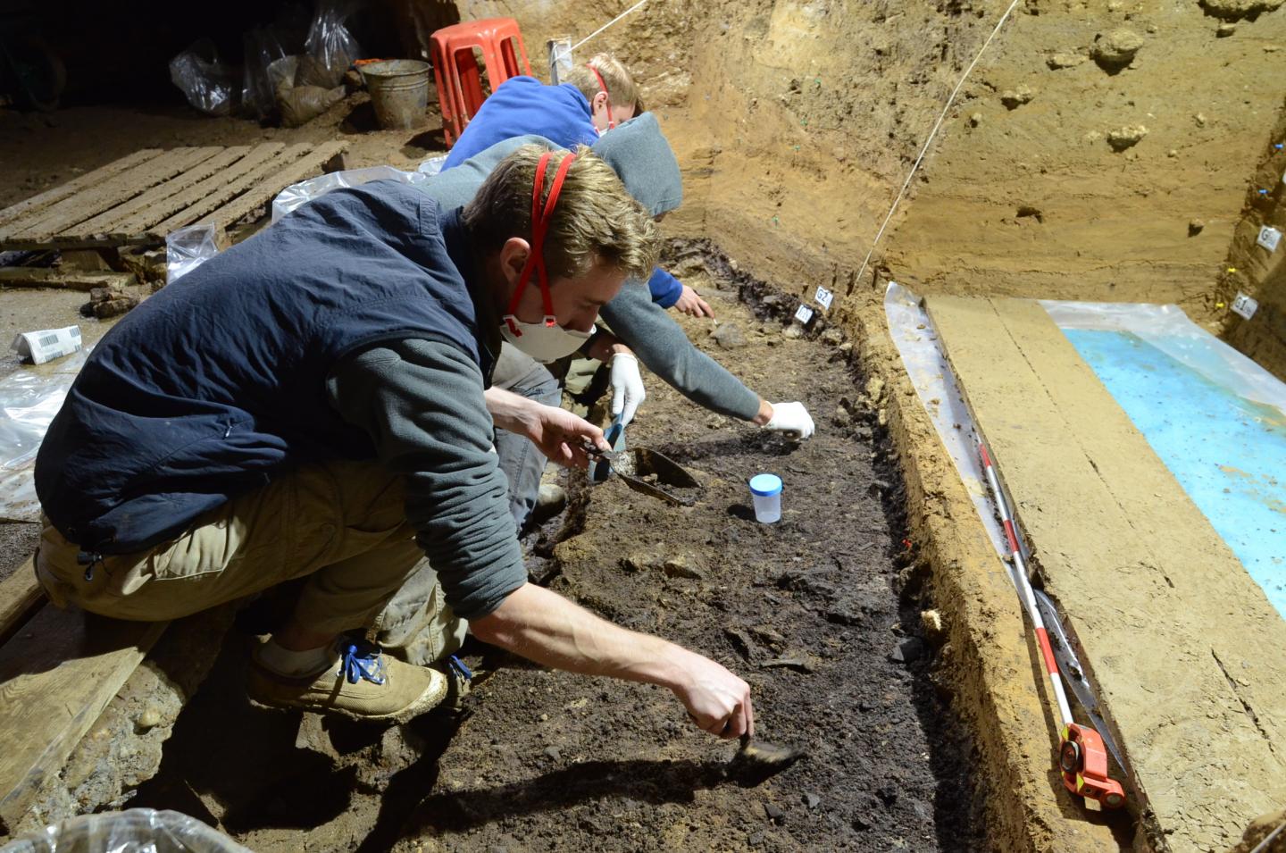
But further exploration of the tomb now faced almost insurmountable hurdles, including the requirement by the Orthodox authorities that the tomb remains not be touched or disturbed, the challenge of obtaining permissions from several different sources, each of which had a different agenda and a different set of interests to consider and safeguard, and the extremely limited clearance space around the ossuaries within the burial niches of the tomb. What was necessary would be an unprecedented “hands-off” probe of the tomb contents. To accomplish this, the team came up with a unique robotic arm and camera/video assembly specially designed for the task.
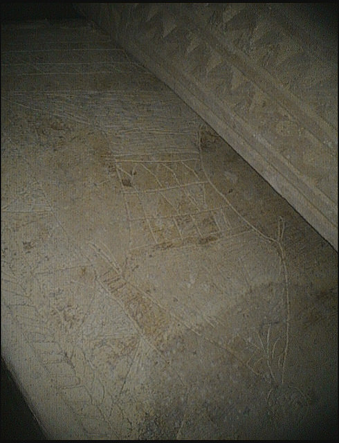
The results, after painstaking efforts and mid-course adjustments, were nothing less than astonishing. In addition to the findings of Kloner’s initial investigation, the team was able to distinguish the details of four ossuaries with ornamental engravings, one plain ossuary, and two ossuaries with unique markings and inscriptions.
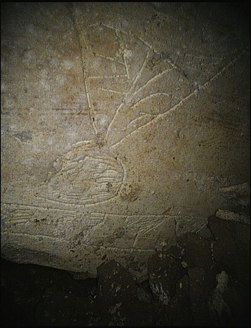
It was the latter two ossuaries, designated as ossuaries 5 and 6, that caused the stir. Ossuary 5 showed an ornamental front façade with twin rosettes and elaborate frieze border. Interestingly, between the rosettes was a four-line Greek inscription. The use of Greek would not necessarily be considered extraordinary. The translated text, however, reading as it were like an epitaph, was quite extraordinary under these circumstances. More unusual still was the use of the word for the name of God, Yahweh, written in Greek on a 1st century ossuary in what is clearly a tomb belonging to a Jewish family of the time, and words that expressed a raising up or resurrection (“rise up to God”, or “rise up to heaven”). Ossuary 6, originally (when explored by Kloner) in the first position closest to the tomb entrance, featured perhaps the most interesting markings. Its front showed what the team interpreted as the image of a fish, including tail, fins, and scales, with what appeared to be a stick-like human figure with a large head emerging from its mouth. Along the top border was a series of smaller, fish-shaped images. Incised on the left end was a bell-shaped circle that featured a cross inside. On the right end was an image that appeared to be a scaled body and tail of a fish, although only the lower portion of it is shown, upended. Within the head of the fish was inscribed what was interpreted to be the name “Jonah” — and it was this finding that Ossuary 6 became popularly known from this point forward as the “Jonah Ossuary”.
“Rise up to heaven”, a fish, an image emerging from the ‘mouth’ of the fish, and the name “Jonah”. So what did these findings mean?
The findings of Ossuary 5 and Ossuary 6 became perhaps the most sensational and most controversial discovery emerging from the tomb. This was, according to the investigative team interpretation, not only because they could be images of a fish, an animal, on a 1st century Jewish ossuary (something that would have been prohibited by 1st century Judaism), but because the imagery was similar to that seen within the 3rd and 4th century CE Christian tombs of the catacombs in Rome—the “sign of Jonah” (as in Jonah and the big fish, or whale, of the biblical account), images that are known to have symbolized the resurrection among early Christians. According to Tabor and colleagues, these could now be the earliest known archaeological finds related to the early followers of Jesus, or Christians.
Tabor’s interpretation has, needless to say, caused a firestorm of debate among scholars. Among them is Kloner himself, the initial IAA archaeologist who investigated the tomb upon its discovery, who now interprets the fish image on the Jonah ossuary not as a fish but as a funerary vase or amphora (joining a number of other scholars suggesting the same interpretation), and that the Greek inscription should not be interpreted to read as a ‘rising up’ or resurrection but actually as a warning expressing a prohibition against disturbing the bones of the tomb.
Slam-Dunk?
Notwithstanding its controversy, the peculiar Patio Tomb’s iconography and proximity to the Garden Tomb could be saying something else, says Tabor. It could be one more indicator that the Garden Tomb is, indeed, the tomb of the family of Jesus of Nazareth, and, not without great controversy, the final resting place of the body of Jesus himself, Mary his mother, Mary Magdalene — considered Jesus’ close companion by both the biblical canon and other ancient accounts — and a child who was the “son of Yeshua, or Jesus. And now James, son of Joseph and brother of Jesus.
When all the pieces are put together—the Garden (“Jesus Family”) Tomb, the Patio (“Resurrection”) Tomb, and the James ossuary, maintains Tabor and his colleagues, then the findings and interpretations make the identification of the Garden Tomb as the tomb of Jesus of Nazareth a “slam-dunk” case.
________________________________________
The apartment complex patio today, under which its namesake Patio Tomb (or ‘Resurrection Tomb’) is located. Like the Garden Tomb, it is now sealed off from entrance.
_________________________________________
View of niche with ossuary within the Patio Tomb, showing blocking stones. Photo credit: William Tarant, GE Inspection Technologies and Associated Producers, Ltd.
__________________________________________
Remote camera view of one of the tomb niches containing ossuaries. The team could see that maneuvering cameras within the spaces would be a challenge, to say the least. Photo credit: William Tarant, GE Inspection Technologies and Associated Producers, Ltd.
___________________________________________
The narrow gaps between the ossuaries and the walls of the niches presented a major problem for a camera probe. Photo credit: William Tarant, GE Inspection Technologies and Associated Producers, Ltd.
____________________________________________________
_____________________________________________________________
Above and below: Views of the inscribed images discovered on the “Jonah Ossuary”, made possible through the robotic arm camera system devised by the team engineers. Photo credit: William Tarant, GE Inspection Technologies and Associated Producers, Ltd.
________________________________________________________________
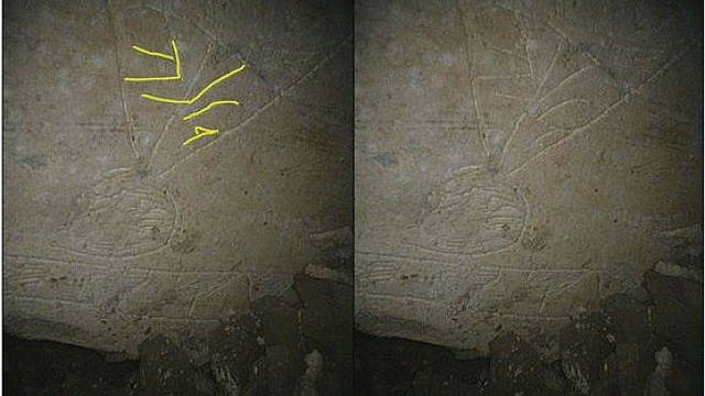
Closeup view of ossuary 6 with YONAH inscription highlighted. Background photo credit: William Tarant, GE Inspection Technologies and Associated Producers, Ltd.
_________________________________________
Article Supplement
The Lost Primacy of James the Just
The discovery of the James Ossuary and its original provenance in the Garden Tomb has served to support and draw attention to an overlooked or, as Tabor would suggest, historically suppressed, point about the man James (otherwise known as ‘James the Just’), the brother of Jesus who was also an Apostle and a major player in the very earliest movement of the followers of Jesus.
James, considered a significant figure associated with Jesus in the Apostolic period, was recorded by Josephus to have died in 62 CE, having been first hurled from the top of Jerusalem’s southeastern Old City wall by his adversaries and then bludgeoned to death after having barely survived the fall into the Kidron Valley below. He has often been referred to as ‘James the Just’, or James, brother of Jesus. Not to be confused with James, son of Zebedee, another apostle, Roman Catholic tradition holds that he was James, son of Alphaeus, or ‘James the Less’. Tabor argues that James was likely Jesus’ “beloved disciple” referred to in the gospel accounts, facilitated in no small measure by his close familial relationship with Jesus (“nursed with the same milk,” as recorded in the Second Apocalypse of James).
“Although Peter is [traditionally] remembered as the titular leader of the apostles, our earliest New Testament sources tell a somewhat different story,” writes Tabor. He points to the Acts of the Apostles, for example, as making reference in several places to the primacy of James’ leadership. And he refers to other sources, such as Eusebius and the testimony of Hegesippus (a Jewish Christian of the early second century CE), as well as the Gospel of Thomas, the famous manuscript found among the Coptic texts in the Nag Hammadi library. “Although the Gospel of Thomas dates to the third century,” writes Tabor, “scholars have shown that it preserves, despite later theological embellishments, an original Aramaic document that comes to us from the early days of the Jerusalem church. It……provides us with our clearest evidence that James succeeded Jesus as leader of the movement.”
Tabor asserts that James was systematically, over time, written out or downplayed in the evolving Rome-centered Christian theology’s emphasis on Peter as the apostle through whom the ‘keys of the kingdom’ were to pass and to whom ecclesiastical authority was to be traced after Jesus.
________________________________________
Article Supplement
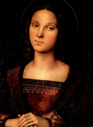
Mary Magdalene — The Companion of Jesus?
Dan Brown’s popular novel, The Da Vinci Code, tells the sensational story revolving around the notion that Mary Magdalene was the wife of Jesus, giving birth to his child and thus leaving a legacy of physical ‘heirs’ to his lineage. A false and unthinkable circumstance, according to many scholars and certainly according to most theologians. There is little disputing, however, that she is considered one of Jesus’ inner circle of followers. It is clear from the canonized gospel accounts.
But a closer and broader examination of ancient writings could be depicting a significantly different portrait of the woman who, next to his mother Mary, figured so prominently in Jesus’ life — one that may not be too far removed from the fictional image so portrayed of Mary Magdalene in the Dan Brown book. Tabor writes about it in his blog and in his books, drawing from a variety of ancient texts, included among them the Coptic text of The Gospel of Mary and The Gospel of Philip. They describe a Mary who is closer to him than any of the other apostles, privy to his thoughts, and even his intimate companion, as would be typically ascribed to a wife:
“Peter saying to Mary: “Sister, we know the savior loved you more than any other woman. Tell us the words of the savior that you remember, which you know but we do not, because we have not heard them.” Mary answered and said, “What is hidden from you I shall reveal to you.” (Gospel of Mary)
“The companion of the [savior] is Mary Magdalene. The [savior loved] her more than [all] the disciples, [and he] kissed her often on her [mouth]. The other [disciples] said to him, Why do you love her more than all of us?” (Gospel of Philip)
“Taken together, these texts [to which he refers to a number of texts in addition to the gospels of Mary and Philip]…….provide us with a broader context in which the evidence from the Talpiot tombs can be read in a new light,” writes Tabor.
By ‘evidence from the Talpiot tombs’ Tabor refers mostly to the Talpiot Garden Tomb which contained, according to him, an ossuary with an inscription identifying Mary Magdalene — an ossuary that contained ancient bone residue which, based on scientific DNA analysis, revealed a person interred in the tomb who bore no blood relationship to the person whose bone residue was found in the Jesus, Son of Joseph ossuary.
It brings us to the question: Was Mary Magdalene the wife of Jesus?
Given that no blood connection likely meant a family member through the relationship of marriage, based on what is known about the remains of individuals in ancient 1st century CE Jewish tombs, one has to consider the possibility, according to Tabor. And it would have been natural for a rabbi of the time, which Jesus was, to be married and the head of a family, he adds. He maintains that the ascetic concept of celibacy was introduced by church fathers interpreting the writings of Paul in later centuries, becoming a part of the accepted doctrine governing the behavior and circumstances of ecclesiastical authorities.
_______________________________
A Continuing Quest
Tabor’s quest to uncover the historical truth about Jesus has not ended with the tombs. His research into the ancient writings, both canonized and otherwise, lie at the core of his endeavors. However, equally significant for him are the onging archaeological investigations into the places and artifacts that could bear on the historicity of Jesus’ life and times. His co-directorship of the Mount Zion excavations in Jerusalem, where he and co-director archaeologist Shimon Gibson have been excavating for several seasons, has, and he hopes will continue to, shed additional new light on the lifeways and circumstances of members of the Jerusalem power elite during the crucial last days of Jesus, filling in new details in the backdrop that framed the events of his trial, death and its aftermath. He plans to conduct archaeological excavations in the area beneath the Armenian parking lot that lies on the other side of the Turkish Old City wall, adjacent to his suggested judgment seat of Pilate, where he suspects remains of the Roman Praetorium still lie buried. And there is still the future potential for conducting further DNA testing on any osteological/organic traces that may still exist within the interior porous limestone walls of the Garden Tomb ossuaries—leading, for example, to clarification of the relationship of the subject who was interred in the Judah son of Jesus ossuary to those who were interred in the Jesus son of Joseph and Maramene Mara (‘Mary Magdalene’) ossuaries.
Given the sensitivity that surrounds any findings and scientific claims related to the historicity of Jesus of Nazareth, however, Tabor makes clear that his research does not discredit or destroy faith. Indeed, anyone who spends time with Tabor would clearly see that there is a man of deep faith behind the practicing scientist/historian. It can be seen particularly in how he personally views Jesus.
“I see the main focus of Jesus’ message summarized best in the prayer he taught,” he says: ‘Let your Kingdom come, let your will be done, on earth as it is in heaven.’ Jesus focused on the proclamation of the Kingdom of God, which he declared was at hand! This means more than just a future apocalyptic “end of the age,” as he makes clear, but a present transformation of all areas of human society toward justice and righteousness.”
_____________________________________________________
In addition to accompanying him throughout the ‘Holy Land’ and Jerusalem, Popular Archaeology interviewed Tabor. Below are his responses to some key questions related to his work. (Pictured left: Tabor looks on near the remains of the judgment seat of Pilate)
The Talpiot Tombs
Q: What in your mind is the most significant contribution or impact of the Jesus family (Talpiot A) tomb discovery on the scholarly quest to understand the historical Jesus and early Christianity? Why is this important?
A: There are several important contributions. If the Talpiot A tomb is truly the family tomb of Jesus of Nazareth, along with the “James ossuary” that we now believe was also removed from this tomb, this would give us the first direct material archaeological link to Jesus himself—not to mention his family. Further, that we would find the bones of Jesus preserved in an ossuary helps to advance our understanding of the nature of the earliest Christian faith in resurrection as expounded by Paul. The physical body, as Paul says, is shuffled off like old clothing, and the “naked” soul is then reclothed with a new spiritual body (2 Corinthians 5:1-10). This serves to reinforce for us that the earliest Christian faith in Jesus’ resurrection was not simply the resuscitation of his corpse, but a transformation into a new spiritual body, with the old “clothing” left behind. Finally, we learn from this tomb that Jesus was married and had at least one son—Judah, something our theologically oriented gospels, written decades after the destruction of Jerusalem in 70 CE, would not preserve or choose to mention in the interest of an emphasis on Jesus’ heavenly origins and divinity.
Q: Do you have any reason to suspect or suggest that there may be more tombs with features/finds of similar import to be found in the area of the Talpiot tombs?
A: There is a third tomb in the area but unfortunately it was destroyed completely in 1980 by the building blasts at the time. What we could eventually do is actually enter the “Patio” tomb, just 60 meters from the Jesus tomb, and examine in great detail all the evidence, especially settling some of the questions regarding the inscribed ossuaries and what they mean.
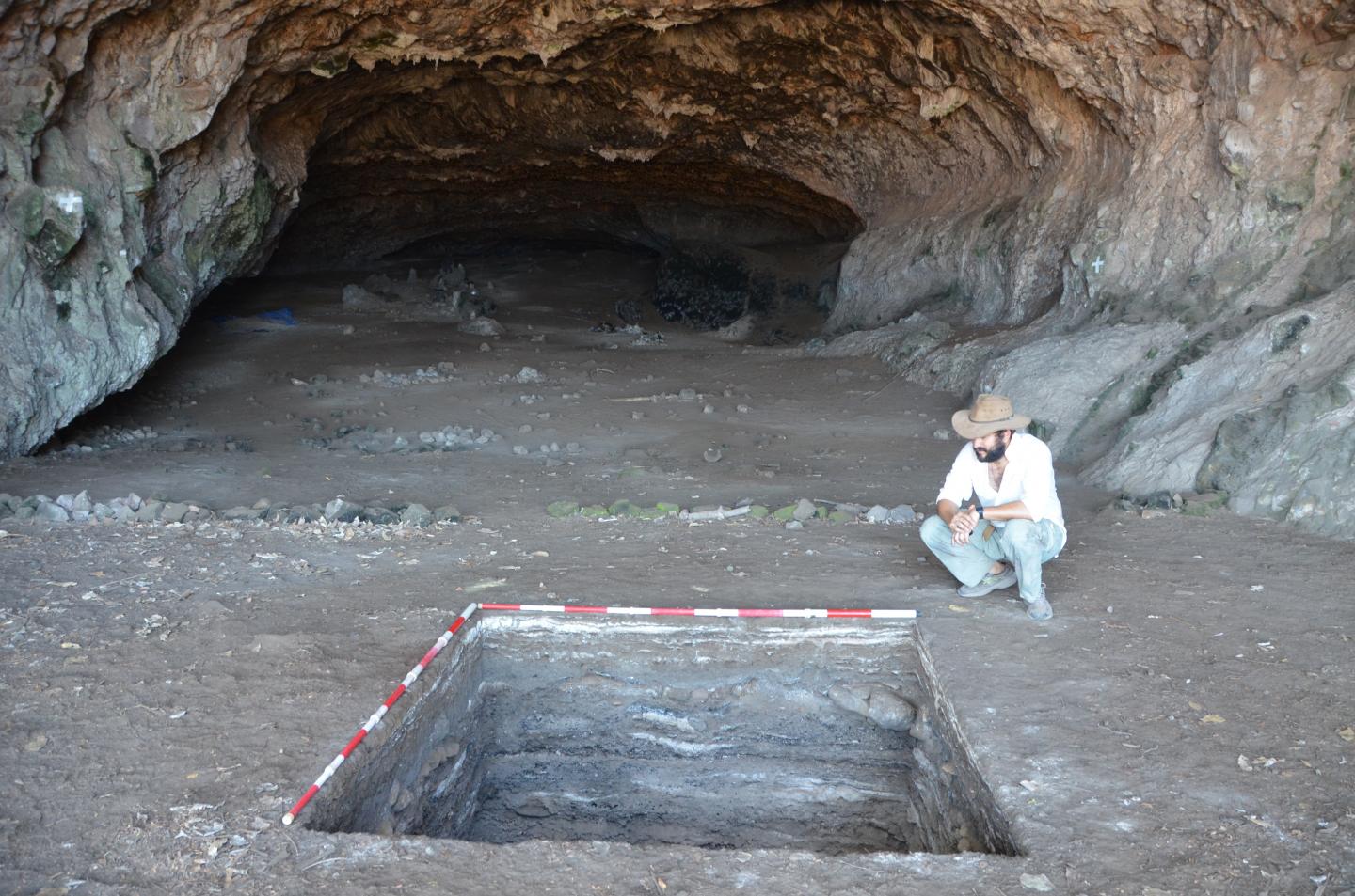
The Mount Zion Excavation
Q: Are there any significant finds, or potentially significant finds related to the Mount Zion excavations, that you think should be mentioned, but have not been mentioned or covered adequately thus far in the popular press?
A: I think the main thing is that this area of the city in the time of Jesus was a priestly “district” or Quarter—running up the slope to the top of Mt Zion, and we know that Caiaphus and other priestly families lived in this exclusive area. That Jesus has connections through the patron that owned the “Upper Room” house [the scene of the ‘Last Supper] at the top tells us that he did move in a wide variety of circles. It helps to explain how Joseph of Arimathea and Nicodemus, both members of the Jewish Sanhedrin, would have been sympathetic followers of Jesus.
General
Q: Are there any other comments or observations you would like to make related to the historical Jesus and John the Baptizer?
A: I believe it is important to see the two of them as a powerful team, united in purpose and cause, with John given his proper role as “greater” than any of those born of women. He went before Jesus but was his Teacher and inspiration. Later Christian theology totally reverses this by marginalizing John and exalting Jesus as the preexistent God in the flesh. This is totally alien to things as they were and act as a barrier to appreciating these two towering figures in terms of what they truly stood for.
Q: Given the controversial and sensitive nature of some of the hypotheses and suggestions that you have advanced about the historical Jesus, what has given you the courage to continue to speak out in defense of your views and findings?
A: I don’t in fact find any of the things I have suggested as properly “controversial” or “sensitive.” I am simply trying to see Jesus in a realistic way—as he actually was—rather than through the veil of Christian theology. He was a Jew, not a Christian and he knew nothing of the theological propositions that came to be propagated in his name. In fact I think he would be quite horrified at the whole transformation.
Q: When your life and work is finished, what would be the personal legacy you hope to leave in our understanding of the historical Jesus?
A: That Jesus was the man in whom God was well pleased and who unleashed a movement that centered on seeing the “will of God done on earth as it is in heaven”—still inspiring millions with his program and his cause.
________________________________________
Not all of Tabor’s suggestions about the historical Jesus have been covered within the limitations of this article. However, more detailed information about the results of Dr. Tabor’s decades of research can be obtained from his books, The Jesus Dynasty, and The Jesus Discovery, both published by Simon and Schuster. Also of interest would be Tabor’s blog, which is updated frequently with new posts.
—Ed.
Unless otherwise noted, all images courtesy of the author.
For more articles like this, subscribe to Popular Archaeology Premium. Available on all laptops and mobile devices, and still the industry’s best value at only $9.00 annually.
_________________________________
Advertisement


_(28484907412).jpg)
.jpg)