Arrival and the Villa
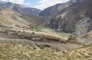
Driving up the Pacific Coast Highway feels like moving between centuries. On one side, the ocean sparkles in metallic blues. On the other, the hills of Malibu rise in dry olive tones, seemingly more Mediterranean than Californian. Somewhere along that stretch, just past Santa Monica, a house appears that seems to have lost its way from the shores of the Aegean.
At first sight it looks like something from a dream of Greece or Rome: pale walls the color of sand, red-tiled roofs, columns catching the sunlight. That first glimpse happens fast, a moment’s illusion between highway turns. This building turns out not to be the Getty Villa, the intended destination of my journey. It is the neighboring Villa de Leon, a private residence so theatrically Italian-Greek that it deceives countless travelers. I was one of them.
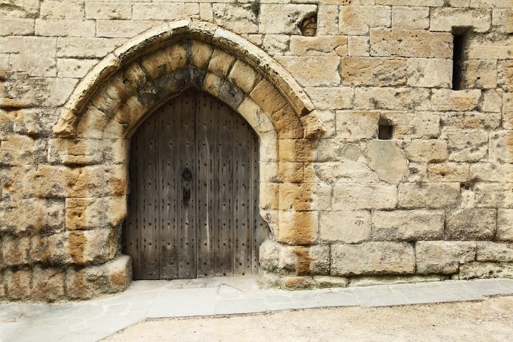
Later, when I finally managed to enter the real Getty Villa, I understood that deception almost felt deliberate. The Villa hides itself in the slope of the hill, partly invisible from the road, as if protecting something sacred. One must pass through a formal entrance pavilion, climb a staircase that narrows the field of vision, and arrive at a small terrace before anything is revealed. Only fragments appear first: a patch of lawn, a corner of a marble column, a glimpse of the sea. The rest remains withheld.
I came here at the kind invitation of Dan McLerran, editor of Popular Archaeology, to see this remarkable museum through my own eyes and gather notes for a story he hoped would carry both scholarship and wonder. It seemed a gentle assignment, yet it drew me into something much larger – a conversation between past and present, between the ruins of Greece and the light of Southern California.
From the terrace, the path leads naturally to the Barbara and Lawrence Fleishman Theater, an open-air amphitheater modeled after ancient arenas. Stone seats curve toward a modest stage; the Pacific wind moves through the arches. Even empty, the theater feels inhabited by echoes. It accommodates about four-hundred-fifty people, though its true audience seems to be time itself.
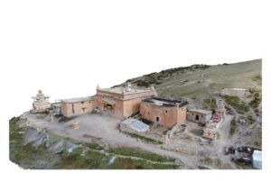
Beyond the theater, the Villa opens like a labyrinth of courtyards. Every perspective ends in water or foliage or marble. The geometry is Roman – symmetry softened by gardens. The plan is based on the Villa dei Papiri at Herculaneum, buried by Vesuvius and rediscovered in the eighteenth century. Because only partial drawings of the ruins existed when architects began this project in the late 1960s, missing details were borrowed from other Roman houses. The result is both authentic and imagined – a reconstruction of something that was never fully known.
Inside, the air changes. Columns divide the light; it falls vertically from the roof through an opening called the compluvium onto a shallow pool, the impluvium, catching fragments of sky. This atrium – the heart of the house – was designed for rain, sunlight, and reflection to coexist. The sound of water softens footsteps.
Rooms branch, each small; windows are made not of glass but of polished onyx, translucent and amber-warm. The stone filters daylight into a gentle permanence, as if centuries are diffused before they reach the eye.
Most galleries hold the museum’s permanent collection: Greek vases painted with scenes of athletes and gods, Roman bronzes whose expressions hover between serenity and defiance, Etruscan jewelry that glows with impossible craftsmanship. Temporary exhibitions rotate through a few adjoining rooms, but the Villa’s real spirit resides in the architecture itself.
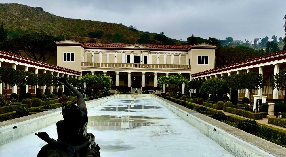
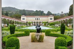
The inner peristyle garden lies just beyond the atrium – a rectangle of green enclosed by covered colonnades. Its stillness is domestic, almost private. In contrast, the outer peristyle stretches toward the sea, more formal and theatrical. A long reflecting pool runs through its center, bordered by laurel, myrtle, and boxwood. The day I visited, the pool was dry – part of California’s campaign for mindful water use. The emptiness of the basin turned it into a mirror of absence, reflecting only light and air.
Benches line the colonnades. Their legs are carved into animal paws – an antique whimsy that reminds visitors that beauty, even in marble, can smile. People sit there in contemplative silence, some reading, others simply breathing in the scent of oleander and rosemary.
Four gardens encircle the Villa: the outer and inner peristyles, the east garden with its shell-mosaic fountain copied from Pompeii, and the herb garden that grows medicinal and culinary plants. Each space speaks a different dialect of antiquity – public, domestic, decorative, and practical. To walk through them is to move through Roman life itself, translated into Californian light.
The sculptures that populate these spaces seem half-alive. Many are bronze copies of works excavated from the original Villa dei Papiri. Indoors their eyes are blank – pale marble left unpainted. Outdoors they are painted again, a modern nod to how ancient bronzes were once inlaid with stones or pigments. The effect is strangely human: faces that almost meet your gaze.
Some visitors come only for the gardens, drawn by the hush that settles between the columns. Others stay inside the galleries, tracing the evolution of form from archaic stiffness to Hellenistic grace. Everywhere, the sense of measure endures – nothing excessive, nothing hurried.
The Villa’s design defies its geography. Set above the Pacific, it could have been pretentious, yet it feels introspective. The architects built not a mansion but a metaphor – a house for memory.
And memory, here, has many layers.
_____________________________
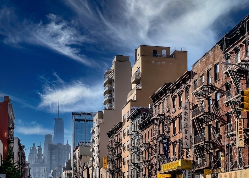
Outer Peristyle at the Getty Villa. Photo: Cassia Davis © 2022 J. Paul Getty Trust
_____________________________
Getty’s Dream and the Kingdom of Pylos
The Villa was born from an obsession.
J. Paul Getty, oil magnate and reluctant philanthropist, collected antiquities with the precision of an accountant and the hunger of a poet. In 1954 he opened his first museum inside his Malibu ranch house, displaying Greek vases beside French furniture, Roman bronzes beside Dutch paintings. But the collection outgrew the house, and the man outgrew modesty.
In 1968, Getty commissioned construction of a full Roman villa to house his treasures – a resurrection of the Villa dei Papiri, complete with peristyles, frescoes, and tiled pools. The irony is that he never saw it finished. By the time the museum opened to the public in 1974, Getty was living in England and would die there two years later. His will left most of his fortune to the institution, transforming a private curiosity into one of the richest cultural trusts in the world.
What fascinates me is not the wealth but the paradox: a man described by many as cold and miserly builds a museum that radiates generosity. Perhaps architecture redeemed him where affection could not. The Villa feels like an apology – to art, to history, maybe even to himself.
Today, the Getty Villa stands as both museum and experiment. It offers an education in how the ancient world might live within modern California: Doric columns under electric light, olives growing beside parking lots, archaeology framed by ocean fog.
The day of my visit, the Villa’s main exhibition was called “The Kingdom of Pylos: The World of the Warrior Princes of Mycenaean Greece.” The name itself sounded mythical – half history, half legend. Yet the show was rigorously scientific, co-organized with the Hellenic Ministry of Culture and the University of Cincinnati excavations at Pylos.
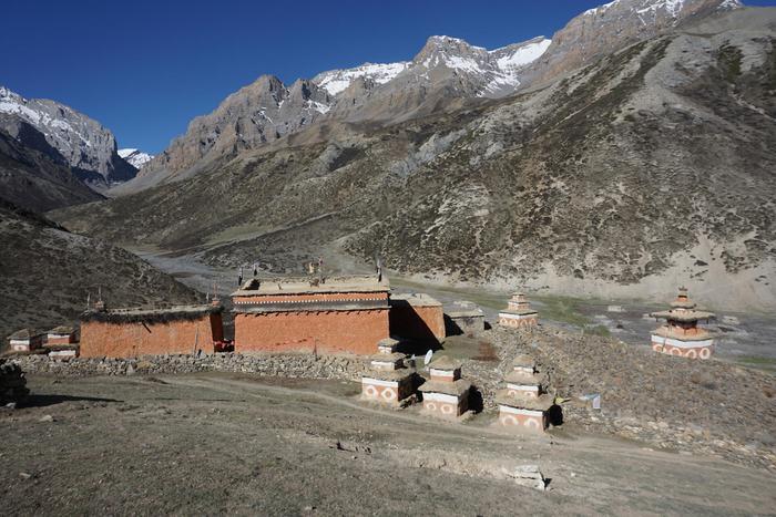
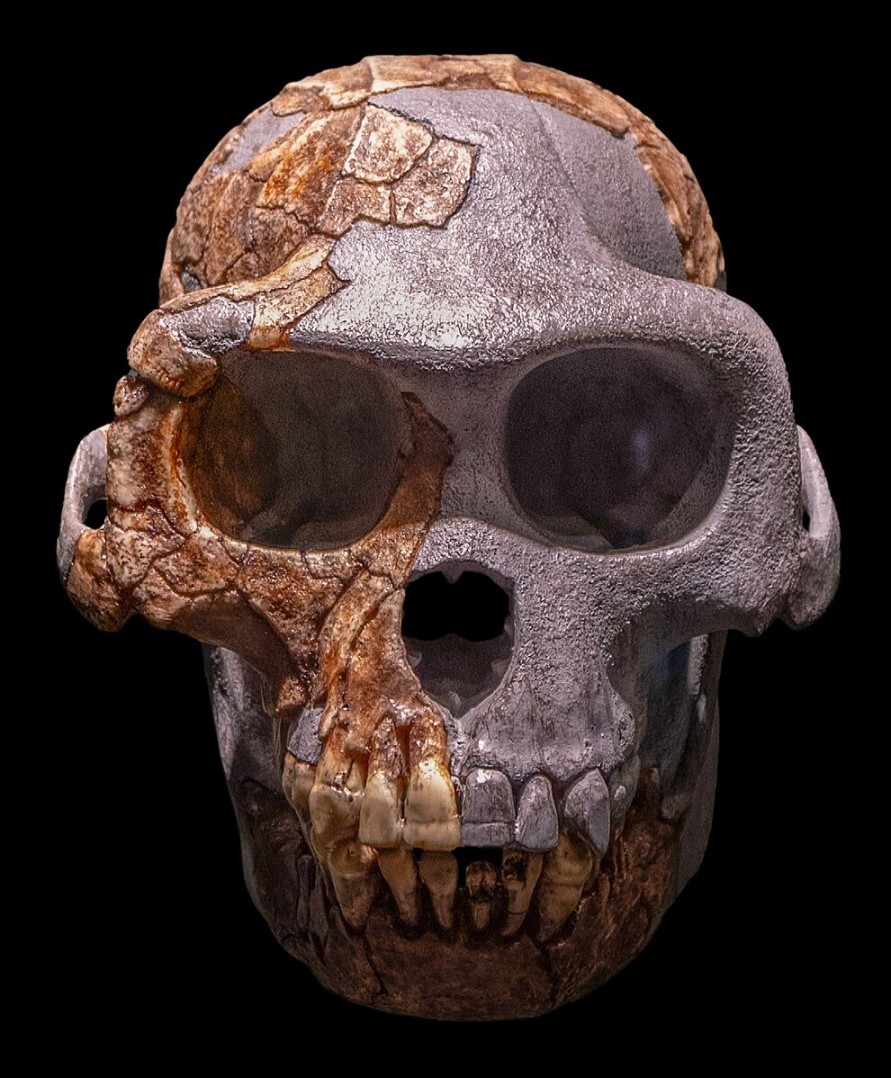
Inside, the lighting dimmed to a honeyed dusk. The exhibition opened with a map of the Aegean, a constellation of names – Mycenae, Tiryns, Thebes, Knossos, and Pylos – each a pulse in the Late Bronze Age. Around 1700 to 1070 BCE, this network of citadels shaped the first advanced culture of mainland Greece. These people built palaces, kept administrative tablets, traded luxuries across seas, and buried their elite with gold, weapons, and painted vessels.
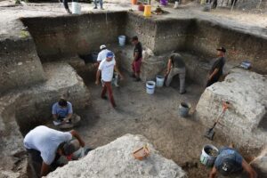
Among the centers of this civilization was Pylos, ruled by a monarch whose realm stretched across 800 square miles. Homer later called him Nestor – the wise old king of the Iliad and Odyssey, host to Telemachus and keeper of counsel. For centuries that name hung between poetry and possibility until archaeologists unearthed the Palace of Nestor, confirming the myth’s geography.
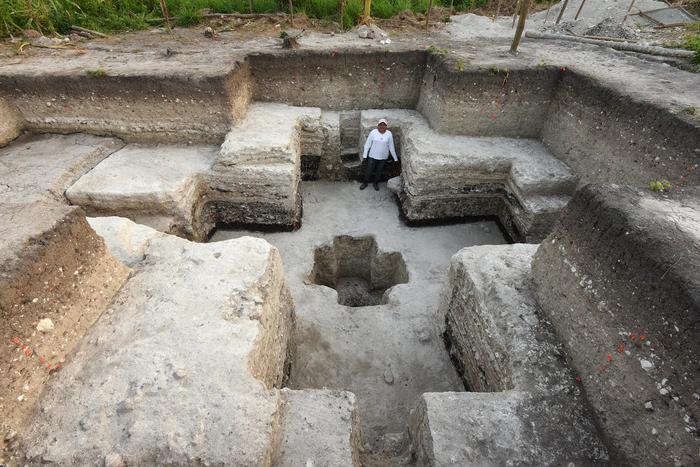
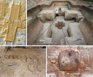
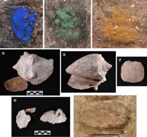
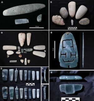
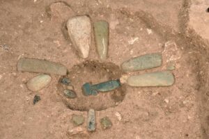
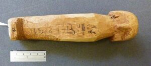
The Getty exhibition showcases gathered artifacts and reconstructions from those excavations: fragments of frescoes showing processions of women in vivid robes, Linear B tablets inscribed with the earliest known Greek, bronze swords still bright with ceremonial polish. Yet the heart of the display was one grave – the Griffin Warrior, discovered in 2015 near the Palace of Nestor.
The man in that tomb, dated around 1450 BCE, was buried with four gold signet rings, a sword of bronze and ivory, and a small carved gem barely larger than a thumbnail. On that gem – now called the Pylos Combat Agate – a warrior drives his blade into an enemy’s neck while another collapses at his feet. The carving is so detailed that scholars had to use microscopes to study its lines. How such miniature precision existed in that era remains one of archaeology’s quiet miracles and intriguing mysteries.
Standing before the replica of the gem, I thought of how art often begins where survival ends. The Griffin Warrior lived in a time of blades and tribute, yet someone in his circle carved a scene of exquisite empathy – the human body at its limit of grace and pain.
The exhibition turned these discoveries into a larger story: how Mycenaean culture absorbed Minoan elegance from Crete; how its palatial order eventually collapsed around 1070 BCE; and how, out of that darkness, Greek myth was born. Bronze gave way to iron, kings to legends, record-keepers to poets. What survives are fragments, but they hum with continuity.
In one gallery a looping video showed aerial footage of the Messenian landscape – olive groves, dry hills, the sea folding into Voidokilia Bay. Watching it inside the Villa, I felt geography bend. The hills of Greece echoed the slopes of Malibu; the same light, filtered through different centuries, fell on stone and water.
Visitors moved quietly, as if walking through a memory rather than an exhibition. Children pointed at the gold rings; an elderly man traced the Linear B characters in the air. Everyone seemed to understand that the distance between antiquity and the present was thinner than it appeared.
As I left the final room, I noticed a line printed near the exit: “The latest techniques for interpreting the remains of Late Bronze Age society reveal the history behind the myths.” It struck me that this could describe not only archaeology but also the Villa itself – a place that keeps revealing history behind myth, reality behind architecture, humanity behind wealth.
____________________________
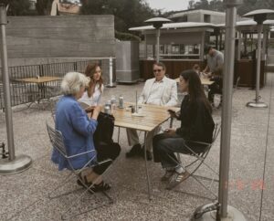
Discussing the special exhibit, The Kingdom of Pylos: Warrior-Princes of Ancient Greece, showing at the Getty Villa Museum. Clockwise from left to right: Claire Lyons, Curator of Antiquities with the Getty Museum; Anastasia Adeler (in white), article author; Dan McLerran, Editor of Popular Archaeology; and Shannon Iriarte, Communications Specialist with the Getty Museum.
____________________________
Conversations and Light
Outside, the afternoon was beginning to thin. The Pacific light had shifted to that hour when everything seems gilded from within. From the upper terrace the ocean looked like beaten metal, the same color as the ancient bronzes inside. A few visitors stood on the steps, holding their phones up to capture the symmetry of columns and shadows.
I lingered, reluctant to leave. It wasn’t the objects themselves that held me, nor even the architecture, but the sensation of parallel time – the strange comfort of finding ancient Rome and Greece suspended in the present tense of California. The Villa is often described as a museum, yet it behaves more like a poem: each corridor a line, each garden a stanza.
Walking again through the inner peristyle, I noticed the way silence travels differently here – just as texture. The air carried traces of salt from the ocean below and of rosemary from the herb garden. Somewhere water dripped lightly into a basin, as if to remind visitors that everything enduring begins with small repetitions.
I thought of Getty himself – the complicated man who imagined this sanctuary. The official history calls him a visionary collector, a believer in art as civilization’s teacher. The personal histories call him miserly, remote, almost cruel. Perhaps both are true. Perhaps all patrons of eternity are divided that way: one part greed, one part reverence. Yet his legacy, however flawed, gave shape to this miracle on the coast.
The Villa’s relationship with light feels spiritual. Morning enters through onyx windows as amber translucence; afternoon slides along the colonnades; at dusk, everything turns to bronze. The architects couldn’t have planned it better. Even the shadows behave like memory, drifting gently across frescoes and floor mosaics before vanishing.
I paused before a marble torso of a young athlete, headless, one arm missing. The surface was worn to the texture of skin. I thought about how many times beauty survives through incompleteness, how fragments insist on being whole in the imagination. That, perhaps, is why places like this matter: they teach us that restoration is not the same as resurrection.
Outside, the amphitheater had emptied. A gull crossed the open stage, then the sky beyond it. From the path above, the outlines of Villa de Leon reappeared – the impostor house that had first deceived me. I smiled. Now I understood the difference between imitation and conversation. The Getty Villa doesn’t imitate antiquity; it converses with it.
The drive back along the Pacific felt slower, though the distance hadn’t changed. The ocean’s edge glimmered with small waves. Somewhere far across that horizon lay Greece – the original light, the origin of the stories. Here in California, those stories had found a second shore.
As twilight folded over the coast, I thought of Nestor’s palace, the Griffin Warrior’s tomb, and the persistence of craftsmanship. We build museums not to own the past but to keep asking what it meant to be human then, and what it still means now.
The Villa behind me disappeared into the hillside. Its columns caught the last flare of sun and turned gold for an instant before dimming to ivory. For a heartbeat the scene felt like the end of an old epic – heroes at rest, kingdoms turned to memory, light becoming legend.
Driving away, I whispered the word that had followed me through the day: Pylos. It sounded soft, resonant, unfinished.
_____________________________
The Getty Villa Museum is open for visitors daily between 10:00 a.m. and 5:00 p.m. It is closed on Tuesdays.