Over more than a thousand years, Venice transformed from a modest refuge into a dominant Mediterranean power. Despite various crises and encircling empires, the Venetian Republic avoided foreign rule, revolution, and collapse.
It developed an adaptable and efficient political system, building on its semi-independence from the 5th century until Napoleon’s conquest in 1797. In an international system dominated by self-proclaimed democratic republics, the longevity and eventual downfall of Venice’s oligarchic republican model provides insights for tailoring governance to contemporary challenges. Its unique political structure inspired founding fathers of the United States, like Alexander Hamilton and John Adams, who looked to Venice’s early system when shaping the republic. By blending Roman legal principles, Byzantine refinements like the Justinian Code (a compilation of Roman laws shaped by Greek traditions that codified and systematized legal practices), and its original innovations, Venice became a symbol of stability, endurance, and independence.
The Origins of Venice and Its Push for Independence
Venetian society was deeply paternalistic, governed by a hereditary elite with limited public participation, and yet it contained many elements of distribution of powers and checks on authority that are ubiquitous today. Geopolitically savvy and culturally diverse, Venice was open to new and foreign influence while preserving its traditions. Venetian diplomat Gasparo Contarini’s 16th-century account, shaped by his family’s central role in Venetian politics, alongside other sources, highlights Venice’s self-proclamation as the Serenissima Repubblica di Venezia—the Most Serene Republic of Venice.
Venice’s origins, according to tradition, trace back to 421 AD, when Roman refugees fleeing invasions in northern Italy established self-governed settlements in the Venetian Lagoon. The Rialto, which became synonymous with Venice, only emerged as the city’s center 400 years later. The collapse of the Western Roman Empire in 476 left northern Italy contested, with instability driving more settlers to the lagoon.
During the 5th and 6th centuries, trade networks and influential families began to shape the region. They reflected a mix of loyalties: pro-Byzantine landowners tied to the mainland coexisted with a rising merchant class seeking autonomy, along with the Frankish factions loyal to Rome. These groups dominated the informal councils, assemblies, and tribune leadership roles that governed early Venetian society.
By the 7th century, Venetian settlers recognized Byzantine authority in exchange for protection and securing vital trade access. Historian John Julius Norwich emphasized the Byzantine’s role in shaping Venice’s identity, alongside its Roman heritage.
In 697 AD, the lagoon’s settlers elected their first doge (duke), marking the beginning of Venice’s independence. Initially, the doge’s authority required approval from Constantinople, but Byzantine authority in the region was never strong and gradually faded. Seeking stronger local governance to navigate the delicate political landscape, Venetians resisted certain Byzantine decrees and a revolt in 726 saw them elect their own doge without outside interference. In the early 9th century, Venice successfully secured greater autonomy from the Byzantine Empire while keeping the Frankish Empire at bay by playing a crucial role in mediating peace between them, a settlement later known as Pax Nicephori.
Over the following centuries, Venetian autonomy increased as it forged ties with Rome to enhance its influence in Europe. Venice’s role in the 1204 sack of Constantinople, led by Latin forces, solidified its independence as a sovereign republic, coinciding with the rise of powerful republican city-states across Italy. Its push for independence was vital in shaping a political system aligned with Venice’s unique needs, values, and aspirations as a sovereign state.
Constraining Doge Power and Creating a Republic
Like the Roman Republic, Venice lacked a formal written constitution or judicially enforced laws. Instead, its political system relied on unwritten customs, allowing flexibility in responding to new challenges, and also demonstrating that the republican culture depends on habits of the heart and mind more than documents that record statements of principle.
Though dominated by a hereditary elite, Venice’s republican system prioritized power decentralization, an unusual approach at the time that encouraged a balance of authority and political stability. Early doges ruled autocratically for life, often attempting to establish dynasties, leading to rivalries, assassinations, and exiles. By 1032, Venetian patricians chose to abolish de facto hereditary dogeship, and though the doge retained a lifetime title, they could be deposed or pressured to resign.
Secrecy was essential to shielding political affairs from outside influence. With few grand political rallies or public speeches, rivalries were mostly confined to private councils. This restraint also helped prevent stirring up public sentiment, avoiding sensationalism, and maintaining a sense of calm and order in the city.
Venetians were willing to adapt when necessary, but once a solution proved effective, they stuck with it. The threat of factionalism over the doge’s position, led by the Tiepolo and Dandolo families in the 1200s, prompted patricians to introduce a unique voting process for the doge in 1268. Combining lotteries and voting, this system would remain largely unchanged for the next 500 years.
Council members gathered and drew from an urn containing hundreds of balls (ballotta)—30 gold and the rest silver; those drawing gold advanced, while those who picked silver exited. The ballottino, a young attendant, managed the urns. The 30 who picked gold then repeated the lottery, reducing their number to nine. These nine members then deliberated and agreed on 40 candidates, each requiring a minimum of seven votes from the group of nine to be considered. The process continued: the 40 were reduced to 12, who nominated 25; the 25 to nine, who nominated 45, and finally, the 45 to 11, who selected 41 electors. The final electors deliberated and voted on the doge, who required a minimum of 25 votes to win.
The process combined the impartiality of lotteries with the selectivity of voting, minimizing the chance for corruption while ensuring the legitimacy of decisions through broad consensus. The often weeks-long change broke the families’ duopoly, and ensuing elections often took weeks.
Contarini observed that doges were neither glorified nor vilified. Their terms were subject to posthumous review, with poor leadership censured or erased from public memory, while the contributions of effective rulers were recognized. This helped to ensure that leadership was viewed as a collective effort rather than the achievement of any single individual.
Fear of the doge’s authority also led patricians to steadily decentralize power into hereditary committees, integrating government expertise within the oligarchy. This ensured balanced decision-making and reduced the risk of autocratic rule. In 1142, the Minor Council was established as a small executive body to assist and monitor the doge. This was followed by the Great Council in 1172, which became the foundation of Venetian governance and the principal legislative body, severely limiting the doge’s power. Membership in the Great Council was a lifetime privilege for patrician males.
From 1179, judicial authority was invested in the Quarantia Criminale (criminal law), followed later by two other Councils of Forty (highest appeal court). By the early 13th century, the Senate emerged from the Great Council, focusing on trade and foreign policy, and was composed of serving and former officials.
Meanwhile, in response to the failed 1310 revolt by Bajamonte Tiepolo, the Council of Ten was created to track down conspirators, later evolving to handle crises, conduct investigations, and oversee internal security. Despite rising governmental complexity, Venice’s bureaucracy remained efficient and avoided runaway growth.
Political offices outside the dogeship also faced constraints. Terms were typically limited to one year to prevent consolidation of power and reelections often required formal approval. Close relatives were prohibited from holding the same office, running in the same election, or voting in elections involving each other to prevent familial monopolies.
Contarini noted that accountability was shared among the elite. Nobles who supported candidates were held financially liable if those candidates were later convicted of embezzlement and unable to repay the amount. Corruption resulted in punishments such as property confiscation and exile, with the competitive noble families keeping each other in check.
As the doge’s role became largely symbolic, real power shifted to the Council of Ten, the Great Council, and the Senate. These bodies dominated Venetian politics during its Golden Age, Renaissance, and eventual collapse, adapting to changing needs while maintaining cohesion and expertise through overlapping membership.
The Arengo or Concio, a general assembly of Venetian general citizens, initially played a strong political role alongside the doge. However, Venice’s noble families were similarly distrustful of commoner influence through democracy. Public participation in governance declined sharply after the Serrata of 1297 or the closing of the Great Council, which solidified hereditary governance and saw the Arengo lose its political authority before it was formally abolished in 1423. These decisions effectively ended democracy in Venice and ensured political power remained concentrated among the nobles. Given the rarity of democracy at the time, this approach nonetheless permitted greater political stability by minimizing potential disruptions from populist movements.
Social Hierarchy and Economic Opportunities in Venice
The late 13th and early 14th centuries “marked the formal separation of the nobles from the rest of the population,” entrenching Venice’s oligarchy and placing the non-patrician majority—approximately 95 percent of the city’s population—under elite control. The disconnect between the elites and commoners could be stark—Contarini praised Venice’s commitment to protecting commoners during crises like the plague, but later accounts paint a less charitable picture.
Despite limited political representation and rigid social classes, Venice’s nobles managed to maintain enough support for the political system to survive. A tiered hierarchy emerged under them, with the cittadini—a privileged class of merchants, skilled artisans, notaries, and administrators—forming approximately eight percent of the population, while the majority were commoners (popolani).
Social hierarchy in Venice was strictly enforced, with laws dictating what each class could wear. Intermarriage between patricians and cittadini was rare, though the latter class experienced regular turnover. Richer cittadini often surpassed certain aristocratic families in wealth, while patricians invested in merchant enterprises, creating economic interdependence.
The cittadini also controlled the civil service, led by the Grand Chancellor of Venice—the highest-ranking non-noble official. Through the Order of Secretaries, the cittadini served as notaries, clerks, tax collectors, and judicial officers. The wealthiest of their families with long-standing Venetian roots (cittadini originari) were included in the Book of Silver and granted additional opportunities in committees. Granting the cittadini some political influence prevented the patricians from completely dominating government affairs and ensured efficiency through their administrative expertise.
Despite the large and relatively powerless commoner class, Venice avoided the social upheavals common in other Italian city-states. According to Dennis Romano, professor emeritus of history at Syracuse University, 14th-century Venice remained stable because patricians and commoners were less rigidly separated, and tradition coexisted with flexibility. Social networks could overlap and legal and moral boundaries occasionally blurred during this period. Social rules were relaxed during holidays and festivals, elevating a sense of civic community, while commoners could participate in religious roles, including as members of the clergy.
Symbols of unity, such as the Venetian mask, the lion of Saint Mark, and the figure of the doge, reinforced civic identity. Legal protections through the Avogaria de Comun (public prosecutors), established in the late 12th century, ensured justice for commoners and legal representation for the poor. The state also supported infrastructure projects, welfare institutions, and charities, and wealthy nobles were expected to engage in philanthropy without fanfare and provide financial aid to the state during crises.
Venice’s economic allure and social mobility opportunities were, however, arguably the most crucial factors in maintaining stability. Venetian contract law ensured trust and stability in trade. The republic’s vast commerce and trade networks and position as a vital connector between the East and the West offered opportunities to commoners rarely found elsewhere.
While they suffered more during conflicts, famines, and plagues, the diverse composition of the popolani made it difficult for them to unite around common grievances. Additionally, Venice’s stable governance and potential for social mobility left them better off than those in neighboring city-states and empires. As a result, though commoners were excluded from major political decisions, they accepted their limited role, trusting in the fairness and accountability of Venice’s governing class, institutions, and rule of law.
Within the city, a thriving retail sector and diverse economic opportunities complemented a strong manufacturing base. Venice became a leader in shipbuilding, wool and silk cloth production, and glassmaking, attracting talent and investment. Commoners could also join merchant guilds and trade associations along with cittadini, gaining modest political representation and participation in collective decision-making. In later centuries, Venice evolved into a hub of printing and intellectual life, eventually becoming a center for culture and leisure, renowned for its prestige as a museum city. Venice’s economic adaptability, driven by both patricians and the merchant class, was key to Venice’s sustained prosperity, driving innovation and supporting the city’s ability to respond to shifting trade and political dynamics.
Military Strength, Foreign Holdings, and Diplomacy
But Venice’s survival and success also came from its military strength. Surrounded by larger states, its central hub in the Venetian Lagoon provided a defensible core for its navy. The state-owned Arsenal, a pioneering shipyard, and private enterprises enabled the mass production of ships, blending commerce and defense. Merchant ships were often fitted for combat, doubling as warships to protect trade routes, while military expeditions were self-sustaining through trade conducted en route. Boasting the strongest navy in Europe, Venice compensated for its limited land power by employing professional mercenaries and condottieri (or military commanders).
The republic avoided overextension, focusing on maintaining positive relations with its limited territories. Mainland cities enjoyed considerable autonomy, with several independent city-states voluntarily joining the republic. During the War of Cambrai (1508 to 1516), Venice contemplated ceding mainland territories, but revolts in occupied cities in support of Venice helped drive out invaders.
At its height in the 16th century, Venice’s dogado around the lagoon housed approximately 150,000 inhabitants, with its wider territories encompassing 2.3 million people. The Domini da Tera administered mainland Italy, while the Domini da Mar governed overseas colonies. Venetian military officials, like their political counterparts, were rotated regularly to avoid power accumulation and provide numerous nobles with administrative and military experience.
Revolts in Crete against Venetian rule exposed governance flaws in its territories, but efforts to promote greater equality between Venetian settlers and local populations eventually brought peace and showcased Venice’s adaptability in managing overseas territories.
Venice also maintained its independence through skilled diplomacy and a calculated focus on the balance of power. Supported by an expansive network of spies, diplomats, and agents, the small republic successfully navigated challenges from larger, powerful rivals, including Byzantium, the Carolingians, the Holy Roman Empire, the Ottomans, France, and Spain. An early strategic alliance with Byzantium secured access to key ports, while ties with Rome and trade posts as far as China reinforced its position as a reliable trading partner and intermediary. Ties with entities like the Hanseatic League (a trading network) further expanded Venice’s global reach.
Even during its economic decline, Venice played a powerful diplomatic role. Several Venetian popes were elected from the 1400s to 1700s, and Venetian diplomat Alvise Contarini played a crucial role in mediating the Peace of Westphalia in 1648, ending the Thirty Years’ War.
Steady Decline
The seeds of Venice’s decline were nonetheless sown early into its foreign expansion. The Fourth Crusade in 1204 enriched Venice and expanded its territories but strained its relations with Eastern Orthodoxy. The smaller, weakened Byzantine Empire, restored after the crusade, could not withstand the rising Ottoman Empire, whose conquest of Constantinople in 1453 disrupted Venice’s critical eastern trading routes. Venice maintained a strong presence in the Mediterranean, but logistical challenges, heavier taxation, and growing Ottoman competition gradually pushed it into a defensive retreat.
In 1492, Spain’s accidental arrival in the Americas marked a shift in global trade and the need for larger, ocean-bound ships. Venice’s lack of access to the Atlantic, which would fuel later European empires, was soon compounded by the Portuguese voyage to India via Africa in 1498, further undercutting its trade with the East. Venetians later established footholds in cities like Paris, London, and the Low Countries to collaborate with the rapidly growing Atlantic powers, but they struggled to keep pace.
The city’s preference for autonomy left it isolated in a rapidly changing European geopolitical landscape. While Venice’s early history of isolationism gave way to expansion, the city reverted to a more defensive and conservative isolationism in a world dominated by global powers. Repeated outbreaks of plague, particularly in 1575 to 1577 and 1630 to 1631, devastated Venice’s population and weakened its economic and military foundation.
By the 17th century, Venice’s once-adaptative nobles and political system had come to resist reform. Venice’s oligarchic social and political structure, as noted by historian John Norwich, had become rigid and highly corrupt. The nobility, formerly active merchants, had become passive investors, landowners, or city administrators. Destitute aristocrats could no longer sustain their privileges, weakening both their status and the socio-political hierarchy. Political activists, inspired by French Jacobin ideals and Italian nationalism, became increasingly vocal.
Venice’s system had also arguably become too outdated by the 18th century. Nation-states and the modern concept of nationalism simply overwhelmed merchant republics in demographics, territory, and wealth. Napoleon’s revolutionary changes in both warfare and social systems allowed the French military to take Venice without a fight. The Great Council then voted itself out of existence, and France transferred the region to Austria, which shifted the center of the regional government to Milan and prioritized nearby Triest as a port instead. Venice was later incorporated into Italy in 1866, which it has remained part of ever since.
Venice’s Strengths and Other Former Republics
Other Italian city-state republics also achieved prominence. Florence flourished with its banking sector, textile industry, and legal protections afforded to its citizens. Lucca maintained independence longer than Venice, while Pisa and Siena enjoyed periods of prominence. Genoa emerged as a significant maritime power, rivaling Venice for centuries.
However, Florence shifted to hereditary and dynastic rule under the Medici family in the 16th century and conquered Pisa and Siena. Lucca lacked Venice’s scale and influence, while Genoa, despite its strengths, struggled with internal tensions. Merchants and aristocrats were often at odds, as were rival noble clans who reverted to warring among themselves during peacetime. This instability often required foreign mediation, gradually eroding Genoa’s autonomy, while its later alliance with Spain further subordinated Genoa’s independence.
In contrast, Venice managed to avoid conquest, retaining its republican system, political autonomy, and global significance long after many of its counterparts had faded or been absorbed. Even centuries after its fall, no other Italian republic holds the same mystique of Venice. The city’s cultural impact alone was immense, producing creative figures like Tintoretto, Antonio Vivaldi, and Giovanni Bellini, and attracting Andrea Palladio and Titian. Its architectural beauty, set against the lagoon and emulating Roman styles, remains an international draw. Venice’s maintenance and adaptation of Greek and Roman political influences created a system that lasted centuries, which though weakened by the time of French conquest, may have had the potential to rebound.
Venice’s independence movement, which has accelerated since 2014, is unlikely to achieve secession due to significant barriers, including the constraints of Italy’s constitution, lack of international recognition, and disputes over the territorial feasibility of such a split.
The city’s modern economy is driven by tourism, with more than 5.7 million visitors in 2023. Other Italian city-states survive in their own ways: Genoa revived as a key port city in the 1800s and remains so today. The Grimaldi family, originally from Genoa, meanwhile, seized control of Monaco in 1297 and has ruled the country ever since. San Marino, a city-state republic with a claim to a 1700-year-old history, successfully diplomatically negotiated its independence in 301 AD.
Other republics outside Italy emerged during Venice’s time but struggled to endure. The Novgorod Republic established in 1136 in modern Russia, thrived on trade and featured a large assembly, term limits, and checks on elite power. However, its lack of a strong military left it vulnerable, and Moscow captured it in 1478.
The Dutch Republic, established in 1588, decentralized government between provinces and the States General for shared decision-making. It prioritized legal protections, religious tolerance, trade, literacy, and social mobility, though the Dutch East and West India companies undermined republican ideals through colonization and slavery. In 1795, the Dutch Republic fell to France and was replaced by the centralized Batavian Republic, which struggled with regionalism and reliance and dominance by France. By 1810, it became a French-controlled monarchy, until Dutch independence in 1813 reintroduced a monarchy that persists today.
Modern Republican Rule
Modern republics remain young and show a range of adaptations. Parliamentary republics rely on coalition-building, but this risks marginalizing even the most popular parties. Votes of confidence can swiftly remove leaders, but shorter political terms can lead to prioritizing short-term visions. Presidential systems can, meanwhile, run the risk of autocracy, particularly with longer-term limits and incumbency advantage. Other challenges include promoting democratic participation without runaway populism, balancing decentralization and centralization, creating effective political bodies without needless bureaucracy, and striving for peace while remaining prepared for conflict.
Switzerland stands out for its sustained stability, avoiding revolution, occupation, or imperialism since its unification in 1848. It combines regional and international autonomy, open trade, and its role as a global financial and diplomatic hub. Seasonal canton voting embodies direct democracy and encourages citizen participation. However, universal suffrage faces resistance tied to immigration, with referendums on non-citizen voting rights from 1992 to 2016 struggling in areas with higher foreign populations, reflecting concerns over integration and “over-foreignization” in the country.
Singapore, an independent city-state republic since 1965, has thrived and maintained its autonomy by emerging as a trade hub, balancing Cold War powers and rising U.S.-China tensions over the last 20 years. Despite its nominally democratic and republican system, governance has remained centralized under the People’s Action Party, dominated by Lee Kuan Yew’s family and close allies.
The Need for Greater Corporate Accountability
The discussion of decentralized leadership should extend beyond nations to the private sector. Early corporations like the British East India Company, as well as modern constitutional republics, were modeled on medieval chartered towns that were given powers to legislate, imprison, and wage conflicts.
Modern multinational corporations operate globally, influencing markets, negotiating with governments, and increasingly having access to armed forces. Their growing autonomy has led to efforts to link corporate governance with civic responsibility, including proposals to replace the hijacked democratic “one share, one vote” system that has allowed major shareholders to consolidate power and exploit corporate governance in recent decades.
The likelihood of self-imposed corporate accountability is low. However, introducing more layered governance with checks and balances could improve oversight, as private governing entities continue to evolve. Increasing experimentation with private cities globally signals a resurgence of corporate governance, seen more than a century ago in the U.S. with company towns. Similarly, Próspera, a private charter city on Roatán Island in Honduras, is run by a U.S. corporation with a proclaimed commitment to libertarian ideals.
It’s important to view the workers and communities these corporations interact with as similar to state subjects. The growth of corporate power challenges the classical liberal idea that contracts between companies and workers should be free of authority. Republican-style corporate leadership in such projects could address concerns about civic participation, autocracy, and the rule of law.
Venice’s Lessons for Modern Democracies
Many factors contributed to Venice’s success: expansive trade networks, social mobility, technological innovation, geographic advantages, military power, and diplomatic prowess. These elements were mutually reinforcing, underpinned by political stability achieved through distributing authority across collaborative bodies. While Venice’s oligarchy compromised the non-hereditary ideal of republicanism, it effectively prevented dynasties and upheld the principle of power distribution. The public largely trusted the nobles, though the exclusive nature of the noble class contributed to their decline in later centuries.
Venice’s political evolution and trajectory are a priceless repository of history for modern democracies to study. The presence of a non-hereditary figure like the doge provided a unifying focal point for governance, helping to anchor symbolic authority and reduce factionalism. A commitment to checks and balances allowed for a balanced distribution of power. Economic opportunities were cultivated by elites and merchant classes and embraced by the commoners, driving Venice’s prosperity and social mobility. Its ability to continuously adapt its political and economic systems was similarly a major reason for its long-term survival.
Today, frequent power and public opinion shifts, coupled with the influence of wealth and corporations, are fueling instability and gridlock, undermining the long-term effectiveness of democratic institutions. History shows that democratic societies have voted to unintentionally dismantle their own democratic and republican systems, and contemporary voters have often turned to populism and autocracy in the 21st century out of frustration.
But how much power should rest with individuals? Governance could be strengthened by withholding our tendency to center authority in people and instead placing it into political bodies. Venice’s system, for all its strengths, failed to create a fully open, meritocratic system, but its emphasis on collaborative bodies within a professional political class is something modern democracies may need to reconsider. Had Venice’s republican system continued to adapt rather than become increasingly rigid, it may have endured to this day.
____________________________
This article was produced by Human Bridges.
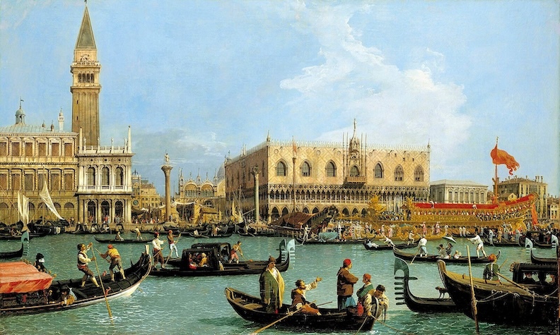
Cover Image, Top Left: Painting of historic Venice by Canaletto. Public Domain, Wikimedia Commons
____________________________

EXPLORE THE ANCIENT ETRUSCANS IN PERSON!
Experience a unique, up-close-and-personal hike among ancient hilltop towns in central Italy. You will walk the sensational countryside of the regions of Umbria and Tuscany, soaking in important sites attesting to the advanced Etruscan civilization, forerunners of the ancient Romans; imposing architectural and cultural remains of Medieval Italy; local food and drink; and perhaps best of all — spectacular scenic views! Join us in this collaborative event for the trip of a lifetime!


