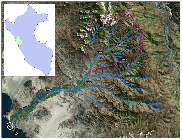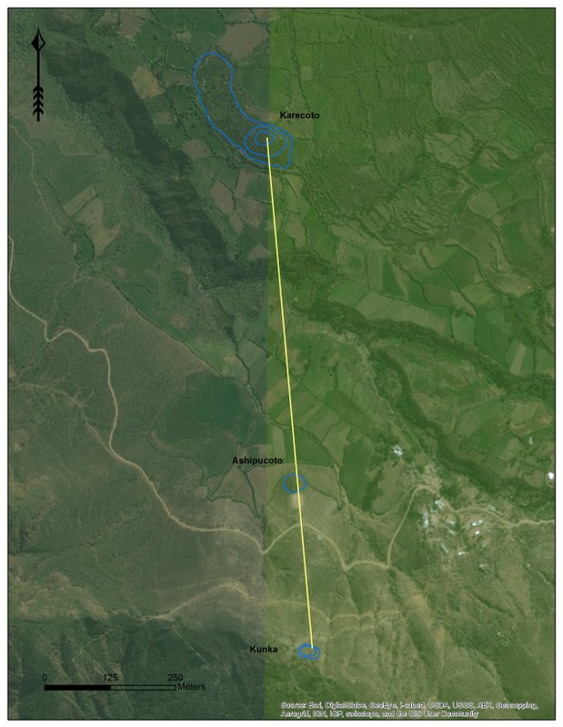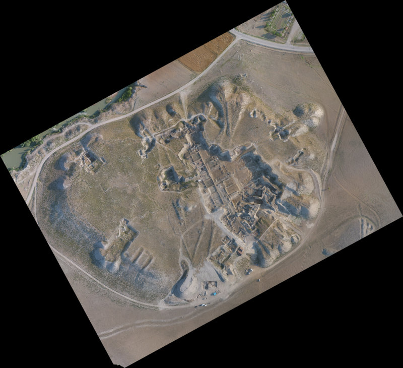
This report presents the results of excavations undertaken in the patio area of ‘Building Group 78’ at Xno’ha by the Maya Research Program (MRP) in 2014. The site of Xno’ha is situated in northwestern Belize between the Bajo Alacranes and the Dumbbell Bajo (Guderjan 2007: 15) (see Figure 1). Characterised as a medium-sized Maya centre, comprising a large central plaza surrounded by an abundance of residential building groups, “the name [Xno’ha] was given to the site in reference to Xno’ha Creek which enters the Rio Azul/Hondo from Mexico just north of the site” (Guderjan 2013: 11).
Analysis of ceramics recovered from all excavated contexts suggests that the entire patio platform, fronting structures designated ’79’ and ’80’, was constructed during the Late Preclassic period (300 BC – 250 AD). In 2013 a Late Preclassic ceramic cache (comprising 9 Sierra Red vessels) was found while excavating the Group 78 patio. Follow-up excavations undertaken in 2014 identified a second component to Cache 13-03 configured in a cruciform pattern. The discovery of additional vessels in the vicinity of Cache 13-03 increased the minimum number of associated Preclassic vessels to 25. In addition to this finding, immediately south of Burial 13-01 (a tomb that was excavated the previous year) a second burial was discovered that contained a variety of ornamental grave goods including a Late Preclassic bird-effigy incensario. Representing what was probably the earliest period of the building group’s construction, a fragmented Late Preclassic incensario was also found close to bedrock, sealed below the thick plaster floor, in association with a remnant wall.
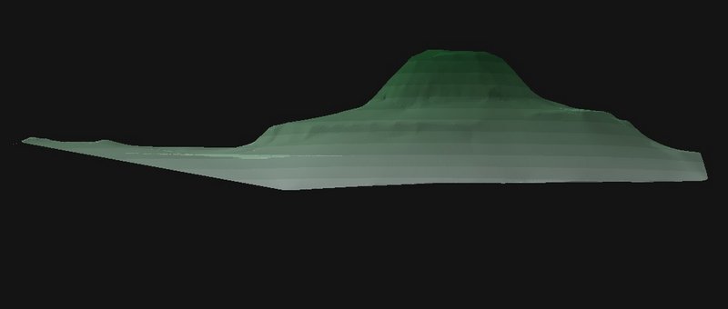
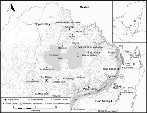 Figure 1: Location of Xno’ha (upper center of picture) and Related Sites. Courtesy Mark Wolf (after Guderjan 2013).
Xno’ha Group 78 – General Description
Group 78 is described here as a patio group as defined by Guderjan, Lichtenstein and Hanratty (2003: 35). Patio groups usually comprise L-shaped configurations that generally face eastward and are positioned on a levelled hill where peripheral masonry structures define a central open space. Consistent with this description, Xno’ha Group 78 comprises an elevated and level open space that is bounded on its northern and western limits by remnant rectilinear range-type structures. Maya range structures are described as large, vaulted and multi-roomed and ordered so as to surround small plazas or patios (Kowalski 2003: 204).
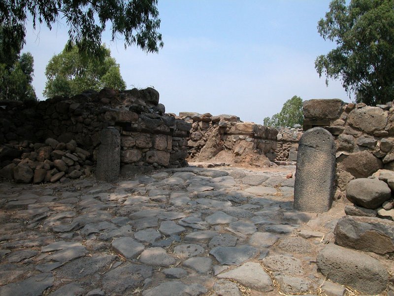
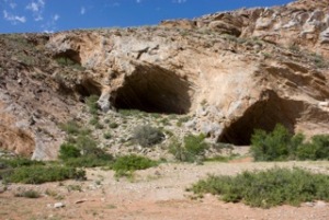
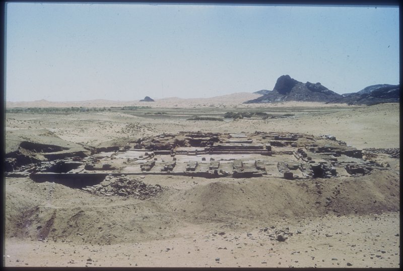
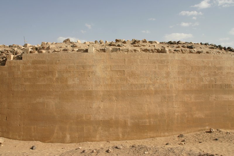
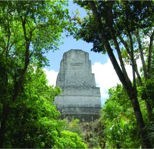
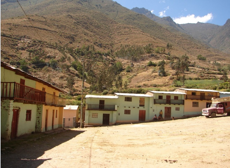
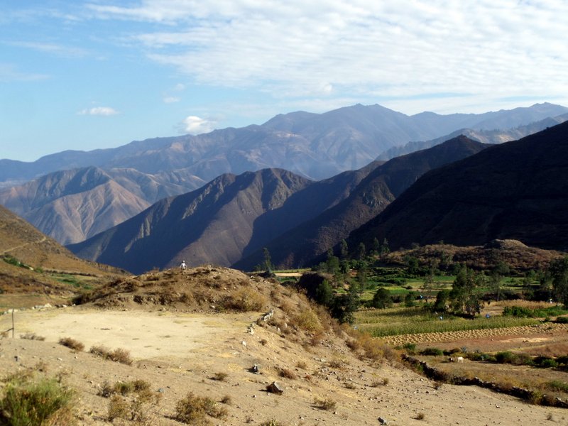
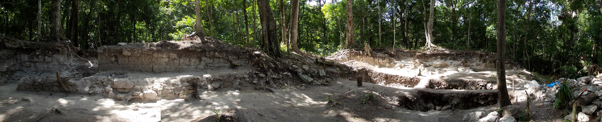 Figure 2: Building Group 78 Panorama Showing Structures 79 and 80 and Patio in the Foreground
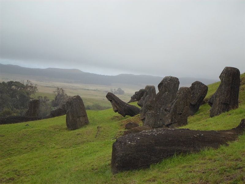
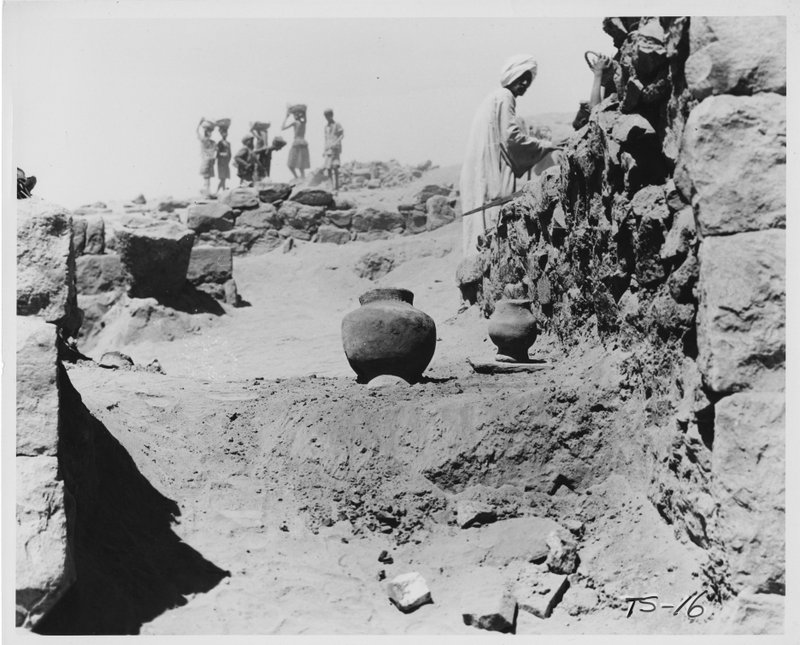
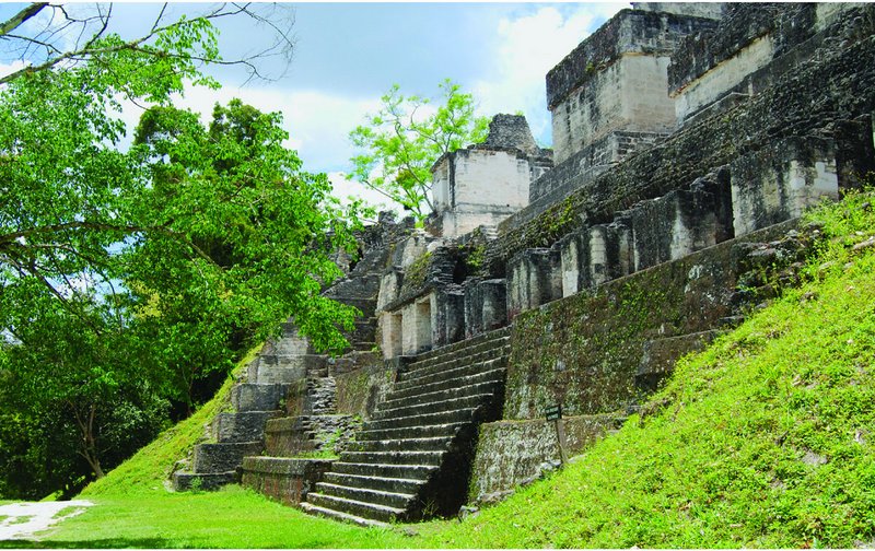
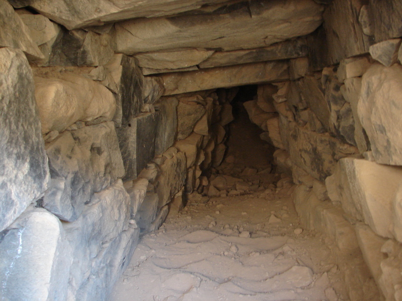
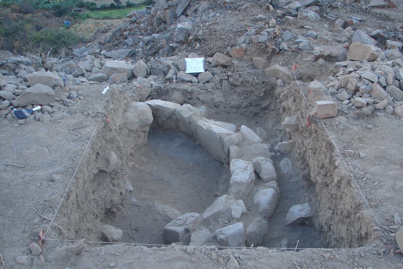
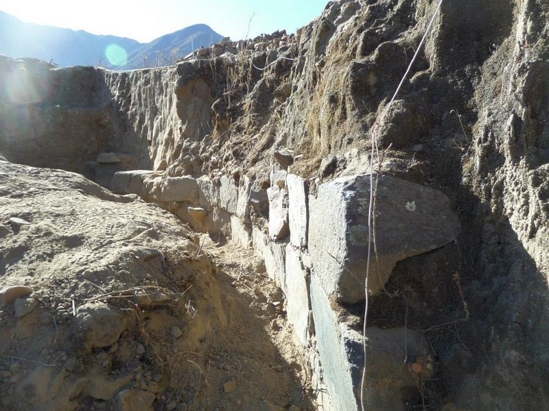
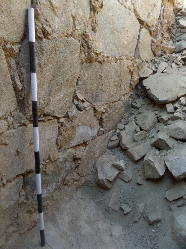
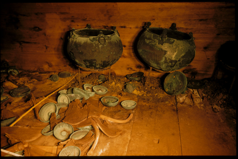
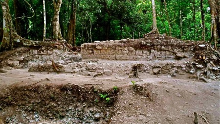
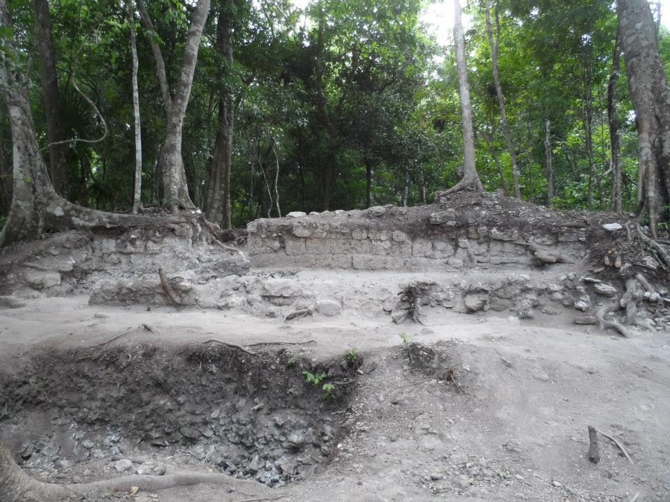 A View of Excavated Remains of Patio Group 78.
Located approximately 200 metres due east of Structure 1, and the sites central plaza, Xno’ha Group 78 is oriented approximately 8° east of magnetic north and measures about 25 metres x 25 metres. Structure 79 is positioned to mark the western limits of the building group and Structure 80 defines its northern boundary. While the more precise dimensions (and orientation) of the buildings will only be ascertained following more extensive excavation, preliminary estimations of the mounds and structural features indicate that buildings measure between 15-17 metres in length (as gauged along the midline of the mounds) to the point where they intersect in the northwest corner of the group. The patio extends approximately 14 metres east-west and 19 metres north-south, as measured from the baseline of the building mounds to where the ground begins to slope away at the eastern and southern limits of the group. One datum point was recorded for Group 78 (with a handheld GPS) during the 2013 excavations – Alex 1: 1984915.49N, 0288124E-not corrected.
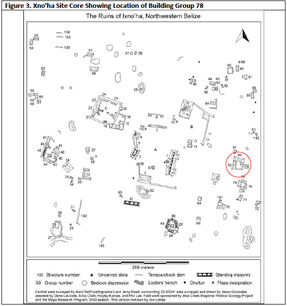
On the east side of the building group is a shallow rectangular depression in the patio platform, which measures 4 metres north-south and 5.4 metres east-west. It has yet to be determined what this surface depression is; whether it represents slumping of the building group’s patio or, alternatively, a remnant architectural feature. Initial clearing of vegetation in 2013 undertaken on the inclined ground on the eastern side of the group suggests that it may have once formed part of a terraced approach, functioning as the formal entrance to the group. However, this has yet to be verified archaeologically.
While no known archaeological excavations have occurred within Group 78 prior to 2013, some ground disturbance is evident on the eastern boundary of Structure 79. Oriented north-south, this disturbance measures approximately 2 metres by 3 metres and is visible in the form of backfilled area of ground. The presence of this disturbance suggests that some archaeological testing of the group may have occurred but may have not been previously reported. It is possible that it was undertaken as part of excavations carried out between 2002 and 2004 when many of the Xno’ha buildings were test excavated to determine their age and phases of construction.
Xno’ha – Summary of Previous Archaeological Investigations
The long-term goal of the archaeological inquiry at Xno’ha Group 78 is to build on previous work first undertaken by Jason Gonzales between 2002 and 2004 (Gonzales 2005a and 2005b); to construct a ‘domestic structure database’ through the excavation of elite household groups and compounds within the settlement zone. A key question driving the inquiry at Xno’ha is how did Maya elites create, develop and maintain their power structures (see Guderjan 2013: 1-15)? It has been long argued that “gradations within archaeological remains suggest that the distinction between the elites and the non-elite is more of a continuum than a well-defined division” (Sharer 1994: 490). Remnants of “monumental earthen constructions, elaborate human burials, diverse arrays of luxury goods, and other remains… [exist] as evidence… [of the] sociopolitical complexity [among the ancient Maya]” (Sharer 1989: 166). Importantly, Xno’ha’s location mid-way between Blue Creek and Nojol Nah permits MRP to examine the dynamics of ancient Maya elite interaction at the intra-site and regional level. The establishment of such a database would also provide a basis for a comparative study of behaviour between royal elites and between royal elites and non-royal elites and commoners.
Xno’ha Excavations 2002-2004
Xno’ha was first identified in 1990 and was subsequently surveyed, mapped, and partially excavated between 2002 and 2004. The primary goal of the 2002 survey and archaeological evaluations was to determine whether Xno’ha was an autonomous centre or a subsidiary of La Milpa (Gonzalez 2003; Knippe and Gonzalez 2003). La Milpa is the largest Maya centre in close proximity to Xno’ha and was likely to be the dominant regional power during the period of its political florescence through the Late Preclassic period (300BC – 250 AD) (Guderjan 2007: 16). In 2003, Jason Gonzalez undertook test excavations in the site’s main plaza and within the limits of a proposed ballcourt (see LaLonde 2003, Gonzalez and Knippe 2004, Gonzales 2005a and 2005b). Additionally, extensive test excavations were undertaken in and around the many residential buildings located at the site (see Gonzalez 2005).
While dating has yet to establish the precise period or periods of occupation within Group 78, preliminary assessment of excavated ceramics suggest that it functioned as an elite residential complex during the Late Preclassic and Classic periods. Excavations undertaken at the site between 2002 and 2004 suggest that the site of Xno’ha was occupied from the Late Preclassic to the Terminal Classic period (300BC – 925AD). According to Gonzales (2005a: 147), analysis of ceramics obtained from construction fill contexts during the 2002, 2003 and 2004 investigations indicated that the first buildings were erected within the site core area during the Late Preclassic, with some lesser construction occurring during Late Preclassic period. Civic expansion at Xno’ha during the Early Classic period is suggested by the construction of the larger public building in the site’s core as well as some increased building in residential areas of the site; as well as landscape modifications both in the centre and the periphery of the site. Following an apparent drop in construction during the Middle to Late Classic period, there was a substantial increase in construction in the interior and on the margin of the site during the Late Terminal Classic period. All this construction, however, was restricted to the residential areas and in the form of general modifications to the landscape; no large public architecture was built during the Terminal Late Classic period (Gonzales 2005a: 147).
The relationship that Xno’ha had with regional centres such as Rio Azul and La Milpa has yet to be established; including the impact such centres had on the cultural and occupational history of the site. Gonzales proposes that an objective of future research at the site should be to determine why there was a reduction in construction at Xno’ha during the Early and late Classic periods and why there was a substantial increase in building during the Terminal Classic period. Beyond this, it remains important to establish the reasons for the site’s abandonment at the end of the Terminal Classic Period, and how this movement fits within the greater regional history of north-western Belize (Gonzales 2005a: 147).
Xno’ha Excavations 2012
In 2012, excavations continued at Xno’ha, which focused on Structure 1; a gallery style building positioned on the eastern edge of Plaza A. Structure 1 measures approximately 62 meters north-south and 23 meters east-west and is oriented 18° east off magnetic north. The building stands 4.5 metres tall and has a large central staircase leading up from Plaza A at the front of the building; there is also a staircase leading up from Plaza B at the rear. During the 2012 excavations, the areas south of the structure’s centreline were targeted, allowing a general picture of this very large building to be ascertained within the limited time available (Guderjan and Preston 2012: 24).
Excavations in 2012 resulted in the removal of overburden along the midline of Structure 1 and the exposure of the southwest corner of the building. The gallery located at the top of the basal platform measures approximately four metres wide with walls 80cm thick. The interior of the structure consists of a single room that has seven doorways on the west side of the building; three of which were unearthed during the 2012 excavations. Digging on the eastern side of the gallery also revealed multiple doorways. Very few artefacts were recovered during these stripping operations (Guderjan and Preston 2012: 25)
During the 2012 field season, a two-metre wide trench was also placed along the midline of an alleged ballcourt; at the level of the proposed playing field. The purpose of the excavation was to obtain information regarding the period of its construction and to determine how long it may have been used. The investigations undertaken during the 2013 field season were insufficient to determine the function of this building group.
Xno’ha Excavations 2013
The Purported Ball Court at Xno’ha
In 2013, MRP undertook an archaeological assessment of Pitz Nah (i.e. MRP Operation 13:01), a building complex located within the larger Maya site of Xno’ha. The building group comprises a small plazuela bounded by two parallel buildings, in addition to a peripheralstructure positioned immediately west of Structure 16 (i.e. Structure 16A). The earliest archaeological assessment (undertaken in 2002) documented this group as a ballcourt (see Lalonde 2002, Gonzales 2003, Lohse et al 2004, and Guderjan 2013). The presence of Aguila Orange ceramics identified during excavations suggested that the group was constructed during the Early Classic period. Excavations undertaken in 2012 revealed a lower platform within the plazuela, pushing the date of the earliest phase of construction back to the Preclassic period (Guderjan and Preston, 2012).
In 2013, MRP expanded the previous year’s operations at this group in order to provide a more complete understanding of the function and temporal nature of the group. Archaeological assessment revealed substantially disturbed soils as well as discrepancies in architectural features reported by Lalonde (2002).
Clarification of the 2002 findings warranted a more thorough examination into the function of the group as well as a refinement of the temporal sequencing for Structures 15 and 16 and Platform 17. The findings from the 2013 excavation revealed that the structures displayed markedly different construction phases as well as substantial differences between the two main structures represented. More specifically, the structures did not display any continuity of design or architectonic symmetry, common among ball courts in Central America (Mead, Mastropietro and LeMasters 2013: 51-52).
Excavations of a Terminal Classic Courtyard Structure at Xno’ha
In 2013, a small Courtyard Group, designated Group 63, was also excavated. The group comprises five small structures that surround a small plaza, located south of Structure 1 and in close proximity to the Xno’ha site core. The objective of the investigation was to generate a sample of residential architecture to compare with other sites in the region, namely Nojol Nah, Tulix Mul and Blue Creek.
Focus of the investigation was directed at Structure 67, which was completely excavated over a four-week period. The structure measures approximately eight meters long and comprises four rooms, three of which were oriented east to west. The fourth Room, oriented north-south, was assessed as being the earliest of the four rooms. All ceramic material recovered during the excavation dated to the Terminal Classic Period and all but one was built in a single construction phase. It was noted during the excavations that the entire structure was built directly onto the bedrock. This style of architecture seems prevalent at Xno’ha, while presently unknown at both Nojol Nah and Tulix Mul (Hannah Plumer 2014: 83-85)
Excavations at Group 78
The excavations were undertaken at Group 78 over a four-week period in July 2013. The purpose of the excavations was to commence exposing Structures 79 and 80 before subsequent excavations reveal the broader construction history of the group in later field seasons. The approach undertaken was to first locate the patio surface and baseline of two superstructures before broader stripping of the associated architecture. In addition to the general objectives of the fieldwork being achieved, a Late Preclassic ceramic cache (comprising 9 Sierra Red vessels) was recovered during excavations as well as an Early Classic tomb.
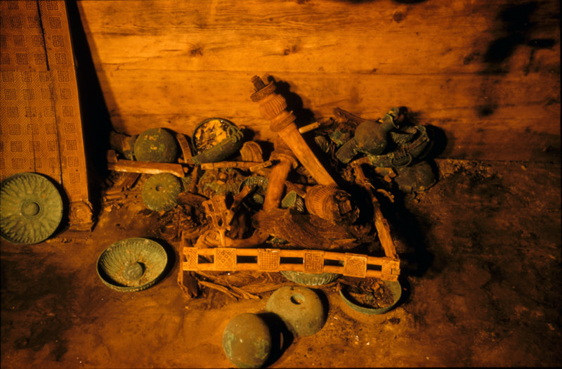
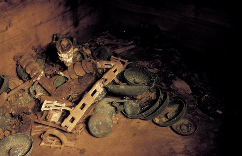
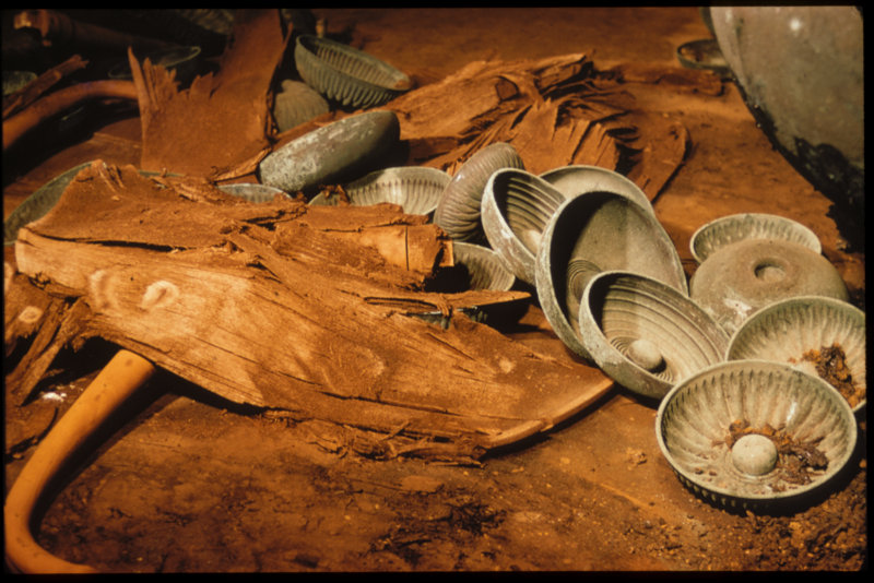
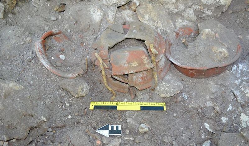 The Late Preclassic Ceramic Cache in Situ (as found)
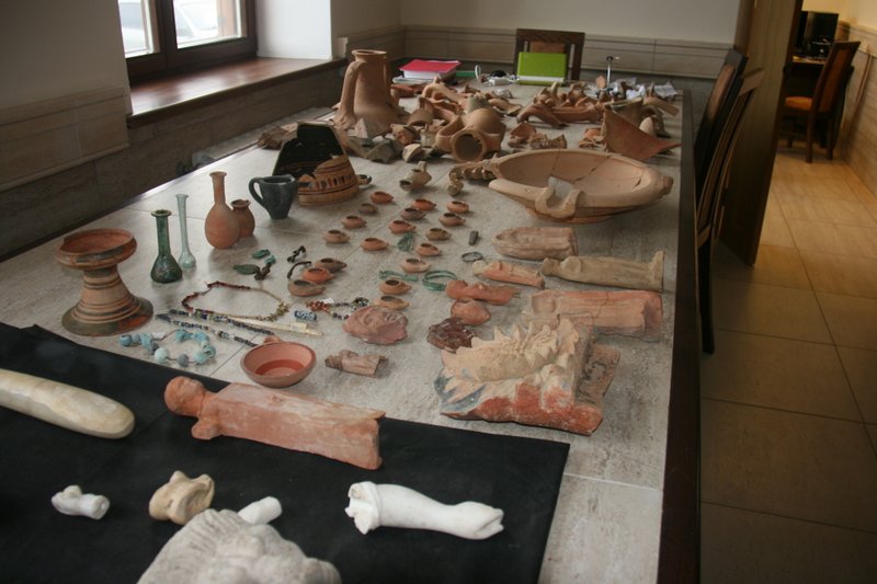
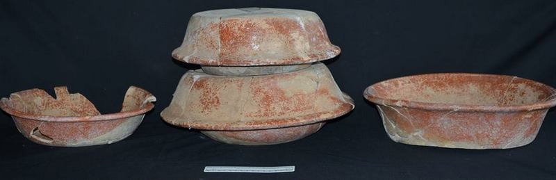 Figure 4: Reconstruction of Preclassic Ceramic Cache 13-03, Vessels 2-7, East View
Preclassic Ceramic Cache
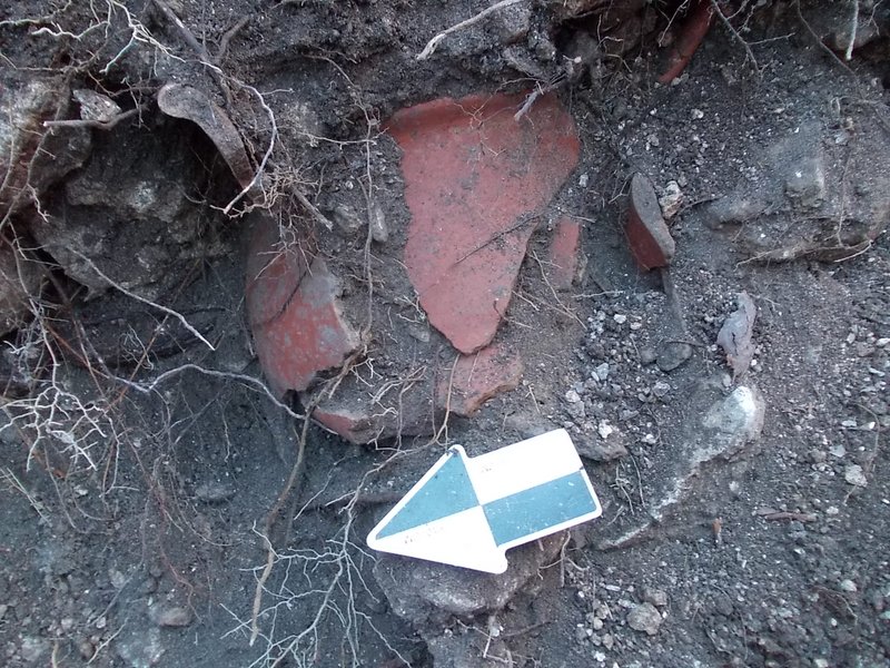
During 2013 a sub-patio ceramic deposit was uncovered during the stripping operations connected with Structure 78. Designated Xno’ha Cache 13-03, the cache consisted of 9 fragmented Sierra Red vessels dating typologically to the Late Preclassic period (300 BC-250 AD).
Found in the southeast quadrant of Sub-operation A, against the east wall of the trench, the most intact portion of the cache (Vessels 2 to 7) were found at a depth of 110 cm. Highly fragmented Vessels 1, 8 and 9, were located directly above this deposit. The cache measured 125 cm north-south and 50 cm east-west in its horizontal extent and 45 cm vertically. Two vessels remained in the east wall of Sub-operation A at the end of the 2013 field season.
The most ordered component of the cache was represented by 6 pots numbered 2 -7. Four of the vessels (Vessels 1, 2, 3 and 4) were staked in a lip-to-lip configuration with one vessel positioned immediately north and south of the stack. Pollen and phytolith analysis of the sediments contained within the vessels determined the following:
This sample is characterized by high frequencies of leaves from shrubs and trees, as well as herbaceous monocots, similar to the assemblage from the burial at Chum Balam Na. A trace of hat-shaped phytoliths (0.4 percent) indicates that palm fruits may have been part of the offering. A low frequency of spinulose spheres > 10µ (2.2 percent) indicate that oil extracted from A. cohune and/or R. regia may have been poured into the lower vessel. Two sponge spicules were found while scanning. Their rarity indicates that the spicules may have leaked into the vessel from the surrounding matrix. As in the Chum Balam Na sample, this isolate required oxidation (in concentrated hydrogen peroxide) to remove large amounts of microscopic plant material that were probably the result of large amounts of leaves having been placed in the cache (Bozarth 2013: 12-13).
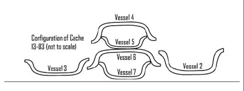 Figure 5: Configuration of Multiple Vessel Lip-to-Lip Cache, Lot 7, Vessels 2-7, East View
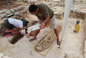
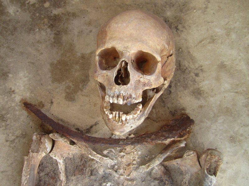
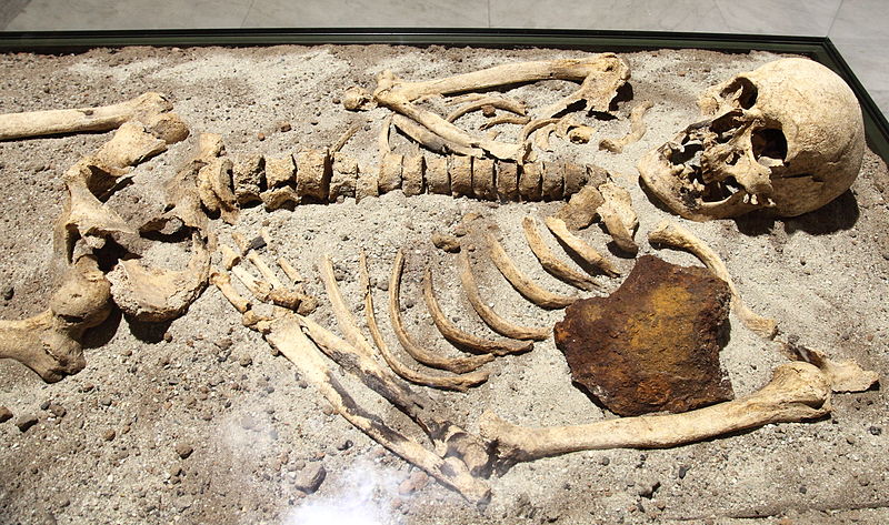
Xno’ha Burial 13-01
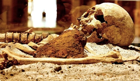
During the excavation of Xno’ha Sub-operation B, two closely positioned capstones were revealed overlying a human burial at the western end of the excavation. The poor condition of the burial chamber suggested that the tomb may have succumbed to compression from the surrounding construction fill. Excavation revealed a burial cavity measuring 110 cm by 65 cm containing the individual interred in a flexed position facing eastward with the head oriented to the south. Some of the more distinguishable skeletal remains were a partial cranium and several long bones, which included an ulna, radius, humerus and femur. A highly fragmented pelvis was also identifiable; in addition there were bone fragments and several teeth that were recovered during sieving of the burial deposits. As formal analysis of the remains has yet to be undertaken, it is unclear whether it will be possible to determine the age and gender of the individual, due primarily to the poor condition of the remains.
One highly degraded and non-diagnostic fragment of pottery, probably associated with the surrounding construction fill, was recovered while excavating Lot 6. Additionally, two marine shells and a jade cylinder bead were also found. The mottled whitish-green jade bead (measuring 60 mm long and 25 mm thick) was found positioned between the ulna/radius and the cranium of the individual. The bore drilled through the length of the bead measured 6 mm. The marine shells were recovered whilst sieving the burial deposits. It is clear that the floor, below which the burial had been placed, corresponded to an earlier construction phase of the patio group.
Xno’ha Excavations 2014
Building Group 78 – Excavation Method and Stratigraphy
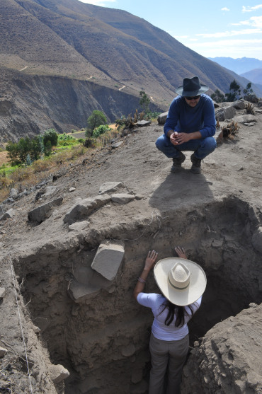
The excavations at Group 78 were undertaken over an eight-week period commencing in early June and finishing at the end of July 2014. Due to time constraints, the excavations were undertaken by two teams of volunteers led by MRP Staff and interns. Ian Lemasters and Holly Lincoln led one team that focused on the continued stripping operation of Structures 79 and 80, which began the previous year (see Lemasters and Lincoln, this volume). The excavation in the patio area was supervised by Alexander Parmington whose qualifications include a Doctorate in Maya Archaeology from La Trobe University, Australia.
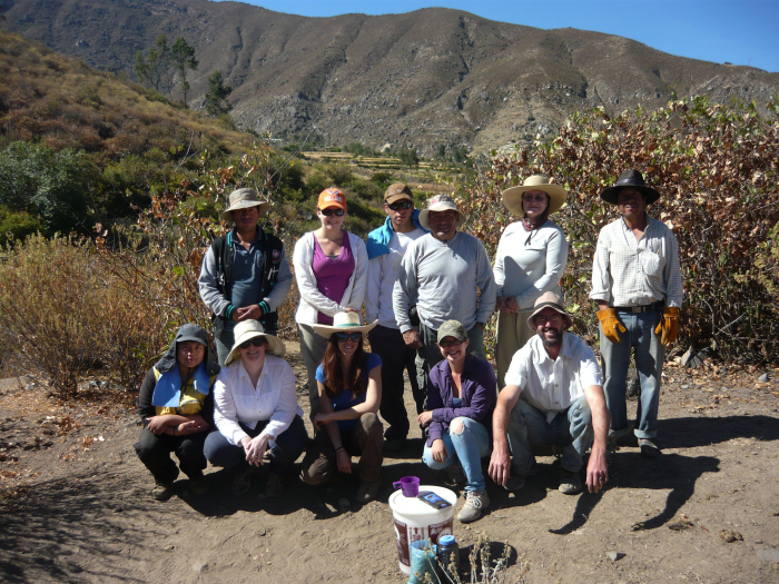
Excavations were undertaken at Xno’ha Group 78 Patio from the 1st of July to the 29th of July utilizing teams of volunteers, numbering 6-8, over two consecutive 2 week sessions (i.e. Sessions 3 and 4); participants included local workers from San Felipe as well as volunteers from the United States. The Session 3 volunteers were Fidel Cruz, Kevin Austin, Megan Weldy, Jack Magee, Emily Prichard, Julia Mahr, Shelby Betz, and Beth Eraul; the Session 4 volunteer participants were Katie Wahler, Mariela Mendoza, Douglas Reithmuller, Romano Derosa, and Chabli Bravo. What follows is a description of the excavations, which were undertaken in accordance with the research objectives and ‘Specific Planned Activity’ items 1 and 4 as out lined in the 2014 research proposal:
Specific Planned Activity items 1 and 4
- 1. Excavations of elite residential groups. As part of our ongoing concern with the events and processes of abandonment, we propose to continue stripping excavations of several elite residences at Xno’ha, Nojol Nah and Tulix Mul Blue Creek. The major effort will be at Xno’ha, where we will continue investigating elite residences associated with the main plaza.” (see Guderjan 2014: 2).
- 4. Continuation of excavations at Xno’ha. A major part of our long-term planning is to enhance our understanding of regional processes of interaction and abandonment. Earlier research at Xno’ha focused on similar questions but did not address acquisition of data from the Central Precinct. We undertook first excavations in 2012 and in 2013 found that the buildings believed to be a ballcourt was not. We will continue these excavations in 2014.”(see Guderjan 2014: 3).
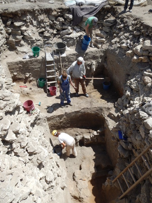
Eight sub-operations were excavated in the Building Group 78 Patio area during the 2014 field season (i.e. A, B, M, N, O, P, T and U) [Note: in this report, Lots Q 62 and Q 67 have been redesignated P 62 and P 67]. In the following discussion, profile drawings, figures and plans will be presented for the sub-operations and lots; lots being the smallest provenance designations recorded. Figure 6 provides a key for the locations of the sub-operations and their positions relative to the structures they were assigned to investigate. All of the sub-operations excavated measured 2 metres by 4 metres, with exception of Sub-operation P and U, which were excavated to chase out (i.e. determine the extent) of cultural deposits (see Figure 6).
Each sub-operation was placed so that its long axis ran parallel to the sub-operations excavated in 2013. Due to the prospective depths of the excavations and concerns regarding access and stability of the excavations, the 2 metre by 4 metre sub-operations were each separated by a 50 cm balk. During excavations, four primary stratigraphic layers were identified; overlayed by a humus of amassed soils. Each related to different phases of the patio’s construction. The humic layer within all sub-operations generally consisted of a moist brownish-grey silty loam with abundant tree roots and gravels throughout. The underlying rubble generally consisted of poorly sorted limestone cobble mixed with limestone and silty soils. All boundaries between gravels and soils were relatively diffuse with moderate to abundant root disturbance apparent throughout the upper fill.
All lots were excavated stratigraphically; each is discussed numerically under the relevant sub-operation header (see below). Due to the disturbed nature of the upper deposits, all excavation of the upper structural fill was undertaken with a mattock, hand pick, and shovel. Additionally, while all associated ceramic and lithic artefacts were collected and assigned relevant Lot numbers, only every fourth bucket of excavated humus was dry-screened. Every second bucket of soils collected below humic level was screened, while 100% screening of subsoils was limited to those lots with in-situ deposits.
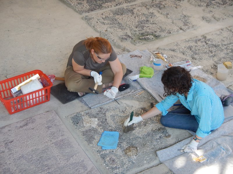
All architectural features and special deposits were excavated by trowel, hand-pick, brush and pan; they were also progressively documented and digitally photographed. The X, Y and Z coordinates for all in-situ cultural material was recorded with tape and compass. Vertical control was achieved and maintained with a transit. Excavation of the structures were undertaken systematically; for example, when an architectural feature or special deposit was identified, the archaeological investigation determined the horizontal extent of the deposit, or find, before proceeding downward through the underlying strata. Where applicable, soil samples were collected for pollen and phosphate testing as was the case with the Sub-operation P and the Sub-operation U (see relevant sections below). Human remains were excavated with dental tools, small plastic spatulas and brushes to minimise damage to the bone during excavation. Where possible, lots were dated by the associated ceramics (analyses provided by Colleen Hanratty).
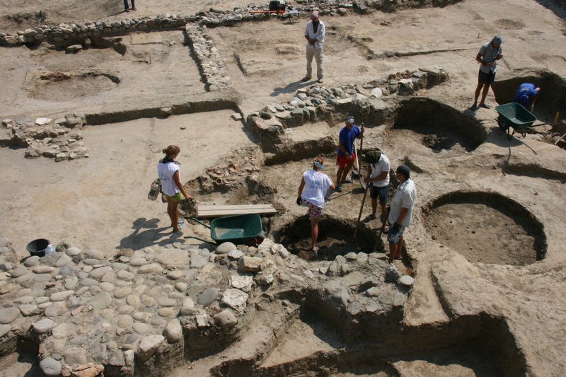
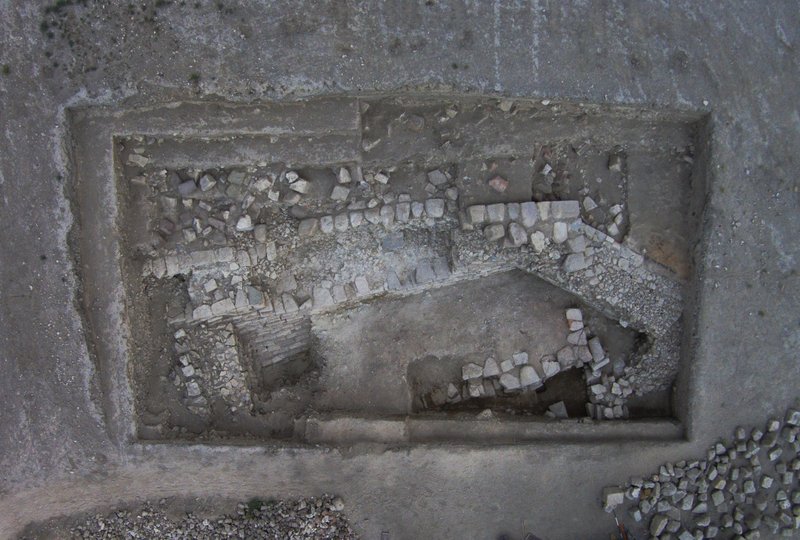
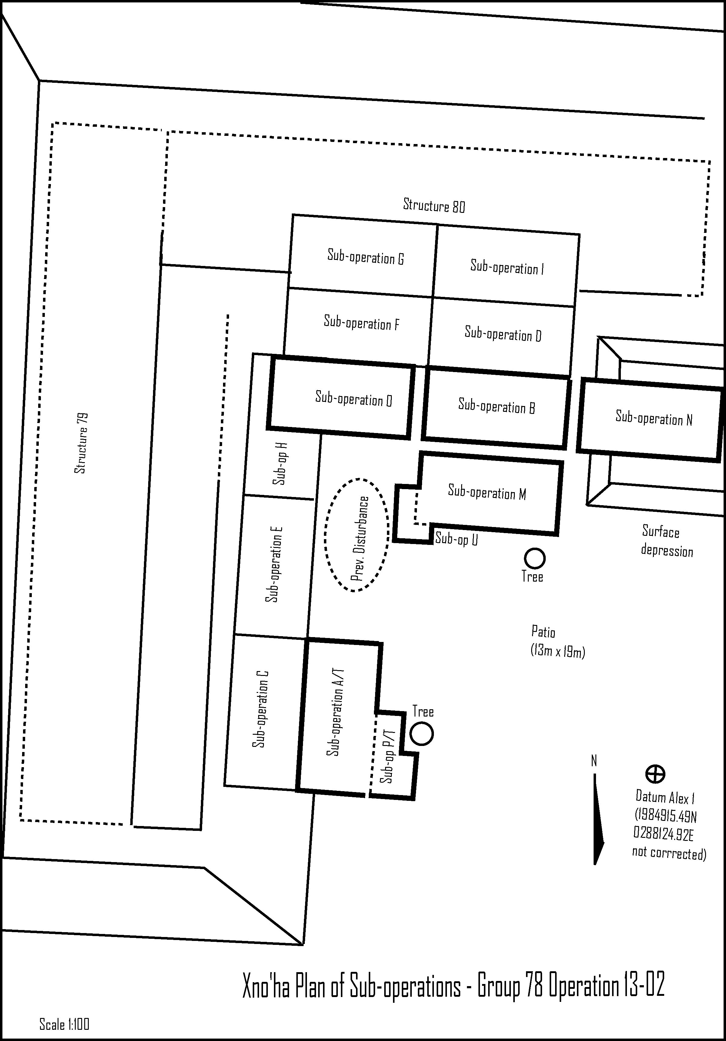 Figure 6: Plan of Excavations, Xno’ha Group 78 – Patio Area. Courtesy MRP
Xno’ha Operation 13-02, Sub-operation M – Lots 51, 54, 60, 66, 68 and 88
Oriented east-west, Xno’ha Sub-operation M comprised a 4 metre by 2 metre trench located south of sub-operation B and Structure 80 (see Figure 6). The objective of Xno’ha Sub-operation M was to investigate the external patio area of Building Group 78. This included verifying the presence of a suspected floor that was detected during the excavation of Suboperation B in 2013. Located immediately north of Sub-operation M, associated with this floor, was a large ceramic deposit that was located in the east of the sub-operation.
The excavation of Sub-operation M was undertaken to a maximum depth of 120 cm below surface level and began with the removal of the overburden resulting from the accumulation of soils and plant decomposition. This was followed by the excavation of the underlying construction fill revealing two floor surfaces. Two capstones covering what turned out to be a Late Preclassic tomb (see Sub-operation U, Lot 96) were also found during the excavation of Sub-operation M as well as the remains of a large Late Preclassic vessel (see Lots 51, 54, 60, 66, 68 88 and Figures 8 and 9).
Lot 51 – Removal of Humus
Occasional chipped stone (i.e. lithics) and ceramic fragments were unearthed, collected and bagged during the excavation of Lot 51. The excavation of Lot 51 extended to a depth of 45 cm. The compaction of the soil was found to be loose, comprising moist dark-brown silty loam (5YR 3/1) with frequent course limestone pebbles and cobbles. Cortical cert and abundant roots were found throughout the deposit. The relative percentage of the pebbles/cobbles to soil matrix was estimated to be 30% and 70% respectively. Removal of the humic layer exposed increasing cobble composed primarily of limestone. No formal surface to the patio was identified during the excavation of Sub-operation M, Lot 51. The lot was closed following the detection of a substantial increase of cobble material.
Lot 54 – Patio Construction Fill and Preclassic Pot
Lot 54 comprised loose dark greyish-brown soils (10YR 4/2) with limestone and chert cobble, the relative percentages of cobble and soil was 70% and 30% respectively. Artefactual material comprised infrequent chipped stone artefacts and ceramic sherds. The remains of a Late Preclassic pot measuring approximately 25 cm in diameter, was detected in the east profile of the sub-operation; located at the interface between the primary humic layer and the underlying cobble fill. Even though the vessel was highly fragmented, its vertical (upright) orientation could be discerned during excavation. Only a portion of the vessel was recovered during the excavation of Lot 54. Recovering any remaining vessel fragments will require extending Sub-operation M eastward. Lot 54 was excavated to a maximum depth of 65 cm and ceased when an increase in the size of underlying ballast was identified. Lot 54 was closed when large rubble was detected representing the primary construction fill for the latest phase of the patio’s construction.
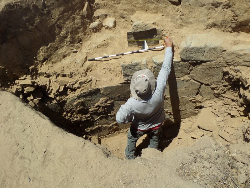
 Lot 51, East Profile, Late Preclassic Jar Offering
Lot 60 – Patio Construction Fill and Capstones
Large boulders of chert and limestone were identified during the excavation of Lot 60. The matrix in between the boulders comprised moist dark grey brown silty loam (10YR 4/2) loam with infrequent poorly sorted cobbles and pebbles. Percentages of soils verses ballast material was 20% and 80% respectively.
Occasional chipped stone (i.e. lithics) and ceramic fragments were unearthed, collected, and bagged during the excavation of Lot 60. Lot 60 extended to a maximum depth of 85cm and terminated following an apparent reduction in the size and frequency of ballast material, the discovery of several pieces of fragmented bone, and the identification of two capstones located in the south-west quadrant of the sub-operation. The bone fragments were found in association with what was initially thought to be a disturbed burial on the east side of the sub-operation. Oriented north-east, the burial was suggested by two rows of stones that appeared to be set in a parallel configuration. It was originally believed that the stones may have once been positioned to support capstones and contain human remains; however, further inquiry could not verify this proposal nor discount the possibility that the stones were simply residual cobble material suspended in the surrounding soil matrix.
Lot 66 – Exposure of Remnant Floor
Occasional chipped stone (i.e. lithics) and ceramic fragments were unearthed, collected, and bagged during the excavation of Lot 66. Lot 66 comprised a greyish-brown fine grained silty loam (7.5YR 5/1) with inclusions of limestone ranging in size from 5-30cm in their maximum dimension. Excavation of Lot 60 exposed a grey silty relatively free of rock suggesting the excavation was on or approaching a remnant floor surface. Several fragments of bone as well as a medial obsidian blade were found while dry sieving the deposits. During excavation, the fragments of bone and obsidian blade were viewed as potential floor deposits. The excavation of Lot 66 ceased following the identification of the suspected floor deposit, which corresponded to the elevation of the remnant floor surface identified during the excavation of Sub-operation B Lot 4 in 2013, which approximated 89.85 metres above sea level. Lot 66 reached a maximum depth of 110 cm.
Lot 68 – Excavation of Floor
The objective of Lot 68 was to excavate the floor identified during the previous lot. Occasional chipped stone and ceramic fragments were collected and bagged during the excavation of Lot 68. The remnant floor comprised a compact greyish-brown fine grained silty loam (7.5YR 5/1) with infrequent inclusions of limestone and suspended ballast material ranging in size from 5-40cm. The floor surface was poorly preserved and extended westward as far as two capstones that were exposed during the excavation of Lot 66. The termination of the floor on the eastern side of the capstones indicated that it did not extend across the entire sub-operation and that the burial (verified during the excavation of Sub-operation U), penetrated through the floor surface into the supporting construction fill. The intrusive nature of the burial was also evidenced by a concentration of cobble material, at the floor level, visible in the western profile of the sub-operation. Lot 68 reached a maximum depth of approximating 120 cm. As previously stated, the depth of the remnant floor was consistent with the level of the floor identified in the northern and neighbouring Sub-operation B, which was excavated in 2013. The excavation of Lot 68 ceased when a darkening of soil was detected as well as the reappearance of supporting cobble construction fill.
Lot 88 – Sub-floor Construction Fill
The objective of the Sub-operation 88 was to break through the remnant sub-floor construction fill to the underlying bedrock, which was identified during the excavation of Sub-operation T (see relevant sections). Lot 88 comprised a relatively thin layer of limestone and chert cobble fill suspended a matrix of dark grey-brown silty loam with increasing clay content (munsel 2.5YR 4/1); the relative percentages of cobble and soil were 80% and 20% respectively. Occasional chipped stone artefacts and ceramic fragments were collected and bagged during the excavation of Lot 88. The suspected burial, located in the east of Sub-operation M (see Lot 60), was further investigated and subsequently dismissed as a possibility, during the excavation of Lot 88. Limited time prevented the completion of the Lot 88, which will continue in 2015. Sub-operation M reached a maximum depth of 130 cm from surface level.
Xno’ha Operation 13-02, Sub-operation N – Lot 52
Oriented east-west, Xno’ha Sub-operation N was to be a 4 metre by 2 metre trench located east of sub-operation M. The objective of Xno’ha Sub-operation N was to investigate a shallow surface depression and an area of inclined ground located on the eastern side of the group (see Figure 6). The surface depression measures 4 metres north-south and 5.4 metres east-west. As previously stated, it is unclear what this surface depression is; whether it represents slumping of the building group’s patio or, alternatively, a remnant architectural feature. Initial clearing of vegetation in 2013 suggested that it may have once formed part of a terraced approach, functioning as the formal entrance to the group. Unfortunately, time constraints prevented the excavation of Suboperation N beyond general clearing of surface vegetation. It is projected the excavation of Sub-operation N will continue in 2015.
Xno’ha Operation 13-02, Sub-operation O – Lots 55, 59, 70, 72 and 105
Oriented east-west, Xno’ha Sub-operation O comprised a 4 metre by 2 metre trench located immediately west of sub-operation B and south of Structure 80 (see Figure 6). The objectives of Xno’ha Sub-operation O were generally consistent with Sub-operation M: to investigate the external patio fronting Building Group 78. This included verifying the presence and extent of a floor that was detected during the excavation of Suboperation B in 2013 as well identify any associated architectural features if present. Additionally, it was decided that further excavation of the patio fronting Structure 80 may uncover cache deposits associated with the dedication of Structure 80 and/or any earlier construction phases of the building group.
The excavation of Sub-operation O and was undertaken to a maximum depth of 140cm below surface level and began with the removal of the overburden resulting from the accumulation of soils and plant decomposition. This was followed by the excavation of successive spits of platform construction fill. The excavation of Sub-operation exposed what is currently believed to be a small bench or platform (see Lots 55, 59, 70, 72 and 105).
Lots 55 and 59 – Removal of Humus
Infrequent chipped stone and fragmented ceramics were unearthed, collected and bagged during the excavation of Lots 55 and 59. The excavation of Lots 55 and 59 was undertaken in arbitrary spits of 30-40 cm and extended to a maximum depth of 70 cm. The compaction of the soil was consistent with Sub-operation M and was found to be loose comprising moist dark brown silty loam (5YR 3/1) with frequent roots and occasional course limestone pebbles and cobbles. Small cortical chert cobbles were also found throughout Lots 55 and 59. The relative percentage of the pebbles/cobbles to soil matrix was estimated to be 20% and 80% respectively. Removal of the humic layer exposed increasing cobble composed primarily of limestone. No formal surface to the patio was identified during the excavation of Lots 55 and 59. There was gradual lightening of the soils as Sub-operation progressed deeper. Lot 59 was closed following the removal of the primary root zone as well as the detection of an apparent increase in the frequency of pebble and cobble material.
Lot 70 – Exposure of Plastered Surface
Lot 70 comprised loose mid Greyish-brown loam (7.5YR 5/1) mixed with a concentration of moderately sorted pebble and cobble material. Infrequent lithics and ceramic fragments were unearthed, collected and bagged during the excavation of Lot 70. Excavation of Lot 70 ceased at a maximum depth of 100 cm from surface level; following the detection of the compact plaster surface at the centre of the sub-operation. This plaster surface was initially thought to be a floor but is now believed to be a potential bench following the excavation of subsequent lots (see Lots 72 and 105). Lot 70 was closed and a new lot assigned, following the identification of the compact plastered surface. This was done to separate any potential cultural deposits associated with the surface of this feature (see Lot 72).
Lot 72 – Cut in Plaster Surface and Remnant Wall
The excavation of Lot 72 revealed a plaster surface in the central area of Sub-operation O. The plaster feature measures approximately 2 m east-west (the northern and southern extent of the feature has yet to be determined) and is bounded on the east by a line of stones suggesting the presence of a rudimentary wall. The plaster feature is delineated on the west by a north-south oriented cut. During excavation, an additional thin covering of plaster was found extending from the cut. The western profile of the sub-operation suggested that it may have been capping something below. The Lot was closed following the identification of the cut, the additional plaster surface, and the remnant wall located on the east side of the sub-operation.
Lot 105 – Exposure of Bench Feature
The objective of Lot 105 was to investigate a cut found adjacent to a plaster feature, which was identified during the exaction of Lot 72. The Excavation of Lot 105 revealed a 40 cm high bench-like feature, located in the central area of Sub-operation O. A remnant plaster floor was also found lipping up to the bench on its western side. An examination of the cut revealed no overlying cultural deposits other than construction fill. Excavation around the feature reaffirmed the presence of the rudimentary wall abutting the eastern side of the bench; the western side of the bench was constructed from a single course of cut stone. A break in the plaster render, on the top surface of the bench, indicated that the bench is constructed primarily of cobble fill.
The excavation of Lot 105, on the eastern and western sided of the bench, extended to a maximum depth of 140 cm from the surface level. The compaction of the soil was loose comprising loose mid greyish-brown silty loam (7.5YR 5/1) mixed with frequent chert and limestone pebbles and cobbles. The relative percentage of the soil matrix to pebble/cobble material was estimated to be 20% and 80% respectively. Infrequent chipped stone and fragmented ceramics were unearthed, collected and bagged during the excavation of Lot 105. The northern and southern extent of the bench has yet to be ascertained.
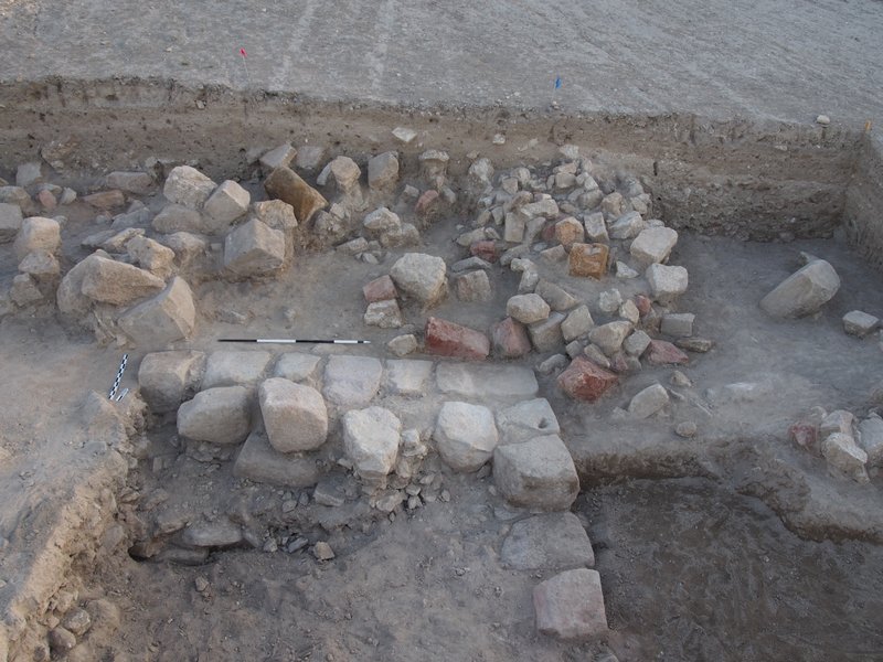
Xno’ha Operation 13-02, Sub-operation P Lots 56, 57, 58, 61, 62, 67, 71, 86
The objective of Sub-operation P was to recover the remainder of Cache 13-03, which was partially excavated in 2013. During the 2013 excavations, a sub-patio cache of vessels was exposed during the stripping operations associated with Structure 78. Subsequent excavations revealed that the cache comprised at least 9 fragmented Sierra Red vessels dating typologically to the Late Preclassic period (300BC-250AD). At the end of the 2013 field season, two fragmented vessels, ordered in a lip-to-lip configuration, remained visible in the east wall of Sub-operation A at the northern end of the cache deposit. Sub-operation P was positioned immediately east of Sub-operation A (refer Figure 6). On completion, Sub-operation P measured 2.3 metres north-south and 1.4 metres east-west and reached a maximum depth of around 120 cm below surface level.
Sub-operation P began with the removal of overburden resulting from the accumulation of soils and plant decomposition. This was followed by the excavation of the underlying construction fill and the recovery of 6 complete and 10 partial vessels. All vessels were found broken and suspended in the construction fill of the patio. The highly fragmented condition of the vessels was the result of compression by the surrounding construction fill and presence of a large tree found growing directly above and down through the cache deposit (see Lots 56, 57, 58, 61, 62, 67, 71, 86).
While it remains unclear whether vessels recovered during the 2014 excavations are a component of Xno’ha Cache 13-03, it is possible that the vessels recovered during the excavation of Sub-operation P were an unrelated deposit. This is evidenced by differences in the size and configuration of the vessels recovered during the 2013 and 2014 field seasons as well as differences in the elevations of both ceramic deposits. Following the excavation of Sub-operation P, and subsequent lab analysis of the vessels recovered, the minimum number of individual vessels that recovered in the vicinity of Cache 13-03, increased from 9 (as documented in 2013) to 25.
Lot 56 – Removal of Humus and Tree Roots
Occasional chipped stone artefacts and ceramic sherds were unearthed, collected and bagged during the excavation of Lot 56. The excavation of Lot 56 extended to a depth of 50 cm. The compaction of the soil was found to be loose comprising moist fine dark-brown silty loam (5YR 3/1) with frequent medium sized course limestone pebbles and cobbles and abundant tree roots throughout. The relative percentage of the pebbles/cobbles to soil matrix was estimated to be 30% and 70% respectively. Removal of the humic layer exposed cobble composed primarily of limestone. The lot was closed following penetration through the primary root zone.
A choice was made during the excavation of Lot 56 not to remove the entire tree located in the vicinity of Cache 13-03; but rather, to excavate around it. This was due to concerns regarding the stability of the ground and the fragility of any remaining cached vessels: The removal of the tree would have resulted in substantial ground disturbance in the vicinity of the cache.
Lot 57 – Fill above Cache 13-03
The interface between Lot 56 and 57 was diffuse, occurring over a vertical distance of approximately 15 cm. Occasional chipped stone and ceramic fragments were unearthed, collected, and bagged during the excavation of Lot 57. Large cobbles of chert and limestone, measuring 10-60 cm, were identified during the excavation of Lot 57. The matrix in between the cobble comprised a moist grey-brown silty loam (10YR 4/2) with frequent poorly sorted pebbles and cobble. Percentages of soils verses pebble/cobble was 30% and 70% respectively. Lot 57 was excavated to a depth of 60 cm and ceased on the identification of an area of grey loam (10YR 4/2) that was free of rubble measuring approximately 120 cm north-south and 70 cm east-west.
Lot 58 – Exposure of Capstones
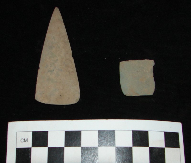
The objective of Lot 58 was to determine the nature of the cobble-free deposit located east of the Cache deposit identified in 2013 (see MRP 2013 field report). Excavation of Lot 58 revealed two capstones, aligned north-south, at a depth of 70 cm. On discovery of the capstones, the excavation of Lot 58 continued for the purpose of removing associate soils and exposing any underlying features. The deposit consisted of moist grey-brown silty loam (10YR 4/2), surrounding what was initially thought to be a tomb. This suggestion was later dismissed following the discovery of fragmented vessels in subsequent lots that were set in a lip to lip configuration below the capstones. Excavation of Lot 58 ceased at a depth of 100 cm, once the capstones and the surrounding ballast were fully exposed. One broken and incised dolomite bead, measuring 55 mm in maximum dimension, was recovered during the excavation of the deposit overlying the capstones.
Lot 61 – Ceramic Deposit: Cache Outer, Northwest
The purpose of Lot 61 was the recovery of two fragmented lip-to-lip vessels identified in the south profile of Sub-operation A in 2013 (see MRP field report 2013). The deposit was designated ‘Ceramic Deposit, Northwest Corner’ following the identification of additional vessels underlying a northern most capstone, which was found during the excavation of Lot 58; it was determined that the vessels beneath the capstone comprised the central portion of a larger ceramic deposit (see Lots 62 and 67). During the excavation of Lot 61, all pottery was removed with associated soils for the purpose of sampling. The supporting material comprised relatively small well sorted limestone cobble. No unusual residues were identified during excavation of the vessels. Following lab analysis, one Sierra Red bichrome bowl measuring 19 cm in diameter was reconstructed showing punctuations on the exterior, dating to the Late Preclassic period.
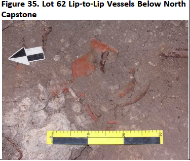
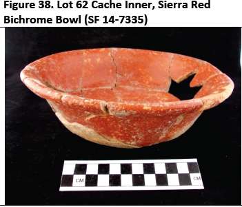
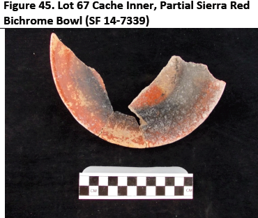
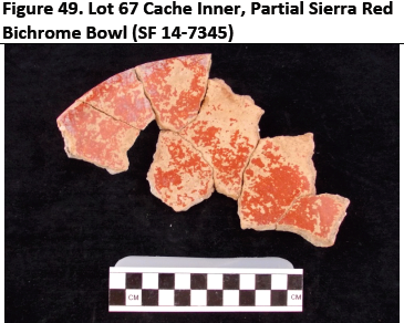
Lot 62 Ceramic Deposit: Cache Inner
The purpose of Lot 62 was to determine the nature of the deposit underlying two capstones that were found during the excavation of Lot 58. First suspected to be a burial, the lot was subsequently designated ‘Ceramic Deposit, Cache Inner’ when several vessels were found beneath the northern capstone, which comprised the central portion of a larger ceramic deposit (see Lots 61 and 67): On removal of the capstones, and adjacent cobble, a total of six fragmented Sierra Red vessels dating to the Late Preclassic period were recovered at a depth of approximately 80 cm from the surface level; two of which were configured in a lip-to-lip configuration and positioned directly beneath the northern most capstone. While the ordering of the remaining ‘Cache Inner’ vessels could not be ascertained (due to their high fragmentation), there was a clear concentration of vessels just north of those underling the capstones. The poor condition of the vessels suggested that the cache may have succumbed to compression from the surrounding construction fill. During the excavation of Lot 67, all pottery was removed with associated soils for the purpose of sampling. No unusual residues were identified during excavation of the vessels. The surrounding material comprised small well sorted limestone a cobble that was apparently utilised as packing to support the cached vessels. Following lab analysis, six vessels were reconstructed which ranged from 19-25cm in diameter. On recovery of the vessels beneath the capstones, it was found that the cache deposit extended eastward into the root zone of an overlying tree (see Lot 67 Ceramic Cache East Outer).

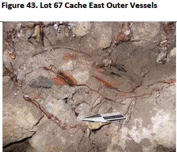
Lot 67 – Ceramic Cache: East Outer
The objective of Lot 67 was to determine the eastern extent of a ceramic deposit that was exposed during the recovery central portion of deposit underlying two capstones, which were found during the excavation of Lot 58. Lot 67 was designated ‘Ceramic Deposit, Cache East-Outer’, which comprised the eastern portion of a larger ceramic deposit (see Lots 61 and 62). A concentration of ten partial Sierra Red vessels, dating to the Late Preclassic period, was recovered during excavation of Lot 67. While the precise configuration of the eastern segment of the cache could not be ascertained (again, due to their high fragmentation), at least two vessels appeared to be in a lip-to-lip configuration. The poor preservation of the eastern component of the cache could be attributed to a large amount of disturbance due to the presence of a tree roots growing directly above and through the deposit. No unusual residues were identified during excavation of the vessels. The surrounding soil comprised a loose mid greyish-brown loam (7.5YR 5/1) mixed with moderately sorted pebble and cobble material. Following lab analysis, the partial vessels were reconstructed where possible. Estimates of vessel size ranged from 20 to 25 cm in diameter. The depth of the east-outer component of the cache was consistent with Lot 62: The vessels were recovered from a depth of approximately 80 cm from the surface level.
The Lot 67 was closed once all noticeable ceramics were recovered. Given the partial nature of all vessels recovered from the east-outer component of the cache, there remains some potential for further associated ceramic to found following the removal of the tree and when Sub-operation P is extended eastward in 2015.
Lot 71 – Cobble Below Cache Overlying Floor
Below Lots 61, 62 and 67 was a layer of cobble overlying remnant plastered floor, designated Lot 71. The deposit comprised a mid greyish-brown silty loam with large cobble ballast mixed throughout. The relative percentage of the cobbles to soil matrix (7.5YR 5/1) was estimated to be 70% and 30% respectively. During the excavation of Lot 71, a compact plaster floor was found extending across the entire sub-operation. The objective of Sub-operation 71 was to expose the plaster floor taking special note of any cultural deposits that may have been present on close to floor level. Two broken jade beads (split longitudinally) were recovered during the excavation of Sub-operation P. Measuring 16 mm and 11mm in their maximum dimension, the smaller of the two beads was found while sieving the deposits and the other was found in situ while scraping back the floor in the vicinity of the Cache 13-01. The presence of these broken beads suggests that they once comprised a component of the Cache 13-01. Lot 71 extended to a maximum depth of 120 cm-130 cm from surface level and was close once the floor was fully exposed. During the excavation of Lot 71, some degraded bone was also identified in the east wall of Sub-operation P.
Lot 86 – Bone Deposit On Floor Below Cache 13-03 East Outer
On clearing of the deposits underlying Ceramic Cache 13-03 East Outer (i.e. Lot 71), a deposit of highly degraded bone was found in the east profile of Sub-operation P at a depth of 120 cm from the surface level. The purpose of Lot 86 was to determine the nature of this bone deposit. The small area of localised bone was surrounded by a grey-brown silty loam (7.5YR 5/1) that was relatively free of any stone or cobble material. Measuring 15-20 cm east-west, the bone was highly friable; held together only by the surrounding soil matrix. It could not be determined during excavation whether the bone was human; on its removal it completely disintegrated. During the excavation of Lot 86, associated soils were bagged for the purpose of sampling.
Location: Xno’ha Operation 13-02, Sub-operation A – Lot 73
Oriented north-south, Xno’ha Sub-operation A comprised a 4-metre by 2-metre trench located on the western side of Sub-operation P (see Figure 6). Beginning in 2013, the purpose of Xno’ha Sub-operation A was to define the baseline (east side) of Structure 79. This required identifying the most recent phase of the plaza’s construction before extending northward towards the building with subsequent sub-operations. A deposit of nine Late Preclassic vessels was recovered during the excavations in the patio area of Sub-operation A. The excavations ceased at a depth of 110 cm in 2013, following removal of the cached vessels.
Excavation of Suboperation A continued in 2014 (i.e. Lot 73) to verify the presence of a floor identified during the exaction neighbouring Sub-operation P (see Lot 71). This required removal of a layer of cobble ballast approximately 20 cm thick. The excavation of Lot 73 confirmed that the floor, identified during the excavation Lot 71, did extend across Sub-operation A.
During the excavation of Lot 73, a small concentration of ceramic sherds (collectively comprising one near complete Sierra Red vessel) was recovered from the patio construction fill in the northeast quadrant of Sub-operation A. Located near the northwest boundary of Sub-operation P, the size and form of the vessel (once reconstructed) was consistent with those recovered from Lots 61, 62 and 67, indicating that it may have been a component of the Cache 13-03. However, given its positioning away from the larger Cache I3-03 deposit, this vessel may have no direct association.
Xno’ha Operation 13-02, Sub-operation T – Lots 76 & 80
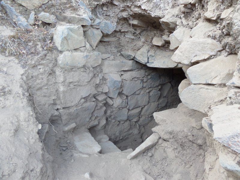
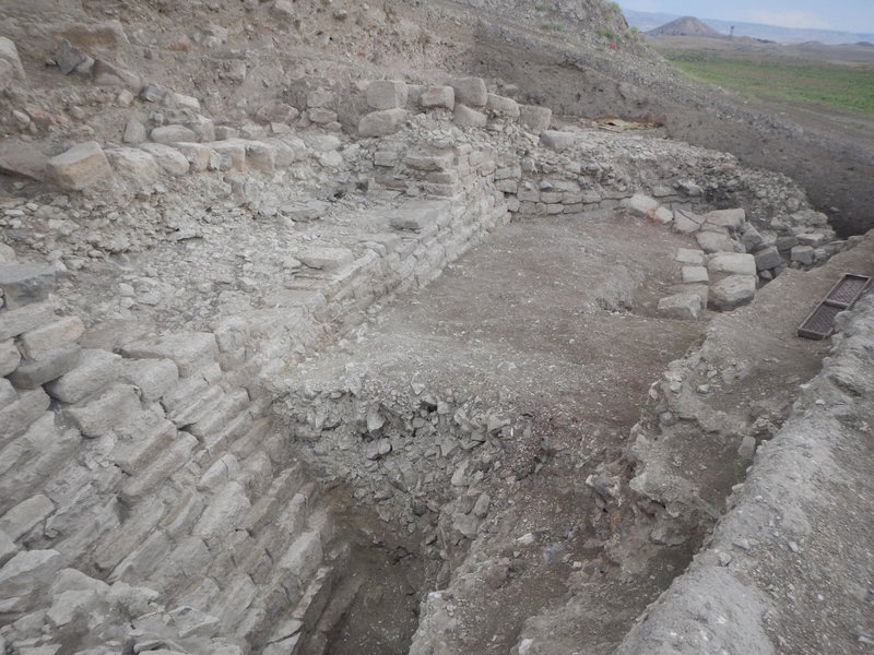
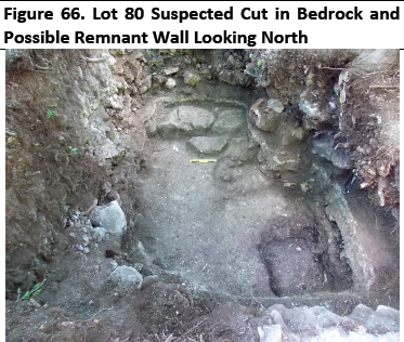
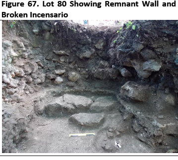
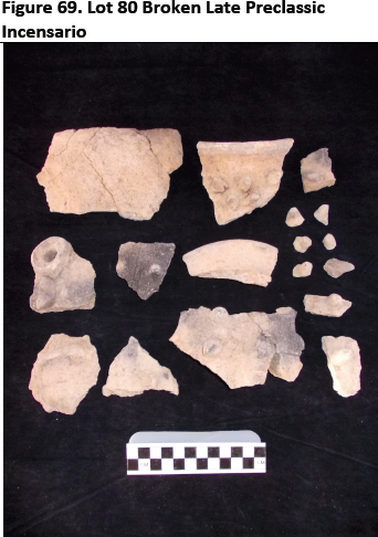
Sub-operation T was undertaken to investigate the floor identified during the excavation of Sub-operations A and P (see Lots 71 and 73). To abridge the inquiry, a decision was made to consolidate Sub-operations A and P into one sub-operation. Sub-operation T comprised two lots (Lots 76 and 80), which, on excavation, revealed a heavy plaster flooring (believed to be earliest construction phase of the patio) adhered to a thin underlying layer of construction fill. This was followed by the exposure of a layer of clayey soil (see Lot 80) covering undulating bedrock. During the excavation of Lot 80 a cut was identified in the underlying bedrock in the southeast of the sub-operation; in addition to a remnant wall and fragmented Late Preclassic incensario in the north of the sub-operation. The excavation of Sub-operation T was undertaken to a maximum depth of 210 cm below surface level (see Lots 76 and 80).
Lot 76 – Penetration of Plaster
The object Lot 76 was to penetrate a plaster floor that was identified during the excavation of Lots 71 and 73 and expose any underlying construction fill. Excavation of Lot 76 revealed a floor measuring 20-30 cm thick that was adhered to a thin layer of cobble fill. The weight of the floor, combined with its close proximity to bedrock (see Lot 80), suggested that it relates to the earliest construction phase of the patio. The expanse of this early floor was suggested by the presence of a remnant floor found at a corresponding depth (see Lots 66, 71 and 73) during the excavation of Sub-operation M. It has yet to be established what relationship this early floor has with the Structures 79 and 80; although, it is certain that it corresponds to earlier phase construction. Infrequent chipped stone and fragmented ceramics were unearthed, collected and bagged during the excavation of Lot 76. The excavation of Lot 76 extended to a maximum depth of 150 cm below surface level and cease following the identification of a layer clayey soils overlying bedrock.
Lot 80 – Clay over Bedrock and Remnant Architectural Feature
The objective of the Sub-operation 80 was to excavate the soil deposit identified during the excavation of Lot 76, which comprised a dark grey-brown loam with high clay content (munsel 2.5YR 4/1). Found to be reasonably free of cobble, the relative percentages of soil and cobble/stone material were 95% and 5% respectively. Occasional chipped stone artefacts and ceramic fragments were collected and bagged during the excavation of Lot 80.
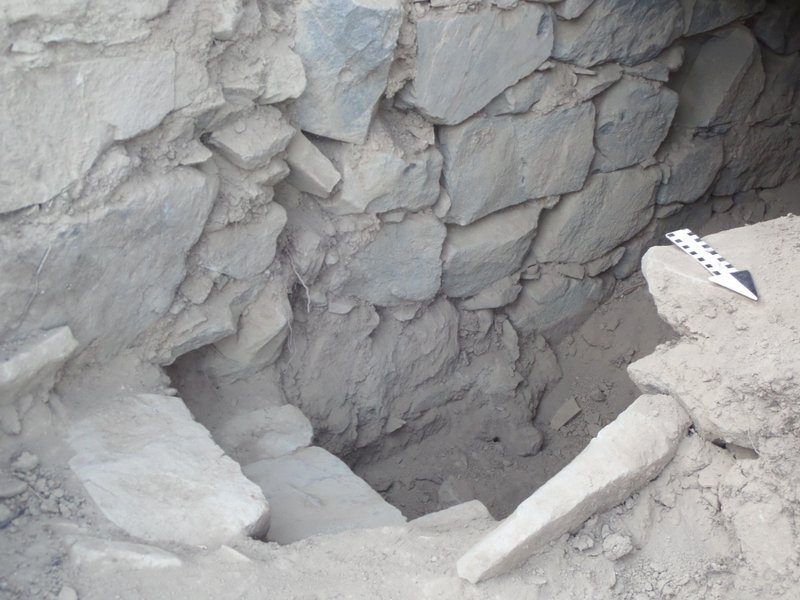
The excavation of Lot 80 revealed what appeared to be a 100 cm x 60 cm cut in the bedrock in the southeast quadrant of Sub-operation T as well as a small deposit of highly degraded bone located immediately west of this cut. In addition to these finds, a suspected remnant wall was identified immediately below the thick plaster floor at a depth of 160 cm in the north of the sub-operation. The wall comprised two single parallel courses of cut stone (chert) that were oriented in east-west. A highly fragmented Late Preclassic vessel was found in association with this architectural feature. A possible termination deposit, the form and likely function of this vessel have yet to be ascertained; however, the presence of protuberances or spikes over the vessel exterior (on occasion referred to as hobnails and thought to be symbolic of the Ceiba tree) is not an uncommon feature of Maya incensarios. The excavation of Lot 80 ceased at a maximum depth of 210 cm from surface level, once bedrock was reached. Some further excavation of Lot 80 will be required in 2015 to recover any additional pieces of the incensario that may have been missed during the excavation of Lot 80.
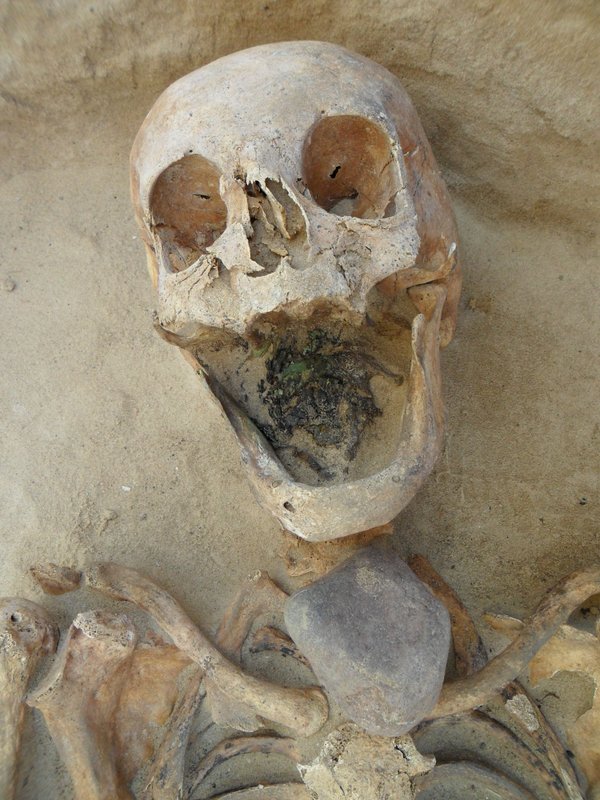
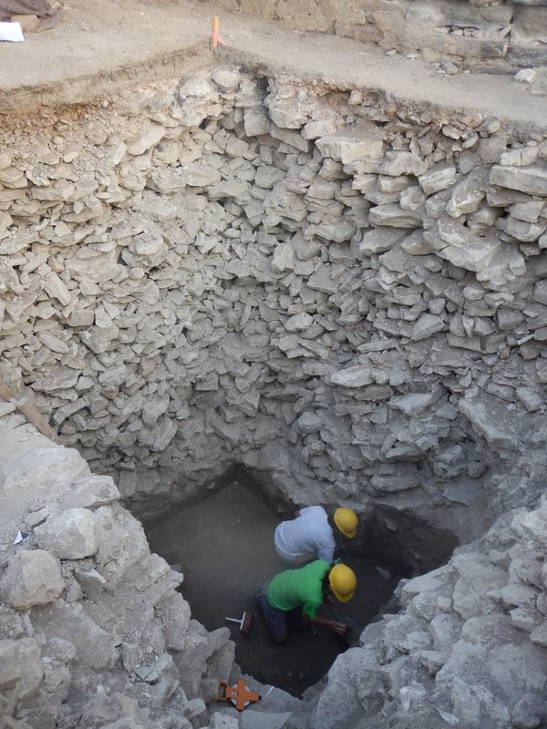
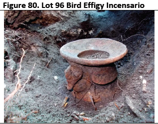
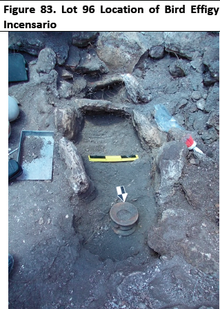
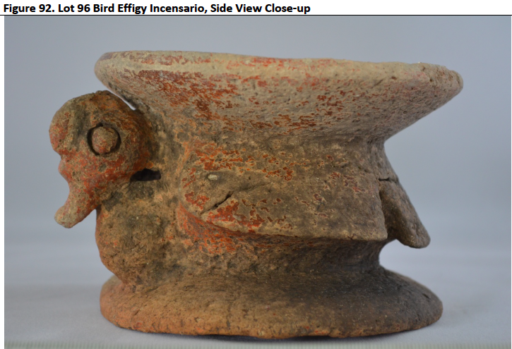
Following discovery of two capstones in the southwest of Sub-operation M (see Lot 60), suggesting the presence of a burial, a decision was made to extend the trench westward under a new sub-operation. Designated Sub-operation U, its purpose was to fully expose the outside of the suspected burial before lifting the capstones and excavating its interior. The excavation of the burial and the overlying deposits under a new sub-operation provided tighter control over the provenance of materials recovered during excavation. The excavation of Sub-operation U verified the presence of a burial (Tomb 14-01) containing an interred individual with an array of burial goods comprising macro botanicals, an intact Late Preclassic bird effigy incensario, and various items of body ornamentation.
Approximating 140 cm x 150 cm, the excavation of Sub-operation U was undertaken to a maximum depth of 140 cm below surface level. It began with the removal of aggraded soils resulting from plant decomposition. This was followed by the excavation of the underlying construction fill. Following this, the three capstones were subsequently removed and the interior of the burial excavated (see Lots 92, 93, and 96).
Lot 92 – Removal of Humus
Consistent with Sub-operation M, Lot 51, occasional chipped stone artefacts and ceramic fragments were unearthed, collected and bagged during the excavation of Lot 92. The excavation of Lot 92 extended to a depth of 45 cm. The compaction of the soil was found to be loose comprising moist dark fine brown silty loam (5YR 3/1) with frequent course limestone pebbles and cobbles. Cortical cert and abundant roots were found throughout the deposit. The relative percentage of the pebbles/cobbles to soil matrix was estimated to be 30% and 70% respectively. Removal of the humic layer exposed increasing cobble composed primarily of limestone. No formal surface to the patio was identified during the excavation of Sub-operation U, Lot 92. The lot was closed following the detection of a substantial increase in underlying cobble material.
Lot 93 – Construction Fill Over Burial
Lot 93 comprised loose dark greyish brown soils (10YR 4/2) with limestone and chert cobble, the relative percentages of cobble and soil was 70% and 30% respectively. Artefactual material comprised infrequent chipped stone artefacts and ceramic sherds, which were collected and bagged during the excavation. Lot 93 was excavated to a maximum depth of 85 cm and ceased when all capstones were exposed. A third capstone was identified during the excavation of Lot 93 positioned just south of the two identified during the excavation of Suboperation M Lot 60.
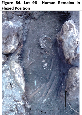
Lot 96 – Tomb 14-01 Interior
The objective of Lot 96 was the excavation of Tomb 14-01 interior. Removal of the three capstones revealed a thin layer of gravels over loose greyish-brown silty loam (2.5YR 4/1) free of construction fill. On excavating down into the burial cavity, which measured 120 cm north-south and 50 cm east-west and was lined with cut limestone, highly degraded human skeletal remains were identified. The first appearance of the skeletal remains occurred at a depth 0f 100 cm and ended at a depth of 140 cm from surface level. Excavation of these remains revealed a human individual interred in a flexed position facing eastward with the head oriented to the North. Some of the more distinguishable skeletal vestiges included a partial cranium and several long bones; they also included a partial radius and humerus as well as a partial femur and tibia. In addition to long bones and bone fragments, several teeth were found while sieving of the surrounding deposits. As formal analysis of the remains has yet to be undertaken, it is unclear whether it will be possible to determine the age, health and gender of the individual; this is due primarily to their poor condition of the remains. Soils samples were collected from the burial for pollen and phytolith, results of which are pending.
Grave goods found with the burial included twenty-three plant seeds from three different plant varieties. Formal identification these macro-botanicals have yet to be undertaken. The seeds were found within the soil overlying the burial; their presence suggested that related plant material was deposited with burial. This finding is generally consistent with those associated with Xno’ha Burial 13-01,which was excavated the previous year (see MRP 2013 field report). Analysis of the soil sample taken from Burial 13-01 determined the following:
The high frequency of unknown phytoliths is the result of poor preservation. No hat-shaped palm phytoliths were found. However, the frequency of spinulose spheres > 10µ (4.8 percent) indicates that oil extracted from A. cohune and/or R. regia may have been poured into the vessel. Moreover, a low frequency of sponge spicules (1.2 percent) indicates that sponges were part of the offering (Bozarth 2013: 13).
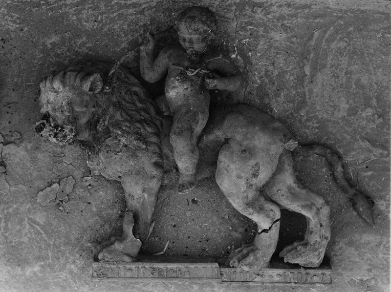
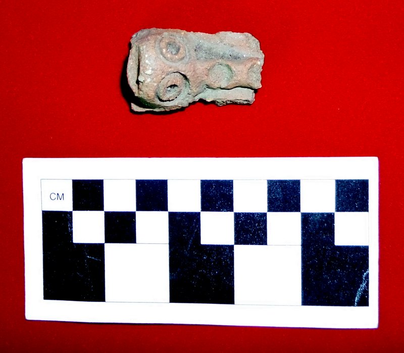
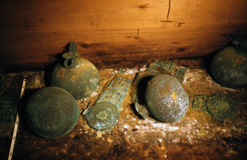
In addition to the macro botanicals, a conch shell ornament carved into a flower shape (measuring 27 mm across) was found over the midsection of the individual; together with a red coral cruciform insert. The shell ornament and coral insert were found separated from one another; it was on their recovery that it was revealed that the pieces fitted together. A large jade cylinder bead, measuring 50 mm x 10 mm, was also recovered just south of the other ornamental pieces, as well as seventeen lithic flakes weighing 112 grams and one chert uni-face weighing 632 grams. Several marine shell fragments and a redware turkey effigy incensario were also found during the excavation of the Burial 14-01.
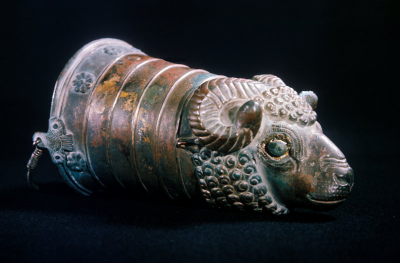
Measuring approximately 16 cm across and 14 cm in height, a Late Preclassic bird-effigy-incensario was found during the excavation of Burial 14-01. Preliminarily assessment suggests that the vessel was designed to resemble a turkey. This is implied by the comb on the head as well as general form and posture of the creature. Oriented westward in the burial, the head of the bird is clearly visible on one side of the vessel as it projects downward over the breast of the animal. Three phalanges located around the midsection of the incensario signify the wings and tail of the bird. Both the top and base of the vessel have comparable proportions and are dish shaped. A hole, measuring approximately 70 mm across, penetrates right through the centre of the incensario.
Xno’ha Operation 13-02, Sub-operation B – Lots 77, 84, 91 and 97
The excavation of Sub-operation B continued in 2014. The primary objective was the investigation of the sub-floor deposits east of Burial 13-01. Sub-operation B comprised four lots (i.e. Lots 77, 84, 91 and 97) and was excavated to a maximum depth of 175 cm from surface level. Cleaning and close examination of the profiles, immediately adjacent to Burial 13-01, suggest that the burial was intrusive, penetrating the floor in the east of the sub-operation. The excavation of Sub-operation B also revealed a second remnant floor, which occurred at comparable depth as the first-phase-patio-floor found in Sub-operations A and P (see relevant sections).
Lot 77 – Excavation of Remnant Floor
The objective of Lot 77 was to investigate the floor identified during the excavation Lot 3 in 2013 (see MRP Field Report 2013). Occasional chipped stone and ceramic fragments were collected and bagged during the excavation of Lot 77. The remnant floor comprised a compact greyish-brown fine grained silty loam (7.5YR 5/1) with infrequent inclusions of limestone and suspended ballast material ranging in size from 5-40 cm. The floor surface was poorly preserved and extended as far as the eastern edge of the burial cavity located in the west of the sub-operation. The termination of the floor, on the eastern side of the Burial 13-01, indicated that it did not extend across the entire sub-operation and that the burial (like Burial 14-01 in Sub-operation U), penetrated through the remnant floor surface into the supporting construction fill. The intrusive nature of the burial was also evidenced by a concentration of cobble material visible in the southern profile of the sub-operation. Lot 77 reached a maximum depth approximating 105 cm. The depth of the remnant floor was consistent with the level of the floor identified in neighbouring Sub-operation M. The excavation of Lot 77 ceased when a darkening of soil was detected as well as the reappearance of supporting cobble construction fill.
Lot 84 – Sub-floor Construction Fill
The objective of the Sub-operation 84 was to excavate down through the layer of construction fill found underlying a remnant floor on the eastern side of Sub-operation B. Lot 84 comprised a relatively thin layer of limestone and chert ballast suspended a matrix of dark grey-brown silty loam with increasing clay content (munsel 7.5YR 5/1); the relative percentages of cobble and soil were 80% and 20% respectively. Occasional chipped stone artefacts and ceramic fragments were collected and bagged during the excavation of Lot 84. The excavation of Lot 84 reached a maximum depth of 120 cm from surface level and ceased on the identification of a second remnant floor found at a corresponding depth to the first-phase-patio-surface found in Sub-operations A and P (see relevant sections).
Lot 91- Sub-floor Construction Fill and First Phase Patio
The object Lot 91 was to penetrate the remnant floor that was identified during the excavation of Lots 76 and expose the underlying construction fill. Excavation of Lot 91 revealed a layer of cobble 20-30 cm thick. The absence of large amounts of cobble was the resulted of the floor’s close proximity to bedrock. Infrequent chipped stone and fragmented ceramics were unearthed, collected and bagged during the excavation of Lot 91. The excavation of Lot 91 extended to a maximum depth of 150 cm below surface level and cease following the identification of a layer clayey soils overlying bedrock.
Lot 97 – Clay over Bedrock
The objective of the Sub-operation 97 was to excavate the soil deposit identified during the excavation of Lot 97, which comprised a dark grey-brown loam with high clay content (munsel 2.5YR 4/1). Found to be reasonably free of cobble, the relative percentages of soil and cobble/stone material were 95% and 5% respectively. Occasional chipped stone artefacts and ceramic fragments were collected and bagged during the excavation of Lot 97. The excavation of Lot 97 ceased at a maximum depth of 175 cm from surface level, once bedrock was reached.
_______________________________
All images courtesy Maya Research Program, unless otherwise noted.
Acknowledgements:
I would like to thank Tom Guderjan and Colleen Hanratty and all the team for the invaluable support they provided during my stay over MRP field Sessions 3 and 4 2014. This work would also not have been possible without the efforts of the workers from San Felipe as well as volunteers Fidel Cruz, Kevin Austin, Megan Weldy, Jack Magee, Emily Prichard, Julia Mahr, Shelby Betz, Beth Eraul, Katie Wahler, Mariela Mendoza, Douglas Reithmuller, Romano Derosa, and Chabli Bravo.
References
Bozarth, S. R. 2013. Blue Creek 2013 Biosilicate Report: Analysis of Biosilicates and Charred Phytoliths at Chum Balam Na, Nojol Nah, and Xno’ha North western Belize. Department of Geography University of Kansas.
Chase, A. F. and D. Z. Chase. 1992a. Mesoamerican Elites: Assumptions, Definitions, and Models. In Mesoamerican Elites, An Archaeological Assessment, edited by D. Z. Chase and A. F. Chase: 3–17. Norman, University of Oklahoma Press.
González, J. J. 2003. Cultural Landscapes, Cultural Identity: Settlement at Ixno’Ha, Belize. pages 39-43 Blue Creek Regional Political Ecology Project: 2001 And 2002 Research Summaries, edited by Jon C. Lohse. Maya Research Program, Fort Worth, Texas.
González, J. J, and H Knippe. 2004. Ixno’ha Excavation Report, 2003. Pages 33-52. Blue Creek Regional Political Ecology Project 2003 Seasonedited by Jon C. Lohse. Maya Research Program, Fort Worth, Texas.
González, Jason J. 2005 2004 Ixno’ha Excavation Report , pages 108-158. In 2004 Season Summaries of the Blue Creek Regional Political Ecology Project, edited by Jon C. Lohse and Kerry L. Sagabiel. Maya Research Program, Fort Worth, Texas.
Guderjan, T and Hanratty. C . 2014. The 22nd annual report of the Blue Creek Archaeological Project. Maya Research Program, University of Texas at Tyler.
Guderjan, T.H., R. J. Lichtenstein, et al. 2003. Elite Residences at Blue Creek, Belize. In Maya Palaces and Elite Residences: An Interdisciplinary Approach, edited by J. Joyce Christie: 13–45. Austin, University of Texas Press.
Guderjan, T. H. 2007. The Nature of a Maya City: Resources, Interaction and Power at Blue Creek, Belize. University of Alabama Press, Tuscaloosa.
Guderjan T. H. 2013. Archaeological Research Proposal for Blue Creek Nojol Nah, and Xno’ha.
Kanippe, H. and J. J, González. 2003 Small Sites Versus Large Sites: Questioning Maya Political and Economic Settlement Relationships pages 44-49 Blue Creek Regional Political Ecology Project: 2001 And 2002 Research Summaries, edited by Jon C. Lohse. Maya Research Program, Fort Worth, Texas.
Kowalski, J. K. 2003. Evidence for the Functions and Meanings of some Northern Maya Palaces. In Maya Palaces and Elite Residences: An Interdisciplinary Approach, edited by J. Joyce Christie: 204–253. Austin, University of Texas Press.
Lalonde, D. 2002. Ixno’Ha 2002 Season Excavation Summary pages 50-52. Blue Creek Regional Political Ecology Project: 2001 And 2002 Research Summaries, edited by Jon C. Lohse. Maya Research Program, Fort Worth, Texas.
Marcus, J. 1992b. Royal Families, Royal Texts: Examples from the Zapotec and Maya. In Mesoamerican Elites, An Archaeological Assessment, edited by D. Z. Chase and A. F. Chase: 221–241. Norman, University of Oklahoma Press.
Mead, K., G. Mastropietro and I. LeMasters. 2014. Pitz Nah Or Ma’ Pitz Nah, That Is The Question – 2013 Excavations at a Purported Ball Court at Xnoha. In The 22nd annual report of the Blue Creek Archaeological Project. Maya Research Program, University of Texas at Tyler.
Parmington, A. 2013. Excavations Undertaken at Xnoha Building Group 78. In The 22nd annual report of the Blue Creek Archaeological Project. Maya Research Program, University of Texas at Tyler
Plumer, H. 2014. Excavations of a Terminal Classic Courtyard at Xnoha. In The 22nd annual report of the Blue Creek Archaeological Project. Maya Research Program, University of Texas at Tyler.
Preston, T and T Guderjan. 2013. 2012 Excavations at Xno’ha. The 21st annual report of the Blue Creek Archaeological Project. Edited by Thomas H. Guderjan and C. Colleen Hanratty. Maya Research Program, University of Texas at Tyler.
Sanders, W. T. 1992. Ranking and Stratification in Prehispanic Mesoamerica. In Mesoamerican Elites, An Archaeological Assessment, edited by D. Z. Chase and A. F. Chase: 278– 291. Norman, University of Oklahoma Press. Sharer, R. J. 1994. The Ancient Maya [Fifth Edition]. Stanford, California, Stanford University Press.
Schele, L. and P. Mathews. 1998. The Code of Kings: The Language of Seven Sacred Temples and Tombs. New York, Scribner.
Sharer, R. J. 1994. The Ancient Maya [Fifth Edition]. Stanford, California, Stanford University Press

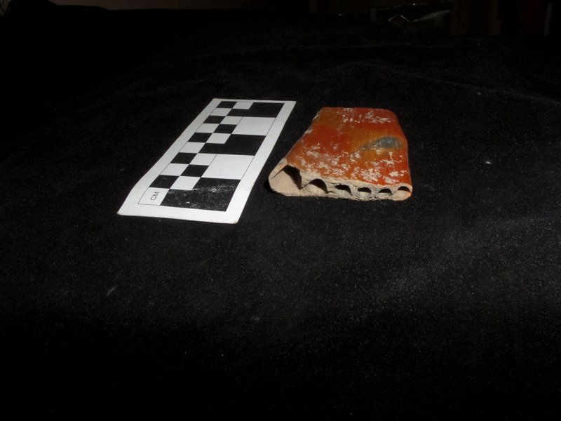
 Found at Apollonia Pontica, terracotta plaque frieze fragment artifact shows two hoplites. Marie Lan-Nguyen, Wikimedia Commons
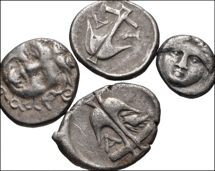 Found at Apollonia Pontica, a lot of 4 Greek silver coins. Wikimedia Commons