Stone carvings and painted imagery bear some of the earliest forms of human communication. In place of written words, numerous cultures employed artistic representations to communicate ideas, thoughts, and beliefs. From the American southwest to the outback of Australia, I examine how this form of art was utilized by dissociate and quite different cultures to relate a variety of sociocultural events.
Introduction
The immense complexity regarding rock-art is as grand in scale and diverse in nature as the landscape it adores (ARB 2013: 68). It is an area of study that encompasses numerous geographical regions strewn over millennia and is reflected in and a sign of disparate religious practices, sociopolitical structures and economic communities (Flood 2004: 191-96; Whitley 2005: 93-94). Broadly, it may be argued that where rock-art is found, it is part of a larger landscape where varying inter or intra cultural events were expressed through a numerous array of symbolic imagery in an almost linguistic fashion (Ouzman 1998: 30-32; Solomon 1998: 271). However, while rock-art is a cognitive expression wrought by human hands, the ‘meaning’ or purpose of the ‘art’ is sometimes obscured in a myriad of sociocultural variables (Taçon and Chippindale 1998a: 1-6).
For example, certain forms of rock-art may have had an active role in shaping a society’s beliefs and customs, while other forms could have been influenced by natural surroundings. Consequently, rock-art may be interpreted as fulfilling a practical function for an individual, community or society (ARB 2013: 66-67). That being said, studies on rock-art range from the role natural phenomena played vis-à-vis the selection of site and the impact a society’s beliefs may have had on an image’s features; to the degree that a belief system influenced the art or was itself (re)shaped by it in successive generations (Chippendale and Taçon 1998a: 2). As such, rock art’s symbolism forms an important part of a wider cultural narrative (Whitley 2005: 80-85).
To help decode some of these pictographic puzzles, archaeologists often turn to ethnography. As is known to many, ethnographic studies have been an important ally for both historical and prehistoric scholars (Johnson 2010: 21-22, 53-54). In order to discuss how ethnographically informed approaches may contribute to the archaeological study of rock-art, I will examine case studies from two continents. Accordingly, this article will be separated into two distinct geographical segments 1) North America, and 2) Australia. In each case, I shall examine many aspects of rock-art in light of ethnographic materials. All the while, I will endeavor to underscore cross-categorical topics such as social beliefs, rituals and warfare.
Part I: North America
Religious practices
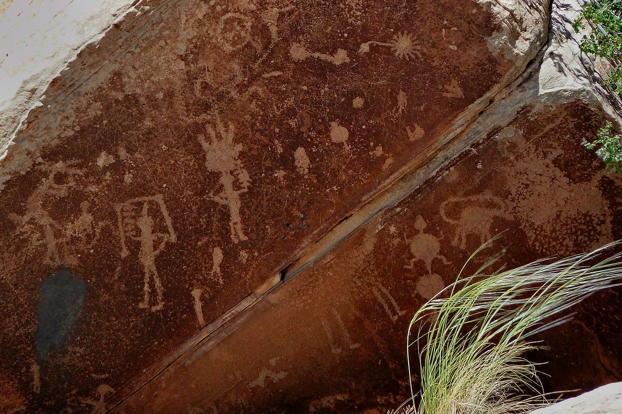
Like the words of a sentence, rock-art is not a collection of randomly assigned symbols with no coherent meaning. There is an ordered structure to the iconography, even if it is not a grammatical order, per se (Whitley 2005: 81). Two cases in point may be found among the Californian (c. AD 1-1800) and Great Basin (c. 16,500 BC-AD 500) traditions. Drawing from ethnographic data, reoccurring patterns of rock-art in both regions are seen as evidence of a broad western North American sociocultural tradition extending from the archaic period down to the present day (Whitley 1998: 14). In addition, the data acquired from more recent hunter-gatherer tribes has inferred that the practice of creating rock-art was itself part of cultural ritual where the individual symbols did not necessarily possess a grammatical meaning but did have specific functions within diverse ceremonies (Whitley 1998: 14-15; ARB 2013: 93).
For example, certain forms of rock-art have been interpreted as a ritualistic expression of shamans engaged in communicating with supernatural entities while in an altered state of consciousness (Whitley 1998: 15-18; See also Rossano 2011: 47). The purpose of many such ceremonies was to enhance one’s perception by channeling mystical or paranormal energies known generally as ‘medicine power’ (Keyser and Klassen 2001: 35, 55-56). In addition, it has been inferred that parallels found within the iconography of both traditions results from the shared neuropsychological reactions of human beings in a psychedelic state (Whitley 1998: 14). This is supported by ethnography involving the San people of southern Africa, where hallucinogenically induced images are known as ‘trance metaphors’ (Solomon 1998: 270-72). Consequently, certain rock-art examples may be interpreted as the first-person account of these events.
However, ethnographic data has also suggested that certain rock-art forms highlight social events involving non-shaman communal members. For instance, adolescent females have been identified as the makers of panels consisting of monochrome handprints juxtaposed with rattlesnake ‘zigzags’ (Whitley 1998: 16, 18-21). These images were part of a ceremony to mark the sexual maturity of the young women. Interestingly, the shamanistic image of the rattlesnake clearly has a religious connotation (see below). However, here it is found as an integral part of an event that is both biological and social in practice. Accordingly, it may be argued that certain symbols did not represent the material or celestial worlds in isolation from one another. Rather, they may have been intended to communicate spiritual insight or psychic commentary on everyday human issues (Whitley 1998: 15; See also Whitley 2005: 84-85). Consequently, any preconceived line between the sacred and more ‘mundane’ aspects of the world becomes muddled (Whitley 1998: 18, Cf. 24-26). Perhaps religious beliefs while distinguishable were also inseparable from secular functions. In any case, ethnographic approaches regarding shamanism have helped to elucidate the physical conditions under which the rock-art was created.
Great Plains Tradition
An analogous pattern of symbols may also be observed in southern Canada at the site of Writing-On-Stone. Here, ethnographic studies of the symbols have categorized static petroglyphs as ‘iconic’. That is to say, certain symbols are part of ‘medicine imagery’ and as such possessed a specific spiritual function within the community (Klassen 1998: 44). For example, individual signs, such as Shield Figures, relate the belief that body shields possessed sacred properties, capable of being transferred to the owner of the shield (Klassen 1998: 45, 47-49). Moreover, recent ethnographic accounts from the Blackfoot have interpreted some symbols, such as muskets, as reflecting the tribal practice of ‘counting of coup’ — itself a spiritual custom (Klassen 1998: 50). Thus, the point of contact between the rock-art and the native warrior could be seen as a window into a ‘celestial’ realm (Klassen 1998: 44-45). This begs the question: did the geological landscape influence the placement of rock-art? And if so, what relationship do the symbols have with the rock features within the landscape?
Canvassing the Landscape
Interestingly, ethnographic data has revealed that the places where rock-art was positioned were not simple blank canvases but functional landscapes, consciously selected because of their natural phenomena (Whitley 1998: 16). For example, features such as caves, stone cliffs and crevices were viewed as apertures into another world (Cf. ARB 2013: 94). For that reason, it is not uncommon to find these areas adorned with cultural symbols. Turning to an archaeological site in the Colorado Desert, zigzag motifs evoking the rattlesnake are positioned at clefts in the rocks (Whitley 1998: 17-18). Fascinatingly, one figure possesses a human head, arms and hands attached to the body of a serpent (Whitley 1998: 17). Moreover, it appears that this ‘snake’ is entering/exiting a fissure in the stone.
Given the indigenous associations between shamanism and rattlesnake iconography, it may be deduced that this image depicts a shaman metamorphosing into a serpent, or conversely as a serpent into a shaman, as it moves in between the supernatural and physical worlds as part of a ritual ‘vision quest’ (Whitley 1998: 18-21). Similarly, according to the Blackfoot, the landscape of the Great Plains played an important role in the ritual experiences of shamans. Here, the geology of the land — appropriately titled ‘hoodoo’ — most likely offered a euphoric experience for the shaman entering an altered state of consciousness (Klassen 1998: 42-43, 69). Such associations between the rock-art’s landscape and the sacred are not restricted to shaman usage. For example, in the Columbia Plateau of the northwest, Native Americans revere one very painted cave as the abode of the creator god Gmok’am’c (Keyser and Poetschat 2004: 121; Cf. Whitley 1998: 22). Thus, it may be argued that rock-art occasionally functioned as signposts to otherworld portals.
Narratives of Conflict
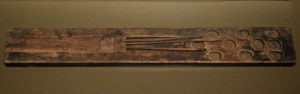
In contrast to more isolated symbols, some rock-art signs form the part of a larger, more literal cultural narrative. As such, their position in respect to each other becomes essential to interpretation. For example, in the (Great) Plains Biographical Tradition (c. AD 1725-1850), the ritual ‘ceremonial’ Shield Figures were utilized as part of a fluid rock-art mural (Klassen 1998: 43). Here, groups of images depict social interaction, such as acts of valor and courageous deeds (Whitley 2005: 101-02). A case in point is a depiction of a Shield Figure challenging a mounted warrior equipped with what appears to be (European?) horse armor (Klassen 1998: 57).
While it is conceivable that this specimen reflects an encounter with a Spanish conquistador, it is perhaps more likely to reflect the adoption of horse armor by natives, as is seen in other Mounted Horse motifs and attested to by ethnographic sources (Mitchell 2004: 116, 118-23; Klassen 1998: 54, 56). Other scenes contain various arrangements of Shield Figures, foot soldiers (‘pedestrians’) and equestrian warriors (Klassen 1998: 54-55, 57, 60-63). By carefully analyzing their size and proportion in relation to each other, the images are clearly indicative of conflict, either among individuals within the same tribe, amidst warriors from rival tribes, or between Europeans and Native Americans (Klassen 1998: 55, 64).
It should be noted here that unlike the ‘iconic’ style, narrative imagery — or narrativity — appears to be more focused on the mundane events of everyday life. However, narrativity has also had an important historical association with sacred social customs such as ‘counting of coup’ (Klassen 1998: 54, 60-61, 67-68; Tovías 2011: 21-22, 142; See also Mitchell 2004: 115). This has been suggested by the Blackfoot whose unique use of magical ‘medicine bundles’ on horses are quite visible on the narrative rock-art. Collectively, a complex degree of integration between the sacred and more secular aspects of society becomes evident (Cf. Klassen 1998: 59-60, 68).
In the same way, the evolution of static ‘ceremonial’ symbols into panels depicting fluid action may be reflective of increases in the social complexity of the communities (Klassen 1998: 65-67). Consequently, any ‘variations’ detected in rock-art — such as proportion, color or size — may be the result of internal structural variables within clans, changes related to contact with outside forces, or some combination of the two (Klassen 1998: 69, Cf. 44; Mitchell 2004: 125; Howey and O’Shea 2009: 199). A critical analysis by archaeologists regarding the veracity of ethnographic approaches to rock-art has pointed out that changes in ‘culture’ — including beliefs and practices — have a stylistic impact on rock-art symbolism (Schaafsma 2013: 30). Regardless, it is unlikely that examining ethnicity alone will explain changes to rock-art forms (ARB 2013: 73).
Contradictions
While the many aspects of rock-art sites may be established through ethnographic resources, sometimes ethnographic approaches are not very clear, or may be contradicted by other forms of evidence. For example, in the Four Corners region, Hopi ethnography has been instrumental in identifying certain motifs as clan ‘signatures’, thus allowing an interpretation as to the ethnic origin of some rock-art panels (OGCD 1995: 142; Whitley 2005: 96). However, Hopi traditions disagree with their own ethnographic accounts as well. For instance, in a bizarre use of circular reasoning, the Hopi have ascribed various cosmological attributes to their god Kokopelli, based on their assertion that unidentified kachina glyphs represent early forms of Kokopelli (Malotki 2004: 7-12).
In addition, the Hopi have misrepresented prehistoric ‘masklike’ images while being interviewed by scholars, stating that the ‘masks’ are part of Hopi kachnina iconography. This they maintained even though material evidence suggests that these interpretations are anachronistic (Schaafsma 2013: 30-31). This is unsurprising though. The Hopi define many prehistoric rock-art sites, especially those created by the Anasazi, by their own ancestral traditions. For example, a Hopi interpretation of prehistoric (Anasazi) concentric circles is that it refers to Ancestral Pueblo migration narratives regarding the Hopi (Wilson 1998: 181). However, such an assertion requires the assumption that a cultural continuity exists between the Anasazi and Hopi. In any case, these examples showcase how evolving religious beliefs amongst indigenous people may affect how rock-art is interpreted by successive generations. Moreover, it highlights how current social perceptions and bias may influence analysis. This should always be taken into consideration while making use of ethnographic sources (ARB 2013: 78).
_________________________
PART II: Australia
Ancestral Traditions and Rock-Art
Like is found in other continents, Australian rock-art is strongly associated with the ancient beliefs of the indigenous people and their cosmological views. That being said, ethnographic data has enabled scholars to illuminate the ‘sacred relationship’ that underpins the religious belief, social identity and human geography of various clan groups (David et al. 1994: 242; ARB 2013: 69; Cf. ‘Places of Power’ in Colson 1997: 48-52). For instance, Aboriginal explanations regarding rock-art frequently associate the local geological features with the physical activities of totemic deities (Flood 2004: 183; Whitley 2005: 96). Ancient waterholes and caves, for example, are revered as the product of primordial Ancestral Beings. These cosmological views are part of the complex belief system known as buwarraja, or ‘Dreaming-time’, the period of Earth’s creation (David 2006: 57; ARB 2013: 69-70; Chippendale and Taçon 1998b: 92). Consequently, many rock-shelters possess a combination of natural features and symbolism which evoke these ontological conceptions (Flood 2004: 194).
A case in point may be seen at the cavernous site of Wirlin.gunyang in northern Australia. Here, according to myth, the god Gorrondolmi upon completing his ‘Dreaming Track’ journey, made a self-portrait which included his wife (Flood 2004: 189-90). The painted images positioned directly above a waterhole. However, there is also a practical — and quite secular — calculation behind certain sites and their iconography which might also be applicable here. For example, ethnographic records from Aboriginal seasonal camps suggest that sites such as Yingalarri and Garnawala, were chosen because they were shelters which afforded natural resources (Flood 2004: 193, 195). Hence, it may be posited that Wirlin.gunyang doubled as a seasonal shelter for prehistoric Aboriginals. Regardless, the great mural of Gorrondolmi and his bride underscore the linkage between Aboriginal beliefs involving the creation of the Earth and the local geography.
The Narrative of the Stone
Another aspect of Australian rock-art is the unique function it has in defining social space. This is because ethnic regions are identified, in part, by their respected iconography and cultural affiliation (Layton 1992: 62). For example, the Kunwinjku people of the Arnhem Land are widely associated with the rock-art of Oenpelli (May 2008: 173). Among the various images found at Oenpelli, the most common are the Mimi. These are images of ‘minor’ sacred beings which according to ethnographic accounts, instructed the Kunwinjku in select social customs (Layton 1992: 79-80). In addition, certain images — such as totemic gods — may act as a historical marker on the landscape (David et al. 1994: 242-44; McDonald and Veth 2006: 106-07; Cf. McDonald 1998: 324). For example, at Yiwarlarlay and Garnawala, the location of images such as the Lightning Brothers and Rainbow Serpent, may reflect a narrative involving social changes such as migration (David et al. 1994: 247-50).
Early rock-art
But how old are these beliefs? Perhaps an answer can be found in the Panaramitee Tradition of South Australia. While dated to the Late Pleistocene, Panaramitee imagery, such as geometric signs, possess a stylistic affinity with other regional varieties of rock-art (Flood 2004: 185-86). Were the ancient Panaramitee signs meant to represent a Dreaming Track of ancestral gods? Possibly. For example, concentric circles found in Panaramitee rock-art may be interpreted as totemic references to deities (Taçon 2001: 540; Layton 2001: 324-25). Of course, to conjecture this one must utilize conflicting data from ethnographic sources which is not a sound practice (Munn 2006: 331).
In a similar fashion, using Aboriginal ethnography, one may infer the meaning of an example of Upper Paleolithic rock-art: cupules. A uniquely pitted rock-art pattern, the ‘cupule’ has been dated to c. 15,000 B.C. (Taçon 2001: 537). However, unlike the Dreaming iconography, the data suggests that cupules are linked to a fertility ritual which involved the striking of stone to release a ‘spirit essence’ (Flood 2004: 191-92; Cf. Taçon 1999: 46). This is inferred from ethnohistorical accounts. If this interpretation is correct, it may be inferred that a side effect of rock-art production — generating rock-dust — was among the first Australian rock-art rituals.
_______________________
Conclusion: ‘Only the rocks live forever…’
In this essay, I have attempted to show the significant role ethnography plays in the archaeological research of rock-art. Beginning in North America, I examined shamanistic practices and their associations with the rock-art landscapes of the Great Basin and Californian traditions, before moving to the Great Plains were I discussed changes in iconographic styles over time. Turning south to the Four Corners, I emphasized how cultural traditions may negatively impact archaeological studies of rock-art. Finally, while analyzing Australia, I drew attention to the special bond rock-art has with Aboriginal beliefs and societal customs.
In all cases throughout this essay, I have underscored themes related to the cultural sites examined and attempted to relate these to informed approaches. Topics such as shamanism, warfare and the natural formations of landscape were linked to rock-art by ethnographic accounts involving a diverse range of cultures. In summation, I hope I have illuminated a small chapter in the great saga of rock-art research. As the fictional Arapaho warrior Gray Wolf said to a young Lame Beaver in the epic Centennial: ‘only the rocks live forever’ (Michener 1974: 130). If that is true, then both rock-art and its research have an enduring place on the landscape.
Bibliography
ARB, 2013. The Archaeology of Religion and Belief (level 3 course reader). Leicester: University of Leicester.
Bsktmkr, 2004. Shield Figures from Arrow Canyon, Nevada. [Photo]
Available at: http://www.flickr.com/photos/wdhyder/870657421/
[Accessed 15 July 2013].
Colson, E., 1997. Places and Power and Shrines of the Land. Paideuma, Volume XLIII, pp. 47-57.
David, B., 2006. Archaeology and the Dreaming: Toward an Archaeology of Ontology. In: I. Lilley, ed. Archaeology of Oceania: Australia and the Pacific Islands. Malden: Blackwell Publishing, pp. 48-68.
David, B. et al., 1994. Of Lightning Brothers and white cockatoos: dating the antiquity of signifying systems in the Northern Territory, Australia. Antiquity, LXVIII(259), pp. 241-51.
Flood, J., 2004. Linkage between rock-art and landscape in Aboriginal Australia. In: C. Chippindale & G. Nash, eds. The Figured Landscapes of Rock-Art. Looking at Pictures in Place. Cambridge: Cambridge University Press, pp. 182-200.
GNA, 2013. Go Native America. [Photo]
Available at: http://www.gonativeamerica.com
[Accessed 16 July 2013].
Howey, M. C. L. & O’Shea, J., 2009. On Archaeology and the Study of Ritual: Considering Inadequacies in the Culture-History Approach and Quests for Internal “Meaning”. American Antiquity, LXXIV(1), pp. 193-201.
Johnson, M., 2010. Archaeological Theory: An Introduction. Second ed. Hoboken: Wiley-Blackwell.
Keyser, J. D. & Klassen, M. A., 2001. Plains Indians Rock Art. Seattle: University of Washington Press.
Keyser, J. D. & Poetschat, G., 2004. The canvas as the art: landscape analysis of the rock-art panel. In: C. Chippindale & G. Nash, eds. The Figured Landscapes of Rock-Art: Looking at Pictures in Place. Cambridge: Cambridge University Press, pp. 118-30.
Klassen, M. A., 1998. Icon and narrative in transition: contact-period rock-art at Writing-On-Stone, southern Alberta, Canada. In: C. Chippindale & P. S. C. Taçon, eds. The Archaeology of Rock-Art. Cambridge: Cambridge University Press, pp. 42-72.
Layton, R., 1992. Australian Rock Art: A New Synthesis. Cambridge: Cambridge University Press.
Layton, R., 2001. Ethnographic Study and Symbolic Analysis. In: D. S. Whitley, ed. Handbook of Rock Art Research. Lanham: Rowman & Littlefield Publishers, Inc, pp. 311-31.
Malotki, E., 2000. Kokopelli: The Making of an Icon. Lincoln: University of Nebraska Press.
May, S. K., 2008. Learning Art, Learning Culture: Art, Education, and the Formation of New Artistic Identities in the Arnhem Land, Australia. In: D. Fiore, I. D. Sanz & S. K. May, eds. Archaeologies of Art: Time, Place, Identity. Walnut Creek: Left Coast Press, pp. 171-94.
McDonald, J., 1998. Shelter rock-art in the Sydney Basin — a space-time continuum: exploring different influences on stylistic change. In: C. Chippindale & P. S. C. Taçon, eds. The Archaeology of Rock-Art. Cambridge: Cambridge University Press, pp. 319-35.
McDonald, J. & Veth, P., 2006. Rock Art and Social Identity: A Comparison of Holocene Graphic Systems in Arid and Fertile Environments. In: I. Lilley, ed. Archaeology of Oceania: Australia and the Pacific Islands. Malden: Blackwell Publishing, pp. 96-115.
Michener, J. A., 1974. Centennial. New York: Random House, Inc.
Mitchell, M. D., 2004. Tracing Comanche history: Eighteenth-century rock art depictions of leather armored horses from the Arkansas River basin, south-eastern Colorado, USA. Antiquity, LXXVIII(299), pp. 115-26.
Munn, N. D., 2006. Visual Categories: An Approach to the Study of Representational Systems. In: H. Morphy & M. Perkins, eds. The Anthropology of Art: A Reader. Malden: Blackwell Publishing, pp. 326-38.
OGCD, 1995. Operation of Glen Canyon Dam: Colorado River Storage Project, Arizona. Washington: United States Bureau of Reclamation.
Ouzman, S., 1998. Towards a mindscape of landscape; rock-art as expression of world-understanding. In: C. Chippindale & P. S. C. Taçon, eds. The Archaeology of Rock-Art. Cambridge: Cambridge University Press, pp. 30-41.
Rossano, M. J., 2011. Setting Our Own Terms: How We Used Ritual to Become Human. In: H. Walach, S. Schmidt & W. B. Jonas, eds. Neuroscience, Consciousness and Spirituality. New York: Springer Publishing, pp. 39-55.
Schaafsma, P., 2013. Images and Power: Rock Art and Ethics. New York: Springer Publishing.
Solomon, A., 1998. Ethnography and method in southern African rock-art research. In: P. S. C. Taçon & C. Chippindale, eds. The Archaeology of Rock-Art. Cambridge: Cambridge University Press, pp. 268-84.
Taçon, P. S. C., 1999. Identifying Ancient Sacred Landscapes in Australia: From Physical to Social. In: W. Ashmore & A. B. Knapp, eds. Archaeologies of Landscapes: Contemporary Perspectives. Oxford: Blackwell Publishers, pp. 33-57.
Taçon, P. S. C., 2001. Australia. In: D. S. Whitley, ed. Handbook of Rock Art Research. Lanham: Rowman & Littlefield Publishers, Inc, pp. 530-75.
Taçon, P. S. C. & Chippindale, C., 1998a. An Archaeology of rock-art through informed methods and formal methods. In: P. S. C. Taçon & C. Chippindale, eds. The Archaeology of Rock-Art. Cambridge: Cambridge University Press, pp. 1-10.
Taçon, P. S. C. & Chippindale, C., 1998b. The many ways of dating Arnhem Land rock-art, north Australia. In: P. S. C. Taçon & C. Chippindale, eds. The Archaeology of Rock-Art. Cambridge: Cambridge University Press, pp. 90-111.
Tovías, B., 2011. Colonialism on the Prairies: Blackfoot Settlement and Cultural Transformation, 1870-1920. Portland: Sussex Academic Press.
WC, 2013. Wiki Commons. [Photo]
Available at: http://commons.wikimedia.org/wiki/Main_Page
[Accessed 15 July 2013].
Whitley, D. S., 1998. Finding rain in the desert: landscape, gender and far western North America rock-art. In: C. Chippindale & P. S. C. Taçon, eds. The Archaeology of Rock-Art. Cambridge: Cambridge University Press, pp. 11-29.
Whitley, D. S., 2005. Introduction to Rock Art Research. Walnut Creek: Left Coast Press.
Wilson, J., 1998. The Earth Shall Weep: A History of Native America. New York: Grove Press.


 From MASADA: From Jewish Revolt to Modern Myth by Jodi Magness. Copyright © 2019 by Princeton University Press. Reprinted by permission

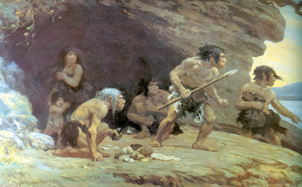
 From An Atlas of Human Prehistory by Cameron Smith. Copyright © 2019 by Cognella, Inc. Republished by permission.