
TEL-AVIV UNIVERSITY—Archaeologists from Tel Aviv University have uncovered the mystery surrounding extensive Paleolithic stone quarrying and tool-making sites: Why did Homo erectus repeatedly revisit the very same locations for hundreds of thousands of years? The answer lies in the migration routes of elephants, which they hunted and dismembered using flint tools crafted at these quarrying sites.
The research was led by Dr. Meir Finkel and Prof. Ran Barkai of Tel Aviv University’s Jacob M. Alkow Department of Archaeology and Ancient Near Eastern Cultures
The study* was published in the journal Archaeologies.
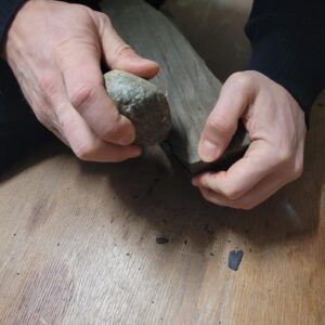
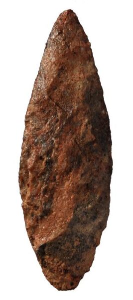
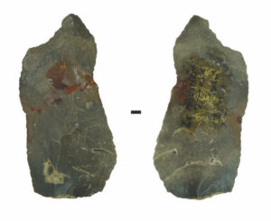
Prof. Ran Barkai explains: “Ancient humans required three things: water, food and stone. While water and food are necessities for all creatures, humans relied on stone tools to hunt and butcher animals, as they lack the sharp claws or fangs of other predators. The question is, why do we find rock outcrops that were used for the production of flint tools, surrounded by thousands of stone tools, and next to them rock outcrops containing flint that was not used for the production of tools? A study of indigenous groups that lived until recently, with some still alive today, shows that hunter-gatherers attribute great importance to the source of the stone — the quarry itself — imbuing it with potency and sanctity, and hence also spiritual worship. People have been making pilgrimages to such sites for generations upon generations, leaving offerings at the rock outcrop, while adjacent outcrops, equally suitable for stone tool production, remain untouched. We sought to understand why; what is special about these sites?”
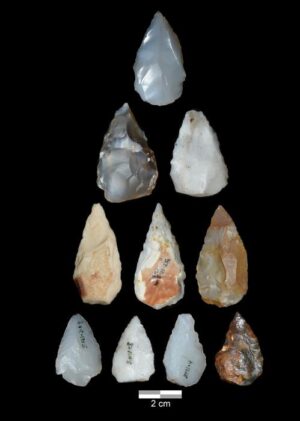
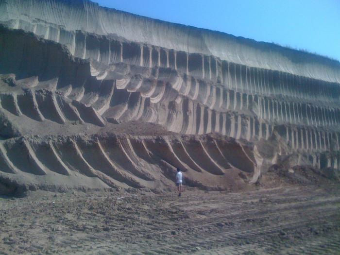
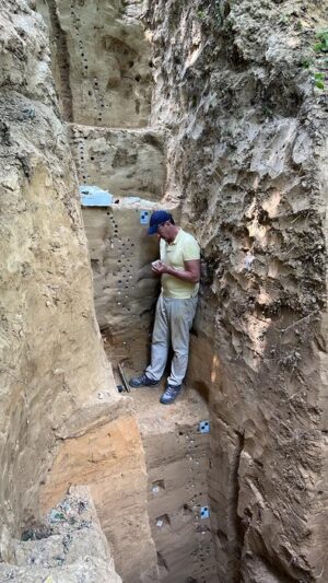
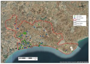
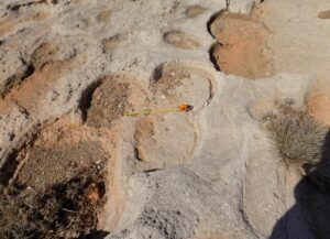
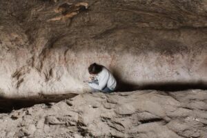
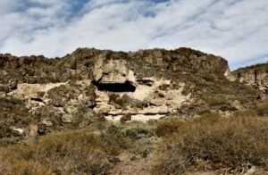
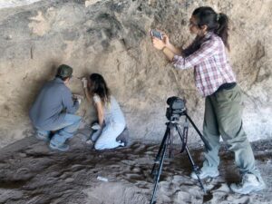
For nearly 20 years, Prof. Barkai and his colleagues have been researching flint quarrying and tool-making sites in the Upper Galilee. These sites are characterized by large nodules of flint convenient for crafting and are located within walking distance of the major Paleolithic sites of the Hula Valley — Gesher Benot Ya’akov and Ma’ayan Baruch. These sites boast thousands of quarrying and extraction localities where, until half a million years ago, in the Lower Paleolithic period, prehistoric humans fashioned tools and left offerings, despite the presence of flint in other geological formations in various places. Because elephants were the primary dietary component for these early humans, the Tel Aviv University researchers cross-referenced the database of the sites’ distribution with the database of the elephants’ migration routes, and discovered that the flint quarrying and knapping sites were situated in rock outcrops near the elephants’ migration paths.
“An elephant consumes 400 liters of water a day on average, and that’s why it has fixed movement paths,” says Dr. Finkel. “These are animals that rely on a daily supply of water, and therefore on water sources — the banks of lakes, rivers and streams. In many instances, we discover elephant hunting and processing sites at “necessary crossings” — where a stream or river passes through a steep mountain pass, or when a path along a lakeshore is limited to the space between the shore and a mountain range. At the same time, given the absence of available means of preservation and the presence of predatory animals in the area, the window of opportunity for a group of hunter-gatherers to exhaust their elephant prey was limited. Therefore, it was imperative to prepare suitable cutting tools in large quantities in advance and nearby. For this reason, we find quarrying and knapping sites in the Upper Galilee located a short distance from elephant butchering sites, which are positioned along the elephants’ movement paths.”
Subsequently, the researchers sought to apply an adapted model from the one they developed in Israel to several sites from the Lower Paleolithic period in Asia, Europe and Africa, where such a “triad” exists. These included both sites where the hunted animals were elephants or mammoths, as well as later sites where other animals, such as hippos, camels, and horses, were the prey.
“It appears that the Paleolithic holy trinity holds true universally: Wherever there was water, there were elephants, and wherever there were elephants, humans had to find suitable rock outcrops to quarry stone and make tools in order to hunt and butcher their favorite mega herbivores,” says Prof. Barkai. “It was a tradition: For hundreds of thousands of years the elephants wandered along the same route, while humans produced stone tools nearby. Ultimately, those elephants became extinct, and the world changed forever.”
_______________________________
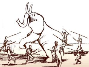
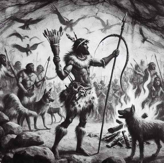
Illustration of elephant hunting using spears by Dana Ackerfeld. Dana Ackerfeld
_______________________________
Article Source: TEL AVIV UNIVERSITY news release.
*Finkel, M., Barkai, R. Quarries as Places of Significance in the Lower Paleolithic Holy Triad of Elephants, Water, and Stone. Arch (2024). https://link.springer.com/article/10.1007/s11759-024-09491-y
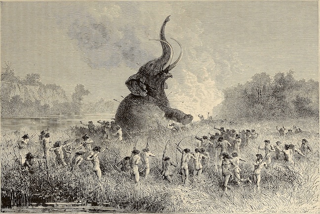
Cover Image, Top Left: Mammoth Hunt; Bryant, William Cullen, 1794-1878;Gay, Sydney Howard, 1814-1888; Public Domain, Wikimedia Commons
_______________________________
Advertisement

See the incredible archaeology, architecture, and art of northern Spain. A unique tour with special expert guides and lecturers through the collaboration of Popular Archaeology Magazine and Stone & Compass Tours. Not to be missed. Read More About It: https://popular-archaeology.com/article/northern-spains-triple-a-archaeology-architecture-and-art/.
_______________________________


