

New York State is layered with history: from millennia-old Indigenous sites, colonial-era relics, and buried settlements, to modern urban infrastructure and occasional catastrophes of collapse, contamination or construction accidents. In each case, discoveries—whether intentional archaeological digs or unexpected unearthings through development or accident—raise important legal questions about preservation, liability, property rights, and public safety.
This article examines key regional discoveries across New York and uses them as illustrations of how law grapples with the tension between uncovering the past and addressing immediate responsibilities in the present. Along the way, we draw lessons for developers, municipalities, landowners, legal practitioners, and preservationists on how to manage the duties connected to both ancient artifacts and modern accidents. For additional regional news coverage, see regional news coverage
1. A Glimpse of the Past: Archaeological Discoveries in New York
1.1 The Lamoka Site — A Window into Archaic Life
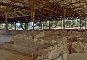
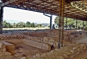
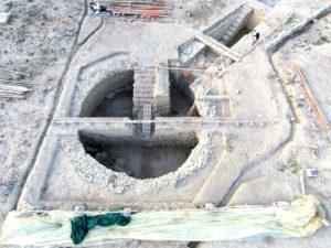
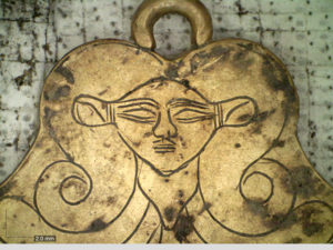
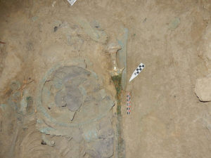
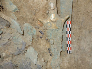
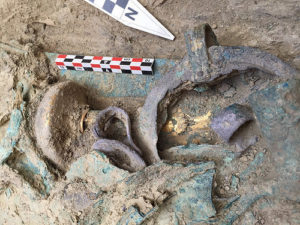
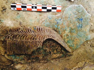
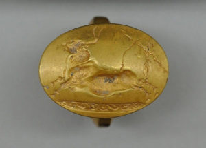
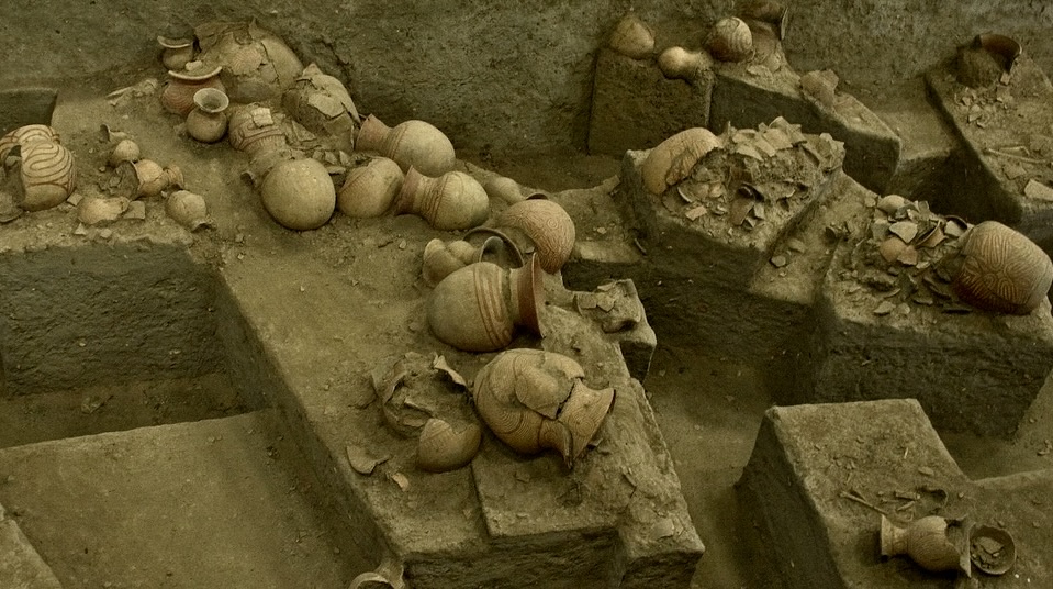
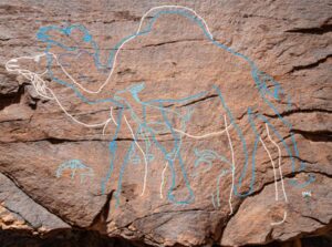
One of New York’s most celebrated archaeological sites is the Lamoka Lake site (near Tyrone in Schuyler County). Occupied around 4,500 years ago, the site has yielded projectile points (so-called “Lamoka points”), bone tools, hearths, and other material reflecting a Late Archaic hunter-gatherer culture
Because of its importance, part of the site is under preservation, and archaeological work there has spanned multiple institutions over decades. This site highlights how long-term archaeological stewardship operates in New York — how artifacts are recovered, curated, interpreted, and protected for posterity.
1.2 Seneca Village Beneath Central Park
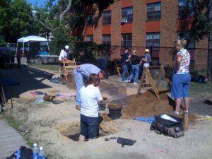
Archaeological work in New York City has also yielded potent reminders of hidden histories. Seneca Village, a predominantly African American community displaced in the 1850s to make way for Central Park, was largely erased from the physical fabric of the city. In the early 2000s, researchers using remote sensing, soil borings, ground-penetrating radar, and test excavations successfully identified traces of cellars, foundations, backyard deposits, and artifacts (including personal items like a child’s shoe sole) beneath the park.
The Seneca Village excavations have become emblematic of how archaeology in an urban setting uncovers suppressed or marginalized histories—and how such work must be carefully balanced with modern use of land and amenities (e.g., public parks).
1.3 The Forestville Commonwealth Utopian Community
Another example is the Forestville Commonwealth archaeological district in Greene County, built in 1826–27 as one of several utopian social experiments in New York. Today this site is recognized on the National Register of Historic Places.
Though smaller in scale, the Forestville site demonstrates how even short-lived communities leave material traces and how those traces must be managed under historic preservation frameworks.
2. Legal Frameworks for Preservation in New York
The discoveries above exist inside a broader legal tapestry of federal, state, and local law regulating archaeological resources, historic sites, and the responsibilities of development. Understanding that context is crucial to interpreting how modern accidents or unplanned finds should be handled.
2.1 Federal Protections: ARPA and the National Historic Preservation Act
At the federal level, the Archaeological Resources Protection Act (ARPA) of 1979 prohibits unauthorized excavation, removal, or damage to archaeological resources on federal lands or Native American lands without permit. Wikipedia ARPA also regulates transport, exchange, or sale of archaeological specimens taken from protected lands.
Likewise, the National Historic Preservation Act (NHPA) of 1966 created the framework for Section 106 review, which requires federal agencies to consider impacts on historic properties in any undertaking that involves federal funds, permits, or licensing.
These laws set a baseline: significant discoveries made during federally funded projects must be accounted for, and mitigation or preservation plans may be required.
2.2 New York State’s Preservation Laws
New York has its own complementary laws.
- The New York State Historic Preservation Act (1980), Section 14.09, designates historic preservation as a state policy and requires consultation with the State Historic Preservation Office (SHPO) whenever state agencies plan actions affecting historic or archaeological properties.
- The State Environmental Quality Review Act (SEQRA) mandates that state, county, and local agencies include historic and archaeological impacts in environmental review.
- In regulatory detail, 9 NYCRR § 442.2 requires that identification, evaluation, curation, interpretation, and protection activities in archaeological projects be conducted under supervision of a qualified professional archaeologist; site disturbance must be minimized, and mitigation or data recovery only allowed under certain criteria (e.g. unavoidable disturbance).
- On state-owned lands, New York Education Law prohibits appropriation, excavation, injury, or destruction of archaeological objects without written permission of the Commissioner of Education. Violations constitute misdemeanors.
- Also, New York law allows withholding of information on site locations from the public in order to protect them.
These overlapping rules give both tools and constraints. Agencies, developers, landowners, and archaeologists must coordinate under this framework to pursue preservation while accommodating lawful development.
2.3 Professional Standards & Archaeological Best Practices
Technical guidelines also matter. The New York Archaeological Council (NYAC) publishes a Standards Handbook outlining accepted methodologies for reconnaissance surveys, site evaluation, mitigation excavations, and curation of collections.
These professional protocols help ensure that even when disturbance is allowed, investigations are systematic, documented, and scientifically rigorous.
3. When Discovery Meets Development: Legal Tensions and Harmonies
The moment when a construction crew unearths an artifact or sensitive site is a crucible for law in practice. Such “inadvertent discoveries” test the boundaries between preservationist ideals, property rights, and public safety/obligation.
3.1 Duty to Report and Suspend Work
Many statutes, regulations, or permit conditions require that upon discovery of archaeological remains or human remains, work must pause, responsible authorities be notified, and further investigation or mitigation must follow. Indeed, under New York rules, plans for infrastructure development often include a “work stoppage clause” triggered by discovery of possible archaeological remains.
Failure to do so can expose developers to legal liability, permit revocation, fines, or criminal penalties for unlawful disturbance.
3.2 Mitigation vs Avoidance
When a project encounters a sensitive archaeological site, there are generally two paths: avoidance (rerouting work to leave the site undisturbed) or mitigation/data recovery (carefully excavating and recording before construction proceeds). The law tends to prefer avoidance where feasible. But when disturbance is unavoidable—and justified under the federal or state scheme—mitigation steps are required. 9 NYCRR § 442.2 explicitly contemplates data recovery or mitigation for unavoidable disturbance.
The balance is delicate. Mitigation may preserve scientific information, but it still destroys site integrity. The legal and regulatory regime must evaluate whether the benefits of disturbance (infrastructure, development) outweigh the heritage loss.
3.3 Liability & Insurance Concerns
From a developer’s perspective, legal risk emerges if improper handling leads to lawsuit (e.g. from concerned descendants, tribes, historical societies), regulatory enforcement actions, or reputational harm. Insurance policies may or may not cover such archaeological liabilities. Some jurisdictions require developers to secure a bond or escrow to account for unforeseen delays or heritage mitigation costs.
3.4 Conflicts with Private Property Rights
Another tension lies between private property rights and public interest in preservation. Landowners may not wish to impede construction, but almost all archaeological and heritage protections override unfettered capability to disturb land when historical resources are implicated. Regulatory frameworks—like SEQRA at the local level—require that land-use decisions weigh archaeological impacts, even on private property, especially when government permits are involved.
4. From Artifacts to Accidents: Parallels in Modern Liability
While much of the legal framing above is about premeditated or semi-planned archaeological work, similar legal dynamics emerge when modern accidents unearth hazards — think sinkholes, collapse of buried infrastructure, contamination, or inadvertent exposure of archaeological remains during unexpected ground failure.
4.1 Accidents Involving Buried Infrastructure
When a utility trench collapse exposes previously unknown wiring, pipelines, or buried tanks, immediate responsibilities kick in: ensuring public safety, containment, investigation, remediation, and dealing with liability to injured parties, property owners, and third parties.
Though not heritage-focused, these same core legal questions emerge:
- Who bears the duty of care? (Contractor, utility company, local government)
- Was there negligence in planning, mapping, or safe excavation?
- Must operations stop pending investigation?
- What insurance coverage or indemnification applies?
These liability lines mirror the archeological work stoppage duties, but operate in the realm of tort, occupational safety law, and public works regulation.
4.2 Uncovering Human Remains in a Construction Accident
Sometimes a construction accident or collapse may unexpectedly reveal human remains—potentially ancient. In such cases, legal frameworks for artifact preservation, human remains protections, and accident investigations overlap.
Under New York’s Unmarked Burial Site Protection Act (2024), newly enacted in the state, requirements now mandate immediate reporting of burial sites, cessation of disturbance, consultation with descendants or culturally affiliated groups, and sensitive disposition of remains if older than 50 years.
Thus, a modern accident can transition from routine liability to a complex cultural heritage issue—requiring coordination with archaeologists, the state, and sometimes tribes or community groups.
4.3 Environmental Contamination & Hidden Hazards
Imagine a case where development disturbs a historic dump, revealing buried toxins, decaying containers, or lead pipes. Legal responsibility may pull in environmental statutes (e.g. hazardous waste laws), tort liability, public nuisance doctrines, and historic preservation mandates.
Of particular importance: timely notice, containment, remediation measures, and potential obligations to fund archaeological or heritage investigations if historically relevant material is intermingled. The overlapping responsibilities can lead to complicated allocation of risk among developers, environmental consultants, local governments, and contractors.
5. Regional Case Studies & Lessons
To ground the theory, let us consider a few examples (actual or stylized) where regional discoveries or accidents in New York reveal how legal responsibilities play out.
5.1 Case Study: Suburban Road Widening & Indigenous Site Discovery
Suppose a county plans to widen a road in western New York. During grading, contractors uncover lithic flakes and possible post-mold stains indicative of precontact Indigenous habitation. Work stops, the SHPO is notified, and an archaeologist is engaged under a standardized Phase I and possibly Phase II work program. The route is realigned to avoid the most sensitive portion; where unavoidable, mitigation excavation is authorized under permit conditions. The county and contractors assume the cost of the archaeological work and its delays, but the project proceeds in step with legal procedures.
This scenario mirrors many actual instances where roadway projects triggered Section 106 or SEQRA review and cultural resources discovery. The key lesson: incorporate archaeological sensitivity assessments early, budget contingencies, and embed contractual provisions for discovery response.
5.2 Case Study: Urban Redevelopment & Seneca Village
In New York City, urban redevelopment is constant. The Seneca Village excavation under Central Park shows how even in high-stakes urban settings, archaeological discovery must negotiate existing land use (public parks, pedestrian traffic), stakeholder interests (descendant communities, city agencies), and public programming (e.g. museums, exhibits).
So far, artifacts have been documented and exhibited, and the site has been integrated into interpretive initiatives, but the primary function of the land (i.e. park) continues. This is a classic example of balancing preservation and modern function—requiring legal agreements, public engagement, and institutional partnerships.
5.3 Hypothetical: Sinkhole Reveals 19th-Century Cemetery at Suburban Site
Imagine a development in upstate New York where a sinkhole opens, exposing tombstones and human remains linked to a 19th-century cemetery. The developer is obligated under the emergency response regime to cordon off the site, notify authorities, halt work, and engage forensic archaeologists and legal counsel. Under the new Unmarked Burial Site Protection Act, the discovery must be treated as a culturally significant burial site; remains over 50 years old require involvement of the state archaeologist and descendant notification. Meanwhile, the developer may face tort claims from neighbors or public safety regulators, and permit compliance issues must be sorted out before construction resumes.
This hypothetical encapsulates how a modern accident can suddenly entangle preservation law, human remains law, safety duty, and delay/dispute risk.
6. Comparative Legal Lessons & Best Practices
From the examples and regulatory framework, several broad lessons emerge:
6.1 Advance Planning & Sensitivity Assessment
One of the most effective risk controls is early archaeological sensitivity studies (Phase I) before heavy ground-disturbing activity. These assessments can identify zones of high risk, allowing avoidance or design modifications before work begins. The NYAC standards and New York law strongly endorse such procedures.
By doing this upfront, developers and agencies reduce surprises, delays, and litigation risk.
6.2 Embed Discovery Clauses & Contingency Budgets in Contracts
Contracts for construction, engineering, or site work should include clauses specifying that if archaeological remains or human remains are discovered, work must stop, appropriate notification must occur, and a defined process (with timelines, responsible parties, and cost-sharing) is triggered. Likewise, budgeting a contingency for unforeseen archaeological or safety responses is wise.
6.3 Engage Qualified Professionals & Follow Standards
When discovery occurs, compliance with professional standards (such as those published by NYAC) and supervision by qualified archaeologists is legally required (e.g. under 9 NYCRR § 442.2).
Cutting corners may invite regulatory penalties or undermine the scientific integrity of the work.
6.4 Prioritize Avoidance & Minimization Where Feasible
Preservation law generally disfavors wholesale site destruction. Where possible, re-routing, design alteration, or other structural solutions should be used to reduce impact on historically sensitive areas.
6.5 Transparent Stakeholder Engagement & Public Communication
Especially for sites of cultural or community importance (e.g. Indigenous heritage, burial grounds, minority communities), proactive consultation with descendant groups, public communication, and interpretive planning help reduce opposition and build legitimacy.
6.6 Insurance, Indemnities & Liability Allocation
Parties should negotiate insurance coverage, indemnification, and risk-sharing clauses up front, especially in contracts involving subsurface work. Insurers should understand archaeological exposures, and parties should allocate liability for delays or remedial work.
6.7 Emergency Response & Safety Protocols
In accidents (sinkholes, collapse, contamination), safety takes precedence. But prompt coordination with preservation authorities must follow. Where human remains or artifacts emerge, procedural safeguards (work stoppage, notification, forensic or archaeological assessment) should guide the response. The newer Unmarked Burial Site Protection Act in New York underscores this convergence.
6.8 Judicial & Administrative Precedent Awareness
Lawyers and practitioners must stay attuned to case law or administrative decisions around heritage disputes, tort claims tied to archaeological damage, and permit enforcement actions. While not as high profile as other domains, precedent can shape the risk environment.
7. Toward a Holistic Framework: Integrating Ancient and Modern Risks
The journey from ancient artifacts to modern accidents may seem like two separate worlds, but they converge in the legal domain. When we unearth the past, we must do so responsibly and lawfully; when the present inadvertently reveals hidden risks, we must respond ethically, safely, and within regulatory boundaries.
A holistic framework for managing both kinds of discovery could feature:
- Pre-construction planning — archaeological sensitivity studies, risk mapping, stakeholder consultation
- Contract architecture — robust discovery clauses, contingency funds, indemnities, insurance
- Response protocol — immediate work stoppage, notification to authorities (SHPO, state archaeologist, coroner, descendant groups), engagement of qualified professionals
- Mitigation or avoidance decision-making — preference for non-disturbance where possible; when disturbance is needed, scientifically sound data recovery in compliance with law
- Oversight and documentation — rigorous record-keeping, reporting to preservation offices, curation of recovered materials
- Public transparency and interpretation — sharing findings with communities, museums, or local institutions to build cultural capital
- Post-incident liability and remediation — addressing tort claims, regulatory penalties, or cleanup obligations in modern accident contexts
In all phases, the legal obligations and risk exposures are intertwined: failures in archaeological compliance may affect permit standing; accidents revealing heritage may trigger new liability; and safety failures may aggravate regulatory outcomes in heritage contexts.
_______________________________
The historical depths of New York State—its Indigenous heritage, colonial legacies, forgotten settlements, and buried artifacts—are not just academic curiosities. They carry concrete legal weight. At the same time, modern accidents—sinkholes, infrastructure collapse, land subsidence, surprise unearthing of human remains or toxic materials—remind us that the ground is a dynamic interface of past and present.
Regional discoveries across New York, from the Lamoka site to Seneca Village and numerous smaller finds, illustrate how legal regimes structure responsibility: prescribing when and how archaeological work proceeds, how human remains must be handled, how developers and public agencies must budget for surprises, and how safety and liability demands intersect with preservation duties.
The lessons are clear: anticipatory planning, professional standards, smart contracts, stakeholder communication, and responsive protocols are essential. Whether one is building a road or probing historic soil, the same legal currents run beneath.
If you’re facing a situation on the ground in New York—perhaps a development with an unexpected discovery or an accident revealing buried hazards—legal counsel steeped in both property, tort, and preservation law is crucial. For specialized assistance in central New York, particularly around Auburn, you may consult an expert such as an Auburn, NY personal injury attorney


