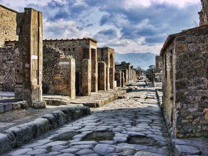
It is known as the Gabinetto Segreto, or ‘Secret Room’ in english. Tucked away among the mosaics collection in a separate room within the Naples National Archaeological Museum, it houses 250 sexually-themed objects, acquired mostly from excavations in Pompeii and Herculaneum. Fresco paintings, detached from the walls of private residences and villas, most prominently those of the wealthy of ancient Pompeii, display in unapologetic fashion and in full-throttle view the erotic lives and culture of the city’s citizens. Objects include garden decorations and frescoes from the lupanare, brothels, banquet furnishings, and phallus-shaped objects. Enter Pompeii itself, and one will see this culture sprinkled throughout the remains.
This ancient city, which was preserved under the volcanic ash of the volcanic eruption of Mt. Vesuvius in 79 AD, offers a remarkable glimpse into the sexual mores and practices of its inhabitants. The frescoes and mosaics of Pompeii serve as a vibrant visual narrative that encapsulates the complexities of human sexuality in the ancient city. These artistic expressions reveal not only the erotic desires of the Pompeians but also their social norms and cultural practices. The walls of homes, public baths, and taverns were adorned with explicit imagery that reflects a society unafraid to celebrate sensuality. Through these artworks, we glean insights into the everyday lives of the inhabitants and the prominent role sexuality played in their interactions.
In many individual households, frescoes depicted scenes of love and eroticism, often featuring mythological figures intertwined in intimate embraces. These representations were not merely decorative; they were imbued with meaning and purpose, often serving as talismans for fertility and prosperity. The presence of such imagery suggests that sexuality was a vital component of domestic life, influencing marital customs and the expectations of partners within relationships. As we explore these artworks, we begin to understand how visual art functioned as a narrative device that communicated societal values, personal aspirations, and simply what it was to be human.
Mosaics, on the other hand, often highlighted the roles of gender and power dynamics within Pompeian society. In public spaces, these intricate designs frequently showcased both male and female figures engaged in various activities, some of which alluded to sexual encounters. The placement of these mosaics in areas frequented by the public suggests a deliberate intention to provoke dialogue about sexuality and desire. Such artworks provide a window into the myriad of sexual relationships that flourished in Pompeii, including those that transgressed conventional boundaries of the time, such as same-sex relationships and their acceptance in certain contexts.
Moreover, the interplay between class and sexuality is vividly illustrated through the artistic choices made by the Pompeians. Wealthier citizens often commissioned more elaborate and explicit works, using art to signal their social status and sophistication. This disparity in artistic expression raises important questions about how class influenced sexual norms and practices in Pompeian culture. As we examine these artworks, we must consider the ways in which they reflect not only individual desires but also the broader societal structures that shaped and constrained those desires.
The Symbolism of Sexual Imagery
In the vibrant and complex society of Pompeii, sexual imagery served as a powerful symbol reflecting the values, beliefs, and dynamics of daily life. The use of sexual motifs in art and architecture was not merely for shock value; rather, it conveyed messages about fertility, prosperity, and the interconnectedness of the human experience with the divine. From frescoes to mosaics, the explicit representation of sexual acts and symbols played a significant role in public and private spaces, influencing how inhabitants perceived their sexuality and relationships.
Contrary to the visual conventions and constraints of modern society today, the prominence of sexual imagery in Pompeian society can be observed in various public settings, including baths and taverns, where such depictions were commonplace. These images were not only decorative but also served as a form of social commentary, reflecting the attitudes towards sexuality that permeated everyday life. They often highlighted the celebration of the human body and its desires, suggesting a culture that embraced rather than shunned sexuality as an integral part of existence.
Gender dynamics within Pompeian society were intricately linked to the symbolism of sexual imagery. Men and women were often depicted in ways that reinforced societal roles, with male figures frequently shown in positions of dominance. This representation mirrored the patriarchal structure of Pompeian life, where male authority was celebrated, while female sexuality was both revered and objectified. The artistic portrayal of women in sexual contexts often sparked debates about agency and power, revealing the nuanced complexities of gender relations in ancient Rome.
_______________________________

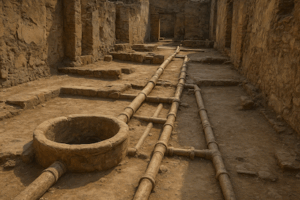
This room is thought to have been a dressing room for people attending the baths.[1][2][3]
These wall paintings were found in 1986[1] in the newly excavated Suburban Baths. The paintings are dated to 62 to 79 CE. Sailko, CC BY-SA 4.0, Wikimedia Commons
_______________________________
Gender Dynamics and Sexual Relationships in Pompeian Society
Roles of Men and Women in Sexual Relationships
In Pompeian society, the roles of men and women in sexual relationships were deeply intertwined with the cultural, social, and economic fabric of daily life. Men were often viewed as the dominant figures, wielding power not only in public spheres but also within private relationships. This patriarchal structure dictated not only the conduct of men but also shaped the expectations placed on women, who were generally expected to be submissive and nurturing, focusing on domestic responsibilities while adhering to the ideals of fidelity and modesty.
Women in Pompeii, while often relegated to the background, played vital roles in the sexual dynamics of their relationships. Their sexuality was both a source of power and a site of oppression. Although many women were confined to the household, their influence could extend beyond domesticity, particularly in matters of family lineage and inheritance. The perception of women as vessels of honor meant that their sexual conduct was closely monitored, reflecting the values of Pompeian society and the significance of reputation.
The artistic representations of sexuality in Pompeii reveal much about the gender dynamics at play. Frescoes and mosaics often depicted scenes of sexual encounters, serving both as erotic art and as commentary on societal norms. These artworks not only celebrated the physical beauty of both sexes but also illustrated the perceived roles within sexual relationships, often highlighting the dichotomy of male virility and female passivity. The prevalence of such imagery indicates a society that not only accepted but also openly engaged with sexual expression, albeit within the constraints of established gender roles.
Understanding the roles of men and women in these sexual relationships offers insight into the broader socio-cultural landscape of Pompeii. The intersection of class, gender, and sexuality created a unique tapestry of human interaction, where personal desires were often at odds with societal expectations. This exploration not only sheds light on the nature of intimacy in ancient times but also prompts reflection on the evolving dynamics of gender and sexuality in contemporary society.
Power Dynamics and Consent
In the vibrant society of Pompeii, power dynamics played a crucial role in shaping sexual relationships and consent. The interplay between social status and individual desires influenced how consent was understood and enacted. Wealthy citizens often held significant power over their less affluent counterparts, creating an environment where consent could be coerced or manipulated. This disparity highlights a nuanced understanding of consent that was often intertwined with economic and social hierarchies, complicating the notion of mutual agreement in sexual encounters.
Artistic representations from Pompeii provide a lens through which we can explore these power dynamics. Murals and mosaics frequently depicted sexual themes, showcasing both consensual and non-consensual acts. These artworks not only served as decoration but also as social commentary, reflecting the accepted norms and practices of the time. By analysing these visual narratives, one can discern the subtle distinctions between desire and obligation, illustrating how consent was often overshadowed by power imbalances.
Gender dynamics further complicated the landscape of consent in Pompeian society. Men typically held dominant positions, dictating the terms of sexual relationships. Women, on the other hand, were often relegated to passive roles, their autonomy frequently undermined. However, women could also exert influence within their domestic spheres, negotiating terms of consent in their relationships. This duality reveals a complex interplay between power and consent, suggesting that while societal norms often constrained women, they were not entirely powerless in their sexual agency.
Marital Customs and Sexual Norms in Pompeian Culture
Marriage Practices and Expectations
Marriage in Pompeii was a multifaceted institution that reflected the complexities of social dynamics and personal relationships. It served not only as a bond between individuals but also as a crucial element of societal structure. Marriages were often arranged, reflecting family interests and alliances, and were expected to ensure the continuation of family lineage. Love and personal desire were frequently secondary to these practical considerations, shaping the expectations surrounding marital unions in Pompeian society.
The role of sexuality within marriage was equally intricate. Sexual relations were not merely about procreation but were also a means to reinforce social bonds and obligations. Husbands were expected to fulfill their duties towards their wives, while wives were often confined to roles that prioritized domestic responsibilities over personal desires. This dynamic created a complex interplay of power and expectation, with men often holding authority in both public and private spheres, while women’s sexuality was largely dictated by societal norms.
Artistic representations from Pompeii offer valuable insights into the sexual norms and marital customs of the time. Frescoes and mosaics often depicted scenes of love, desire, and even eroticism within the context of marriage. These artworks suggest a society that acknowledged and celebrated sexual expression, albeit within the confines of established marital roles. They provide a visual narrative that contrasts with the more rigid expectations that governed daily life, highlighting the duality of experience within Pompeian marriages.
Gender dynamics played a significant role in shaping the experiences of married couples in Pompeii. Men and women navigated their relationships within a framework of societal expectations that often dictated their behavior and interactions. While men enjoyed greater freedoms, women were often expected to embody virtues of fidelity and modesty. This disparity created a social landscape where the expectations of marriage were heavily influenced by gender, impacting the nature of sexual relationships and personal satisfaction within these unions.
The intersection of class and sexuality further complicates the understanding of marriage practices in Pompeii. Wealth and social status influenced not only the choice of partners but also the nature of marital contracts. Elite families often sought to maintain their status through strategic marriages, while lower classes may have had more flexibility in their choices. This stratification reveals that while marriage was a universal institution in Pompeii, the expectations and experiences associated with it varied greatly depending on one’s social standing, reflecting broader themes of desire and power within the ashes of this ancient city.
Infidelity and Its Consequences
Infidelity was a complex and often contentious issue in Pompeian society, deeply intertwined with the cultural norms of sexuality and marital customs. In this vibrant community, the expectations of fidelity were often at odds with the realities of human desire. Marriages were frequently arranged for economic or social reasons rather than romantic love, which sometimes led individuals to seek emotional or physical satisfaction outside their unions. This duality created a fertile ground for infidelity, which was both condemned and yet tolerated to varying degrees within different social classes.
The consequences of infidelity in Pompeii could be severe, impacting not only the individuals involved but also the broader family unit and community. For women, the repercussions were particularly harsh; they were often held to stringent standards of fidelity, and a woman’s infidelity could lead to social ostracism or even violence. Men, on the other hand, often navigated a more permissive landscape where extramarital affairs were more socially acceptable, especially if conducted discreetly. This gender disparity reflects the underlying power dynamics present in Pompeian society, where male privilege often dictated the rules of engagement in relationships.
Artistic representations of infidelity in Pompeii reveal much about the societal attitudes toward sexual relationships. Frescoes and mosaics often depicted scenes of love and lust, sometimes celebrating infidelity in a manner that suggests a level of acceptance or even admiration for such acts. These artworks served as both a reflection of and a commentary on the sexual norms of the time, illustrating the complexities of desire and the often blurred lines between fidelity and infidelity within the vibrant social fabric of Pompeii.
Interestingly, infidelity also intersected with issues of class in Pompeian society. Wealthy individuals had greater access to resources that allowed them to engage in extramarital affairs with less risk of social repercussions. In contrast, those from lower classes faced harsher judgments and consequences for similar behaviors. This class dynamic underscores the idea that infidelity was not merely a personal failing but was also shaped by societal structures and economic realities that dictated the terms of sexual relationships.
Ultimately, the consequences of infidelity in Pompeii reflect the broader themes of desire, power, and societal expectations. By examining these dynamics, one gains insight into how sexuality was not just a private matter but a public spectacle that influenced social standing, personal relationships, and community cohesion. The exploration of infidelity in this ancient city highlights the timeless nature of human desire and the intricate ways in which it shapes and is shaped by cultural contexts.
The Intersection of Class and Sexuality in Pompeii
Class Distinctions and Sexual Behavior
In Pompeian society, class distinctions played a significant role in shaping sexual behavior and relationships. The city’s social hierarchy created a landscape where the wealthy and the impoverished navigated their desires within different constraints and opportunities. For the elite, sexual encounters often reflected their status and power, as they could engage in relationships with courtesans or slaves, while still maintaining a veneer of respectability. Conversely, those of lower social standing faced limitations, and their sexual expressions were often dictated by the need for survival and social mobility.
The interplay between sexuality and daily life in Pompeii reveals how class influenced not only personal relationships but also the broader cultural norms surrounding sexual conduct. Public spaces such as baths and taverns served as venues where social classes intersected, allowing for both consensual and transactional encounters. This dynamic not only facilitated sexual exploration but also reinforced existing class structures, as wealth and power often dictated the terms of engagement in these interactions. The fluidity of sexual relationships in these settings underscores the complexity of Pompeian society, where desire and status were inextricably linked.
Artistic representations from Pompeii provide valuable insights into the sexual mores of the time, illustrating how class distinctions informed the depiction of erotic themes. Frescoes and mosaics often celebrated the sensuality of the elite, portraying lavish banquets and indulgent encounters that highlighted their wealth and excess. In contrast, more modest representations reflected the realities of the lower classes, who might engage in sexual activities out of necessity rather than desire. These artistic expressions serve as a testament to the varied experiences of sexuality across different social strata, revealing the underlying tensions and desires that characterized Pompeian life.
Gender dynamics also played a crucial role in shaping sexual behavior, with expectations differing markedly between men and women. For instance, men often enjoyed greater freedom to explore same-sex relationships, while women were typically confined to heterosexual norms within marriage. This disparity highlighted the patriarchal nature of Pompeian society, where women’s sexual autonomy was heavily restricted. However, the existence of same-sex relationships among men points to a more nuanced understanding of sexuality, suggesting that desire was often more fluid than rigid societal norms would imply.
Ultimately, the intersection of class and sexuality in Pompeii underscores the complexity of human desire in a society steeped in both privilege and poverty. The varying experiences of sexual expression, shaped by social standing, gender, and cultural expectations, reflect a rich tapestry of human behavior. Understanding these distinctions not only enriches our knowledge of Pompeian life but also invites us to consider how similar dynamics continue to influence sexual relationships in contemporary societies.
The Influence of Wealth on Sexual Practices
In Pompeian society, wealth played a pivotal role in shaping sexual practices and relationships. The affluent classes had access to a broader range of sexual experiences, often facilitated by their economic means. Luxury villas, adorned with explicit frescoes, served as both homes and venues for intimate encounters, reflecting the owners’ status and desires. This environment enabled the wealthy to engage in sexual activities that transcended the norms of their lower-class counterparts, revealing a distinct divide in sexual freedoms and expectations based on economic status.
The intersection of class and sexuality is particularly evident in the portrayal of sexual acts in Pompeian art. Many frescoes and mosaics depict scenes that suggest a celebration of eroticism, often commissioned by wealthy patrons. These artistic representations not only showcase the sexual exploits of the elite but also reinforce societal norms surrounding sexuality. For instance, the imagery often highlights heterosexual relationships, yet it also hints at the existence of same-sex interactions, providing a glimpse into the varied sexual dynamics that flourished among different social classes.
Moreover, the role of sexual relationships in shaping personal and political alliances cannot be understated. Wealthy families often used marriages as strategic tools to enhance their status or secure advantageous connections. This practice was not limited to heterosexual unions; same-sex relationships among the elite could also serve similar purposes, creating networks of loyalty and support. The sexual practices of the wealthy thus reflect broader societal values, where personal desires intersect with economic and political ambitions.
However, the sexual norms and expectations varied significantly between classes. While the elite might indulge in sexual experimentation and libertinism, the lower classes faced stricter societal constraints. This disparity in sexual freedom often led to a duality in sexual expression, where the privileged could openly explore their desires while the lower classes were relegated to more covert expressions of sexuality. Such dynamics illustrate the complex interplay between wealth, power, and sexual identity in Pompeii.
__________________________

Wall Painting of Priapus, House of the Vettii. Sailko, CC BY-SA 4.0, Wikimedia Commons
__________________________
Homosexuality and Same-Sex Relationships in Pompeii
In the ancient city of Pompeii, evidence of same-sex relationships can be found in various forms, from graffiti to artistic representations. These remnants reveal a complex understanding of sexuality that transcended the binary norms prevalent in many societies. The vibrant culture of Pompeii allowed for varied expressions of desire, showcasing relationships that were as passionate as they were clandestine. The inscriptions on walls, often filled with playful messages or declarations of love, provide a glimpse into the emotional lives of individuals who sought connections beyond the heterosexual norm.
Artistic representations in Pompeii therefore further illuminated the existence of same-sex relationships. Frescoes, mosaics, and sculptures depict intimate interactions between individuals of the same sex, often celebrating their affection openly. Such artworks not only reflect the societal acceptance of these relationships but also suggest that they were an integral aspect of daily life. By examining these pieces, we can better understand how sexuality was portrayed and perceived in the context of Pompeian culture, hinting at a society that embraced a broader spectrum of human desire.
The societal dynamics of Pompeii also played a significant role in shaping same-sex relationships. Gender roles were distinctly defined, yet there existed a fluidity that allowed for diverse interactions. Men and women engaged in same-sex relationships without the stigma that would later emerge in other historical contexts. The interplay of class and sexuality further complicated these dynamics, with the elite often having more freedom to express their desires, regardless of societal expectations. This intersection highlights the importance of class in understanding the nuances of sexual relationships in Pompeii.
Marital customs in Pompeii also provide insight into the acceptance of same-sex relationships. While marriage was primarily viewed as a means of procreation and social alliance, love and desire were not strictly limited to heterosexual unions. The existence of same-sex relationships within this framework reveals the complexities of human sexuality, where emotional bonds could flourish outside traditional norms. This acceptance indicates a broader understanding of love and companionship, which was celebrated in both public and private spheres.
__________________________
Cover Image, Top Left: Venus and Eros. Mentnafunangann, CC By-SA 4.0, Wikimedia Commons