Editor’s Note: Following is a re-publication of a previous article that appeared in Popular Archaeology in 2021 about excavations, conservation work, and other investigations at the famous ancient site of Gordion in central Türkiye. This new update includes a recap of some of the most recent work done at the site.
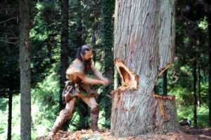
When Alexander the Great entered the city of Gordion in 333 BCE, the city was already ancient, only a vestige of its former glory. By this time it was governed within a satrapy of King Darius III’s Persian Empire, a hegemony that Alexander was determined to dismantle the best way he knew how—by military force. Gordion was a staging point and a place to rest his troops. From here he would muster his forces to march into Cilicia to battle the Persians, but not before he accomplished one important thing — untying the legendary knot that fastened the pole to the legendary oxcart that still stood within the old palace of the ancient Phrygian kings. According to prophecy, anyone who could untie the knot would go on to rule all of Asia.
Ancient writers have told the story in different ways, but arguably the most popular version has it that Alexander, frustrated with his failed attempts to untie the knot with his hands, took his sword and simply cut the knot. The event proved to be a metaphor for Alexander’s way of creating a new Hellenistic empire, and he went on to defeat the armies of Darius at the Battle of Gaugamela in 331 BCE, leading to the collapse of the Persian Empire.
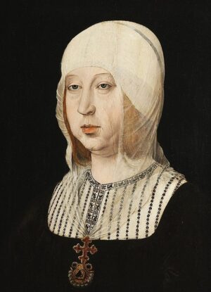
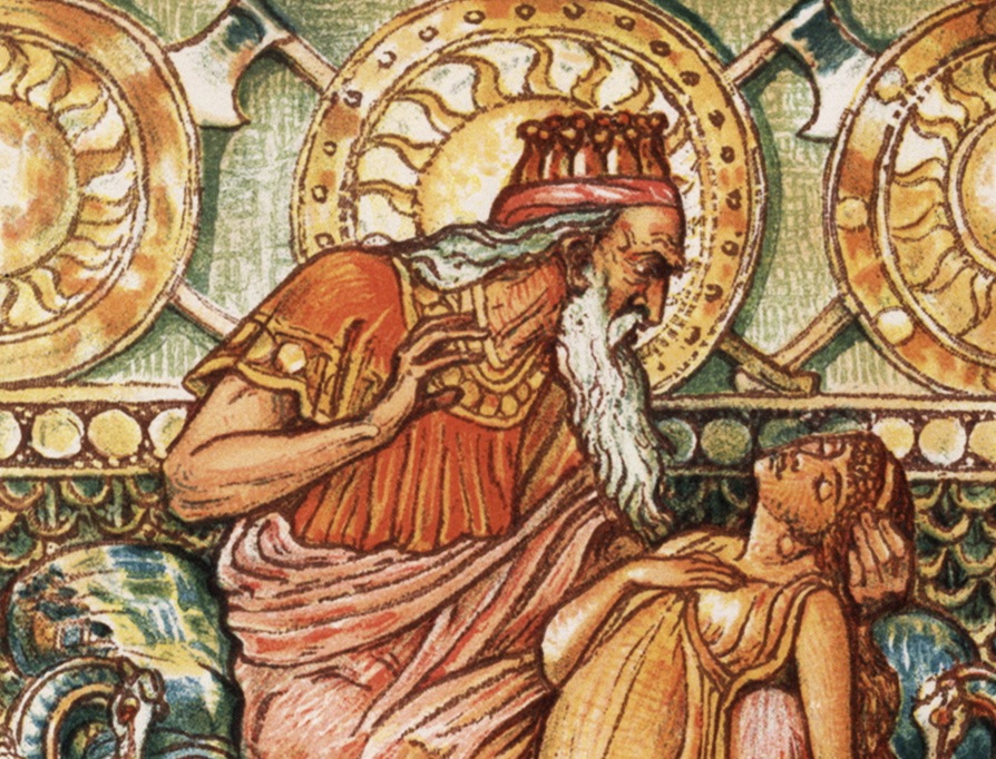
Gordion, the ancient capital of the Phrygians, is popularly known by another story. It was in Phrygia that the legendary King Midas lived, known in ancient Greek mythology as the king whose touch turned everything to gold, an ability that was granted to him through a wish to the satyr Silenus. What was initially thought to be a great gift turned out to be a curse, however, as he soon found that even the food he needed for sustenance turned to gold at his touch.
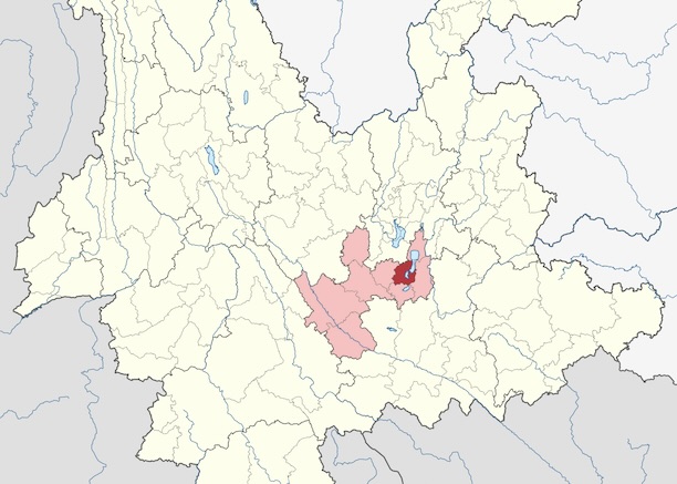
Other than recorded myth and literature, there is little direct, indisputable evidence of the existence of the King Midas of Greek mythology. But historical sources tell of three different kings of Phrygia by the name of Midas, with one who ruled Phrygia in the late 8th century BCE well known from Greek and Assyrian sources. Of the reality of the Phrygian kingdom itself, there is plentiful physical and archaeological evidence, and much of it can be found at the ancient archaeological site of Gordion, otherwise known as Gordium. Located in present-day west central Turkey near modern Yassıhüyük about 70 – 80 km southwest of Ankara, its ruins stand as a testament to Phrygian monumental architecture, an urban presence spanning across two kilometers, dominated by massive buildings and fortifications and over 100 burial mounds, lying strategically as it were where an ancient well-traveled road crossed the Sakarya river between Lydia and Assyria/Babylonia. It was the capital and largest city of an Anatolian kingdom, whose power peaked during the late 8th century BCE under the historical king Midas, when it dominated western and central Anatolia and rivaled Assyria and Urartu to its east for the eastern regions of Anatolia. More anciently, during the Bronze Age, it allied itself with the Trojans, according to Homer’s The Iliad, to battle the Achaeans.
 King Midas with his daughter, turned to gold with death at his touch, from A Wonder Book for Boys and Girls by Nathaniel Hawthorne. Painting by Walter Crane (1845-1915).
Today, Gordion’s population is history. It’s inhabitants now consist mostly of a seasonal influx of archaeologists, conservators, excavators, and a mix of other experts and specialists whose tasks revolve around systematically uncovering what remains of the city, restoring and preserving what can be pieced back together again, and showcasing its finds in an onsite museum.
But this work goes back decades. Historically, it has been the focus of on-and-off excavations since it was discovered in 1893 by Alfred Körte, who initiated exploratory excavations at the site in 1900. The best known excavations were conducted under the directorship of Rodney Young of the University of Pennsylvania Museum of Archaeology and Anthropology (Penn Museum) beginning in the 1950’s. His excavations over 17 seasons uncovered major sections of the Phrygian period Citadel Mound, including overlying Hellenistic towns, and a mudbrick fortress and defensive walls of a Lower Town near the Citadel. Young also uncovered no less than 30 burial tumuli, which included the sensational royal ‘Tumulus MM‘ (the “Midas Mound”) and a nearby tomb of a wealthy Phrygian child (‘Tumulus P’).
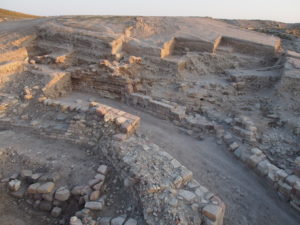
Now, under the directorship of Brian Rose of the University of Pennsylvania, teams have, since 2007, uncovered additional finds. Solid new evidence has emerged for defensive works, including massive defensive walls, part of a road, and industrial work spaces dated back to some of the earliest periods of the site, all adding to the historical and chronological sequence of the site.
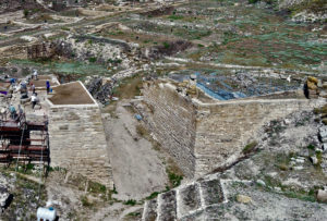
“Gordion’s historical significance derives from its very long and complex sequence of occupation, with seven successive settlements spanning a period of nearly 4500 years,” says Rose. “What we discovered was a large glacis or stepped terrace wall over 2.5 m in height, dating to the Early Phrygian period, that supported a substantial fortification wall nearly 3 m. wide. This has proven that the western side of the mound was fortified, and that those fortifications had already been established in the Early Phrygian period (9th c. B.C.), neither of which had been known previously.”*
Other massive fortifications, particularly on the eastern side of the Citadel Mound, had already been uncovered through previous expeditions. But the new features now expanded the emerging picture of the Gordion defensive fabric. Rose’s excavations revealed fortifications spanning the entire time period of Phrygian rule in the region. “We were fortunate this year in uncovering new fortifications dating to three different periods: Early Phrygian (9th c. BC), Middle Phrygian (8th c. BC) and Late Phrygian (6th c. BC)…….it is already clear that the scale of the citadel fortifications throughout the entire Phrygian period was much more ambitious than formerly suspected,” wrote Rose in the report of the 2014 season.*
 Aerial view of the newly excavated Early, Middle, and Late Phrygian fortifications on the southern side of the Citadel Mound. Photo by Lucas Stephens. (Picture credit: Penn Museum Gordion Archive, 2014-Area 1 Aerial 5)
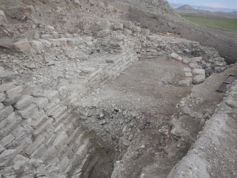 View of the Early and Middle Phrygian fortifications on the southern side of the Citadel Mound, looking east. Tumulus MM (Midas Mound) is visible at upper right. Photo by Brian Rose. (Picture credit: Penn Museum Gordion Archive, 2014-7483)
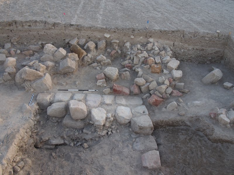 View of collapsed colored stones newly discovered behind the Middle Phrygian fortification wall on the southern side of the Citadel Mound, looking north. Photo by Gebhard Bieg. (Picture credit: Penn Museum Gordion Archive, 2014-1579)
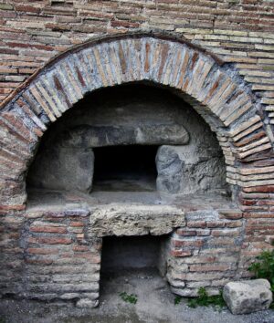
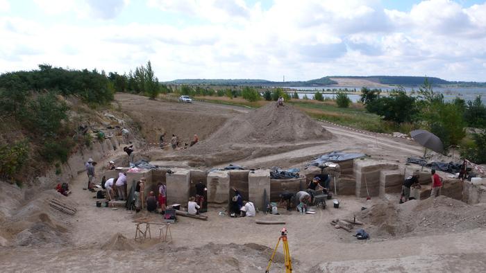
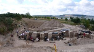
Additionally, Rose’s team excavated a sondage trench through what has been designated the Terrace Building, a structure discovered during previous excavations and thought to be a building where industrial activities occurred. They uncovered a large industrial kiln surrounded by ceramic remains that helped to date the feature to the Early Iron Age, or the 11th century BCE. Above and east of the kiln they excavated an Early Iron Age house structure, which contained objects related to textile manufacture, such as spindle whorls and loom weights, and a bell-shaped pit that contained fragments of Early Iron Age handmade wares and animal bones. “The evidence yielded by the sondage demonstrates that there was considerable industrial activity in this area before the Terrace Building was constructed, beginning in the 11th c. B.C.,” wrote Rose in a recent newsletter report.*
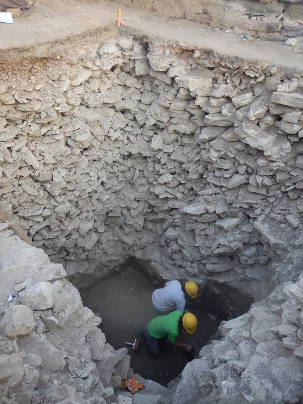 Excavators Olivia Hayden and Jane Gordion digging beneath the rubble fill in the Terrace Building sondage. Photo by Brian Rose. Picture credit: Penn Museum Gordion Archive, 2014-4142)
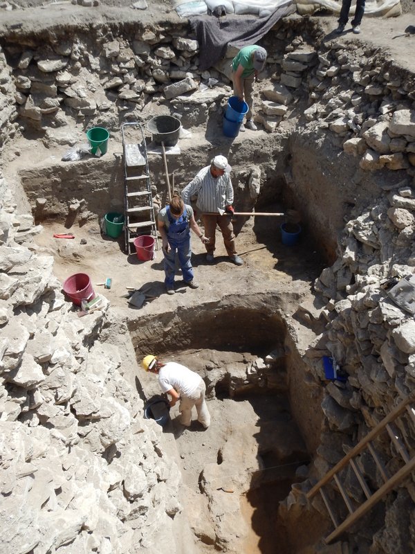 Excavators Kate Morgan, Olivia Hayden, and Jane Gordion uncovering the Early Iron Age house below the rubble fill under the Terrace Building, looking east. The upper part of a kiln is visible at the bottom. Photo by Gebhard Bieg. (Picture credit: Penn Museum Gordion Archive, 2014-6666)
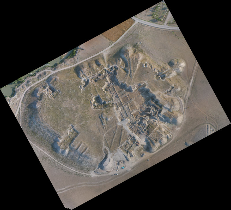 Aerial view of the Citadel Mound of Gordion in 2014. Photo by Lucas Stephens. (Picture credit: Penn Museum Gordion Archive, 2014-CM Aerial 1)
The Outer Town
The Citadel Mound tells only part of the story of urban Gordion. Beyond and below the imposing defensive bastion thrived a city of people who left vestiges of other monumental public buildings and domestic structures, a Gordion far more robust and expansive than a single citadel. During Young’s excavations decades before at a small mound (called ‘Küçük Höyük’) near the Citadel, archaeologists revealed a mudbrick fortress set atop a mudbrick bastion, interpreted as a probable ancient Lydian construction dated to the late 7th or early 6th century BCE. They found that its associated walls, including connected ditch-work, actually enclosed a settlement area they designated as the Lower Town, an area consisting of evidence of residential, or domestic, structures. Remote sensing has since successfully defined the fortification walls, streets and buildings of this settlement area.
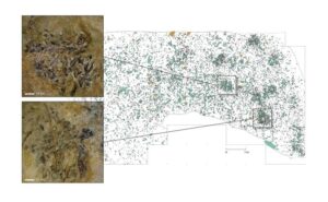
Most recently, a team under the direction of Stefan Giese and Christian Huebner of GGH in Freiburg, Germany, conducted a geophysical survey that yielded traces of yet another associated settlement area, an ‘Outer Town’, using magnetometry and electric resistivity techniques. The Outer Town is a second residential area with detected remains just west of the Lower Town. What they found was no less revelatory than the new Citadel Mound discoveries. They detected signs that this Outer Town was “bordered by a ditch with a defensive wall on its interior”*, which the team believes surrounded the entire Outer Town. And this was not all—the findings included other features that suggested a monumental fort. “At the western end of the Outer Town,” write Rose, et al., “nearly 1 km to the west of the citadel mound, we discovered the presence of what we interpret as a monumental fort, approximately the same size as the fort of Küçük Höyük (the “minor mound”) in the Lower Town.” The new findings seemed to match the pattern found previously with the Lower Town, though they appeared to have been planned as separate residential areas demarcated by a fortification wall between them.
Did these findings suggest or imply something about ancient Godion’s social structure? The investigators have no answers, yet. But further surveys and excavation may shed some light.
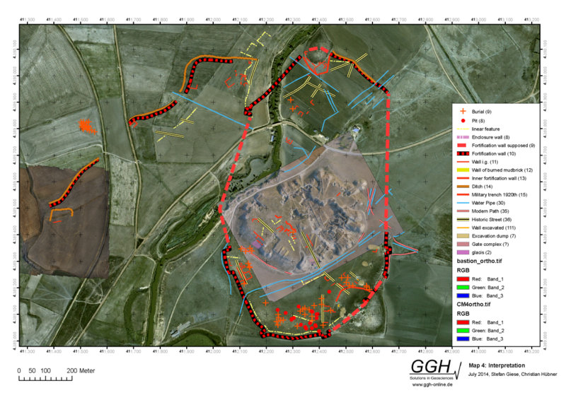 The fortifications of Gordion detected through remote sensing. The new results in the Outer Town appear at left. Plan by GGH. (Picture credit: Penn Museum Gordion Archive, GGH 2014 Map 4)
The Conservation Task
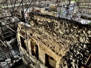
The combined forces of time, weather, exposure and other elements take their inevitable toll on archaeological sites. Gordion has been no exception. Perhaps most dramatic were the effects caused by a major earthquake in 1999, which left a significant bulge in the masonry of the Early Phrygian Gate (later renamed the East Citadel Gate). Because of its monumentality and importance as the best-preserved citadel gate of Iron Age Asia Minor, it has arguably become one of the most urgent tasks for conservators at the site. “We realized that strategic intervention was necessary if a collapse was to be averted, now and in the future,” wrote Rose, et al.* With the help of a number of organizations, individuals, and consulting firms, solid steps have been taken to shore up the structure, which included erection of a new scaffolding system, removing displaced stones, repairing deteriorated or damaged stones, and inserting steel support straps, among other measures.
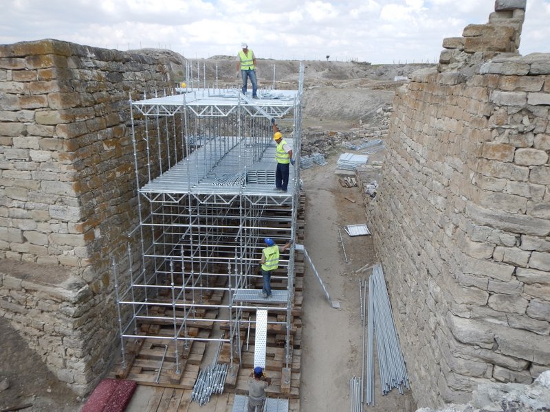 Erection of the new scaffolding at the Early Phrygian Citadel Gate (East Citadel Gate) prior to the beginning of conservation. Photo by Brian Rose. (Picture credit: Penn Museum Gordion Archive, 2014-4535)
Other damage was caused by more ancient events, such as an 800 BCE conflagration that damaged the masonry foundations of the Early Phrygian Terrace Building, which anciently was an 8-room industrial complex. Since 2009, conservators and other expert workers have been busy repairing and rebuilding the foundations and walls of the various rooms within the structure.
Like that of other major archaeological sites, the artwork of Gordion has drawn special attention from conservators. In 1956, Young excavated a remarkable late 9th century BCE pebble mosaic near the Terrace Building, a piece that, according to archaeologists, featured “a series of polychromatic geometric designs that most likely echo the kinds of textiles that would have been produced in the adjacent Terrace Building.”* This effort has involved application of the latest restoration techniques by experts specially trained in the art of repair and restoration.
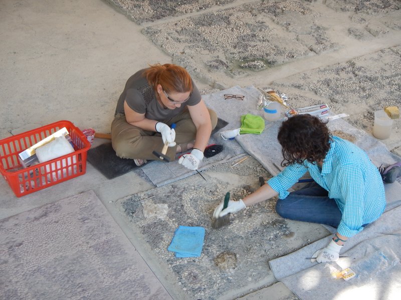 Sema Küreckçi and Meredith Keller cleaning the pebble mosaic from Megaron 2 (an Early Phrygian period structure). Photo by Gebhard Bieg. (Picture credit: Penn Museum Gordion Archive, 2014-4408)
For Rose and colleagues, there is much more work to do. Countless features and artifacts are left to be uncovered, work that will occupy researchers for many years ahead. But in the short time span of Rose’s research at the site thus far, much has already been accomplished. Popular Archaeology asked Rose what he thought were some of the most important discoveries made since renewed excavations began in 2007.
“We discovered four inscriptions in Tumulus MM, the tomb that probably held the body of Midas’ father [Gordias, the founder of Gordion],” Rose replied. “These may be the signatures of the officials who oversaw the burial. We’ve also been able to determine that the Phrygians used a special pigment to color their clothing, which gave them a golden sheen. This may tie in to the legend of Midas’s Golden Touch.” More recent investigations in the area of the ancient site have uncovered another major tumulus. About 17 meters in height, and like Tumulus MM, this one also features a wooden burial chamber within. Initially found as a result of illegal looting excavations by treasure hunters, Rose now hopes to conduct controlled archaeological salvage excavations at the mound to determine more about its nature and the possible remains of its human occupant. Although detailed information about it is still forthcoming, Rose suggests, based on data thus far acquired, that the new tumulus dates to the 8th century B.C. and may contain the remains of a Phrygian king.
But perhaps the most far-reaching discovery revolves around the newly found immensity of the ancient city itself. “We have been able to determine that the city was twice as large as we previously thought, because we’ve identified the outer fortifications of the city through remote sensing.” With this in mind, one of Rose’s more immediate goals relates to developing a city plan of Gordion based on the available and emerging data. “We have not yet determined the city plan of the settlement,” says Rose, “but by combining excavation with remote sensing (radar, magnetic prospection), we should be able to do it.”
_________________________________________
New Developments
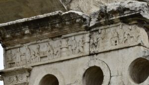
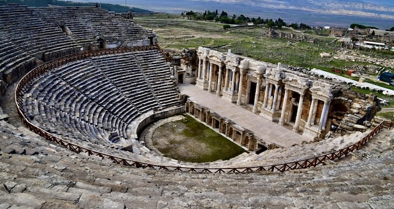
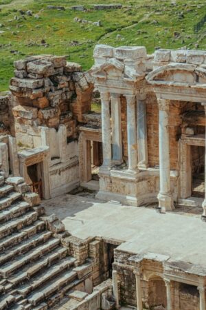
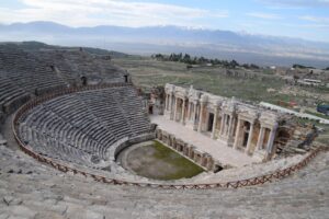
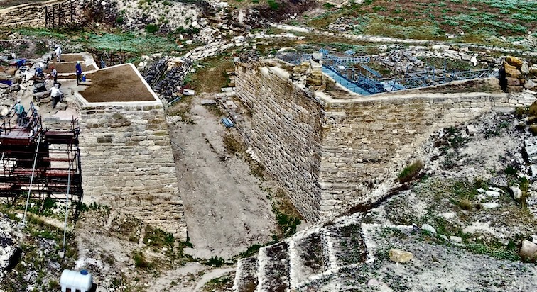
Recent years have seen new excavations, discoveries, and conservation results that have only added to the extraordinary story of ancient Gordion’s unearthing. Perhaps most apparent, from a site visitor’s perspective, is the completion of the restoration/reconstruction efforts on the massive East Citadel Gate. Initially constructed during the 9th century BCE and thought by archaeologists to be the main gate entrance to the Citadel Mound complex, it endured as an active city gate until the 4th century BCE. Despite the ravages of time, including earthquakes, the gate construction has been remarkably preserved. Reconstruction was completed in 2018/2019 and it now shows its ancient original height. It is the best preserved and largest ancient Iron Age city gate in Asia Minor.
_______________________________
The restored East Citadel Gate (9th century BCE) at the end of the 2019 season, looking northwest. Photo by Braden Cordivari. Penn Museum Gordion Archives
_______________________________
In addition to the East Citadel Gate, conservation efforts continued on the Early Phrygian Terrace Building on the Citadel Mound. It was an industrial area, a center for weaving and food preparation. Walls of the 8-room complex have been restored. Also in terms of conservation, treatment was continued on the 33 pebble mosaic panels of Megaron 2, dated to about 825 BCE, considered the earliest pebble mosaic floor ever excavated. This type floor is thought to have originated in Gordion and later spread throughout regions controlled by the Assyrians.
Documentation efforts have continuously improved, including the use of the latest techniques to digitally record and reconstruct Tumulus MM (see more, including the excavation story, below). It was built in 740 BCE and is today considered the oldest standing wooden building in the world.
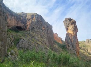
Also, efforts were made to visually reconstruct the appearance of the citadel during the Middle Phrygian period, at the time of Midas. Particular attention was focused on the citadel’s megaron buildings, using examples of ancient rock-cut facade remains located about 150 km west of the Gordion citadel mound. Most notable as a model is the so-called “Midas Monument” at ancient Yazilikaya/Midas City, the facade of which has dimensions that are the same as some of the facades of megaron remains at the Gordion citadel.
______________________________
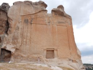
The Midas Monument at Midas City. Photo by Brian Rose. Penn Museum Gordion Archives.
______________________________
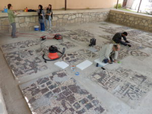
Conservation of the Early Phrygian (9th century BCE) pebble mosaic in the Gordion Museum. Photo by Brian Rose. Penn Museum Gordion Archives.
______________________________
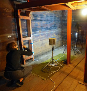
E. Keats Webb planning for a 3D recording of the interior of the Tumulus MM tomb chamber (ca. 740 BCE). Photo by Gebhard Bieg. Penn Museum Gordion Archives.
______________________________
New Excavations and Investigations
New discoveries have marked remarkably successful efforts over recent excavation seasons at Gordion. They include:
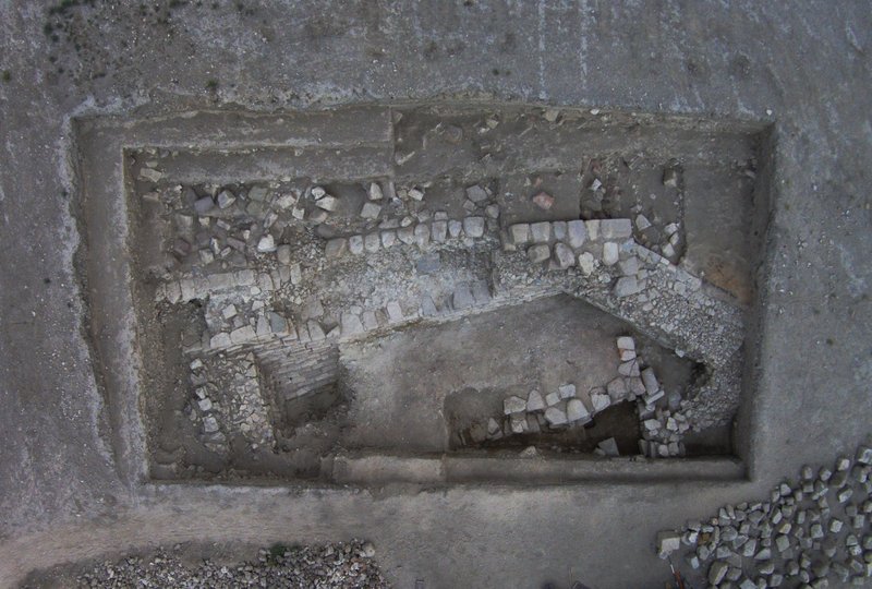
1. The unearthing of the South Gate gate complex in Area 1. Excavations in this area included the discovery of a roadway flanked by well-cut and finished massive ashlar stones. The South Gate was the main entrance to the city for 1,200 years, beginning in the 9th century BCE to the 4th century CE.
_______________________________
The approach road of the South Gate (Area 1), looking northwest. Photo by Gebhard Bieg. Penn Museum Gordion Archives.
_______________________________
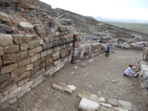
The northern wall of the approach road at the South Gate (Area 1), looking northeast. Photo by Brian Rose. Penn Museum Gordion Archives
_______________________________
Archaeological investigation indicates that it was rebuilt multiple times through history, with the first rebuilding in the 8th century BCE after a great fire, the second in the 6th century BCE after a Persian military assault, and finally in the 4th century CE, after Gordion became a Roman fort. Excavations have also revealed that the early and middle Phrygian walls of the 9th and 8th centuries endured functionally while the road adjacent to them changed through time. Most recently archaeologists excavated across an area of nearly 44 meters, including a portion of the Early Phrygian citadel’s upper perimeter wall, which anciently enclosed the city’s Citadel Mound. There is now evidence for a second road directed from the west toward the South Gatehouse, which extended to the Southern Lower Town, continuing toward the Western Outer Town. Excavations further revealed a terrace wall west of the South Gatehouse. It functioned as a platform to support more structures. New dating for the beginning of Middle Phrygian construction in this area was obtained through dendrochronological analysis of wood samples, as well as through the typology of two found small bronze fibulae, confirming a date of around 800 BCE.
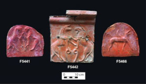
Excavations revealed more of the last major reconstruction at the South Gate complex, the Late Roman in the 4th century CE when Gordion was a Roman military base. This saw extensive construction of new walls and significant resurfacing of the ramped approach road. Additionally, evidence consisting of architectural details of two large rooms added to the western side of the South Gatehouse emerged, part of a multi-room complex, and sections of more rooms, extending west, east and north of the Gatehouse, have now been excavated. Study and exploration of walls of these structures show that they were strengthened in the latter part of the 4th century CE. New finds discovered in ancient fill deposits of the ancient Roman yielded Late Phrygian (4th century BCE) and Hellenistic (3rd – 2nd centuries BCE) artifacts. The most significant find was a hydria , featuring a gilded spearhead necklace motif. On the neck is an incised inscription, stating that a man named Chairigenes dedicated the vessel to the mother goddess Mater, known to have been venerated at Gordion during the Phrygian period. Archaeologists suggest that this hydria was likely originally housed in the adjacent Mosaic Building Complex (discussed below), a sacred space, and thought to be the site of the exhibition of the Gordian Knot, famed to have been cut by Alexander the Great.
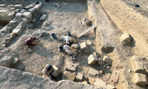
2. Excavations at the Mosaic Building complex—New excavations have taken place at the so-called Mosaic Building, a large complex that is thought to have been the residence for Gordion’s rulers during the 6th century BCE. Of note from previous years, the excavation team unearthed parts of an armor corselet made of iron and bronze scales, dated to the 6th century. Archaeologists suggest that it was part of the armor of a defender during the Persian attack on the city around 540 BCE. Although initially excavated in the early 1950s, the complex has seen renewed excavations beginning in 2019, yielding, in addition to the 6th century BCE iron and bronze scale armor, a shrine, a 6th century BCE gilded ivory sphinx thought to have adorned a throne or wood chair, and an omphalos, discovered in 2022. Excavations in 2024 yielded another structure, with evidence for the roof, now no longer in place. The southwestern wall remains of the room/structure featured blocks that were anciently labeled with a Lydian-related numbering system—similar to what had been discovered in 2022 and 2023 on a northeastern wall. Study suggests that the stones were actually originally numbered and used somewhere else, perhaps in an early 6th century BCE structure. Archaeologists theorize that they were thus relocated for reuse here, during the late 6th century after the Persian occupation of Gordion. Moreover and more precisely, archaeologists suggest that the numbering system came to Gordion from Sardis, the Lydian capital, as some of the incised characters are nearly identical to those used in the monumental architecture at Sardis.
Finds from the room included evidence of a large wooden beam that had fallen onto the floor, with iron nails and two iron hinges; spilled granules of grain; evidence of parts of the roof; some decorated architectural terracottas; and a headless alabaster figurine with crossed arms.
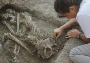
Most significantly, an unusual and remarkable find emerged from the northwestern sector of the trench excavation—the articulated human burial of an adult female, about 36–48 years old and over 1.5 meters tall. She was placed into a very contracted position on her right side, clasping her legs. Analysis of the skeleton, which showed disfiguration in fingers and teeth, indicated she likely worked as a weaver. Her body was placed in a deposit that also included animal bones, below a scattering of 6th century BCE type terracotta roof and wall tiles. The body was tucked into a small area between two wall lines that were dated to an earlier time, the Early Hellenistic period, or late 4th – early 3rd century BCE, making the burial later. The characteristics of the burial, combined with the relative deposit position, suggests the burial took place during the Middle Hellenistic, or later 3rd – early 2nd century BCE, corresponding to the Celtic Galatian occupation period at Gordion, a time when new, outside cultic, ritual, and burial practices were introduced to the area. Archaeologists interpret the burial as a purification deposit or ritual apotropaic deposit, marking a new cultural period at Gordion.
______________________________
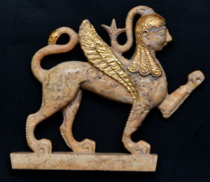
Gilded ivory sphinx discovered in the Mosaic Building (early 6th century BCE). Photo by
Ahmet Remzi Erdoğan.
______________________________
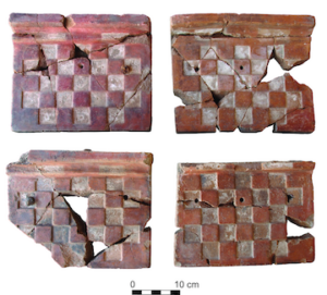
Architectural terracottas from the Mosaic Building in Area 1, early 6th century B.C.
Photo by Gebhard Bieg.
______________________________
Architectural terracottas from the Mosaic Building complex, early 6th century BCE.
Photo by Gebhard Bieg.
______________________________
Excavation of the collapsed wall blocks in the Mosaic Building Complex. The view is
looking south. Photo by Gebhard Bieg.
______________________________
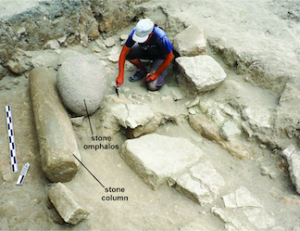
Excavation of the Mosaic Building in 2022, looking northwest. Sarah Leppard
uncovers the andesite omphalos and limestone column. Photo by Gebhard Bieg
__________________________

The pebble mosaic floor in the Mosaic Building as uncovered by Rodney Young in 1952,
looking northwest. Photo: Gordion Archive.
__________________________
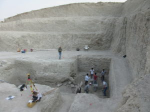
3. Excavations at the center of the Citadel Mound, which revealed material from a nearly complete Phrygian roof destroyed by the Persians in the 6th century BCE. Archaeologists believe that there is enough material from the excavation to reconstruct most of the roof.
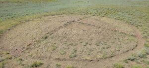
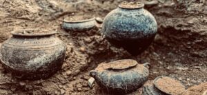
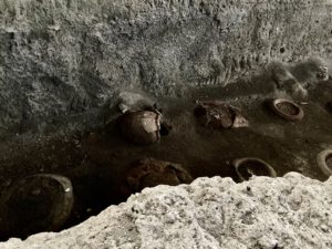
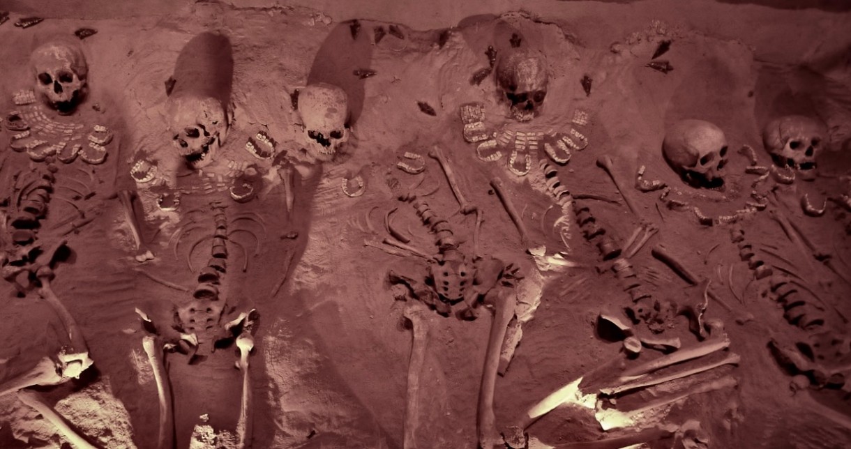
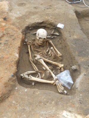
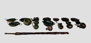
4. The excavation of the Beyceğiz Tumulus and Tumulus 52. The Beyceğiz Tumulus. a 15-meter high mound located about 12 km east of the Citadel Mound, became the subject of rescue excavations due to extensive looting. Archaeologists found no tomb chamber, meaning that this mound was constructed as a cenotaph (dated to around 700 BCE based on artifacts) during the reign of King Midas, possibly created to honor important Phrygian warriors who never returned from battle. The second tumulus, designated Tumulus 52, or T52, is a large mound 14 m high and more than 105 m in diameter. The weight of the overlying earth had in time collapsed the rectangular wooden burial chamber within, but in addition the chamber contents had also been extensively looted. Finds suggest a date possibly within the 8th century BCE. The finds include a number of bronze bowls, a bronze cauldron, bronze ladle, bronze fibulae (clothing pins), several ceramic storage jars, an iron weight, many small amber objects, a bronze bird finial, and iron tripod. Archaeologists also recovered more than 3,000 amber beads. Analysis of the beads indicated that they were likely imported from the Baltic Sea, suggesting Gordion’s activity in long-distance trade.
Evidence for the human remains for two individuals were found—a young female about 25 years old and a child about 8 or 9 years old. These finds are unusual in the sense that the burial of women within tumuli at Gordion were not known to have occurred until after about 580 BCE. and double burials are not common finds. The tumulus and its contents are clearly indications of elite remains.
_______________________________
The Tumulus 52 excavation in progress. Photo by Gebhard Bieg. Penn Museum Gordion Archives.
_______________________________
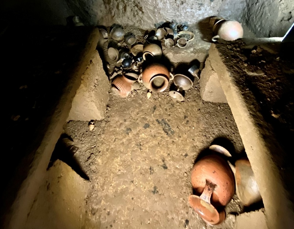
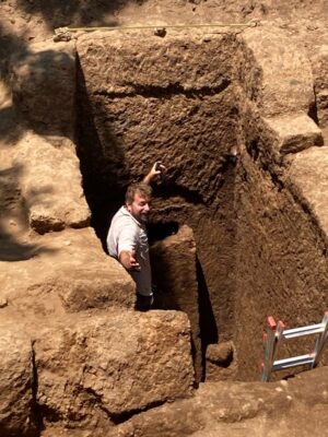
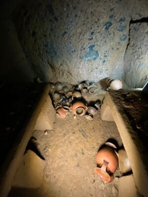
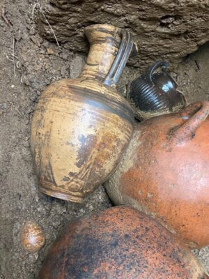
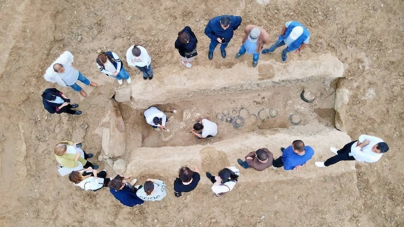
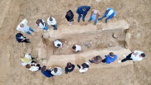
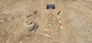
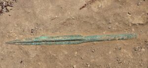
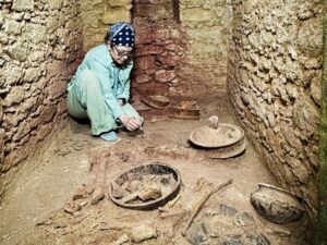
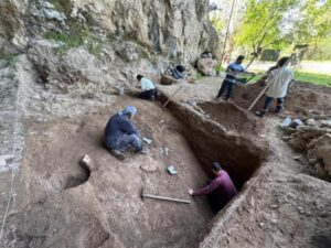
5. A New Royal Tomb, T26—Most recently, joint excavation efforts that included Professor Yücel Şenyurt of Ankara’s Haci Bayram Veli University, and Brian Rose of the University of Pennsylvania and the Penn Museum, revealed a remarkably well-preserved 8th century BCE royal tomb chamber. The chamber is located in a monumental burial mound near the Gordion Museum, designated Tumulus T-26. One of 130 mounds surrounding the remains of Gordion’s ancient citadel, scientists first used remote sensing (magnetic prospection) technology on the mound. Results showed the likely internal presence of a wooden chamber.
After four months of ensuing excavations, the burial chamber was revealed. Excavators found that the roof had collapsed, but the burial objects deposited in the tomb (dated to ca. 750 BCE) were still in situ (in their original places as deposited by the ancient caretakers). No tomb robbery had taken place, as is typically the case for so many other ancient tombs.
Objects included a number of well-preserved bronze vessels of the type used for banquets, as well as iron tools. Finds also included two large bronze cauldrons, small bronze cauldrons, bowls, and jugs—items typically used as food and drink serving vessels for a funeral activity. Traces of textiles were found adhering to the vessels.
This burial was a cremation, an unusual find as cremations were previously not thought to have been introduced at Gordion for another 100 years.
Because the tumulus containing the tomb exhibits characteristics of an elite or royal personage, along with its proximity to the Midas Mound tomb (Tumulus MM, see section below), archaeologists suggest that the tumulus and tomb may be connected to Midas’s family or associated individuals.
______________________________
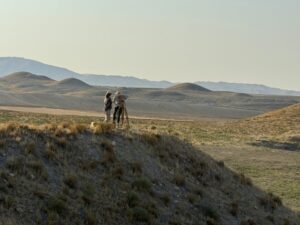
Studying the tumuli and what might rest beneath, researchers gather near the citadel of Gordion, Türkiye. Photo: Brian Rose for the Penn Museum
______________________________
Bronze discoveries from Tumulus 26. Courtesy Penn Museum
______________________________
6. Geophysical investigations using electric resistivity tomography (ERT), conducted to determine the size and configuration of fortifications surrounding the Citadel Mound and the Outer Town area of the ancient city. Related structures were detected that helped to define the perimeter fortification of the Citadel Mound as well as the defensive wall system of the Outer Town. Researchers were able to confirm that the Outer Town was about 109 — 111 acres in area.
Most recently, remote sensing focused to the north, east, and west of the Citadel Mound. Amost 110,000 sq m (11 hectares) were surveyed using both magnetometry and ERT. With the discovery in 2023 of the Eastern Outer Town, encompassing 7 hectares enclosed by a fortification wall, the detection of a possible large megaron structure, and a series of walls, surveys continued further in 2024 with the detection of possible Bronze Age pithos burials. Surveys further suggested another structural complex connected to Iron Age structures already excavated.
Surveys in the Western Outer Town indicated a likely dividing wall that marked small districts, similar to the same discovered in the Eastern Outer Town, and a search continued to find the thus far elusive eastern fortification wall for the Lower Town.
More information about Gordion and the Gordion Archaeological Project can be found at the project website. For individuals interested in making a donation to the project, see the Friends of Gordion page. Friends of Gordion receive an annual newsletter about the most recent results of research and excavation and may also receive special guided tours of the site.
__________________________________
- * Rose, C. Brian and Gürsan-Salzman, Ayse, Friends of Gordion Newsletter, September 2014
_______________________________________________________
A R T I C L E S U P P L E M E N T
The Funeral of Tumulus MM
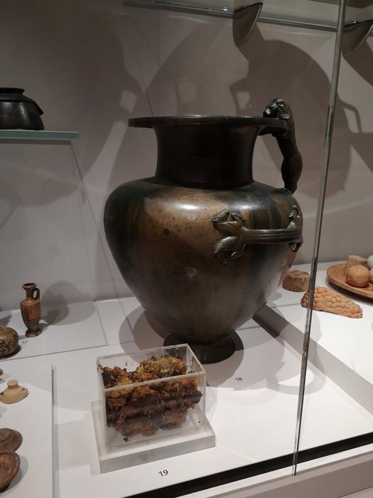
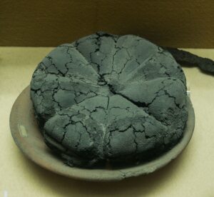
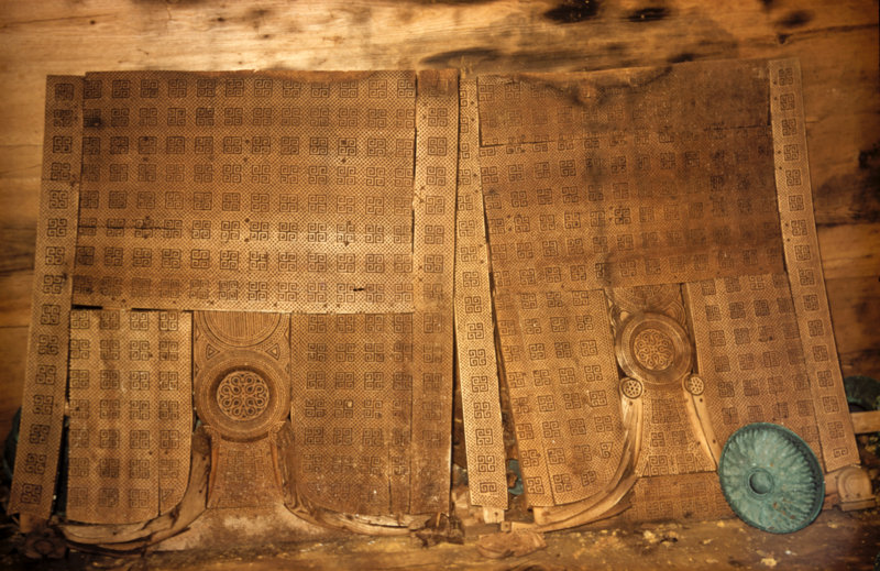
One of the most spectacular discoveries at the Gordion archaeological site came when Rodney Young of the University of Pennsylvania opened an imposing tumulus mound in 1957 known as Tumulus MM, today interpreted to have been the probable tomb of Gordias, founder of the city of Gordion and father of the legendary King Midas. Within a wooden chamber of the tumulus tomb, Young and his colleagues found the remains of a man determined to have died when he was between 60 and 65 years old. His remains had been placed on a pile of dyed textiles inside a wooden coffin. The coffin was accompanied by 14 remarkably well-preserved items of wood furniture, thought to have been dining and serving tables used at a funerary banquet before the interment. Also found were 3 large cauldrons on iron tripod stands, 19 large two-handled bowls, 100 bronze drinking bowls, round-bottomed buckets, 19 juglets, 2 jugs, a ram-headed situla, and a lion-headed situla. Further analysis indicated that vessels had contained a beverage made from a mixture of honey mead, grape wine, and barley beer. Eighteen ceramic jars showed evidence of a spicy funerary feast of lentils and barbecued sheep or goat stew. It was, according to the archaeologists, evidence of an elaborate banquet fit for a king.
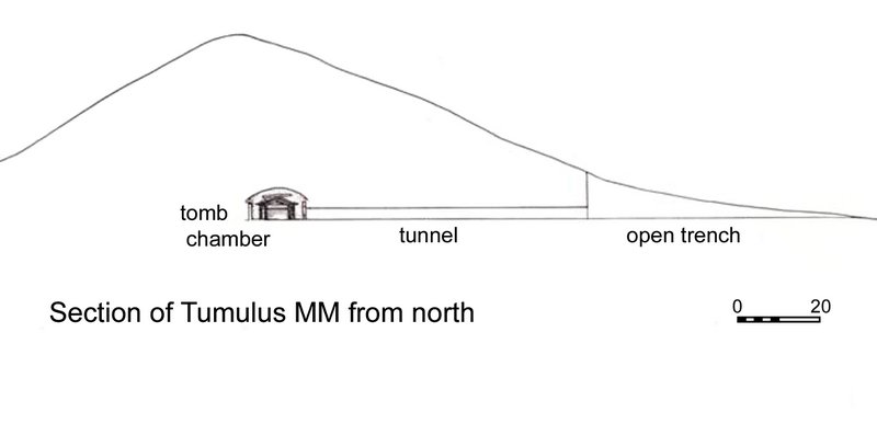 Section of Tumulus MM from the north, showing the open trench and tunnel cut during the excavation of 1957. Drawing by Richard Liebhart, after Young 1981: fig. 51. (Picture credit: Penn Museum Gordion Archive 102811, and Richard Liebhart)
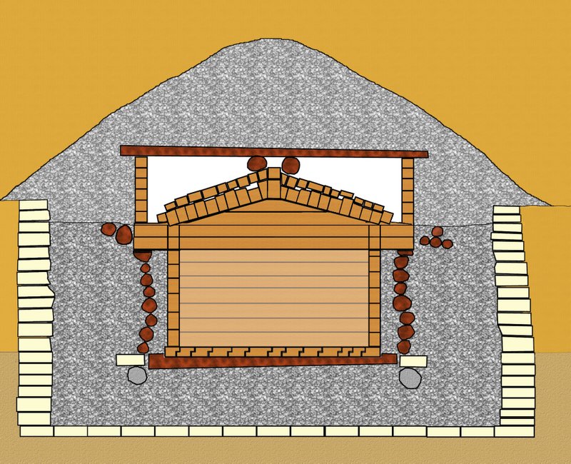 Tumulus MM: Center cross-section construction of the tomb chamber complex (looking north). Drawing by Richard Liebhart. (Picture credit: Gordion Archaeological Project, Richard Liebhart)
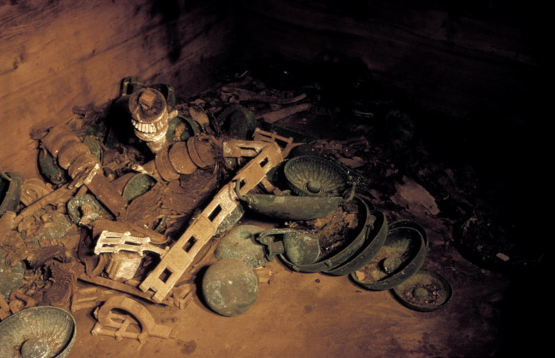
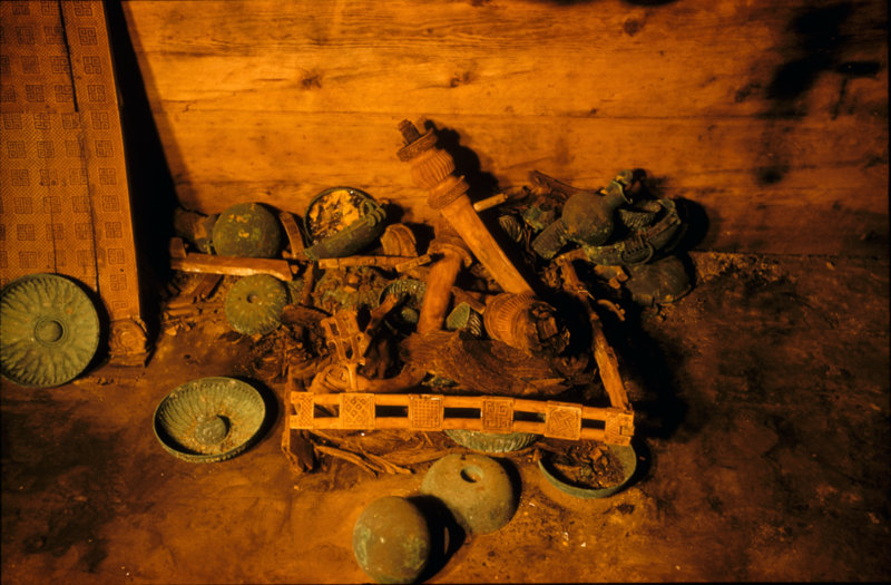 Above and below: Tumulus MM, 1957: Inlaid table as found, with bronze vessels. Middle Phrygian period, c. 740 B.C.E. (Penn Museum Gordion Archive)
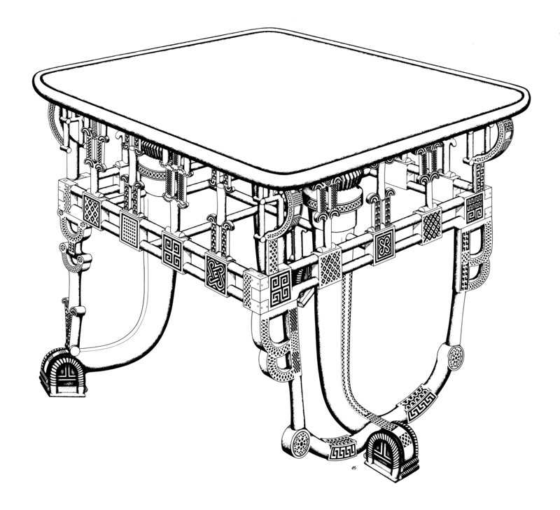 Above: Inlaid table, Tumulus MM, reconstruction drawing by Elizabeth Simpson, 1985. Copyright E. Simpson.
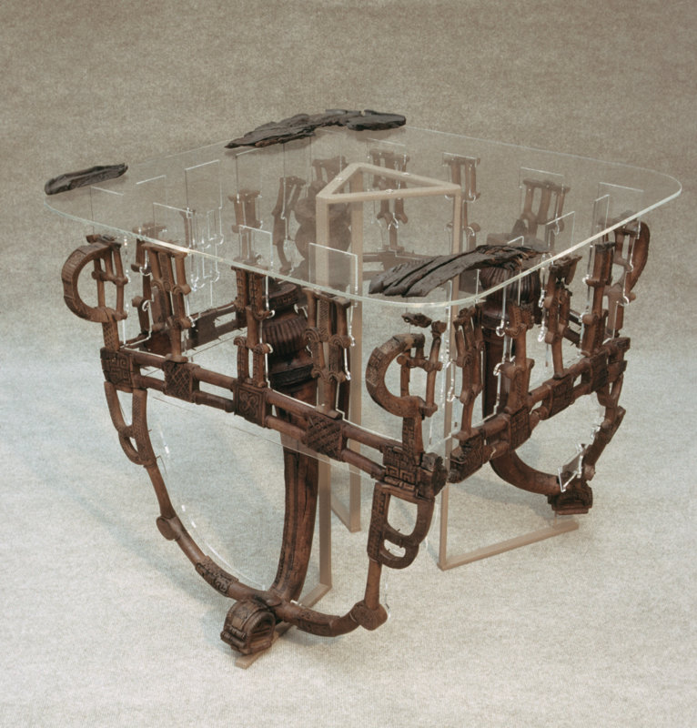 Above: Inlaid table from Tumulus MM reconstructed for display, 1989. Courtesy Gordion Furniture Project.
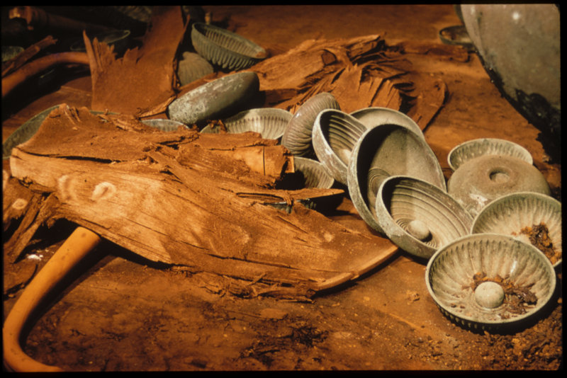 Above: Tumulus MM, 1957: Remains of a plain table, with bronze bowls, as found. Middle Phrygian period, c. 740 B.C.E. (Penn Museum Gordion Archive, G-2376)
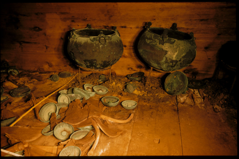 Tumulus MM, 1957: Southern end of the tomb chamber, with bronze cauldrons against the wall, the remains of plain Tables in front, and bowls and jugs scattered across the floor. Middle Phrygian period, c. 740 B.C.E. (Penn Museum Gordion Archive, G-2385)
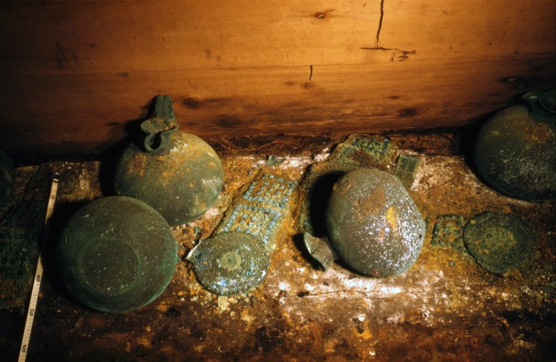 Tumulus MM, 1957: Bronze-studded leather belts with decorative bronze disc attachments, and bronze trefoil- mouthed jugs, on the floor where they had fallen in antiquity. Middle Phrygian period, c. 740 B.C.E. (Penn Museum Gordion Archive, G-2404)
 Tumulus MM, 1957: Wooden serving stands in place: stand A at right and stand B at left. Middle Phrygian period, c. 740 B.C.E. (Penn Museum Gordion Archive, G-2343)
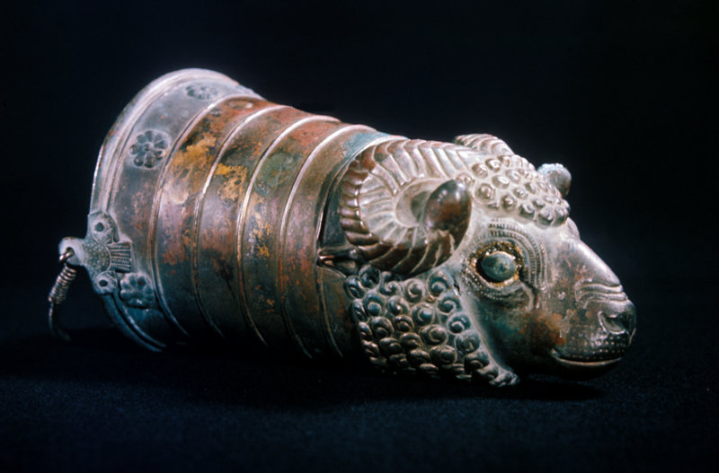 Tumulus MM, 1957: Bronze ram’s-head situla, after cleaning by the British Museum. Middle Phrygian period, c. 740 B.C.E. (Penn Museum Gordion Archive, G-3008)
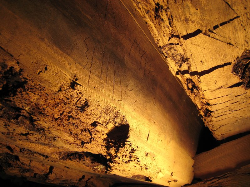
Decades later, in 2007, Richard Liebhart, Rose and colleagues discovered four Phrygian inscriptions incised on several timbers while investigating the northwest corner of the outer tomb chamber. “The names [NANA, MYKSOS, SI↑IDOS, and KYRYNIS] had clearly been scratched into the beams before they were set in place around 740 BCE,” wrote the researchers about the find. “The hand of the inscriber was steady and sure, and all the words appear to have been inscribed by the same man, at approximately the same size, with SI↑IDOS written slightly larger than the other words. The SI↑IDOS beam was also probably the first one to have been placed on the tomb after the funeral ended.” Rose and colleagues suggest that SI↑IDOS was likely a prominent man in the community of Gordion.
“One can think of this as an early prototype of the Memorial Name Books that are still used in funerals today,” wrote Rose and colleagues.**
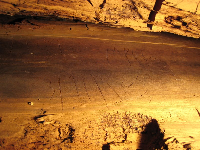 Above and below: The names inscribed on the roof beam in Tumulus MM. Photos by Richard Liebhart (Picture credit: Gordion Archaeological Project, Richard Liebhart)
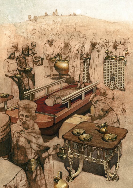 The Royal Funeral Ceremony Banquet. Reconstruction of the funeral ceremony held before the Tumulus MM burial. Painting by Greg Harlin based on drawings by Elizabeth Simpson, 2001. Copyright G. Harlin and E. Simpson.
_______________________________________________________
** http://sites.museum.upenn.edu/gordion/articles/history-archaeology/69-the-funeral-in-tumulus-mm
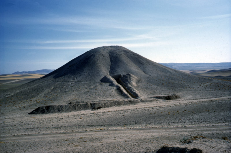
Image, top: Tumulus MM, 1957: Note the long excavation trench running into the mound, and the horse and wagon in front for scale. (Picture credit: Penn Museum Gordion)