What follows is a reprise of the previously published article about the historic 16th century “lost colony” of Roanoke, North Carolina, America’s first, albeit unsuccessful, British colony which famously disappeared almost without a trace years before the founding of Jamestown, Virginia. This article also includes the latest arguable evidence more recently released, bearing on the final location of at least some of the lost inhabitants of the colony.
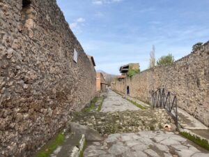
Best known for fishing and as a popular vacation destination for tourists, Hatteras Island snakes down a long 42 miles beginning just beyond the southern end of the bustling northern Outer Banks vacation communities of Nags Head, Kill Devil Hills and Kitty Hawk, just off the coast of North Carolina. Constituting the greater part of the Cape Hatteras National Seashore, it is far less populated and commercial than its adjoining Outer Banks neighbors to the north. Traveling south, I drove a seemingly endless, quiet, almost pristine ribbon of sand, with a view of the Atlantic Ocean waves crashing against it to the east on the left and the Pamlico Sound lapping up against it to the west on the right. I encountered almost nobody along the way. The ocean shelf just beyond the beaches is a virtual graveyard of shipwrecks, accumulated over the centuries on a stormy, watery stage that historically also saw the likes of Edward Teach, otherwise infamously known as Blackbeard the Pirate. Today, every summer, some discriminating vacationers avoid the crowds of the beach communities in the north and rent their getaway homes and cottages in or near the island’s tiny towns of Rodanthe, Waves, Salvo, Avon, Buxton, Frisco, and Hatteras Village. But in recent years, despite its quiet, off-the-beaten-path character, something quite extraordinary has been happening on Hatteras. At its far southern end, near the communities of Frisco, Buxton and Hatteras Village, teams composed of students and local volunteers, led by a U.K. archaeologist from the University of Bristol, have been digging into the soil sediments to uncover the island’s history—a history that may have a profound impact on solving a 433-year-old cold case mystery.
For Scott Dawson, a teacher, firefighter and EMT in his early 40’s, it would be no exaggeration to say that this has been the adventure of a lifetime. Dawson is deeply connected to the island. His family roots here go back over three hundred years into the 17th century. Over the years his passionate interest in the history and archaeology of the island has led him to dive intensely into the historic documents that underpin the real story of the indigenous Native American inhabitants of Hatteras—the Croatoan—and the earliest British newcomers who first came to explore and settle the region over 430 years ago. That story happened over 20 years before colonists set foot on what became Jamestown in present-day southern Virginia. Now, as founder and President of the non-profit Croatoan Archaeological Society, he and the society’s membership have played a key role in archaeological investigations related to that earliest colony under the direction of the University of Bristol’s Dr. Mark Horton.
When I initially spoke with Dawson about the investigations, I was in the process of reading his book, The Lost Colony and Hatteras Island, and the fascinating artifact discoveries from Horton’s excavations he described within. I already knew the story of the famous ‘lost colony’ from my own readings, so I did what all too many people in my position did—skip immediately to the second part of his book, which related in detail the story about the latest artifact findings that had commanded so much attention from the popular press in recent years.
Before I could get very far in our conversation, he stopped me.
“Did you read Part 1 of the book?”, he asked.
With a sense of embarrassment, I answered him. “No.”
And that is where the entire direction of the discussion changed. “That’s a common mistake,” he said. “In order to really understand the significance of our finds, you need to understand the true history behind them. Most people who have read about the Croatoan and the lost colony think they know the story. But they don’t. What we have learned in school is not accurate.”
Dawson knows this because he was exposed to the same misinformation as a child growing up on the island—until he decided to really dig for the truth by going to the primary first-hand accounts and historic records.
Understanding what the latest finds mean requires going back to the historic backdrop that defined their significance………
Raleigh’s Chartered Voyages
Written history tells us that it was on the shores of the Outer Banks where the very beginnings of English colonization took place. And though far from the Elizabethan England of its time, these initial explorations and attempts owe their inception in large measure to the geopolitics, culture and economic enterprise of the broader European 16th century stage. Queen Elizabeth I and her England, with its upstart naval prowess, were challenging Spain’s undisputed position as the world’s preeminent naval power. News of Spain’s solid and strengthening foothold in the New World and the vast new resources—especially gold—that flowed from it, quickly caught the attention of the Queen and her chief playmakers—men like the favored and influential courtier Sir Walter Raleigh.
Keen to make England the most powerful monarchy of Europe, the Virgin Queen and Raleigh knew that enlarging the royal treasury and expanding the kingdom’s economy was key. Steeped in the politics of the times, they aimed to explore the New World and establish colonies to stake England’s claim and to also act as a springboard for launching raids on the Spanish West Indies and Spain’s treasure fleets. The Queen granted Raleigh a royal charter, authorizing him to explore, colonize, and control any “remote, heathen and barbarous lands, countries, and territories, not actually possessed of any Christian Prince, or inhabited by Christian People,” in return for a portion of all the gold and silver that might be acquired there.* Simultaneously, while navigating the currents of the Atlantic from England to the Caribbean and up North America’s eastern seaboard of what is today the United States, the Queen’s privateers would, and did, aggressively encounter and loot the Spanish treasure ships as they sailed in return from their conquered and established sources in the Americas. But there was another side to England’s design in this venture. The English sought to undermine the Spanish foothold among the Native Americans, who the Spanish had systematically and cruelly subjugated, plundered and murdered ever since the Christopher Columbus voyages, as a means of attaining their desired preeminence in the new-found lands. Known as the “Elizabethan Model” for colonization, it was a vision of conquest through befriending and trading with the natives, as opposed to domination and subjugation. The concept was first espoused and advanced by the Queen’s preeminent historian Richard Hakluyt in his Discourse Concerning Western Planting, published in 1584. This approach was immediately and officially adopted as a means for English colonization. Hakluyt, also a geographer, became a principal member of the first voyages. And as will be seen later, the “Elizabethan Model” proved key to the survivability of the early colonists.
With that, Raleigh financed, solicited investors, and organized the first English expeditions. It was first and foremost an economic and military venture, as well as a vanguard undertaking in scientific research. The initial two expeditions, the first a reconnaissance mission headed by Philip Amadas and Arthur Barlowe, and the second a military mission commanded by Sir Richard Grenville, which were launched in 1584 and 1585 respectively, explored primarily Croatoan (today’s Hatteras Island). The expeditions were fruitful, bringing back knowledge of the resources and inhabitants of the newly found land. Discovered and documented in detail through notes, watercolors and drawings by expedition artist, cartographer and explorer John White and expedition scientist Thomas Harriot, the earliest expeditions produced for the first time a picture of “the new found land of Virginia,” and of “the commodities and of the nature and manners of the natural inhabitants” for Raleigh and the expedition’s gentlemen British investors—and perhaps more importantly, from the Crown’s perspective, rumors of gold and a passage to the South Sea.* Equally important, friendly relations were established with the natives, of whom the famous Manteo and Wanchese were leading members, voyaging back to England with Grenville to visit as arguably America’s first Native American ambassadors. At the same time, however, acts perpetrated by the military expedition of 1585 saw the making of new enemies among the native tribes, especially the Secotan, the repercussions of which would continue to flow through the dynamics of subsequent ventures and relationships. This could explain at least in part why Wanchese was suspicious of the English. He ended his relationship with the English, but Manteo and others of his tribe remained staunch friends and allies. Thus, though the returns from the first two reconnaissance missions were mixed, it was enough in the beginning to incentivize and outfit a civilian expedition to permanently colonize the new territory with a start-up group of 118 men, women, and children. The objective was to find a deep harbor in the Chesapeake Bay area to establish a port town, and to stop briefly at Roanoke Island to retrieve 15 soldiers left on the island by the 1585 expedition. Circumstances, however, proved to alter the original plans and the colonists ended up remaining on Roanoke.
__________________________________
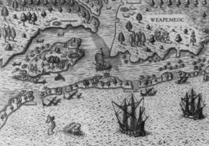
Map by John White, dated 1590, of the coast of present-day North Carolina where the English first began their colonization efforts. Wikimedia Commons, Public Domain
__________________________________
Veteran explorer John White was commissioned as the expedition’s leader and colony governor. In addition to the enormous responsibility for the welfare and protection of friends and families under his command, his stake in the mission was also deeply personal—along with him came his daughter Ellinor and son-in-law Ananias Dare. It was an unprecedented experiment in English civilian colonization on North American soil.
But, as it turned out, the effort was short-lived. After six weeks, White left the colony to return to England for much-needed supplies and reinforcements, leaving behind the bulk of the group, including his daughter Ellinor, son-in-law Ananias, and new granddaughter Virginia, the first English person to be born on American soil, to thrive as best they could until his return.
A return that wouldn’t occur for another three years.
The Queen needed every ship she could muster to defend England against the impending Spanish threat, and that, along with other complicating circumstances, locked White into a furiously frustrating wait until resources could finally be made available for the return trip.
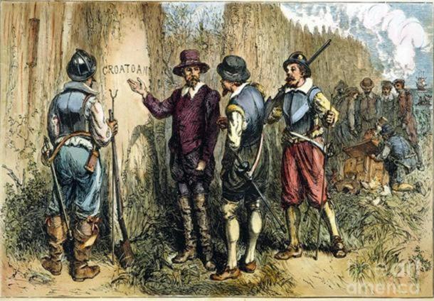
Finally, in the year 1590, White stepped back onto Roanoke Island and into the site of the settlement on August 18, serendipitously coinciding with the third birthday of his granddaughter, Virginia. But there was no birthday celebration, for as White and his party could see, not a single settler remained.
“We passed toward the place where they were left in sundry houses,” White wrote in his account, “but we found the houses taken down, and the place very strongly enclosed with a high palisado of great trees, with cortynes and flankers very fort-like, and one of the chief trees or posts at the right side of the entrance had the bark taken off, and 5 feet from the ground in fair capital letters was [en]graven CROATOAN without any cross or sign of distress…..”**
White and the settlers had agreed that a cross symbol would be engraved if the settlers had encountered trouble or distress before, or as the cause for leaving, should they have to abandon the settlement. Clearly from the lack of such signage, all seemed to be well. Engraved into the tree post was ‘CROATOAN’, the name of a native group. Had the colonists gone to live with the natives? To White, this would make perfect sense. Manteo, who was left with the 1587 colonists after his return from England, was a great friend and asset to the colonists. He was a critical link to the Croatoan, the group of natives with whom the early explorers and colonists had already established a mutually beneficial symbiotic relationship, and White likely knew that he would be critical to the colony’s survival during his absence. Moreover, White knew where the Croatoan lived—on the island known today as Hatteras.
White and his party then sailed south toward Hatteras. But a violent storm drove his ship out to sea. The attempt was abandoned and he returned to England, never to return again.
One can only imagine White’s heartbreak and the enduring haunt that likely plagued the rest of his days. His last years are lost to history, but in a letter he wrote to Hakluyt, who wrote about the early English experience in America, he summed up his final trip with the words “as luckless to many, as sinister to myself”.
Needless to say, the fate and whereabouts of the “lost colony”, as it came to be called in the popular literature, has been the subject of historical and archaeological investigation for many decades. But the story and mysteries of the first English settlement go well beyond the “lost colony”, and archaeologists and historians have been busy, off and on and as resources have allowed, conducting research to find the answers.
The search began on the north end of Roanoke Island, where some surface features and finds gave clues to the past presence of the first colony.
The Elusive Settlement
Edward “Clay” Swindell, who is the Mid-Atlantic Regional Archaeologist for the U.S. Navy, led me down narrow paths in a thicket of woods within what is today the Fort Raleigh National Historic Site area. Swindell has been a key member of a team that has recently uncovered artifacts that could give new clues about the final whereabouts of at least some of the members of the lost colony. But here, in these woods on the Island of Roanoke, North Carolina, he guides me to four places where scientists over the decades have unearthed some tantalizing traces of this first English presence in America.
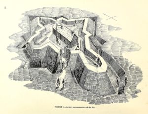
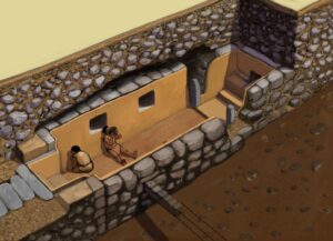
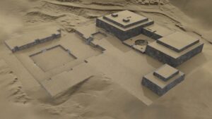
One such place is the famous earthwork “fort”, the most prominent and visible feature on the historical landscape surrounding the Fort Raleigh National Historic Site visitor center. It was in this immediate area where the first full professional excavations on the island began under the direction of National Park Service archaeologist Jean “Pinky” Harrington in 1947 and 1948. What he excavated then, however, was a faint physical reminder of what once stood here. Visitors today see the reconstructed earthwork, actually constructed in the 1950’s, the way researchers and archaeologists suggest the “fort” may have appeared in its day. For years, historians and archaeologists have suggested that the simple earthwork sconce, or ‘fort’, served as the major defensive function for the early colonists, featuring perhaps the placement of cannon directed to the nearby shoreline to protect the main colony from potential Spanish attack or advances. But today archaeologists, including Swindell, disagree with that scenario.
“It’s just too far from the shoreline for that to work,” he says. “It wouldn’t make sense.”
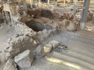
_________________________________
_________________________________
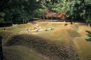
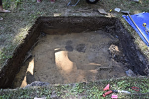
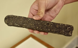
The reconstructed earthwork, showing excavations in progress at the site. Courtesy First Colony Foundation, from the previous article published on the same subject.
_________________________________
The shoreline has changed over time since the late 16th century. But even given the original shoreline, the distance would have been too great for the fort placement to make sense. Swindell suggests that the earthwork may have been constructed as a quickly-raised earthen sconce to defend or protect an element of the early colony from nearby natives, known to be living in an established village just north of the location—or that it may have served some purpose other than defense of the colony from threats from the sea. Harrington and his team uncovered musket balls, sherds of small crucibles, olive jars, German jettons, and copper nuggets from the earthwork site. Further excavations just west of the earthwork in 1982 and 1983 by the Southeast Archaeological Center of the National Park Service also revealed similar Elizabethan period artifacts, including sherds of crucibles, more Normandy flasks, and tin-glazed ointment pots. And most recently, in 2010, ground-truthing excavations connected to a 2008-2009 Radar Tomography survey uncovered a spread of charcoal. More telling was Harrington’s excavation in 1965, including later excavations by the late Ivor Noël Hume of the Colonial Willamsburg Foundation, which revealed another adjacent site, defined by a nine-foot-square line of postmolds (dark soil where wooden posts in the ground had long rotted away) and a one-foot-deep sunken floor that featured three pits. One of the pits contained bricks, some of which were modified, 16 sherds of a Normandy flask, and native pottery. The consensus among archaeologists now suggests that this site was Thomas Harriot’s “workshop” or “science center”, a place where he, as the expedition ‘scientist’, conducted work to extract minerals and other resources – a metallurgical workshop of sorts. The charcoal feature at the earthwork uncovered in the 2010 excavations has also since been identified as fuel made by Harriot and his workmen, likely during the 1585 expedition. The archaeology has shown that this workshop site may actually have preceded the earthwork. So it is not an altogether unsupportable suggestion that the earthwork feature might have been designed to protect the workshop due to worsening relations with the neighboring natives.
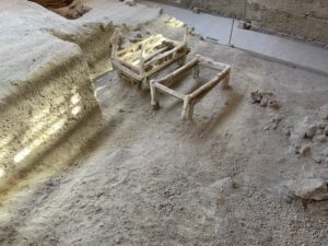
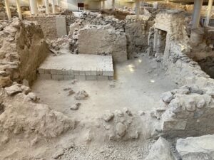
______________________________
The workshop or “science center” site under excavation. Courtesy First Colony Foundation, from the previous article published on the same subject.
______________________________
Walking further north, Swindell leads me to a place where, in 2008, 2009, and 2010, archaeologists uncovered more artifacts. As we swat mosquitoes from our faces, he points and delineates the area where the excavations took place. One would hardly know any excavation had ever taken place here. Tucked deep in the woods along a nature trail, it appeared virtually untouched by the human hand. But in 2008 archaeologists had to dig 3 feet down through sand in this place before they could reach any signs of past cultural activity. The dune build-up over time had covered over the original late 16th century surface. Today the place is known as the ‘Harriot Woods’ site, where excavators uncovered two cache pits containing European artifacts, including a necklace made of diamond-shaped copper plates (a likely trade item of high value to the local Algonquian natives of the time), copper aiglets typically used to lace up Elizabethan clothing, a fragment of lace, and glass Venetian beads (also a valued trade item among the local Indians). Further excavation at the site revealed a slot trench feature that was identified as evidence of a palisade fence that ran northward toward the shoreline. Radiocarbon dating of organic material found at the site indicated a date range of 1540 – 1640 AD.
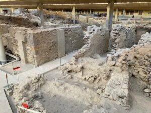
________________________________
Above and below: The ‘Harriot Woods’ site under excavation. Courtesy First Colony Foundation, from the previous article published on the same subject.
________________________________
Copper plates, thought to have been components of a necklace, unearthed at the Harriot Woods site. Courtesy First Colony Foundation, from the previous article published on the same subject.
________________________________
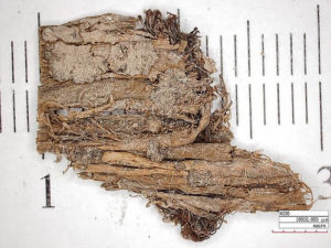
Sample of organic cordage found in association with the copper necklace. It is thought to have been part of a container or bag in which the necklace was placed. Courtesy First Colony Foundation, from the previous article published on the same subject.
________________________________
Was this, along with the earthwork and the ‘science center’ site, part of the remains of the main settlement and fort documented in the historical accounts?
Archaeologists have their doubts.
“None of the artifacts or features here are evidence of domestic activity,” says Swindell. “Harrington’s work, Hume’s work, and our (more recent) work didn’t show any kind of habitation here (that would be characteristic of a domestic settlement, such as at Jamestown).” And even the earthwork, interpreted as a defensive feature, would not be substantial enough to be considered a fort of the type that the colony would need for overall defense. Now, archaeologists question the earlier suppositions that the main settlement site has been found. Nonetheless, the earthwork site and the other sites nearby clearly indicate a 16th century European presence on the island.
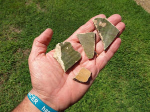
Much more work needs to be done before solid conclusions can be drawn, says Swindell. That work will be challenging, and part of that challenge has to do with the changing environment and the dunes. Dune formation in this area has covered the surface to the point where one must typically excavate at least several feet before reaching any cultural layers that could be identified with the colonial period. Significant shoreline erosion has been another culprit. Swindell walked me eastward along a narrow trail through the woods to a point on the shoreline. We emerged at the edge of a high sand dune bluff overlooking the shoreline. It was sculpted by the unrelenting elements of water and wind over time. Called “Barrel Beach”, this is where archaeologists recovered the lower part of a wooden barrel and a hollowed-out log in shallow water along the shore in 1982. Radiocarbon-dated to the late 16th century, they are thought by some archaeologists to be parts of a well facility established by the colonists for access to fresh water. Here also archaeologists found Iberian olive jar sherds and a few 16th century objects, including an axe. But the point is that none of these objects would have been found at the time if it hadn’t been for the extensive, ongoing erosion of the deep dune layers along the shoreline. The erosion, in a sense, did the digging for them. Yet even this has its drawbacks. “It’s a race against time,” says Swindell. “In 2006 test units were excavated at this spot above the shoreline. Now that surface is gone. We’ve probably lost about 50 feet of shoreline due to erosion over the past decade. There was potentially an Elizabethan component here. Underwater testing has been done, but it hasn’t turned up much.” Swindell added that much of the dune accumulation, shifting and erosion we see today occurred since the early 19th century after logging removed the foliage critical for supporting and protecting the land surface from sand encroachment and erosion. It has vastly complicated efforts to investigate what lies beneath. “In some places the sand could be as much as 10 to 12 feet above the original 16th century land surface,” he says.
________________________________
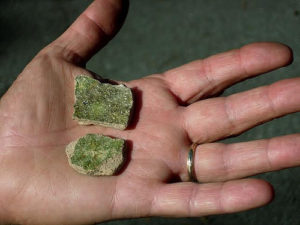
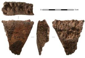
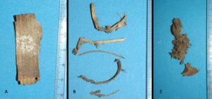
16th century ceramic fragments found near Barrel Beach. Courtesy First Colony Foundation, from the previous article published on the same subject.
________________________________
So, with the doubts about the “Fort Raleigh” earthwork site as a viable candidate for the colony’s main settlement site and no evidence of artifacts or structures in the area that would signal domestic habitation, I asked Swindell where he thought the main settlement could possibly be.
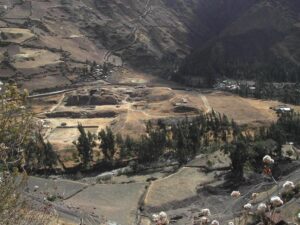
We hopped into his SUV and proceeded south from the archaeological sites along highway 64 toward Manteo, the modern town on Roanoke. “Even Pinky (long before the popular perception that the main settlement was located around or near the earthwork) suspected that the main settlement and fort was down south in the vicinity of Shallowbag Bay,” said Swindell. Manteo abuts Shallowbag Bay, home to the town’s main marina and an ideal waterfront for docking boats of a variety of capacities. The trip took only 5 minutes, and we were soon walking up a peer that jutted into the bay. We stopped at the end of the pier, at the edge of the water.
Looking at it, and comparing it to the shore area further north near the archaeological sites, it was easy to see how this would have been a much more desirable place to establish a fort and settlement.
“This is a nice, deep area for portage and docking,” he says. “The entrance to the Outer Banks is more easily accessible. You have this nice sheltered bay that better accommodates the docking of ships. So you can imagine that this would be a better place to protect your ships and to actually bring supplies in, whereas toward the north (where the current archaeological sites are) there is really no (workable) place to keep your boats and offload supplies.”
“This isn’t a new revelation or proposal,” he continues, “but the traditional ‘Fort Raleigh’ location identified with the earthwork further north at the Park acted like a ‘red herring’, diverting attention from further exploration or consideration of this location.”
He points to another side of the bay, a concentration of condos along the shoreline. “That is one of the areas we are interested in—back in the 30’s, there was a young man who found an English sixpence in that area. Other (unprovenanced) small finds have cropped up in the area. None of them have been pursued archaeologically. We are hoping to pursue some of these leads, among other things.”
But none of this is to say that investigations at the traditional ‘Fort Raleigh’ site on the north of the island are over.
“People think there is nothing left to find here,” says archaeologist Eric Deetz, a member of the First Colony Foundation team and lecturer at the University of North Carolina in Chapel Hill. “I don’t buy that.”
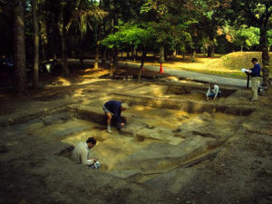
Deetz conducted a limited excavation at the workshop/science center site in 2017, re-investigating what has already been done to clarify and hopefully find answers to some outstanding questions—like uncovering and identifying postholes for missed clues to any structures. He suggests that during Harrington’s time, the excavators were not as adept at recognizing the subtle soil features that give clues to the presence of past structures. Deetz applies his years of experience from the Jamestown excavations, where they uncovered the many subtle posthole traces of the (what was thought to be long lost) palisade trenches defining James Fort, as well as its other associated structures.
“I have a dream,” he says. “And I think it’s going to come to pass.”
Like the renewed workshop/science center excavation, Deetz hopes to re-excavate many of Harrington’s old, now re-filled trenches. He shows me a site plan made of Harrington’s old trenches. He argues that the level and intensity, and thus the thoroughness, of the investigations and excavations conducted at the present-day Fort Raleigh National Historic Park area never approached the level and intensity given to the Jamestown site further north in Virginia. To illustrate this further he describes an excavation conducted in 2009-2010 that uncovered traces of a previously undetected slot trench not far from where excavators found the copper necklace and trade beads (see above). “It could be a 16th century palisade,” he speculates, “or it could be some place where they built a fence for a pigsty in 1760.” No artifacts were found that could help date the feature. However, archaeologists took soil samples from the site and sent them for OSL (Optimally Stimulated Luminescence) testing. “So if we get results indicating it could be 16th century,” he exclaims with a hopeful gleam in his eye, “then we’re off to the races.”
_____________________________

Above and below: Deetz’s 2017 excavated unit at the site of the Harriot workshop/science center.
_____________________________
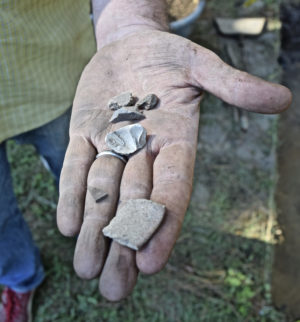
Artifacts recovered from the 2017 excavated unit at the Harriot workshop/science center site. They were found within the back-fill from the old Harrington excavations. At least two of the fragments are 16th century ceramic ware.
_____________________________
The North Side Story: Clues to the Lost Colony
A number of accounts and theories have been advanced over the years by historians and scholars about the fate of the ‘lost colonists’. But recent archaeological investigations may be shedding new light…………
Site X
Most archaeologists who have been involved in the ongoing research related to the first English colonial ventures on the present-day Outer Banks would say that it was unlikely that everything happened in one place. As Swindell maintains, the early expedition operations and colonial attempts likely extended beyond the single settlement locale most often depicted in popular perception. The first two voyages spent much of their time in and around Croatoan — Hatteras Island — where they initially encountered the Croatoans and established a friendly, mutually beneficial trade relationship. This is where they met Manteo, the great friend, ally, and interpreter for the early colonists, and who also famously visited with the Queen on his first voyage to England. And based on the historical accounts alone, we also know that Raleigh’s explorer-colonists were keenly interested in exploring into the interior of the land, with the prospect of claiming and settling new territory and tapping into new resources for the English Crown. The Virginea Pars map, originally drawn by John White, shows a strong interest in what is today the western Albemarle Sound. Indeed, according to White, there were plans to “remove 50 miles into the Main” from Roanoke Island. Combined with the evidence of White’s map, that would place their intentions into the lands bordering the western Albemarle Sound.
Could this be where at least some of the members of the ‘lost colony’ ended up?
Archaeologists of the First Colony Foundation think this is an explanation that cannot be dismissed. Established in 2004, the First Colony Foundation has been dedicated primarily to conducting archaeological and historical research on American beginnings related to the Elizabethan expeditions and colonies of the 1580’s.
“Work and resources shifted away from Roanoke to the Salmon Creek area (adjacent to the western Albemarle Sound) after about 2009,” said Swindell. “With pending construction of new developments in the area, the James River Institute (a cultural resources management firm) was enlisted to survey the area. One of the sites surveyed yielded early ceramics that hinted at a European presence that appeared to predate the later colonial settlements of the area.”
The Salmon Creek site (now popularly referred to as “Site X”) was actually first identified in 2007 through an archaeological shovel test survey and later through test pits. During the surveys, archaeologists recovered a mix of Native American and early English ceramic artifacts, artifacts indicating evidence of 17th and 18th century English activity or settlement. But some of the ceramic fragments, based on later expert examination, suggested late 16th century, the time of Raleigh’s expeditions. Subsequently, the First Colony Foundation began excavations at the site in 2012—and this is where the story really took off. It began when Brent Lane, professor of Heritage Economics at the University of North Carolina at Chapel Hill, requested the British Museum to examine White’s 1585 Virginea Pars map. The document was being used by the Foundation to inform their research and surveys in the area. “We noticed the patches on the White map and asked the British Museum to place the map (the original being located at the Museum) on a light table,” said Swindell. “This revealed a symbol or shape beneath that looked much like a fort. We had already done work in that area, so we went back to look at it again, what had been found (the early ceramics), and renewed excavations there.”
What they discovered, and the resulting interpretation of the finds, has since become a major media splash that has captured the attention of the general public and scholars alike. Beginning in 2012 and ending in 2017, with each season lasting from 7 to 10 days, archaeologists dug a total of 53 two-meter-square units over 2,250 square feet, recovering a variety of artifacts and features providing evidence mostly of a Native American, but also, to a much smaller degree, a possible European/English presence. Most noteworthy were objects, for these purposes, consisting of 40 sherds representing perhaps 6 or 7 vessels of 16th century Surrey-Hampshire Border ware; 8 sherds representing a North Devon plain baluster jar—both types of ceramic ware commonly used during the 16th and 17th centuries, the baluster jar having been typically used as a provisioning jar on sea voyages; two tenter hooks, of a type similar to that used at the early Jamestown settlement and possibly used to stretch canvas (sail cloth) to create temporary shelters or to stretch and dry animal skins; and an aiglet of the type that would have secured Elizabethan clothing, among other artifacts. The finds were generally concentrated in two of the 53-unit total excavation area. It is worth noting that the artifacts are also significant in that the earliest recorded presence of English settlement in the western Albemarle Sound area did not occur before about 1655.
So what do these finds mean? Is this evidence of the lost colony?
Perhaps. But the accounts of the Raleigh expeditions also record initial exploratory forays westward into the mainland under the leadership of Philip Amadas and Ralph Lane, leaders of the first expedition in 1585. Could the artifacts represent traces of those ventures?
The Foundation report dismisses this explanation. “The excavation of domestic table wares from several different diagnostic vessels along with other less diagnostic, but possibly contemporaneous artifacts, strongly suggests that the above mentioned European presence was of a longer duration and the activities different from those recorded for the pre-1587 English exploration of the lower Chowan River basin [as documented in the historical record].”***
But were the artifacts simply transported there by the Native Americans through trade? Possibly—Site X is primarily a Native American settlement site, and the native inhabitants of the time had a known, active trade network. The early colonists exchanged goods with them as needs dictated. European objects, unique and novel to the native inhabitants, were highly valued, especially items of iron, iron tools, objects made of copper, and glass Venetian beads. But, reports the Foundation team, “missing at Site X are the most common trade goods, like beads…….fragments of European pottery do occur in a few VA/NC Indian site assemblages that probably date as early as the 1660s, but they are not common, and it seems that ceramics were not routinely carried into Indian country by traders until the mid-1700s.”*** The report further notes that there are no records that indicate the presence of European traders in the area prior to 1655. And even the Native American artifacts provide some clues, suggest the report authors — “preliminary analysis of the Colington series [a type of Native American pottery] ceramics from Site X suggests that this phase of Carolina Native American occupation occurred before the 17th century. Years of regional research informs us that this shell-tempered ware is representative of the Carolina Algonkians, or the group of Native American Indians occupying the region at the time of Elizabethan exploration in the 16th century.”***
Nonetheless,”we do not have the smoking gun,” said archaeologist Nicholas Luccketti, director of the Site X excavations. “We have no features of European-built structures. We have not found a fort. Nor do we claim to have found the main relocation site or even the main group of the 1587 Roanoke colonists” at this site. “Quite the contrary, we believe that a small number of Roanoke colonists resided for a few years at Site X—a contention based on circumstantial evidence.”****
The First Colony Foundation team thus suggests that any habitation by Roanoke colonists at the site may have only consisted of a small surviving part of the original 1587 group, similar in vain to the accounts acquired by some Jamestown colonists from the Native Americans about the presence of other ‘white people’ in other places in the region, as later recorded on the Zuniga map of 1608. (The reported locations were placed on a map of the region, the original having been lost. But a Spanish spy sent a copy, the so-called Zuniga Map, to the Spanish court. The map indicated two locations along tributaries to the North Carolina Sounds where survivors of the 1587 colony may have resided).
Site Y
Notwithstanding the intriguing implications of Site X, it was not the only site where the First Colony Foundation uncovered some fascinating new clues. Most recently, archaeologists excavated at a location near the Chowan River, north of Site X. Here, after surveys and subsequent excavation of 72 test units, they unearthed what was identified as 16th century pottery sherds—London redware, a North Devon baluster jar, Spanish olive jars, Martincamp stoneware, Essex fine redware, and, like that found at Site X—Surrey Hampshire borderware. In all, this collection of sherds exceeded that found at Site X, and the archaeological team has concluded that the ceramic-ware finds were likely not the result of trade, in which the Natives acquired them earlier from Europeans and retained and used them for some time after. According to Lucketti, the finds suggest that there was a small contingent of colonists for a short time period at this location, much like Site X. The finds point to the possibility that the original colonists at Roanoke split up into smaller groups or families, some of them moving inland to locations like that of Site X and Y, others perhaps to Hatteras. But the jury is still out on where the main, or larger, body of the 1587 colonists may have moved or settled.
The First Colony team is now deliberating on where to go next. The story unfolding for this region remains wide open.*****
________________________________
Excavations at the Salmon Creek site, or ‘Site X’. Courtesy First Colony Foundation, from the previous article published on the same subject.
________________________________
16th century aiglet excavated at Site X. This was typically used to secure clothing, much like a button. Courtesy First Colony Foundation, from the previous article published on the same subject.
________________________________
Sherds of yellow and green glazed Surrey-Hampshire Border Ware, excavated from Site X. Courtesy First Colony Foundation, from the previous article published on the same subject.
________________________________
Assuming that what the Foundation archaeologists are suggesting is true, what about the rest of the colonists? And what about the letters White observed carved into a tree and post at the abandoned 1587 colony site, which seemed to indicate that the colonists had moved to live with or near the Croatoans, who inhabited present-day Hatteras Island at the time?
Compelling new evidence unearthed on Hatteras Island may provide some clues………….
The South Side Story: Area 31DR1, The Hatteras Excavations
As is often the case with archaeology, the first leads to making discoveries sometimes begin with random findings made by locals and non-professionals. This was the case for Hatteras early in the 20th century when, for example, a mostly intact 16th century Spanish olive jar was found by local islander Eustes White; an “old sword’, along with bones, buttons, arrowheads, and a pot were reportedly found by another local Charles Miller; and a Nuremburg token (casting counter that looks like a coin and used, for example, on 16th century ships to count inventory), was found in the 1930’s and later brought to the attention of archaeologist J.C. Harrington by a Hatteras local named Tandy. Harrington was excavating (from 1947 and 1953) on Roanoke Island at the time. Reports like this also likely led to survey work by the National Park Service, which designated the island, and particularly an area near Buxton, as a location of archaeological interest —what became known as Smithsonian designated area ‘31DR1’.
To be accurate, the archaeological record on Hatteras Island, both discovered and yet undiscovered, is overwhelmingly reflective of the indigenous Native American populations that have historically inhabited the island for thousands of years, extending back deep into Paleolithic times. The most numerous finds and archaeological features uncovered thus far represent the native groups of the Late Woodland Period (AD 900 until 1650), particularly that of the Croatoan culture. This was also a time period, especially in the 17th century, when this indigenous society underwent significant social and cultural transformations through contact with the new European arrivals. The beginning of this contact period has formed the context for understanding what was happening on the island during and after the time of Raleigh’s initial exploratory and colonization efforts from 1584 to 1587.
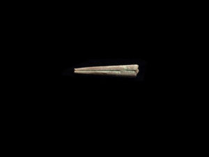
It was in area 31DR1 where perhaps some of the most sensational finds were uncovered by archaeologist Dr. David Phelps of East Carolina University and his team during a full scale archaeological excavation beginning in 1998. Along with an abundance of both Native American and European artifacts — mostly Native American — including such objects as lead shot, Native and European pipe fragments, nails, glass beads, copper items, bricks, ceramic ware, and glass fragments and bottles, they uncovered a late 16th century snaphouse gunlock and a well-preserved 16th century style bronze signet ring. Though no more important archaeologically speaking than the other finds, these latter two items became the ‘poster child’ finds from the excavation, garnering the attention of local and national media reporters and writers. The finds became a sensation not only because these were the ‘sexiest’ objects found, but at least in part because they were pulled from carefully recorded, stratified deposits through systematic, professionally controlled excavations — not random surface or digging finds happened upon by local adventurers or others going about their own business or hobbies. And they were clearly evidence for the presence of, or trade with, late 16th century Europeans on Hatteras Island.
___________________________
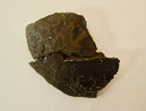
The 16th century gunlock. Courtesy Dr. David S. Phelps and Charles L. Heath, from the previous article published on the same subject.
___________________________
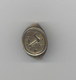
The bronze signet ring. Courtesy Dr. David S. Phelps and Charles L. Heath, from the previous article published on the same subject.
___________________________
Fast forward to 2007, when local heritage enthusiast and historian Scott Dawson self-published a book entitled Croatoan: Birthplace of America, which, along with word of mouth about Dawson at an event at the Festival Park in Manteo, caught the attention of attending archaeologist Dr. Mark Horton of the University of Bristol (UoB). Horton, already interested in the history of the Outer Banks as it related to the first English attempts at colonizing the Americas, connected with Dawson. A number of discussions and email exchanges later, and Horton and PhD candidate Louisa Pittman and other UoB students were on the island in November of 2009 conducting test pits and full scale excavations, with the sponsorship and help of volunteer members of the newly formed Croatoan Archaeological Society. Dawson, one of the founders and now President of the organization, was among the participants of these excavations. Within the first few years of careful and painstaking digging and recording, they encountered some intriguing new finds and, like those of the previous Phelps excavations, they generated public notice through a flurry of news and magazine articles……….
Whisperings of a Vanished World
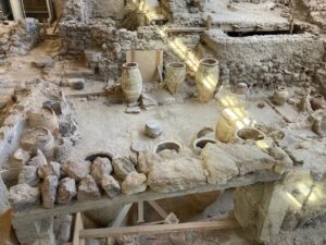
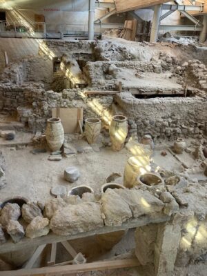
When traveling south along NC 12, the main road or highway through the tiny town of Hatteras Village at the southern tip of Hatteras Island, it is easy to miss the little, and only, public library. It is a component of a larger set of buildings that define the town’s community center. It might typify the kind of library one would naturally expect for a community this size, except for one thing—this facility features, at least archaeologically speaking, Hatteras Island’s biggest claim to fame—artifacts that tell a story of Croatoan Native Americans who inhabited the island and built a thriving culture here centuries ago. Along with these artifacts are objects that also evidence the presence of Europeans near or among them as early as the late 16th century—the time of the ‘lost’ colony.
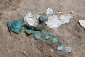
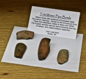
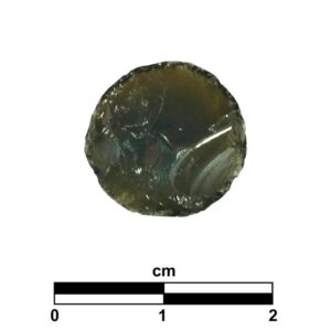
I met Dawson there early one bright October morning. With masks donned (COVID-19 precautions were still in full force), he led me into the library, and more specifically, a large room facilitated to exhibit some of the “star” artifacts excavated by archaeological teams over the years. According to Dawson, these represented but a tiny fraction of the thousands of cultural and faunal finds unearthed by Horton and his mixed team of students and volunteers over recent years at several sites in the Buxton/Frisco/Hatteras Village area. It was “a ridiculously high number,” said Dawson. “Enough to fill a garage with bins—mostly bits of brick, glass, pig teeth, peach pits, pottery, pipes, little copper squares and hooks, net weights.” Consisting mostly of artifacts and other finds related to the Native American inhabitants of the island, the massive haul is now housed and managed at a storage facility in Currituck, far to the north on the North Carolina mainland. What we saw in this refitted library room was, however, according to Dawson, the really “sexy stuff”. He led me to a large, glass climate-controlled case wherein laid the star attractions of the exhibit—the late 16th century European artifacts unearthed during the Horton team’s 2012-2013 seasons. They included a silver ring—likely once belonging to a woman, given its finger size; an Elizabethan period copper aiglet (likely used at one time to secure the end of a shoe lace); a smelted copper bun, the product of smelting typically done during the European metallurgical operations performed in the area by the earliest European arrivals; a 16th century firebar, also a product of 16th century metallurgy; a 16th century brass apostle that once held gunpowder; a fragment of a 16th century Germanic stoneware jug; a 16th century Nuremberg token; a 16th century glass arrowhead, fashioned from European glass; a 16th century lead pencil and writing slate fragment featuring drawing and other clearly human-made markings; and perhaps most interesting of all—a fragment of a 16th century swept hilt rapier. Some of these objects were not typical items valued for trade by the Native inhabitants, based on what scholars know from historical documents. And aside from the type style of the individual artifacts, the excavation layer in which these artifacts were found was dated to the late 16th century—the time period of the “lost” colony—so they were likely not objects long held over from a previous time period and deposited in sediments dated to a later time. They were all located among other finds of a Croatoan village, also likely a village that flourished during the late 16th century, as the Croatoan pottery sherds found within the mix were characteristically or stylistically typical for pottery made and used by the Native Americans before the 17th century. “Almost all natives on the east coast had a particular style in the 1500s where the lip of the vessel flares out then curves in then back out so that it’s like a backwards “S” or a “z” with curves,” said Dawson. “The Native pottery in the 1600s is straighter, on the whole smaller and in my own opinion less decorative.” Moreover, added Dawson, “the big change in the 1500s vs 1600 is the absence of glass beads [a popular trade item between the Europeans and the Native Americans] and tidewater pipe bowls we find constantly in the 1600s.”
Artifacts were not the only hints to a 16th century European presence. One of the special skills archaeologists acquire is the ability to recognize and identify the subtle changes in soil texture, color and consistency as they dig progressively down through the layers. Like shadows in the earth, the various forms of things, especially organic objects such as wood that disintegrated over time, leave behind their effects in the sediment. Horton and his team encountered and mapped numerous postholes left by the wood frames of the Croatoan houses and other structures. These postholes were typically round. But among them were larger, square postholes, as well—not a feature ever found related to Native American structures, at least in this region of the country. Dawson suggests that these were the traces of 16th century European structures/houses. And they could not have been from the first two Raleigh expeditions, which were largely military—based on historical documentation, they sojourned in this area in tent. The square postholes had to evidence a more permanent European presence. Could these have been structures built by the “lost” colony among the Croatoan villagers?
As exciting as these artifacts are, Dawson believes that most people who come to visit this place are really ‘missing the elephant in the room’. For him, perhaps the bigger story is how an entire nation of Native Americans, the Croatoans, largely vanished from American history, forgotten in the limelight of the history that is typically taught in American schools and American history books. This needs to change, he says. The countless artifacts uncovered in the excavations provide a testament to this lost history.
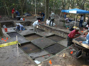
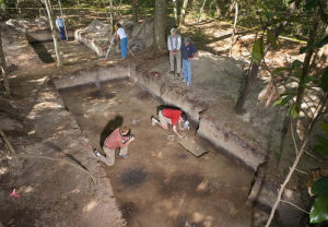
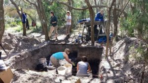
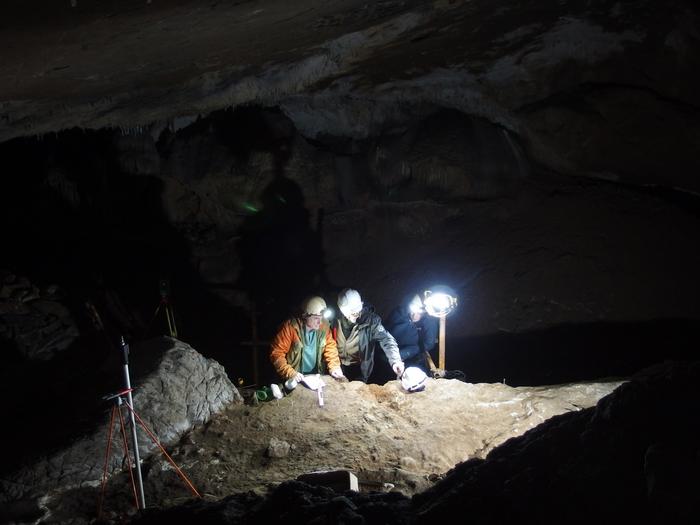
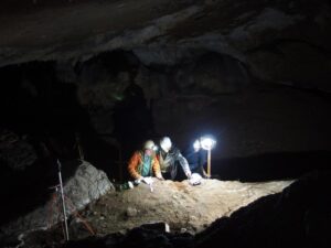
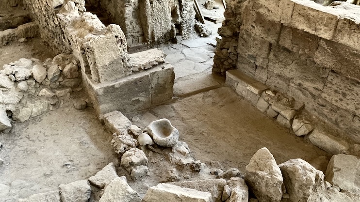
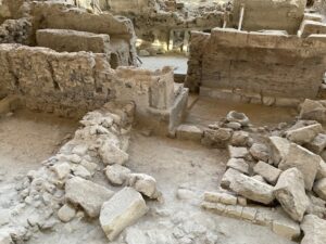
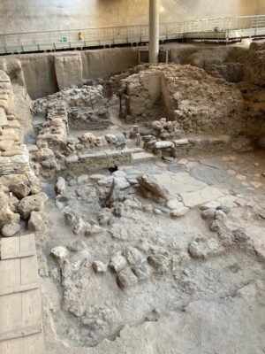
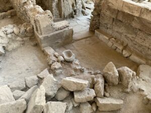
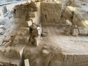
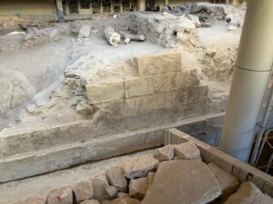
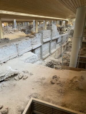
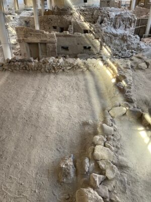
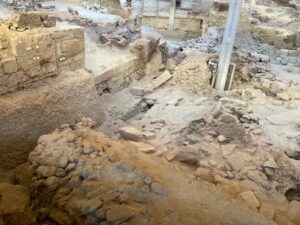
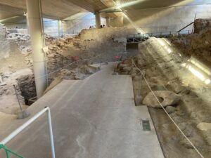
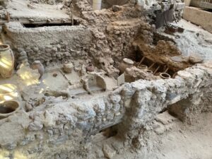
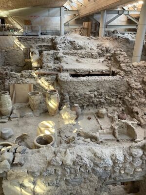
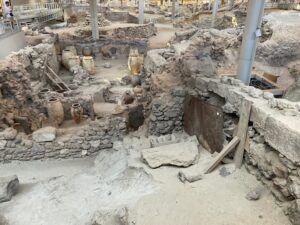
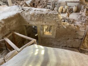
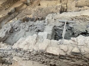
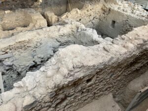
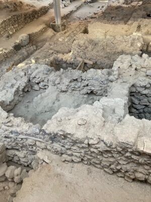
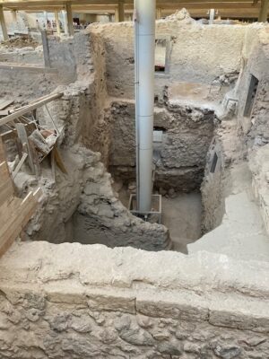
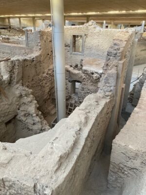
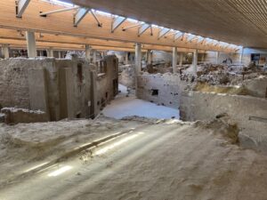
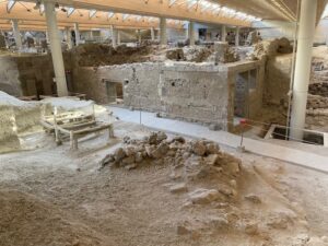
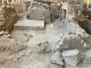
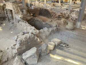
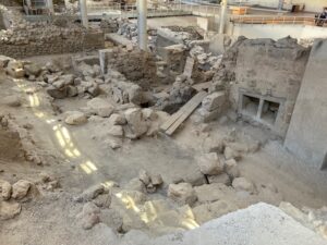
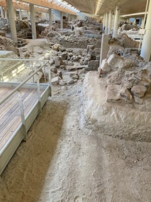
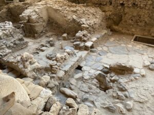
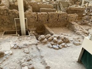
__________________________________
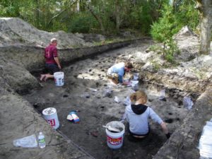
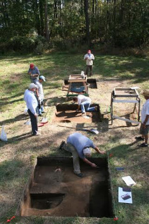
Above and below: The excavation team at work at two of the Hatteras Island excavation units. Note the numerous postholes. Courtesy Croatoan Archaeological Society
__________________________________
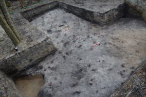
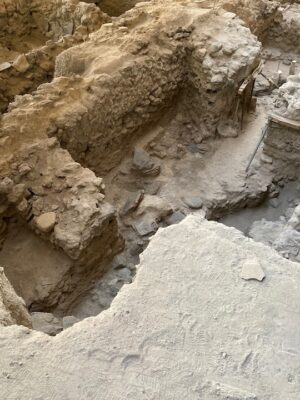
A t trench excavation unit, showing how the soil gives clues to history. Courtesy Croatoan Archaeological Society
__________________________________
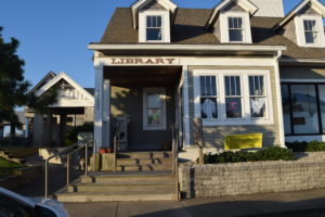
The library in Hatteras Village where the artifacts are currently on display for the public.
__________________________________
The copper aiglet, or shoelace tie, dated to the 16th century. Found in a purely Native context along with the Nuremburg token, silver ring, copper bun, and fragment of 16th century German stoneware. Courtesy Croatoan Archaeological Society.
__________________________________
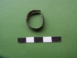
The silver ring, found in a 16th century context. Courtesy Croatoan Archaeological Society.
__________________________________
The copper bun. It is formed by smelting copper and then pouring it into a mold to cool, which creates the bun shape shown here. This type of metalworking was not done by the Native Americans during the 16th century, the date of the context from which this bun was excavated. It was found in the same 16th century layer as the Nuremburg token and other objects.
__________________________________
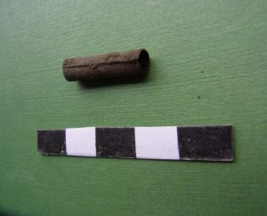
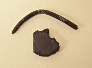
Iron firebar, used in metalworking, found next to the copper bun.
__________________________________
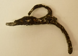
A 16th century apostle, or gunpowder flask, found in the excavations. This was hung across the chest like a bandolier. An identical apostle was found on an Elizabethan shipwreck.
__________________________________
The 16th century lead pencil and part of the writing slate.
__________________________________
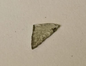
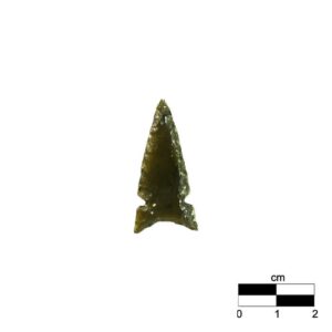
Arrowhead, made by the Croatoan villagers from European glass.
__________________________________
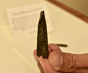
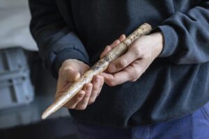
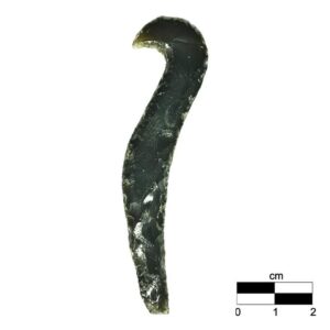
Above and below: The 16th century swept hilt rapier fragment.
__________________________________
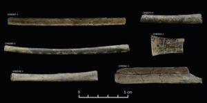
Lead shot and lead shot waste found during the excavations. The lead shot was found less than 100 feet from the location of a 16th century gunlock found in a previous excavation. Courtesy Croatoan Archaeological Society
__________________________________
__________________________________
Following the Tokens
This much is certain: the ongoing search for the “lost” colony’ on Hatteras Island is not over. For one thing, one find may likely open a new chapter — the Nuremberg token found by Tandy on Hatteras in the 1930’s that ended up in the hands of J.C. Harrington in the 1950’s while he worked at the early Roanoke excavations. It matched two of three almost identical tokens found on Roanoke. Moreover, another identical token was unearthed later during Horton’s Hatteras excavations in 2013. The first token found by Tandy had no provenance in terms of excavation. But the token recovered on Hatteras in 2013 had a clear provenance documented through systematic excavation. It was stratified — confirming that the token dated to the 16th century.
Horton was keenly curious about where the Tandy token was originally found on Hatteras. Doing some research on his own, fellow excavator Dawson found the answer. A copy of a report by archaeologist William Haag from previous investigations indicated the latitude in which the token was found. With this, Dawson led Horton to the general location in which the token was found by Tandy in 1938. Nowhere near the location of Horton’s recent excavations — the site of the Croatoan village — this raised another question: how did it get there, and why so far from a habitation site?
_________________________________
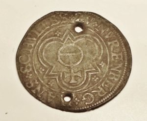
The Nuremburg token found decades ago in the area of the possible ‘fort’ location on Hatteras Island. Courtesy Croatoan Archaeological Society
_________________________________
To Dawson and Horton’s knowledge, no excavations had ever been conducted in this area, so absence of evidence did not necessarily mean evidence of absence. Compounding things, this location was on private property, so Horton and his team had no permission and mandate to do any test digging. But as an archaeologist familiar with the array of new tools available to archaeologists today, Horton knew what to do. He employed a drone, equipped with remote sensing technology, to conduct an aerial survey of the area of the property in which the token was found. With this, Horton hoped to detect any evidence in the landscape that would provide clues to any structures or possible human activity leaving its mark in the landscape in the past. After the drone had completed its work, the data was entered into a computer for imaging.
What they found did not disappoint.
Imaging revealed evidence of a perfectly rectangular formation, a feature that could not be seen standing at ground level. It was certainly not a natural feature. It had to be human-made. Someone, at some time in the past, had created or constructed something on this ground. It was in a field at an elevated point, surrounded on three sides by woods and a good view of the sea on the remaining side. According to Dawson and Horton, this would have been an ideal strategic location for a fort or colony ‘survivors’ camp’—good for keeping a watch on the Spanish along the coast and perhaps the still hoped-for returning resupply ships with John White — and not too far from their supportive friends, the Croatoan.
I asked Dawson during our discussion at the library why he referred to this finding as a possible ‘fort’. He led me over to a table within the artifact exhibit and flipped to a blank page in the exhibit guest book. Grabbing a pen, he drew a rough outline of the image their remote sensing revealed. It was a rectangle to be sure, but on at least two of the rectangle corners he drew square extensions—resembling in principle the same bulwark features discovered at the corners of the James Fort remains unearthed much farther north at Jamestown in Virginia, though the James Fort bulwarks were round in shape. The remote sensing imaging was not clear enough to determine the presence of similar extensions on the other two corners. In addition, said Dawson, the imaging map revealed another interesting feature—possible square postholes positioned within the area encompassed by the rectangular boundary. Was this evidence for support for a large structure within the ‘fort’? One could only speculate at this point.
Though the fort hypothesis was mere speculation, Dawson felt it was worth future investigation, once permission from the landowner was obtained to explore the matter further. “This will be a future activity of our project,” said Dawson.
Finally, and most recently, in April, 2025, archaeologists uncovered large amounts of hammerscale, a flaky or spheroidal byproduct of the iron forging process, dated to the time period of the lost colonists. While the hammerscale was recovered from a location of Native American habitation, metal-working was not within the technological culture of the natives. This material and skill is known to have come with the English settlers. It is suggested as further evidence that the colonists had encountered or joined the Croatoans and were subsequently assimilated into their community.
There is still plenty of work to do analyzing, interpreting and reporting the results of past, current, and future excavations.
The Myth of the Lost Colony
According to Dawson, archaeologists plan to return to the area during the spring of 2021 to continue the investigations. Though there is far more work to be done on Hatteras, Dawson believes that a workable hypothesis for the fate of the lost colony can already be formulated. “The lost colony is a myth created in 1937 by a play of the same name,” he explains. “When the governor [John White] returns with resupplies the colony has vanished, leaving behind no trace except for the word Croatoan carved onto a tree. In the myth no one knows what this word means. This mythology is also taught in schools and it is completely false. In reality, the colony was never lost and the word Croatoan has always been understood. Croatoan is on the maps from the time and even the latitude of the inlets is given. This is why we began to conduct archaeology on Hatteras Island, then known as Croatoan. And alas, we found them exactly where the colony indicated they had gone. This is the story of what we found, literally bringing the truth to the surface. This colony was never actually lost nor was the word Croatoan ever a mystery. The two peoples assimilated together and the archaeology demonstrates this beautifully.”
Saying goodbye to Dawson and thanking him for his valuable time and insights, I hopped back into my car. It would be a long drive up that lonely river of sand back to Nags Head — and perhaps back again to that museum at Fort Raleigh National Historic Park on Roanoke Island, where some of the most important finds of the Roanoke excavations are still housed and exhibited.
The story hasn’t ended. In December, 2021, a small group of volunteers, again under the direction of Horton, returned to dig near Buxton. What they uncovered was not inconsistent with the kinds of finds they have already encountered. Among them: Thousands of shards of Croatoan pottery; a grinding stone for corn; brick; animal bones and remains of shellfish; copper; iron nails; a bronze button; window glass and daub from a 16th century home structure; a dagger handle; a saker cannon ball (usually fired by a medium cannon, slightly smaller than a culverin, developed during the early 16th century and often used by the English); metal sea chest handles that had been modified into tools; dozens of pipes, both English and Croatoan; lead shot; glass beads; redware; a frizzen (part of a gunlock); and an English Tudor Rose decor that was once part of a horse bridle.
Not a bad haul, that.
Note: The author asked Dawson if there were plans to return again to excavate. “Yes,” he responded. “But the main focus with all we have found over the years is to build a museum on the island to showcase it all.”
______________________________
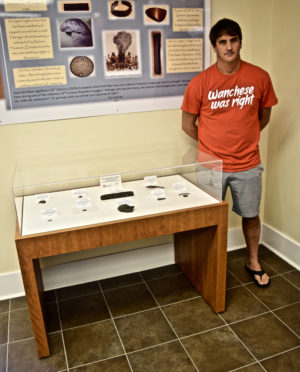
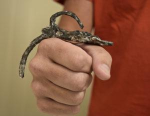
Scott Dawson, standing next to the case where the key artifacts are on display.
______________________________
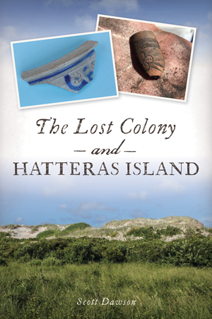 You can read in much greater detail about the history and discoveries on Hatteras Island related to the lost colony by purchasing the book by Scott Dawson at Arcadia Publishing. You can also read more about the archaeological project and how to donate by going to http://www.cashatteras.com/ .
______________________________
* From Thomas Harriot’s “A Briefe and True Report of the New Found Land of Virginia”.
** From Richard Hakluyt, Principal Navigations, Voyages and Discoveries of the English Nation (1600).
*** From First Colony Foundation Report, An Archaeological Brief for Site X.
****From Nicholas Luccketti’s remarks at the OBX History Weekend Symposium, October 27-28, 2017, on Roanoke Island.
***** Kozak, Catherine, ‘Lost colony’ moved inland: Archaeologists, Coastal Review Online, October 16, 2020.
______________________________
Cover Image, Top Left: Painting by Englishman John White. Sir Walter Raleghi’s 1590 Expedition to Roanoke Island to find the Lost Colony uncovered ‘Croatoan’ carved on a tree. This may be in reference to the Croatan island or people. Public Domain, Wikimedia Commons
Advertisement


.jpg)
.jpg)