In the early 20th century, architects turned to a newly discovered past to craft novel visions of the future: the ancient history of Mesopotamia. Eva Miller traces how both the mythology of Babel and reconstructions of stepped-pyramid forms influenced skyscraper design, speculative cinema in the 1910s and 20s, and, above all else, the retrofuturist dreams of Hugh Ferriss, architectural delineator extraordinaire.
In a dramatic, monochrome rendering in ink and charcoal, a fractal of pyramids and steps regenerates at different scales and angles. Vertiginous towers, the tallest outgrowing the frame, ascend from a base of tiered structures—or ziggurats—rising in regular terraces. The roofs of lower blocks are dotted with minuscule trees that echo the larger, man-made shapes around them. They are the only living things visible at this scale, but an accompanying text tells us that this skyline is populated with people who enjoy the city’s elaborate roof gardens, sun porches, and open-air swimming pools.
This was how Hugh Ferriss imagined the future of urbanism in his treatise Metropolis of Tomorrow (1929). Born in St. Louis in 1899, Ferris trained as an architect and forged a career for himself in a role for which he invented his own job title: “architectural delineator,” bringing other architects’ projects to life on paper. His portfolio, now held by the Avery Art and Architecture Library at Columbia University, speaks to his proximity to numerous major works of modern architecture and engineering, including renderings of Rockefeller Center, Works Progress Administration infrastructure projects, World’s Fairs, United Nations buildings, and various mysterious, unnamed structures of his own imagination—visions swimming up to us through Ferriss’ dramatic wash of line and shadow.
City of Tomorrow
Metropolis is a portfolio of Ferriss’ images, annotated with reflections on the work he had participated in and the architectural changes he had witnessed during recent decades, when American cities, especially his adopted home of New York, exploded upward. He made modest trend forecasts for the near future: glass, he predicted, would be huge (true); hydroplanes would be everywhere (sadly not).
In the final, most memorable section of the book, he sketched a distant City of Tomorrow. This city would be planned along rational lines to maximize human health and spiritual happiness through a three-part plan with districts for art, science, and business, each centered on aesthetically appropriate superblocks.
Ferriss’ dramatic depictions of towering skyscrapers and lofty perspectives became, as media scholar Eric Gordon argues, the means by which “the image of the American urban future in the popular imagination took shape.” His futurism anticipated and influenced Norman Bel Geddes, as he created his Futurama for the 1939 New York World’s Fair, the Walt Disney Company’s Tomorrowland, TV’s “The Jetsons,” and numerous other prognostications of the rational planned city, the elevated expressway, and the heliport.
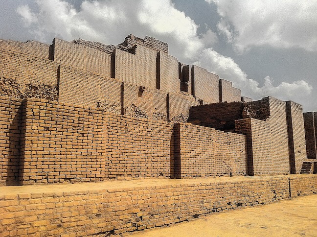
Yet Ferriss’s forward-looking vision also repeatedly evoked the ancient past. The pyramid skyscraper that he promoted was, in his own description, a “modern ziggurat,” the monumental architectural form of ancient Mesopotamian cities. Centered in modern-day Iraq, both Assyria and Babylon were geopolitical superpowers of the first millennium BCE, empires discussed in both biblical and classical traditions, which had once been considered lost to the desolating force of time. Beginning in the mid-19th century, the crumbled remains of ziggurat towers had inspired speculative reconstructions.
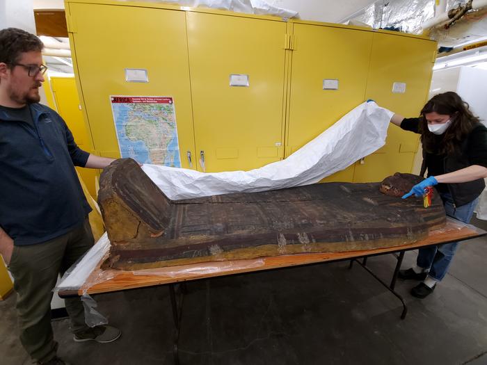
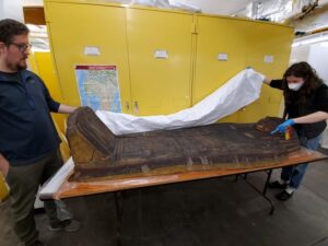
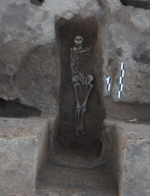
By the 1920s, German excavations had exposed the well-preserved urban fabric of Babylon’s 6th-century BCE city walls and gates, parts of which were also partially reconstructed in Berlin’s Pergamon Museum, looking rather Art Nouveau. Meanwhile, the nearby city of Ur was being excavated by thousands of workers in digs sponsored by the British Museum and the Penn Museum, turning up mass burials of gold-bedecked bodies. These new discoveries stirred those who read about them in the popular press to imagine an antiquity that was also somehow strangely modern: The women’s fashion in the Ur burials led to press jokes about the dead bodies being traces of the original flappers.
Ferriss was clearly not the only person who thought there might be some connection between the urban spaces of ancient Babylon and Assyria and the cutting edge of modernity. At a time when being modern, especially in architecture, often meant explicitly rejecting historical reference, it is notable how much the idea of an original urban form structured visions of the future.
Learning From the Past
At the time of Ferriss’ Metropolis, a question had bedeviled modern architects for decades: What could be learned from the traditions of the past? Were the great buildings of antiquity, particularly of classical Greece and Rome, eternal blueprints, a standard never to be bettered? Architectural training programs in the United States during the early 20th century suggested this was the case. But increasing numbers of builders worried that the adulation of the past produced dead, stagnant structures that were irrelevant to the modern world.
Wherever they came down on this matter (and there was a wide middle ground), numerous commentators with different aesthetic preferences could agree on damning random and eclectic historical borrowing—even if they might have disagreed on what constituted an example of that tendency.
Perhaps no writer treated this historicizing, classicizing eclecticism with more vitriol than the perpetually worked-up Ayn Rand. Her architectural-philosophical melodrama The Fountainhead, published in 1943 but set during the years that Ferriss was writing, was an insightful, if unsubtle, rant against these trends. She castigated architects who “competed on who could steal best, from the oldest source and from the most sources at once,” resulting in “shingled post offices with Doric porticos, brick mansions with iron pediments, lofts made of twelve Parthenons piled on top of one another.” She imagined a benighted public who celebrated a skyscraper which “offered so many columns, pediments, friezes, tripods, gladiators, urns, and volutes that it looked as if it had not been built of white marble but squeezed out of a pastry tube.”
Ferriss was against this kind of inauthenticity, too, advocating that modern buildings must follow the diktat of America’s great modernist innovator, Louis Sullivan: Form ever follows function. Architects of the future, Ferriss assures us:
“…will dismiss, as sentimentality, the notion that architectural beauty was once and for all delivered to the builders of ancient times. The employment of modern construction to support what are little more than classic or medieval stage sets, they will look upon as, at its most harmless, a minor theatrical art, but no longer as being Architecture.”
He mocked this kind of “stage set” architecture in an illustration of the “Reversion to Past Styles” for Metropolis. He bemoaned this tendency’s persistence “despite the logical, and sometimes impassioned, pleas of leaders in modern design.” Still, stacks of “the same conventional forms” were appearing, and Ferriss believed it was his “duty to show what would happen if architects continued piling Parthenons upon skyscrapers!”
Ferriss nonetheless found in the past some examples of an ethos, if not an aesthetic, to imitate. He explained: “It can be recalled that there have been periods in the past when architects must have been quite aware of the influence of Architecture and consciously employed it for a specific object. Moreover, it is precisely these periods that are still spoken of as the ‘great periods’ of Architecture.”
His illustrative example is the Gothic cathedral, intended by its builders, through its very form, to exert “an influence for the betterment of mankind… It would seem, in fact, that Architecture was here consciously employed for no less an object than the elevation and evolution of Man.” This decidedly futurist conception of architecture’s possible benefits (“elevation,” “evolution,” and “Man” with a capital “M”) had a venerable, historical precedent.
Ferriss’ distinction—between mere regurgitation, on the one hand, and a deeper appreciation of the eternal power of certain forms and practices, on the other—was also made by architects who agreed that there might be lessons to be drawn from the approaches of medieval and ancient civilizations. The Swiss modernist Le Corbusier, perhaps the most famous prophet of planned future cities, cited the Parthenon as the apogee of an architecture of basic geometric forms, a “pure creation of the mind,” evoking “emotion of a superior, mathematical order” and embodying a spirit of “imagination and cold reason.” He detected an analogous spirit at work in the design of the telephone, the airplane, and the automobile.
Louis Sullivan agreed. In the same article in which he argued for form to follow function, Sullivan cited rare periods when architecture was a “living art,” which had produced “the Greek temple, the Gothic cathedral, the medieval fortress”—a grouping he argued was now being joined by “the tall office building.” In all of these examples, radical designs enabled by new technologies were nonetheless produced by the same animating spirit, the same eternal dicta, as the enduringly powerful forms of the past.
The Tower of Babel and Modern Babylons
While Greek temples and Gothic cathedrals were often cited in this period as architecture done right, they were also models tarnished by poor and unsuitable imitation and inauthentic to modern materials and methods of construction. For thinkers wary of mere historical reproduction but nevertheless in search of essential or eternal forms, ancient Assyria and Babylon were appealing places to turn to due to their simultaneous associations with modernity (a “newly discovered” past) and originality.
This latter association was forged both by historians who drew on archaeological evidence to identify these civilizations of ancient Mesopotamia as the cradle of (Western) civilization and by the enduring cultural power of one of the most familiar and transmitted stories about the origins of monumental architecture: the Biblical Tower of Babel (or Babylon—merely two English renderings of the same place name).
Western artistic traditions had often visualized the Tower of Babel as a spiral, a form that Frank Lloyd Wright famously adopted and described as a ziggurat or, when turned upside down for the Guggenheim, a “tarrugiz.” As historical knowledge of ancient Iraq grew in the latter decades of the 19th and early 20th centuries, archaeological reconstructions imagined the mythical urban tower as a stepped pyramid, similar to the descriptions of Babylonian buildings by the Greek historian Herodotus.
The brief but rich story of the Tower of Babel closes the series of primordial origin myths in the first part of Genesis: the end of humanity’s childhood. “Let us build ourselves a city and a tower with its top in the heavens, and let us make a name for ourselves; otherwise we shall be scattered abroad upon the face of the whole earth,” its builders resolve. God sees a threat in this cooperative venture, for humans who could complete such a project would be unstoppable, like gods. To prevent its completion, he turns their universal language into a nonsensical babble of tongues and scatters humans across the earth.
In the early 20th century, the Tower of Babel was frequently associated with the emerging skyscraper form. The reference had an ambiguous valence. It could express unease about the changing look of modern cities and anxieties about whether experimenting with non-traditional values (architectural or otherwise) was the first symptom of societal collapse on a biblical scale.
The Tower of Babel’s link with technological hubris dovetailed with associations regarding ancient sexual immorality, derived from Herodotus’ salacious reports of ritualized prostitution in Babylon and the New Testament figure of the “Whore of Babylon” in the Book of Revelation, where Babylon was a stand-in for the Roman Empire. In the late 19th century, it was low-rise London that was most often designated “Modern Babylon” after an 1885 series of articles published in the Pall Mall Gazette by its editor W. T. Stead exposed sexual trafficking in the city; the series was entitled, with reference to Herodotus, “The Maiden Tribute of Modern Babylon.”
The “babble” that the Tower of Babel triggered could also lend itself to associations with modern polyglot cosmopolitan spaces, which were both celebrated for their variety and damned for their dangerous racial ferment.
Yet as the skyscraper came to dominate the skylines of many American cities in the 1920s, designating a city a “modern Babylon” was increasingly meant primarily to invoke its architectural form. Absent from the connotations of sexual depravity or confusion of tongues, the association of skyscrapers with the never-bettered ancient tower was often merely a form of aggrandizement, a celebration of the technological wonders modernity could produce, coupled with perhaps a tinge of nostalgic hope that modern technology might facilitate a return to cooperation and human unity of purpose.
Hence: a 1908 article on the triumphant rebuilding of post-earthquake San Francisco as a record achievement for any “ancient or modern Babylon”; a 1923 article on the skylines of New York and ancient Babylon as “growing more alike every day,” in each case a “good advertisement” for urbanism; a 1924 article describing the University of Pittsburgh’s “Cathedral of Learning” skyscraper as a new Tower of Babel uniting all scattered tongues with “all the sciences and arts of the age of steel”; a 1929 review of the painter William S. Horton’s New York skyline scenes showing “a modern Babylon, as no Babylon ever was, burning in gold and luxurious color, a city rising far above its mere human inhabitants, and dreaming the long dreams of mingled past and future”; and a 1934 description of the Boulder Dam as “Modern Babylon,” representing “the application of all the newest knowledge engineering,” yet visually “reminiscent of long bygone days.”
Here, biblical associations were joined by classical Greek accounts expressing awe at Babylon’s magnificent monumental architecture, including the seemingly mythical Hanging Gardens, a watered and planted version of the ziggurat, and a canonical Wonder of the World.
The most famous mobilization of Babylon for a vision of futurity was another, better-known, Metropolis of the 1920s: the German director Fritz Lang’s 1927 epic film. The design of its futuristic skyscraper city, home of a “new tower of Babel,” in which an underclass toiled in the bowels of factories and the rich played erotic games on rooftop gardens, was inspired by the skyline of New York. The film features a sequence in which its kindhearted, revolutionary heroine tells the biblical Tower of Babel story to a meeting of workers, rendering it as a parable about exploitation and injustice. The heroine’s evil double, most famous for her android form, appears in a dream sequence as the Whore of Babylon, in minimal clothing.
Lang’s various evocations of Babylon show that he was thinking of grandiose architecture, sexual immorality, and doomed tyrannical political powers all at once. But he was perhaps also thinking merely about what worked as a cinematic spectacle. At the time, Hollywood’s most famous depiction of ancient Babylon was D.W. Griffith’s 1916 mega hit Intolerance, which boasted massive, riotously adorned sets of the ancient city. This Orientalist extravaganza and other similar epics with biblical settings—like the Austrian Sodom und Gomorra (1922), which featured an enormous ziggurat—provided Lang with a suitably monumental cinematic vocabulary to invoke other worlds, whether long gone or yet to come.
Ferriss and the Ziggurat Form
The ziggurat-skyscraper shape that Lang detected in the New York skyline was kindled by one regulation of outsized importance: the 1916 New York City zoning law that established maximum permissible massing for new buildings in the city. This law limited the total area of a lot that a building could occupy after a certain height, meaning that buildings would need to be “stepped back” as they rose, allowing sufficient light and air to reach surrounding structures.
The law effectively ended the possibility of simply building up in ever-higher boxes, a trend that had characterized skyscrapers before the law was passed. While the so-called “step-back skyscraper” emerged as a solution to a local piece of municipal legislation, the architectural historian Carol Willis has argued that, over the course of the 1920s, it would come to be understood by American critics and architects as the ultimate expression of a positive, and deliberate, aesthetic for American modernity. Outside of New York, other cities followed suit, and the step-back form became the paradigmatic shape of the skyscraper, as seen in the Empire State Building and Chrysler Building.
Ferriss was an evangelist for the forms encouraged by the 1916 zoning law. In 1922, he created a series of visualizations of step-backs in successive stages of abstraction. In Ferriss’ four-part sequence, the ziggurat, an ancient form, is revealed by this empirical, mathematical calculation of space as the answer for the future. Discussing this sequence of the “evolution of the step-back building” in Metropolis, Ferriss contrasts the pre-zoning Cube City with the post-zoning Pyramid City. A city of cubes is one in which each building “loses its essential identity,” whereas “no matter how closely pyramids are placed in rows, each preserves its essential individuality of form… which is essential to architectural dignity.”
No wonder, then, that in the whole of Metropolis, the ziggurat is the only ancient architectural form Ferriss evokes as a direct solution for the modern age: “The ancient Assyrian ziggurat, as a matter of fact, is an excellent embodiment of the modern New York legal restriction; may we not for a moment imagine an array of modern ziggurats, providing restaurants and theaters on their ascending levels?” Through Ferriss’s hand, the sacred architecture of ancient civilizations gets reimagined for the Jazz Age.
Ferriss’s interest in ziggurats likely had its origins in an act of imaginative reconstruction of a famous biblical structure with a better reputation than the Tower of Babel. In 1923 and 1924, the architect Harvey Wiley Corbett commissioned Ferriss to make a series of drawings for a reconstructed Temple of Solomon, the “First Temple,” destroyed by Babylonian troops in 585 BCE during the reign of Nebuchadnezzar II. This was no mere exercise of historical speculation: The temple was to be erected as a temporary structure at the 1926 Philadelphia Sesquicentennial Exposition, celebrating 150 years since the foundation of the U.S.
The mastermind of this project was John Wesley Kelchner, an eccentric New York native who spent his career pursuing reconstructions of Moses’ wilderness tabernacle and ultimately of Solomon’s Temple, styling himself as the leader of the “Temple Restoration Movement.” Kelchner ultimately wanted to reconstruct seven identical Temples of Solomon “as world symbols of universal peace—the physical embodiments of a plan of spiritual unity throughout the world.”
The Temple of Solomon is one of the most often reimagined ancient buildings, even more so than the Tower of Babel. A detailed description in 1 Kings 7 provided the raw material for these imaginings, and from the early 19th century, ideas about Solomon’s Temple increasingly reflected the European fascination with Egyptian architecture. After the excavation of Assyrian palaces in northern Iraq in the 1840s, the architecture of Mesopotamia was also drafted to provide an analog of the Israelite wonder.
The exterior form that Ferriss and Corbett imagined for the temple seemingly drew from archaeological reconstructions, as well as from the set design of Griffith’s Intolerance, with its hybrid of Assyrian, Persian, and modern “Oriental” references. Corbett explained that “in the final design there will be found the trace of every type of construction known at the time of King Solomon: influences of Assyria, Babylonia, and Egypt all blended into a magnificent and harmonious structure.” He promised that “when we have completed our work, you will behold exactly the spectacle that King Solomon gazed upon when he had finished his temple”—an extraordinary claim for the collapsing of the ancient into the modern.
Yet, despite much publicity around the Philadelphia plan, the donation of land by the city, and the creation of a company called Temples and Citadels Incorporated to fund the venture, the reconstruction was never financially or practically feasible. Ferriss’ drawings simultaneously depict scenes of the ancient Middle Eastern past and the (then) American future: the ziggurat Temple of Solomon, as it existed in antiquity, but also as it could have been reconstructed in Philadelphia for a fair celebrating the foundation of the U.S., yet never was.
Ferriss got something out of it, though: a drawing he could reuse for imagining the architecture of the future. The style and certain incidental details make it clear that Ferriss’s “Modern Ziggurats” drawing, featured in Metropolis of Tomorrow, must surely have once belonged to this sequence of renderings.
Ferriss’ Final Clue
In the epilogue of Metropolis of Tomorrow, Ferriss reflects on the ideas he has presented and leaves us with one last image, a schematic city plan with a gnomic aphorism: “The CITY — ITS SCIENCES / ITS ARTS / ITS BUSINESS — could be made in the image of MAN — HIS THOUGHTS / HIS FEELINGS / HIS SENSES — who is made in the image of…” The sentence remains incomplete, its final words seemingly torn off the manuscript, but Ferriss proceeds to explain this image within a frame narration:
“A few years ago, he [Ferriss, writing in third person] happened upon a rather curious inscription. The manuscript was partly mutilated; it may have been of quite ancient origin. Was it simply a curio? Or did it contain a clue? The author did not actually comprehend… yet he secured the copy which he now, at the last moment, includes—leaving it to whatever attention the chance reader may be inclined to give.”
This graphic and its apocryphal discovery are the most explicit evocation of an esoteric and mystical dimension that underlies all of Ferriss’ futurism. Though never a committed follower of any specific mystical path, he was, as Carol Willis puts it, drawn to “mystical philosophies which celebrated intuition and personal creativity and looked to geometry and harmonic proportions to discern universal laws.”
Ferriss traveled in circles enchanted by both Theosophism and the teachings of the Greek-Armenian mystic G.I. Gurdjieff. For Ferriss, as for many colleagues and friends in the modernist arts scene of 1920s New York, Machine Age aesthetics and their association with the rational complemented, rather than clashed with, an interest in a geometric mysticism that assigned psychological and spiritual significance to certain built forms.
When does the “discovery” of this piece of paper, this “clue,” take place? Is it “now,” in Ferriss’s present day, or in a faraway future walk-through of the Metropolis? The text doesn’t make it clear, but I think the latter. As such, the broken, “ancient” document probably could be dated to 1929, when Ferriss conceived this plan and dedicated it to the future builders who might realize his urban dream. It is fitting that his work ends with a confusion between past, present, and future, evoking a city of the future that, his text suggests, might have been planned at a time of “quite ancient origin.”
____________________________
This article, “Modern Babylon: Ziggurat Skyscrapers and Hugh Ferriss’ Retrofuturism” was originally published on The Public Domain Review under a Creative Commons Attribution-ShareAlike 3.0. If you wish to reuse it, please see: https://publicdomainreview.org/reusing-material. This version was produced for The Observatory by the Independent Media Institute.
____________________________
Cover Image, Top Left: Ziggurat at Chogha Zanbil, Alireza.heydear, CC BY-SA 4.0, Wikimedia Commons