
FIELD MUSEUM—A team of archaeologists, led by Field Museum scientist Luis Muro Ynoñán, has unearthed the remains of what appears to be a four-thousand-year-old temple and theater in coastal Peru.
“It was amazing,” says Muro Ynoñán, a research scientist in the Negaunee Integrative Research Center at the Field Museum in Chicago. “This discovery tells us about the early origins of religion in Peru. We still know very little about how and under which circumstances complex belief systems emerged in the Andes, and now we have evidence about some of the earliest religious spaces that people were creating in this part of the world.”
Peru’s most famous archaeological site, the citadel of Machu Picchu, was built by the Inca Empire about 600 years ago, in the 15th century AD. The newly-discovered temple predates Machu Picchu by roughly 3,500 years, and was made long before the Inca and their predecessors, including the Moche and Nazca cultures. “We don’t know what these people called themselves, or how other people referred to them. All we know about them comes from what they created: their houses, temples, and funerary goods” says Muro Ynoñan.
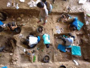
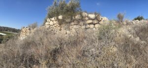
Muro Ynoñán and his team were made aware of the new archaeological site, La Otra Banda, Cerro Las Animas, in 2023. The local government reached out to alert them to looting that had been taking place near the historic town of Zaña, and called on them to study the area before it was destroyed. Supporters including Dumbarton Oaks, Archaeology in Action, and the Pontifical Catholic University of Peru raised funds to excavate the site, and the archaeologists began digging in June 2024.
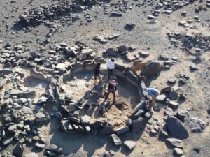
The team selected a plot roughly 33 by 33 feet (10 by 10 meters) and began slowly removing the sediment that had piled up over the millenia. Just six feet deep, the team found signs of ancient walls made of mud and clay. “It was so surprising that these very ancient structures were so close to the modern surface,” says Muro Ynoñan.
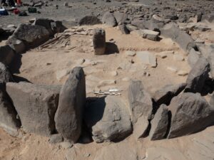
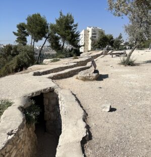
As they dug deeper, the archaeologists found evidence that the site once housed a temple. “We think that a large temple was built into the side of the mountain, and we’ve found one section of it,” says Muro Ynoñan. “One of the most exciting things we found was a small theater, with a backstage area and a staircase that led to a stage-like platform. This could have been used for ritual performances in front of a selected audience.”
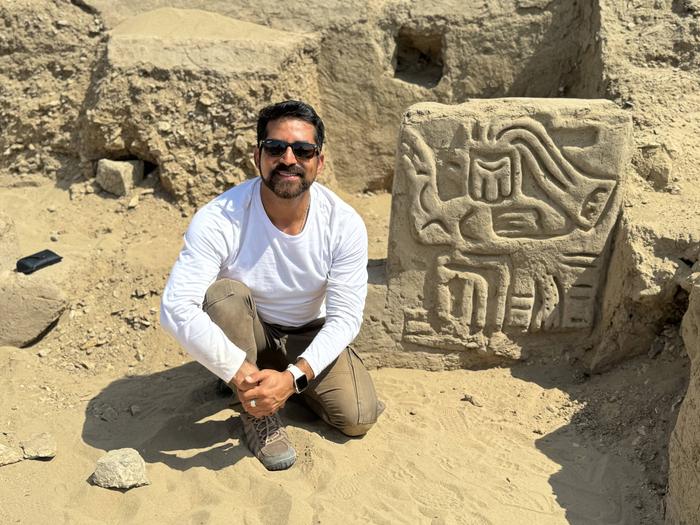
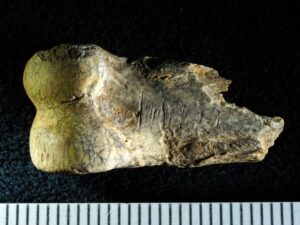
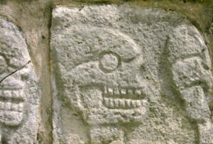
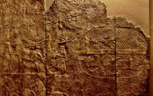
Flanking one of the theater’s staircases, the team found mud panels decorated with elaborate carved designs showing a bird-like creature. “It’s a very beautiful and, at the same time, intriguing design, of a mythological creature– it’s like an anthropomorphic bird, but with some reptilian features,” says Muro Ynoñán.
This figure stood out to the archaeologists because it gives important clues as to when the temple was built and how this construction relates to other ancient temples built by early groups from the Andes.
Other images of mythological creatures similar to the one found by Muro Ynoñán’s team have been found in Peru, dating to what archaeologists call the Initial Period, roughly 4,000 years ago. (Despite the name, the people of the Initial Period were not the first to live in the region: people have inhabited Peru for 15,000 years. Around 5000-3000 BCE, called the Preceramic Period, people in coastal Peru began creating societies and complex political systems. The Initial Period came next, starting around 2,000 BCE and lasting until 900 BCE.)
“The Initial Period is important because it’s when we first start to see evidence of an institutionalized religion in Peru,” says Muro Ynoñan. “The bird creature at this temple resembles a figure known from the Chavín region, nearly 500 years later. This new site could help reveal the origins of this religion.”
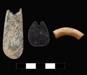
The archaeologists also found several large murals painted on the walls. Muro Ynoñán also specializes in analyzing pigments in paint; the chemical makeup of pigments can reveal where they came from, and in turn, can show who ancient people were trading with. “I collected samples of the pigments from the murals, and I’m bringing them back to the Field Museum this fall to study them in our elemental analysis laboratory,” says Muro Ynoñán. “I’ll also be sending samples off for carbon dating analysis, to confirm how old the site is.”
The clues this site gives about the origins of complex religions in the area have broader lessons for humanity, says Muro Ynoñan. “The people here created complex religious systems and perceptions about their cosmos,” he says. “Religion was an important aspect of the emergence of political authority. People used religion to wield control over each other, early leaders personified mythological figures in performances. It gives us insight into the human mind because religion is still used as a tool for political purposes today.”
Beyond the scientific significance of the findings, Muro Ynoñán has a personal connection with this discovery. “This is the story of my own ancestors. Both my mother’s and my father’s families come from this area, so it was really incredible to come face to face with these depictions of an ancient god that was so important for these ancient groups,” he says. “My connection with it is so special, so deep.”
____________________________
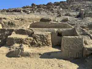
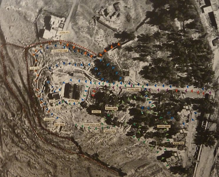
New archaeological site, including carving of a mythological bird creature in La Otra Banda, Cerro Las Animas. Photo by the Ucupe Cultural Landscape Archaeological Project
____________________________
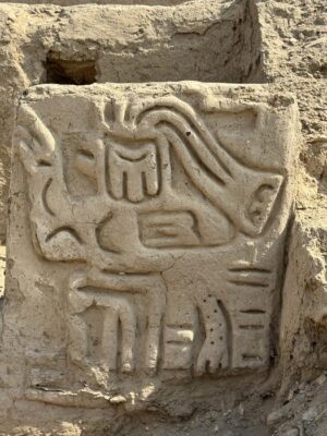
Close-up of the carving of a mythological bird creature in La Otra Banda, Cerro Las Animas. Photo by the Ucupe Cultural Landscape Archaeological Project
____________________________
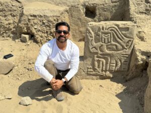
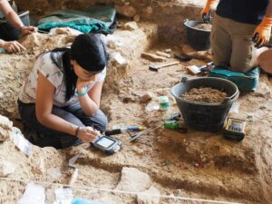
Field Museum scientist Luis Muro Ynoñán with the carving of a mythological bird creature in La Otra Banda, Cerro Las Animas. Photo by the Ucupe Cultural Landscape Archaeological Project
____________________________
Article Source: Field Museum news release.
____________________________
Advertisement

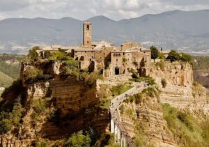
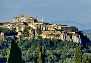
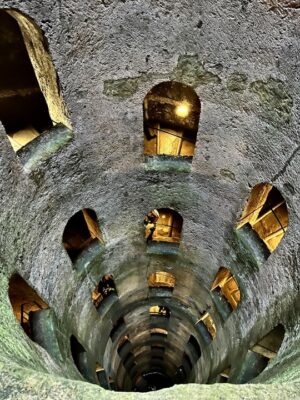
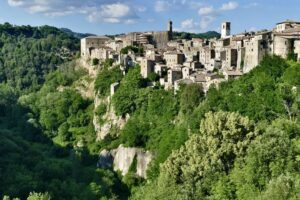
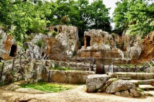
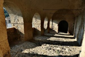
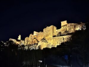
EXPLORE THE ANCIENT ETRUSCANS IN PERSON!
Experience a unique, up-close-and-personal hike among ancient hilltop towns in central Italy. You will walk the sensational countryside of the regions of Umbria and Tuscany, soaking in important sites attesting to the advanced Etruscan civilization, forerunners of the ancient Romans; imposing architectural and cultural remains of Medieval Italy; local food and drink; and perhaps best of all — spectacular scenic views! Join us in this collaborative event for the trip of a lifetime!


