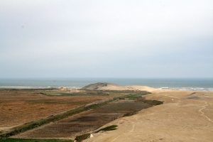
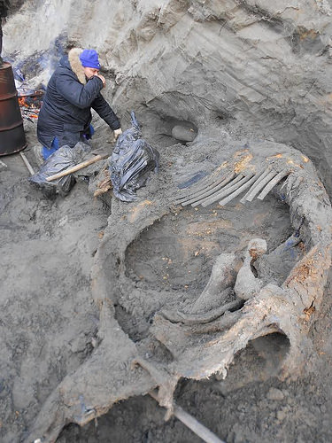
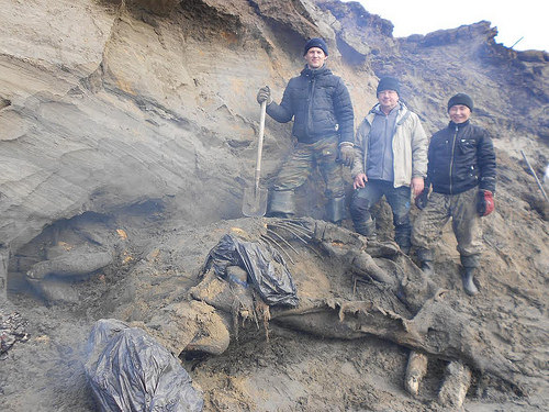
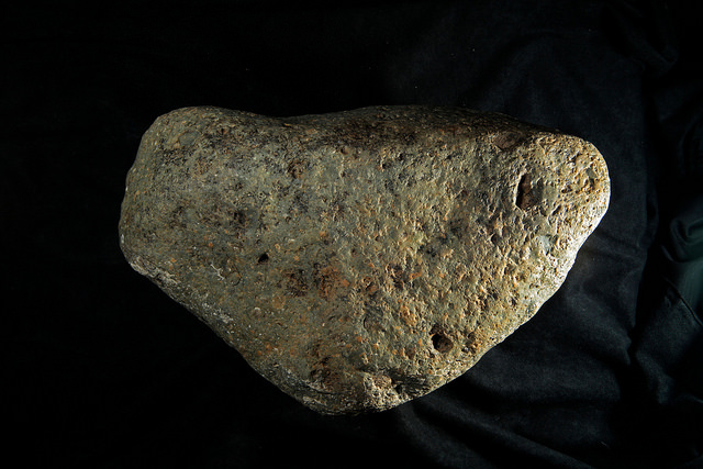
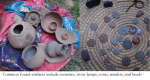
INSTITUT NATIONAL DE LA RECHERCHE SCIENTIFIQUE – INRS—Soil erosion reduces the productivity of ecosystems, it changes nutrient cycles and it thus directly impacts climate and society. An international team of researchers, including Professor Pierre Francus at the Institut National de la Recherche Scientifique (INRS), recorded temporal changes of soil erosion by analyzing sediment deposits in more than 600 lakes worldwide. They found that the accumulation of lake sediments increased significantly on a global scale around 4,000 years ago. At the same time, tree cover decreased as shown by pollen records, which is a clear indicator of deforestation. The study suggests that human practices and land-use change have intensified soil erosion long before industrialization.
Soils are the foundation for almost all biological processes on the Earth’s land surface. On millennial time scales, their weathering and erosion is controlled mainly by climatic and tectonic impacts. In the short term and at smaller local scales, anthropogenic activities are the main drivers of soil erosion. It remained unclear, however, if soil erosion caused by humans has an impact on the global scale as well.
To address this question, European and Canadian researchers looked back in time regarding soil erosion. They investigated cores of sediments from 632 lakes worldwide, which had been collected during the last decades.
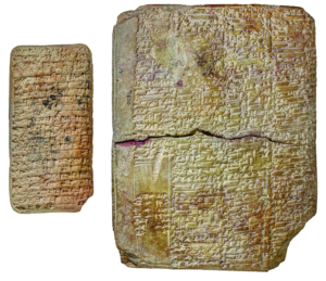
“Lake sediments are considered natural archives of erosion activities. All fluxes and processes removing soil, rock and dissolved materials result in chronological sediment layers that are accumulated and preserved at the bottom of lakes”, says lead author, Dr. Jean-Philippe Jenny, from Max Planck Institute for Biogeochemistry, Jena, Germany, and CARRTEL Limnology Center, Thonon-les-Bains, France.
Using 14C radiocarbon measurements, the scientists dated the age of lake sediment layers and the sediment accumulation rates. “This is the first time that by compiling data from so many lakes we see a general trend that shows an increasing sediment accumulation during the Holocene (or the last 10 000 years),” says co-author Professor Francus, who also holds a Canada Research Chair in Environmental Sedimentology at INRS.
When searching for potential causes of this increased sedimentation, the researchers looked at the pollen fossils recorded in the same lakes, in order to reconstruct land cover changes in each lake watersheds.
“We were excited to find that increased sediment accumulation 4,000 years ago coincided with a reduction of arboreal pollen derived from trees” says Dr. Jenny. “The tree pollen decrease reflects land-cover changes, in particular land clearances, e.g., for agriculture and settlement, that in turn are likely to lead to soil degradation and erosion.”
Further statistical analyses supported the notion that land cover change was the main driver of globally accelerated sediment accumulation in lakes, which is the proxy for soil erosion.
”This means that land use had a major impact as many as 4000 years ago, when the human population was much lower than it is today. Our ecosystems are extremely sensitive to modifications to land use,” explains Professor Francus.
Looking closer at their data, the researchers also found other exiting connections: on a regional level, changes in sediment accumulation seem to correlate with historical socio-economic developments during human settlements. For example, the increase of soil erosion started later in North America than in Europe. This increase likely corresponds to the delayed introduction of European agricultural practices in North America following colonization. On the contrary, the decrease in sediment accumulation in 23 percent of sites is likely associated with increased water use and building dams, especially in the Roman and Chinese empires 3,000 years ago.
Collectively, this study suggests that the change in tree abundance in lake catchments has long been the leading factor driving soil erosion. Furthermore, anthropogenic deforestation explains the accelerated soil erosion during the last four millennia.
“These findings are important as it will allow us to get better and more precise predictions of the carbon cycle in the long-term, ” adds Professor Francus.
“Well before the more recent and abrupt influences by greenhouse gas emissions, human activities must have influenced the global environment already 4,000 years ago,” concludes Dr. Jenny who led the research project at Max Planck Institute for Biogeochemistry as a fellow funded by the AXA research foundation. Dr. Jenny was also a postdoctoral fellow in Professor Francus’ laboratory at INRS – Centre Eau Terre Environnement (Research Centre on Water, Earth, and the Environment).
______________________________
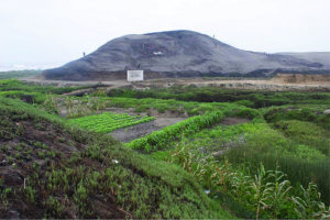
Erosion caused by agriculture is a major cause of land degradation. Rick Bohn / United States Fish and Wildlife Service (USFWS)
______________________________
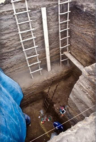
Taking samples from a sediment core for age determination by radiocarbon measurements. Jean-Philippe-Jenny
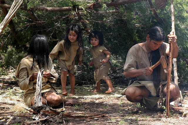
GARVAN INSTITUTE OF MEDICAL RESEARCH—A study has concluded that the earliest ancestors of anatomically modern humans (Homo sapiens sapiens) emerged in a southern African ‘homeland’ and thrived there for 70 thousand years. The breakthrough findings are published in the prestigious journal Nature today. The authors propose that changes in Africa’s climate triggered the first human explorations, which initiated the development of humans’ genetic, ethnic and cultural diversity. This study provides a window into the first 100 thousand years of modern humans’ history.
DNA as a time capsule
“It has been clear for some time that anatomically modern humans appeared in Africa roughly 200 thousand years ago. What has been long debated is the exact location of this emergence and subsequent dispersal of our earliest ancestors,” says study lead Professor Vanessa Hayes from the Garvan Institute of Medical Research and University of Sydney, and Extraordinary Professor at the University of Pretoria.
“Mitochondrial DNA acts like a time capsule of our ancestral mothers, accumulating changes slowly over generations. Comparing the complete DNA code, or mitogenome, from different individuals provides information on how closely they are related.”
In their study, Professor Hayes and her colleagues collected blood samples to establish a comprehensive catalogue of modern human’s earliest mitogenomes from the so-called ‘L0’ lineage. “Our work would not have been possible without the generous contributions of local communities and study participants in Namibia and South Africa, which allowed us to uncover rare and new L0 sub-branches,” says study author and public health Professor Riana Bornman from the University of Pretoria.
“We merged 198 new, rare mitogenomes to the current database of modern human’s earliest known population, the L0 lineage. This allowed us to refine the evolutionary tree of our earliest ancestral branches better than ever before,” says first author Dr Eva Chan from the Garvan Institute of Medical Research, who led the phylogenetic analyses.
By combining the L0 lineage timeline with the linguistic, cultural and geographic distributions of different sub-lineages, the study authors revealed that 200 thousand years ago, the first Homo sapiens sapiens maternal lineage emerged in a ‘homeland’ south of the Greater Zambezi River Basin region, which includes the entire expanse of northern Botswana into Namibia to the west and Zimbabwe to the east.
A homeland perfect for life to thrive
Investigating existing geological, archeological and fossil evidence, geologist Dr Andy Moore, from Rhodes University, revealed that the homeland region once held Africa’s largest ever lake system, Lake Makgadikgadi.
“Prior to modern human emergence, the lake had begun to drain due to shifts in underlying tectonic plates. This would have created a vast wetland, which is known to be one of the most productive ecosystems for sustaining life,” says Dr Moore.
Modern humans’ first migrations
The authors’ new evolutionary timelines suggest that the ancient wetland ecosystem provided a stable ecological environment for modern humans’ first ancestors to thrive for 70 thousand years.
“We observed significant genetic divergence in the modern humans’ earliest maternal sub-lineages, that indicates our ancestors migrated out of the homeland between 130 and 110 thousand years ago,” explains Professor Hayes. “The first migrants ventured northeast, followed by a second wave of migrants who travelled southwest. A third population remained in the homeland until today.”
“In contrast to the northeasterly migrants, the southwesterly explorers appear to flourish, experiencing steady population growth,” says Professor Hayes. The authors speculate that the success of this migration was most likely a result of adaptation to marine foraging, which is further supported by extensive archaeological evidence along the southern tip of Africa.
Climate effects
To investigate what may have driven these early human migrations, co-corresponding author Professor Axel Timmermann, Director of the IBS Center for Climate Physics at Pusan National University, analysed climate computer model simulations and geological data, which capture Southern Africa’s climate history of the past 250 thousand years.
“Our simulations suggest that the slow wobble of Earth’s axis changes summer solar radiation in the Southern Hemisphere, leading to periodic shifts in rainfall across southern Africa,” says Professor Timmermann. “These shifts in climate would have opened green, vegetated corridors, first 130 thousand years ago to the northeast, and then around 110 thousand years ago to the southwest, allowing our earliest ancestors to migrate away from the homeland for the first time.”
“These first migrants left behind a homeland population,” remarks Professor Hayes. “Eventually adapting to the drying lands, maternal descendants of the homeland population can be found in the greater Kalahari region today.”
This study uniquely combined the disciplines of genetics, geology and climatic physics to rewrite our earliest human history.
_____________________________
Professor Vanessa Hayes learning how to make fire with Ju ‘hoansi hunters in the now dried homeland of the greater Kalahari of Namibia. From left to right: Namce Sao, kun Namce, Vanessa Hayes and kun kunta. Chris Bennett, Evolving Picture
The research was supported by an Australian Research Council Discovery Project grant (DP170103071) and the Institute for Basic Science (IBS-R028-D1). Professor Vanessa Hayes holds the Sydney University Petre Chair of Prostate Cancer Research.
This study was conducted in consultation with the local African communities, approval from community leaders and ethics approval from the Ministry of Health and Social Services in Namibia, the University of Pretoria Human Research Ethics Committee and St Vincent’s Hospital, Sydney. Participants for this study were recruited within the borders of South Africa and Namibia. The study was reviewed and approved by the Ministry of Health and Social Services (MoHSS) in Namibia (#17-3-3), with additional local approvals from community leaders, and the University of Pretoria Human Research Ethics Committee (HREC #43/2010 and HREC #280/2017), including US Federal-wide assurance (FWA00002567 and IRB00002235 IORG0001762).
HOKKAIDO UNIVERSITY—Fossil coral records provide new evidence that frequent winter shamals, or dust storms, and a prolonged cold winter season contributed to the collapse of the ancient Akkadian Empire in Mesopotamia.
The Akkadian Empire (24th to 22nd century B.C.E.) was the first united empire in Mesopotamia and thrived with the development of irrigation. Yet, settlements appear to have been suddenly abandoned ca. 4,200 years ago, causing its collapse. The area would also not experience resettlement until about 300 years later.
Past studies have shown that the Akkadian Empire likely collapsed due to abrupt drought and civil turmoil. However, the climatic dynamics which caused widespread agricultural failures and the end of an era have yet to be sufficiently explored.
Researchers from Hokkaido University, the KIKAI Institute for Coral Reef Sciences, Kyushu University, and Kiel University made paleoclimatic reconstructions of the temperature and hydrological changes of the areas around the archaeological site of Tell Leilan, the center of the Akkadian Empire. They sampled six 4,100-year-old fossil Porites corals from the Gulf of Oman, just directly downwind. The samples were aged by radiocarbon dating and geochemically analyzed to confirm they have not been significantly altered from their present state.
The coral data was then compared to modern coral samples and meteorological information. Although it is normal for the survey area to receive a significant amount of rainfall in the winter, the coral data suggests that, during the time of the empire’s collapse, the area suffered from significant dry spells. The data before and since the collapse are furthermore comparable to modern coral data, showing the dry spells would have been sudden and intense.
The fossil evidence shows that there was a prolonged winter shamal season accompanied by frequent shamal days. The impact of the dust storms and the lack of rainfall would have caused major agricultural problems possibly leading to social instability and famine, both factors which have been previously associated with the collapse of the empire.
“Although the official mark of the collapse of the Akkadian Empire is the invasion of Mesopotamia by other populations, our fossil samples are windows in time showing that variations in climate significantly contributed to the empire’s decline,” said Tsuyoshi Watanabe of Hokkaido University’s Department of Natural History Sciences. “Further interdisciplinary research will help improve our understanding of connections between climate changes and human societies in the past.”
____________________________
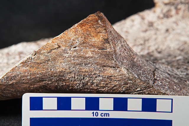
A 4,100-year-old Oman coral fossil. Hokkaido University
____________________________
A map showing the sample sites (red stars) in respect to Mesopotamia (green dots) and wind direction. (Watanabe T.K. et al, The Geological Society of America. September 2, 2019). Watanabe T.K. et al, The Geological Society of America. September 2, 2019
PLOS—Early Celts from the Heuneburg settlement may have enjoyed Mediterranean wine well before they began importing Mediterranean drinking vessels–and this special drink may have been available to all in the community, according to a study* published October 23, 2019 in the open-access journal PLOS ONE by Maxime Rageot from Ludwig-Maximilians-Universität München and the University of Tübingen, and colleagues.
The Early Celtic “Heuneburg” settlement north of the Alps in modern-day Germany was a locus for early urbanization during the Early Iron Age (7th-5th centuries BCE): excavation has revealed several elite burials as well as a rich collection of Mediterranean imported goods used for feasting. In order to better understand feasting and consumption practices in the Heuneburg, Rageot and colleagues analyzed organic residues left on 126 local vessels and seven imported Attic ceramics recovered across the settlement, used for drinking and serving beverages, and food storage and preparation.
The results of the gas chromatography and mass spectrometry analyses showed that Mediterranean grape wine was present earlier than previously expected, and drunk from a large variety of vessels, including the oldest local ceramics created prior to the presence of imported Attic vessels or the formation of the settlement’s fortified central plateau (where elite members of the settlement are thought to have lived). This complicates a previous assumption that imported wine was reserved for the elite: this wine may have been available to all members of the community, at least early in Heuneburg’s history.
A bee or plant fermentation byproduct was also found in many of the vessels across the settlement, including Mediterranean-style goblets, so residents might have appropriated Mediterranean drinking style for local fermented beverages, too.
The authors’ analysis suggests that later, with the introduction of new imported Attic pottery and wheel-thrown local ceramics, residents may have preferred to drink imported wine solely from these finer vessels–potentially inspired by an increased knowledge of Mediterranean drinking practices.
After the elite plateau was walled off, the authors found more fermented beverage evidence in vessels from the plateau, and more millet/food evidence (including animal fats indicating consumption of dairy products) in vessels from the lower town, suggesting an increased distinction in vessel use between social classes. The intricate and shifting social dynamics hinted at in these findings suggest lines for future inquiry into Early Celtic sites.
______________________________
Heuneberg pottery / Heuneburg early celts from all social classes may have consumed mediterranean wine in local ceramics. Victor S. Brigola
*Rageot M, Mötsch A, Schorer B, Gutekunst A, Patrizi G, Zerrer M, et al. (2019) The dynamics of Early Celtic consumption practices: A case study of the pottery from the Heuneburg. PLoS ONE 14(10): e0222991. https://doi.org/10.1371/journal.pone.0222991
FLINDERS UNIVERSITY—October 16, 2019 marks 360 years since the Dutch merchant ship Melckmeyt (Milkmaid) was wrecked off a remote Icelandic island during a clandestine trading mission.
Since its discovery in 1992 it has remained the oldest identified shipwreck in Iceland, and its lower hull has remained unusually well-preserved in Iceland’s icy waters.
To mark this anniversary, digital archaeology specialists at Flinders University have collaborated with maritime archaeologists at the University of Iceland to release a 360 degree virtual dive on the wreck.
This is a highly realistic virtual experience of the wreck and includes a digital reconstruction of how the ship might have appeared on the seabed moments after it sank.
The three minute virtual dive was created for an exhibition at the Reykjavik Maritime Museum, but has now been published through YouTube and is available to anyone with a VR headset – it can also be viewed with a smartphone or tablet just by turning it around to view the scene.
The wreck at the centre of the experience is a merchant ship around 33 meters long named Melckmeyt (Milkmaid), thought to be a type of Dutch ship known as a flute.
Flutes were one of the most widely used ship types in the 17th century, a period when the Dutch ruled the seas and piracy and sea battles were a frequent occurrence. The kingdom of Denmark ruled Iceland and forbade other European nations from trading with the island.
However, in 1659 a surprise attack by the Swedish king on the Danish capital prevented any Danish supply ships from traveling to Iceland.
Sensing an opportunity, enterprising merchants in the Netherlands sent a small fleet of unlicensed ships flying under a false Danish flag to trade illegally with the Icelandic population for fish and other goods. If discovered their ships were at risk of confiscation or attack by Danish authorities.
On October 16th, the ship Melckmeyt paid the ultimate price, wrecking in a remote harbor during a sudden storm, with the death of one crew member.
The survivors took shelter above water in the highest point of wreck for the next two days. Although recorded in the Icelandic annals, this event was largely forgotten until its rediscovery in 1992 by local divers Erlendur Guðmundsson and Sævar Árnason. In 2016 PHD candidate Kevin Martin from the University of Iceland returned to the wreck site to carry out a detailed high-resolution 3D survey with his team, including archaeologists from the Cultural Heritage Agency of the Netherlands.
“The significance of this wreck is enormous for Iceland. As it is one of the oldest known historic wrecks in this part of the world, it shines a light on a fascinating period of Icelandic history, when Denmark ruled the island and had a monopoly over trade here for a period of 200 years.”
“We have also been able to directly embed a 3D survey of the seabed with full photographic texture. In theory, a member of the public viewing this might even spot something on the wreck that we have missed during our dives on it!”
PHD candidate in Maritime Archaeology at Flinders University, John McCarthy created the virtual dive.
“Funding from the Embassy of the Kingdom of the Netherlands in Canberra allowed me to travel from Australia to the Netherlands to make a 3D scan of a rare ship model from the 17th century, supporting the most authentic reconstruction of the ship possible.”
“We have even based the stern painting on a real contemporary Dutch painting, Vermeer’s’ famous ‘Milkmaid’, painted just one year before the ship was wrecked.”
______________________________
______________________________
Milkmaid virtual dive. Image by John McCarthy
______________________________
Map of Milkmaid wreck location. Image by John McCarthy
TAYLOR & FRANCIS GROUP—An ancient walkway most likely used by pilgrims as they made their way to worship at the Temple Mount has been uncovered in the “City of David” in the Jerusalem Walls National Park.
In a new study* published in Tel Aviv: Journal of the Institute of Archaeology of Tel Aviv University, researchers at the Israel Antiquities Authority detail finding over 100 coins beneath the paving stones that date the street to approximately 31 CE. The finding provides strong evidence that the street was commissioned by Pontius Pilate.
After six years of extensive archaeological excavations, researchers from the Israel Antiquities Authority and Tel Aviv University have uncovered a 220-meter-long section of an ancient street first discovered by British archaeologists in 1894. The walkway ascends from the Pool of Siloam in the south to the Temple Mount.
Both monuments are hugely significant to followers of Judaism and Christianity. The Temple Mount, located within the Old City of Jerusalem, has been venerated as a holy site for thousands of years. At the time of the street’s construction, it is where Jesus is said to have cured a man’s blindness by sending him to wash in the Siloam Pool.
The excavation revealed over 100 coins trapped beneath paving stones. The latest coins were dated between 17 CE to 31 CE, which provides firm evidence that work began and was completed during the time that Pontius Pilate governed Judea.
“Dating using coins is very exact,” says Dr Donald T. Ariel, an archaeologist and coin expert with the Israel Antiquities Authority, and one of the co-authors of the article. “As some coins have the year in which they were minted on them, what that means is that if a coin with the date 30 CE on it is found beneath the street, the street had to be built in the same year or after that coin had been minted, so any time after 30 CE.”
“However, our study goes further, because statistically, coins minted some 10 years later are the most common coins in Jerusalem, so not having them beneath the street means the street was built before their appearance, in other words only in the time of Pilate.”
The magnificent street 600 meters long and approximately 8 meters wide was paved with large stone slabs, as was customary throughout the Roman Empire. The researchers estimate that some 10,000 tons of quarried limestone rock was used in its construction, which would have required considerable skill.
The opulent and grand nature of the street coupled with the fact that it links two of the most important spots in Jerusalem—the Siloam Pool and Temple Mount—is strong evidence that the street acted as a pilgrim’s route.
“If this was a simple walkway connecting point A to point B, there would be no need to build such a grand street,” says Dr Joe Uziel and Moran Hagbi, archaeologists at the Israel Antiquities Authority, co-authors of the study. “At its minimum it is 8 meters wide. This, coupled with its finely carved stone and ornate ‘furnishings’ like a stepped podium along the street, all indicate that this was a special street.”
“Part of it may have been to appease the residents of Jerusalem, part of it may have been about the way Jerusalem would fit in the Roman world, and part of it may have been to aggrandize his name through major building projects,” says author Nahshon Szanton.
The paving stones of the street were found hidden beneath layers of rubble, thought to be from when the Romans captured and destroyed the city in 70 CE. The rubble contained weapons such as arrowheads and sling stones, remains of burnt trees, and collapsed stones from the buildings along its edge.
It is possible that he had the street constructed to reduce tensions with the Jewish population. “We can’t know for sure, although all these reasons do find support in the historical documents, and it is likely that it was some combination of the three.”
___________________________
The pavement of the street and the solid foundation that was exposed in a place where no paving stones were preserved. A. Peretz, IAA
___________________________
View of the foundations of the Western Wall (left) and the retaining wall that abutted it, built on bedrock (below). To the right are the constructive layers that filled the support system. M. Hagbi, IAA
___________________________
location map, marking excavation sites. D. Levi, IAA; printed by permission of the Survey of Israel.
AMERICAN ASSOCIATION FOR THE ADVANCEMENT OF SCIENCE—Modern Melanesians harbor beneficial genetic variants that they inherited from archaic Neanderthal and Denisovan hominins, according to a new study*. These genes are not found in many other human populations, the study adds. The results suggest that large structural variants introgressed from our archaic ancestors may have played an important role in the adaptation of early modern human populations and that they may represent an under-appreciated source of the genetic variation that remains to be characterized in our modern genomes. As populations of our ancestors migrated out of Africa and into the vast Eurasian continent, they were required to adapt to the wide range of environments they encountered. They also interbred with the archaic hominin ancestors they encountered. However, the role of genetic exchange between archaic hominin and anatomically modern human populations in adaption and human evolution remains elusive. Genetic surveys with single-nucleotide variants (SNVs) have suggested their involvement in archaic introgression and adaptation. However, compared to SNVs, copy number variants (CNVs), a larger form of structural variant, are far more likely to be associated with genotype expression and are subject to stronger selective pressure. Despite this, the adaptive role of introgressed CNVs in human evolution and the genetic variation of modern humans remains unexplored. PingHsun Hsieh performed a genome-wide search for evidence of selective and archaic introgressed CNVs among Melanesian genomes. The Islanders of Melanesia harbor some of the greatest amounts of archaic human ancestry known. Hsieh et al. discovered hominin-shared, stratified CNVs associated with positive selection in the modern Melanesian genomes. Furthermore, the results revealed evidence for adaptive CNVs introgression at chromosomes 16p11.2 and 8p21.3, which were derived from Denisovans and Neanderthals, respectively. The results tentatively suggest that CNV introgression from ancestral hominins may have allowed modern humans to adapt to new environments by providing a source of beneficial genetic variation.
_____________________________
The Islanders of Melanesia harbor some of the greatest amounts of archaic human ancestry known.
MCMASTER UNIVERSITY—An international research team led by scientists from McMaster University has unearthed new evidence in Greece proving that the island of Naxos was inhabited by Neanderthals and earlier humans at least 200,000 years ago, tens of thousands of years earlier than previously believed.
The findings, published today in the journal Science Advances, are based on years of excavations and challenge current thinking about human movement in the region—long thought to have been inaccessible and uninhabitable to anyone but modern humans. The new evidence is leading researchers to reconsider the routes our early ancestors took as they moved out of Africa into Europe and demonstrates their ability to adapt to new environmental challenges.
“Until recently, this part of the world was seen as irrelevant to early human studies but the results force us to completely rethink the history of the Mediterranean islands,” says Tristan Carter, an associate professor of anthropology at McMaster University and lead author on the study. He conducted the work with Dimitris Athanasoulis, head of archaeology at the Cycladic Ephorate of Antiquities within the Greek Ministry of Culture.
While Stone Age hunters are known to have been living on mainland Europe for over 1 million years, the Mediterranean islands were previously believed to be settled only 9,000 years ago, by farmers, the idea being that only modern humans – Homo sapiens – were sophisticated enough to build seafaring vessels.
Scholars had believed the Aegean Sea, separating western Anatolia (modern Turkey) from continental Greece, was therefore impassable to the Neanderthals and earlier hominins, with the only obvious route in and out of Europe across the land bridge of Thrace (southeast Balkans).
The authors of this paper suggest that the Aegean basin was in fact accessible much earlier than believed. At certain times of the Ice Age the sea was much lower, exposing a land route between the continents that would have allowed early prehistoric populations to walk to Stelida, and an alternative migration route connecting Europe and Africa. Researchers believe the area would have been attractive to early humans because of its abundance of raw materials ideal for toolmaking and for its fresh water.
At the same time however, “in entering this region the pre-Neanderthal populations would have been faced with a new and challenging environment, with different animals, plants and diseases, all requiring new adaptive strategies,” says Carter.
In this paper, the team details evidence of human activity spanning almost 200,000 years at Stelida, a prehistoric quarry on the northwest coast of Naxos. Here early Homo sapiens, Neanderthals and earlier humans used the local stone (chert) to make their tools and hunting weapons, of which the team has unearthed hundreds of thousands.
Reams of scientific data collected at the site add to the ongoing debate about the importance of coastal and marine routes to human movement. While present data suggests that the Aegean could be crossed by foot over 200,000 years ago, the authors also raise the possibility that Neanderthals may also have fashioned crude seafaring boats capable of crossing short distances.
This research is part of the Stelida Naxos Archaeological Project, a larger collaboration involving scholars from all over the world. They have been working at the site since 2013.
____________________________
A researcher works at a trench at Stelida (Naxos, Greece). Evaggelos Tzoumenekas
____________________________
Today Naxos is completely surrounded by the sea, but “while present data suggests that the Aegean could be crossed by foot over 200,000 years ago, the authors also raise the possibility that Neanderthals may also have fashioned crude seafaring boats capable of crossing short distances.”
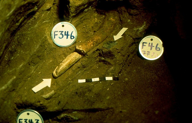
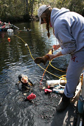
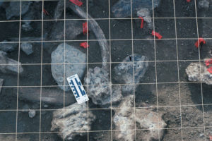
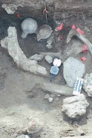
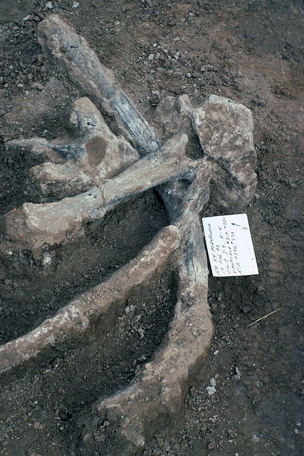
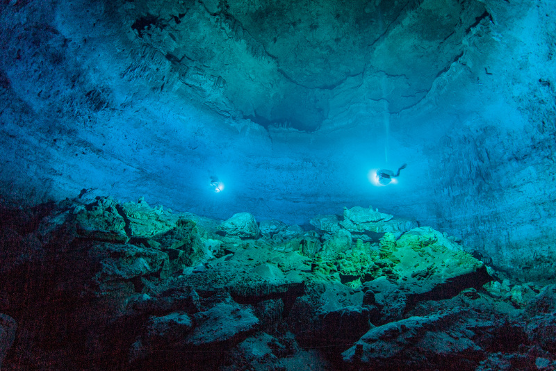
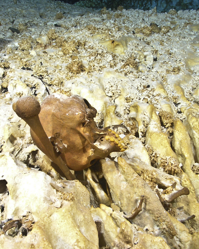
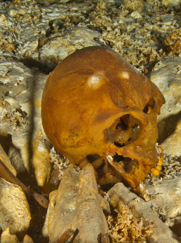
UNIVERSITY OF GÖTTINGEN—Recent archaeological investigations in the Tollense Valley led by the University of Göttingen, the State Agency for Cultural Heritage in Mecklenburg-Vorpommern and the University of Greifswald have unearthed a collection of 31 unusual objects. Researchers believe this is the personal equipment of a Bronze Age warrior who died on the battlefield 3,300 years ago. This unique find was discovered by a diving team headed by Dr Joachim Krüger, from the University of Greifswald, and seems to have been protected in the river from the looting, which inevitably followed fighting. The study was published in Antiquity.
The archaeological records of the European Bronze Age are dominated by settlement finds, hoards and evidence of funeral sites. However, the site at the river Tollense in Northern Germany is very different and provides for the first time in Europe the evidence of a prehistoric battlefield. Over 12,000 pieces of human bone have already been recovered from the valley and osteoanthropologist Ute Brinker, from the State Agency has identified more than 140 individuals – young adult males in good physical condition. Their bones showed signs of recent trauma – the result of close and long-range weapons – and healed lesions, which probably indicate they were accustomed to combat. Isotopic results suggested that at least some of the group were not from the local area, but until now, it was not clear how far they travelled.
The discovery of a new set of artifacts from the remains of battle provides important new clues. The divers could document a number of Bronze finds in their original position on the river ground, among them a decorated belt box, three dress pins and also arrow heads. Surprisingly they also found 31 objects (250g) tightly packed together, suggesting they were in a container made of wood or cloth that has since rotted away. The items include a bronze tool with a birch handle, a knife, a chisel and fragments of bronze. Radiocarbon dating of the collection of objects demonstrates that the finds belong to the battlefield layer and they were probably the personal equipment of one of the victims. The finds were studied in a Master’s thesis by Tobias Uhlig and the new results make it increasingly clear that there was a massive violent conflict in the older Nordic Bronze Age (2000-1200 BC). In fact, recent evidence suggests that it is likely to have been on a large scale, clearly stretching beyond regional borders.
Professor Thomas Terberger, from the Department of Pre- and Early History at the University of Göttingen, says, “This is the first discovery of personal belongings on a battlefield and it provides insights into the equipment of a warrior. The fragmented bronze was probably used as a form of early currency. The discovery of a new set of artifacts also provides us with clues about the origins of the men who fought in this battle and there is increasing evidence that at least some of the warriors originated in southern Central Europe.”
____________________________
This collection of objects was found by divers in the Tollense river and is probably the contents of a personal pouch of a warrior who died 3,300 years ago on the battlefield. Volker Minkus
____________________________
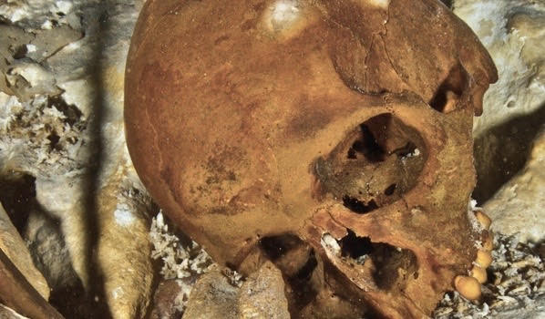
Human skull found in the Tollense valley with fatal trauma caused by a Bronze arrowhead. Volker Minkus
____________________________
The battlefield remains from the layer where objects were found at the site near the Tollense river in Weltzin. Stefan Sauer
*Tobias Uhlig et al., Lost in combat? A scrap metal find from the Bronze Age battlefield site at Tollense (2019), Antiquity. DOI: 10.15184/aqy.2019.137
SANTA FE INSTITUTE—Humankind first started farming in Mesopotamia about 11,500 years ago. Subsequently, the practices of cultivating crops and raising livestock emerged independently at perhaps a dozen other places around the world, in what archaeologists call the Neolithic Agricultural Revolution. It’s one of the most thoroughly-studied episodes in prehistory — but a new paper in the Journal of Political Economy shows that most explanations for it don’t agree with the evidence, and offers a new interpretation.
With farming came a vast expansion of the realm over which private property governed access to valued goods, replacing the forager social norms around sharing food upon acquisition. A common explanation is that farming increased labor productivity, which then encouraged the adoption of private property by providing incentives for the long-term investments required in a farming economy.
“But it’s not what the data are telling us”, says Santa Fe Institute economist Samuel Bowles, a co-author of the paper. “It is very unlikely that the number of calories acquired from a day’s work at the advent of farming made it a better option than hunting and gathering and it could well have been quite a bit worse.”
Prior studies, including those of human and animal bones, suggest that farming actually took an extreme nutritional toll on early adopters and their livestock. So why farm in the first place?
Some have suggested an inferior technology could have been imposed by political elites as a strategy for extracting taxes, tribute, or rents. But farming was independently adopted millennia before the emergence of governments or political elites capable of imposing a new way of life on heavily-armed foraging communities.
Bowles and co-author Jung-Kyoo Choi, an economist at Kyungpook National University in South Korea, use both evolutionary game theory and archaeological evidence to propose a new interpretation of the Neolithic. Based on their model, a system of mutually recognized private property rights was both a precondition for farming and also a means of limiting costly conflicts among members of a population. While rare among foragers, private property did exist among a few groups of sedentary hunter-gatherers. Among them, farming could have benefited the first adopters because it would have been easier to establish the private possession of cultivated crops and domesticated animals than for the diffuse wild resources on which hunter-gatherers relied.
“It is a lot easier to define and defend property rights in a domesticated cow than in a wild kudu,” says Choi. “Farming initially succeeded because it facilitated a broader application of private property rights, not because it lightened the toil of making a living.”
_____________________________
Did private property facilitate the agricultural revolution?
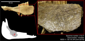
It was once called Nipéhe, an ancient village site of the Nez Perce Tribe.Located at the confluence of Rock Creek and the lower Salmon River in western Idaho, this spot also saw bands of Paleoindians sojourneying here thousands of years ago. Long since abandoned as a modern world has moved in, it is today called Cooper’s Ferry, a location known to few. But this place has acquired a very special meaning to a team of archaeologists and student volunteers led by Loren Davis of Oregon State University. They have been excavating here for ten years, and the results of their efforts have been nothing less than remarkable: during the last two years, they discovered lithic artifacts (stone tools) in the lowest excavation layers—radiocarbon-dated to between 15,280 and 16,560 years ago. Thus far, the deposits have revealed hundreds of objects, including stone tools; fire-cracked rock; charcoal; and animal bone fragments, including tooth fragments from an extinct species of horse that lived in North America at the end of the last glaciation. Most significantly, according to Davis, Cooper’s Ferry is the “oldest radiocarbon-dated site in North America that includes artifacts associated with the bones of extinct animals”.*
Because of the age of the findings, Davis and the team are suggesting some tantalizingly specific implications about how and when humans settled North America. “Early peoples moving south along the Pacific coast would have encountered the Columbia River as the first place below the glaciers where they could easily walk and paddle in to North America,” said Davis. “Essentially, the Columbia River corridor was the first off-ramp of a Pacific coast migration route. The timing and position of the Cooper’s Ferry site is consistent with and most easily explained as the result of an early Pacific coastal migration.”*
Coopers Ferry is also included among a small but growing number of sites across the Americas that are revealing evidence of human occupation significantly before 13,000 years ago, the time when the Clovis culture, long thought to have been the most ancient Paleoindian culture in the Americas, emerged.
___________________________
Cooper’s Ferry site excavations in progress in 2018. Loren Davis, Oregon State University
___________________________
About 2,000 miles due east of Cooper’s Ferry, Devlin Gandy, an archaeologist from St. John’s College at the University of Cambridge, dons a hazmat suit, multiple hairnets, and a respirator and proceeds to incise into a vertical profile of sediment with a scalpel to extract a cube of an ancient deposit before placing it carefully into a centrifuge vial. The sediment cube sample comes from what has been dubbed the “deep hole”, consisting of some of the earliest and deepest excavated cultural layers within the famous site of Meadowcroft Rockshelter, located within a remote forested area of the western Pennsylvania Appalachian region. Meadowcroft is long known to have produced evidence of what some scientists arguably suggest to be the earliest presence of humans in North America — an occupation that goes back at least 16,000 years ago. The purpose of the sampling, among other things, is to test the possible presence of human DNA still remaining in the soil, left there by human occupiers who may have lived and worked there at that early time. The sampling was sent to the Centre for Geogenetics in Copenhagen, Denmark, where, at this writing, they are being systematically tested.
“The site remains as one of the first serious challenges to the formerly prevailing Clovis First model and also clearly indicates that among the first inhabitants of the New World were broad-spectrum foragers rather than focused big game hunters,” says James Adovasio, the archaeologist who led excavations at the site.“The early assemblage from Meadowcroft is now seen to have analogs at Cactus Hill, Virginia, as well as several sites on the Delmarva Peninsula of Maryland.”
Adovasio makes clear that he is not hanging his hat on the sample testing results. “We stress that the absence of any human, animal, or plant DNA in no way undermines previous conclusions about the site,” he emphasizes. The archaeological investigations have historically churned up too much other data to be overturned by any new, single sampling. Moreover, investigations are not finished. “More than one-third of the site remains unexcavated,” Adovasio adds. But there are no plans to conduct on-site investigations in the immediate future.
_________________________
Above and below: Collecting the deposit sampling within the Meadowcroft Rockshelter for testing . Courtesy James Adovasio
_________________________
_________________________
Across North and South America — north, south, east, and west — a new narrative is emerging about the discovery of artifacts and other finds that are radically re-shaping the traditional paradigm of the early settling of the Americas. What follows is a consolidation of major feature articles that have appeared in Popular Archaeology over the past few years, stories that are helping to inform a complex new narrative.
Excavations at the 15,000-year-old Friedkin site in 2016.Image courtesy Michael R. Waters andCenter for the Study of the First Americans, Texas A&M University
____________________________
Few had ever heard of the little town of Buttermilk Creek, Texas, until it was placed on the map in early 2011 when Texas A&M University anthropologist Michael Waters made his public announcement.He and a team of archaeologists, researchers, students and volunteers had been painstakingly excavating at an archaeological site, known as the Debra L. Firiedkin site, for years. What they discovered there had generated excitement in the world of American archaeology.
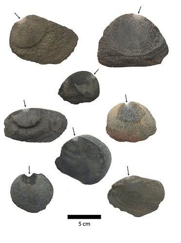
Yielding a prolific assemblage of artifacts, the Buttermilk Creek Complex, as researchers are now calling it, contained evidence of small blades, choppers and scrapers, implements made by people who had long departed the scene, long before any notion in the minds of the early European explorers that anyone had ever inhabited the North American continent.
“Most of these are chipping debris from the making and resharpening of tools,” said Waters, “but over 50 are tools. There are bifacial artifacts that tell us they were making projectile points and knives at the site. There are expediently made tools and blades that were used for cutting and scraping.”
On the face of it, his discovery could hardly eclipse any of the finds made by other archaeologists through decades of excavation and research about the early peopling of the Americas. But there were several important differences that made the site, and the finds, unique. They had to do with the sheer number of the finds, their nature, and the dating, with the most sensational difference being the dating.
“What is special about the Debra L. Friedkin site is that it has the largest number of artifacts dating to the pre-Clovis time period, that these artifacts show an array of different technologies, and that these artifacts date to a very early time,” said Waters.
The Clovis time refers to a time period (beginning about 13,500 years ago) to which, according to many scholars, the earliest known stone tools and weapons made by early ancestral Native Americans could be assigned. Best known for their medium to large fluted lanceolate projectile points and distinctive bone and ivory items, these stone artifact finds constitute the evidential basis for the widely accepted “Clovis First” hypothesis, which suggests that the people associated with the artifacts were the first inhabitants of the Americas. Clovis artifacts have been found in abundance at sites across the North American continent.
But the headline-making finds at the Friedkin site were not Clovis, and they were older than the oldest known Clovis tools by about 2,000 years.
Waters and his associates used Optically Stimulated Luminescence (OSL) dating, a technique that measures the amount of light energy trapped over thousands of years in minerals within the sediment surrounding artifacts. Professor Steven Forman of the University of Illinois at Chicago worked with Waters at the site, collecting 50 core samples from two sites at Buttermilk Creek for testing. “We found Buttermilk Creek to be about 15,500 years ago — a few thousand years before Clovis” said Forman. “We dated the sediments by a variety of optical methods. We also dated different mineral fractions as well, and we consistently got the same ages. We looked at the age structure of the sediment by many different ways and got the same answers.”
In addition to providing compelling evidence for pushing the clock back on when the earliest Americans arrived, the Friedkin site findings have provided additional credence to the suggestion that the stone tool technology of the Clovis culture was not imported into the Americas via the Bering Land Bridge (“Beringia”) in accordance with the Clovis Model, but instead evolved in North America from an earlier technology. Given the nature and characteristics of the Buttermilk Creek Complex, Waters maintains that the Complex represents a “type of assemblage from which the Clovis assemblage could emerge” with the new dating providing “ample time for people to settle into the environments of North America, colonize South America by at least ~14.1 to 14.6 ka, develop the Clovis tool kit, and create a base population through which Clovis technology could spread”.[1]
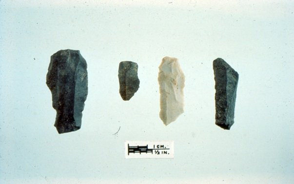
Some of the artifacts from the 15,500-year-old horizon. Image courtesy Michael R. Waters.
_______________________________
The Mounting Evidence
The arguments against the traditional Clovis First perspective point to the fact that no Clovis-type artifacts have been found in Northeast Asia, from where the early Americans under the Clovis Model are suggested to have migrated, and fluted stone points that are iconic for Clovis and found in Alaska are all dated too late to be assigned to the Clovis horizon. Moreover, six major sites in South America with stratigraphic layers dated to the Clovis period are devoid of Clovis period artifacts.
Nevertheless, comparing the evidence of Clovis technology dated to very early occupation of the Americas with what is available for the same time period for other technology forms had traditionally given Clovis the decided edge in the debate. But new evidence against Clovis has been mounting. The Friedkin site is not the only site that has been dated to the pre-Clovis time period. Pre-Clovis finds have been recorded at sites such as Pedra Furada in Brazil, Monte Verde in Chile, two mammoth kill sites in Wisconsin, Topper in South Carolina, Cactus Hill and Saltville in Virginia, and Meadowcroft in Pennsylvania, among others. The evidence at these sites, however, has been in dispute and is not as robust as that found at Friedkin.
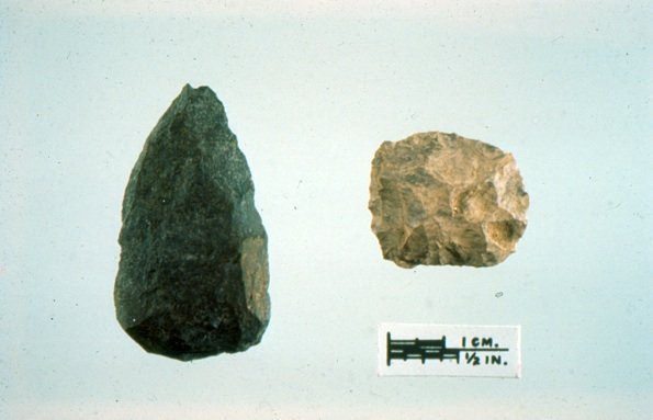
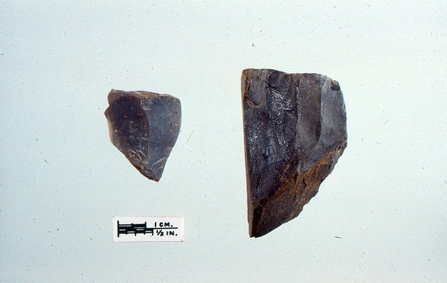
Excavators examine a cluster on the proposed pre-Clovis surface at the Topper site. Courtesy Center for the Study of the First Americans.
_______________________________
Proposed pre-Clovis artifacts found at the Topper site. Courtesy Center for the Study of the First Americans.
__________________________________
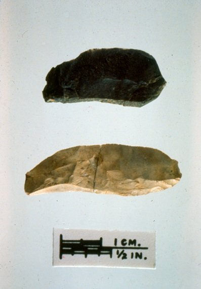
Proposed pre-Clovis bend break tools found at the Topper site. Courtesy Center for the Study of the First Americans.
______________________________
But new discoveries have emerged and joined Friedkin with stronger evidence of pre-Clovis beginnings…….
At the Paisley caves in south-central Oregon, a team of research scientists led by Dennis L. Jenkins of the University of Oregon’s Museum of Natural and Cultural History found evidence that an early stone implement technology, known as “Western Stemmed” projectile points (darts or thrusting spearheads), were manufactured at least 11,070 to 11,340 radiocarbon years ago, making them concurrent with or possibly earlier than the Clovis culture (dated to 13,000 calendar years ago). The researchers obtained 190 radiocarbon dates on artifacts, human coprolites (dried feces), bones and sagebrush twigs within layers of silt deposited over thousands of years in the caves. The broad, concave-based, fluted Clovis projectile points often associated with early Americans who lived about 12,000 – 13,000 years ago were not found in the caves.
Past studies of the Paisley Caves have also reported very early dates from human coprolites with ancient DNA, but questions arose about whether those samples could have been contaminated, and whether they were found in true context with artifacts from the same era. So the researchers did an exhaustive examination of the stratigraphy, which is one of Loren Davis’ specialties. Davis was a member of the archaeological team investigating Paisley.
“We continued to excavate Paisley Caves from 2009 through 2011,” the authors wrote in Science. “To resolve the question of stratigraphic integrity, we acquired 121 new AMS [accelerator mass spectrometry] radiocarbon dates on samples of terrestrial plants, macrofossils from coprolites, bone collagen and water soluble extracts recovered from each of these categories. To date, a total of 190 radiocarbon dates have been produced from the Paisley Caves.”
Davis conducted microscopic analysis of the soil using a “petrographic” microscope, to eliminate any indications that liquid – such as water or urine from humans or animals – may have moved down from higher layers into the lower layers, thus “contaminating” or compromising the integrity of the dating of the soil. They also analyzed the silt where the stem points were found and bracketed above and below those layers to determine if the radiocarbon dates synchronized.
The result: “The stemmed points were in great context,” Davis said. “There is no doubt that they were in primary context, associated with excellent radiocarbon dates.” The new dating was valid and few could now argue with the results.
The significance of the Paisley finds extends from the fact that Western Stemmed points and Clovis points differ fundamentally in terms of their hafting portions, the part of the stone point that connects to a shaft. Stemmed points are narrower or constricted at their bases, whereas the hafting portions of Clovis points are not narrow, but thinned width-wise through removal of large flakes from their bases.
“These two approaches to making projectile points were really quite different,” Davis said, “and the fact that Western Stemmed point-makers fully overlap, or even pre-date Clovis point makers likely means that Clovis peoples were not the sole founding population of the Americas.”
Moreover, the dating of the Western Stemmed projectile points to possibly pre-Clovis times adds new data to digest in the ongoing debate about the starkly different production technologies overlapping in time and whether or not they developed separately. The results even suggest that the Clovis culture may have developed or originated in the Southeastern region of the United States and moved westward, while the Western Stemmed tradition originated, perhaps earlier than the Clovis, in the West and moved eastward.
“From our dating, it appears to be impossible to derive Western Stemmed points from a proto-Clovis tradition,” Jenkins said. “It suggests that we may have here in the Western United States a tradition that is at least as old as Clovis, and quite possibly older. We seem to have two different traditions co-existing in the United States that did not blend for a period of hundreds of years.”
It is interesting to note in this context that Clovis technology has only been found in the New World, whereas Western Stemmed technology is similar to stone technology seen in northeastern Asia.
At least three other Western sites, including Cooper’s Ferry in Idaho, Smith Creek Cave in Nevada, and Bonneville Estates Rockshelter, also in Nevada, also contain only Western Stemmed points in deposits of this early time period.
Displayed in the hand of University of Oregon archaeologist Dennis Jenkins are three bases for Western Stemmed projectiles from the Paisley Caves in Oregon. The bases date to some 13,000 years ago.[Photo by Jim Barlow]
________________________________
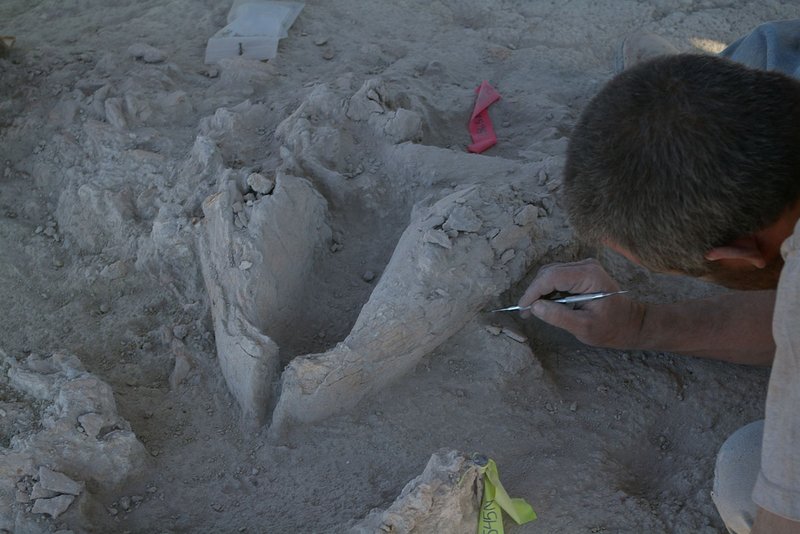
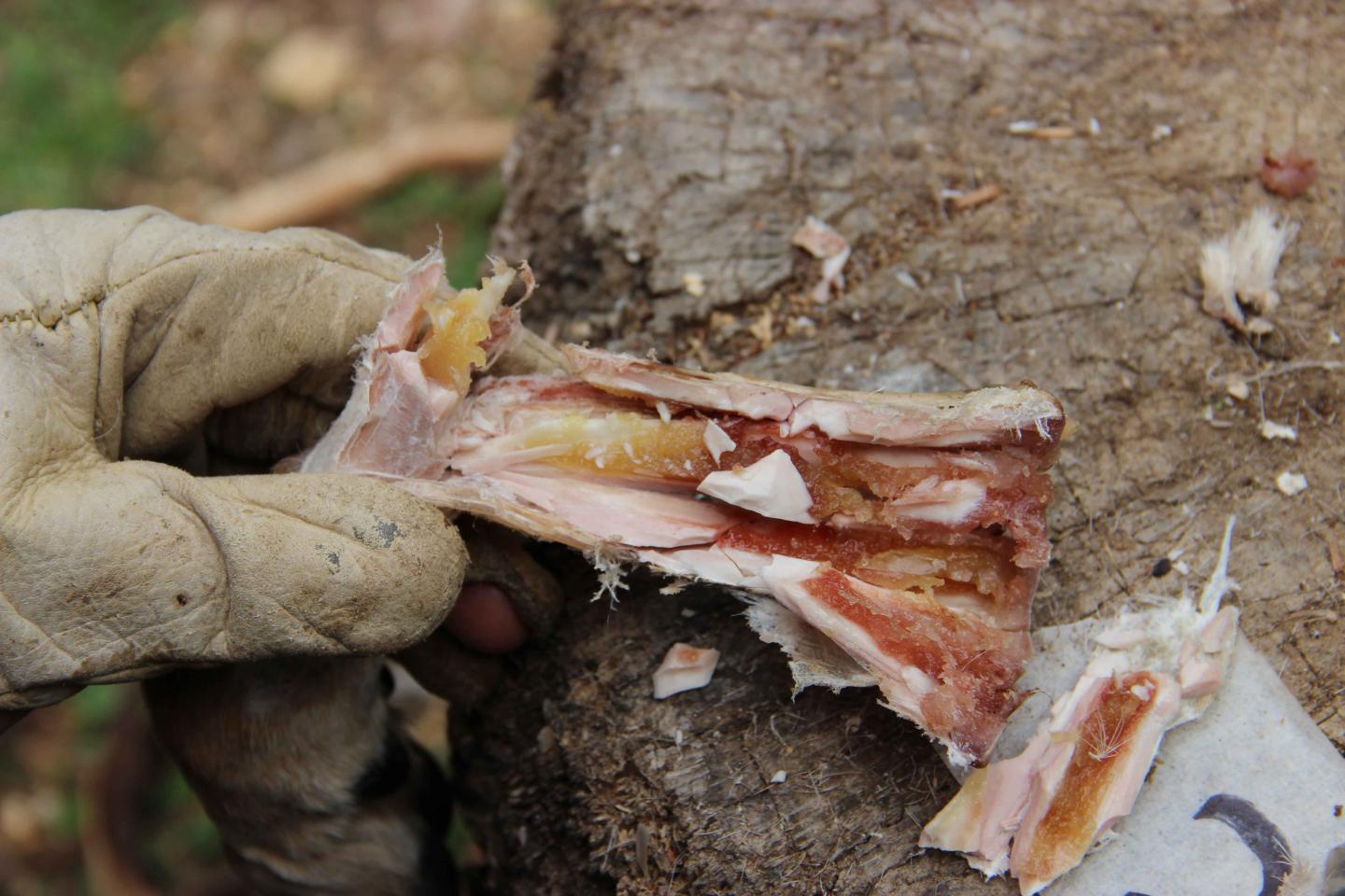
Enter here another site, located in Manis, Washington, where the fossil remains of a mastodon were excavated by Dr. Carl Gustafson and a team from Washington State University in the 1970’s. He concluded from radiocarbon dating of charcoal deposits around the remains that it was about 14,000 years old. It was a conclusion that had been the subject of considerable debate among scholarly critics, particularly as he maintained that a bone point found embedded in the rib bone of the mastodon was an early projectile point, similar to other bone projectile points found at other Paleoindian sites.
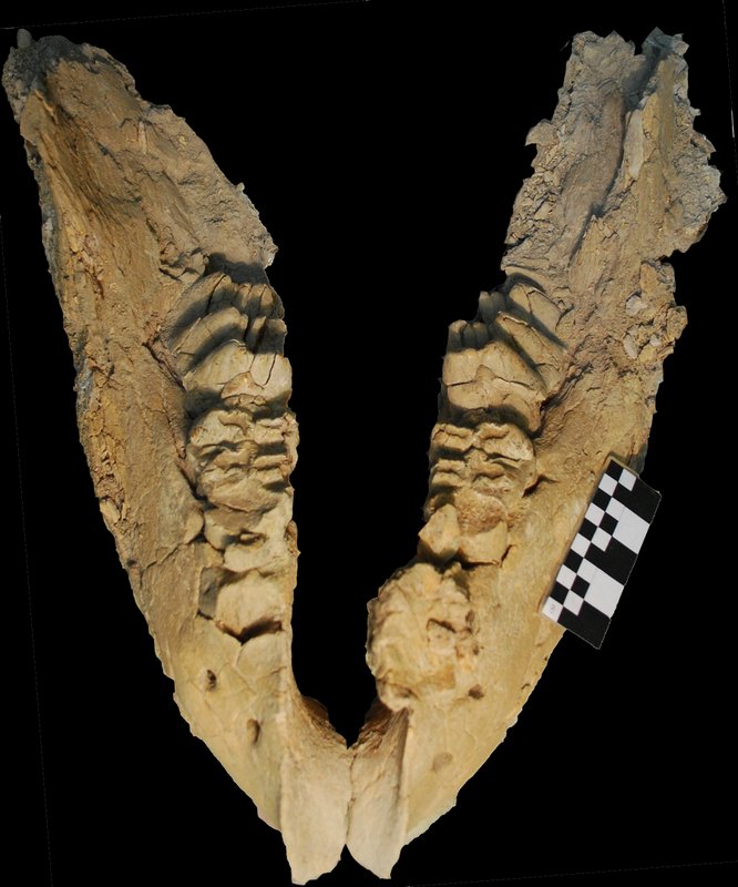
The case was revisited recently when Dr. Michael Waters of Texas A & M University, the excavator of the Firiedkin site who, along with a team of colleagues, used mass spectrometry to date carbon in samples of bone from the rib, a pair of tusks found at the same site, and the embedded point. Results indicated that all of the fossils tested were about 13,800 years old. They also used high-resolution X-ray CT scanning of the embedded bone point to produce a three-dimensional visual study or image. Based on this, they determined that the point was likely at least 27 centimeters long, similar in length to those of later, Clovis-age projectile points that were used in throwing or thrusting weapons made by Paleolithic hunters of North America. Moreover, the team examined the specimen using DNA protein analysis of material from the bone point and the rib in which it was embedded. They concluded that the point itself was fashioned from mastodon bone.
Most significantly, the findings constitute more evidence that Paleoindians settled the Americas before 13,000 – 13,500 B.P.E., the earliest date range that has traditionally been assigned to the emergence of the “Clovis” cultural horizon.
Said Waters, “We’re looking at another pre-Clovis locality in North America where, in this case, bone weaponry was used to hunt mastodons 800 years before Clovis stone weaponry show up on the landscape.”
This is a mastodon skeleton and outline of a mastodon. The location of the rib and approximate angle of the spear is indicated. The point had to penetrate 25-30 cm of hide, tissue, and muscle. Image courtesy of Center for the Study of the First Americans, Texas A&M University
___________________________________
Mastodon rib with the embedded bone projectile point. (A) Closeup view. (B) Reconstruction showing the bone point with the broken tip. The thin layer represents the exterior of the rib. (C) CT x-ray showing the long shaft of the point from the exterior to the interior of the rib. (D) The entire rib fragment with the embedded bone projectile point. Image courtesy of Science/AAAS
__________________________________
But the archaeological finds are not the only body of evidence emerging in the changing picture related to who, when, and from where the first peopling of the Americas took place. New findings are developing with the application of genetic and paleoclimate studies….
Following the DNA Trail
In a study published in the American Journal of Human Genetics, Theodore Schurr, an associate professor in the University of Pennsylvania’s Department of Anthropology, in collaboration with a research team that included Ludmila Osipova of the Institute of Cytology and Genetics in Novosibirsk, Russia and others, analyzed the genetics of individuals living in Russia’s Altai Republic for markers in both mitochondrial DNA and Y chromosome DNA. Mitochondrial DNA traces the maternal, or female line of descent, whereas Y chromosome DNA traces the paternal, or male, descent. They compared the samples to those that had previously been collected from individuals in southern Siberia, East Asia, Central Asia, Mongolia, and a number of different Native American groups.
After analyzing the Y chromosome DNA, the researchers found a unique mutation common to both the Native Americans and southern Altaians in a lineage dubbed as “Q”. The Altai region is located at the four corners of what is today China, Russia, Mongolia, and Kazakhstan. Says Schurr, it “is a key area because it’s a place that people have been coming and going for thousands and thousands of years. Our goal in working in this area was to better define what those founding lineages or sister lineages are to Native American populations.”
They found similar results when analyzing the mitochondrial DNA. “We find forms of haplogroups C and D in southern Altaians and D in northern Altaians that look like some of the founder types that arose in North America, although the northern Altaians appeared more distantly related to Native Americans” says Schurr.
Determining how long ago the mutations took place, the researchers concluded that the southern Altaian lineage diverged genetically from the Native American lineage about 13,000 to 14,000 years ago. This correlates with current theories that support the migration of peoples into the Americas from Siberia between roughly 15,000 and 20,000 years ago.
The large and diverse nature of the database ensured a relatively high degree of confidence among the researchers about the validity and precision of the findings. Says Schurr, “at this level of resolution we can see the connections more clearly”.
Moreover, the completed research at the Paisley caves has also confirmed, through additional DNA testing, that the early occupants of the caves had ancestral Siberia-East Asian origins, and that they were using the caves as far back as at least 12,450 radiocarbon years ago (about 13,500 calendar years ago).
The results of another study (published in the July 11, 2012 issue of the journal Nature), while supporting Schurr’s analysis and conclusions, paints a dramatically more complex picture of early American origins.
Led by Professor Andres Ruiz-Linares from the University College London (UCL) and Professor David Reich of the Harvard Medical School, an international team of researchers analyzed data samples from 52 Native American and 17 Siberian groups, examining more than 300,000 DNA sequences to examine patterns of genetic similarities and differences between the population groups. The study was complicated by the fact that the Americas experienced an influx of European and African immigrants since 1492, with 500 years of genetic mixing. To address this, the researchers developed a methodology to isolate genomes that were of entirely Native American origin. “We developed a method to peel back this mixture to learn about the relationships among Native Americans before Europeans and Africans arrived,” Reich said, “allowing us to study the history of many more Native American populations than we could have done otherwise.”
What they found was eye-opening.
“For years it has been contentious whether the settlement of the Americas occurred by means of a single or multiple migrations from Siberia,” said Ruiz-Linares. “But our research settles this debate: Native Americans do not stem from a single migration”.
Their results showed that Native American populations originally arose, not from one single migration of people, but at least three. The majority descended from a single original group of First American migrants, but at least two subsequent migrations also made important genetic contributions. Moreover, their origins could be genetically traced to populations traversing across the ancient Beringia land bridge (pictured above, right) that existed during the ice ages over 15,000 years ago. The second and third migrations left their imprint only in Arctic populations that speak Eskimo-Aleut languages and in the Canadian Chipewyan who speak a Na-Dene language. But even these people inherited most of their genetic makeup from the first migration. Eskimo-Aleut speakers, for example, derive more than 50% of their DNA from the first migrants, and the Chipewyan even more, about 90%. This suggests that the two later migrant groups mixed with descendants of the first migrants after they arrived in North America.
Said co-author Reich, “the Asian lineage leading to First Americans is the most anciently diverged, whereas the Asian lineages [the second and third migrations] that contributed some of the DNA to Eskimo–Aleut speakers and the Na-Dene-speaking Chipewyan from Canada are more closely related to present-day East Asian populations.”
What is more, said Ruiz-Linares, “our study also begins to cast light on patterns of human dispersal within the Americas”.
They found that people expanded southward along a route that hugged the coast. As they went southward, population groups split off along the way. After the splitting, there was little gene flow among Native American groups, especially in South America.
But the dynamics were not always this simple. They found, for example, that the first, Central American Chibchan-speakers have ancestry from both North and South America, suggesting a back-migration from South America, and that the Naukan and coastal Chukchi from north-eastern Siberia carry ‘First American’ DNA: the Eskimo-Aleut speakers migrated back to Asia, bringing with them the Native American genetic material.
Clues from a Past Climate
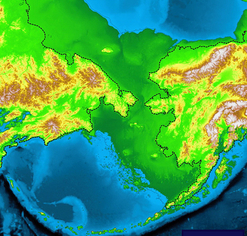
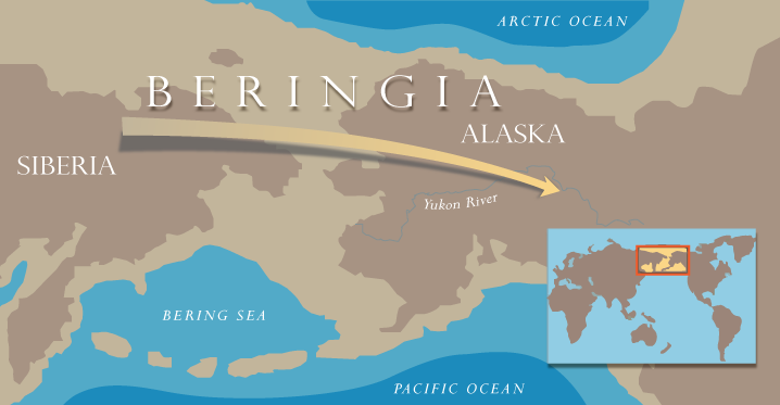
The broadly accepted view about when and how the first Americans entered the Americas has revolved in part around the changes in the glacial periods associated with the last glacial period of the Ice Age. Since about 40,000 B.P., the Cordilleran and Laurentide ice sheets covered much of Canada. However, during the warmer interglacial periods they retreated to create ice-free corridors along the Pacific coast and areas east of the Rocky Mountains of Canada. Scientists have long suggested that it was through these corridors that humans were likely able to cross Beringia into the Americas. Beringia was a land bridge as much as 1,000 miles wide that joined present-day Alaska and eastern Siberia at various times 110,000 to 10,000 years ago. Exactly when and how this crossing may have occurred has been a matter of debate for decades, but the most widely accepted proposal advances the suggestion that it occurred around 15,000 years ago.
A study published in the professional journal, Quaternary Science Reviews, resulted in findings that differ from this prevailing hypothesis by as much as 2,000 years. Led by Nicole Misarti of Oregon State University, the study, known as the Sanak Island Biocomplexity Project and funded by the National Science Foundation, was intended to examine the abundance of ancient salmon runs in the Beringia region. They analyzed core samples taken from Sanak Island, a remote island about 700 miles from Anchorage, Alaska, and about 40 miles from the coast of the western Alaska Peninsula. As the researchers began examining core samples from Sanak Island lakes looking for evidence of salmon remains, they came up with radiocarbon dates much earlier than they had expected. The dates were based on organic material in the sediments, composed of terrestrial plant macrofossils that indicated the region was actually ice-free earlier than believed. Deglaciation there from the last Ice Age, it seemed, took place as much as 1,500 to 2,000 years earlier. Moreover, the researchers had also concluded that the maximum thickness of the ice sheet in the Sanak Island region during the last glacial maximum was actually only 70 meters – or about half that previously projected. This suggested that deglaciation could have happened more rapidly than earlier models had predicted. Given the location, this opened the door for the possibility of earlier coastal migration models for the Americas.
“It is important to note that we did not find any archaeological evidence documenting earlier entrance into the continent,” said Misarti. “But we did collect cores from widespread places on the island and determined the lake’s age of origin based on 22 radiocarbon dates that clearly document that the retreat of the Alaska Peninsula Glacier Complex was earlier than previously thought. Glaciers would have retreated sufficiently so as to not hinder the movement of humans along the southern edge of the Bering land bridge as early as almost 17,000 years ago.”
This shed new light on a long-standing question. If humans had not arrived in the Americas until about 15,000 B.P. as traditional models had suggested, then how could they have spread so quickly to inhabit areas thousands of miles southward, as evidenced archaeologically by their presence at sites such as Monte Verde, Chile, and Huaca Prieta, showing remains dating back to 14,000 to 14,200 years ago? The answer, based on the Sanak Island findings, was that they had actually arrived in the Americas up to 2,000 years earlier.
Another finding was related to the presence of pollen in the samples.
“We found a full contingent of pollen that indicated dry tundra vegetation by 16,300 years ago,” Misarti said. “That would have been a viable landscape for people to survive on, or move through. It wasn’t just bare ice and rock.”
Moreover, she added, based on the findings in the tested area, “the region wasn’t one big glacial complex. The ice was thinner and the glaciers retreated earlier.” Furthermore, previous studies have indicated warmer sea surface temperatures possibly preceding the retreat of the Alaska Peninsula Glacier Complex (APGC), creating conditions more favorable to supporting productive coastal ecosystems that humans could have exploited.
Thus, if the researchers are right, the stage for human entry into the Americas had been set earlier than long theorized. As they wrote in the published study: “While not proving that first Americans migrated along this corridor, these latest data from Sanak Island show that human migration across this portion of the coastal landscape was unimpeded by the APGC after 17 (thousand years before present), with a viable terrestrial landscape in place by 16.3 (thousand years before present), well before the earliest accepted sites in the Americas were inhabited.”
The Emerging Picture
Taken together, new discoveries and research results are thus beginning to paint a picture of a human beginning in the Americas that is considerably more complex and likely earlier than previously thought.
That genetic studies have shown that a single original population of modern humans dispersed from southern Siberia toward the Bering Land Bridge, or ancient Beringia, as early as about 30,000 years ago, and further dispersed from Beringia to the Americas by perhaps 16,500 years ago. But there was more than one migration event, and some of them traversed from the Americas back into Asia. From the paleoclimate evidence, we see indications that the environmental stage was set by at least 16,300 years ago for an accommodating passage for humans into the Americas. From archaeology, we know that humans appeared south of the Canadian ice sheets by at least 15,000 years ago, 2,000 or more years before the emergence and spread of the Clovis culture, and it is no longer clear that there is a clear linear evolutionary relationship between the Clovis culture and early technology discovered in the western regions of the North American continent. Finally, from archaeology, evidence builds to support a suggested route along the deglaciated north Pacific coastline.
To be sure, new discoveries could significantly change or challenge this developing paradigm of the peopling of the American continents, but it could also continue to strengthen it. Time and continuing research will tell. Writes a researcher at the Center of the Study for First Americans at Texas A& M University: “This is an exciting time to be studying the peopling of the Americas. We are confident that through continued empirical research and active interdisciplinary dialog, we will soon know precisely when and how humans dispersed across the New World.”[1]
________________________
[1] The Story of the First Americans, The Center for the Study of the First Americans. http://csfa.tamu.edu/who.php
Article cover image, top left: Excavation team at work at the Friedkin site in 2016.Courtesy Michael R. WatersandCenter for the Study of the First Americans, Texas A&M University
______________________________________
Meadowcroft
By Dan McLerran
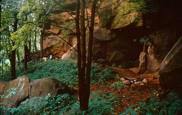
Peering up at it from below, I could see that this wouldn’t be a leisurely stroll.This flight of seemingly countless steps, ascending with rails almost like scaffolding to a destination high above, invited a small sense of adventure. But I could envision that, long before this modern, convenient construction, human visitors surely had a more challenging task. I was told that casual visitors once had to ascend with the aid of a rope assemblage, and long before that, Native Americans had to reach it using whatever devices or efforts at their disposal. Carved by nature in a bluff overlooking a tributary of the Ohio River known as Cross Creek, the ancient rockshelter above had remained tucked away for millennia within a lush green, hilly landscape of what is today called the Allegheny Plateau of western Pennsylvania. Thousands of years of weathering and erosion made this place a cave-like shelter for prehistoric human sojourners—affording them protection from the elements without and a space to rest, sleep and eat within.
Once I reached the top of the steps, I could move freely over a spacious, human-made platform, designed to hold small capacity crowds. I could now see the interior of the rockshelter clearly laid out before me, left as it was after the latest archaeological excavations closed out (although the site continues to be investigated). But long before archaeologists and others came to investigate and work at the site, nature’s hand had already morphed its appearance many times over through thousands of years of weathering and erosion. I could see the visible reminders of this in the face of the sandstone cliffs surrounding it. Slowly sculpted by water, wind and ice, it was an almost surrealistic picture of what time and the elements could do to otherwise seemingly impermeable and impenetrable stone. Today, the rockshelter is enveloped in an impressive, protective overhanging wooden construction, an architectural wonder by itself.
Archaeologists, historians and the public call this place Meadowcroft. For those who know something about the site, the Meadowcroft rockshelter is now widely thought to have yielded evidence of the earliest known presence of humans in North America, along with the longest sequence of continuous human occupation. It was first systematically excavated by Dr. James M. Adovasio. His efforts included a team of colleagues and field school students in the early 1970’s. All together, they uncovered evidence of a human presence they suggested dated thousands of years before the time of the advent of the first broadly recognized human culture in the Americas—the Clovis—and its implied first peopling of the North American continent. Their dating at this site pushed the clock back on human occupation of North America to as much as at least 16,000 years ago.
But this stature and acceptance didn’t come quickly and easily for Meadowcroft and its chief archaeologist. It challenged the prevailing paradigm, radically pushing back the dates on human occupation of the continent. From the very beginning, the validity of his findings related to the earliest human modified stone objects and other features of human habitation found at the site were marked with controversy. Decades later, however, the story of the Meadowcroft controversy has evolved to one of broad acceptance. Partly due to the mounting evidence from other sites with Pre-Clovis artifacts across the Americas, and in no small measure to the meticulous and scientifically rigorous methods used in the Meadowcroft research, the site has arguably become a kingpin in a new mainstream of scientific inquiry that has increasingly legitimized the ‘Pre-Clovis’ way of thinking. Today, Meadowcroft is designated as a National Historic Landmark, drawing thousands of visitors yearly.
Popular Archaeology took the opportunity to interview Dr. Adovasio (pictured below, right) about the site and its significance within the context of the ongoing search and debate on the first peopling of the Americas. What follows are the details of that interview:
_______________________________________
Q1: Would you describe your personal route/experience, attributes and interests that drove you to your current occupation or career?
As I indicated in my book, “The First Americans,” I was essentially programmed to be an archaeologist by my mother, Lena M. Adovasio. She was a four-field major in college, one of which was history and another of which was chemistry. She taught me to read well before kindergarten with geology, paleontology, and archaeology books. As a consequence I never really wanted to do anything else except pursue an archaeology career. I knew where I wanted to go to undergraduate school in the 6th grade and, in fact, attended that institution (The University of Arizona). The attributes which I brought to the “archaeology table” were and remain, extreme attention to detail, a high degree of organization leavened with intense self-discipline, and, I suppose, the ability to absorb and synthesize oftentimes very diverse data sets. It probably helped that, like my mother, I was endowed with a near perfect memory.
Q2: What is the story of how Meadowcroft first came to your attention?
When I assumed a faculty position at The University of Pittsburgh in 1972, I was told that one of the parameters of that position was the establishment of an archaeological and geoaracheological field training program in western Pennsylvania. What I had hoped to locate was an area with little or no previous archaeological or geoarchaeological research coupled with relatively easy striking distance of Pittsburgh for obvious logistical reasons. I also sought an area which contained at least one cave or rockshelter site because these were the sites I was most familiar with from my graduate career at The University of Utah. Because I had previous research commitments on the Island of Cyprus in the eastern Mediterranean, I did not have the time to locate a suitable study area myself. So I circulated word amongst my colleagues in the profession, and as a result, a now deceased historian/amateur archaeologist from what was then California State College, California, Pennsylvania, informed me about Meadowcroft Rcokshelter in the early spring of 1973. His name was Phil Jack, a longtime friend of the landowner, Albert Miller, who discovered the site. I arranged with both of them to visit the site in the later spring of 1973 and upon viewing it decided to solicit permission from the landowners to begin excavations there in June of 1973. The rest is, literally, history.
Q3: While excavating at Meadowcroft in the 1970’s, what was it that made you realize that there was something special or unusual about this site?
We initially believed that the deposits at Meadowcroft would be something less than a meter in thickness and that the oldest occupation would be Late Archaic or Early Woodland, at best. These estimates were based on excavations at other rockshelters in southwestern Pennsylvania and adjacent portions of Ohio and West Virginia. However, early in the 1973 season it became clear that the deposits at the site were well in excess of a meter in thickness and the recovery of Middle and Early Archaic materials signaled an older occupation than we had imagined. Of course, when the first radiocarbon dates were run after the 1973 season was over, it was evident that the site was initially occupied earlier than we suspected.
___________________________________________
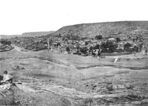
General view of Meadowcroft Rockshelter facing west before excavation in 1973; vegetation marks the limits of the vegetation current overhang; large block in lower left represents a roof detachment ca. 12,500 years ago. Image courtesy James M. Adovasio
____________________________________________
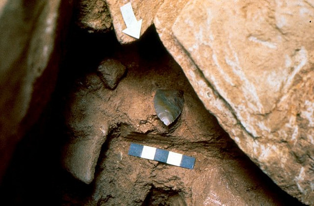
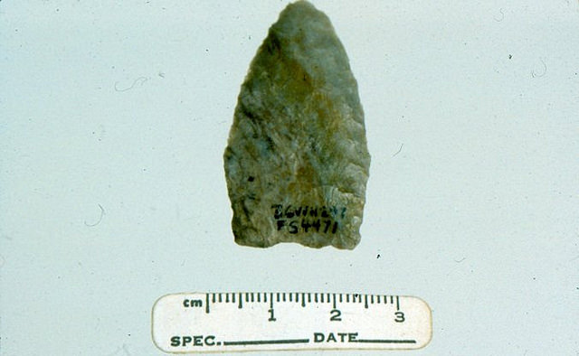
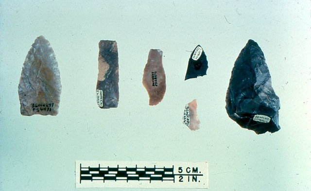
Q4:What finds convinced you that you had uncovered evidence of human occupation at this site going back possibly 16,000 years or more?
The answer to this question is more complicated than it seems. The deposits at Meadowcroft are characterized by a series of roof spalling and block collapse events which dramatically altered both the configuration of the rockshelter, as well as the availability of “livable” floor space through time. One such spalling event marks, in effect, the Pleistocene-Holocene boundary as well as, for all intents and purposes, the end of the Clovis interval in southwestern Pennsylvania. Beneath this spalling event, we expected to encounter no additional, older cultural material, but rather the parent bedrock of the rockshelter in the form of the Birmingham Shale. Instead of the Birmingham Shale, we found a series of apparent occupational surfaces replete with shallow fire pits and associated artifacts of indisputable anthropogenic origin. Radiocarbon dates derived from charcoal within these pits clearly preceded the established age of Clovis in eastern North America, thereby, and surprisingly to us, indicating an earlier than Clovis occupation. Additionally, none of the recovered artifacts, most notably the unfluted lanceolate so-called Miller projectile point [named after the site’s discoverer] and small blade flakes, were consistent with a Clovis ascription.
_______________________________________
Lithic shown under rockfall is the type specimen of the Miller Lanceolate projectile point form. Courtesy James M. Adovasio
______________________________
Miller Lanceolate projectile point type specimen, obverse surface; the specimen is significantly re-sharpened and reduced in overall dimensions from the hypothesized prototype; it is unfluted, but basically ground. Courtesy James M. Adovasio
_________________________________
Assorted Miller Complex artifacts from Stratum IIa (containing the oldest cultural remains radiocarbon dated to about 16,000 years B.P.) at Meadowcroft Rockshelter; from left to right: Miller Lanceolate type specimen made of local Cross Creek chert, prismatic blade flake made from Onandaga chert, prismatic blade flake made from Flint Ridge chert, biface fragments made from Flint Ridge or Kanawha chert (black specimens are Kanawha). Courtesy James M. Adovasio
Q5: What is the significance of these findings within the context of the Clovis First debate?
Meadowcroft was the first site in nearly 40 years to seriously challenge the long held Clovis-First paradigm. Between 1933 and 1973, more than 500 archaeological sites in North and South America were claimed to be older than the Clovis horizon of ca. 10,900 to 11,300 uncorrected radiocarbon years ago. Prior to Meadowcroft, all of these Pre-Clovis claimants exhibited a similar history. First, you would read about them in a local newspaper or popular scientific journal, then more extensive treatments would appear in the technical scientific literature. Inevitably, the sites would then be exposed for some real or imagined flaw – the artifacts were not definitively of human origin; the stratigraphy was non-existent or imperfectly defined; the context and association of even genuine recovered artifactual material was problematic, etc. As I pointed out in “The First Americans,” each of these sites enjoyed a Warholesque 15 minutes of fame, then disappeared into oblivion. Each time one of these claimant sites failed, it reinforced the Clovis-First model. Therefore, by the time the initial reports on Meadowcroft appeared, there was a long established record of failure which served to render the Meadowcroft discoveries suspect ab initio.
Q6: Do you think the Clovis First paradigm is now discredited, or on its way out, given the findings from other sites across the Americas that show evidence of human occupation before Clovis times? (In other words, do you think there is sufficient evidence now to support a pre-Clovis presence or culture in the Americas, and why?)
To answer this question, it is perhaps useful to cite an observation by Dr. Jonathan C. Lothrop in his review of a Pre-Clovis site in the Americas, a volume published by the Smithsonian Institution. He says,
“In 2015, if one polled New World archaeologists familiar with the literature, I suspect most would agree that there is a growing body of evidence of human occupation in the Americas that pre-dates ca. 13,200 Cal. B.P.” (Lothrop 2015: p. 256)
I certainly concur with Lothrop’s assessment, but it is also worth stressing that a handful of very vocal, Clovis-Firsters still remain and, like Hrdlicka in an earlier time, will probably go to their graves with their minds unchanged. The death of established paradigms often takes a very long time—as witnessed, for example, by the many decades which elapsed between the promulgation of continental drift and its widespread acceptance in the geological community. I completely underestimated how long it would take for Clovis-First to expire and I also misjudged the degree to which its “spear carriers” would hold on to their beliefs. This is all particularly interesting given the fact that, almost from its inception, most European scholars and virtually all South American scholars questioned the underpinnings of the Clovis-First model. The American response, of course, was that the Europeans were simply ignorant of the facts and that the South Americans didn’t even publish in English. The number and distribution of what might be called broadly acceptable Pre-Clovis archaeological sites now clearly points to an earlier than Clovis presence. I stress, however, that even if there were only one, then one would be sufficient. Monte Verde effectively terminated the argument even if its still vocal critics don’t accept the fact.
_____________________________________________
Blade flakes from Stratum IIa at Meadowcroft Rockshelter; cross sections range from prismatic on the first three specimens to triangular on the forth; the edge is intentionally dulled for hafting. Courtesy Jame M. Adovasio
________________________________
Bifaces from Stratum IIa at Meadowcroft Rockshelter. Courtesy James M. Adovasio
Close up of blade flakes from Meadowcroft Rockshelter; one edge of each blade flake is intentionally dulled for hafting, while the opposite edge is the working edge. Courtesy James M. Adovasio
___________________________________
Polyhedral blade cores of the type from which Meadowcroft blade flakes were struck; these are very different from Clovis blade cores. Courtesy James M. Adovasio
Fractured punch made of antler and truncated blade flake lying upon a 13,500 year old surface. Courtesy James M. Adovasio
_________________________________
Q7: What were the specific challenges of excavating and investigating the site?
All cave and rockshelter sites around the world are part of what some archaeologists call the “marked landscape”. Places so designated were well known to aboriginal populations both in time and through time and as such, were frequently visited and utilized. While some of these sites probably witnessed yearly visits, many were only episodically visited. Because of repetitive visits, often over very long periods of time, such sites provide the opportunity for studying environmental change and concomitant human adjustments to those changes in very unique ways. Unfortunately, depending on the nature, intensity, and duration of these visits, these types of sites may evidence considerable anthropogenic disturbance with attendant difficulties in establishing the stratigraphic/occupational sequence. Additionally, because of the nature of the depositional process in many of these sites, even without human disturbance, the stratification may be remarkably complex. The combination of naturally complicated stratigraphy and repetitive human visits with attendant disturbance render the proper excavation of these kinds of sites very difficult.
Q8: What specific techniques, processes, methodologies and applications made the investigation of this site stand out from other excavations or investigations?
A necessary preamble to this answer is to state that a field archaeologist in virtually any setting – prehistoric, historic, or forensic – has three basic responsibilities. The first, and most fundamental of these, is the reconstruction of stratigraphy from visible stratification. While in English, we tend to use the terms “stratigraphy’ and “stratification” interchangeably, they do not, in fact, mean the same thing. Stratification is an objective phenomenon. It has both subjective and objective physical properties which can be detected, assessed, and measured. Stratification is a product. Stratigraphy is both the process by which stratification is created and the study of that process. The establishment of stratigraphy from observable stratification is fundamental and critical to the other two responsibilities of a field archaeologist. Without it, the other two cannot be done. The second responsibility is the delineation of context. Context literally means place in time and space and unless the context of all recovered material is explicitly defined in a stratigraphic perspective, there is no context. Finally, perhaps the most difficult field responsibility is the demonstration of association. Association means that two or more items have entered the archaeological record penecontemporaneously as a consequence of the same process. Association refers, in forensic terms, to primary or probative evidence as opposed to secondary or circumstantial evidence.
Suffice to note, for reasons already articulated, it is particularly and peculiarly difficult to execute the three responsibilities of a field archaeologist in a cave or rockshelter situation. To execute these responsibilities in any excavation situation requires knowledge of and the ability to operationalize all of the so-called laws of stratigraphy. While most people are familiar with the first of these laws – superposition – many are, to varying degrees, unfamiliar with the remainder. These include original horizontality, lateral continuity, and intersecting relationships. The key to operationalizing all of these principles – frequently referred to as Steno’s Laws – requires the ability to recognize and delineate the contacts or interfaces between discrete strata. Without digressing into an arcane lecture on methodology, it should be noted that during the Meadowcroft excavations much of our attention was directed precisely at facilitating and defining interfaces and contacts. Students were exhaustively trained to recognize strata differences on the basis of perceived textural differences. In practice, this meant that they could use their trowels to detect differences in compactness versus friability, density versus porosity, and related properties by feel and even sound. Once sufficiently skilled, our students could recognize stratigraphic differences quite literally with their eyes shut in much the same way that anyone could detect by feel and sound alone the difference between layers of cake and icing between those layers. Despite the reliance on texture in the excavation training process, a wide array of other things were done to maximize the ability to “see” stratigraphic transformations in profile. Meadowcroft, virtually from the outset, was fully electrified and thanks to University of Pittsburgh engineers in conjunction with assistance from Westinghouse, we were able to install an experimental lighting system that allowed the excavators to combine different light sources to illuminate stratigraphic profiles in a variety of ways. The difference between different light source combinations was and is striking and, at that time, had not been employed extensively as a supplement to excavation.
In order to systematically plot the three-dimensional Cartesian coordinates of artifacts and ecofacts, a series of vertical and horizontal datum points were combined, initially manually, and later, via total stations, to ensure the establishment of the appropriate provenience or context of excavated materials. Since the rockshelter had an active phone line, we could then communicate directly via telephone modem to the mainframe at the University of Pittsburgh to encode excavation data. To my knowledge, this is also the first time that was ever done – at least in a cave or rockshelter setting.
In order to provide objective verification of what were subjectively defined strata, samples of sediment from each stratum or microstratum were processed with a Coulter blood cell counter converted to measure sediment size differences. Once again, this was the first time such technology had been employed in the field.
I could continue in this vein, but the point here is simply this – given the experience and imagination of the investigators, coupled with sufficient funding, we were able to implement a variety of data recovery and documentation as well as analytical protocols which had never been extensively employed before. While some of these did not work as expected, many did. The collective effect was a level of precision in the excavations which virtually no critic of the site has ever questioned.
______________________________________________
Precision and care: Excavation of a thin anthropogenic surface at the site via single-edged razorblade. Courtesy James M. Adovasio
_________________________________
Above and below: On-site documentation procedures at Meadowcroft Rockshelter; colored pencils which represented different combinations of silt, sand, and clay-sized materials were employed to produce microstratigraphic profile maps of all parts of the excavation. Courtesy James M. Adovasio
_________________________________
Q9: What arguments or issues did you have to address regarding the validity of the finds and their dating?
Virtually from the publication of the first radiocarbon chronology from Meadowcroft in 1974, the possible age of the earliest occupation of the site engendered great controversy. Significantly, especially as compared to other putative Pre-Clovis claimant localities, none of this controversy surrounded either the excavation methodology employed at the site nor the possible anthropogenic origin of any of the earliest artifacts. As already noted, the excavations at Meadowcroft were, and still are, widely hailed as “meticulous” and the “early” artifacts bear the unmistakable stigmata of humanly modified materials. Instead, the criticisms of the possible antiquity of the site pivoted around three basic issues: 1) the possible particulate or non-particulate contamination of only the eleven oldest radiocarbon samples from the site; 2) the absence of Pleistocene faunal remains; and 3) the apparently anomalous character of the recovered floral materials.
Dozens of pages of published material have been devoted to refuting the objections to the apparent age of the lower and middle Stratum IIa materials from Meadowcroft and these arguments will not be repeated here. It should be sufficient to note that there is absolutely no probative evidence for the particulate contamination of any of the eleven oldest C-14 samples from Meadowcroft. As to non-particulate contamination, the introduction of dissolved older carbon into just the eleven deepest radiocarbon samples from Meadowcroft requires a vehicle for contamination in the form of groundwater movement. An intensive micromorphological study conclusively demonstrated that such movement did not occur and, therefore, the non-particulate contamination issue is moot.
As to the faunal and floral critiques, modern research indicates that the paleoenvironment south of the glacial ice front in North America was remarkably variable and diverse. Further, the floral species represented at Meadowcroft were not inconsistent with such diversity. Finally, the faunal remains from Meadowcroft’s oldest deposits are diminutive both in numbers and weight, though all of the species represented have been reported in Late Pleistocene contexts elsewhere in eastern North America.
Put most simply, all of the currently available data suggests that Meadowcroft was sequentially and sporadically visited before the advent and spread of Clovis technology by populations who may or may not have been the ancestors to the makers of fluted points.
Of course, a larger issue, at least for some scholars, was the absence for a period of time of “other Meadowcrofts.” Now, of course, there are other sites of demonstrable Pre-Clovis age. Despite the best efforts of diehard Clovis-Firsters to discredit these other localities, often with incredibly convoluted and far-fetched scenarios, the existence of Pre-Clovis populations in the new world is now widely accepted.
Meadowcroft set the evidentiary bar! Monte Verde broke it! Other sites are appearing to join them. For Clovis-First it is the end of the game.
Q10: If you were to create a scenario or story describing the nature and lifestyle of the early, Pre-Clovis inhabitants of the site, what would it be?
As described in various publications, the earliest visitors to Meadowcroft appear to have been broad spectrum foragers rather than megafauna-focused big game hunters. These populations visited the site, as would their successors, principally in the fall of the year, utilizing a durable technology that included the production of unfluted lanceolate projectile points and the manufacture of diminutive blade flakes from polyhedral cores. They also employed a perishable technology that included basketry and presumably a variety of other less well documented related technologies. Their visits to Meadowcroft were apparently brief and perhaps separated by a number of years. They exploited a wide array of lithic raw material sources which I personally do not believe reflect their range. I would suspect these materials were acquired by trade and exchange. These sources include Kanawha chert from West Virginia, Onandaga chert from New York, and Flint Ridge chert from Ohio to name but a few. Evidence of these earliest visitors to Meadowcroft, named by us the Miller Complex after Albert Miller who discovered the site, are also evidenced at several other localities in the Cross Creek Drainage and a very similar durable technology is also evident at more remote locations like Cactus Hill in Virginia. While there are no obvious technological connections between Miller durable technology and Clovis, there is the possibility that some sort of relationship may be discovered in the future.
_____________________________________________
Reenactment of Paleoindian family unit showing both genders, different ages, durable and non-durable technology. Courtesy James M. Adovasio
_____________________________
Q11: What is in store for the future investigation and research of this site?
About one third of Meadowcroft remains unexcavated. This area is available for future study when there are even more resolute excavation, documentation, and analysis protocols available. The main task at present is to complete the long overdue final report as well as a series of smaller contributions about one or another aspect of the long Meadowcroft sequence.
Q12: Are there any other comments you would like to make?
The Meadowcroft/Cross Creek operation was originally designed as an undergraduate and graduate training project aimed at both anthropology/archaeology students and those in related fields. Obviously, there was also a research component but this was, at least on paper, secondary to the student training goal. Because of the experience of the multidisciplinary research staff as well as access to extraordinary funding, it was possible to not only offer students state-of-the-art protocols in site excavation, documentation, and analysis, but also to constantly refine those protocols from both a methodological and substantive perspective. Because of the foregoing, the excavations at Meadowcroft were considered by others to be at the very cutting edge of the field. That they are still considered by many to be so is a testimony to the success of the methodological aspect of the project. We have always been more proud and pleased with the methodological “end” of the Meadowcroft project than any, or even all, of the results it produced. Expanding the envelope of the field in any perspective is rewarding, but in terms of actual enhancement of field data collecting procedures, it is and has been particularly gratifying. From a more substantive perspective, while the earliest materials from Meadocroft have garnered the most attention, the incredible length of the occupational sequence is to us far more striking. Because of the lengthy and hyper-detailed Paleo-environmental record from Meadowcroft, we can examine macro and micro climatic changes and their attendant consequences very precisely. We can also articulate in unique ways human responses and adjustments to those changes. That was in essence the “cake” we were trying to bake. That the site proved to be quite old was the unintended “icing.”
Underwater excavations at the 14,600-year-old Page-Ladson site. Center for the Study of the First Americans, Texas A&M University
_________________________
As it traverses the marshy Gulf coast lowlands of the Florida panhandle’s Big Bend region, the aquifer-fed Aucilla River would not fit the typical description of a North American river.It flows visibly above the surface in places, like most rivers do, but then disappears in other places into an ancient underground sinkhole system, carved into a vast limestone bedrock foundation over time by geological processes of erosion and collapse. Many thousands of years ago, one might not have recognized it as a river at all. Back then, when sea level was much lower, it was simply a series of sinkholes of various sizes, clearly visible from the surface. Today, the river is an underwater treasure trove of fossilized remains of long-extinct creatures. Needless to say, it has been an important paleontological destination for scientists conducting research on the North American Pleistocene past.
One place along the river, known as the Page-Ladson site, has recently yielded some tantalizing finds — evidence of a very ancient human presence, people who lived here before the Clovis era more than 14,000 years ago.
But few people can actually see this site. It lies submerged under about 30 feet of water and additional layers of sediment within a bedrock limestone sinkhole 60 meters in diameter. It is the exclusive domain of scuba divers. Everyone else, at the surface, only sees the slow-moving river flowing through a thick cypress swampland. During Pleistocene times, however, this sinkhole was essentially dry and easily accessible, and for the animals of the time, it had a particularly attractive feature — a small freshwater pond at its base. We know this because, since the mid-1980’s, scientists have studied the geology and recovered bones and other evidence there that tell a story of giant Ice Age mammals frequenting the pond for its fresh water.
Digging Page-Ladson
It was in the early 1980’s when Buddy Page, a recreational diver and avocational archaeologist, recovered elephant bones beneath the surface of what is today known as the Half-Mile Run section of the Aucilla River. Thinking that any further investigation would require the services of a professional team of scientists, he reported the site and his finds to Jim Dunbar, then of the Florida Bureau of Archaeological Research, and David Webb, professor of Vertebrate Paleontology at the University of Florida. Together with a team of divers and other experts, Dunbar and Webb proceeded to excavate and study the site beginning in 1983, discovering in the process eight stone artifacts, mostly flakes, in association with butchered mastodon bones within a deposit dated through radiocarbon dating techniques to more than 14,400 years old. Most remarkable was an adult mastodon tusk that exhibited what appeared to be human-made cut-marks.
The findings were not without controversy. The age of the finds based on the dated deposit “was an impossible age for the scientific community to accept at the time,” says Jessi Halligan of Florida State University, a co-author of the most recent study and report on the Page-Ladson site, “because it was well-accepted that the Americas were colonized by the Clovis people who arrived on the continent over the Bering Land Bridge no more than 13,500 years ago at the oldest.”
Part of the difficulty surrounded the nature and difficulty of the location. “As an underwater site, it could not be visited by just any member of the archaeological community, so the discoveries could not be verified by impartial peers,” says Halligan. “And everyone knows that rivers are destructive earth-movers, so it seemed quite possible that even if the layers were as old as the researchers reported, that the material may not be cultural at all.”
Dunbar and Webb published their research on the findings, but for years their findings, enshrouded in dispute, were consigned to near oblivion.
Until 2012.
Texas A&M University’s Center for the Study of the First Americans decided to take on the challenge by returning to Page-Ladson to finally resolve the status of the site. “I always thought the site had great potential to help us resolve the issue of whether people were here before Clovis and I always wanted to investigate the site,” said archaeologist Michael Waters, Director of the Center. “I got my chance in 2012 when John Ladson [the owner of the property surrounding the site] invited me to investigate the site.”
Waters, long a well-known name in First American studies, turned to Jessi Halligan to join him as co-director of the new project. Halligan, a veteran of 20 years in North American archaeology and who studied under Waters at Texas A&M, had already been deeply involved in Aucilla River research since 2007. Together, they headed a group composed of scientists and divers that would lend the best expertise to the total research effort. It was a perfect team.
But the challenges were considerable. First of all, the site was 30 feet underwater, requiring SCUBA access. Communications between divers during any excavation thus meant using hand signals and notes written on mylar clipboards. Because the river water was stained into a dark red color by tannins, most sunlight could not penetrate the depths to the site, so lights were needed to work. Safety was a premium, so work demanded extensive logistics which required diving in teams of two, redundant SCUBA equipment, a dredge and dredge operator for the dive teams, and additional divers at the surface to manage the divers and air supply. All materials recovered and brought to the surface had to be meticulously dried and conserved, a time-consuming process.
Added to this were the environmental and weather conditions. “We were hot, dirty, and bitten by bugs,” said Waters. “The first year we worked at the site, we were plagued by flooding and hurricanes.”
Reaching their goal of finding new evidence of pre-Clovis occupation proved elusive at first. “The area we excavated yielded no artifacts,” wrote Waters to Popular Archaeology. “We confirmed the stratigraphy and found some bones of extinct animals, but we needed artifacts.”
But for Waters and Halligan, persistence was the name of the game. “We were convinced we needed to give it another try and the next season we had better weather,” said Waters.
Along with the better weather came better results. In 2013, Waters and Halligan hit their ‘pay dirt’. There were multiple dives, but on one dive, a crew that included Morgan Smith, a graduate student of Waters, and John Albertson, went down to clean up an excavation unit and began to excavate a new level. As they dug, Albertson’s trowel met some resistance. Fanning the sediments away, he found what appeared to be an artifact — a biface. Leaving it in place, Smith came up to the surface to announce the new discovery.
“We decided to collect samples from all around the biface and above it and below it for radiocarbon dating so that there would be no confusion about its age,” said Waters. “In the end, 71 samples were radiocarbon dated and confirmed the age of the artifact to 14,550 years ago.”
Finally bringing the artifact up to the surface after the dating samples were taken, they determined upon examination that it was indeed a biface — a reworked knife fragment — lying in the same deposit that contained the remains of extinct mammals — mastodons, camels and bison. This was the same deposit in which Dunbar and Webb had discovered the mastodon tusk that featured cut-marks — the multiple, parallel, deep linear grooves that ran perpendicular to the long axis of the tusk — clear signs of human activity. Other flakes were found within the same or similar deposits, bringing the total artifact finds to six.
“We were all excited,” Waters wrote Popular Archaeology. “I will never forget that day and the feeling of excitement when the artifact came to the surface. It was like a moment when you know you have found something special that will change a long held paradigm.”
Waters was right. It was a moment, like some other moments at other sites, that would change what we know about when and how the first Americans made their debut in the Americas.
_________________________________________
Surface setup at the site, showing the floating screen decks with yellow hoses leading to divers underwater, bubbles by buoys are air bubbles from divers. Pictured are John Albertson, Rodrigo Torres, and Jessi Halligan on floating screen decks. Photo by Adam Burke. Provided courtesy of the Center for the Study of the First Americans (CSFA).
_______________________________
Halligan waiting to begin a dive. Photo by Brendan Fenerty. Provided courtesy of the Center for the Study of the First Americans (CSFA).
Halligan and Neil Puckett examining find. This is a juvenile mastodon radius. Photo by Brendan Fenerty. Provided courtesy of the Center for the Study of the First Americans (CSFA).
________________________________________
Puckett bringing subadult mastodon bone to surface for conservation. Photo by Brendan Fenerty. Provided courtesy of the Center for the Study of the First Americans (CSFA).
_______________________________________
Halligan excavating underwater during 2015 season. Photo by Shawn Joy. Provided courtesy of the Center for the Study of the First Americans (CSFA).
The pre-Clovis biface in place at the bottom of the 2013 excavation block just after discovery. Photos by Jessi Halligan. Provided courtesy of the Center for the Study of the First Americans (CSFA).
Excavation Schematic Image by Jessi Halligan. Provided courtesy of the Center for the Study of the First Americans (CSFA).
________________________________________________
Morgan Smith and Michael R. Waters examining biface immediately after its discovery (by Smith and his dive buddy, John Albertson). Photo by Adam Burke. Provided courtesy of the Center for the Study of the First Americans (CSFA).
_____________________________________________
Tusk reassembled. Adult mastodon tusk from ARPP excavations at the Page-Ladson site (UF 150701) shown reassembled for Dr. Daniel Fisher’s reexamination of the cut-marks. Jessi Halligan, Cindy Fisher, and FLMNH researcher Jason Bourque shown. Photo by Daniel Fisher.
__________________________________________
Making the Case
“The Gold Standard necessary to demonstrate unequivocally that a site pre-dates Clovis has always been 1) clear evidence of human activity usually in the form of stone tools; 2) artifacts occurring in a solid geologic context, and 3) artifacts dated using a reliable dating technique,” asserts Waters. Page-Ladson, they maintain, meets all of these criteria for several reasons:
At Page-Ladson, unequivocal lithic artifacts, including a bifacial knife and utilized flakes, are associated with mastodon remains (including a tusk with stone tool marks).
These artifacts are sealed in undisturbed geological deposits at the base of a 4-m-thick stratified sequence.
Seventy-one new radiocarbon ages show that the artifacts date to 14,550 years ago and that the stratigraphy at the site is undisturbed.*
Armed with this evidence, Waters and Halligan suggest that the site plays a significant role in informing the ongoing debate about how and when the first peoples of the Americas settled the landscape and what they were doing. They point to the research showing that Page-Ladson is about the same age as the Monte Verde site, indicating that people were living on both American continents at least 14,500 years ago; that there were also people, based on archaeological finds, present at this time in Washington, Oregon, Texas, Wisconsin, and Pennsylvania; that the findings are consistent with the genetic research showing a pre-Clovis presence in the Americas; and that evidence in the form of dung fungus at Page-Ladson indicates that large mammals like mastodons became extinct around 12,600 years ago, showing an overlap of humans and a large extinct mammal presence, suggesting the possibility that human hunting may have had an impact on their extinction.
Most significantly, the Page-Ladson finds feed into an emerging new paradigm. “At the time people were butchering or scavenging a mastodon carcass at 14,550 years ago at Page-Ladson, the Ice Free Corridor or inland route into the Americas would have been closed,” Waters concludes. “The evidence from Page-Ladson provides indirect support for a coastal migration into the Americas. How people made their way to Florida and how long this took, we can only speculate, but this [obviously] hints at an even earlier arrival of people into the Americas.”
Popular Archaeology asked Halligan if she, based on the findings, could reconstruct the scene that existed at this place so long ago in prehistory:
What we have evidence for is the following: 14,500 years ago, people were within this steep-walled sinkhole butchering a mastodon at the edge (and possibly partially within) a shallow pond. They expended a great deal of effort to extract a tusk that they later left behind, either because they were only interested in the fatty meat within the tusk cavity, or because they wanted to leave it preserved in the shallow pond for later, but never returned for it. The evidence from this site is sparse, but its location and contents can tell us some important things: this site shows people were well-familiar with the landscape, and knew where to get stone for toolmaking, knew how to extract a tusk, and knew when, where, and how to access freshwater. In other words, they were very capable and competent hunter-gatherers who probably were pretty familiar with this landscape.
Looking Ahead
For now, neither Waters nor Halligan have any immediate plans to return to the field at Page-Ladson. It doesn’t mean, however, that work is over. Project staff is busy documenting the findings from the younger strata at the site, including pollen and spore analysis and special studies on core and sediment samples, and Waters and Halligan are also continuing their search for other sites that may bear on the earliest Americans.
In the end, whether or not scientists return to Page-Ladson for further excavation and survey, the site is already well on its way to leaving a legacy.
“The record of human habitation in the Americas between 14,000 and 15,000 years ago is sparse, but it is real,” concludes Waters. “The few stone tools and the other evidence left behind by hunter-gatherers at the bottom of the Page-Ladson sinkhole 14,550 years ago will have a long lasting and profound impact on our understanding of the earliest pioneers and explorers of the Americas.”
Divingcrew lined up for survey work. These divers are waiting to conduct a survey, looking for new sites. Photo by Jessi Halligan. Provided courtesy of the Center for the Study of the First Americans (CSFA).
________________________________
*Michael Waters, response to Popular Archaeology inquiry, January 2017.
Information for this article was obtained from a variety of sources, including written interviews with Michael Waters and Jessi Halligan, as well as the detailed study report cited below.
Halligan et al., Pre-Clovis occupation 14,550 years ago at the Page-Ladson site, Florida, and the peopling of the Americas, Science Advances 13 May 2016;2:e1600375
Cover image, top: SCUBA diver Ivy Owens collecting micromorphology samples during 2015 season. Photo by Shawn Joy. Provided courtesy of the Center for the Study of the First Americans (CSFA).
________________________________
West Coast Rising: Huaca Prieta
By James Kensington
View of the Huaca Prieta site on the coast of Peru. Courtesy Tom Dillehay
___________________________
Just north of the bustling city of Trujillo, a distinctively imposing 30-meter-high mound of earth and stone overlooks the Pacific coast along the edge of the Chicama Valley. Unlike Trujillo, it is a quiet place. Agricultural fields dress its backdrop nearby. It has a name — Huaca Prieta, which, in Spanish, means “dark mound”. To the casual passer-by it strikes the impressive image of a distinctive greyish natural hill rising prominently behind the beach. But aside from its imposing physical appearance, Huaca Prieta stands apart for another very dramatic reason: within the underlying terrace that defines its foundation lies an archaeological record of human occupation that goes back as long ago as nearly 15,000 years B.P., with the astounding discovery of this very early occupation only recently coming to light.
________________________________________
Huaca Prieta means “dark mound”, which was built on a low late Pleistocene terrace between 7,800-3,500 years ago and since then used as a burial place for later cultures. Today it is used for shaman rituals. Buried in the terrace below the mound are maritime and terrestrial cultural remains dated from about 14,500 to 8,000 years ago. Courtesy Tom Dillehay
Archaeologists first began uncovering the mystery of the mound when excavations began under Junius B. Bird in 1946–1947. He and his team excavated three test pits. Among their finds were complex textiles with designs representing mythological humans, snakes, crabs and condors, as well as stone artifacts such as pebble tools and flakes. While excavating, they encountered the remains of underground structures, some of them featuring burials constructed of cobblestones and an ash-water mix. Evidence also emerged, with objects such as fish net weights and fish bones, that suggested the ancient inhabitants were fishers and gathered shellfish, with organic remains also indicating they were agriculturalists, growing beans, squash, gourds, tubers, peppers, cotton and fruit.
But the latest, and perhaps most remarkable, chapter at Huaca Prieta did not unfold until 2006, when anthropologist Tom Dillehay of Vanderbilt University began excavations and investigations of the site with the late Peruvian archaeologist, Duccio Bonavia, and a multi-disciplinary team of scientists and specialists. (Dillehay is best known for his work and discoveries at Monte Verde in Chile, where evidence of early human settlement more than 14,000 years old was found in 1975, challenging the long-held Clovis theory that suggested the first human arrival in the Americas was no older than 13,000 years ago). “I was always fascinated by the work of Junius Bird at the site and by the incredibly distinct color and form of the mound located next to the ocean,” said Dillehay of the site. “I had never seen anything like it.”Dillehay had been working on the north coast of Peru since 1976 and continued to visit the site, but a series of unanswered questions, and a tip from geologists who had previously examined the site suggesting it could possibly contain cultural material deep into prehistory, inspired him to renew investigations.
As a scientist, however, Dillehay’s interest went far beyond the prospect of discovering deep history. “The objectives were simply to better understand the economy, stratigraphy and chronology of the site with new questions and methods,” he continued. “We also planned a detailed interdisciplinary study focused on paleoecology and outlying settlement patterns in the area, including other Preceramic sites, and we wanted to produce detailed quantification and qualification of the faunal and floral remains.”
His investigations slowly made their way to accomplishing these goals. But little did he know what treasures awaited him and his team as they carefully and systematically dug their way down through the mound. “We had expected many of the findings, but we found many more and diverse items than Bird had found,” said Dillehay. The team uncovered exotic materials, as well as food and non-food remains, and countless flecks of charcoal that suggested, in the context of associated artifacts, ritual fires.“Bird thought the mound was residential, like a midden,” said Dillehay, “but it was almost exclusively ritual and mortuary.” Many other well-preserved organic remains were uncovered, including textiles, cordage, and ornate baskets. The basket remnants consisted of diverse materials, including a local reed still used by basket makers today. Some of the baskets were remarkably sophisticated, featuring segments made from domesticated cotton, colored with what was determined to be one of the oldest dyes known in the Americas. Indeed, in 2016, 6,000-year-old dyed cotton fabric was discovered. Analysis showed that it was indigotin, an indigoid dye, the earliest documented use of indigo dye to date, predating the use of indigo in Egypt by 1,500 years. In addition, stone tools, including a variety of hooks and objects likely used for deep-sea fishing, were also found.
But equally exciting was the dating of the site, particularly the lower layers.
“We were very surprised when we started getting early dates underneath the mound and especially on the south end of the mound where Bird never excavated,” exclaimed Dillehay in his correspondence with Popular Archaeology. Radiocarbon dating techniques showed human occupation as early as nearly 15,000 years ago.
__________________________________
Workers taking bucket loads of excavated sedimentsfrom a deep excavation unit to screens for sifting. Courtesy Tom Dillehay
_______________________________________________
Archaeologists working at the 30 m depth level at Huaca Prieta. Courtesy Tom Dillehay
___________________________________
An Early Society
It is no longer extraordinary to discover evidence of a human presence in the Americas before 13,000 years ago. A number of discoveries at disparate locations have attested to this — such as Blue Fish caves in the Yukon territory of Canada where archaeological remains suggest humans at about 24,000 years ago, Meadowcroft Rockshelter in western Pennsylvania, where stone tools were found to be as much as 16,000+ years old, and Monte Verde in Chile, the site of Dillehay’s excavations beginning in the 1970’s, with evidence suggesting human occupation as long ago as 18,500 B.P. These sites and discoveries name only a few that have emerged in recent years. The findings have supported the formulation of new paradigms for human migration into the Americas, adding the possibility that humans crossed by water, along coastal routes, in addition to the traditionally accepted inland routes (such as passage through the ice-free corridor from ancient Beringia after leaving Asia).
Perhaps the biggest takeaway from the Huaca Prieta investigations thus far, outside of the early dates, is the realization that a relatively sophisticated society was emerging in the region long before the earliest great civilizations were taking shape in other areas of the world. Part of the foundation of that early civilization as exemplified by Huaca Prieta was in part because of the exploitation of multiple streams of resources, combining maritime and agricultural-based economies into an integrated strategy for survival and creating an economic surplus as the basis for the early, structured, urbanized centers that followed.
“These strings of events that we have uncovered demonstrate that these people had a remarkable capacity to utilize different types of food resources, which led to a larger society size and everything that goes along with it such as the emergence of bureaucracy and highly organized religion,” said James Adovasio, co-author of the recently published study on Huaca Prieta and a world-acclaimed archaeologist at Florida Atlantic University. (It was Adovasio who conducted the pioneering work at the Meadowcroft Rockshelter in Pennsylvania, where some of the earliest evidence of human occupation in the Americas was found).
Adovasio is one of the world’s leading experts in the analysis of ancient textiles and basketry. He focused particularly on the extensive collection of basket remnants excavated at the site.
“To make these complicated textiles and baskets indicates that there was a standardized or organized manufacturing process in place and that all of these artifacts were much fancier than they needed to be for that time period,” said Adovasio. “Like so many of the materials that were excavated, even the baskets reflect a level of complexity that signals a more sophisticated society as well as the desire for and a means for showing social stature. All of these things together tell us that these early humans were engaged in very complicated social relationships with each other and that these fancy objects all bespeak that kind of social messaging.”*
____________________________________________
Various unifacial flakes from basalt and andesite cobbles, dating between ~14,500-13,500 years ago. Courtesy Tom Dillehay
_________________________________________
Above: Some of the exotic ritual offerings dated between 7,000-4,500 yrs ago: a, Spondylus fragment; b-c, turquoise fragments; d, malachite; e, Scleractinia sp. coral; f, rock crystals; g, ceramic fragments. Courtesy Tom Dillehay
_______________________________
Textiles: Early cotton fibers were dated to around 6,200 yrs ago. The textiles shown here are dated to 5,500-4,000 yrs ago: a, Specimen 2009.154.02.B before (left) and after (right) it was washed with hexametasulfate to remove paste and reveal dark-blue warp stripes (left: photo by the author; right: photo by Lauren Badams); b, comparison of Specimen 2009.114.12 before (left) and after (right) washing it with hexametasulfate, revealing a gold color (photos by Lauren Badams); c, Specimen 2009.001.11 (front, back, and detail) of tapestry band with gold camelid hair; d, Specimen 2009.052.01.B, which was dyed with indigo (photo by Lauren Badams); e, Specimen 2009.114.08, which has overall red color (photo by Lauren Badams). Courtesy Tom Dillehay
__________________________________
Basket remnants retrieved from the site were made from diverse materials including a local reed that is still used today by modern basket makers. More elaborate baskets included segments made from domesticated cotton and were colored using some of the oldest dyes known in the New World. Credit: Florida Atlantic University’s Harbor Branch Oceanographic Institute
________________________________
James M. Adovasio, Ph.D., D.Sc., co-author of the study and a world acclaimed archaeologist at FAU’s Harbor Branch, with a basket artifact from the site. Adovasio is one of the world’s foremost authorities on ancient textiles and materials such as those used in basketry. Credit: Florida Atlantic University’s Harbor Branch Oceanographic Institute
_______________________________
Strata in Unit 15, showing late Pleistocene and early Holocene levels and radiocarbon dates. Courtesy Tom Dillehay
_______________________________
Above: Profile of Unit 22, showing intact floors, fills, and radiocarbon dates. Courtesy Tom Dillehay
_______________________________
Above: a, photograph of burial HP08-01 on the south rim of the sunken circular plaza; b, cobblestone architecture of Tomb 8 containing HP08-01 on the rim of the circular plaza. Courtesy Tom Dillehay
________________________________
Moving forward, Dillehay, Adovasio and colleagues are convinced that Huaca Prieta, and sites like it, will open new windows on our understanding of how and why remarkably early monumental civilizations arose along the Peruvian coast, in addition to a better understanding of the full chronology of civilization in Peru.
“Huaca Prieta is located on the Sangamon terrace**, which also contains later occupations all the way up to the Colonial period, so that area has the entire history of Peru there,” said Dillehay. “As for the peopling of the Americas, the early material simply adds another site to the now longer list of Pre-Clovis locales in the New World.”
Zacatecas, Mexico — Until recently, few people other than the local villagers in the valley region below knew about this cave. Formed by natural forces in the face of a mountain slope some 1,000 meters above the valley floor, it saw a major transformation about 12,000 years ago when the initial cave entrance at least partially collapsed. Clearly, however, this did not stop the cave from harboring a variety of creatures small and large through time. Bats — thousands of them — made their home here. Over the past century, local farmers laboriously climbed the steep slope of the mountain over loose sand and gravel to reach the cave. Taking their packed donkeys up with them and into the cave, they gathered the guano (bat droppings) that coated the cave floor. Depositing it in large bags, as many as they could handle, they packed their animals with their haul and again traversed the rough trail, this time down and back to their farms below. Though routinely difficult, the trip was well worth it: guano was as valuable as water to them. It was a natural fertilizer, rich in nitrogen, phosphate, and potassium — essential for growing crops.
Known today as Chiquihuite Cave, it came to the attention of archaeologist Ciprian Ardelean of the University of Zacatecas in Mexico a little more than 10 years ago as he traveled about the region. At that time, he was conducting field research for his PhD. Searching for caves in northern and central Mexico that could potentially contain evidence of prehistoric human occupation, he would talk with local villagers who had personal knowledge of the region. A tip led him to explore the Chiquihuite Cave. What Ardelean found was the beginning of a remarkable 10-year journey of discovery within a limestone cave featuring two large interconnecting chambers, each 50+ meters wide and 15 meters high. Characterized with randomly distributed speleothems, the cave’s interior ceiling and floor landscape inclined downward away from the entrance toward the rear of the cave with roof-fall blocks of stone and debris flow deposits. During his exploration within, he found an area 50 meters from the cave entrance that was clear of roof collapse boulders, providing the opportunity for further investigation. Here, in 2012, he dug a test pit. Among other materials, as he had hoped, it revealed evidence of a past human presence. Most remarkable, however, were the results he obtained from the dating analysis. These finds were between 18,000 and 26,000 years old. This placed them at or before the Last Glacial Maximum (LGM), when ice sheets covered North America to its greatest extent — and, if the dating was right, it meant that humans had entered the Americas a whopping 10,000 — 15,000 years earlier than the oldest currently accepted dates in mainstream scholarship. The implications of the finding for anyone who knew anything about American archaeology and the earliest inhabitants of the American continents were extraordinary.
Could this be accurate?
_______________________________
View of the Sierra El Astillero mountains where the Chiquihuite cave was found in 2012. Devlin A. Gandy
_______________________________
Unprecedented
As the adage goes, extraordinary claims usually require extraordinary evidence. More finds were needed. So Ardelean and an international team of scientists went to work by extensively expanding the excavation, beginning in 2016. They knew this would be a dangerous and difficult task. Drug cartels controlled the area.
“It was an unforgettable experience,” said Dr Mikkel Winther Pedersen, a team geneticist from the University of Copenhagen who became a lead author of the excavation project research paper. “It is a very unsafe place to travel so we were accompanied by Mexican police officers in armored cars to the foot of the mountain. We left before sunrise to climb up to the cave so that we weren’t spotted.”* Additionally”, Pederson continued, “everything from water to food as well as sampling equipment had to carried up by us and 50 donkeys in order for us to stay at the excavation without having to descend each evening.” In essence, for the researchers like Pedersen, it was like a cave camping expedition. But Ardelean was accustomed to this. He had already spent a number of months in the cave like this for years before other specialists like Pedersen ever set foot inside.
Covering a total area of 62 square meters, the team proceeded to meticulously and systematically dig, recording all materials, features and finds encountered in the process. Digging from 2016 into 2017, they revealed a dissected cave floor that consisted of, in profile, a ten-foot column of six distinct layers of compressed, stable sediments — perfect for defining undisturbed spatial relationships of objects and for dating the finds. In all, they recovered 1,930 stone artifacts unmistakably identified as either stone tools or fragments related to stone tool making, as well as bone and other organic material. The stone artifacts included stone cores, flakes, bladelets, modified or used debitage, scrapers, points, and adzes. The abundance of bladelets and blade fragments suggested a microlith technology , a stone tool tradition that was commonly employed by humans from around 35,000 to 3,000 years ago to fashion spear points and arrowheads across Africa, Europe, Asia and Australia. More than 90% of the artifacts were manufactured from what the researchers described as “green and blackish varieties of recrystallized limestone”**, a material that did not belong to the petrology of the cave, and thus must have been selectively acquired from areas outside of the cave. All of these factors clearly pointed to lithics in the cave showing anthropogenic modification — these stone objects were the result of purposeful, intentional human activity. Equally important, the tools represented a “lithic industry with no evident similarities to any other Pleistocene/early Holocene cultural complexes known in the Americas”.** They were unique among all other stone tool cultural traditions discovered thus far on the American continents.
_________________________________
The team was escorted by armed police in protection from nearby drug cartels and gangs. Mads Thomsen
_________________________________
Locals with donkeys from the nearby town were hired to help transport water and food to the cave site. Mads Thomsen
_________________________________
Professor Eske Willerslev, a key researcher and lead study author, and the team members ascending to the cave site which lies behind the tree line. Mikkel Winther Pedersen
_________________________________
Team members entering the Chiquihuite cave. Devlin A. Gandy
_________________________________
Team members eating lunch on the small platform around the Cave entrance. Mads Thomsen
_________________________________
Stone tool found below the Last Glacial Maximum (LGM) layer, within Stratigraphic Component C, at Chiquihuite Cave. Ciprian Ardelean.
_________________________________
Stone tool found above the Last Glacial Maximum (LGM) layer, within Stratigraphic Component B, at Chiquihuite Cave. This particular piece was made from a greenish crystallized limestone, typical of the Chiquihuite assemblage. Ciprian Ardelean.
_________________________________
Stone tool found below the Last Glacial Maximum (LGM) layer, within Stratigraphic Component C, at Chiquihuite Cave. Ciprian Ardelean.
_________________________________
How Old?
As exciting as the artifacts were, however, the researchers knew that none of this would have as much meaning without knowing or confirming when they were produced and used. Were any of these stone tools in this expanded excavation as old as those found in the earlier 2012 test pit? To determine this, they employed both radiocarbon and OSL (Optically Stimulated Luminescense) dating to bone, charcoal, and sediment samples taken from the excavation area, ensuring that sampling was spatially tight with the artifacts to assure association integrity of the artifacts with the sampled context. Using radiocarbon dating as their primary dating tool, they obtained 46 determinations from a total of 59 samples, and 6 OSL determinations as an independent control group from 8 samples. The confidence level for the dating accuracy and reliability among the scientists was high. Said Pedersen, “This is a very precise method for age estimation and often provides an age with a -+50-year accuracy…….samples of bone or other organic material found in the layers from top to bottom were dated, which provided a highly detailed chronology for all the layers.” Aside from the stone tools and some possible evidence of controlled burning within the cave, chemical residue analysis of the sediment also yielded data that suggested human activity within the cave.
The results of the dating?
Focusing on the oldest layers, the data suggested that humans were occupying the cave between 25,000 and 30,000 years ago, with the earliest artifacts dated to about 27,000 years ago — well within the LGM, when glaciers covered much of the American continent.
The Paleoenvironment
While much of the North American continent was covered with glaciers between 20,000 and 30,000 years ago, the image of a stark landscape characterized by ice and snow was not what the early inhabitants of the Chiquihuite Cave were likely experiencing, based on the data recovered by the research team. “The view from the cave entrance today overlooks mountain slopes covered by pine and different species of Yucca such as Joshua trees,” said Pedersen. “There is also a great look over parts of the valley and in the background you see the other mountains surrounding the valley.” Between 25,000 and 30,000 years ago, for the ancient hunters who sojourned here, the scene would have been similar, affording them a strategic view of the landscape and its game below. But there were a few differences. “From our findings,” Pedersen continued, “it seems to have been more forested which coincides [with a] climate [that] would have been colder……at times there would have been quite a bit more precipitation.” Inside the cave, a variety of fauna and flora thrived, or at least made their way into the cave over time.
To piece together this picture, a team of geneticists conducted eDNA analysis on the cave sediments. They donned full-body suits, including masks, gloves and shoe coverings to prevent contaminant DNA from their bodies and clothes from skewing subsequent test results. Pedersen and his team of specialists used delicate sterile tools and tubes to extract samples. This careful, protective process was essential, according to Pedersen, as DNA degrades over time, hence very ancient DNA would be in extremely low concentration after many thousands of years. The team obtained 31 DNA extractions from samples taken from 15 key stratigraphic units. They brought all samples back to the Globe Institute in Copenhagen, where state-of-the-art techniques, processes and equipment were used to retrieve the DNA from the samples and computationally analyze it. The analysis results helped them to reconstruct the paleoenvironment, indicating that the earliest dated periods featured a mixture of forest plant species such as junipers, firs, pine, spruce, grasses, rosins and Indian paintbrush. Through the millennia, the analysis also showed the cave was occupied by a variety of animals, including bears, rodents, birds, goats, and, of course — bats.
“Another objective was to see if we could retrieve DNA the humans may have left behind in the cave in order to determine who they were related to in the past – and hence understand where they came from,” said Pedersen. They found no human DNA — at least not within the samples taken. “This does not negate human presence at Chiquihuite Cave,” report the authors of the related study published in Nature, “as the probability of detecting ancient DNA from cave sediments has been shown to be low”.**
________________________________
Assistant professor Mikkel Winther Pedersen with team members carefully sampling the different cultural layers in the cave. Above photo:Mads Thomsen; Below photo: Devlin A. Gandy
________________________________
________________________________
Assistant professor Mikkel Winther Pedersen from the University of Copenhagen sampling the cave sediments for DNA. Devlin A. Gandy
________________________________
Implications, and Other Sites
In sum, by combining the artifact, eDNA, and soil chemistry analysis, the researchers were able to build a preliminary albeit sketchy portrait of what was happening in this cave nearly 30,000 years ago:
Picture small bands of hunters sojourning in the cave. These were in essence nomadic campers, passing through as they moved on to new destinations. As Pedersen interprets the findings: “We think these early people would probably have come back for a few months a year to exploit reoccurring natural resources available to them and then move on…..probably when herds of large mammals would have been in the area and who had little experience with humans so they would have been easy prey.”* Therefore, the cave was not a permanent habitation place, where humans made their home year-round. They came and left through time on a periodic but persistent (“….. stone tools were found in all excavated strata.”)**basis, obviously adapted to higher altitudes and mountain environments, following the shifting game and their fortunes made in the valley below them.
But this is not the only place where possible clues to a human presence of sojourning hunters have come to light. Far to the north, at Bluefish caves in today’s Canadian Yukon, scientists have uncovered cut bone that could tell a similar story. Among other finds, they found a horse mandible and caribou pelvis that showed tell-tale signs of human-made butchery cut-marks that were dated to 20,000 years ago. “The absence of hearth features and other markers suggest that the caves were used seasonally, probably as short-term hunting sites,” wrote author Jesse Holth about the site in the article, “Bluefish Caves: The Oldest Known First Americans?”, published in Popular Archaeology. Thousands of years ago, the site would have been located just east of most of ancient Beringia, the land bridge that connected Asia with North America during the Ice Age. Old Crow Basin, also in this region of the Yukon, has yielded fossils that show possible human-caused breakage of mammoth bones dated to 25,000 to 40,000 years ago. And thousands of miles to the south and east, there are six Brazilian archaeological sites dated older than 20,000 years ago. At the Brazilian site of Toca da Tira Peia, for example, scientists uncovered possible evidence of a very early human presence, including 113 stone artifacts within five soil layers, with the lowest layer dated to 22,000 years ago. None of these sites mentioned thus far are of course without dispute. Scholarly debate will surround these discoveries, just as it will for the Chiquihuite and Bluefish caves claims.
________________________________
Horse mandible from Cave II at Bluefish : Cut-marks indicate removal of tongue with stone tool. Image courtesy Lauriane Bourgeon, Ariane Burke, and Thomas Higham
________________________________
If the findings at these sites and any new sites prove ultimately indisputable, the question then shifts more to searching for evidence in the paleoclimate record that might support the early dates. The broadly accepted view about when and how the first Americans entered the Americas has revolved in part around the changes in the glacial periods associated with the last glacial period of the Ice Age. During the LGM, the Cordilleran and Laurentide ice sheets covered much of Canada. However, during the warmer interglacial periods they retreated to create ice-free corridors along the Pacific coast and areas east of the Rocky Mountains of Canada. Scientists have long suggested that it was through these corridors that humans were likely able to cross Beringia or journey in stepped advances along the Pacific coast into the Americas. Exactly when and how these movements may have occurred has been a matter of debate for decades. The most widely accepted proposal has advanced the suggestion that a major entrance opportunity occurred around 15 – 16,000 years ago, after a “standstill” period (known as the Beringian Standstill Hypothesis), wherein the people who would eventually colonize the Americas spent between ten to twenty thousand years living on the Bering Land Bridge, a plain that connected the Americas with Asia during the Ice Age. Theoretically, at least some of the Beringians ventured east into the Americas when the climate warmed following the close of the LGM, the Bridge gradually becoming inundated by the melting ice and rising Bering Sea.
______________________________
Demarcated region shows location of ancient Beringia, most of which is now inundated by the Bering Sea.
______________________________
With the results from Chiquihuite, however, Pedersen and his colleagues entertain the possibility that the ancestors of the Chiquihuite sojourners may have even entered the Americas before 30,000 years ago. With the growth of the ice sheets of the LGM commencing at 33,000 years ago, and maximum coverage not occurring until between 26,500 years and 19–20,000 years ago, pre-LGM conditions may have afforded an irresistible opportunity for early hunting bands. Those Ice Age hunters, following the migrating big game, could have eventually found themselves far east and south of ancient Beringia long before current scientists had ever thought possible.
Moving Forward
“The excavation is now closed, but the analyses continues,” wrote Pedersen to Popular Archaeology when asked what was next on their research agenda. “A lot of samples have been taken during the past 10 years and still remain to be processed. The big wish for the first samples analyzed for DNA was to identify the DNA from these ancient humans. While this hasn’t been found yet, we are still working on finding it and hopefully [we will] be able to identify who these people were related to.” In addition, future researchers will need to take another, closer look at other disputed sites across the Americas and investigate new areas and possibilities.
“We don’t know who they were, where they came from or where they went,” concludes Ardelean. “They are a complete enigma. We falsely assume that the indigenous populations in the Americas today are direct descendants from the earliest Americans, but now we do not think that is the case.
“By the time the famous Clovis population entered America, the very early Americans had disappeared thousands of years before. There could have been many failed colonizations that were lost in time and did not leave genetic traces in the population today.”*
Clearly, if the very early findings made at Chiquihuite and other sites in the Americas hold up after additional scrutiny, including new investigations and discoveries, mainstream scholarship may need to rethink how and when the first Americans arrived, and, equally intriguing — determine who they were.
_____________________________________
Professor Eske Willerslev and professor Ciprian F. Ardelean at the entrance to the cave. Mads Thomsen
_____________________________________
*Humans in America as much as 30,000 years ago, suggest scientists, Popular Archaeology, July 22, 2020.
**Ardelean, C.F., Becerra-Valdivia, L., Pedersen, M.W. et al. Evidence of human occupation in Mexico around the Last Glacial Maximum. Nature 584, 87–92 (2020). https://doi.org/10.1038/s41586-020-2509-0
In addition to the artifacts, fossils and skeletal remains have provided scientists with valuable evidence for human activity in the Americas during the late Pleistocene. Continuing the anthology, the following articles tell the story of discoveries, some still controversial, made primarily through the excavation and examination of ancient bones. The first article takes us tens of thousands of years before humans began their journey into the Western Hemisphere, with possible implications about humans who lived within what many scientists suggest were early American ancestral Siberian and East Asian homelands:
_____________________________
Pushing the Prehistoric Fringe
By Jason Weaver
_____________________________
For some, July and August in Siberia’s otherwise frigid Taimyr Peninsula could afford tolerable temperatures for walking about. At least that was the case for 11-year-old young explorer Yevgeny Salinder. During the summer of 2012, Yevgeny was living with his parents at the Sopkarga polar meteorological station on the Sopochnaya Karga (SK) Cape, where they were working. About 2,200 miles northeast of Moscow, the Cape is a stark sub-polar alpine landscape with mossy bogs, a moist tundra with waterlogged soils, and a home for the likes of animals like reindeer, wolves, arctic foxes, wolverines and mountain hare. For most of humanity, exploring this area might be at once both severe and exotic. For Yevgeny, however, a day’s adventure hiking about the Cape would not have been extraordinary.
Until he found a dead mammoth along the way.
Preserved for tens of thousands of years where it fell to its death in the permafrost, at least some of its remains were exposed enough by 2012 to have been visible to young Yevgeny on a coastal bluff off the eastern shore of Yenisei Bay—limbs sticking out of the frozen mud where a river enters the Yenisei Bay just 3 kilometers away from his station home.
It was like finding buried treasure.
After his return, he told his parents who, recognizing the potential rarity and import of the discovery, brought it to the attention of those who would know something about such things—like Alexei Tikhonov of the Russian Academy of Sciences in St. Petersburg. Tikhonov is a zoologist by education, but he is perhaps best known for his recent discoveries and published research related to paleontological finds through various excavations at arctic and subarctic locations. Leading a small team in late September of 2012, Tikhonov carefully excavated the carcass from its natural grave. In the process, more of its features became apparent—a nearly complete mammoth, with the right half of the carcass still retaining soft tissue, including skin, hair, one ear and even male reproductive organs. Weighing in at more than 500 kg, it turned out to be among the best-preserved mammoths ever found. The excavated remains were sent for cold storage in nearby Dudinks and then shipped to St Petersburg in early May of 2013.
A Pleistocene Hunting Scene
The most tantalizing findings, however, did not occur until after the scientists dated the bones and began examining them up close. Now popularly nick-named ‘Zhenya’ after the boy founder, researchers determined that the SK mammoth was about 15 or 16 years old when he died at least 45,000 years ago, based on radiocarbon dating. The likely cause of death—human hunting.
This was revelatory, as up until now no humans were known to have existed in the Arctic this long ago. “The [new Yenisei Bay] site is much older than everything known before in the arctic regions, and it is clearly located farther north from the areas where sites of that age have been found,” said Vladimir Pitulko, also of the Russian Academy of Sciences, who examined the remains in detail. “It is about 20 degrees north (about 1900 km, or 1300 miles) of any site of comparable age…… and this is a big change.”
So how did Pitulko and his colleagues come to suggest that Zhenya met his fate by human hunters?
After closely examining Zhenya’s bones, including the left scapula, several ribs, jugal bone, and right tusk, Pitulko could come to no other conclusion than that they bore marks characteristic of wounds inflicted by a weapon and butchering marks left by stone tools. He knew this because at least one of the marks exhibited features very similar to those he found on a Pleistocene wolf humerus from excavations he conducted at Bunge-Toll in the middle Yana river in the western part of the Yana-Indighirka lowland (in westernmost Western Beringia), years before. The wolf remains had been found among the remains of other Pleistocene megafauna, such as mammoth, bison, reindeer, and rhinoceros. Using high-resolution X-ray computed tomography done by Konstantin Kuper at the Budker Institute for Nuclear Physics in Novosibirsk, Pitulko and colleagues could see a clear bone injury caused by penetration of a sharp implement with a conical tip. “The tool penetrated the bone deeply, taking pieces of cortical pieces inside the bone, which means it was a powerful blow,” said Pitulko. And now, some years later, Zhenya’s bone marks were likewise telling. “One of them was found on the inner side of the jugal bone (cheek bone) which was still attached to the skull. There is no natural or taphonomic reason for such an injury — this was not a bone pathology, it was not the result of carnivore chewing and it was not left by the excavation process — therefore we may expect it to be a result of human contact,” said Pitulko. After X-ray computer tomography conducted by Konstantin Kuper, the researchers were actually able to determine the inflicting weapon’s shape and size, enough to even reconstruct the shape of the tip that penetrated the bone. “It had a thinned symmetric outline and was relatively sharp,” continued Pitulko. “In most cases, bone or ivory weapons have a conical tip that is symmetric and quite acute (~30° to 40°) at the end, but they are [usually] relatively fragile and often break as they penetrate bones. In this case, the tool resisted breaking and inflicted injury on the cranial bones. The blade retained its weapon characteristics and retained enough energy to penetrate the cheekbone surface deeply into the bone. The blow was evidently very powerful and was suffered by the animal from the left back and from top down, which is only possible if the animal was lying down on the ground.” Pitulko suggests that the blow was likely an attempt intended for the base of Zhenya’s trunk, a hunting practice still used by elephant hunters today to cut major arteries and cause mortal bleeding. “This blow becomes necessary,” he maintains, “after the animal has been sufficiently injured, and the SK mammoth (Zhenya) displays numerous injuries in the thoracic area (the ribs and the left scapula). The most remarkable of them is found on the fifth left rib. This is an incision or cut mark left by some sharp tool slicing down. This pattern is very typical on mammoth bones, specifically on ribs, found [for example] at the Yana site.”
Overall, Tikhonov, Pitulko and colleagues suggest a scene where Zhenya was encountered by human hunters about 45,000 years ago, wounded/ brought down and killed, and then butchered immediately thereafter in place. Cut marks clearly made by cutting tools were evidenced on the left scapula and ribs, and even the right tusk showed signs of bone removal of a nature that suggested the possibility that the hunters fashioned ivory cutting tools from Zhenya himself.
________________________________________________
Excavations of the SK mammoth site in late September of 2012 near Sopochnaya Karga weather station at the Yenisei river mouth. Photo by Aleksei Tikhonov
________________________________
SK mammoth (‘Zhenya’) unearthed. Sergey Gorbunov is excavating the left side of the carcass in the head area. Photo by Aleksei Tikhonov
_________________________________
The SK mammoth (‘Zhenya’). Aleksei Tikhonov (in the middle, and his field crew). Photo by S.V.Gorbunov
___________________________________________
Selection of bones collected by Tikhonov at the Bunge-Toll site. Note the wolf humerus (top left) positioned by the injuried side up. Photo Aleksei Tikhonov
_________________________________________
Aleksei Tikhonov (left) and Vladimir Pitulko discussing injury on the jugal bone of the SK mammoth at Zoological Museum (RAS), St Petersburg. Photo by Elena Pavlova
_______________________________________
Cut mark on the SK mammoth 5th left rib. Photo Pavel Ivanov
_________________________________________
Documenting human caused injuries on the SK mammoth scapula at the Institute for the History of Material Culture, RAS, St Petersburg. Pavel Ivanov and Vladimir Pitulko (on the right). Photo by Elena Pavlova
__________________________________________
The Significance and Implications
Paleolithic records of humans in the Eurasian Arctic are relatively scarce. Only a few sites in this region have yielded clues to an early human presence. In mainland arctic Siberia, the site of Berelekh, discovered by Nikolay Vereschagin in the early 70s, was for years the location yielding the oldest evidence for human migration into the arctic regions. It dated to about 13,000 years ago. But in 2001 another site in Siberia, known as Yana, produced evidence of a human presence dating back to about 27,000 -30,000 years. Excavated by archaeologist Vladimir Pitulko, also of the Russian Academy of Sciences, it yielded tools made from rhinoceros horn and mammoth tusk, as well as hundreds of other stone artifacts including choppers, scrapers and other biface implements. “But I never thought that even this was the final age estimate for human migrations into the arctic,” said Pitulko.
So Zhenya and the SK site have buttressed the site researchers’ suggestion that people were present in the central Siberian Arctic by about 45,000 years ago. At this time, according to Pitulko, mammoth hunting by modern humans probably became a critical element in human survival in the harsh environment and landscape of what is today Siberia. Like the modern-day elephant, the mammoth would have provided a critical source of food, fuel (dung, fat, and bones), and raw material for construction and hunting weapons and tools for processing, all the more important in the open landscapes of the Northern Eurasian steppe, which is mostly tree-less. Removed from the hunted dead carcasses of their mammoth prey, “ivory became a substitution for materials used for shafts and points long and strong enough for killing large animals, not necessarily the mammoth,” said Pitulko. “Such tools are found elsewhere in the Upper Paleolithic, and this includes even full-size spears of ivory which are known from [the sites of] Sunghir, European Russia or from Berelekh, Siberia. This innovation became a really important discovery for humans and finally helped them in surviving and settling these landscapes.”
_________________________________________
Worked tip of the SK mammoth tusk. Photo by Pavel Ivanov
____________________________________________
Field study of the bones collected at the Yana site from the Yana mass accumulation of mammoth (August 2012) – looking for human impact. Photo Elena Pavlova
_________________________________
Pitulko surveying exposures in Yana river. Photo Elena Pavlova
__________________________________
Thus, according to the researchers’ report, advancements in mammoth hunting likely allowed humans to survive and spread widely across northernmost Arctic Siberia at this time, representing an important cultural shift – one that likely facilitated the arrival of humans in the area close to the Bering land bridge, providing them an opportunity to enter the New World before the Last Glacial Maximum.
“This is especially important for questions related to the peopling of the New World, because now we know that the eastern Siberia up to its arctic limits was populated starting at roughly 50,000 years ago,” says Pitulko. “Until 15,000 years ago, sea-level (though changing) still remained low, which is clear from appropriate dates on terrestrial animals in the New Siberian islands. This presumes that the Bering Land Bridge existed probably most or part of this time, so the New World gate remained open…….The history of the territory which we call Western Beringia is of particular interest since it is close to the Bering Land Bridge area and then everything that was going on in this area is related (or can be related) to the question of the peopling of the New World. Most of the Eurasian north, including Western Beringia, was unglaciated [at this time] and available for humans.”
Could modern humans have crossed over to the New World from here in these early times?
“Probably yes,” says Pitulko.
But did they?
Pitulko recognizes that there is much more work to do, and additional finds that need to be made, before this question can be answered and a conclusive picture of human habitation in these regions can be drawn. In any case, for now, a new stage is set for going forward.
“These finds change our minds about possible options and this is going to provide a new stimulus for further research.”
_______________________________
Bluefish Caves: The Oldest Known First Americans?
By Jesse Holth
____________________________
In 1977, Canadian archaeologist Jacques Cinq-Mars spent 10 years leading the excavation of a uniquely important site known as Bluefish Caves in Yukon, Canada. What he and his team discovered there eventually became what is today one of the most compelling, albeit controversial, chapters in the ongoing search for the first Americans………..
Cut-Marks in the Bones
The Bluefish Caves site consists of three karst (limestone) caves, located about 50 kilometers away from Old Crow village in northern Yukon. TheCaves – like the HMS Terror site in Nunavut, and so many others – were already known to local First Nations members in the area. “The Vuntut Gwitchin [people] knew about the caves and visited the site many times,” says Lauriane Bourgeon, a researcher who has been studying ancient remains recovered from the caves. But it was the Cinq-Mars expedition that conducted the first archaeologically controlled investigation of the site, leading to the recovery of a wealth of faunal remains, including fish, birds, and mammals, as well as around 100 lithic artifacts, including microblades, cores, burins, small flakes, and other debris. When Cinq-Mars and his team radiocarbon dated the artifacts, the results were shocking: they appeared to be close to 25,000 years old.
This new evidence challenged the widely held theory that humans didn’t arrive in North America until much later. Not surprisingly, Cinq-Mars’ work was largely dismissed by much of the scientific community. That is, until decades later, when Université de Montréal’s Ariane Burke and Lauriane Bourgeon of the Hominin Dispersals Research Group (HDRG), and Dr. Thomas Higham, Deputy Director of Oxford University’s Radiocarbon Accelerator Unit, returned to study the faunal collections, now housed at the Canadian Museum of History.
One of their objectives was to re-determine radiocarbon dates for human activity at Bluefish Caves. The first step was to establish which bones were culturally modified, and which bones were marked as a result of natural processes. Since striations and breakages can be produced by rock abrasion, archaeologists must carefully and systematically identify cut-marks made by humans – and separate them from markings that merely seem like human activity, but can be explained by other events.
Misleading cut-marks are often produced by carnivores, for example, whose jaws can create bone breakage and flaking that resemble human attempts at marrow extraction. One way to tell these markings apart is by the presence of other pits and punctures scoring the surface, created by carnivore activity. The bones may also be accompanied by bits of digested bone, left behind from the carnivores that consumed it. One of the most distinctive features of carnivore activity is the U-shaped tooth marks they tend to score into the bones.
Researchers evaluated and recorded such tooth marks for every specimen – with carnivore activity as an alternate explanation, these markings could not be used as evidence for definitive human activity. Bones that appeared to have been damaged by weathering, as well as biological agents like rodent gnawing, were also removed from the group of potential human cut-marks. While it’s possible these other processes may have simply obscured relevant cultural modification, scientific inquiry mandates a greater degree of certainty in the data. Therefore, the researchers used a set of six criteria for each potential cut mark, to determine which ones could have been the result of human butchery.
Searching for evidence of human modification can often be like finding a needle in a haystack. In this case, a whopping 36,000 mammal bones were examined from the caves designated as Bluefish Caves I and II. While researchers determined that the vast majority of samples were the result of carnivore activity – wolves, lions, and foxes were among those responsible for the bone accumulation – both caves also contained human-modified bones. The team postulated that Canids used the caves for den sites in the spring and summer, and that human occupation at the caves was sporadic and brief.
Biological and natural geological processes can present an obstacle when identifying cut-marks. Of the specimens from Cave II, for example, root etching was discovered on over 70% of the bones. Root etching is caused by the excretion of humic acid from plant roots, which leaves dendritic grooves in the surface of the bone. In Cave I, the more significant problem was abrasion – this had caused damage to 57% of the bones.
Ultimately, the researchers were able to determine that fifteen samples were definitively modified by humans, and twenty more were considered “probable” examples of cultural modification. The activities documented by the cut-marks on the bones included skinning, dismembering, and defleshing. The species represented in the human-modified samples included horse, caribou, wapiti (elk), and possibly Dall sheep and bison, as well as a bird scapula.
Six of the cut-marked bone samples were selected for radiocarbon dating, and the results yielded dates ranging from 24,000 to 12,000 cal BP. The oldest specimen was a cut-marked horse mandible from Cave II – this evidence, along with a caribou pelvis (also from Cave II) confirms a human presence dating to 24,000 – 22,000 cal BP. The caribou bone showed signs of filleting, while markings on the horse mandible were consistent with the removal of the tongue. Previous analysis on one of the horse’s teeth had also showed that it was killed in spring or summer, indicating a human presence during the warmer seasons. These findings are significant because they suggest that humans were, at least sporadically, living in North America during the Last Glacial Maximum (or LGM) and not after, as previously thought.
The human presence at Bluefish Caves also spans over 10,000 years – the caves were used on several occasions (or more) during the frigid cold of the LGM (then the Pleistocene) and into the Holocene. Three bone specimens from Cave I were dated to between 22,000 and 15,000 cal BP: a horse humerus, a horse metatarsal, and a caribou metacarpal. The humerus and metacarpal show marks from filleting activity, and the metatarsal shows signs consistent with the stripping of tendons. The youngest specimen, dating to 12,000 cal BP, was an unidentified bone fragment with signs of filleting. While the species couldn’t be confidently identified, researchers suggested it could be a wapiti bone, since other cut-marked wapiti bones were discovered in the same cavity.
While root etching, scavenging, and other biological and natural processes likely destroyed much evidence of human activity, we nevertheless now have definitive proof of human occupation at Bluefish Caves. The absence of hearth features and other markers suggest that the caves were used seasonally, probably as short-term hunting sites. This is the case for several Beringian cave sites, including Alaskan examples like Lime Hills Cave, Lower Rampart Cave 1, and Trail Creek Caves. By dating the cut-marked bone specimens from Bluefish Caves, HDRG researchers have provided archaeological support for what is known as the “Beringian standstill hypothesis.”
___________________________________________
Horse metatarsal from Cave I: Cut-marks from stone tools indicate possible tendon stripping. Image courtesy Lauriane Bourgeon, Ariane Burke, and Thomas Higham
Unknown long bone fragment from Cave I: Possibly Wapiti bone, cut-marks indicate filleting. Image courtesy Lauriane Bourgeon, Ariane Burke, and Thomas Higham
The standstill hypothesis proposed that a genetically isolated human population existed in Beringia, from at least 23,000 to 15,000 cal BP, before eventually spreading into North and South America after the LGM. While human activity had already been documented in Western Beringia, from Yana River sites dating to 32,000 cal BP, there was little evidence to support the theory from Eastern Beringia. That is, until Bluefish Caves, which now verifiably indicate that people were in Eastern Beringia by at least 24,000 cal BP, during the LGM.
According to the theory, Central Beringia would have been the primary habitation zone for a human population until it was submerged at the end of the Pleistocene. Even during the LGM, Central Beringia would have been habitable – with warmer, humid conditions and even occasional shrubs and trees, humans would have had access to both fuel and food. Rising sea levels would eventually push the population inland; unfortunately, this also means any evidence of human habitation in Central Beringia is likely destroyed, degraded, or still underwater.
It’s possible that Bluefish Caves was located at the eastern border of this population’s range. Seasonal hunting parties, venturing out of the core range and into the steppes of Eastern Beringia, would explain intermittent visits to sites like Bluefish Caves. This matches the data recovered, which indicates irregular human occupation over a long period of time. Researchers have proposed that the standstill population was fairly small – tens of thousands at the most – based on both archaeological and genetic evidence. After the LGM, as the climate improved, it’s believed that the population increased and caused new expansions into North America. Humans were still using Bluefish Caves, as documented by the cut-marked bones, but became reliant on different species (such as caribou, bison, and wapiti) since others, like the horse, had become extinct by about 14,000 cal BP.
Around this same time, the warming climate allowed an ice-free corridor to form between the Laurentide and Cordilleran ice sheets. Long since believed to be the route that humans took to migrate from Beringia down into North America, the corridor wouldn’t have been suitable for human travel until 13,000 or 12,500 cal BP. Many archaeologists now suggest that these early inhabitants of Beringia likely travelled down the Pacific coast instead, as early as 16,000 cal BP. Archaeological evidence supports this theory, showing that humans settled south of the ice sheets before the ice-free corridor formed.
Bluefish Caves is not only the oldest known human habitation site in North America – it was also used sporadically for over 10,000 years, and provides evidence of a potential “standstill” population in Beringia during the LGM. It appears that humans survived and subsisted off the land bridge for an extended period of time, creating a genetically distinct population, and only began to migrate when sea levels started rising. As the climate warmed up, more people were able to survive, creating a strain on resources and causing expansion into North America. It’s possible the standstill population travelled along a coastal route, leaving evidence south of the ice sheets. Or, some other seafaring group or groups may have travelled there first – leaving evidence at sites like Buttermilk Creek Complex in Texas and Monte Verde in Chile – and the standstill population followed the ice-free route later. Burke confirms there is “much speculation about possible coastal dispersals,” noting that “the discovery of very early Clovis sites in North America… occur too close to the presumed opening of the ice-sheets to explain their geographical distribution.” According to Burke, “more survey work will be necessary – both in Canada and in eastern Siberia – in order to find more material to support the standstill hypothesis.” Although the theory doesn’t directly address subsequent migration routes, if it can be further substantiated we will be one step closer to determining the settlement patterns of North America’s first humans.
_________________________________________
The Extraordinary Case of the San Diego Mastodon
by James Kensington
______________________________
When news of the published study report in the prestigious scientific journal Nature broke, it became a bombshell headline for science media reporters. “Humans in California 130,000 years ago? Get the Facts,” flashed one widely read headline by National Geographic — “A 130,000-year-old archaeological site in southern California, USA,” reported the study abstract from Nature — “Ancient humans may have reached Americas 100,000 years earlier than thought,” posted USA Today. These were but a fraction of the published stories.
To be certain, the authors of the report, including Thomas Deméré, Steven Holen, Kathleen Holen, and other scholars and scientists, knew this would be grist for scholarly skepticism and criticism for years to come. They were braced for it. But the evidence, to them, after years of study, was compelling enough to move forward with their results in a public way. They knew the implication of their study was enormous — humans, or human-like creatures — hominins — were on this continent, at least in the present-day San Diego area, well more than 100,000 years earlier than the earliest generally accepted dates for the first peopling of the Americas, currently established at around 14-15,000 years ago, or based on the recent Bluefish Caves discoveries, possibly at least 24,000 years ago. A very exciting discovery, if one could ignore a legion of scholars shaking their heads in skepticism.
The Discovery
The story began in November 1992, when workers under a California Department of Transportation (Caltrans) highway construction project exposed something curious while excavating with a backhoe on State Route (SR) 54, where San Diego borders National City. As State law requires, paleontologists from the San Diego Natural History Museum’s PaleoServices Department were on site doing routine monitoring of the grading activities, in case any fossil material might be encountered. It wasn’t long before the paleontologists justified their presence, and in a very exciting way. As field paleontologist Richard Cerutti watched the caterpillar backhoe excavate through the sandy soil, he spotted what appeared to him to be a horizontally oriented mammoth tusk bone. Construction work in the vicinity of the finds was immediately halted, and the nature of the excavation changed from one using heavy construction and excavation equipment to one using much finer methods — methods typically used by paleontologists and archaeologists. Excavations continued on and off over a period of five months, and together with the San Diego Natural History Museum’s PaleoServices Director Dr. Tom Deméré and a team of site investigators, the team encountered more fragments, including molars, clearly revealing that what they were looking at were actually the remains of a mastodon, a large mammal that inhabited the region during the Pleistocene, becoming extinct about 10,000 -13,000 years ago.
But there was something else that was tantalizingly peculiar about these remains. As they continued to excavate, they could see that many of the bones were fractured or broken in a way that was not typical of bones broken by the forces of the natural environment. Said Kathleen Holen, Director for the Center for American Paleolithic Research in Hot Springs, South Dakota, and one of the authors of the study: “The fragments were found to be clustered in two distinct areas around rocks. The heavy limb bones, which are useful for making tools, were smashed and broken up, but the lighter bones like ribs and vertebra were more complete. We found characteristic marks on the bone surfaces, notches and scars where flakes of bone had been removed, and this is characteristic of bone that has been broken by percussion, that is, with hammerstones. We also found cone flakes that occur characteristically around the point of impact, much like when you see a B-B strike a window — those circular patterns break off in flakes. In our experience, these bones were broken in patterns usually associated with human modification, broken while they were still fresh.”*
Added to this was the discovery of several large stones found within the same sediment layer as the bones. Finding large stones was not unusual. But finding them located precisely where the modified bone fragments were located was peculiar. “We found stones that were located right within the concentrations [two separate clusters] of the mastodon bone fragments and flakes and the stones and bone fragments could be refit back together so it showed that whatever happened, it was all in the same location,” continued Holen who, along with her husband scholar and study co-author Steven Holen, joined the team efforts in 2008. “We found marks on the rocks that were characteristic of them being used as pounding tools. So there was pounding evidence on both the rocks and on the mastodon bones. Then we saw other signs of human behavior — for example, the location of one of the impacts indicated that there was cooperation between at least two people to steady this bone on an anvil and then break it.”*
The team considered the possibility that this was all a result of natural processes. But the Holens and colleagues could not fit what they saw into scenarios based on natural causes. “We found no evidence that carnivores have interacted with the bones or that there had been a trampling event that broke the bones and there is no evidence of flooding that would have caused the rocks to break the bones because the flooding would have washed away these smaller fragments that were still right with the stones.”
They knew this would not be enough to draw any conclusions, so to confirm or deny their hunch, they turned to additional expertise. One of these experts was Dr. Dan Fisher, a paleontologist from the University of Michigan — an expert on mastodon fossils. Fisher had significant experience excavating mastodon and mammoth sites that exhibited bones broken while they were still fresh. Carefully examining the site and the evidence, he concluded that there were clear signs that the bones had been broken by percussion.
The logical question followed: Were the stones within the clusters really used as tools by humans to break the bones? To answer this question, in 2015 they sent the stones to a well-recognized expert on use-wear analysis, Dr. Richard Fullagar, an archaeologist at the University of Wollongong in New South Wales, Australia. Fullagar examined the stones and compared them to known stone tools, as well as other stones used by the research team to break open fresh elephant bones as an experiment. His conclusion: The stones showed the same abrasions, fractures, and marks that could only come from repetitive impact. To help with further study of the samples, they employed Dr. Adam Rountrey, a colleague of Fisher’s, to produce 3D digital models.
The researchers were unanimous. This looked like an archaeological site — a site, no longer occupied by human or animal, with evidence of past human activity.
But what about that other critical question — the age of the site?
Once they had solid samples to be sent for dating, the team did not waste any time. They were sent to USC geologist Dr. Richard Ku for analysis using the radiometric (U-Th) dating techniques of the time (1992/1993). On December 29, 1993, Ku called Deméré with some startling news — a caliche (sedimentary rock) sample from the Cerutti mastodon sediment layer yielded a date of about 190,000 ka. Deméré nearly fell out of his chair. In January, 1994, Ku sent the formal letter report of the dating results. But the Cerutti mastodon site, as far as the mainstream scholars were concerned, joined the plethora of American Paleoindian sites considered as questionable in terms of age. It wasn’t until almost two decades later when they again sent samples for dating, this time to Dr. James Paces, geologist and geochronologist at the U.S. Geological Survey. From 2012 to 2015, Paces applied more advanced and reliable Uranium radiometric dating analyses on “prepared multiple specimens, performing digestions, chemical separations and purifications, and complete isotope analyses on nearly 100 individual subsamples”.** The result: The mastodon bones and associated stones were buried in sediments that are about 130,000 years old, give or take 9,400 years.
With this, the research team was ready to go public again, and in 2016 they submitted their report to Nature for review. The report was published in 2017, and the news broke in major venues across the world — humans may have been in the Americas more than a whopping 100,000 years before the earliest known dates for the first peopling of the continents.
Deméré, the Holens, and the rest of the research group anticipated that this would ignite controversy. And sure enough, it generated a firestorm of criticism across a broad spectrum of the scholarly community, especially among scientists involved in First Americans research.
______________________________________
San Diego Natural History Museum paleontologist Richard Cerutti (after whom the site was named) observing an excavator expanding the Cerutti Mastodon site, March 1993. Courtesy San Diego Natural History Museum.
______________________________________
View looking east of the Cerutti Mastodon site, November 1992. Courtesy San Diego Natural History Museum.
___________________________________
Caltrans archaeologists Karen Crafts, Chris White, and Don Laylander excavating fossils found at the Cerutti Mastodon site, November 18, 1992. Courtesy San Diego Natural History Museum.
___________________________________
Brett Agenbroad (top left), Larry Agenbroad (left), James Mead (bottom left), and Dr. Tom Deméré excavating fossils found at the Cerutti Mastodon site, December 29, 1992. Courtesy San Diego Natural History Museum.
__________________________________
Vertebrate paleontologist Dr. James Meade and Director of PaleoServices Dr. Tom Deméré observing an exposed rib and femur ball in the upper right corner of excavation unit D-3 at the Cerutti Mastodon site. Courtesy San Diego Natural History Museum.
Clearly, the Cerutti Mastodon (CM) site findings up-ended the emerging concept on the timing of the first peopling of the Americas in a major way, and the big names in research on the subject were not going to let this go unchallenged. But the dating itself was actually not the biggest problem for the critics. The process and techniques used on the CM site dating are broadly considered to be the most reliable and accurate that could have been done to date. “Basically we have to believe the date,” says Warren Sharp, an expert on radiometric dating. “The date is not the question in this study. There have been lots of people that have claimed that they had some kind of archaeological evidence for people earlier than 15,000 years ago or so. But if this really passes muster, then I think all of those sites and all of those claims are going to be looked at with new eyes and people are going to not just dismiss them out of hand.”*
So with the age set aside as a point of contention, the real problem lies in the interpretation of the site as an archaeological site — a location that bears evidence of human occupation or activity. The most salient critiques have revolved around a widely held principle: that extraordinary conclusions or findings require an extraordinary preponderance of credible evidence. They have to meet several crucial tests, namely, that “(1) Archaeological evidence is found in a defined and undisturbed geologic context; (2) Age is determined by reliable radiometric dating; (3) Multiple lines of evidence from interdisciplinary studies provide consistent results; and (4) Unquestionable artifacts are found in primary context”.***
One of the biggest points of contention centers on the suggestion that the ‘hammerstones’ and ‘anvils’ are indeed artifacts, the fourth test as noted above. “To demonstrate such early occupation of the Americas requires the presence of unequivocal stone artifacts,” says Michael R. Waters. Waters is a prominent scholar on the archaeology of early Americans and has held the Endowed Chair in First American Studies at Texas A&M University, the directorship of the Center for the Study of the First Americans, and serves as the Executive Director of the North Star Archaeological Research Program. Waters has been at the forefront of research with his discoveries of evidence of early American occupation as much as 14,000 – 15,000 years ago at such locations as the Debra L. Friedkin site in Texas and the Page-Ladson site in Florida. Regarding the Cerutti Mastodon site, however, he asserts “there are no unequivocal stone tools associated with the bones.” The stones described at the Cerutti mastodon site simply don’t meet the stringent standards required to be designated as artifacts, he maintains.
Tom Dillehay, the renowned anthropologist with Vanderbilt University who was key to the claimed discovery of a 14,500-year-old human presence at Monte Verde, Chile, agrees. He says that the Cerutti site study does not fully rule out the possibility that the stones were moved to the site by natural processes, and that the wear patterns on the stones may have been the result of the stones bumping against other stones in a moving stream.
“Holen has made similar claims for other sites he has worked on in the Midwest,” says James M. Adovasio, the archaeologist who led the famed excavations of the Meadowcroft rock shelter in Pennsylvania, where evidence of human activity dated to at least 16,000 years ago was discovered. “These sites have also been roundly critiqued because he has not effectively ruled out other means by which the bones may have accumulated. This is perhaps the biggest problem with all such sites. Specifically, is there a natural, non-anthropogenic, possible explanation for the bone accumulations and their patterning? In the case of Cerutti and the Midwestern localities, this question has not been answered.”
Another argument against the Cerutti site raises the problem of a clear absence (thus far) of bifacial stone tools, a technology that was well-established by 130,000 years ago and would likely have been transported to the New World by its original prehistoric Old World settlers coming from the west. “Though bifacial technology is well developed at this time in the Old World, there is not a shred of it at Cerutti,” says Adovasio. “It is obviously not absolutely necessary that bifacial technology be present on such a site,” he adds, but “all of the bona fide Old World sites of this time period exhibit such materials”.
And then there are the bones. Skeptics are not convinced that the large bones, including teeth, were broken by humans using the ‘hammerstones’ and ‘anvils’, as the study suggested. “If, as the authors claim, they are splitting bone for marrow and/or tool production,” says Adovasio, “why are all of the pieces from these processes still there? They all retrofit. Additionally, no one splits teeth for marrow!”
Another voice of caution has been expressed by Briana Pobiner, a paleoanthropologist at the Smithsonian Institution and a noted expert on recognizing human activity through the examination of bones.
“What concerns me most about the CM site is a lack of any butchery marks on the mastodon fossils – and the lack of stone tools,” she says. “Interestingly, at ethnographic and some archaeological proboscidean (elephants and their extinct relatives) butchery sites you sometimes don’t see any butchery marks because these animals are so big that you can easily cut meat off of them without leaving any butchery marks — but that’s when the goal is meat processing. To break open the bones for marrow, you need to strip all the meat away, including the connective tissue (like periosteum and cartilage) surrounding the bone, which can be up to 3mm thick on elephants. It seems odd not to see any evidence for that kind of processing [at this site] — nor for the tools used to do that processing.” However, she added, “perhaps the bone could still be “fresh” after the connective tissue has decayed away. In a 2015 paper, Haynes and Klimowicz noted that elephant limb bones can retain grease for up to 3 years, and retention of grease likely means spiral fracture” when attempting to break open bones for access to marrow. This contrasts with bones when they are dry and past the fresh stage, when breakage is characteristically “jagged, longitudinal, or parallel to the long axis of the bone”.
But Pobiner is not totally convinced that the Cerutti bone spiral fractures were necessarily caused by humans.
“Researchers used to always attribute spiral fracture to human activity, but a few decades ago it was demonstrated that carnivore chewing and other activity can spirally fracture bone –- it’s indicative of the timing of breakage, not the cause of breakage,” she added. “Gary Haynes, an expert on proboscidean butchery, has studied hundreds of natural elephant bone sites in southern Africa, and found that at some sites up to 62% of the limb bones are spirally fractured” by natural causes.
The Defense
The study authors, on the other hand, are confident they have a strong case for further testing and investigation.
“Only a few of them produce the full banquet of evidence that would be convincing to a really wide range of people,” says Fisher, a key participant and co-author of the study report, about sites like the Cerutti case. “I think the Cerutti site produces that full banquet in a way that very few others do. At the same time the nature of the evidence that is there is completely parallel, completely consistent with patterns that we see at other sites. So not only do I not have a problem with interpreting this as human activity, but I feel I would be intellectually dishonest to turn away from this and say, well, it can’t be human activity only because it’s too old. It’s the same as we see in the best cases where we argue for human activity.”
And while some of the best scientists around the world are itching to poke holes in those statements, the Cerutti site team points to a list of reasons why they think their case is convincing. As published for the media by the San Diego Natural History Museum, the researchers had the following to say:
Regarding the argument that the finds may have been caused by other natural or geological events:
— The pattern of the mastodon bone bed differs from that of the skeletons of horse, dire wolf, and deer discovered in other strata within the same Pleistocene rock;
— the occurrence of large and small bones together with five large cobbles within an otherwise sandy silt horizon indicates that fluvial processes did not transport the bones and rocks; and
— we studied sites where flood events left bone material redistributed. At those sites, moving water sorted the bones by density and size. This wasn’t the case at the Cerutti Mastodon Site, where everything from small molar fragments to large rocks were distributed, unsorted, around the site.
Regarding any argument that the bone breakage observed at the Cerutti site may have been caused by animal gnawing or other behaviors:
— No Pleistocene carnivore was capable of breaking a fresh mastodon femur at mid-shaft or producing the observed wide impact notch;
— The presence of attached and detached cone flakes is indicative of hammerstone percussion, not carnivoran gnawing, and there is no carnivore bone modification at the Cerutti Mastodon Site nor bone surface modification from gnawing;
— The differential preservation of fragile ribs and vertebrae rather than heavy limb bones argues against trampling (also no telltale trampling markings) and is consistent with selective breakage by humans; and
— Other skeletons of extinct mammals found in the same layer/strata were found relatively intact.
Regarding the conclusion that there is evidence of human activity at the site:
— The distribution pattern of bones – they were not distributed across the site in a homogenous fashion, but were instead concentrated in two key areas;
— [Again,] the pattern of differential breakage – more fragile bones were intact while the heaviest/strongest were broken;
— The pattern of breakage itself — spiral fractures indicated breakage of the bones when fresh. Impact notches and cone flakes indicated breakage from percussion;
— The way in which the rocks were broken — pieces of broken rock were found scattered throughout the site, in many cases far away from the rock they came from; and several pieces could be refitted, indicating how and exactly where particular stones broke;
— There were two main areas of concentrated bones and rocks;
— [What appeared to be] purposeful placement of some objects — mastodon femoral heads placed together side by side and the tusk driven vertically into lower sedimentary layers were two examples of these anomalies; and
— [Again,] the discrepancy between how the fossils were preserved compared to other Ice Age megafauna discovered at the same site – a sloth, a camel, an ancient horse, a dire wolf, and a capybara — which were the same age. These other animals were mostly the entire carcass/fully articulated skeletons; the mastodon was much more incomplete, and remaining bones were disarticulated and broken.***
Finally, Fullagar, upon examining the purported stone tools from the site, is convinced that the subject stones were actually used as tools. Without knowing the age of the site and their apparent association with the mastodon bones, Fullagar examined key sample stones as submitted by the site archaeologists for study. “Initially when we looked at them I was thinking perhaps they were some kind of plant processing or animal processing tool, for grinding up plant materials or small animals,” said Fullagar. “We’re able to look at these [stones] in low and high magnification and also check whether or not we can see marks that are distinctive of a stone on a bone or a stone on stone.” He found markings indicating stone on bone. “It turned out after I knew a bit more about the site [after examining the bones] that they were used for smashing up mastodon bones,” said Fullagar.
_______________________________________
A concentration of fossil bone and rock. The unusual positions of the femur heads, one up and one down, broken in the same manner next to each other is unusual. Mastodon molars are located in the lower right hand corner next to a large rock comprised of andesite which is in contact with a broken vertebra. Upper left is a rib angled upwards resting on a granitic pegmatite rock fragment. Courtesy San Diego Natural History Museum
____________________________________
Unbroken mastodon ribs and vertebrae, including one vertebra with a large well preserved neural spine. Courtesy San Diego Natural History Museum
A view of a unit containing several fossil remains and stones. Courtesy San Diego Natural History Museum
_____________________________________________
A close-up view of a spirally fractured mastodon femur bone. Courtesy Tom Deméré, San Diego Natural History Museum
____________________________________
The surface of mastodon bone showing half impact notch on a segment of femur. Courtesy Tom Deméré, San Diego Natural History Museum
___________________________________
Side view of groove produced by percussion on a mastodon leg bone. Shows negative flake scar. Courtesy Tom Deméré, San Diego Natural History Museum
_________________________________
A boulder discovered at the Cerutti Mastodon site thought to have been used by early humans as a hammerstone. Courtesy Tom Deméré, San Diego Natural History Museum
___________________________________
One of the stones discovered at the Cerutti Mastodon site thought to be used as an anvil for bones processing. Courtesy Tom Deméré, San Diego Natural History Museum
___________________________________
Layout depicting bone breakage experiment on a modern elephant’s leg bones in an attempt to determine the kinds of breakage patterns resulting from hammerstone percussion. Courtesy Kate Johnson, San Diego Natural History Museum
___________________________________________
What kind of human?
There were no human remains found at the site associated with the finds. But even if it could be irrefutably concluded that humans were at the site 130,000 years ago, what kind of human would we be talking about in this case? At that time in prehistory scientists know that, along with modern humans, other hominins like Homo erectus, Neanderthals, Denisovans, and possibly Homo floresiensis (the Indonesian “hobbits’) were walking the earth, and perhaps at least one other as yet unidentified early human species. However, all of these human populations are known to have existed only in the Old World. There is at this time no evidence that any species of human had journeyed beyond the Old World continents any earlier than between 20,000 – 30,000 years ago, a time when there are clues that humans may have been hanging around the ancient Beringian region (which includes present day Alaska and ancient easterly extensions of present day Siberia). And while it is possible they may have been modern humans (not archaic humans), there is no broadly accepted evidence to date that modern humans had left Africa to colonize the world by 130,000 years ago. Most estimates place them exiting Africa much later.
This leaves hominins like Homo erectus, the first generally recognized globe-trotting human species, Neanderthals (known to have existed in Western Eurasia and the Middle East and as far east as the Altai Mountains in Siberia), Denisovans (known to have existed as far east as Siberia and possibly Melanesia and Australia), Homo floresiensis (Indonesia), or some other unknown species. Any of those possibilities would be game-changing. Especially given the geographic realities of the time………
If a human presence is confirmed, then how did they get here?
The age range of the site falls within the Eemian interglacial period, a time when sea level was high enough to create a water barrier for theorists who posit that early humans crossed Beringia, the land bridge area that many scholars suggest facilitated the entry of humans into the Americas during prehistoric times. This would suggest that early human arrivals in the Americas would have had to reach the Americas by some kind of watercraft — or that their ancestors crossed into the Americas considerably earlier than 130,000 years ago, when sea level was lower and Beringia was above water. Either scenario would be considered by mainstream conservative thinkers to be a real stretch.
But there are some findings in other parts of the world that suggest that humans were capable of crossing significant bodies of water in deep prehistory with boats of some sort. The evidence is indirect, but they present a compelling possibility. One example, on the Cycladic island of Naxos, Greece, could hold a clue.
First discovered in 1981 as part of a survey by the École Française d’Athènes under the direction of René Treuil, the site, known as Stélida, is a 118m high hill on the west of cape of Aghios Prokopios, located on the northwest coast of Naxos. Today the hill is situated on a promontory that juts out into the Aegean, and if one stands at its pinnacle, one can view a vista of the coastline and the Aegean Sea toward the west, separating Naxos from its neighboring island, Paros, clearly seen in the distance. Beginning in 2013, an international team led by Dr. Tristan Carter of McMaster University through the Canadian Institute in Greece, and his co-director Dr. Demetris Athanasoulis of the Cycladic Ephorate of Antiquities of the Hellenic Republic’s Ministry of Culture and Sports, conducted a series of ongoing excavations on the hill. Known as the Stélida Naxos Archaeological Project (SNAP), excavations have uncovered thousands of lithic material (mostly stone debitage), that indicate the site was in use for tens of thousands of years as a place to acquire and manufacture simple stone tools. According to the project scientists, many of the diagnostic pieces, although not an indicator for direct or absolute dating, do suggest a possible date range of hominin occupation or use going back as far as the Middle Paleolithic (spanning from 300,000 to 30,000 years ago). Says Kate Leonard, an archaeologist who worked at the site, “There is tantalizing evidence for activity at Stélida in the form of possible bifaces that could be interpreted as handaxes; these large heavy tools could have been made by Homo heidelbergensis, the predecessor of the Neanderthals in Europe. The possibility for evidence of these early hominids living on what are now the Cycladic islands has not been seriously investigated before.”
____________________________________
Stone tools in situ at Stélida. Photo credit Kate Leonard
_________________________________
Perhaps the most intriguing aspect of Stélida, however, is its location on an island that, during the Middle Paleolithic, would have presented some challenge for access by humans. “Stélida is the earliest known archaeological site in the Cycladic region and when the area was first reached by hominins the landscape would have been much different to now,” says Leonard. “When I looked out from my excavation trench towards the coast I could see the Aegean Sea separating Naxos from its neighbor to the west, the island of Paros. Scientific investigations into the ancient environment suggest that these two islands were joined to a few others as part of one big island known as the ‘Cycladean Island’ during the glacial maximum (the stage of the Ice Age when the maximum amount of sea water was trapped in glaciers). Tens of thousands of years ago when people climbed the hill at Stélida to reach the chert outcrops they would have been looking out over a grassy plain, an estuary or even a lagoon, with the sea many kilometers away. But even still, this ‘mega-island’ was an island and a body of water had to be crossed to reach it from mainland Europe.” Early humans were already known to have existed in mainland Europe at this time, such as Neanderthals, Homo heidelbergensis, and possibly Denisovans.
The clues don’t stop with Stélida. Another site called Mochlos on the island of Crete has revealed stone tools that may be as much as 130,000 years old. The Mochlos site had to have been reached by humans by crossing water, as it was never connected to the Greek mainland. And yet other sites in the south of Spain show evidence of human activity or presence as much as 900,000 to over a million years ago at locations that suggest early humans had to have crossed the Straits of Gibraltar from northern Africa to reach the sites.
Looking ahead — the need for more sites?
So does the Cerutti Mastodon Site show plausible evidence that humans were at the site 130,000 years ago?
Broad scholarly consensus on that question is for now only a fiction. Human bones would certainly cement the case, but there are no telltale early human bones, and that is not unusual. Many prehistoric sites showing clear evidence of human activity do not feature human bones. But DNA research has opened up an intriguing possibility for investigating such sites. Using newly developed techniques, researchers of the Max Planck Institute for Evolutionary Anthropology in Leipzig, Germany, have recently successfully retrieved and identified DNA from Neanderthals from sediment samples taken from four archaeological cave sites, as well as DNA of Denisovans from soil samples from the Denisova Cave in Russia. The DNA was identified in sediments where no hominin skeletal remains have been detected. Scientists now suggest that the same process can be applied at other sites across the world. Why not the Cerutti site?
Aside from breakthroughs like new DNA techniques, Deméré and colleagues hold out for more research and study before cementing their case. They suggest that, now that the Cerutti site has opened up a new possible time range for human occupation in the Americas, it may serve to inspire or direct other researchers or archaeologists to search in areas and sediments/time horizons that were previously ignored or not thoroughly explored. More data and possible evidence from other locations is needed before the Cerutti site can be corroborated within the scholarly world. They are moving forward with this. For starters, says Steven Holen, “we have some preliminary evidence from another site,” that will be explored further.
He wouldn’t reveal the location of the site. Not yet.
__________________________________________
A drawer full of Cerutti Mastodon site stone artifacts in the San Diego Natural History Museum’s Paleontology Collection Room. Courtesy Kate Johnson, San Diego Natural History Museum
_________________________________________
*Interview on Science Friday, April 2017
** CMS Discovery Timeline, San Diego Natural History Museum
***CMS Fact Sheet, San Diego Natural History Museum
___________________________________
The Girl in the Cave
By James Kensington
_____________________________
Tulum, Quintana Roo, in the Yucatán Peninsula of Mexico — It was in May of 2007 when the divers approached it—a cenote deep inside the jungle. Cenotes, or water-filled sinkholes, are not uncommon in these parts. In fact, in the Yucatán, they exist by the thousands. Divers and archaeologists alike love them for the secrets they hide — secrets that could reveal much about a past human presence in a subtropical world that seemed to serve as an unlikely setting for one of the greatest of ancient civilizations, the Maya. Alberto Nava, who took the lead on this dive, is something of a veteran when it comes to such ventures. He is a professional diver with the Bay Area Underwater Explorers, a California-based nonprofit organization dedicated to exploration and conservation of the world’s underwater regions. With his two other diving companions, Alex Alvarez and Franco Attolini, he plunged into the cenote, an entry into an elaborate underwater cave system known as the Sac Actun. It was not unlike most any other dive — until they encountered an unexpected drop.
“We traveled through a flooded tunnel for about 1 mile before we reached the edge of this pit,” recounts Nava. “The floor disappeared under us, and we could not see across to the other side. We pointed our lights down and to the sides. All we could see was darkness. We felt as if our powerful underwater lights were being absorbed by this void, so we called it Black Hole, which in Spanish is Hoyo Negro.”
Nava and his colleagues could see that there was much more to this than they could absorb on a first dive. So they waited for another day.
“A couple of months later, we ventured deeper into this darkness and reached the floor of the pit at about 170 feet. It was a bell-shaped structure 200 feet in diameter. The center was littered with large boulders stacked on top of each other. As our eyes got accustomed to the environment, we started to notice large animal bones. The first one we found was a 3- foot-long femur resting against one of the boulders. My teammates started signaling in all directions as they pointed to animal remains that were resting at the bottom and on the walls of the pit. At that time, we were not sure what kind of bones we were looking at, but we knew they were old and big. All of the sudden, Alex pointed to a human skull resting on the top of a small ledge. It was a small cranium laying upside down with a perfect set of teeth and dark eye sockets looking back at us. The skull was resting on its humerus, and we could see the rest of the upper torso spread to the left and down on the ledge.”
As they usually did when encountering new finds, they began documenting the site. But they could see that this was a discovery that required more specialized attention.
“In 2009, we reported the site to archaeologist Pilar Luna from Mexico’s National Institute of Anthropology and History (INAH), and together we created the Hoyo Negro Consortium (www.hoyonegro.org ), a group of cave divers and researchers working to unravel the mysteries of Hoyo Negro.”
With this, the real scientific journey began at full throttle.
________________________________
A broad view of Hoyo Negro, shot from the floor near the south edge, showing the immensity of the chamber and the complexity of the boulder-strewn bottom. One access tunnel can be seen near the ceiling at top left. This photo was taken by the “painting with light” method on a 30 second exposure. Text andphoto credit: Roberto Chavez Arce
__________________________________
The skull as it was discovered in 2007, resting against the left humerus (upper arm bone). Photo and text credit: Daniel Riordan Araujo
___________________________________
The skull as it appeared in December 2011, after rolling into a near-upright position. Photo credit: Roberto Chavez Arce
_____________________________________________
The Cave and The Water Nymph
Under the auspices of the new consortium, the task now fell to an international interdisciplinary team of scientist-specialists to undertake the meticulous job of additional recording, recovery, examination, and analysis of the various finds — finds that would eventually lead to some headline-making conclusions.
For the anthropologists and archaeologists of the group, the greatest excitement naturally focused on the human remains, what was turning out to be a nearly complete skeleton. But before anyone could understand the age and significance of the skeleton, they needed to understand the context. This required the efforts of specialists with knowledge of things like geology and cave formation, paleontology, dating techniques, and genetics.
Patricia Beddows of Northwestern University is one of those specialists. Her work has focused on cave systems formed by the dissolution of soluble carbonate rocks like limestone and dolomite, especially the flooded caves of the Yucatán Peninsula, including Hoyo Negro. She has logged countless hours diving into the cave systems. “Research in flooded caves is much like space exploration, with divers similar to astronauts reporting back to ‘mission control’ — a much larger scientific team at the surface,” said Beddows. “It all has to be done on SCUBA, which is our life support system.” Beddows’ studies have shown how the extensive Yucatán cave system has drained groundwater to the coast and how the water level in the caves has closely matched the sea level changes over time. “Using this knowledge, we understand how Hoyo Negro has changed over thousands of years,” she says. This has helped to date Hoyo Negro, once a drier cave chamber with lower water levels, to more than 12,000 years ago, when many of the bones or animals, including the human, had apparently fallen into or entered the cave. Her work with the re-crystalized rock sediments in the cave system also helped. The rocks and the bones in Hoyo Negro are coated with rock crystals, including a new form of crystal that Beddows calls “florets”. Using Uranium/Thorium dating analysis, scientists have been able to accurately and reliably date the bone. “An impressive aspect of this research is that we have dated the skeleton directly, but we also have supported these dates with additional dates on the florets,” Beddows said.
But narrowing down the dating has been very much a team effort, with a multi-pronged approach. To begin with, the cave-diving scientists knew that the human skeleton was found within the context of the skeletal remains of 26 large mammals, many of which were identified as the bones of long-extinct fauna, such as saber-toothed cats and gomphotheres (extinct relatives of mastodons). These are mammals that lived more than 11,000 years ago. The human skeleton was found near the bones of a gomphothere. Douglas Kennett, professor of environmental archaeology at Penn State, and Brendan J. Culleton, postdoctoral fellow in anthropology at Penn State, worked with colleagues to construct a geochronological framework for the skeleton by using a combination of methodologies that successfully constrained the age to the end of the Ice Age, the Late Pleistocene. Working with Yemane Asmerom and Victor Polyak from the University of New Mexico, they applied global sea level rise data to determine when the cave system filled with water. As the bones now lie about 130 feet below sea level, they estimated that sea level rise would have raised the groundwater level in the cave system and submerged the bones between 9,700 and 10,200 years ago. Thus, the latest animals and humans could have entered the cave system in a dry state was about 9,700 years ago.
In addition, enamel extracted from a tooth of the skeleton was radiocarbon dated to 12,900 years ago by Kennett’s lab.
“Unfortunately, we can’t rule out that the tooth enamel is contaminated with secondary carbonates from the cave system, but we removed potential contaminates using standard techniques and Tom Stafford, Stafford Research Laboratories, produced a comparable age,” said Kennett. “We consider this a maximum age and when combined with the uranium thorium dates from the adhering speleothems, we argue that the skeleton dates between 12,000 and 13,000 years ago. Well placed as a Paleoamerican.”
A Paleoamerican. This was something quite different than an ancient Mayan. The Maya, best known for the iconic monumental Mesoamerican cities like Chichen Itza, Tikal, and Copan, lived and dominated Central America from about 2000 B.C to about 1500 A.D. The Paleoamericans lived thousands of years earlier, inhabiting the American continents during the final glacial episodes of the late Pleistocene period, as far back as 15,000 years ago. The bones of this skeleton were dated to between 12,000 and 13,000 years ago. This represented one of the six oldest humans found in America. And it was certainly the most complete find for that time period.
But there was more to the skeleton than age. After examination, the team determined that the skeleton belonged to a slightly-built, 4-foot-10-inch girl of between 15 and 16 years of age. A teenager. She may have fallen into the pit while searching for water more than 12,000 years ago, the team surmised. A plausible scenario, as there was no evidence that she had been attacked, killed and dragged into the cave chamber by another preying animal. Scientific teams like to give nick-names to their biggest finds, especially if they are human skeletons. So the Hoyo Negro team called this one Naia, a greek reference to a water nymph. The name stuck and, along with names like “Lucy”, “Turkana Boy” and “Kennewick Man”, “Naia” was soon becoming something of a household word among scientists and the public, alike.
More important to the scientists, however, was that her features were consistent with those often attributed to Paleoamericans based on previous excavations and studies. “The earliest human skeletons found in the Americas differ markedly from those of modern Native Americans in the shapes of their skulls, faces and teeth,” said Dr. James C. Chatters of Applied Paleoscience, lead author of a recently published study related to the Hoyo Negro finds. The 9,000+-year-old Kennewick Man, found near Kennewick in Washington State in 1996, and also examined by Chatters, was a prime example.
Deciphering the ancestry of the first people to populate the Americas has been a challenge. On the basis of some genetic studies, modern Native Americans are thought to descend from Siberians who moved into eastern Beringia (the landmass that anciently connected Asia and North America) between 26,000 and 18,000 years ago. These people, considered the earliest Americans, are suggested to have then spread southward and populated the rest of the continent. But despite widespread support for this idea, the ancestry of the earliest Americans is still debated because, among other things, the facial features of the oldest American skeletons don’t look much like those of modern Native Americans. Thus, in terms of the Native American origins debate, the Hoyo Negro story is significant. And to this, the genetics contingent of the team had something to say about Naia………….
Haplogroups and Beringia
As is often the case, interdisciplinary scientific teams often turn to the best technical experts when it comes to finding answers to their questions. So it was that the Consortium approached Applied Paleoscience founder and Director James Chatters, a forensic anthropologist, archaeologist, and paleontologist. It was Chatters who played the lead role in the study of the famous Kennewick Man, and it is Chatters who is now leading the examination and analysis of Naia’s remains, resulting in a recently-published study that has catapulted Naia front-and-center on the stage of Native American origins research.
For the genetic examination component, Chatters recruited Brian Kemp of Washington State University to take the lead. Using the latest techniques, Kemp, a molecular anthropologist with expertise in the field of ancient human genetics, has sequenced DNA from ancient human remains found in both North and South America, including human coprolites — ancient excrement — from archaeological sites in Oregon and the American Southwest. His task was to tease out small amounts of Mitochodrial DNA (mtDNA), found in the energy-generating structures of cells, of one of Naia’s teeth. Isolating and sequencing mtDNA is common among studies of ancient human remains, as organisms contain many more copies of it than chromosomal DNA. And because it is inherited from the mother, one can determine maternal ancestry.
Extracting and analyzing Naia’s DNA was challenging, to say the least. “There is very little DNA preserved in a skeleton of such great antiquity,” said Kemp.
But because mtDNA is so much more plentiful than chromosomal DNA, and because scientists have now clocked years of experience sequencing mtDNA from ancient bones, it was a feasible undertaking. Using molecular biological techniques to amplify the DNA, Kemp was able to make hundreds of billions of copies of Naia’s original DNA material. “Once so many copies are made,” said Kemp, “it is pretty straightforward to study the DNA.”
The study results were enlightening. Kemp had determined that Naia shared a common ancestry with many of today’s Native Americans — a genetic signature that is derived from an Asian lineage but is only found in the Americas today. Called Haplogroup D1, it is found throughout North, Central and South America. It is thought that about 11% of Native Americans exhibit this haplogroup — especially in South America, where it shows up in about 29% of indigenous Chileans and Argentinians. Geneticists theorize that this lineage arose in Beringia after the ancient Beringian population separated from other Asian populations.
Kemp then asked two other expert colleagues to conduct similar tests on Naia’s tooth to verify his results. Deborah Bolnick, assistant professor of anthropology at the University of Texas at Austin, came up with essentially the same results. University of Illinois anthropology and Institute for Genomic Biology professor Ripan Malhi, focusing on regions of the mitogenome that mutate more slowly than other parts of the genome (and thus could be more reliable markers of genetic relatedness through time), also corroberated Kemp’s results.
Three separate labs had confirmed the same results. Naia, a Paleoamerican with physical characteristics distinctly different than today’s Native Americans, shared the same ancestry — an ancestry that pointed to ancient Beringia — and by extension to Asia.
The finding was not altogether startling. Previous studies have indicated similar results. But this is the first time that a nearly complete skeleton of this age has been genetically linked to today’s Native Americans, and protractively to Beringia and Asia. “Because she exhibits distinctive Paleoamerican skull and facial features,” says Bolnick, “the study shows for the first time that Paleoamericans with these distinctive features can have Beringia ancestry.”
Yet, what accounts for these different physical characteristics?
It could be evolution, suggests Bolnick and colleagues. “It seems likely that differences between Paleoamericans and Native Americans of today are due to evolutionary changes that occurred in Beringia and the Americas over the last 9,000 years,” she says. To support her suggestion, Bolnick points to evolutionary changes that have occurred over the last 10,000 years in other populations — a comparatively short time period on the evolutionary time scale, traditionally measured in millions of years. “There have also been studies of the skeletal morphology in later remains discovered in the Americas over the last 10,000 years. We certainly do see changes in the skull shape, in the facial features over that period of time.” She points additionally to Native American populations in South America who live at high altitudes, who evolved genetic and physical characteristics that have facilitated their survival in these regions.
____________________________________
The upper right third molar of Naia, which was used for both radiocarbon dating and DNA extraction. The tooth is held by ancient genetics expert Brian Kemp of Washington State University, who led the genetic research on the skeleton. Photo credit: James Chatters
________________________________________________
The 10,000-Year Homeland
The Naia story and its evolutionary element have important implications in connection with other recent studies related to Native American origins. Some of them revolve around one emerging theory that has drawn the focus and attention of researchers from all over the world. Known as the “Beringia Standstill” theory, it was first suggested by two Latin American geneticists in 1997 and then refined or corroborated by a University of Tartu research team in Estonia in 2007. From a sampling of mitrochondrial DNA from more than 600 Native Americans, they found that mutations in the DNA pointed to the likelihood that a group of their direct ancestors from Siberia was isolated from their Siberian origins for at least several thousand years, during the time period from 25,000 (if not earlier) to 15,000 years ago (when ice-free corridors developed), before their descendants moved into the Americas. Evidence from recent paleo-ecological research suggested that this isolation most likely occurred in Beringia, a land mass that once covered the present-day Bering Strait between northeast Asia and Alaska.
“A number of supporting pieces have fallen in place during the last decade, including new evidence that central Beringia supported a shrub-tundra region with some trees during the last glacial maximum and was characterized by surprisingly mild temperatures, given the high latitude,” said John Hoffecker of CU-Boulder’s Institute of Arctic and Alpine Research, who is the lead author of a related Perspective article that appeared in the Feb. 28 issue of Sciencemagazine.
This is an important aspect within the overall geographic context of the area, as the last glacial maximum reached its peak about 21,000 years ago with the development of massive ice sheets across North America and Europe, essentially blocking access to North America from northeast Asia until about 15,000 years ago. Thus the ice sheet barrier, along with distance from Siberia, would have created a geographic basis for the gap suggested by the genetic data.
But combining the genetics with the recent paleoecological research, which involved analyzing fossil pollen, plant and insect material taken from sample sediment cores from the now submerged landscape, has been the key.
“The genetic record has been very clear for several years that the Native American genome must have arisen in an isolated population at least by 25,000 years ago, and the bulk of the migrants to the Americas really didn’t arrive south of the ice sheets until nearly 15,000 years ago,” said co-author and University of Utah anthropologist Dennis O’Rourke. “The paleoecological data, which I think most geneticists have not been familiar with, indicate that Beringia was not a uniform environment, and there was a shrub-tundra region, or refugium, that likely provided habitats conducive to continuous human habitation.”
Scott Elias, an article co-author and a professor with the Department of Geography at Royal Holloway, elaborated: “We believe that these ancestors survived on the shrub tundra of the Bering Land Bridge because this was the only region of the Arctic where any woody plants were growing. They needed the wood for fuel to make camp fires in this bitterly cold region of the world. They would have used dwarf shrub wood to get a small fire going, then placed large mammal bones on top of the fire, to ignite the fats inside the bones. Once burning, large leg bones of ice-age mammals would have burned for hours, keeping people alive through Arctic winter nights.”
On the genetic side of things, the theory that humans inhabited Beringia for as much as 10,000 years “helps explain how a Native American genome (genetic blueprint) became separate from its Asian ancestor,” said O’Rourke.
“At some point, the genetic blueprint that defines Native American populations had to become distinct from that Asian ancestry,” he explains. “The only way to do that was for the population to be isolated. Most of us don’t believe that isolation took place in Siberia because we don’t see a place where a population could be sufficiently isolated. It would always have been in contact with other Asian groups on its periphery.”
“But if there were these shrub-tundra refugia in central Beringia, that [would have] provided a place where isolation could occur” due to distance from Siberia, O’Rourke says.
In contrast to the genetic and paleoenvironmental evidence, however, the archaeological record has been lacking. This would be explained by the suggestion that, according to a number of scholars, the archaeological evidence was submerged under the rising sea levels that resulted in today’s geography of the region. “These shrub-tundra areas were likely refugia for a population that would be invisible archaeologically, since the former Beringian lowlands are now submerged,” maintains O’Rourke. The suggestion that rising sea levels subsequently covered the evidence of human migration into the Americas has also been a long-standing theory among researchers studying the model that advances the notion that early Native Americans moved south along the Pacific coast as the glaciers receded and sea levels rose.
In addition, Hoffecker suggests that the Beringia inhabitants during the last glacial maximum could have made successful hunting forays into the uninhabited steppe-tundra region to both the east and west of central Beringia, where drier conditions and more grass supported a plentiful array of large grazing animals, including steppe bison, horse and mammoth.
There is now solid evidence for humans in Beringia before the last glacial maximum, as geneticists first predicted in 1997, according to Hoffecker. After the maximum, there are two sets of archaeological remains dating to less than 15,000 years ago. “One represents a late migration from Asia into Alaska at that time,” he said. “The other has no obvious source outside Beringia and may represent the people who are thought to have sheltered on the land bridge during the glacial maximum. If we are looking for a place to put all of these people during the last glacial maximum, Beringia may be the only realistic option.”
Hoffecker, O’Rourke and colleagues say new archaeological sites must be found in Beringia if the long human layover there is to be confirmed. Although most such sites are presumed to be underwater, they are hopeful that some evidence of human habitation in shrub-tundra areas might remain above sea level in low-lying portions of Alaska and eastern Chukotka (in Russia).
_____________________________________
Map of ancient Beringia, showing the outlines of modern Siberia (left) and Alaska (right) with dashed lines. The area in dark green is the portion of Beringia (now submerged by the ocean) near the end of the last glacial maximum, a period that lasted from 28,000 to 18,000 years ago when sea levels were low and ice sheets extended south into what is now the northern part of the lower 48 states. Photo Credit: Wlliam Manley, Institute of Arctic and Alpine Research, University of Colorado. Illustration below: credit Julie McMahon
___________________________________________
___________________________________
Moving Forward
Although the Hoyo Negro findings have added significant additional support for the Beringian origins theory, the scientists caution that there is much more work to do before any far-reaching conclusions can be drawn. After all, Naia has shown that she is related to only 11 percent of all Native Americans. What about the other 89 percent? The findings thus far suggest that at least some modern-day Native Americans can trace their roots to an ancient Beringian population. But scientists have learned, over and over again, that the more they discover about human prehistory, the more they realize they don’t know. Reconstructing the past often turns out to be far more complicated than we initially suppose. And this, the Hoyo Negro scientists would likely agree, makes the whole journey of discovery all the more exciting.
“The dating and genetic analysis of Naia is a first step in what we hope will be a long productive investigation of Hoyo Negro,” says Chatters, looking ahead. “Our next steps will focus on attempting to sequence Naia’s nuclear DNA, determining the ages and genetics of the cave’s other animal skeletons and reconstructing the environment in which they and Naia lived.”
But it will all take a village of experts, just as it has to this point, employing a variety of disciplines and skills to re-create the evolving picture. “Balancing all of these elements has been a wonderful challenge,” says Pilar Luna from INAH. “On the one hand, we have a large team of renowned scientists who have been extremely generous sharing their knowledge and experience to analyze, understand, and interpret the findings, in order to produce the knowledge we have gotten so far. On the other hand, there are the cave divers, who have taken specialized courses to gather data for archaeological purposes, to properly record the general context taking samples, measurements, photos, videos, etc., and following with extreme care all requests made by the experts, in spite of the complexities and dangers of the cave itself. Also, we have had the support from engineers and technicians who have developed extraordinary methods to be used in this project for the first time, with significant results, mainly in the fields of software and photography.”
The combined efforts will extend to protecting the cave itself from would-be looters and other environmental dangers, so that research can continue as long as possible. “We feel obligated to protect this incredible resource,” says Nava. “So we are working with INAH and other Mexican authorities to control site access and make sure Hoyo Negro is preserved for future generations.”
Time will tell the ultimate fate of the Black Hole. In the meantime, what is collected of Naia’s remains will rest enshrined within laboratory walls and, perhaps in time, behind museum glass.
______________________________________________
Article Supplement
Naia’s World of Gomphotheres
When University of Arizona archaeologist Vance Holliday and colleagues began uncovering large fossilized bones at the site of El Fin del Mundo in the Sonoran Desert of northwestern Mexico in 2007, they weren’t sure what kind of animal they were unearthing.
“At first, just based on the size of the bone, we thought maybe it was a bison, because the extinct bison were a little bigger than our modern bison,” said Holliday, who has been researching geoarchaeology at Paleoindian sites across the U.S. for years.
Then, in 2008, they discovered something that clinched it for them.
“We finally found the mandible, and that’s what told the tale,” Holliday said.
It was a gomphothere.
Actually, two of them.
About the same size as a modern elephant, but smaller than their extinct cousins the mammoths, gomphotheres were once widespread in North America but were thought to have disappeared from the fossil record long before humans arrived in North America some 13,000 to 13,500 years ago.
Until now.
Radiocarbon dating of charcoal flecks and burned bone found within the context of the fossils indicated a reliable age of 13,390 years. This made these two gomphotheres the last known gomphotheres in North America.
________________________________
Gomphothere mandible in place, upside down, at El Fin del Mundo excavation site. The fossil was fully prepared at the INAH zooarchaeology lab in Mexico City. Image courtesy of Vance T. Holliday.
______________________________
The fully excavated and prepared gomphothere mandible. Courtesy Joaquin Arroyo-Cabrales/Instituto Nacional de Antropología e Historia
_____________________________
These sculptures, made by Mexican artist Sergio de la Rosa, show three elephant ancestors: (from left to right) the mastodon, the mammoth and the gomphothere. Courtesy Sergio de la Rosa
_______________________________
But there was more.
As they excavated among the bones, they also uncovered human artifacts—Clovis artifacts, to be specific—including 7 projectile points, some stone cutting tools and 21 flint flakes from stone tool-making. The position and proximity of the Clovis fragments relative to the gomphothere bones at the site suggested that humans did in fact kill the two animals there. Of the seven points found at the site, four were in place among the bones, including one with bone and teeth fragments above and below. The other three points had eroded away from the bone bed and were found scattered nearby. This suggested that the gomphotheres were likely hunted and thus constituted a Clovis prey species, along with mammoths, mastodons, and bison, already known to have been hunted by the Clovis.
________________________________
A clear quartz Clovis point found near the bone bed at El Fin del Mundo. Although very difficult to shape into a tool, quartz was used by Clovis tool makers at several sites. Courtesy INAH Sonora.
______________________________
“This is the first Clovis gomphothere, it’s the first archaeological gomphothere found in North America, it’s the first evidence that people were hunting gomphotheres in North America, and it adds another item to the Clovis menu,” Holliday said.
The Clovis culture, today considered the oldest clearly defined and recognized Paleoindian culture in the Americas, is characterized by its distinctive stone tools, particularly the fluted projectile points. The first examples of this culture were discovered by archaeologists near Clovis, New Mexico, in the 1930s. The El Fin del Mundo site, along with the Aubrey site in Texas, is now among two sites that show the earliest solid evidence of Clovis hunting in North America, indicating that the earliest widespread and recognizable group of hunter-gatherers were already in place 13,390 years ago in the North American Southwest.
Holliday and colleagues suggest that the finds support the model of an American southwestern origin for the Clovis material culture. As they conclude in the study, published this week in the Proceedings of the National Academy of Sciences:
“These data expand our understanding of the age range for Clovis, Clovis diet, raw material preference, and the late Pleistocene megafaunal assemblage of North America, and provide evidence for a southern origin of the Clovis technocomplex.”*
Holliday and the study team report that the radiocarbon ages from El Fin del Mundo were made based on testing the site’s charcoal, shell, and organic matter at the Arizona Accelerator Mass Spectrometry Laboratory.
_______________________________
*Article #14-04546: “Human (Clovis)–gomphothere (Cuvieronius sp.) association ~13,390 calibrated yBP in Sonora, Mexico,” by Vance T. Holliday et al.
In addition to Holliday, authors of the PNAS paper include: lead author Guadalupe Sanchez, who has a doctorate in anthropology from the UA; UA alumni Edmund P. Gaines and Susan M. Mentzer; UA doctoral candidates Natalia Martínez-Tagüeña and Andrew Kowler; UA master’s student Ismael Sanchez-Morales; UA scientists Todd Lange and Gregory Hodgins; and Joaquin Arroyo-Cabrales at the Instituto Nacional de Antropología e Historia.
The dig at El Fin del Mundo, a joint effort between the U.S. and Mexico, was funded by the UA School of Anthropology’s Argonaut Archaeological Research Fund, the National Geographic Society, the Instituto Nacional de Antropología e Historia and The Center for Desert Archaeology in Tucson.
Source: Some material for this article was adapted and edited from a University of Arizona press release, Meet the gomphothere: UA archaeologist involved in discovery of bones of elephant ancestor
________________________________________
Spirit Cave
By Jesse Holth
_______________________________
In 1940, archaeologists Georgia and Sydney Wheeler were working for the Nevada State Parks Commission, surveying for sites that were damaged by looting and guano mining. The couple, performing salvage excavations in the Great Basin Desert, noticed a cave and discovered a short passage inside, leading to a small chamber. Creating a test pit along the chamber’s back wall, Georgia uncovered two sets of human remains, stacked on top of each other. The first burial was one foot deep, wrapped with a fragment of finely woven (twined) tule or cat-tail. Beneath it, she found the second burial at a depth of 2.3 feet.
Working on Burial 2, the Wheelers noted in their journal: “Upper portion of body is partially mummified. Leather mocassins [sic] on the feet. Scalp and some hair on the head. The hair was black when uncovered but rapidly changed to reddish on exposure to the light and air. Body was laid on a fur blanket. Finely woven twined mat of tule or cat-tail was wrapped around upper portion and stitched to form a bag over the head. A second similar mat was wrapped around the lower portion. The mats overlapped. An open twined mat was placed over the whole bundle and the lower corners tied together under the feet.”
It was a remarkable find.
The Wheelers named the site Spirit Cave, and the second, better preserved burial became known as the “Spirit Cave Mummy”. That summer, the remains were displayed at the Nevada State Fair in Fallon before being moved to the Nevada State Museum, where they remained for fifty years. It wasn’t until the 1990s that the significance of this find would be revealed: originally thought to be only 1,500–2,000 years old, radiocarbon testing between 1994 and 1996 dated the remains to 10,500 years old. The Wheelers had discovered remains that were preserved less than a meter below the surface for a shocking ten millennia.
The 1990s also saw the introduction of new legislation regarding ancient remains: NAGPRA, the Native American Graves Protection and Repatriation Act. The Fallon Paiute-Shoshone Tribe made a NAGPRA claim in 1997, stating cultural affiliation with the remains from Spirit Cave. But it wasn’t until recently that DNA evidence proved this affiliation – long after requests to repatriate the remains were refused, mainly based on morphometric analysis of the cranium. This type of identification has since been debated, especially when it comes to NAGPRA claims. DNA analysis is much more accurate, rapidly becoming the ‘gold standard’ for assessing relationships between individuals and populations.
Studies from 1997 indicated that the Spirit Cave Mummy was a male between the ages of 40 and 50, with traces of osteoarthritis in his joints and an extra thoracic vertebra (13 rather than 12). There was a fracture to the frontal bone of his skull, which had completely healed, but three abscessed teeth which were likely the cause of death. His last meals were bulrush (Scirpus) seeds, and two species of fish, likely from the marshes near the cave.
Peopling the Americas: An Emerging New Picture
Although the Spirit Cave remains have been rightfully repatriated, this has not stopped the advancement of scientific inquiry. New research, conducted by Professor Eske Willerslev and colleagues, provides insight into the genetics of not only Spirit Cave, but other remains across North and South America. This includes the 10,400-year-old Lagoa Santa remains, found in Brazil in the 19th century. Together, DNA findings from these two sites contradict the earlier belief that they had belonged to a group of “Paleoamericans” pre-dating Native Americans. “Our study proves that Spirit Cave and Lagoa Santa were actually genetically closer to contemporary Native Americans than to any other ancient or contemporary group sequenced to date,” said Willerslev, who holds positions at both St. John’s College, University of Cambridge, and the University of Copenhagen.
The study involved sequencing 15 genomes from ancient specimens, six of which are over 10,000 years old, and spanned a geographic range from Alaska to Patagonia. Interestingly, all of the remains studied were most closely related to Native Americans, including two so-called “Paleoamericans” and an individual from Ancient Beringia. This challenges a previous theory that “Paleoamericans” were distinct from Native Americans because they had a different cranial form. Craniometry is a centuries-old method that increasingly seems to have very little bearing on modern archaeology and genetic identity. As Willerslev stated, “Looking at the bumps and shapes of a head does not help you understand the true genetic ancestry of a population.”
Specifically, research was conducted on the remains of four individuals from Lovelock Cave, Nevada; five individuals from Lagoa Santa, Brazil; an Incan mummy from Mendoza, Argentina; one individual each from Punta Santa Ana and Ayayema in Patagonian Chile; and remains from Trail Creek Cave 2 (Alaska), Big Bar Lake (British Columbia), and Spirit Cave (Nevada). Based on the DNA sequencing, researchers suggested an unsampled outgroup may have split from Native Americans around 24,700 years ago, overlapping with the inferred split of Native Americans from Siberians and East Asians at 26,100–23,900 years ago. While more data is required, this means that multiple splits occurred in Beringia within a short span of time, which could imply that a moderate population structure existed within Beringia. This supports a “Beringian standstill hypothesis”, as demonstrated by sites like Bluefish Caves.
The researchers estimated, based on their models of divergence, that the dispersal process in the Americas was considerably rapid – with populations expanding across North America in as little as centuries, and into eastern South America within a millennium or two. Data from Spirit Cave and Lagoa Santa showed that the dispersal pattern south of the continental ice sheets involved complex admixture events between earlier established populations. This is suggestive of multiple dispersals into South America. Moreover, the presence of the Australasian genomic signature in Brazil (at Lagoa Santa) indicates a population that reached South America but left no apparent traces in North America. Previous evidence for coastal dispersals could mean that the Australasian signal was brought to South America by a distinct seafaring population.
Geographic barriers like mountains often affect genetic signals, and the study revealed distinct ancestry in populations east of the Andes versus those on the western side. Isolation of gene pools can occur, causing a divergence in genetic signals. The study indicated that soon after arrival, South Americans diverged along multiple geographic paths, and that a second independent migration and gene flow occurred in the Middle to Late Holocene. Researchers also provided further evidence of isolation between groups of different populations in coastal British Columbia versus interior British Columbia (see “The Canadian Iceman”).
The Spirit Cave genome has strong genetic affinities to Lagoa Santa, but the Australasian signal was only detected in one of the Lagoa Santa individuals – the rest of these “Paleoamericans” had no Australasian signal. The Paleoamerican cranial form, therefore, is not associated with the Australasian genetic signal as previously suggested. This study demonstrated that divergences can be principally cultural, and that archaeological, anatomical, and genetic records are not necessary congruent. For example, Spirit Cave was originally thought to represent a genetically divergent group from Clovis, simply because the technologies found were different – but genetically close populations, in this case living on either side of the Rockies, can develop different cultural adaptations.
____________________________
Skulls and other human remains from P.W. Lund’s Collection from Lagoa Santa, Brazil. Kept in the Natural History Museum of Denmark. Natural History Museum of Denmark
____________________________
A skull from P.W. Lund’s Collection from Lagoa Santa, Brazil. Kept in the Natural History Museum of Denmark. Natural History Museum of Denmark
____________________________
Sumidouro Lake in Lagoa Santa, Brazil. The formation to the right of the picture contains the caves where the skulls were found. Natural History Museum of Denmark
____________________________
Diversity and Cultural Respect
Human dispersal and divergence in the Americas is still full of unanswered questions. Archaeologists are constantly discovering older sites and remains, pushing our dates back even further, and genetic discoveries are consistently complicating our view of the past. This study of Spirit Cave and other DNA sequences provided evidence that movement in the Americas was not simple, and not gradual – it entailed many different population groups, some still unknown, essentially “leap-frogging” across large landscapes. Some of these groups filled new environmental niches, and genetically drifted from ancestor populations due to isolation and geographic barriers.
It is important to remember, as we keep looking for answers, that there are still living descendants of some of these groups. NAGPRA provides some recourse for Native Americans looking for repatriation, but often it requires DNA evidence to demonstrate cultural affiliation. In the case of Spirit Cave, Professor Willerslev assured the Fallon Paiute-Shoshone Tribe that he “would not do the DNA testing unless they gave permission.” Once the remains were proven to belong to an ancestor, they were returned to the tribe and Willerslev attended the private reburial ceremony. He said, “it would be like if our father or mother was put in an exhibition,” noting that it was “deeply emotional and deeply cultural.” The tribe was involved throughout the process, and two members were present when all of the DNA sampling was done. Science and cultural sensitivity need not be at odds, as some have suggested: Spirit Cave and the Canadian Iceman are examples of how to be respectful as archaeologists, and that the overarching mandate should be to listen to living peoples about their ancestors.
_________________________________
Professor Eske Willerslev with Donna and Joey, two members of the Fallon Paiute-Shoshone tribe. Linus Mørk, Magus Film
Klaus Wagensonner is a postdoctoral associate in the Department of Near Eastern Languages and Civilizations, Yale University.
Editor’s Note: The fascinating details of ancient civilization come alive most lucently through written records, and it was in ancient Mesopotamia when writing first advanced to the point where the human record really began to tell a story about the past. Mesopotamia has left us with a massive legacy of information about this ancient people’s literature, beliefs, government, diplomacy, conflicts, science, economy, trade, family life, and even their personal relationships, food and cooking. In this [edited] essay excerpt, author and scholar Klaus Wagensonner gives us an intimate view into how the ancient scribes, the creators of Mesopotamia’s vast written record, learned their craft.
BecomingaScribe—StepbyStep
“Go!Kneadyourtablet!Makeit!Writeit!Finishyourtablet!”—thesebriefinstructionsinabilingualvocabularyofferashortglimpseintothedailytasksofascribe. The apprentice startedhistrainingasachild,probablyattheageoffiveorsixyears. The firststep was tocover thebasics:transformingalumpofmoistclayintoatablet.Thenextchallengewastouseareedstylustoformintelligiblesignsontheclay.Afamouslinefromaliteraryworkpointsout,“Thebeginningofthescribalartisthesinglewedge”.Togainsomeroutine,thestudentimpressedhisstylusoverandoveragainintotheclay(Figure1),producingthehorizontal,vertical,andobliquewedgesofwhichcuneiformcharacterswerecomprised.Similarexercisescanstillbefoundinthelatefirstmillennium BC.
____________________________
Fig. 1: The first wedges, a simple sign exercise. FromKlaus Wagensonner
Fig. 6: A school lentil with instructor’s model text (a proverb) on the obverse (left) and student’s copy on the reverse (right). Below, a comparison of three different signs between instructor and student. FromKlaus Wagensonner
_____________________________
Atthisstage,thestudenthadreachedapointwherehecouldhandlethereedstylusproperlyandwasrelativelywellacquaintedwiththeintricaciesofthecuneiformscript.ItisinterestingthathisentirescribaleducationhadbeenbasedonSumerian,whichwasbyandlargeadeadlanguageduringtheOldBabylonianperiod.Thespokenvernacular,Akkadian, appearstohaveplayedaverylimitedroleinschool.If wearetobelieveapassagefromSchooldays,oneofthe OldBabylonianliterarytextsdealingwithschoolwork,itseems,infact,tohavebeenactivelyrepressed:“TheSumerianinstructor(said),‘YouspokeinAkkadian!’(and)beatme.Mymaster(said),‘Yourhandisnotgood!’ (and)hit me”.Despitesuchstatements,Akkadianmodellettersmusthavehadaplaceinthecurriculum(Figure 7). But according to theSumerian“schooldebate”texts,knowinghowtowritesimpletextswasnotthemaingoalofahighereducation.Inoneofthem,anadvancedscribebythenameGirini-isabelittlesthestudent letter; “that’sthelimitforyou!”(Dialogue3,line20).Theyardstickoftruelearnednesswasapparentlythatoneknewthingsthatwereabsolutelyuselessfromapracticalpointofview,butconducivetocreatingan“espritdecorps”amongthemembersofthescribalelite.Andoneofthehighestachievementsinthisregardwas tobecomeacquaintedwithSumerianliterature.
_______________________________
Fig. 7: School text with a name list on the obverse (on left) and draft of a letter (reverse, on right) written perpendicular to the obverse. FromKlaus Wagensonner
Fig. 8: Two copies of the hymn Lipit-Eshtar A (both reverse with colophon). FromKlaus Wagensonner
_____________________________
Intheearlysecondmillennium,thecorpusofSumerianliteraturegrewsignificantly.Forabout175oftheapproximately550knownliterary compositions,wehavemanuscriptsthatcanbelinked to scribal education.
Fig. 9: Four six-sided prisms written by the same scribe. FromKlaus Wagensonner
__________________________
From Ancient Mesopotamia Speaks: Highlights of the Yale Babylonian Collection, edited by Agnete W. Lassen, Eckart Frahm, and Klaus Wagensonner, distributed by Yale University Press for the Yale Peabody Museum of Natural History in April 2019. From Chapter Eleven by Klaus Wagensonner. Reproduced by permission.
Arianna Zakrzewski is an intern and writer for Popular Archaeology. She is also a graduate from Rhode Island College with a Bachelor’s degree in Anthropology. She has had an interest in archaeology since elementary school, specifically Egyptology and the Classics. In recent years, she has also gained an interest in historical archaeology, and has spent time in the field working in St. Mary’s City, Maryland, participating in excavation and archival research. Most recently, she completed her MA in Museum Studies from Johns Hopkins University. She is currently focused on collections management and making archaeological discoveries accessible and exciting to the public.
On June 12, 2019, the Penn Museum moved their famous Sphinx for the first time since 1924. After nearly 95 years in its home in the Lower Egyptian Gallery, the granite Sphinx of Ramses II, the largest ancient sphinx housed in the Western Hemisphere, took a trip through the museum’s courtyard to its new home in the soon-to-be renovated main entrance, making it one of the first objects visitors will see.
According to Dr. Jennifer Houser Wegner, an Associate Curator in the Egyptian Galleries and Egyptologist specializing in Egyptian language, the Sphinx was excavated in 1912 near the Ptah Temple in Memphis by W. M. Flinders Petrie, and was gifted to the museum as a result of their financial support of his work. For the first few years of its residence at the Penn Museum, the Sphinx sat outside in the garden, but in 1916 was moved inside due to concerns about deterioration. It was moved again in 1924 to the Lower Egyptian Gallery, which opened to the public in 1926, where it remained until the summer of 2019.
The Sphinx is dated back to New Kingdom Egypt, and is believed to have been constructed between 1293-1185 BCE. After spending years buried under the sand from the shoulders down, most of the object is still intact. The head, however, has sustained damage over the centuries from exposure to sand, wind, and direct sunlight. Despite the damage, the Sphinx has been identified as depicting Ramses II, otherwise known as Ramses the Great. The statue is made of granite, measures approximately 362cm in length, 145cm in width, and weighs just under 13 tons.
In preparation for the move, I spoke to Bob Thurlow, the Project Manager. Unfortunately due to unforeseen circumstances, I would have to miss the move itself; however, Mr. Thurlow described the procedure in detail to me in the days leading up to the event, and upon my arrival at the Penn Museum the following day, the scaffolding used to move the statue across the premises was still up. Thurlow explained how the move didn’t enter the planning stages until October 2018, despite the Sphinx exhibit having been closed in July 2018. Thurlow explains that, in 2019, it was “a lot less effort” to move the statue; “In the 1920s, it took 40 men and 15 horses to move it,” he said. “Now, it’ll take a compressor and eight people on the rigging and art handling team, plus the conservation team. The whole team will be made up of twelve people.” In order to complete the move, a scaffold was constructed through the courtyard, creating a clear path without closing off significant portions of the museum. The Sphinx traveled from left to right on the pathway, taking two turns before arriving at the main entrance. The moving team also had to work with a 20-degree incline. In order to complete the move with such a small team, they utilized what Thurlow described as “hoverboards.” The statue’s weight and density was a major concern for the move; composed of red granite, with a weight of approximately 25,000 lbs unevenly distributed with the right side weighing more than the left, the possibility of disaster was ever present. The team slipped air dollies underneath the statue, which released pressurized air that lifted the Sphinx a couple inches off the ground, making transport easier and safer.
______________________________
Photograph of the Sphinx during its last move in the 1920s. Photo Credit: University Communications, University of Pennsylvania
______________________________
View of scaffolding path from inside the Penn Museum. Photo Credit: Noelle Myers
______________________________
Outdoor view of the entryway in which the Sphinx re-entered the building. Photo Credit: Noelle Myers
______________________________
The view of the entryway used to re-enter the Sphinx through the building from the inside. Photo Credit: Noelle Myers
______________________________
The Sphinx inside the Main Entrance hall during renovations with the crew. Photo Credit: Noelle Myers
______________________________
Side view of the Sphinx alone in the Main Entrance hall during renovations. Photo Credit: Noelle Myers
______________________________
Head on view of the Sphinx alone in the Main Entrance hall during renovations. Photo Credit: Noelle Myers
______________________________
The reception to watch the move was held on June 12, 2018 in the Mosaic Garden overlooking the courtyard, and the event was recorded and streamed on the Penn Museum’s Facebook page. Everyone I spoke to about the move expressed their excitement for the completed project, and the “wow factor” visitors will experience upon entering the museum and seeing the Sphinx for the first time.
More Changes and New Openings
The successful relocation of the Sphinx is only part of a much bigger plan for change at the Penn Museum, however. In addition to the newly renovated main gallery, which is set to open in the Fall of 2019, changes will include select artifacts from each exhibit, giving visitors a precursory view of 10,000 years of human history. Visitors will also get to enjoy several new exhibits.
During the summer of 2018, when I saw the Sphinx for the last time before the Lower Egyptian Gallery was closed to the public, I also reported on the newly renovated Middle Eastern Galleries. Featuring a wide variety of objects ranging from pottery and coins to Queen Puabi’s headdress, the Middle Eastern Galleries are designed to tell the story of the birth of human civilization, drawing parallels between our ancestors and our modern societies. In addition to the objects themselves, visitors will also have the opportunity to join tours led by refugees, offering a modern, personal take on different archaeological locations as they tell their stories.
Another newly opened exhibit is the Native American Voices exhibit. Featuring objects from Native American tribes across North America and ranging from ancient to modern, the exhibit paints a clear picture of Native American life and gives a voice to these historically oppressed cultures. The most riveting part of the exhibit is the video projection in the middle of the room. Surrounded by benches to resemble a campfire, the projector is motion sensored, beginning the narrated video when it senses motion within its space. The video consists of several members of Native American communities, and tells their story in their own words.
Slated to open this fall are the African, and Mexico/Central American Galleries. Both exhibits have been closed since 2018 and are being redesigned to tell a more accurate history of these regions of the world. The African gallery, for example, will focus heavily on the colonization of the continent and address the often illicit practices in which many of our African artifacts in the West have been acquired over the centuries. As the Penn Museum has acquired most of their African collections through purchase, as opposed to excavation, the colonization and exploitation of these cultures is a conversation the museum wants to encourage with its new gallery.
_____________________________
A lone stele that will be a central feature in the Mexico and Central America Gallery. Photo Credit: Noelle Myers
_____________________________
A preview of the upcoming African Galleries at the Penn Museum. Photo Credit: University Communications, University of Pennsylvania
_____________________________
These changes are meant to promote the mission of the Penn Museum, which is to “transform understanding of the human experience.” When asked what he hopes visitors will take from their experience at the museum, Dr. Julian Siggers, director of the museum, said, “We want people to know we are your museum.” Dr. Siggers, who has been the director of the Penn Museum for seven years, described the importance of field work at the Penn Museum and how the museum is working to interpret that research. There are 10,000 years of history housed within the Penn Museum’s walls, with a renewed focus on telling everyone’s story in a more inclusive environment.
The Sphinx will be on display again on November 16, 2019.
____________________________
About the Penn Museum
The Penn Museum (the University of Pennsylvania Museum of Archaeology and Anthropology) is dedicated to the study and understanding of human history and diversity. Founded in 1887, the Museum has sent more than 300 archaeological and anthropological expeditions to all the inhabited continents of the world. With an active exhibition schedule and educational programming for children and adults, the Museum offers the public an opportunity to share in the ongoing discovery of humankind’s collective heritage.
The Penn Museum is located at 3260 South Street, Philadelphia, PA 19104 (on Penn’s campus, across from Franklin Field). Public transportation to the Museum is available via SEPTA’s Regional Rail Line at University City Station; the Market-Frankford Subway Line at 34th Street Station; trolley routes 11, 13, 34, and 36; and bus routes 21, 30, 40, and 42. Museum hours are Tuesday through Sunday, 10:00 am to 5:00 pm, and first Wednesdays of each month until 8:00 pm. Open select holiday Mondays. Museum admission donation is $15 for adults; $13 for senior citizens (65 and above); free for U.S. Military; $10 for children and full-time students with ID; free to Penn Museum Members, PennCard holders, and children 5 and younger.
___________________________
If you liked this article, you may like Merenptah Rising, a major feature article published previously at Popular Archaeology.
Eberhard Zangger (born 1958 in Kamen, Germany) is a Swiss geoarchaeologist, corporate communications consultant and publicist. Eberhard Zangger studied geology and paleontology at the University of Kiel and obtained a PhD from Stanford University in 1988. After this he was a senior research associate in the Department of Earth Sciences at the University of Cambridge (1988–91). He is currently president of the board of trustees of the international non-profit foundation Luwian Studies.
In May 2016, Luwian Studies went public with a website in German, English and Turkish. As part of its research, the foundation has systematically catalogued extensive settlement sites of the Middle and Late Bronze Age in Western Asia Minor. These sites are presented in a public database on the website. The foundation provides financial support for archaeological excavations and surveys, as well as for linguistic studies dedicated to the cultures of the Middle and Late Bronze Age in western Asia Minor.
James Mellaart (1925–2012) is one of the most dazzling researchers in Anatolian archaeology. Almost singlehandedly, he discovered the Neolithic in Asia Minor and first initiated and then conducted excavations at Beycesultan, Hacılar Höyük, and Çatalhöyük. In the 1950s and 1960s, Mellaart was considered the world’s most famous prehistorian. An archaeologically interested audience around the globe followed his successes in the field. Nothing Mellaart did was irrelevant – both researchers and laymen admired him for his pioneering work, the fact that he had the courage to draw sweeping conclusions, his enthralling, amply illustrated lectures, and the sheer endless series of gripping books showcasing his detailed first-hand knowledge.
Despite this, accusations abound that some of the alleged archaeological artifacts that Mellaart presented in the form of drawings could have sprung from his imagination. In 1959 Mellaart published the so-called Dorak Treasure: artifacts he claimed to have seen in a house in Izmir which soon afterwards could no longer be located. Three years later, Turkish newspapers launched a campaign against Mellaart, starting with an eight-column-wide headline, accusing him of having smuggled this treasure across the border. This was followed by police and scientific investigations. In the end, Mellaart was acquitted of the accusations of smuggling and stealing artifacts. Nevertheless, he lost the support of the British Institute of Archaeology in Ankara and thus the opportunity to work in the field – for life – because of a number of undiplomatic blunders.
Dealing with Mellaart tends to polarize people: one is either a great admirer or a foe, and the intensity of these emotions apparently increases with proximity. The closer scholars were to him, the more intrigued or horrified they were. As the 100th anniversary of Mellaart’s birth approaches, the number of people who knew him personally is dwindling. For upcoming generations of scientists it would have been virtually impossible to reach a balanced judgment on Mellaart’s credibility; the facts are just too garbled.
It is therefore something of a relief that now, some sixty years after the Dorak Affair, we have finally achieved clarity. A scientific evaluation of notes found last year concealed deep in Mellaart’s former study has just been published. The documents leave no doubt that the famous prehistorian lived in a dream world. For decades he tried to substantiate his lofty fantasies with invented Neolithic murals and translations of equally fictitious Late Bronze Age tablets – always insisting that these were his modest reflections on really existing prehistoric artifacts.
James Mellaart was born in London in 1925, the son of an art dealer. When he was seven years old the family moved to Amsterdam because of the global economic crisis. His mother died there shortly afterwards. Her early passing apparently left a permanent mark on Mellaart’s character. In 1947 he left the Netherlands to study Egyptology at University College London, and never returned. After completing his studies, he received a position as a lecturer in 1964, and gave up teaching entirely only in 2005. Although Mellaart never had a doctorate himself, he did train doctoral students. He lived near Finsbury Park in North London for almost forty years, together with his wife Arlette, who came from the Turkish upper class. They had acquired and connected two small adjoining apartments there. Visitors raved about the flat’s cozy atmosphere, a place replete with valuable books and Anatolian kilims. On the walls hung the gold-framed decrees of Ottoman sultans, testifying to the special status of Arlette Mellaart’s family in Turkish society.
There was a remarkable disorder in Mellaart’s study, for the great explorer was a compulsive hoarder. He kept most of the projects, each in an A3 carton that was folded in the middle. Since Mellaart dealt with many hundred topics, the room was in places stacked waist-high with such folders. A photo taken on the occasion of the 80th birthday impressively documents this chaotic filing system. Mellaart did not part with anything: even junk mail and empty cigar boxes did not leave the apartment. That is how the fantasies to which Mellaart had devoted himself over the decades finally came to light. His study did not just contain the final results of his work as intended for publication (!), but also the elaborate drafts and tool kits that were required for their fabrication.
The “Sea Peoples” and the significance of Bronze Age Western Asia Minor
James Mellaart had fooled scientists – including me – throughout his life. Although we never met, we shared a common conviction. Independently of each other, we had both arrived at the conclusion that western Turkey must contain numerous, still-hidden Middle and Late Bronze Age sites. We both also believed that a large part of the Sea Peoples had their home in this region. Their attacks on the shores of the eastern Mediterranean shortly after 1200 BC contributed to the downfall of the Bronze Age cultures of the heroic era. Some of the mercenaries who supported the Hittite king Muwatalli (c. 1295–1272 BC) in 1274 at the Battle of Kadesh came from western Anatolia. The same names then appear in the Sea People inscriptions known from Upper Egypt, and are also found again in Homer’s Iliad among the allies of the Trojans during the Trojan War. The western part of modern Turkey must therefore have been densely populated around 1200 BC. And yet few Bronze Age settlements in this region have been excavated on a substantial scale to date.
This left a huge area of uncharted territory on the map of archaeologically known cultures. Legendary Troy, of all places, lies in this no-man’s-land, but the site was simply given a special status in archaeological paradigms. The empty space between the Mycenaean dominion in southern Greece and the Hittites in central Asia Minor is otherwise filled with what appears to have been uncivilized nomads roaming across the country in yurts and possessing no knowledge of writing. In fact, the only European scholar since Heinrich Schliemann who dared to launch a large-scale archaeological excavation of a Bronze Age site in western Turkey was James Mellaart. The site, called Beycesultan, is being dug up again today under the direction of Eşref Abay of Ege University in Izmir.
In 1995 James Mellaart heard about my book, “Ein neuer Kampf um Troia,” published the year before, in which I argued (like others before and after me) that a large part of the Sea Peoples must have come from Western Asia Minor. Mellaart then wrote me two letters of 22 pages in total with incredibly detailed information about the end of the Bronze Age. He said that he had extracted this information from translations of Late Bronze Age documents. At the time, colleagues advised me against following up on Mellaart’s letters, so I paid no attention to them for over twenty years. However, because of this trusting correspondence – and our shared beliefs about the importance of Bronze Age Western Asia Minor – I was granted the privilege of being the first scientist to review Mellaart’s estate.
In June 2017, Mellaart’s son Alan handed to me what his father had considered to be the most valuable asset in his inheritance. Naturally, I considered this a special honor, and during my first visit to the apartment in London would have never thought of asking permission to examine the rest of the estate.
The fabricated “Beyköy Text”
The documents I received were called the “Beyköy Text” by Mellaart. In 1993 he had mentioned in passing in three of his publications that such a text existed. From his letters, and thanks to a telephone conversation we had in 1995, I knew that these documents were English translations of allegedly Late Bronze Age texts said to have been found near the village of Beyköy in western Turkey at the end of the 19th century. The material included some one hundred typewritten pages of a text that is said to have been originally written on bronze tablets in Akkadian cuneiform script and Hittite language. Including various copies and manuscripts of unpublished evaluations, the whole pile I received from Alan Mellaart comprised about 500 sheets of paper.
The foundation board of Luwian Studies, a charitable non-profit organization dedicated to promoting the study of Bronze Age cultures in Western Asia Minor, decided to have these texts examined by various scientists over a five-year period. Additional indications of the authenticity of the documents would be welcome to justify the application of such substantial research funds. For this reason I asked Alan Mellaart to revisit his father’s study to search for additional evidence that the documents were indeed genuine. So, in February 2018, Alan Mellaart and I returned to North London to examine James Mellaart’s former study over the course of five days. At the very end, we came across an extensive collection of handwritten drafts of the “Beyköy Text.” Mellaart had placed the items he claimed to be the unpublished translations of Late Bronze Age tablets at the entrance to his study, clearly visible and appropriately labeled. The kits he had used to fabricate these documents, however, were kept well hidden. But not only that: I also found pieces of slate with pictorial carvings that were obviously sketches that Mellaart had published as reconstructed murals from Çatalhöyük. By this point there was no longer any doubt that Mellaart was a forger. The fact that he had carefully hidden the drafts hints at a sense of wrongdoing and suggests that Jimmy Bey, as Mellaart was called in Turkey, had also concealed them from his wife.
As the news of Mellaart’s falsification became public, several eyewitnesses came forward confirming our findings. I learned that Mellaart sometimes sketched artifacts that existed only in his imagination, even in the presence of friends. Tactfully, these companions turned a blind eye and had remained silent until today. Now we know that the allegedly “reconstructed” wall paintings from Çatalhöyük, which Mellaart had presented some twenty years after excavations were concluded, as well as the “Beyköy Text,” were pure inventions. Companions of Mellaart with whom I have been able to speak in the meantime also assume that the Dorak Treasure, which had caused a stir in 1962, was also invented, because the story follows the same pattern as the later cases. On the other hand the artifacts that were recovered in Mellaart’s excavations and which are now exhibited in the Turkish museums are without doubt genuine.
The large Luwian hieroglyph inscription remains enigmatic
In the pile of documents which Alan Mellaart passed on to me in June 2017, there were not just translations of allegedly cuneiform tablets, but also drawings of some Luwian hieroglyphic texts. Among these, one stands out, since the original must have been an almost thirty-meter-long inscription on limestone. According to Mellaart, this inscription was also found in Beyköy at the end of the 19th century; however, its research history is certainly invented. I sent the drawings of this hieroglyphic inscription to the Dutch linguist Fred Woudhuizen to ask for his opinion. He saw no reason to question the document’s authenticity and suggested a joint publication. Our work was published in December 2017 as a preliminary online publication in Talanta – Proceedings of the Dutch Archaeological and Historical Society, and is printed in the issue of Talanta that has just come out.
When word spread among colleagues that we were working on the publication of these Luwian hieroglyphic texts, we learned that the great inscription had already been shown and discussed in 1989 at an international conference in Ghent. Since then, there had been a consensus among insiders that this drawing was a forgery. In our paper, Fred Woudhuizen and I devoted five pages to linguistic arguments for and against forgery, but we came to the opposite conclusion. The now-released volume of Talanta contains another article by us with additional arguments that by and large point to the authenticity of the Luwian hieroglyphic inscription we call “Beyköy 2.”
During the past thirty years, since the inscription was first shown, important new insights have been gained in the field of Luwian linguistics. Thanks to these developments, the inscription can now be read much better. For example, it contains a sign for “great prince” which was not seen in a Luwian inscription until 2001. If Mellaart had forged the inscription, he would have invented a character whose existence was confirmed years later. It is thus more likely that Mellaart actually saw the Beyköy 2 inscription somewhere and that he had an opportunity to copy it. His unpublished translations and interpretations also show that he did not nearly understand its (grammatically correct) content.
Mellaart’s approach was always similar: in order to connect spectacular finds with his own models of interpretation, he filled the gap with invented drawings or texts. As part of his excavations in Çatalhöyük he had indeed discovered among many geometric murals one impressive landscape panorama. Twenty years later, he produced seventy additional ones! The “Beyköy Text,” which was also completely invented, may have been meant to link the Luwian inscription (Beyköy 2) with Mellaart’s theories on Bronze Age political developments. However, since the drawing of the Luwian hieroglyphic inscription was also retrieved from Mellaart’s “workshop,” this document will inevitably be treated with care until further notice, even if many linguistic arguments point to its authenticity. It would have been the find of the century – the account describing the end of the Bronze Age, composed by no lesser person than the Luwian Great King himself. Through his ruthlessness, Mellaart may have deprived archaeology of this important find.
One question remains: Why, for half a century, did the world’s most famous archaeologist invent artifacts that never really existed? The unpublished manuscripts in Mellaart’s estate reveal a feeling of superiority. Mellaart enjoys the importance of his own inventions for archaeology. His fantasies were designed to underpin his professional ideas about Anatolian prehistory with “facts.” They also brought him back into the limelight – confirming ideas that he had always claimed to boot. It was, it turns out, a juvenile prank he apparently played throughout his life. His concepts and ideas may not have been all that wrong; the evidence, however, was forged.
_____________________________
Source
All contributions to the 50th volume of Talanta – Proceedings of the Dutch Archaeological and Historical Society, which has now been published, are dedicated to documents from Mellaart’s estate. This paper is a summary of the almost 60-page article “James Mellaart’s Fantasies,” which is available online as a PDF for free download from https://luwianstudies.academia.edu/EZangger.
Samuel C. Walker was born and raised in East Africa and subsequently spent fifteen years in the Middle East including Yemen, Israel/West Bank, Jordan, Sudan, and Egypt. He currently is working in Ethiopia. He holds two Bachelor’s degrees; Religious Studies – Anthropology, and Natural Sciences & History, and two Master’s degrees; History and education (Western Oregon U) and Archaeology & Heritage Mgmt. (University of Leicester). For seven years he lived in the Micronesian Pacific islands conducting research on climate change, ecologies, and conducting research as lead field supervisory archaeologist for US Navy projects for EIS and cultural resource management. Since 2013, Walker has worked in Ethiopia, including establishing a Master’s program in Archaeology for Heritage Management and serving as lead field and supervisory archaeologist. As part of his research dissertation, he is working on creating graduate level field-intensive Cultural Resource Management teams (CRMT) specifically to address the critical needs of archaeological site identification, comprehensive field survey, data recovery and excavation field management skills, laboratory analysis and cultural material conservation, and presentation and display of these rich tangible and intangible heritages.
Most visitors to Aksum, Ethiopia’s 2,000-year-old capital, glimpse little of its past glory. It is estimated that over 95% of this city’s classical wonders still lie buried beneath the desolation of centuries past or languish, neglected by the more pressing demands of an emerging nation. Tourists are regularly shown a few stelae, or standing stones, some secondary-use royal tombs, and the small 7th century AD/CE Dungur villa purporting to be the palace of the Queen of Sheba (11th-10th cent. BC/BCE). The common practice of guides simply repeating fabricated myths with little grounding in archaeological or historical-geographical contexts leaves most tourists disappointed, perplexed, and cynical as they were promised one of the largest and longest-lived empires in Africa.
This, hopefully, is changing.
_____________________________
Fig. 1 – Aerial view of Aksum with Old Town (top left) and the Stelae Field in central foreground. Photo is taken to the west-northwest. (Photo SCW- 2013).
_____________________________
As an archaeologist born and raised in East Africa, I was invited to set up the Master’s program for Archaeology and Heritage at Aksum University in April 2012. I was enthusiastic at the prospect. During my year and a half tenure in the region, no day was ever routine. Surveying the buried old town and its immediate surroundings daily tantalized me with just enough secrets to keep me coming back for more. With every footfall, the very ground seemed to reverberate and writhe under the labor pains of this heritage’s sheer will to be re-born. That, sadly, was not to be. As with so many academic efforts over the past decades, Aksum’s amazing archaeological investigation along with its tourism opportunities were held hostage by regional bureaucratic obstacles, unfounded rumors, and orchestrated misinformation. That has yet to change.
For many and varied reasons, little archaeology has been permitted in Aksum. The reports from the 1906 Deutsche Aksum-Expedition (published 1913) still serve as the definitive archaeological work for Aksum, yet all four volumes, printed in German, are still not available in English or Amharic. Aksum has seen two other more modern excavations in 1972-74 by Dr. Chittick and in 1994-97 with Prof. David Phillipson, along with a few heritage-related smatterings related more to salvage excavations than modern scientific inquiry. Subsequently, an entire generation of Ethiopian cultural resource professionals and archaeologists has been denied thorough training in field management skills or direct access to this remarkable heritage, limiting the brilliant story Aksum can tell.
The long-term negative impacts of preventing young Ethiopian scholars from accessing their heritage in meaningful ways has created a generational gap in field-based capacities, experienced researchers, and published academicians. The short-sighted practice of allowing only outside academic PhDs to excavate continues to hamper field-training along with curtailing awareness of the full range of the phased approach to archaeology.
The decades of negligence by political appointees, however, can quickly be remedied, but it will take courage and integrity from the new leadership, along with a concerted effort and thoughtful, deliberate, field-intensive instruction. It will also require a new model for implementing best practices and modern cultural resource management principles. It is hoped with new leadership and competent authorities we will begin to address the many shortcoming of the previous regime. These decades of inattention, however, have also taken a remarkably tragic toll on existing heritages, not only in Aksum, but across the nation.
_____________________________
Fig. 2 – Image of the Stelae Field from the Deutsche Aksum Expedition – 1906.
_______________________________
In terms of tourism, then, this also means that anyone who visited Aksum within the last four decades would see relatively the same sites, virtually untouched. The image above, over 100 years old, illustrates how little has changed since 1906. Outside of the chance discovery of a new Ezana inscription found while digging a house foundation in 1982, few new artifacts or information are available to tourists. Compare that to similarly archaeologically-rich countries such as Greece, Italy, Egypt, Israel, and Jordan. Every year these countries have multiple new sites and cultural materials for tourists to visit. Additionally, the public relations benefits of these discoveries counter much of the negative press these countries have to deal with. Ethiopia has so many positive stories to tell, but given the limited utilization of its heritage, those stories get buried by the negative press of civil unrest or internally displaced peoples. Hopefully, this too is beginning to change.
For well over a decade, the status of the steady and relentless decline of the main heritage and cultural resources associated with Aksum were documented and repeatedly reported by archaeologists like Drs. David and Laurel Phillipson, the late Dr. Fatovich, and more recently, by myself, to the appropriate authorities in Mekele, Tigrai’s capital, and Addis Ababa. In 2013-2014, working as Coordinator of the Master’s Program in Archaeology and Heritage-management at Aksum University, I revisited and updated those previous assessments, including further recommendations and discoveries. As of August, 2019, few if any of the recommendations from previous reports have been implemented, leading to a series of emergent crises.
A Collapsing Heritage
Due to multiple natural and human factors, aside from neglect, the condition of the two main standing stelae in Aksum (No. 2 and No. 3), now face a critical situation. Stela 2, taken during Italy’s brief occupation (1936-1941), was returned from Rome in 2005 and re-erected in its original position. Unfortunately, as is too often the case, engineers conducted their project without proper oversight or consultation of cultural resource or heritage management experts, let alone archaeologists. As such, the two meters thick foundation of Stela No. 2 is pushing downward, like a piston, upon the now-collapsing, waterlogged, underground chambers of the original structures.
Stela No. 3 is currently shifting, due to the added compression of the re-erection of Stela No. 2, which when secured, was fixed within a foundation of two meters thick of concrete. Prior to the re-installation of returned Stela No. 2, a sub-surface geo-physical survey was conducted in accordance with the requirements of UNESCO. This research identified layers of clayish soils, between 2 meters to 3.5 to 4 meters depth, atop the underlying layer of non-permeable basalt, a rock similar to the hill of Mai Qoho to the southeast. In antiquity, many subterranean shaft tombs and chambers were carved through the clays and into the softer volcanic matrix atop this basalt. Several of these tombs are associated with various stelae on the surface. The underlying clays, due to an inflow of water and a heightened water table (current cause unknown) are slowly being pushed out, away by the downward pressure of the newly added mass of Stela No. 2.
______________________________
Fig. 3 – Map of Aksum – Yellow lines represent ancient roads. The old town is to the lower left. The black and red squares are the chamber tombs of Emperor Kaleb and Gebre Maskel (7th cent. CE) reutilizing an elite structure from the classic period from the 2nd cent. CE.
_______________________________
Consequently, all nearby structures and sub-surface chambers, including the west mausoleum and the unexcavated east tomb, are under threat of collapse. Additionally, the huge concrete anchors holding Stela No.3 appear also to be moving. The staircase leading to the east chambers of the Mausoleum collapsed once already, and the reconstructed wall is again buckling and in danger of failing a second time. A heavy concrete slab-roof was also placed atop the Mausoleum, and the shifting clays upslope are pushing this concrete south, threatening to collapse the existing tomb chambers and south wall.
There is an immediate need to mitigate against the increasing possibility of the collapse of Stela No. 3, as this could lead not only to the destruction of the stela itself, but create a domino effect on close-by stelae and sub-surface chambers and unidentified underlying or unexcavated sites.
A more broad, long-term plan and set of recommendations must be developed by a team of professionally trained, local and international experts in archaeology, heritage management, conservation, etc. to work alongside engineers within various specialties, including, but not limited to soils, hydrology, civil, architectural, and geology, and thus begin to design a thorough data recovery plan to accurately and comprehensively address the whole stelae park and multiple associated sites neglected for years. Partners and local stake-holders should include those previously involved in work associated with Aksum archaeology, survey, conservation and assessment. The MoCT, along with the PM’s office, are mandated by the UNESCO convention to lead this project.
One of the most visible indicators of these negative effects relates to the structure of the 3rd-4th century CE Tomb of the Brick Arches, 80 meters to the east of Stela No. 3. For over a decade now, a serious rise of the water table within the tomb chambers, to over 60-80 cm of standing water even in the dry season, demonstrates a broader, ubiquitous problem. Currently a metal door is in place and the tomb is not accessible to the public. This standing water identifies the whole field as supersaturated and thus much of the cultural materials and chambers are subject to substantial degradation. If chambers begin to subside, sinkholes could cause further instability within the whole stelae park.
_____________________________
Fig. 4 – Tomb of the Brick Arches with over a meter of standing water within the sub-surface chambers. Note the white lines are the water surface. The back arch, covered in water over a meter high. (photo – SCW)
______________________________
Stela 3, the largest of the decorated standing stelae, was restrained during the re-erection of Stela No. 2 to secure it in place. It currently inclines slightly to the north-northeast. Like other stelae, this represents a multi-storied, elite-building. The heavy base plate exhibits an engraved vine decoration around the perimeter and bowls in the center. The entire structure surrounding the stela is built up, with a perimeter wall and steps from the main parking lot area. Two guyed cables currently support the stela. These were installed during the re-erection of Stela No. 2 to the west, and have yet to be removed pending further study and analysis of the consequence of removing them. The degree of inclination of Stela No. 3 has been checked by the cables for the last decade, but present an uglyfying aspect to the whole park.
____________________________
Fig. 5 – Stela No. 3 with decade-old truss and guyed cables holding it in place. Looking east. (photo – SCW)
___________________________
Over the last decade, the fabric truss holding the stela has been weakened by weather and UV from the sun, with no upkeep or proper analysis from previous authorities. Earlier recommendations demanded that funds immediately be set aside to study the feasibility of removing the guyed cables and adjusting the stela to either an upright position, or stabilizing it at its present inclination, including replacing the fabric. Unfortunately, past inactions have exacerbated the present situation, leaving now the radical alternative of actually laying Stela No. 3 down upon the ground until a proper analysis and permanent solution can be found. For obvious reasons, this solution would be highly unpopular, even if the most prudent.
Stela No. 4, a smaller, nearly identical stela to No. 3, lies prone in a northern direction near the current entrance of Enda Eyasu Church, where it was toppled during the Gudit wars of mid-tenth century CE. The cover plate is decorated in a similar fashion as Stela No. 3 and is still in place, if slightly lifted, with the other placement stones in situ. A mitigation excavation of Stela No. 4 would provide a Cultural Resource Management (CRM) team an analysis of the means of assessing the similar erection techniques and technology of Stela No. 3, and therefore provide a safe, proof-of-concept for properly addressing the critical factors facing Stela No. 3.
While conducting the analytical excavation of Stela No. 4, it would make sense to improve access to the other elements of the Stelae Field North. The apex of Stela No. 4, broken into two parts, has been removed to two separate locations. The uppermost part is in the Ezana Gardens park near the Telecom offices and the bottom section is in the church complex of the Fasilidas Mary of Zion church. This apex, containing unique features of two spear points and on the obverse, a shield, also has two circles from which two plaques were affixed. It would make touristic and research sense to bring the two disparate parts back together, placing them in the Aksum museum for proper viewing and safekeeping until Stela No. 4 could be restored fully.
Stela 5 is a decorated stela broken into six pieces and fallen in the river bed of Mai Miheja. Much of the stela is now completely covered by river deposits. Only the cover-plates and the lowest sections of this stela are visible.
Stela 6, similar to Stela 4, is collapsed and mostly intact, and therefore, a good candidate for further analysis. It is the 6th largest, and is decorated on its all sides with an Aksumite elite-structure building motif. Its double apex, fractured from the main body, is well preserved and in situ.
Stela 7 is intact and located at the northern end of the Enda Yesus church compound lying on top of the undecorated Stela 36, in a north to south direction. Stela 7 displays unique decorations with what has been referred to as a house decoration atop a stylized proto-Iolic or Ionic column. The underside decoration is visible to visitors only by laying prone on the ground or kneeling. There have been requests from the public and local authorities for the re-erection of this stela, as tradition stated that its re-erection will usher in a period of wealth and fortune to Aksum as the design is said to represent the symbol of the Ark of the Covenant. Until proper research is conducted and a thorough analysis of the whole area is conducted, it is ill-advised that any shift of status be attempted. Sadly, there are many other issues related to the long-term neglect of Aksum’s heritage, but none are as critical or emergent as the various stelae and monuments within the vicinity.
___________________________
Fig. 6 – Stela No. 7 with unique proto-Ionic or –Aeolic capital design. Local tradition states this to be a representation of the chapel housing the Arc of the Covenant – (photo – SCW)
___________________________
Artifacts Reduced to Curiosities
Addressing the second critical lapse over the last decades relates to found-objects. A substantial component of any heritage management in any region relates to chance finds dug up during construction, road building, agriculture, etc. The persistent inexperience of how to manage found-objects is also a tragic consequence to the broader lack of proper field-intensive archaeological research and hands-on expertise as it relates to conservation and cultural resource management within local universities and among the various agencies and authorities.
Often while living in Aksum and conducting survey with my colleagues, farmers and priests proudly showed us many items plowed up from fields, or discovered while digging foundations, tombs, or latrines. For the most part, these simple ceramic vessels or figurines, coins, beads, or small metal objects constituted mere curiosities with marginal contextual archaeological value beyond site identification and possible chronologies. Many regional farmers and churches have baskets full of such finds which are often sold to tourists for a pittance.
_____________________________
Fig. 7 – Cultural materials commonly found in fields are kept in rural churches. These ceramic vessels represent all periods of ancient Ethiopian history. The coins are from the last five centuries of the Aksumite Empire (end of the 3rd into the end of the 7th cent, CE). (photo – SCW)
_____________________________
One evening in September 2103, I received a somewhat frantic call from a merchant saying some farmers had brought in some special items and would I be able to assess them. What they had uncovered was a series of cast bronze plaques, and other cultural materials the likes of which were not even found in the museum. These included large cast-bronze/copper Ethio-Sabaean inscriptions (8th-5th cent. BCE), images of lions, humans, and winged sphinx, ceramic figurines and vessels, along with various small finds such as name-stamps, and inscribed stone amulets. I photographed what I could and immediately sent the images in e-mails to the former director of the Authority for Research and Conservation of Cultural Heritage (ARCCH) and the then-director of the Bureau of Culture and Tourism in Mekele, the state capital, asking them about the best way for them to take possession of these items.
The law as stated:
From Part Three in the PROCLAMATION NO 209/2000 A Proclamation to Provide for Research and Conservation of Cultural Heritage – 35 – Fortuitous Discovery of Cultural Heritage
1/ Any person who discovers any Cultural Heritage in the course of an excavation connected with mining explorations, building works, road construction or other similar activities or in the course of any other fortuitous event, shall forthwith report same to the Authority, and shall protect and keep same intact, until the Authority takes delivery thereof.
2/ The Authority shall upon a receipt of a report submitted pursuant to Sub-Article (1) hereof, take all appropriate measures to examine, take delivery of, and register the Cultural Heritage so discovered.
3/ Where the Authority fails to take, within six months, appropriate measures in accordance with Sub-Article (2) of this Article, the person who has discovered the Cultural Heritage may be released from his responsibility by submitting a written notification, with a full description of the situation, to the Regional government official.
4/ The Authority shall ensure that the appropriate reward is granted to a person who has handed over a Cultural Heritage discovered fortuitously in accordance with Sub-Articles (1) and (2) of this article. And such person shall be entitled to reimbursement, of expenses, if any, incurred in the course of discharging his duties under this Article.
There was little interest and only a tepid response. Surprised, I brought it up to our university department head. On the advice of local colleagues, they suggested we ask the merchant if we could take some of the smaller, early Ge’ez inscriptions out of the shop and, in the presence of two respected visiting archaeologists, brought them to the Culture and Tourism office in Aksum. We implored their office to take possession of them. We were told to return them to the merchant, since their source was unidentified and therefore knowledge related to their context was lost. As such, they were perceived to have little value. This level of lack of training or understanding of heritage is incomprehensible.
__________________________
Fig. 8 – Montage of various found-artifacts from the Ethio-Sabaean period – (8th-5th cent. BCE). Top left, very rare depiction of a human face in profile; top right are fired clay fertility figurines; bottom left, cast Sabaean inscription, center, lion in profile, bottom right, winged sphinx with serpent tail. These photos were taken in a merchant’s shop and reported to the appropriate authorities at the time – 2104. (photo – SCW)
___________________________
Inscriptions are some of the most coveted finds in archaeology. Stunned, we returned all the artifacts to the shop owner and left it at that. When I had opportunity to personally meet with the authorities at the ARCCH or the Mekele Bureau of Culture and Tourism (BoCT), I inquired if anything had been done regarding the artifacts. I was told it was not in their purview and to leave it alone. Disheartened, I complied.
Strangely, six months on, using the very photographs I had sent to the authorities, the Reporter Amharic newspaper published an article, without verification or evidence, falsely accusing me of having looted the very objects I had brought to the attention of the authorities in the first place. The absurdity of these claims amply illustrated the lack of understanding, at the highest levels, of protocol related to found objects, heritage management and archaeology, let alone the stated law.
With little regard to the artifacts themselves, this quickly became a political football. When this story broke, the farmers and others with whom my university colleagues, including the Dean, had painstakingly been negotiating to transfer the materials to the museum, shied away and much of the cultural material was lost, destroyed, or reburied. According to regulation 4, the authorities apparently viewed as an appropriate reward for bringing these items to their attention, defamation of me and my colleagues and a continual retelling of their pathological nonsense. Ignoring the fact I came to Aksum on a fifth of my US salary and had reported and sent images to the authorities in the first place, the fabricated story of my looting the said objects became an easy out for the those charged with caring for, yet failed to secure them in the first place.
With over twenty years of field archaeology experience across three continents, never once has there been even a single accusation of impropriety. Imagine the irony incumbent within the framework that the only evidence they could muster to level such accusations stemmed from the fact I had reported these items in exact accordance with the law. Fortunately, despite this, and through immeasurable effort and courage, a few trusted colleagues and I were eventually able to convince the merchant to give the remaining valuable objects he had retained to the local Aksum museum for safe keeping. With my university colleague, a city representative, and the MoCT officer as witness, we deposited these items, where, I believe, they remain today in storage.
Had such accusations truly been about the artifacts, those finds could easily have been safeguarded when I initially informed the authorities. Five years on, no local authority has inquired of the museum about the finds, let alone researched or displayed them. Additionally, this falsehood remains the dominant narrative with current ARCCH authorities failing to verify any of these untruths or bothering to investigate the fiasco. This disconnect with reality is illustrated by the fact I am frequently tasked by the MoCT to conduct workshops and was requested to present as an expert at the National Conference for Strengthening Heritage Protection in Ethiopia by the Ministry of Culture and Tourism.
Sadly, this politically motivated debacle, with its subsequent loss of significant cultural materials, has been an all-too-common outcome for inadvertently discovered artifacts. This proves the need for new and clear protocols for addressing preservation of heritage with more open and directed communication between the respective authorities. For so many of my Ethiopian colleagues, the previous unqualified or corrupt political appointees created obstacles to the greater success of broader Ethiopian scholarship, leaving an unconscionable gap in professional training. This dogged fabrication has stolen five years of capacity and archaeological research from true Ethiopian scholars and Ethiopia’s future. Does this not deserve a thorough investigation? A related article can be found at https://www.ethiopia-insight.com/2018/11/07/aksums-true-glory-kept-under-wraps-by-fearful-bureaucracy/
Irrespective, these materials are here published for the first time. If they can still be found in the Aksum museum storage, it is my hope that with new, honest and intelligent leadership, these priceless, not-looted artifacts can actually be displayed and researched by a competent cohort of academics.
Ethiopia’s ongoing challenges regarding heritage management integrally relates directly to how the law concerning found-artifacts is written, or rather implemented. Does there currently exist no legal means for people in government to take possession of found items, even if freely given, without being defamed? Lessons can be learned from the experience of other countries. In the UK and many Scandinavian countries, found-items discovered in farming, building, road construction, etc. are compensated for by the state who therefore can legally take possession. This provides a very good model for ensuring especially valuable items, remain in-country for both research and presentation. It would serve Ethiopia’s long-term heritage interests to consider changing its current, but outdated law related to heritages. Today, many valuable, irreplaceable antiquities and artifacts, inadvertently excavated by farmers, builders, construction, etc. are still sold to tourists or the local antiquities dealer for a paltry sum or lay hidden in churches and homes across the country.
The Profession Dearth
A third major challenge Ethiopia faces is positively presenting its own heritage. With the growing body of skilled, committed, honest Ethiopian scholars, however, many projects, even at the university level, continue to be curtailed by the mismanagement or wrangling of a few politically appointed authorities. Whether it stems from extreme risk-aversion or a lack of clear procedures in working toward proper management or preservation of heritage, every delay sees further destruction of irreplaceable cultural material and sites, and lessens Ethiopia’s footing in launching a reputable and world-class tourism and heritage experience.
Ethiopia continues to rely almost exclusively upon outside academics, which has primarily benefited North American or European archaeologists or researchers. The primary focus of these scholars remains their own research leaving little capacity, time, or resources to adequately train Ethiopian counterparts. Thankfully, there are noted exceptions, however, even the few, field-trained, Ethiopian archaeologist working with these teams have had minimal engagement with the broader training and understanding of framing research questions, compiling desk-based analysis, or initiating comprehensive survey, let alone engaging in proper, current field management skills, formulating data recovery plans, conducting artifact analysis, or participating in full publications of excavations. Additionally, many of these outside scholars spend only a month in Ethiopia each year, exacerbating a knowledge gap in their own development of critical, applicable theories appropriate for Ethiopia’s and Africa’s unique data sets.
Academic PhDs have substantially far less field or excavation experience or expertise in field management skills and implementation than does a modern cultural resource management (CRM) specialist, let alone an entire CRM team. Yet, the ARCCH still relies solely upon such academic professionals. As a result, the vast majority of heritage or archaeological research conducted in Ethiopia over the previous decades has, therefore, focused almost exclusively upon externally driven agendas with questions, hypothesis, theories, or data sets derived from ‘Eurocentric’ academic models rather than indigenous, social-cultural interpretations of the data. Many Ethiopian scholars and their research questions are left out of the equation.
Imagine any other institution relying purely upon academics to facilitate practice. What would result if only physicians who taught in universities were allowed to practice medicine? As it is, a whole cadre of nurses, aides, certified nurse midwives, nurse practitioners, physicians, and other healthcare professionals daily care for the majority of health needs of a nation. Cultural resource management teams fulfil the same basic roles within most heritage and archaeological management issues across the globe. Yet even after decades of ARCCH approved archaeological research and excavations, Ethiopia possesses not a single Cultural Resource Management Team. Is it any wonder Ethiopia has so little to show from its astounding archaeological record and heritage corpus? Ethiopia still gleans comparatively few copper coins from tourism while it sits atop a veritable mountain of heritage gold.
This heavy-reliance on academic institutions indicates a tremendous ignorance of the shifts in the nature of global archaeological principles and best practices over the last four decades. By implementing this archaic model, Ethiopia continues to limit indigenous opportunity and lags far behind the majority of African and other developing nations in trained professionals across all fields related to heritage, cultural resource management, conservation, and tourism development. A more thorough analysis of this critical problem can be found at: https://www.ethiopia-insight.com/2018/10/29/ethiopia-must-overhaul-archaic-heritage-system-to-protect-ancient-treasures/
A Future in Waiting
Despite such challenges, I remain optimistic. During my time in Aksum, and many subsequent visits as part of my broader research, we have identified and/or recorded new sites from the Neolithic and Da’mat (5th – 2nd cent. BCE) periods, elite structures from both Early and Classic Aksumite periods (2nd– 6th cent. CE), a necropolis, and Portuguese fortifications (16th -17th cent.), along with an encampment of Emperor Yohannes IV (1870s). I am emboldened now, with the new leadership, to publish many of these finds, and to ask the current leadership to act boldly. All these and many other remarkable discoveries remain concealed, awaiting research.
Fortunately, even as many colleagues have moved on, we continue to plan and work toward obtaining official permits for opening up the ground for proper archaeological field excavation and training in excavation and cultural resource management skills. In Tigrai, that may still be decades off. But within other regions, it is hoped that the new authorities will find the courage and integrity to clear my name and we can all get back to the business of training field-management personnel to enhance Ethiopian capacity in cultural resource management skills.
With properly trained, competent public servants in the emerging heritage and tourism sector, Ethiopia’s cadre of new archaeologists and heritage and cultural resource management specialists will be successful in preserving and presenting Ethiopia’s rich and deep heritage. I envision the next wave of exploration, discovery, and excavation under the skillful hands and careful eyes of these trustworthy Ethiopian archaeologists and technicians. Of course, this is dependent upon the resoluteness and honesty of good people to stand against the autocratic and debilitating misinformation and obstructions of the past.
Young Ethiopian model in front of the Stelae Field (Stela No. 2) where there is rightfully much national pride related to heritage. – (photo – SCW)
Meanwhile, along with my colleagues, a veritable panoply of scholars wait. And so does a young girl sitting in the shade of the returned ancient stela in the Stelae Park, beginning to learn what it means that she is offspring of the most powerful empire sub-Saharan Africa has ever known. And herein remains the dream—this child, and so many like her, resting in the shadow of her heritage, may soon learn to apprehend her heritage in authentic ways. She will continue to visualize her emerging story of identity, as we carefully excavate and reveal this hidden, neglected jewel of ancient splendor. We will continue our research, hopeful, where our goal remains to transmit that specialized knowledge, expertise and experience of excavation and heritage management. Then, Ethiopia may sing again of her own ancient glories to the rest of the world.
UPPSALA UNIVERSITY—In an interdisciplinary study published in Proceedings of the Royal Society B, an international research team has combined archaeological, genetic and stable isotope data to understand the demographic processes associated with the iconic Battle Axe Culture and its introduction in Scandinavia.
In 1953, a significant burial site belonging to the Battle Axe Culture was found when constructing a roundabout in Linköping. 4,500 years ago, a man and a woman were buried together with a child, a dog and a rich set of grave goods including one of the eponymous battle axes. “Today, we call this site ‘Bergsgraven’. I have been curious about this particular burial for a long time. The collaboration of archaeologists with geneticists allows us to understand more about these people as individuals as well as where their ancestors came from,” says archaeogeneticist Helena Malmström of Uppsala University, lead author of the study.
The Scandinavian Battle Axe Culture appears in the archaeological record about 5,000 years ago and archaeologically it resembles the continental European Corded Ware Culture. “The appearance and development of the culture complex has been debated for a long time, especially whether it was a regional phenomenon or whether it was associated with migratory processes of human groups, and – if the latter – from where,” says osteoarchaeologist Jan Storå of Stockholm University, one of the senior authors of the study.
By sequencing the genomes of prehistoric individuals from present-day Sweden, Estonia and Poland, the research team showed that the Scandinavian Battle Axe Culture and continental Corded Ware Culture share a common genetic ancestry, which had not been present in Scandinavia or central Europe before 5,000 years ago. “This suggests that the introduction of this new cultural manifestation was associated with movements of people. These groups have a history which we ultimately can trace back to the Pontic Steppe north of the Black Sea,” says population geneticist Torsten Günther of Uppsala University, co-lead author of the study.
In previous studies, the research team had been able to show that other cultural changes during the Stone Age, such as the introduction of farming practices, were also associated with movements of people. Torsten Günther: “Again, archaeogenomic analyses reveal new and surprising results concerning demographic processes in the Stone Age.” Jan Storå adds: “Prehistoric movements of people have played a major role in spreading innovations. But there is also some integration and reconnection of previous elements. For example, we find that people sharing the genetic signal of the Battle Axe sites were re-using megalithic tombs for their burials.”
Comparisons between these individuals and other prehistoric Scandinavians provided further valuable insights. Mattias Jakobsson, population geneticist at Uppsala University and one of the senior authors of this study, notes: “It is also interesting that the herders from the Battle Axe Culture differed from other contemporary farmer and hunter-gatherer groups in Scandinavia. At least three genetically and culturally different groups lived side-by-side for centuries and did not mix a lot.”
There is some evidence for low levels of genetic admixture between the incoming herders and other farming cultures. The research team was not able to determine whether this took place before or after their arrival in Scandinavia. “That remains an open question and still leaves room for future studies as more data from additional individuals as well as other geographic regions should provide a more detailed resolution,” concludes Helena Malmström.
The Bergsgraven burial as well as a reconstruction of the individuals is usually on exhibition at Östergötlands Museum in Linköping. “Östergötlands Museum is currently closed for renovation and renewal. Therefore, the display of the Bergsgraven grave has been temporarily removed, but it will be a central part of the upcoming exhibition, in which we aim to integrate current archaeological and historical research. This is a rare opportunity to build a new exhibition, and of course we want to tell the audience about the new analyses and interpretations made of the material,” says Per Nilsson, archaeologist at Östergötlands Museum.
___________________________
A skeleton of a male individual associated with the Neolithic Age Battle Axe culture on exhibition in Linköping, Sweden. Genomic DNA extracted from this individual was analyzed in the study. Jonas Karlsson, Östergötlands museum
AMERICAN FRIENDS OF TEL AVIV UNIVERSITY—Tel Aviv University researchers, in collaboration with scholars from Spain, have uncovered evidence of the storage and delayed consumption of animal bone marrow at Qesem Cave near Tel Aviv, the site of many major discoveries from the late Lower Paleolithic period some 400,000 years ago.
The research provides direct evidence that early Paleolithic people saved animal bones for up to nine weeks before feasting on them inside Qesem Cave.
The study, which was published in the October 9 issue of Science Advances, was led by Dr. Ruth Blasco of TAU’s Department of Archaeology and Ancient Near Eastern Civilizations and Centro Nacional de Investigación Sobre la Evolución Humana (CENIEH) and her TAU colleagues Prof. Ran Barkai and Prof. Avi Gopher. It was conducted in collaboration with Profs. Jordi Rosell and Maite Arilla of Universitat Rovira i Virgili (URV) and Institut Català de Paleoecologia Humana i Evolució Social (IPHES); Prof. Antoni Margalida of University of Lleida, University of Bern, and the Institute for Game and Wildlife Research (IREC); and Prof. Daniel Villalba of University of Lleida.
“Bone marrow constitutes a significant source of nutrition and as such was long featured in the prehistoric diet,” explains Prof. Barkai. “Until now, evidence has pointed to immediate consumption of marrow following the procurement and removal of soft tissues. In our paper, we present evidence of storage and delayed consumption of bone marrow at Qesem Cave.”
“This is the earliest evidence of such behavior and offers insight into the socioeconomics of the humans who lived at Qesem,” adds Dr. Blasco. “It also marks a threshold for new modes of Paleolithic human adaptation.”
“Prehistoric humans brought to the cave selected body parts of the hunted animal carcasses,” explains Prof. Rosell. “The most common prey was fallow deer, and limbs and skulls were brought to the cave while the rest of the carcass was stripped of meat and fat at the hunting scene and left there. We found that the deer leg bones, specifically the metapodials, exhibited unique chopping marks on the shafts, which are not characteristic of the marks left from stripping fresh skin to fracture the bone and extract the marrow.”
The researchers contend that the deer metapodials were kept at the cave covered in skin to facilitate the preservation of marrow for consumption in time of need.
The researchers evaluated the preservation of bone marrow using an experimental series on deer, controlling exposure time and environmental parameters, combined with chemical analyses. The combination of archaeological and experimental results allowed them to isolate the specific marks linked to dry skin removal and determine a low rate of marrow fat degradation of up to nine weeks of exposure.
“We discovered that preserving the bone along with the skin, for a period that could last for many weeks, enabled early humans to break the bone when necessary and eat the still nutritious bone marrow,” adds Dr. Blasco.
“The bones were used as ‘cans’ that preserved the bone marrow for a long period until it was time to take off the dry skin, shatter the bone and eat the marrow,” Prof. Barkai emphasizes.
Until recently, it was believed that the Paleolithic people were hunter gatherers who lived hand-to-mouth (the Stone Age version of farm-to-table), consuming whatever they caught that day and enduring long periods of hunger when food sources were scarce.
“We show for the first time in our study that 420,000 to 200,000 years ago, prehistoric humans at Qesem Cave were sophisticated enough, intelligent enough and talented enough to know that it was possible to preserve particular bones of animals under specific conditions, and, when necessary, remove the skin, crack the bone and eat the bone marrow,” Prof. Gopher explains.
According to the research, this is the earliest evidence in the world of food preservation and delayed consumption of food. This discovery joins other evidence of innovative behaviors found in Qesem Cave including recycling, the regular use of fire, and cooking and roasting meat.
“We assume that all this was because elephants, previously a major source of food for humans, were no longer available, so the prehistoric humans in our region had to develop and invent new ways of living,” concludes Prof. Barkai. “This kind of behavior allowed humans to evolve and enter into a far more sophisticated kind of socioeconomic existence.”
_____________________________
Marrow inside a metapodial bone after six weeks of storage. Dr. Ruth Blasco/AFTAU
A research team led by Matthew Sanger, assistant professor of anthropology at Binghamton University, analyzed human remains, stone tools and a copper band found in an ancient burial pit in the McQueen shell ring on St. Catherine’s Island, Georgia. The burial at the shell ring closely resembles similar graves found in the Great Lakes region, suggesting an exchange network between the Great Lakes and the coastal southeast United States. Similarities in mortuary practices suggest that the movement of objects between these two regions was more direct and unmediated than archaeologists previously assumed.
“Our excavations revealed remarkable parallels between the shell ring in the coastal Southeast and in broadly contemporaneous sites in the Great Lakes including: the use of cremation to handle the dead, cremating the dead in an area separate from where the bones were eventually buried, the use of copper as a burial item, the burial of multiple people at the same time, and the use of ocher in the burial,” said Sanger. “Not only are these practices very similar, our analyses clearly show that the copper found at the shell ring originated in the Great Lakes and was therefore traded between the two regions. Notably, all of these practices are rare, or entirely absent, from the regions between the Great Lakes and the southeast, which suggests that there was not some sort of general diffusion of traditions, but rather a direct “transplant.”
According to the researchers, these findings challenge prevalent notions that view preagricultural Native American communities as relatively isolated from one another and suggest instead that wide social networks spanned much of North America thousands of years before the advent of domestication.
“These findings strongly suggest that Native Americans living in the Eastern Woodlands more than 3,000 years ago were far more interconnected than we have ever thought,” said Sanger. “Rather than living in small groups with limited contacts, Native American communities were cosmopolitan; they traded with distant peoples, they engaged in complex social and economic relationships, and they had direct and indirect knowledge spanning hundreds if not thousands of kilometers. Amazingly, all of this occurred thousands of years before Native Americans invented agricultural practices – the point at which “social complexity” is thought to emerge by many archaeologists.”
The discovery of long-distance exchange of prestige goods among Archaic period communities living in the U.S. Southeast challenges traditional notions of hunter-gatherers as living in relative isolation and instead suggests nonagrarian groups created and maintained vast social networks thousands of years earlier than typically assumed.
“Traditionally, archaeologists have thought that agriculture played a key role in the creation of long-distance interactions as domesticated food sources can produce massive surpluses, which can then be used to establish more complex social and political power structures and relations,” said Sanger. “Increasingly though, archaeologists from around the world are finding that non-agricultural people engaged in activities long thought reserved for farmers. Our findings at the shell ring are part of a much broader revolution in archaeology where non-agricultural people are viewed as living far more complex, interconnected and interesting lives than previously assumed.
_____________________________
Native Americans had long-distance networks before agriculture.
The paper, “Great Lakes Copper and Shared Mortuary Practices on the Atlantic Coast: Implications for Long-Distance Exchange during the Late Archaic,” was published in American Antiquity.
Compelling stories dramatize and humanize major events and characters in the history of Ephesus, the ruins of which are a popular destination for tourists in present-day Turkey.Historium Press, 2023.Available from Amazon and other online booksellers.
WHO WERE THE AEGEANS? The exciting new podcast series exploring the mysteries of the ancient Aegeans, the Bronze Age people who inspired Homer's epic stories of the Iliad and the Odyssey.

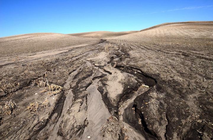
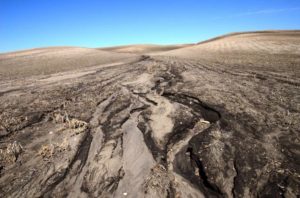
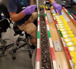


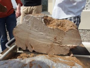

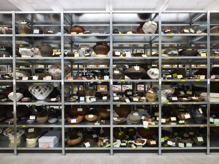


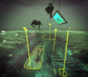

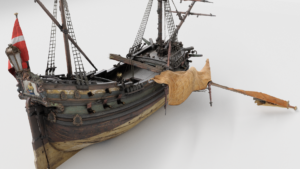
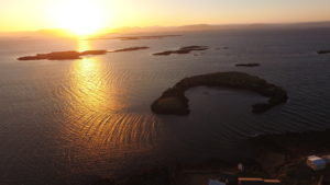

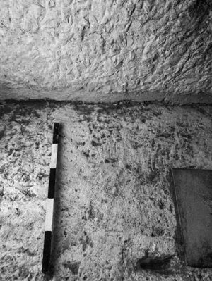
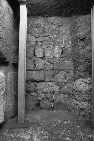
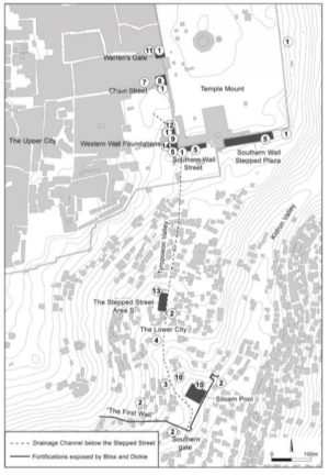


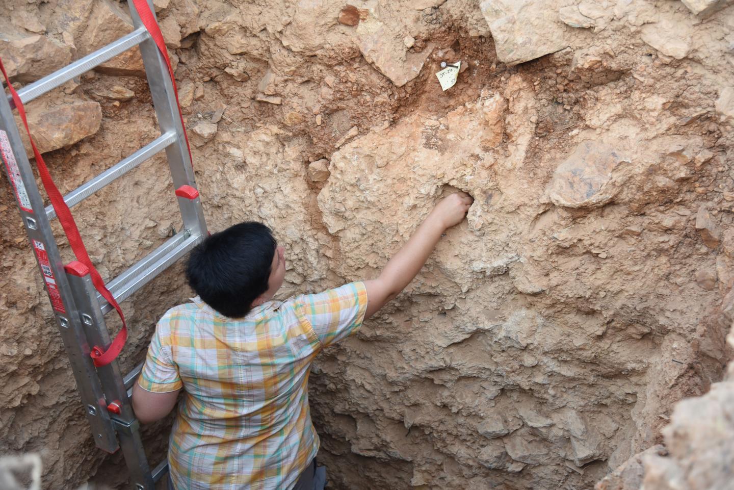


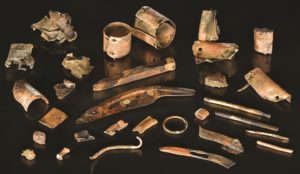


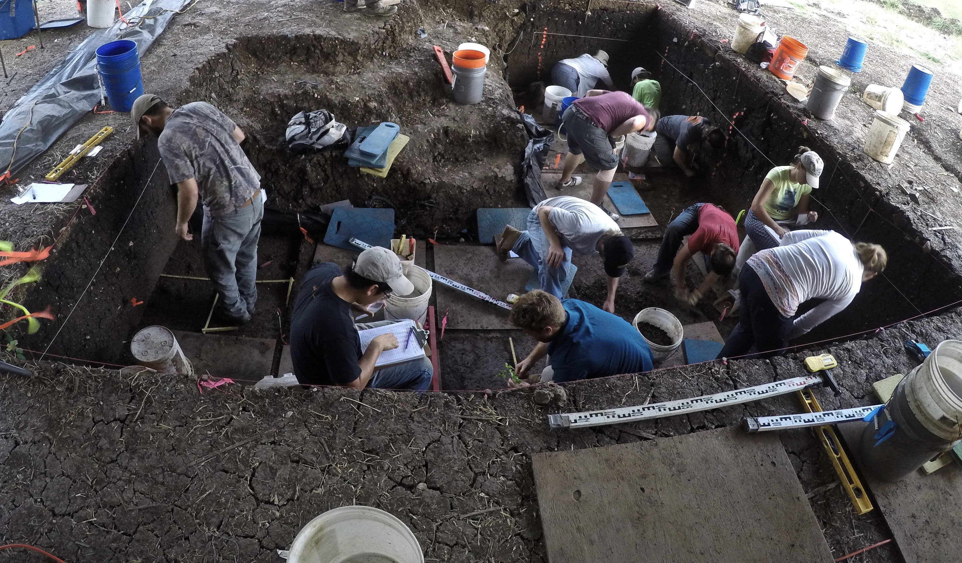
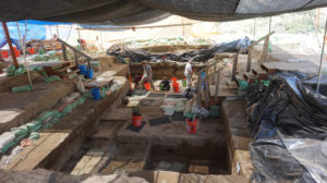
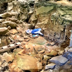
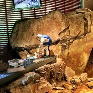
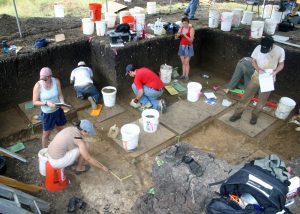
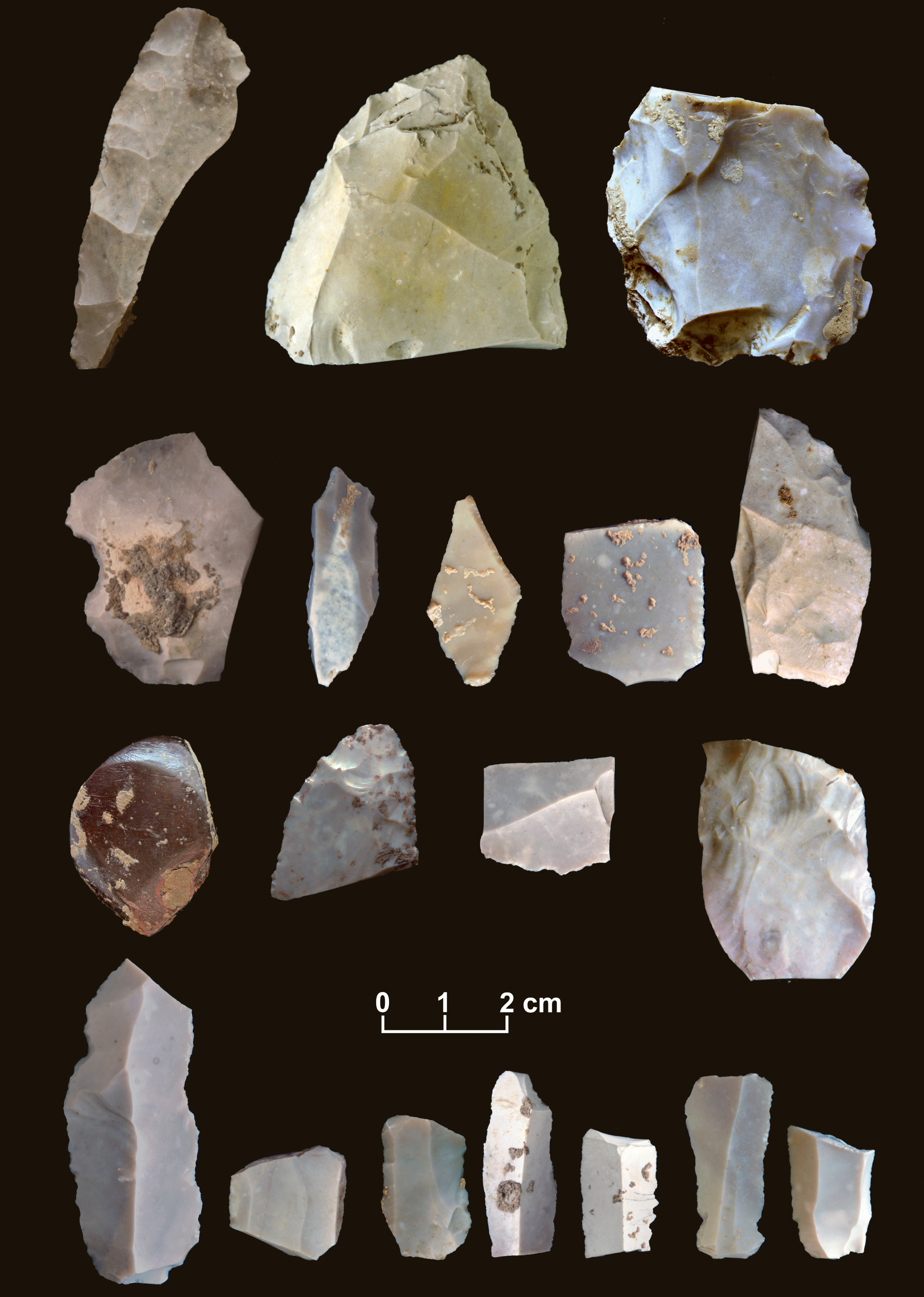
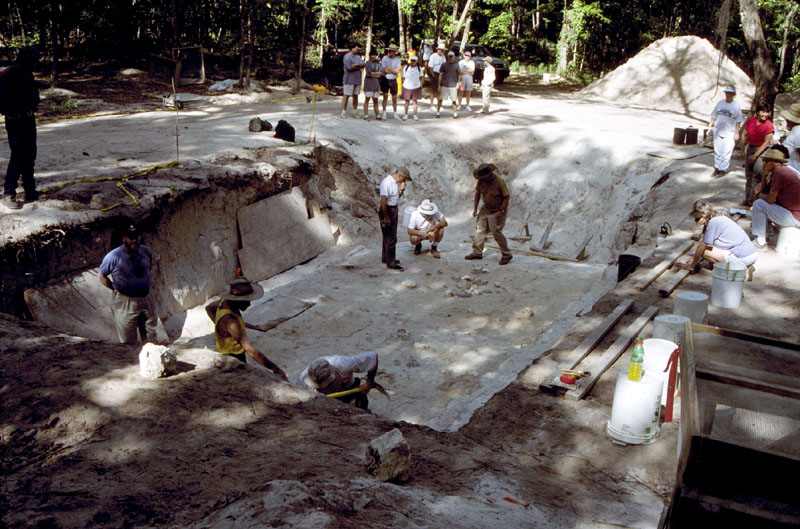
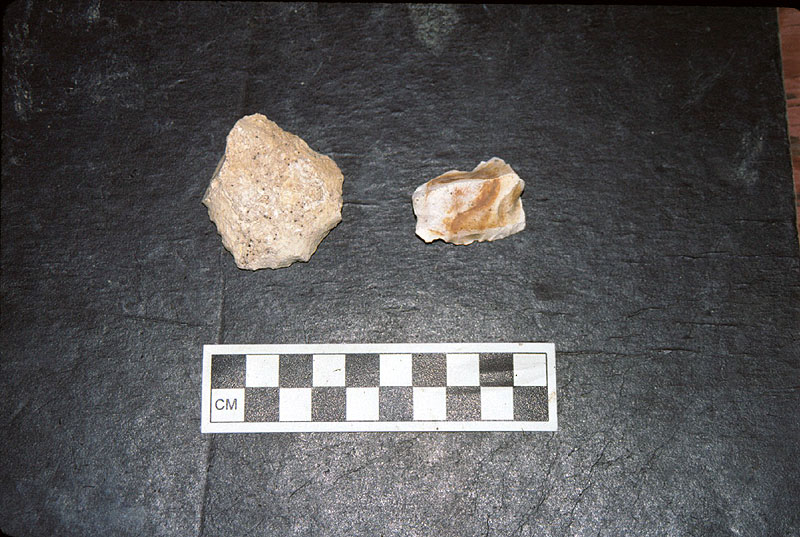
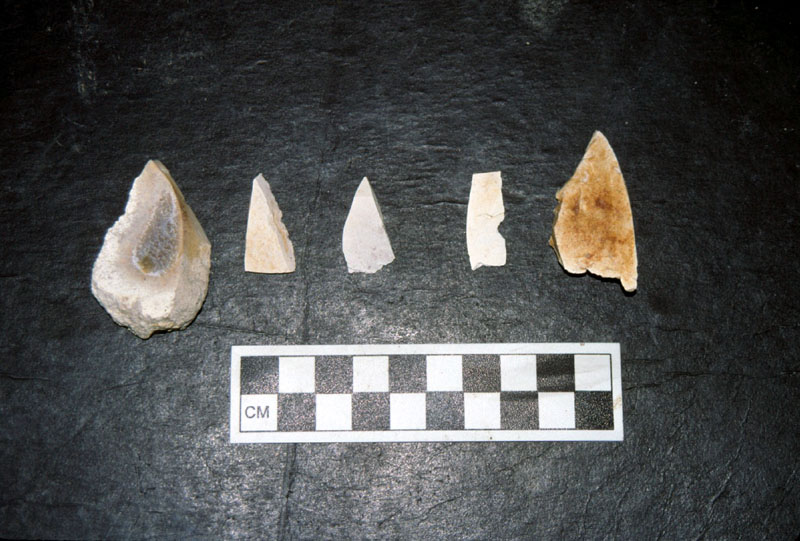
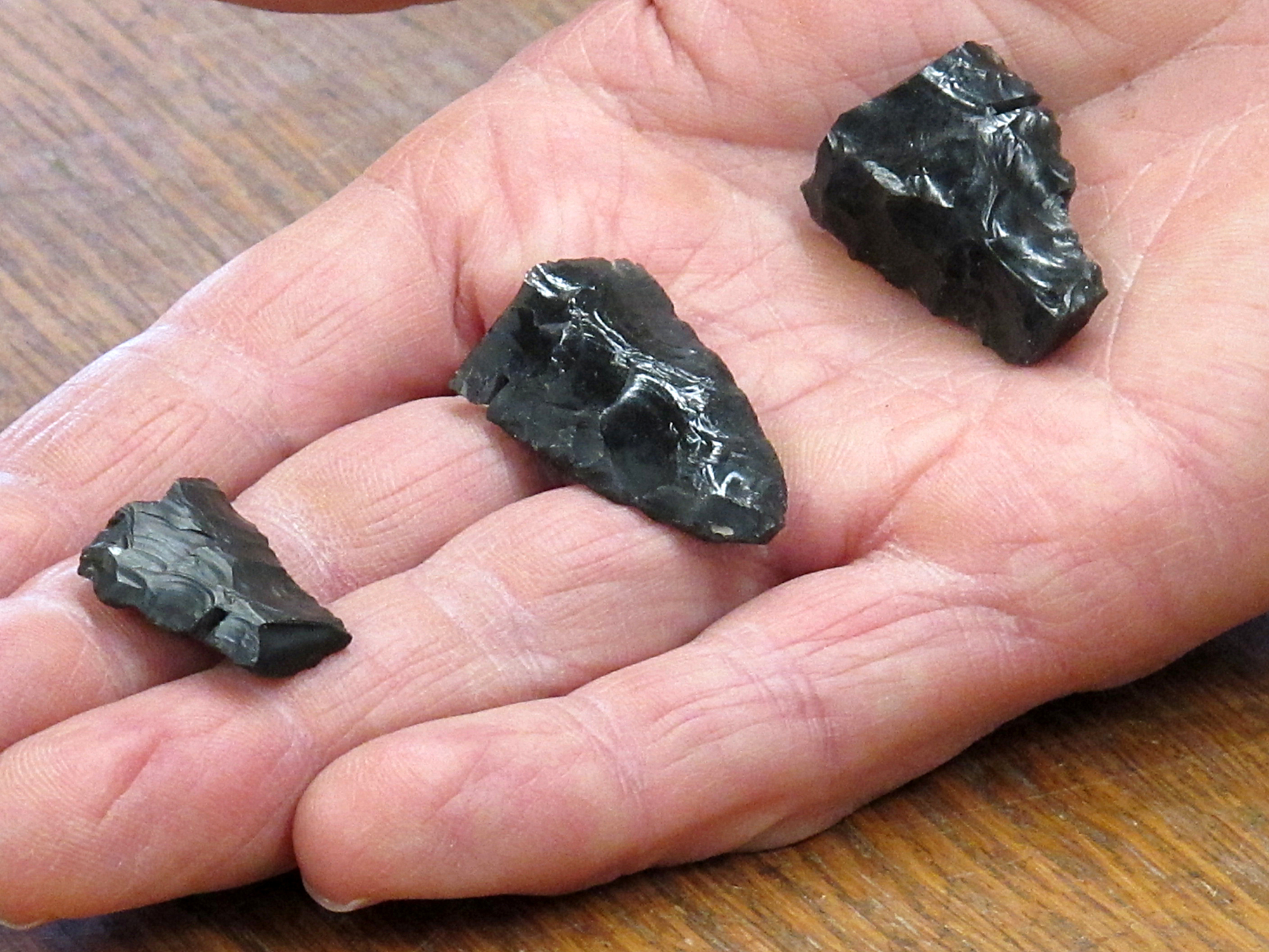
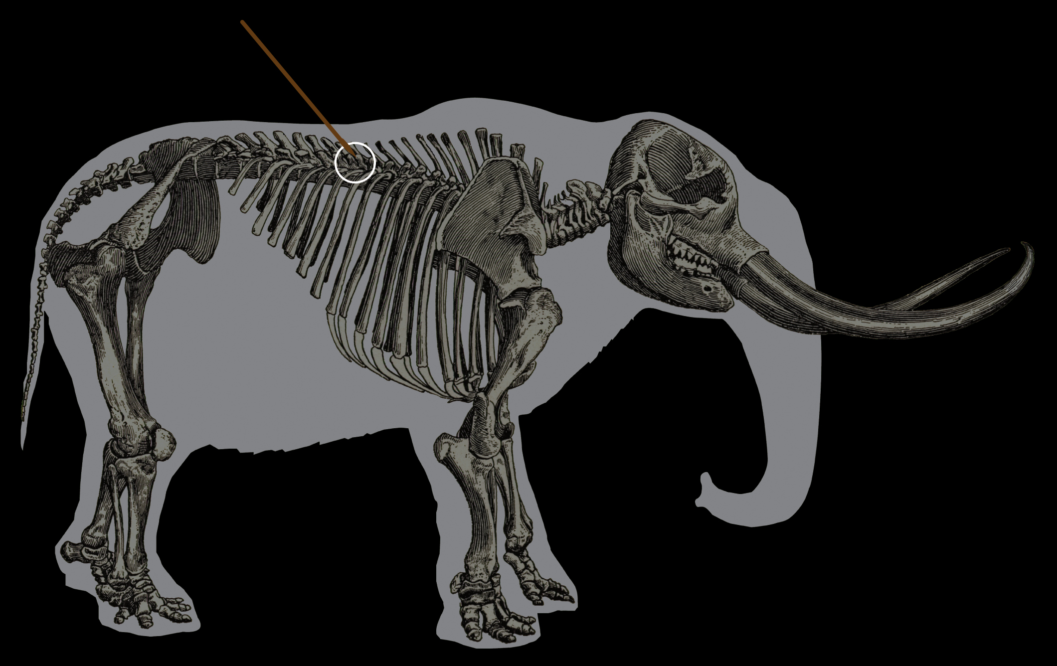
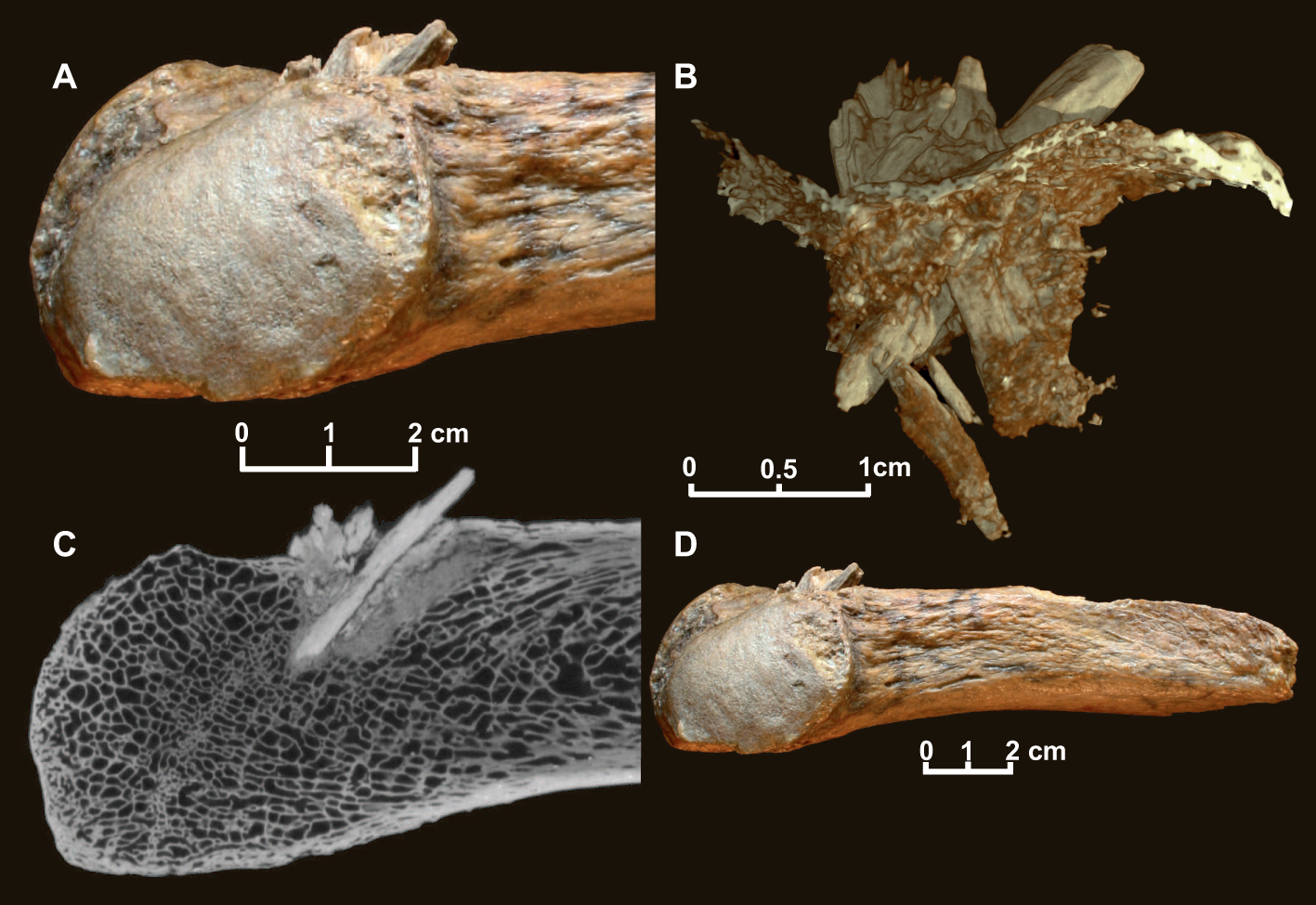
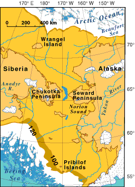 Schurr’s analysis and conclusions, paints a dramatically more complex picture of early American origins.