

In the Menderes district of İzmir, on the valley floor of Ahmetbeyli (Ales), in the Aegean geography where the sun and the sea dominate everything, an unexpected shadow falls. Klaros, located just 13 km from Kolophon (Değirmendere) to the north, was one of the most important centers of prophecy in Antiquity. However, its fame was not fed by the mountaintops, as in neighboring Delphoi, but by a secret emerging from the depths of the earth.
Klaros, as one of Apollo’s two great oracle centers in Anatolia [present day Turkey], functioned as a place where humanity sought answers to its biggest question—What does the future hold?—for approximately 1500 years, from its founding (late 13th century BCE) to its abandonment (4th century CE).
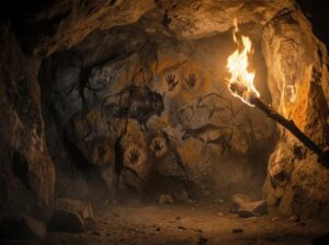
The answers were delivered by blind oracles who communicated with the god, far from daylight, listening to the seepage of the sacred water in the darkness of the subterranean well.
I. The Spring of Tears: The Foundation Myth of Klaros
The history of Klaros dates back to the Akha colonization period of the city of Kolophon, in the 13th century BCE. This was not merely a settlement but a mythological junction connecting two continents.
Rhakios, the founder of the city’s Mycenaean settlement, married Manto from the group of immigrants arriving from Thebai (Greece). Manto was the daughter of the famous prophet Teiresias and was known as a priestess of Apollo. According to legend, the sacred water source in Klaros’s subterranean oracular chamber was formed by the bitter tears of Manto, who was driven from her homeland. These tears symbolize the prophecy’s mournful yet sacred beginning.
Klaros’s fame peaked during the time of Mopsos, the son of Rhakios and Manto, who inherited the prophetic duty from his mother. Kalkhas, the legendary prophet of the Trojan War, came to Klaros after the war and entered a prophetic contest with Mopsos. This mythological duel is interpreted as the defeat of old Greek prophecy against the new, young Anatolian prophecy. Losing the contest, Kalkhas either died here of grief or retreated southward.
Although the first diviner at Klaros was a woman (Manto), in subsequent periods, the duty of prophecy was always undertaken by men.
II. Where Eyes Were Sacrificed: The Ritual of Darkness and Sacred Water
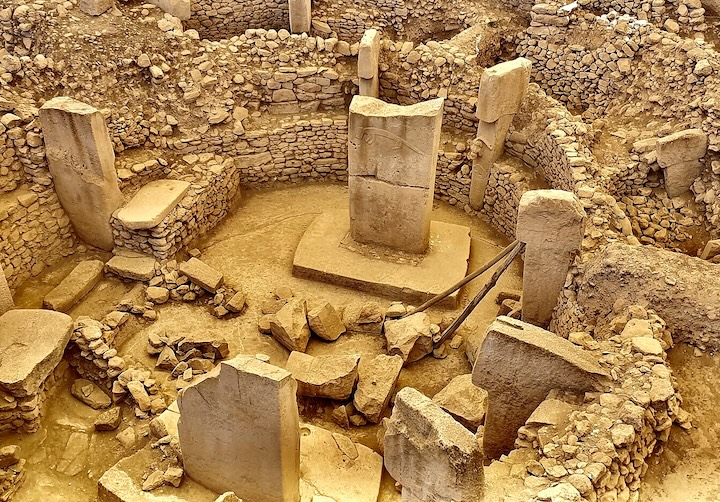
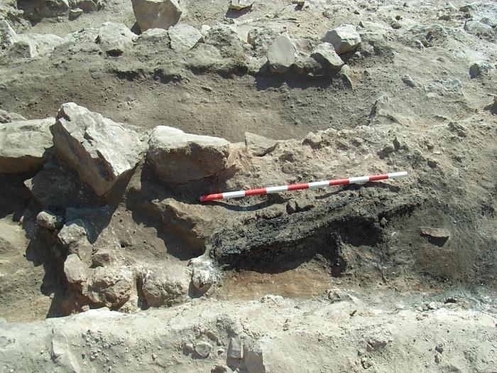
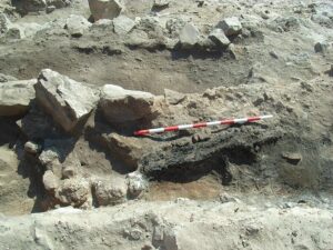
The most striking feature that distinguishes Klaros from other oracle centers like Delphoi is the location and nature of the prophecy ritual itself. Oracles were delivered in the Rear Adyton (Sacred Chamber), an arched, two-room subterranean space hidden beneath the cella of the temple floor.
While ancient inscriptions do not clearly describe this esoteric ritual, archaeological finds and testimonies present the ritual to us:
- Entry and Preparation: The petitioners, the Graphikos (scribe), and the Priest waited in the Front Adyton. The general populace was only allowed up to the temple entrance, as temples were believed to be the dwelling places of the gods.
- The Prophet’s Disappearance: The prophecy ritual began with the prophet entering through a door to the inner room, which he had to enter in darkness. This was the same inner chamber where the omphalos (Apollo’s sacred stone of blue marble) was located. The prophet would enter the western chamber alone, where the sacred well was located.
- Consumption of Sacred Water and Blindness: The prophet would drink the sacred water, believed to be Manto’s tears. After drinking this water, he would pose the questions to the god through divine inspiration and receive the answers. The fact that the prophet delivered his prophecy in the dark and after drinking this special water is thought to have caused his eyes to lose function or to become intentionally blind. Once his physical eyes closed, his soul opened to divine revelation.
- Recording the Revelation: The prophet would whisper the received answer to the Priest waiting in the Front Adyton. The Priest would then have the scribe record it in hexameters (poetic meter) and deliver the prophecy to the petitioner.
The prophecies performed during the full moon, illuminated by torchlight, and accompanied by 7 young girls and 7 boys swinging laurel leaves and singing hymns, provided a contrast to the inner darkness of the oracle chamber.
_______________________
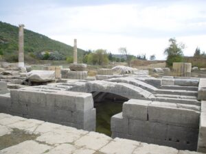
The temple of Claros in İzmir Province. Monsieurdl, Public Domain, Wikimedia Commons
_______________________
III. World Citizenship and Alexander the Great’s Legacy
Initially open only to city delegates, Klaros’s fame became international after the personal consultation by Alexander the Great (Alexander V).
- The Founding of New Smyrna: According to legend, Alexander the Great fell asleep on Pagos Hill (Kadifekale) and dreamt of the Nemesis goddesses telling him to found a city there. Seeking interpretation for his dream, he consulted Klaros. He received the god Apollo’s answer: “The people who will dwell on Pagos outside the sacred Meles River will be three or four times happier.” Following this prophecy, New Smyrna (Izmir) was founded on Pagos.
- Open Gate to Barbarians: After this event, Klaros became a center of prophecy that accepted not only Hellenes (Greeks) but also Barbarians (non-Greeks). While the Apollo of Delphoi served only the Hellenes, Klaros became the second center in Anatolia where the concept of world citizenship was practiced. At the peak of its fame in the 2nd century CE, it received consultations from all corners of the world, from North Africa to Britain.
- Healing Oracles: Klaros was consulted not only for political or military matters but also for health issues. Aelius Aristides, the only author who provides information about the Allianoi Health Center, visited Allianoi on the advice of Apollo Klarios. This shows that Apollo Klarios also served as a consultant, directing those with health problems to the cure centers of his son, Asklepios.
IV. Monumental Evidence: The Hecatomb and the Seated God
Klaros is also unique in its archaeological finds.
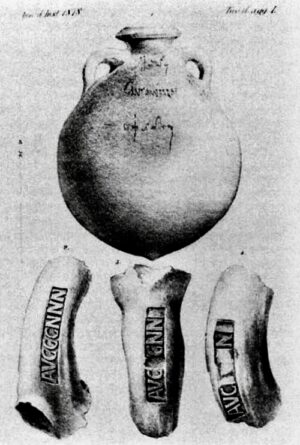
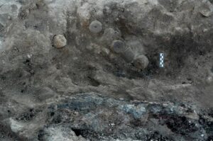
- The Hecatomb Block: While ancient writers describe the sacrifice of animals to all gods, the Hecatomb (sacrifice of one hundred animals) ritual’s first and only archaeological proof was found at Klaros. The discovery of one hundred animal-tethering blocks (rectangular stone blocks with an iron ring on each) in the area between the temple and the altar concretely proves Apollo’s attribute as Hecatombaios (the god to whom numerous sacrifices are offered).
- Cult Statues: The sacred area is rare for its monumental cult statues (approximately 8 meters high) of Apollo, his sister Artemis, and their mother Leto found in situ (in their original place). The fact that the Apollo statue is seated while Artemis and Leto are standing emphasizes the architectural and religious hierarchy.
- Architectural Uniqueness: The temple (Apollo Klarios Temple) is distinguished as the only Doric temple built in Ionia during the Hellenistic period. Furthermore, Klaros is noted in the archaeological record as the only sacred area with inscriptions even on the steps of its temple.
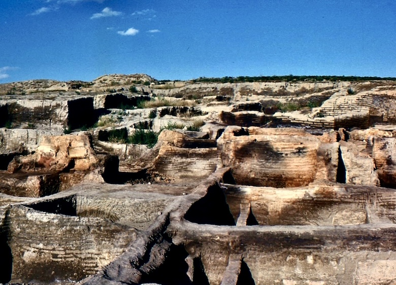
Abandoned in the 4th century CE with the spread of Christianity, Klaros has been excavated for many years. Today, it welcomes visitors as Turkey’s first archaeopark, where the trickle of thousands of years of prophecy still rises from the depths of the water.
_________________________
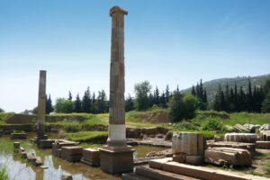
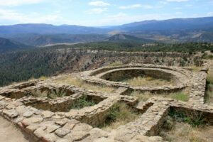
Above and below: On-site views of Klaros as seen today. Image above; Nikater, CC BY-SA 4.0, Wikimedia Commons
_________________________
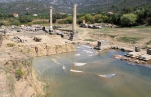
Above and below: Image Credit: Ingeborg Simon, CC BY-SA 3.0, Wikimedia Commons
_________________________

_________________________
Conclusion: The Eternal Legacy of Klaros
Klaros in Izmir demonstrates that prophecy was not merely an art of prediction, but a mystical connection established with personal sacrifice, sacred water, and the underworld. The blind oracles closed their eyes to the light of the outer world, opening their inner light to divine revelation.
The legacy of Klaros proves its influence extended beyond the beliefs of Antiquity to the fields of modern science, health (Allianoi), and politics (the founding of Smyrna).
The darkness of this sacred area and the sacred water formed by Manto’s tears whisper this esoteric truth to visitors thousands of years later: True wisdom sometimes requires ceasing to see and listening in the darkness.


